Road Information |
||
 |
||
| Total Mileage in State: | 20 miles | |
| Northern End: | At I-64, in Hampton | |
| Southern End: | At I-64/I-264, in Chesapeake | |
| Mileage covered in Photos: | 20 miles | |
| Counties covered in Photos: | Chesapeake (city), Suffolk (city), Hampton Roads, Newport New (city), Hampton (city) | |
| Major Junctions in Photos: | US 13/US 58/ US 460, in Chesapeake US 17/VA 164, in Suffolk US 60, in Newport News I-64, in Hampton |
|
| Control Cities in Photos: | Chesapeake, Suffolk, Newport News, Hampton | |
Northbound
 |
Interstate 664 North begins as Interstate 64 reaches its eastern terminus in Chesapeake. (Photo taken 11/8/15). |
 |
Interstate 664 North as it crosses under the ramp from I-664 South to I-264 East. I-64, I-664, and I-264 all terminate at the same 'Y' interchange in Chesapeake. (Photo taken 11/8/15). |
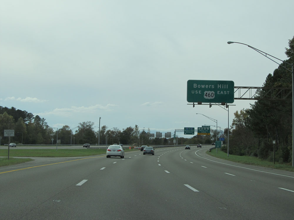 |
Take Exit 13B to Bowers Hill via US 460 East. (Photo taken 11/8/15). |
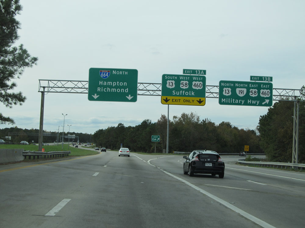 |
Interstate 664 North at Exit 13A: US 13 South / US 58 West / US 460 West - Suffolk; Exit 13B: US 13 North / VA 191 North / US 58 East / US 460 East - Military Hwy (Photo taken 11/8/15). |
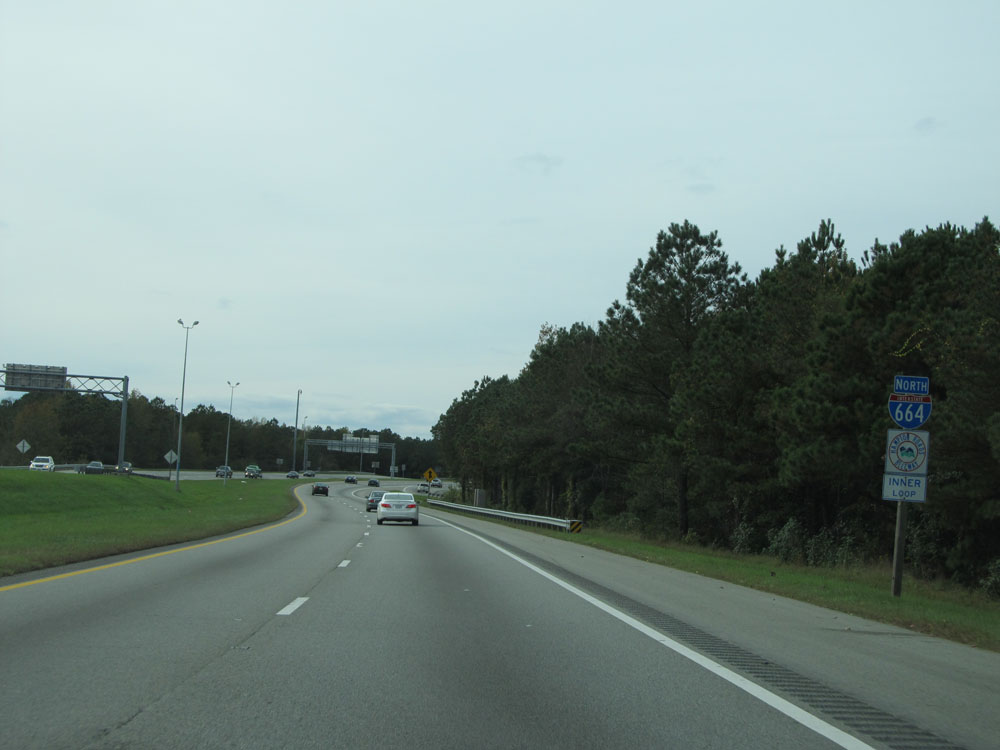 |
Interstate 664 North assurance shield north of Exits 13A-B. The exit numbers on I-664 are sequentially marked, and the mile markers decrease as you head north. Both of these things are unusual. (Photo taken 11/8/15). |
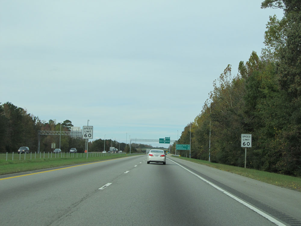 |
Speed limit signs on Interstate 664 North. The speed limit starts out at 60 mph. (Photo taken 11/8/15). |
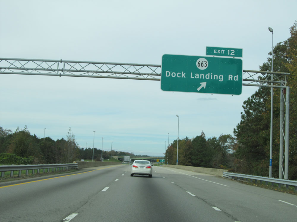 |
Interstate 664 North at Exit 12: SR 663 - Dock Landing Rd (Photo taken 11/8/15). |
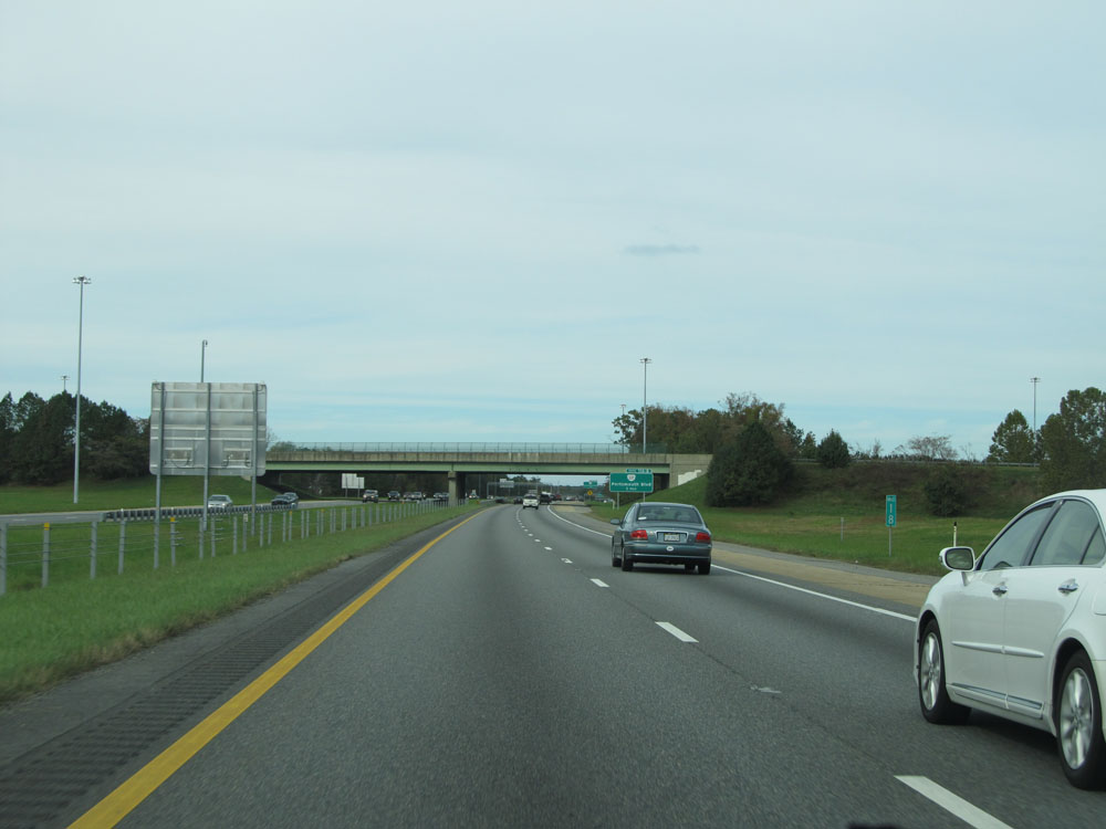 |
Interstate 664 North: Road view from mile marker 18. (Photo taken 11/8/15). |
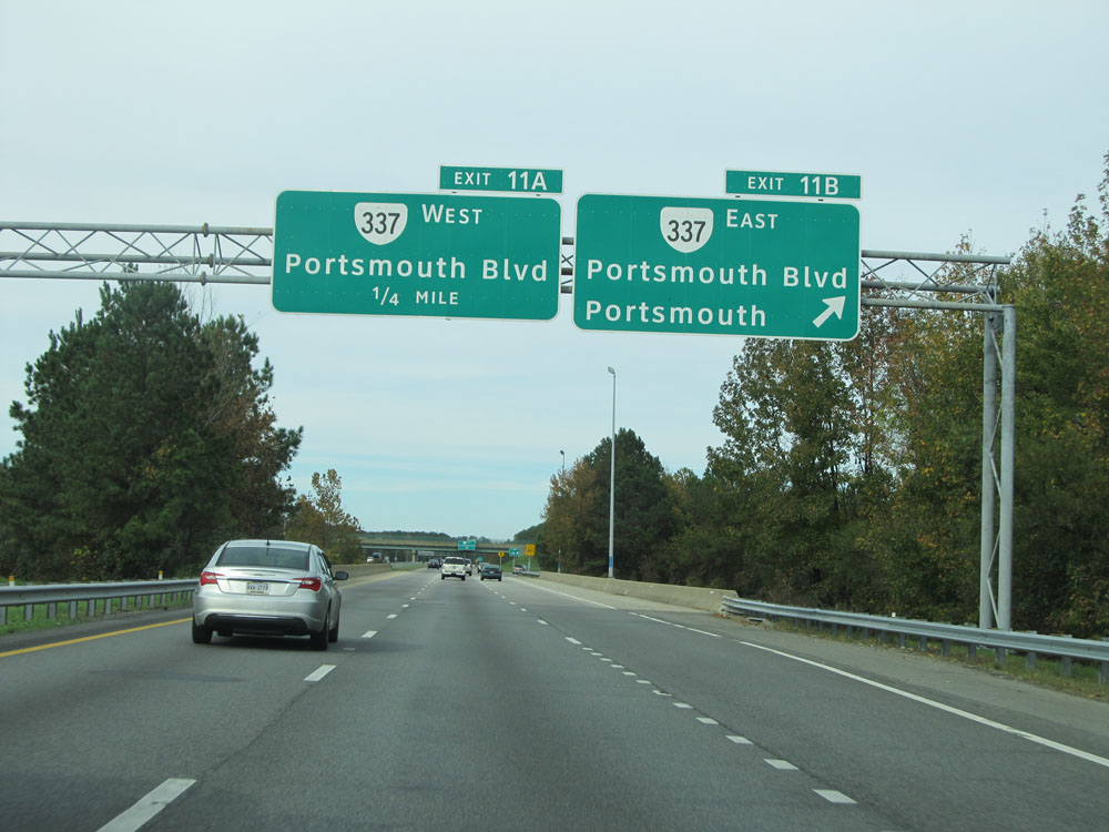 |
Interstate 664 North at Exit 11B: VA 337 East - Portsmouth Blvd / Portsmouth (Photo taken 11/8/15). |
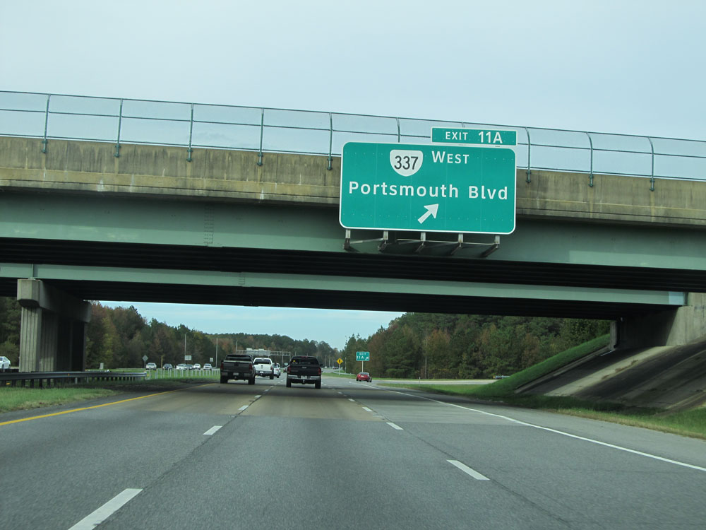 |
Interstate 664 North at Exit 11A: VA 337 West - Portsmouth Blvd (Photo taken 11/8/15). |
 |
Interstate 664 North at mile marker 16. (Photo taken 11/8/15). |
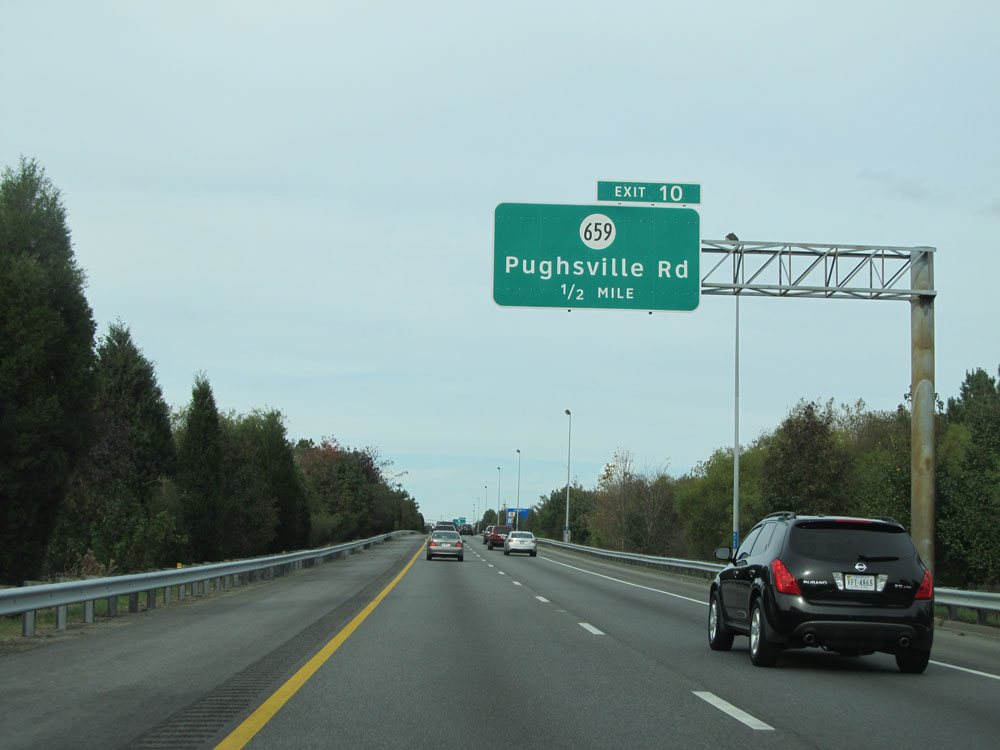 |
Interstate 664 North approaching Exit 10 - 1/2 mile. (Photo taken 11/8/15). |
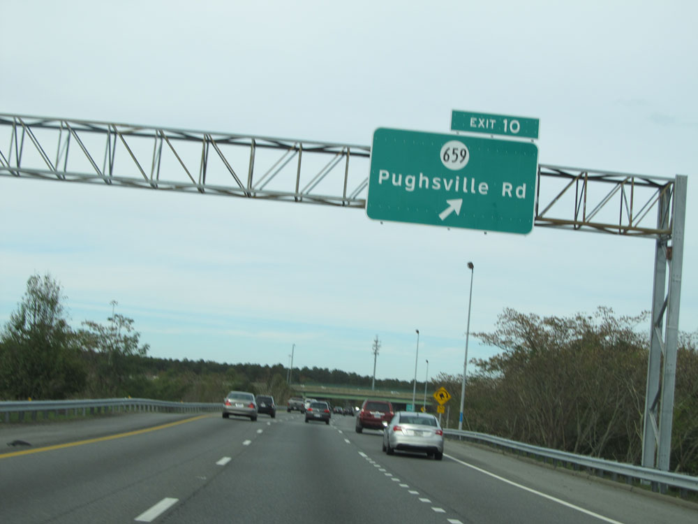 |
Interstate 664 North at Exit 10: SR 659 - Pughsville Rd (Photo taken 11/8/15). |
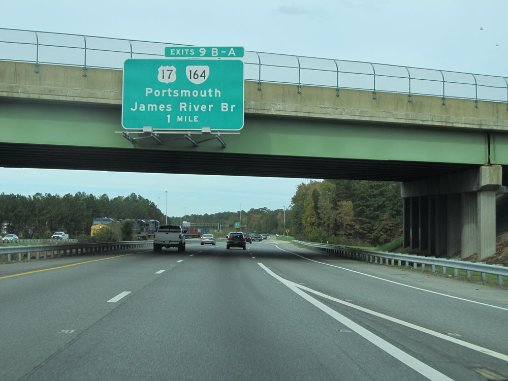 |
Interstate 664 North approaching Exits 9B-A - 1 mile. (Photo taken 11/8/15). |
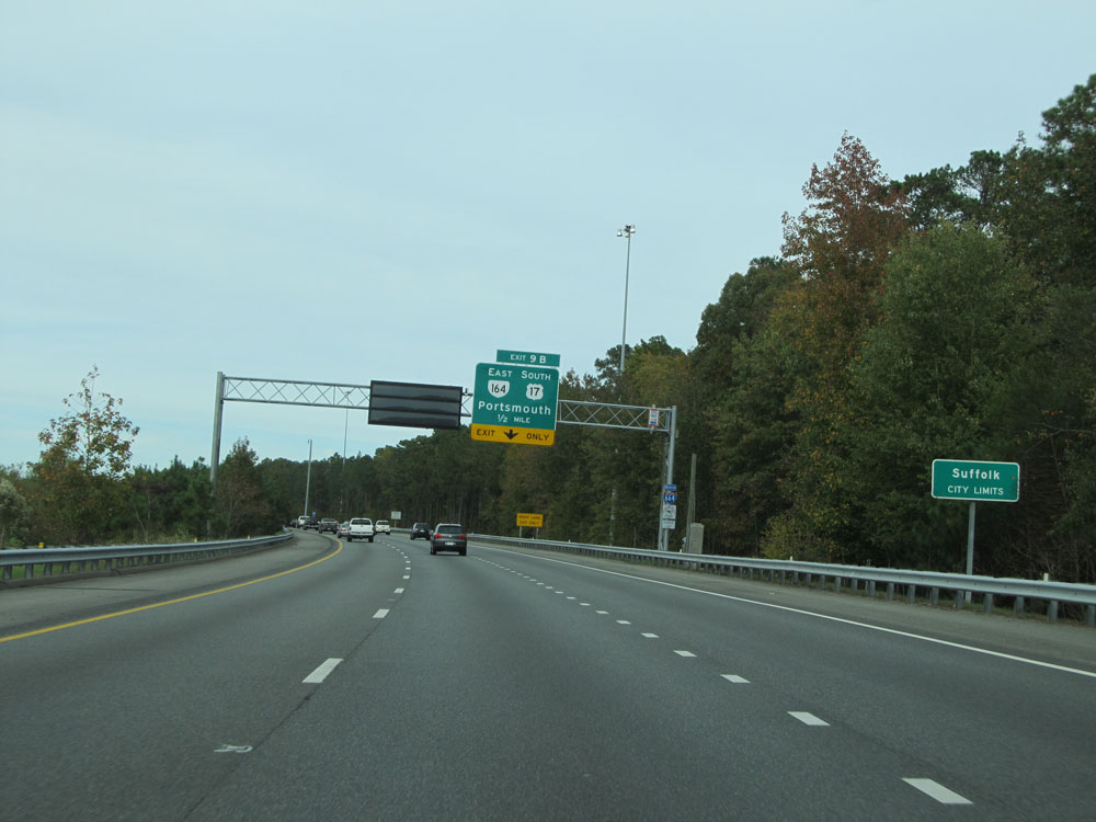 |
Interstate 664 North entering the Suffolk city limits. (Photo taken 11/8/15). |
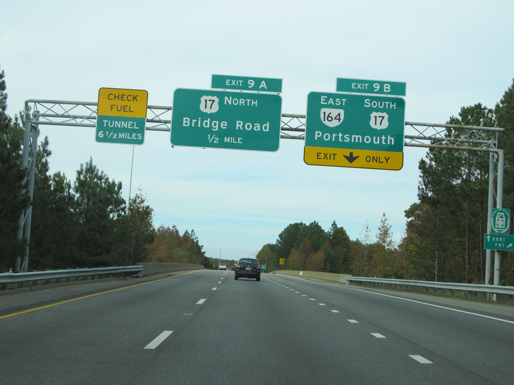 |
Interstate 664 North at Exit 9B: VA 164 East / US 17 South - Portsmouth (Photo taken 11/8/15). |
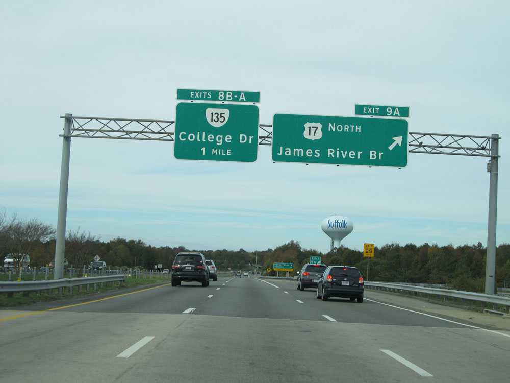 |
Interstate 664 North at Exit 9A: US 17 North - James River Bridge (Photo taken 11/8/15). |
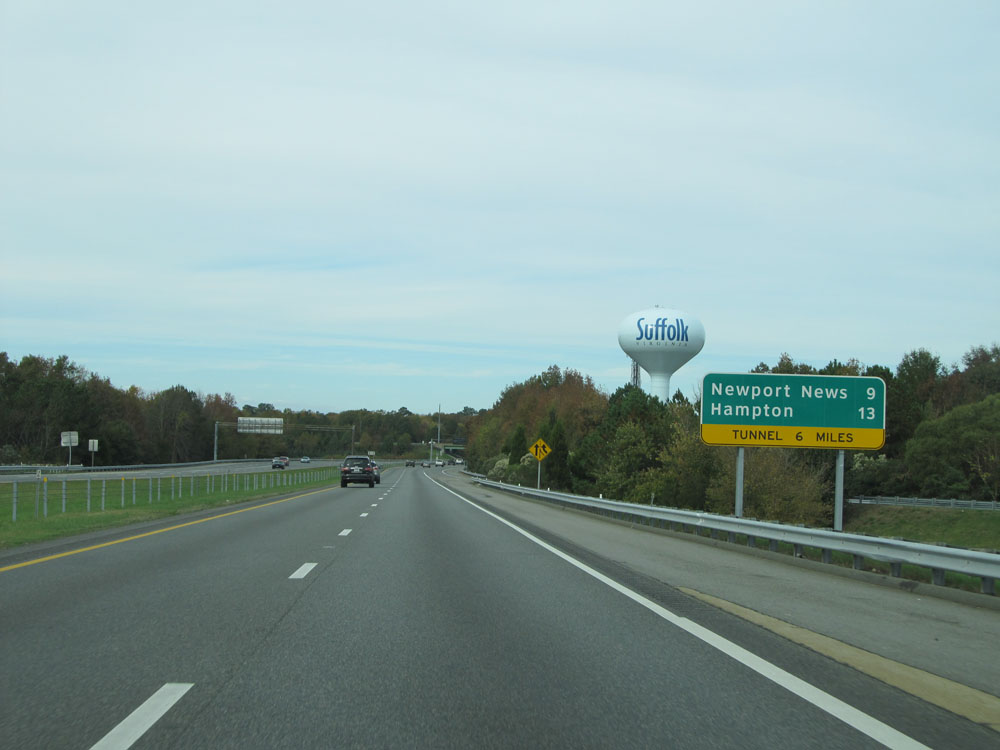 |
Mileage sign just north of Exit 9A. It's 9 miles to Newport News and 13 miles to Hampton. The Monitor-Merrimac Memorial Tunnel lies 6 miles ahead. (Photo taken 11/8/15). |
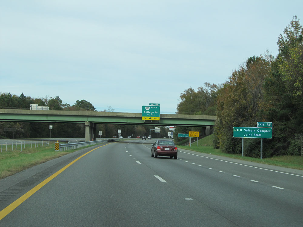 |
Take Exit 8B to DOD Suffolk Complex Joint Staff. (Photo taken 11/8/15). |
 |
Interstate 664 North at Exit 8B: VA 135 South - College Dr (Photo taken 11/8/15). |
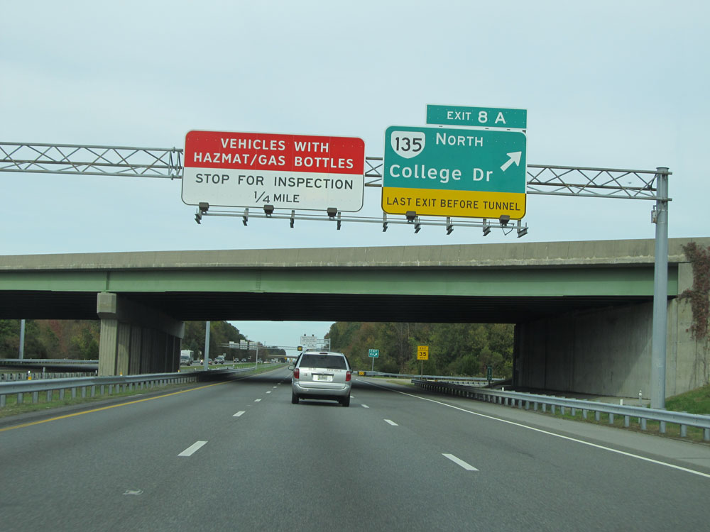 |
Interstate 664 North at Exit 8A: VA 135 North - College Dr. This is the final exit before the Monitor-Merrimac Memorial Tunnel. (Photo taken 11/8/15). |
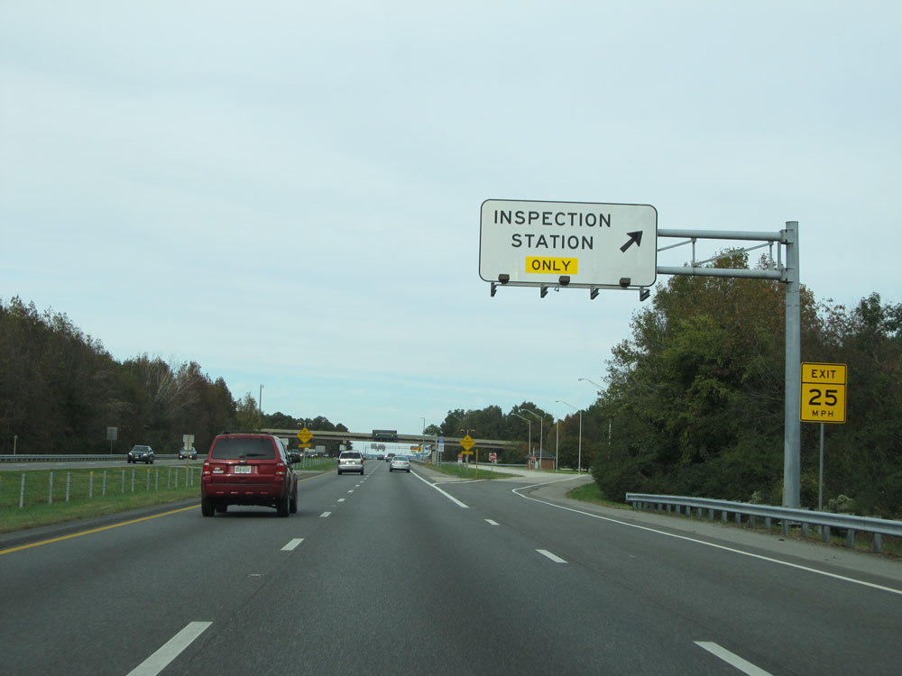 |
Interstate 664 North at the Inspection Station located just before the beginning of the Monitor-Merrimac Memorial Bridge-Tunnel. (Photo taken 11/8/15). |
 |
Interstate 664 North assurance shield located alongside the Inspection Station. (Photo taken 11/8/15). |
 |
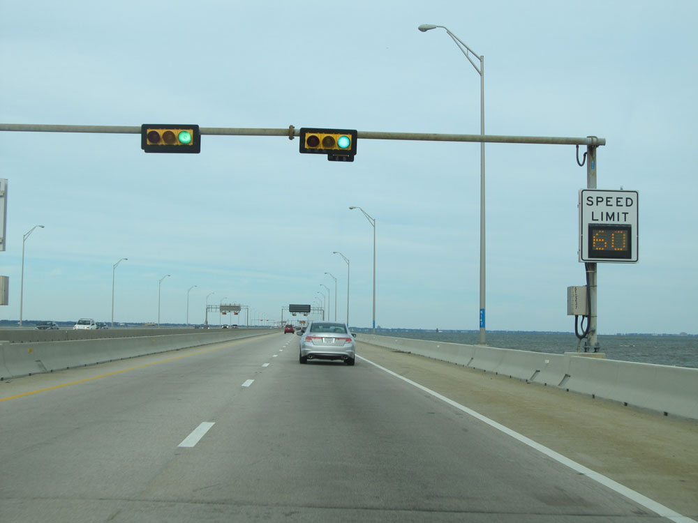
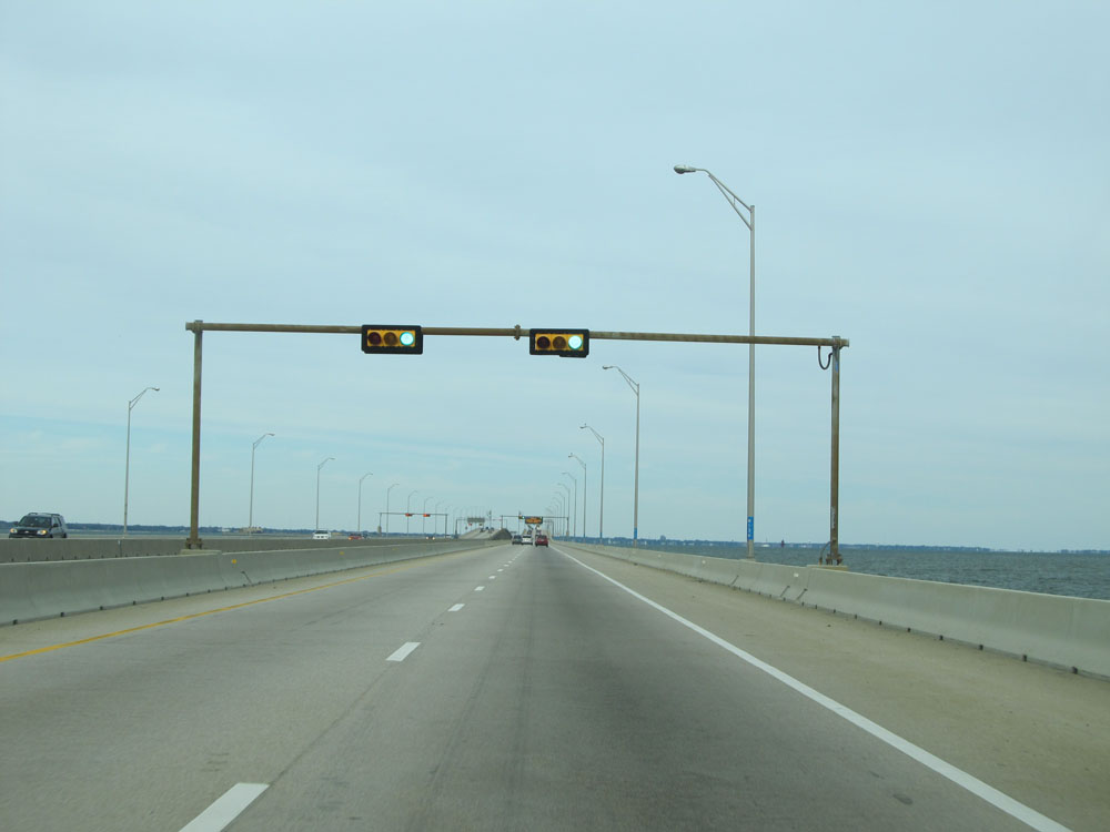
Approaching the Monitor-Merrimac Memorial Bridge-Tunnel, we see traffic signals come into play. There are several signals as we cross the bridge ahead. (Photo taken 11/8/15). |
 |
Interstate 664 North as the Monitor-Merrimac Memorial Bridge-Tunnel over the James River begins. (Photo taken 11/8/15). |
 |
Variable speed limits are used on the Monitor-Merrimac Memorial Bridge-Tunnel. The speed limit remained 60 mph at this time. (Photo taken 11/8/15). |
 |
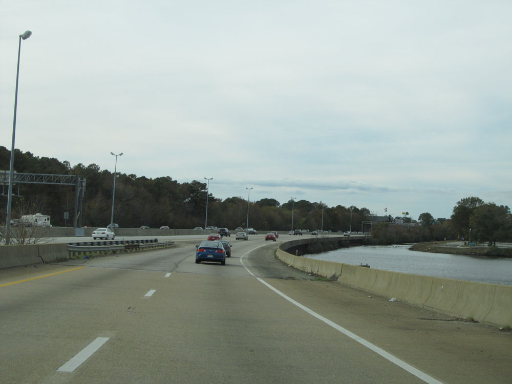
Interstate 664 North: Road view on the Monitor-Merrimac Memorial Bridge. (Photo taken 11/8/15). |
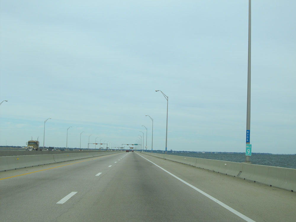 |
Interstate 664 North at mile marker 9. (Photo taken 11/8/15). |
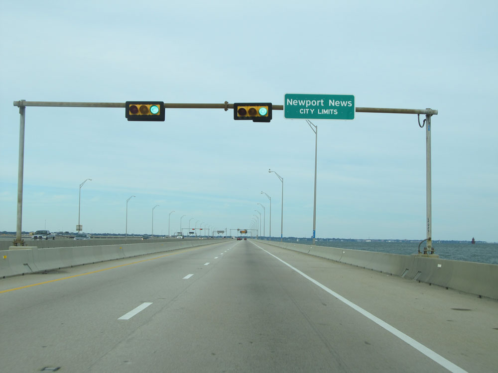 |
Interstate 664 North as it enters the Newport News city limits. (Photo taken 11/8/15). |
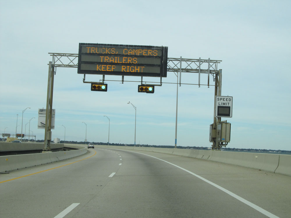 |
Another variable speed limit sign and overhead digital traffic alert sign crossing the bridge. (Photo taken 11/8/15). |
 |
Interstate 664 North as the Monitor-Merrimac Memorial Tunnel entrance comes into view. (Photo taken 11/8/15). |
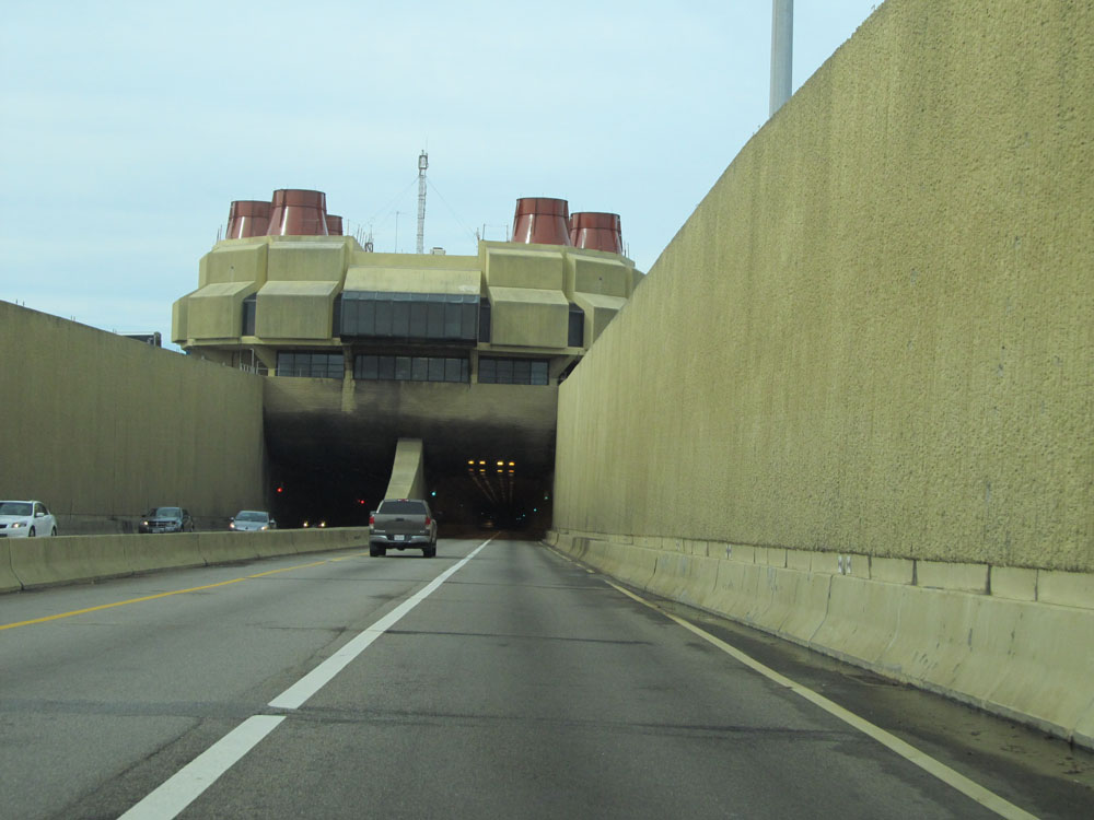 |
Interstate 664 North preparing to enter the Monitor-Merrimac Memorial Tunnel. (Photo taken 11/8/15). |
 |
Interstate 664 North at the entrance to the Monitor-Merrimac Memorial Tunnel. (Photo taken 11/8/15). |
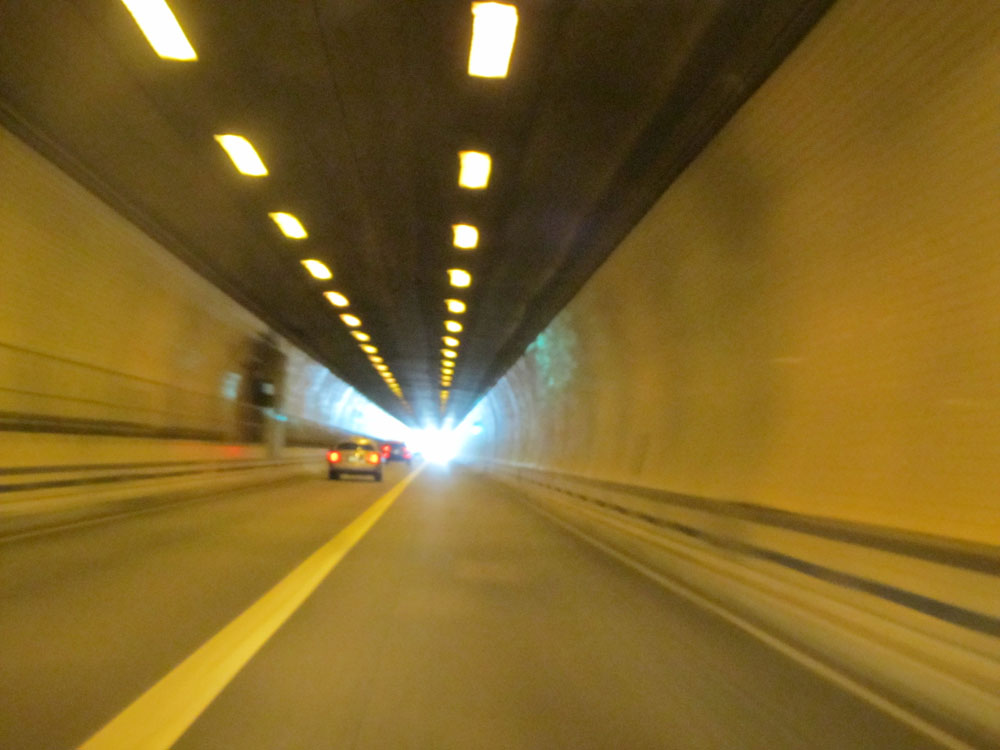 |
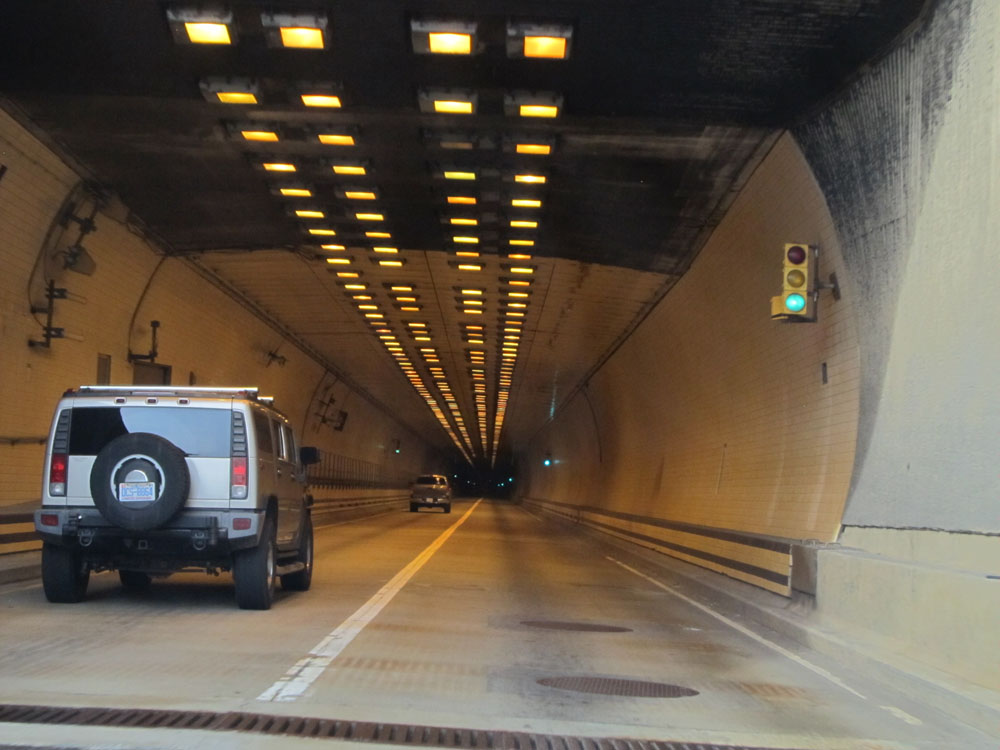
View inside the tunnel. (Photo taken 11/8/15). |
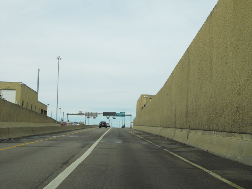 |
Interstate 664 North emerging on the north side of the Monitor-Merrimac Memorial Bridge-Tunnel. (Photo taken 11/8/15). |
 |
Interstate 664 North at Exit 7: Terminal Ave (Photo taken 11/8/15). |
 |
Take Exit 6 to Newport News Marine Terminal via 26th St. (Photo taken 11/8/15). |
 |
Interstate 664 North at Exit 6: 25th St / 26th St (Photo taken 11/8/15). |
 |
Take Exit 4 to Apprentice Athletic Center. (Photo taken 11/8/15). |
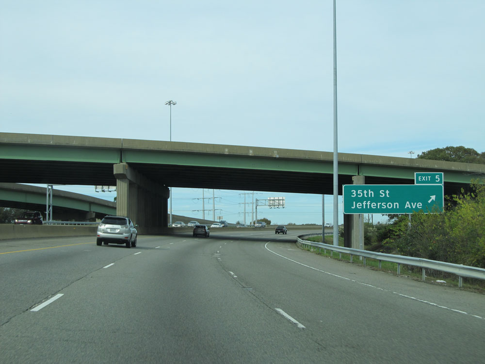 |
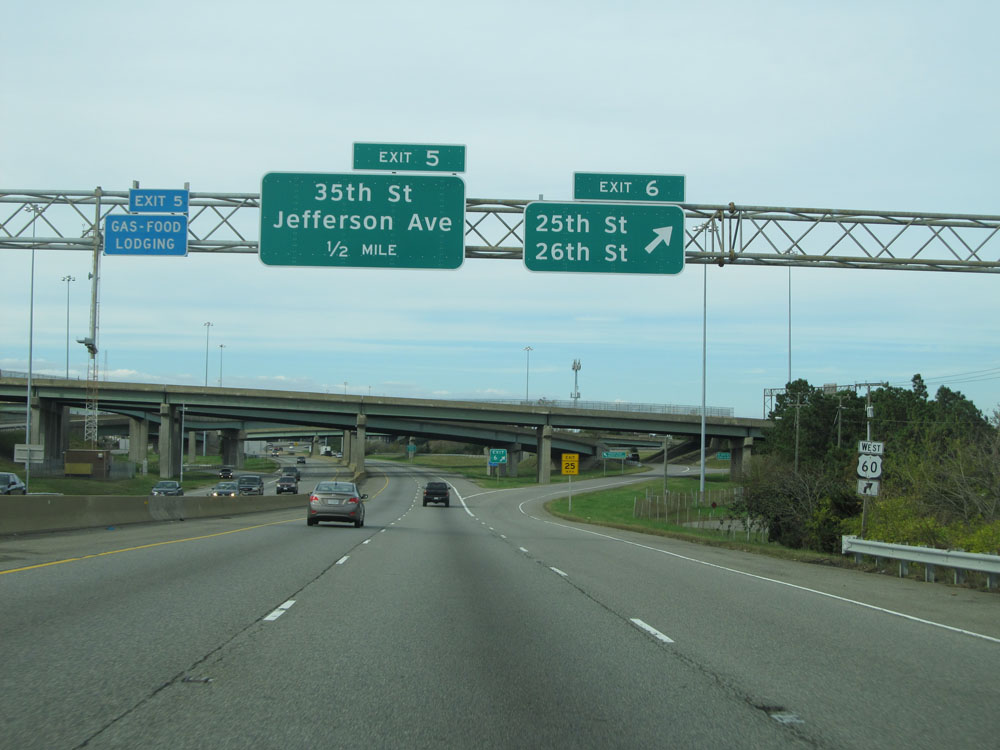
Interstate 664 North at Exit 5: 35th St / Jefferson Ave (Photo taken 11/8/15). |
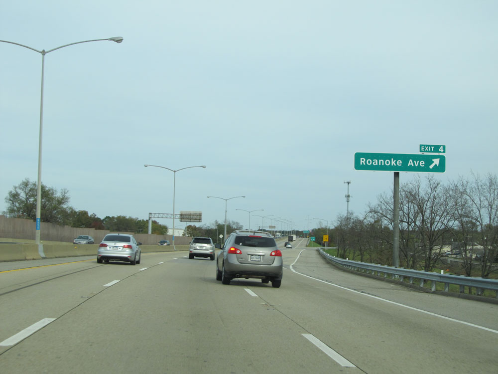 |
Interstate 664 North at Exit 4: Roanoke Ave (Photo taken 11/8/15). |
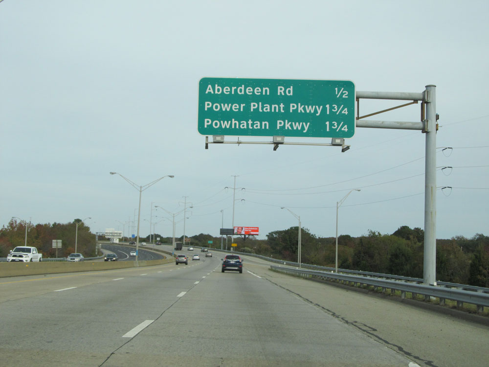 |
Overhead sign listing the distances to the upcoming exits on Interstate 664 North. (Photo taken 11/8/15). |
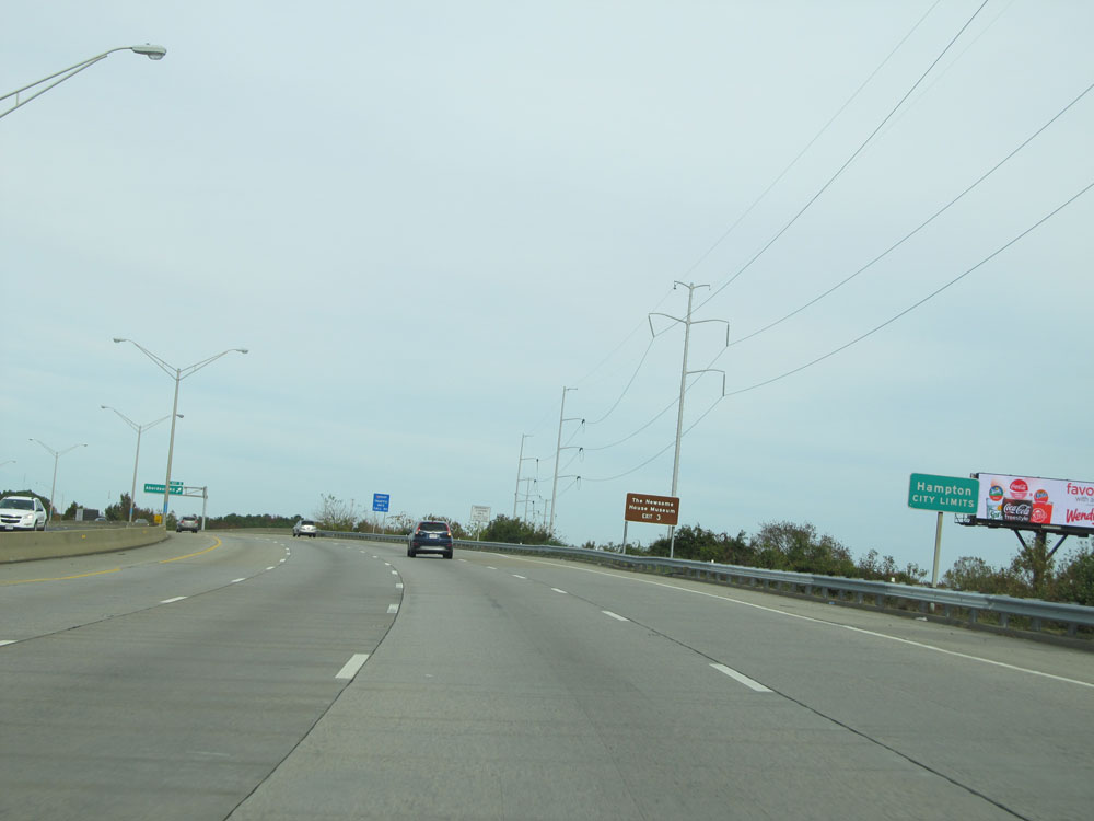 |
Interstate 664 North as it enters the Hampton city limits. (Photo taken 11/8/15). |
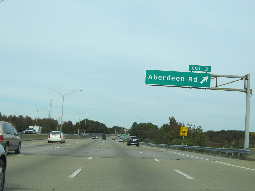 |
Interstate 664 North at Exit 3: Aberdeen Rd (Photo taken 11/8/15). |
 |
Interstate 664 North assurance shield to the north of Exit 3. (Photo taken 11/8/15). |
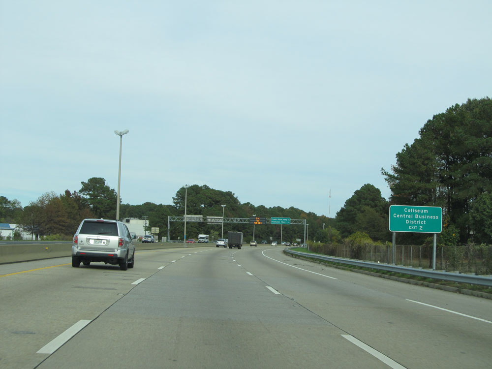 |
Take Exit 2 to the Coliseum and Central Business District. (Photo taken 11/8/15). |
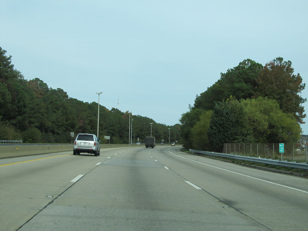 |
Interstate 664 North at mile marker 2. (Photo taken 11/8/15). |
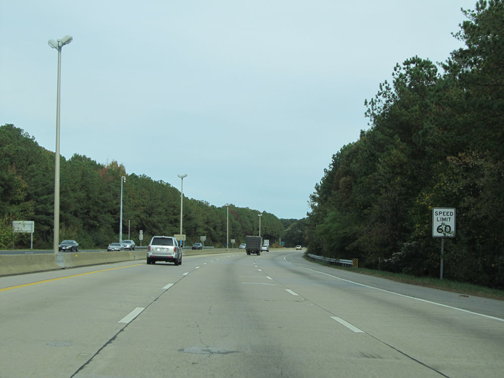 |
Speed limit assurance sign. Speed Limit - 60 mph. (Photo taken 11/8/15). |
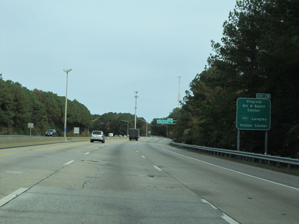 |
Take Exit 1B to Virginia Air & Space Center and Langley Visitor Center. (Photo taken 11/8/15). |
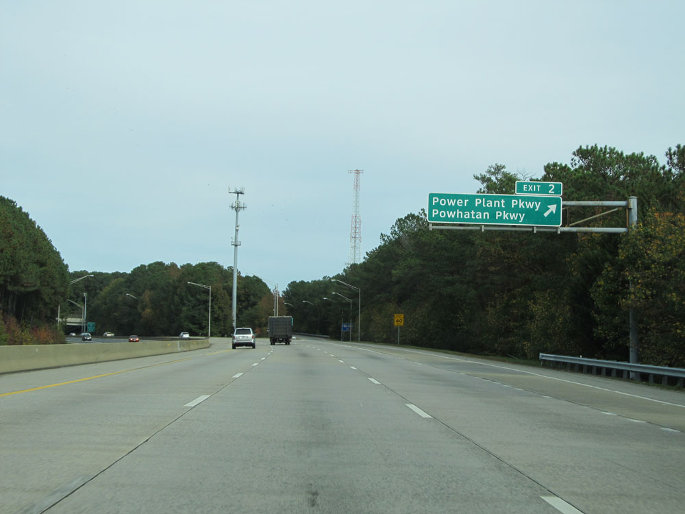 |
Interstate 664 North at Exit 2: Power Plant Pkwy / Powhatan Pkwy (Photo taken 11/8/15). |
 |
Interstate 664 North approaching Exits 1A-B - 1 mile. (Photo taken 11/8/15). |
 |
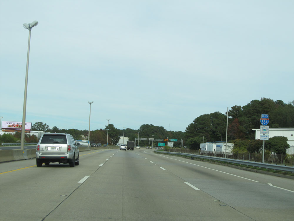
Interstate 664 North at Exit 1A: Interstate 64 West - Williamsburg / Richmond; Exit 1B: Interstate 64 East - Downtown Hampton / Norfolk / Virginia Beach (Photo taken 11/8/15). |
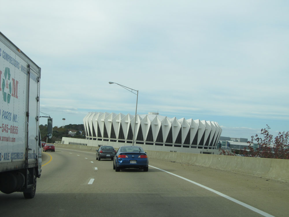 |
On the ramp for Exit 1A (Interstate 64 West), you get a nice view of the Hampton Colesium. (Photo taken 11/8/15). |
 |
As the ramp to Interstate 64 West comes to an end, we reach the northern terminus of Interstate 664. (Photo taken 11/8/15). |