Road Information |
||
 |
||
| Total Mileage in State: | 6.5 miles | |
| Northern End: | At I-81, in Roanoke | |
| Southern End: | At US 220/VA 24, in Roanoke | |
| Mileage covered in Photos: | 6.5 miles | |
| Counties covered in Photos: | City of Roanoke, Roanoke | |
| Major Junctions in Photos: | US 460, in Roanoke I-81, in Roanoke |
|
| Control Cities in Photos: | Roanoke | |
Northbound
 |
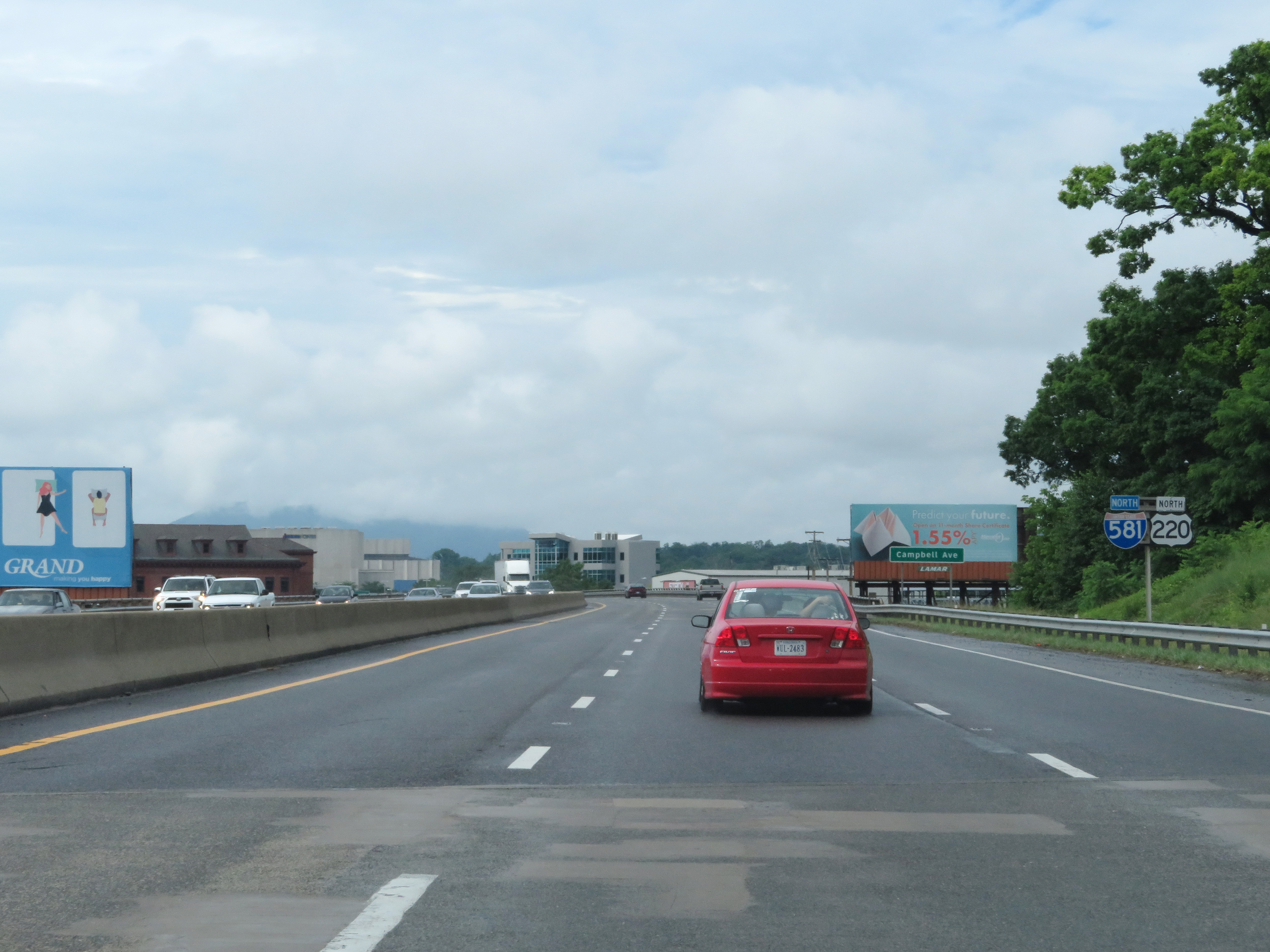
US 220 North approaching the beginning of Interstate 581 North in Roanoke. I-581 is a bit different in the sense that its exit numbers are sequential (not based on mileage) and they're numbered opposite of the mileposts, increasing in value as you go north, contrary to most Interstate highways. (Photo taken 5/26/18). |
 |
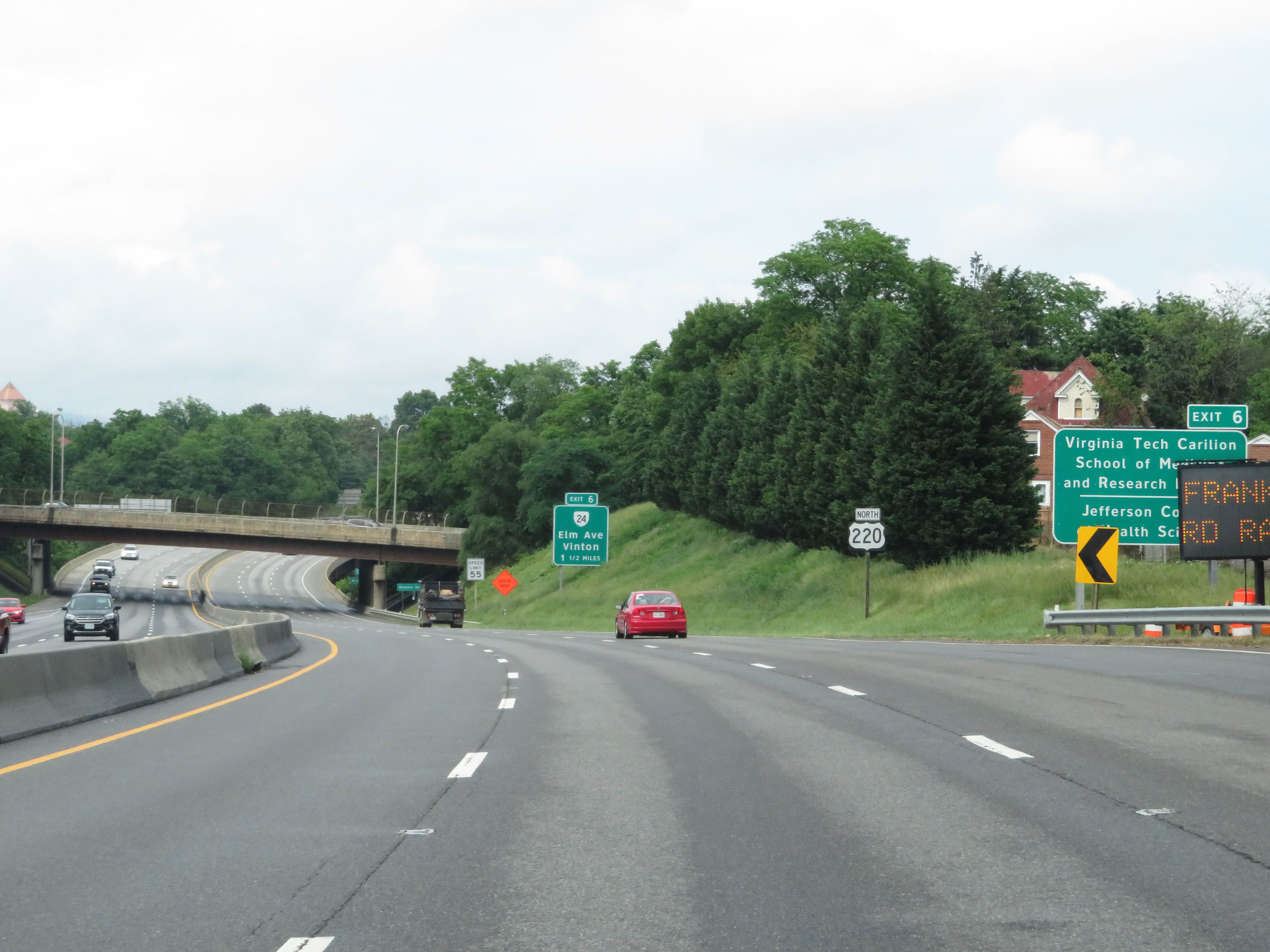
Advance signage for Exit 6, which will be the first exit on Interstate 581 North. The speed limit starts out at 55 mph. (Photo taken 5/26/18). |
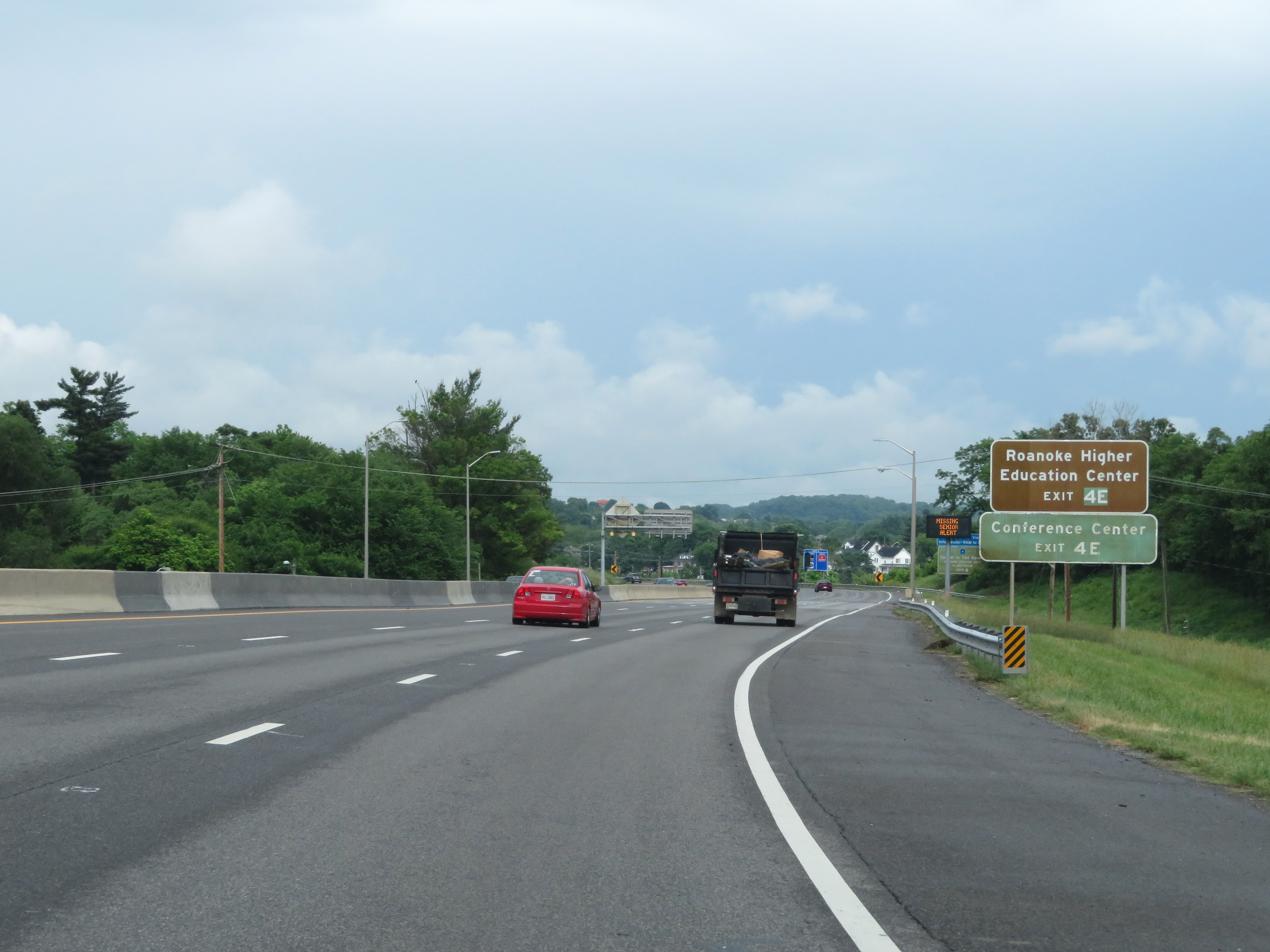 |
Take Exit 4E to Roanoke Higher Education Center and the Conference Center. (Photo taken 5/26/18). |
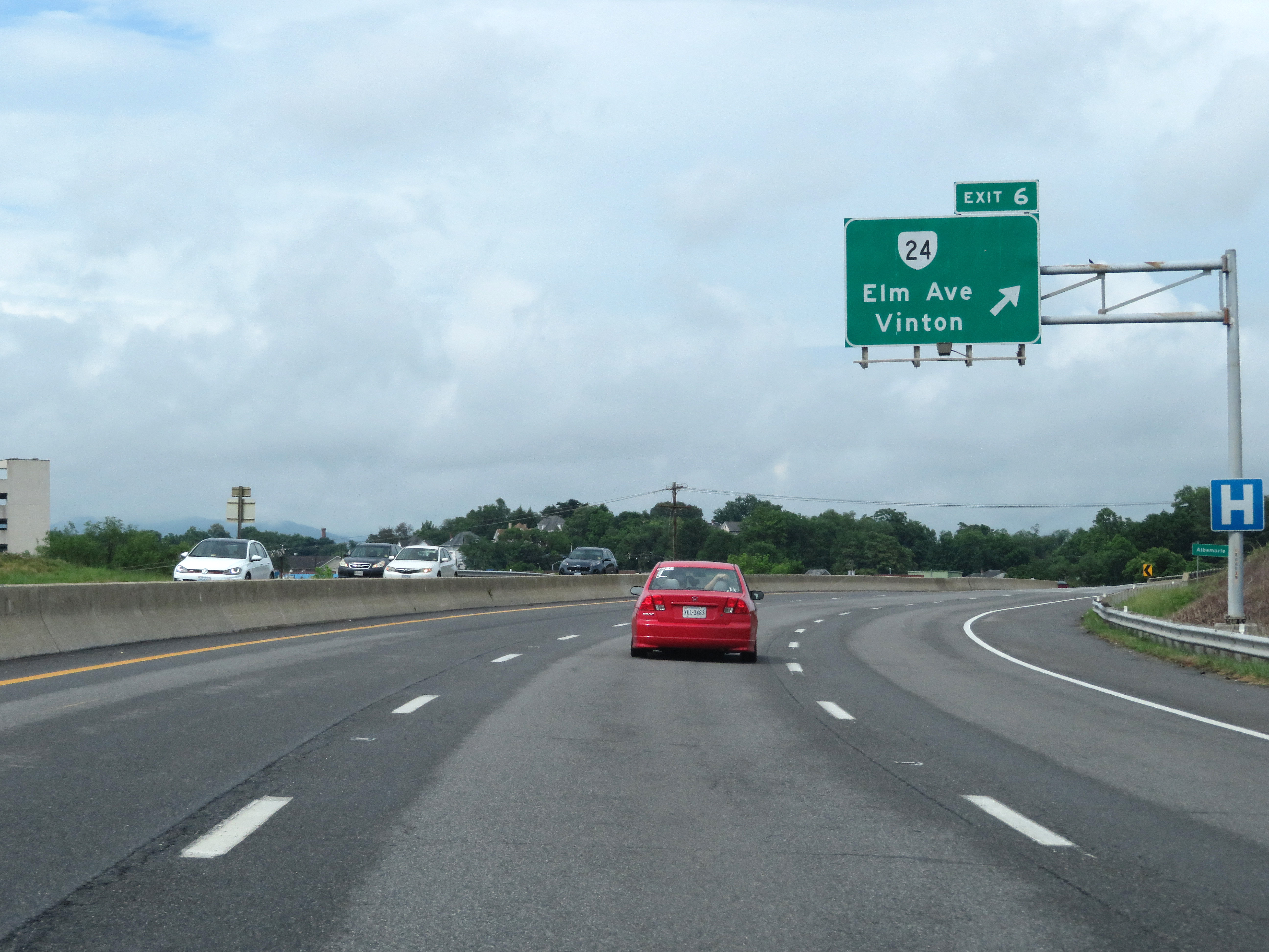 |
Interstate 581 North / US 220 North at Exit 6: VA 24 - Elm Ave / Vinton (Photo taken 5/26/18). |
 |
Immediately beyond Exit 6, this shield marks the beginning of Interstate 581 North, also noted by mile marker 0. Although the exit numbers increase in number as you go north, the mile markers start at 0 and increase going north, as expected on most Interstate highways. (Photo taken 5/26/18). |
 |
Interstate 581 North reassurance shield. (Photo taken 5/26/18). |
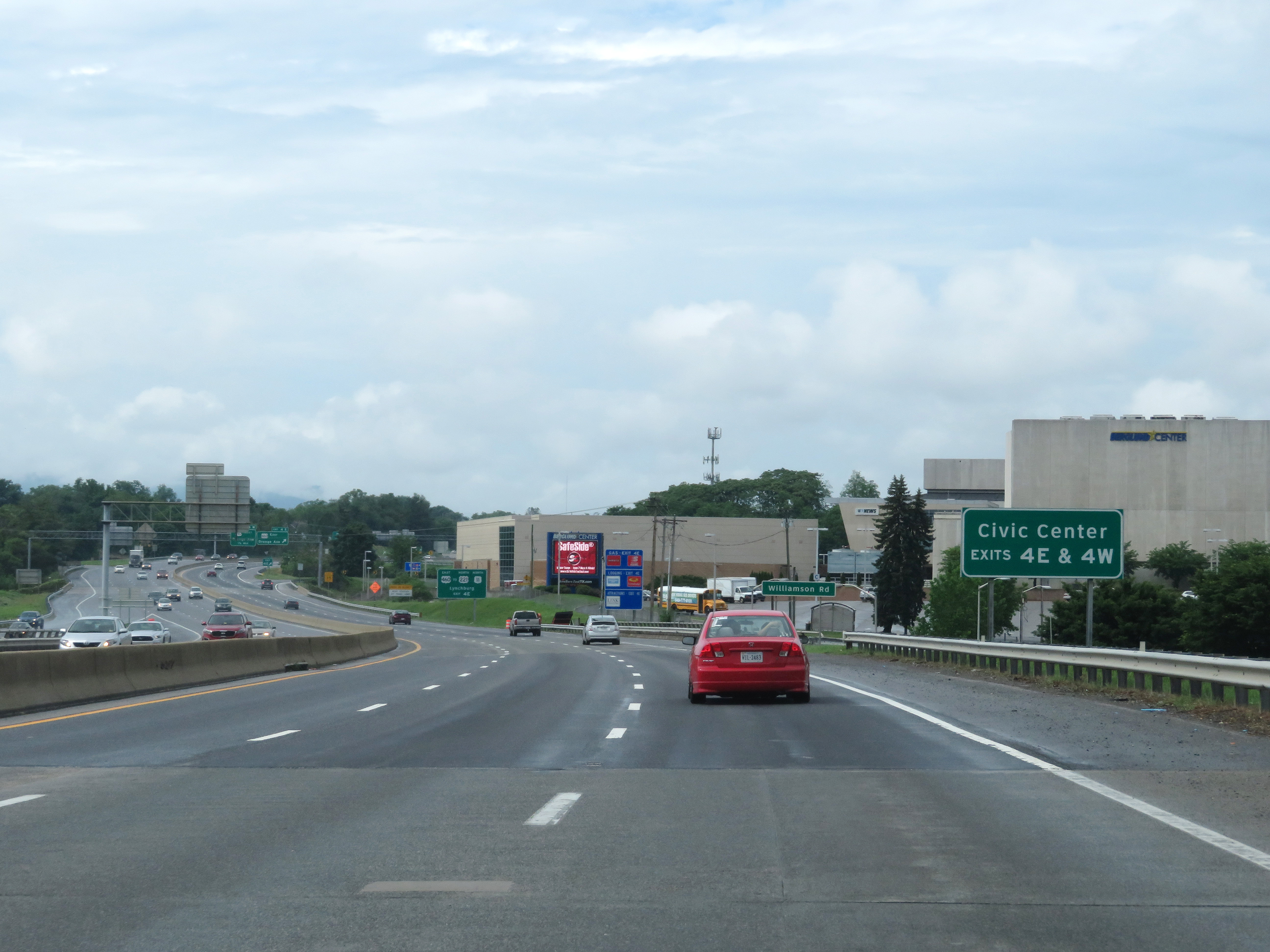 |
Take Exits 4E & 4W to the Civic Center. (Photo taken 5/26/18). |
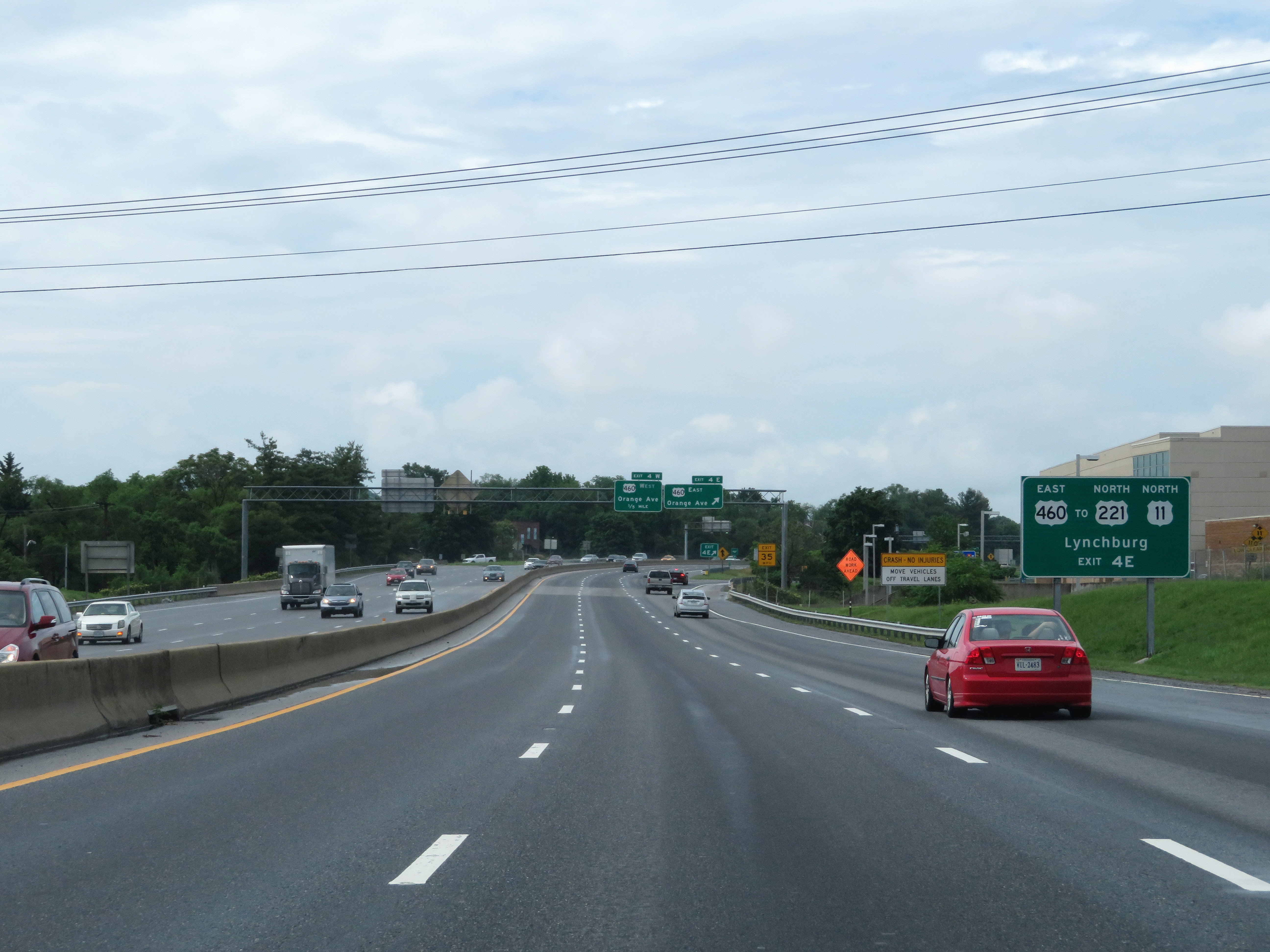 |
Also take Exit 4E to US 221 North / US 11 North toward Lynchburg. (Photo taken 5/26/18). |
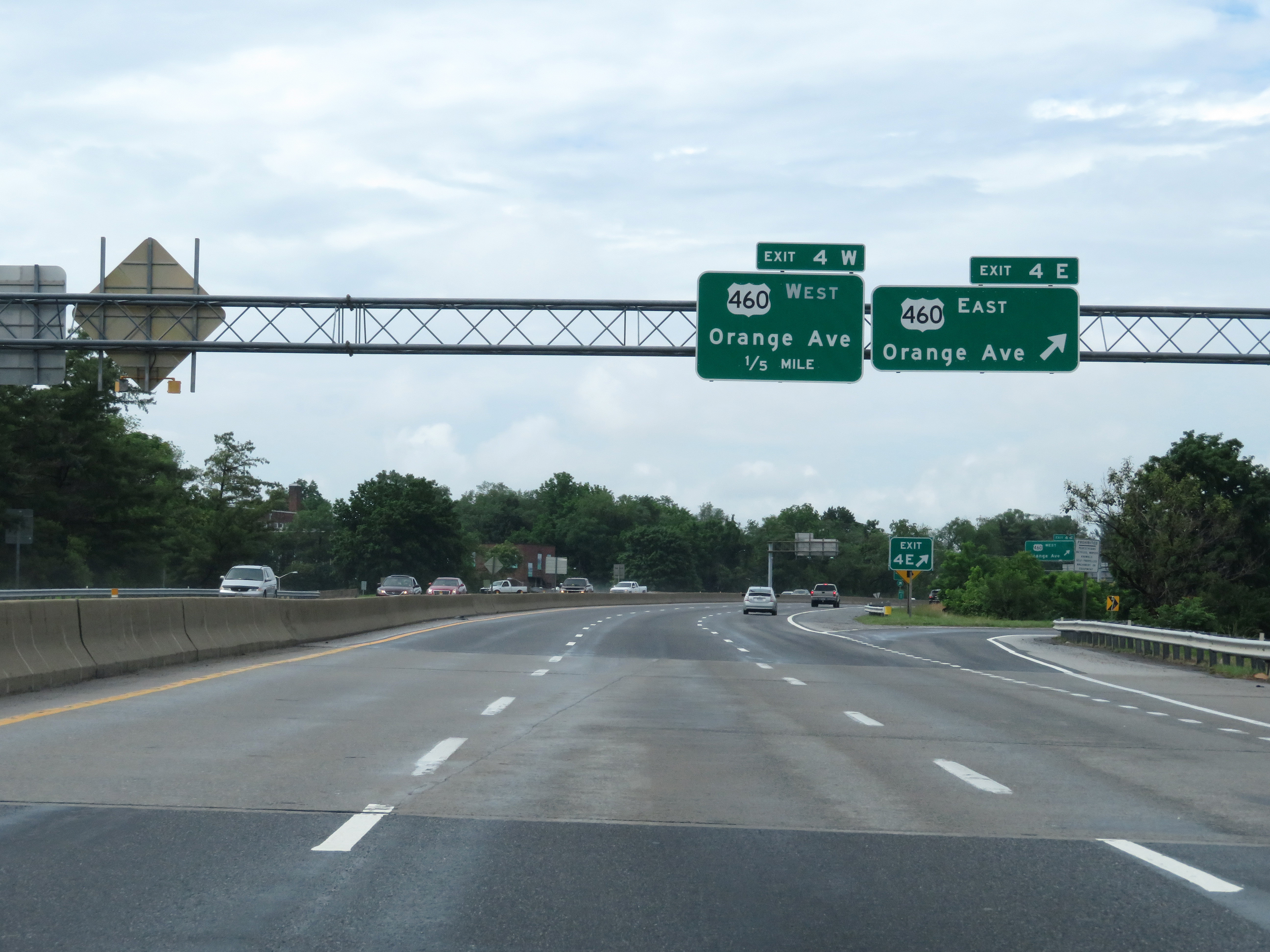 |
Interstate 581 North at Exit 4E: US 460 East - Orange Ave (Photo taken 5/26/18). |
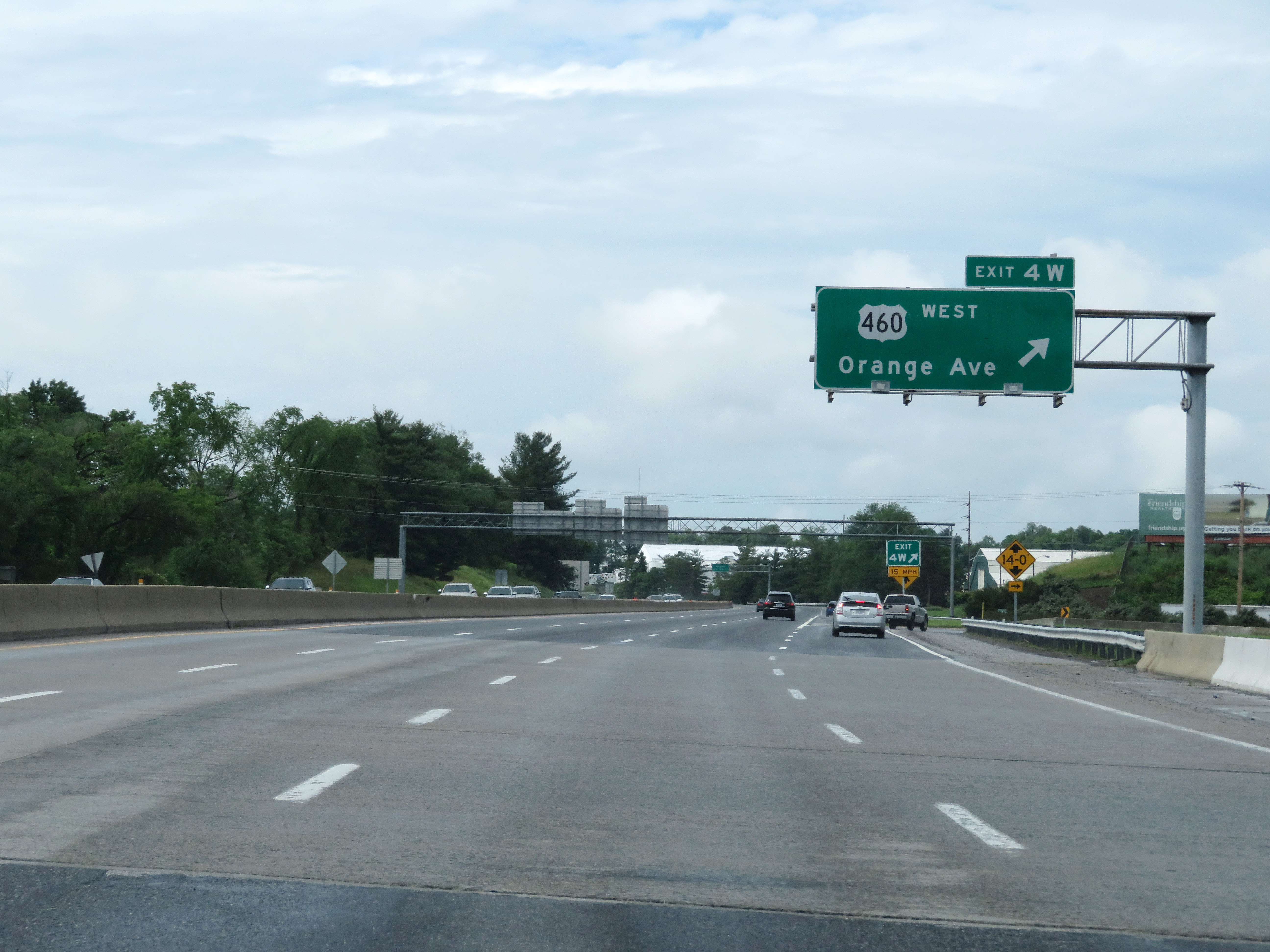 |
Interstate 581 North at Exit 4W: US 460 West - Orange Ave (Photo taken 5/26/18). |
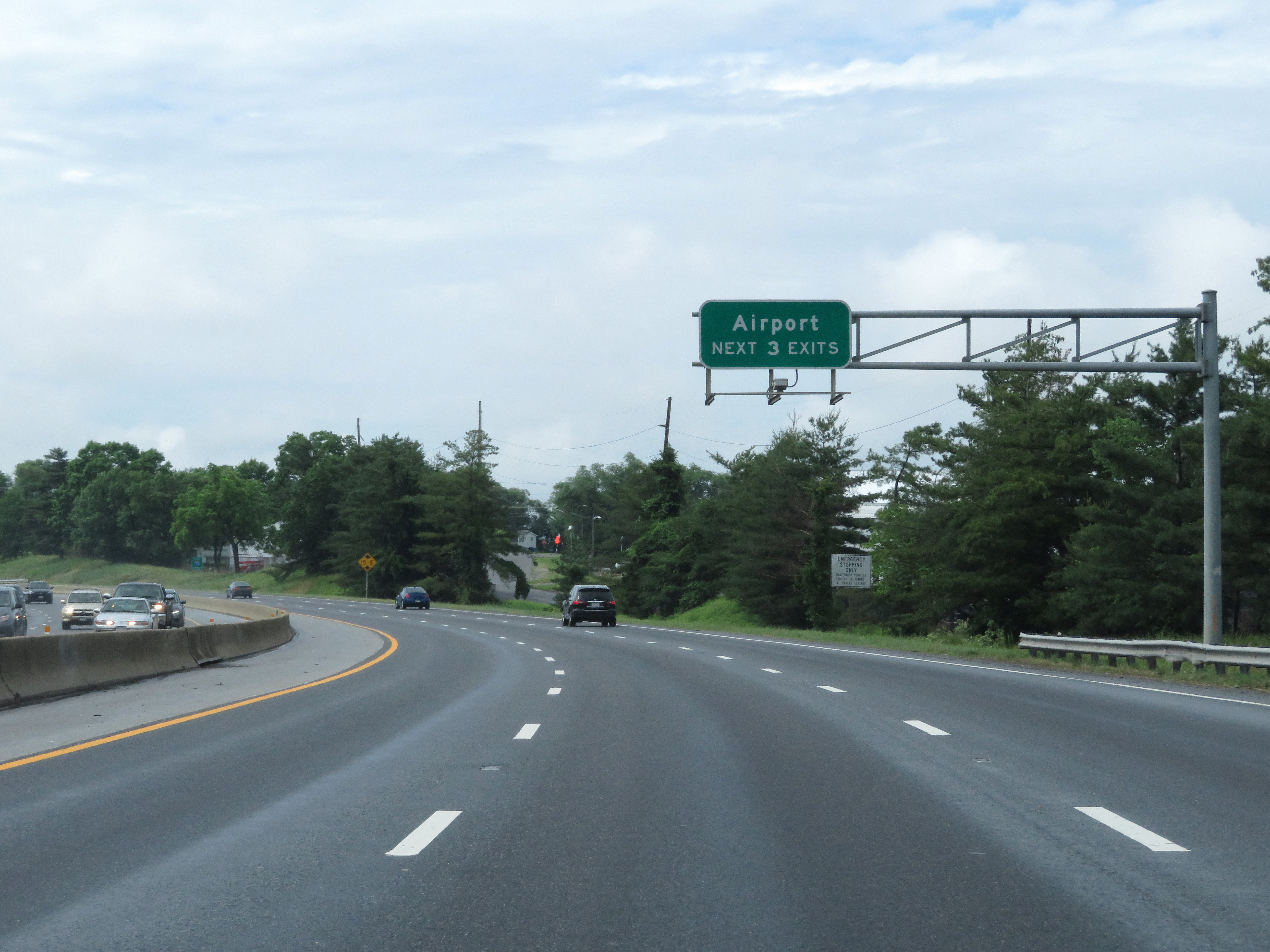 |
Take any of the next 3 exits to the Airport. (Photo taken 5/26/18). |
 |
As this sign reads, Interstate 581 is the future Interstate 73 corridor, once I-73 is extended further north from its current northern terminus in North Carolina. (Photo taken 5/26/18). |
 |
Another Interstate 581 North reassurance shield. (Photo taken 5/26/18). |
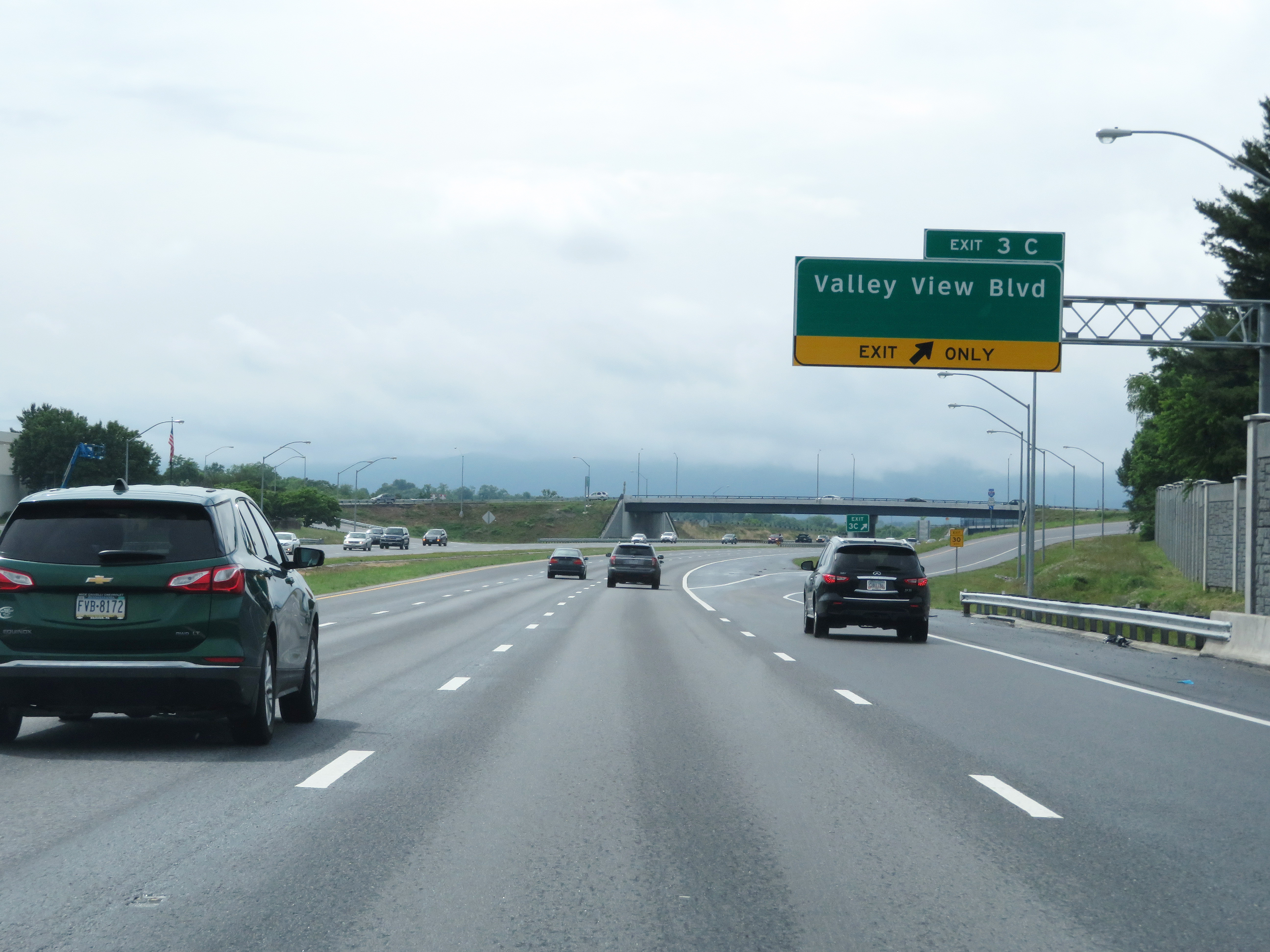 |
Interstate 581 North at Exit 3C: Valley View Blvd (Photo taken 5/26/18). |
 |
Interstate 581 North approaching Exits 3 E-W - 3/4 mile. (Photo taken 5/26/18). |
 |
View on Interstate 581 North at mile marker 3. (Photo taken 5/26/18). |
 |
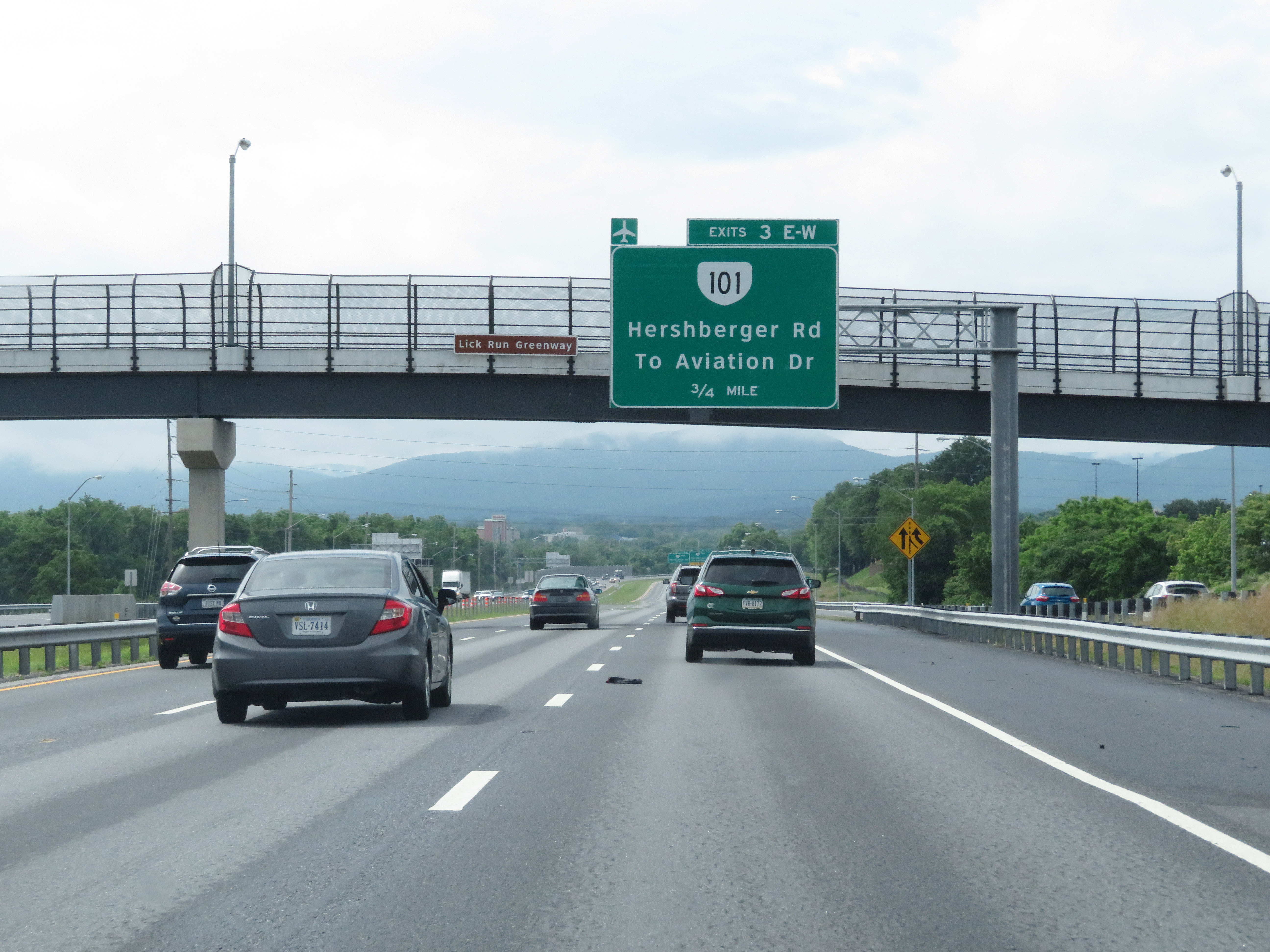
Interstate 581 North at Exit 3E: VA 101 East - Hershberger Rd / To Aviation Dr (Photo taken 5/26/18). |
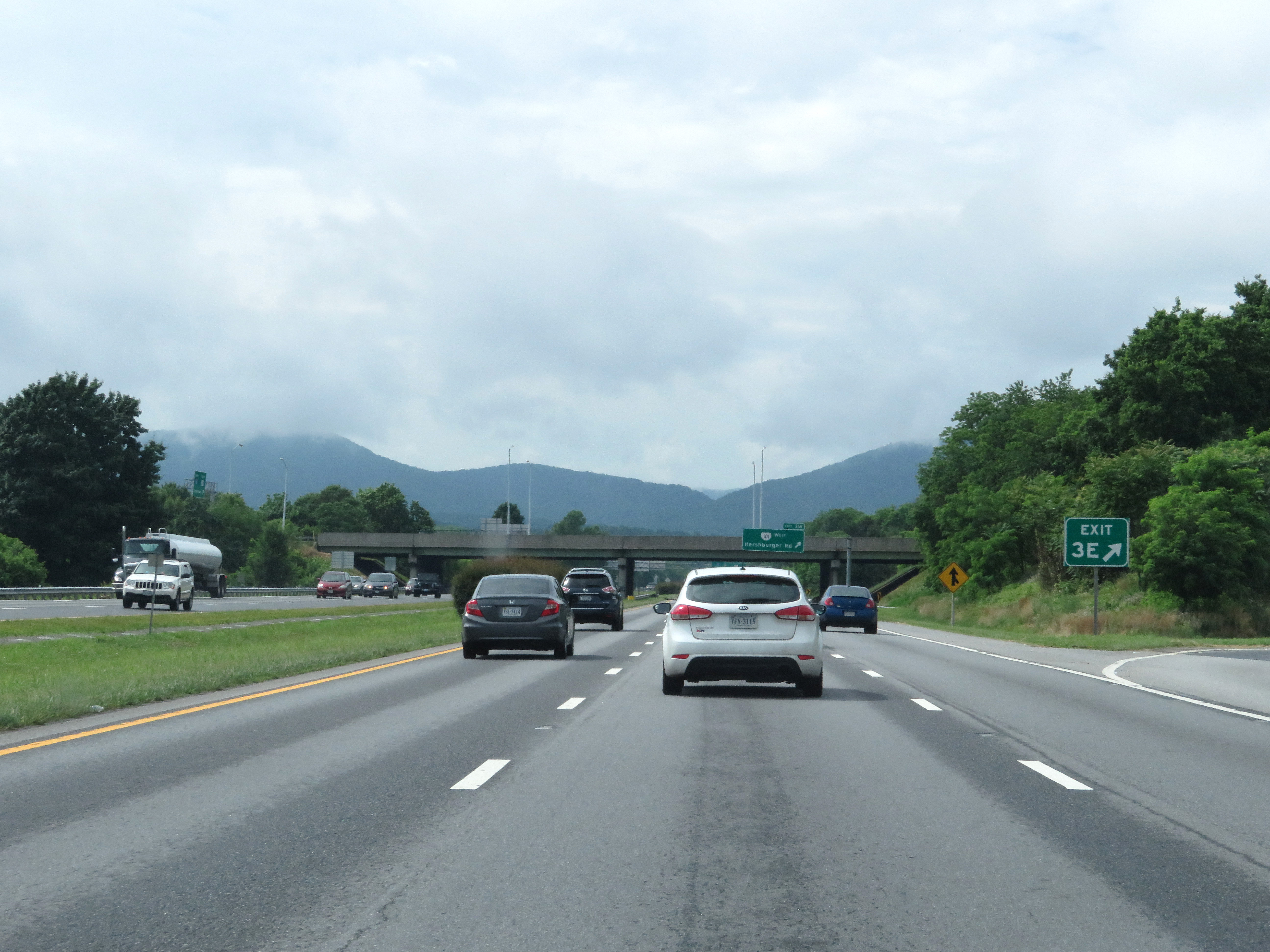 |
Gore point signage for Exit 3E. (Photo taken 5/26/18). |
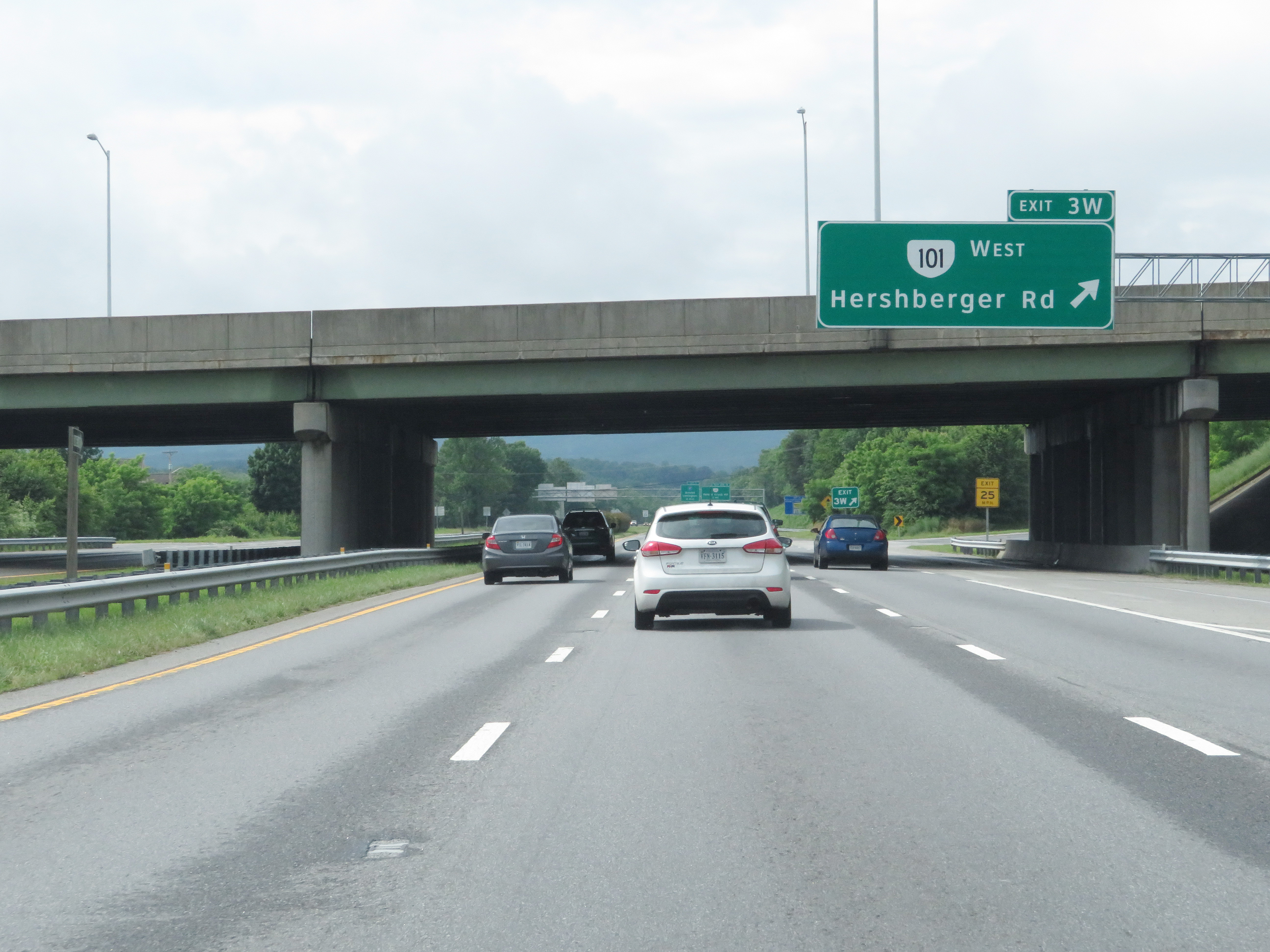 |
Interstate 581 North at Exit 3W: VA 101 West - Hershberger Rd (Photo taken 5/26/18). |
 |
Interstate 581 North reassurance shield. (Photo taken 5/26/18). |
 |
View on Interstate 581 North at mile marker 5. The speed limit remains 55 mph. (Photo taken 5/26/18). |
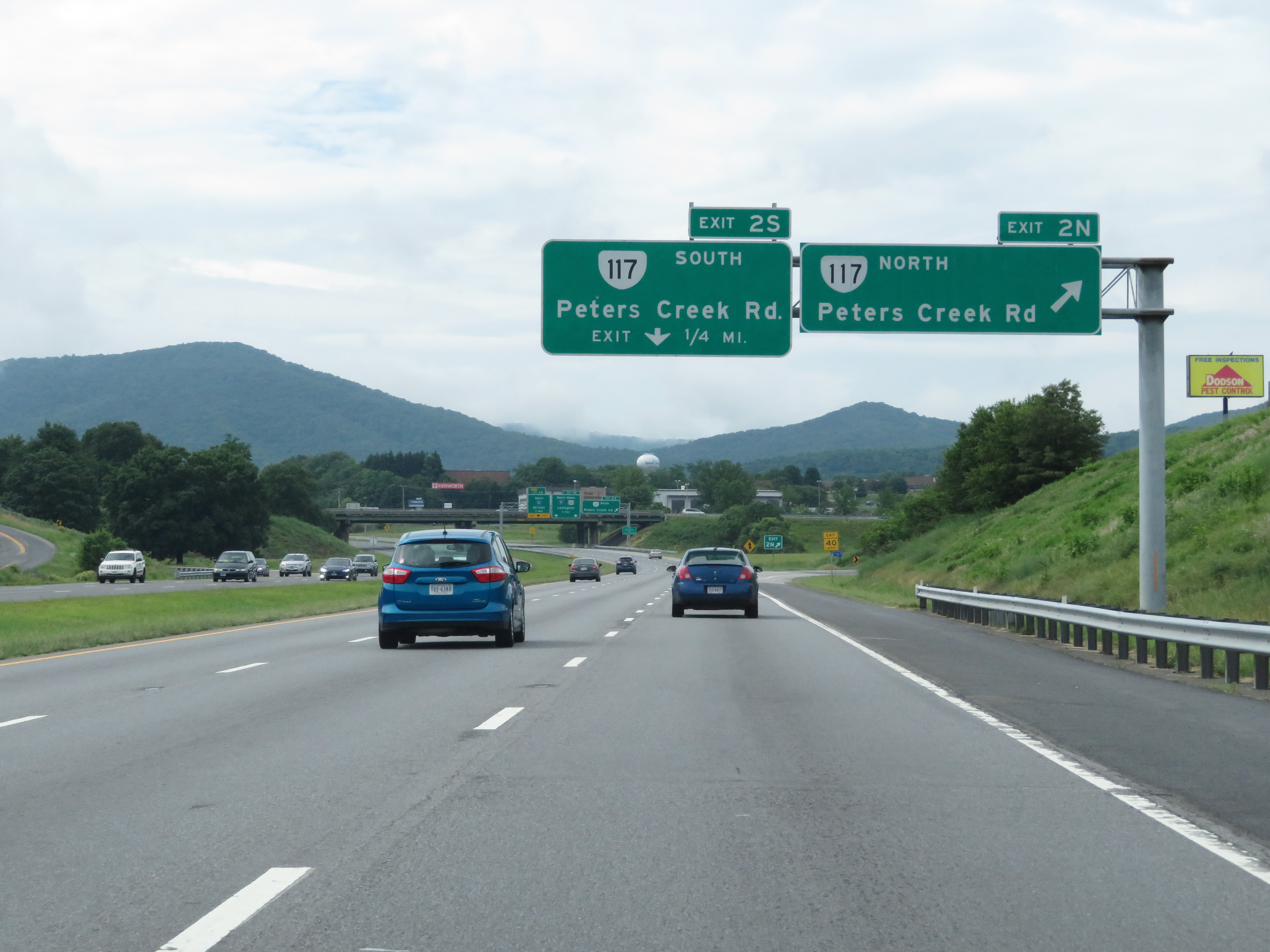 |
Interstate 581 North at Exit 2N: VA 117 North - Peters Creek Rd (Photo taken 5/26/18). |
 |
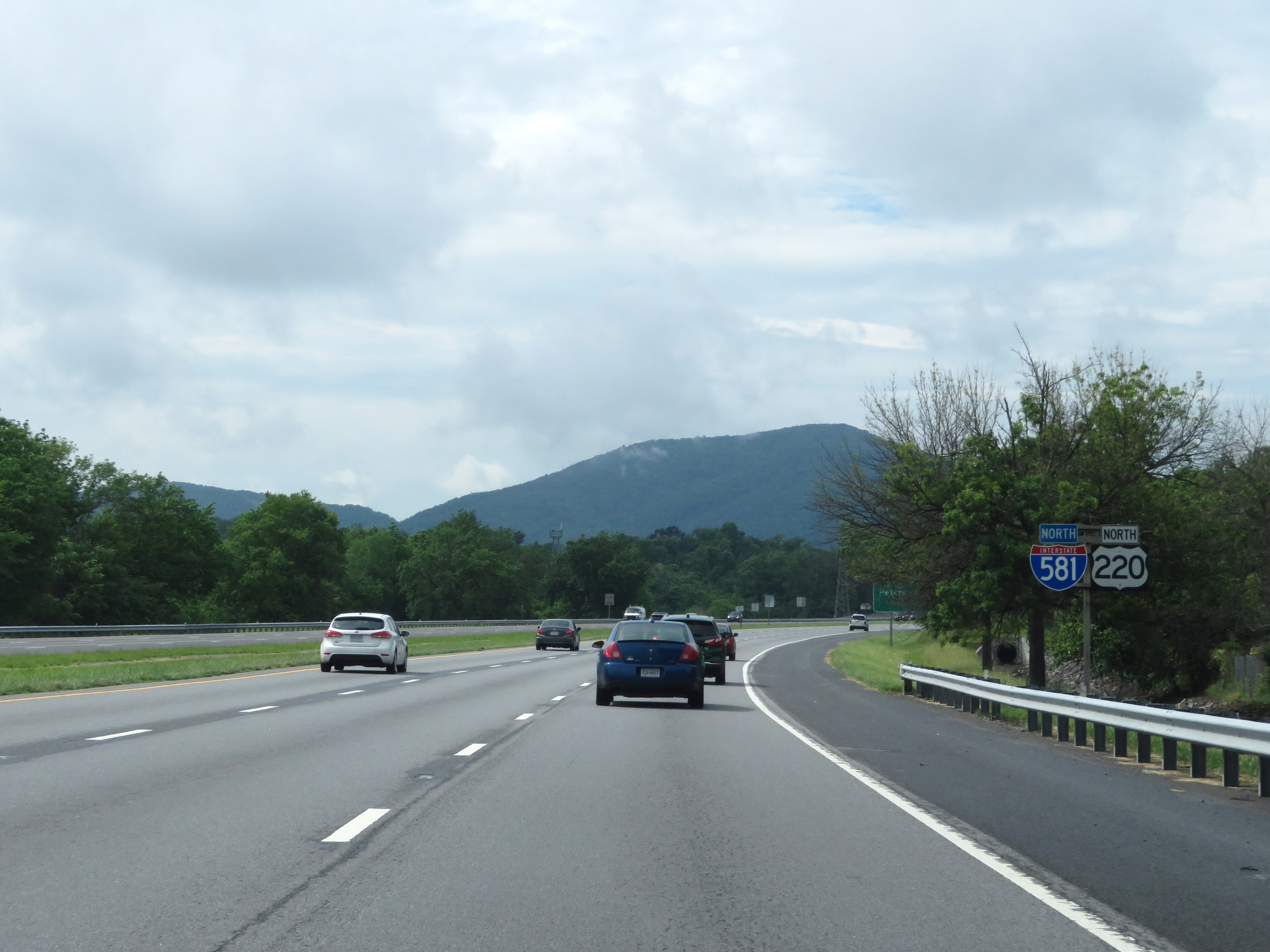
Interstate 581 North at Exit 2S: VA 117 South - Peters Creek Rd. Also at this point, I-581 North leaves the City of Roanoke to enter Roanoke County. (Photo taken 5/26/18). |
 |
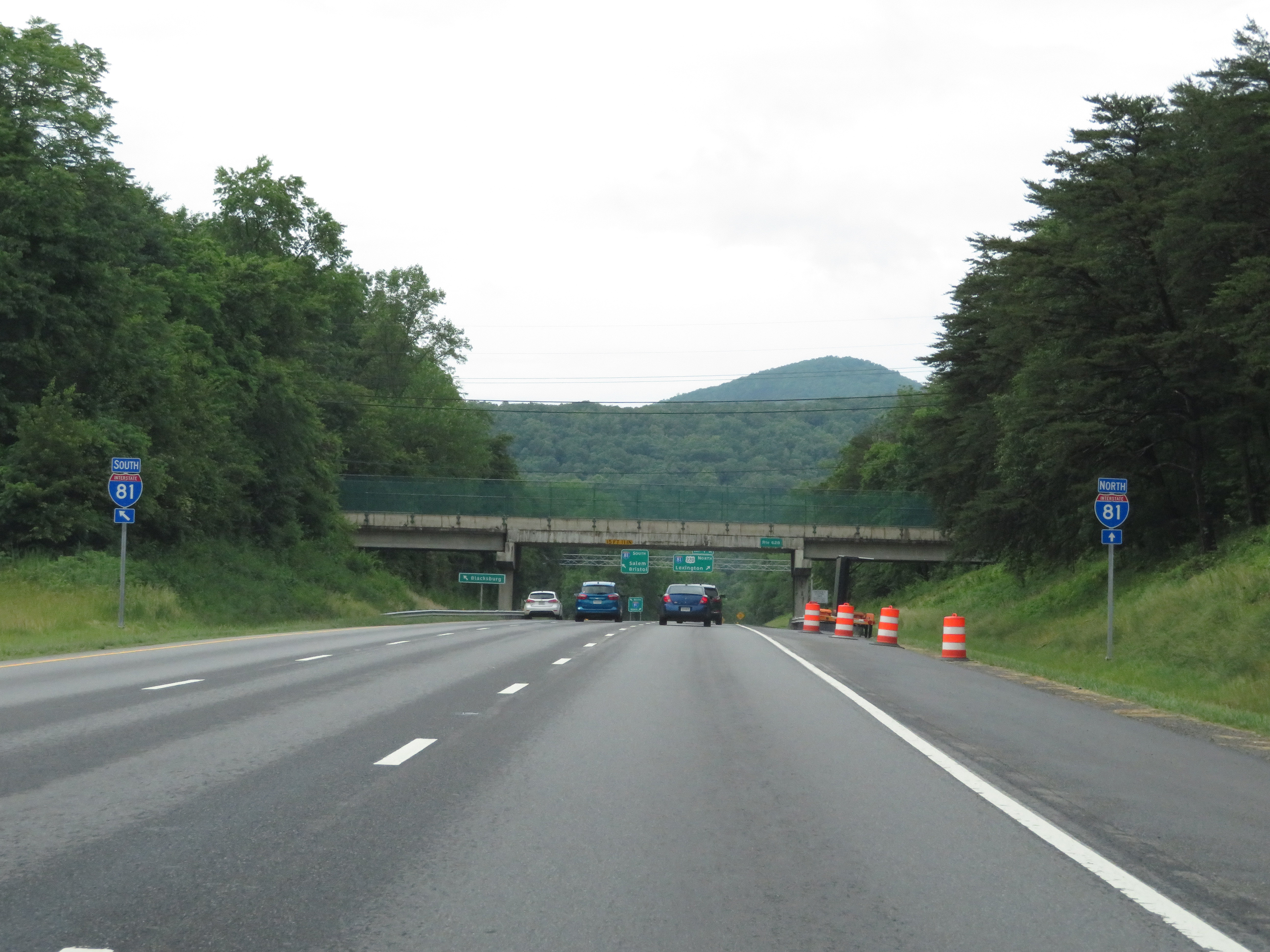
Approaching the junction of Interstate 81 and the northern terminus of Interstate 581, traffic to I-81 South via Exit 1S must get to the left lane as this advance signage shows. (Photo taken 5/26/18). |
 |
View on Interstate 581 North approaching its northern terminus at the junction of Interstate 81. (Photo taken 5/26/18). |
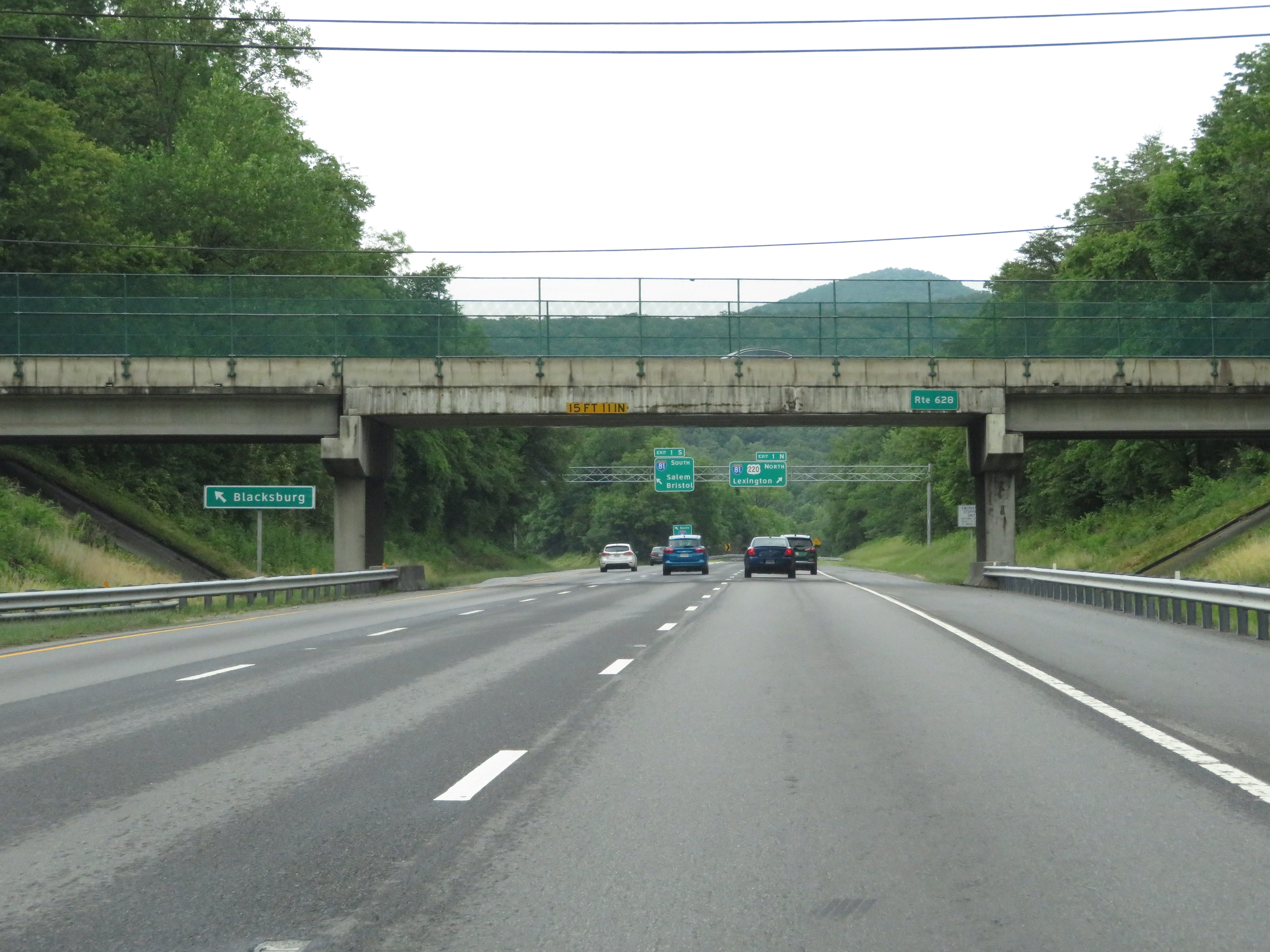 |
Traffic to Blacksburg should use the left lane and follow Interstate 81 South via Exit 1S. (Photo taken 5/26/18). |
 |
Interstate 581 North at Exit 1N: Interstate 81 North / US 220 North - Lexington; Exit 1S: Interstate 81 South - Salem / Bristol (Photo taken 5/26/18). |
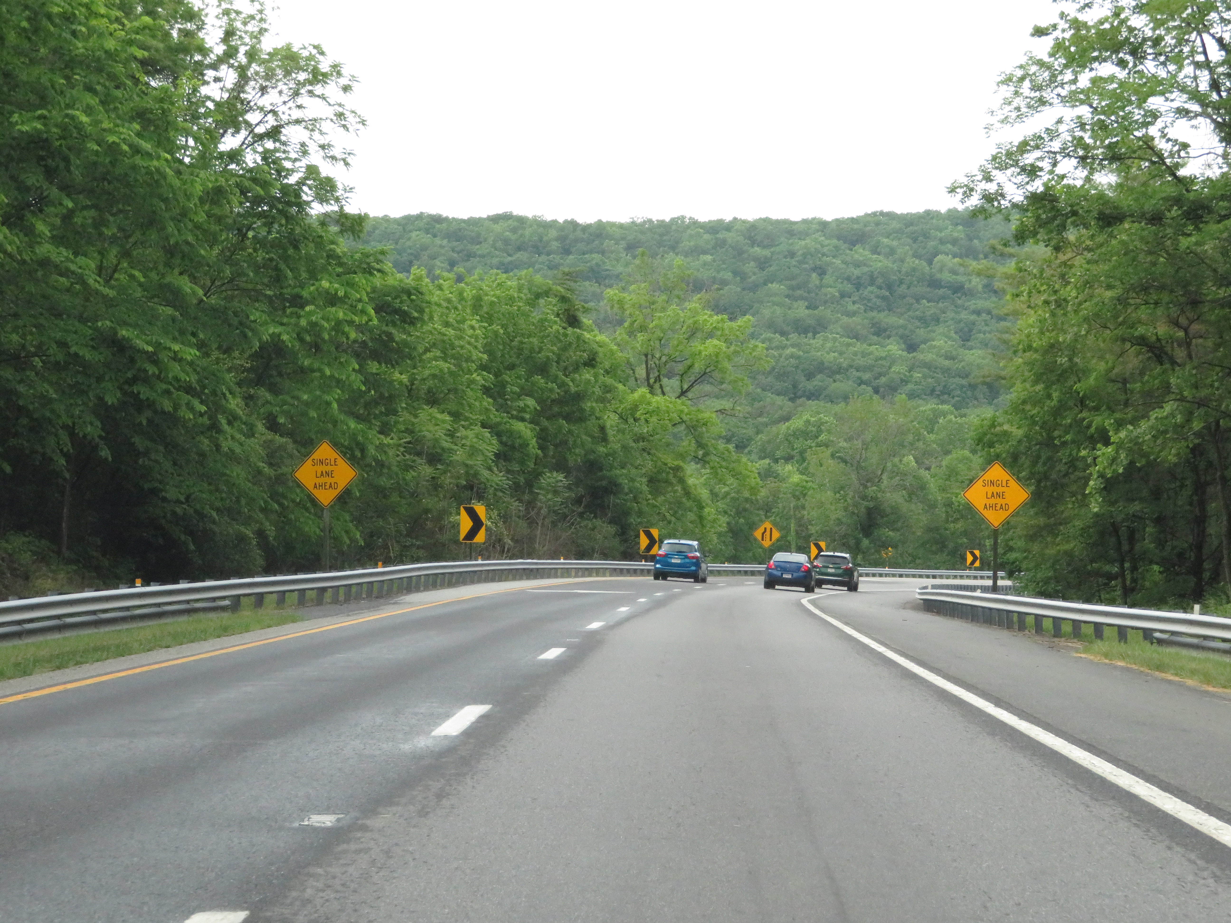 |
The two right lanes of Interstate 581 North become the ramp to Interstate 81 North via Exit 1N, seen here. The left lane will come to an end ahead. (Photo taken 5/26/18). |
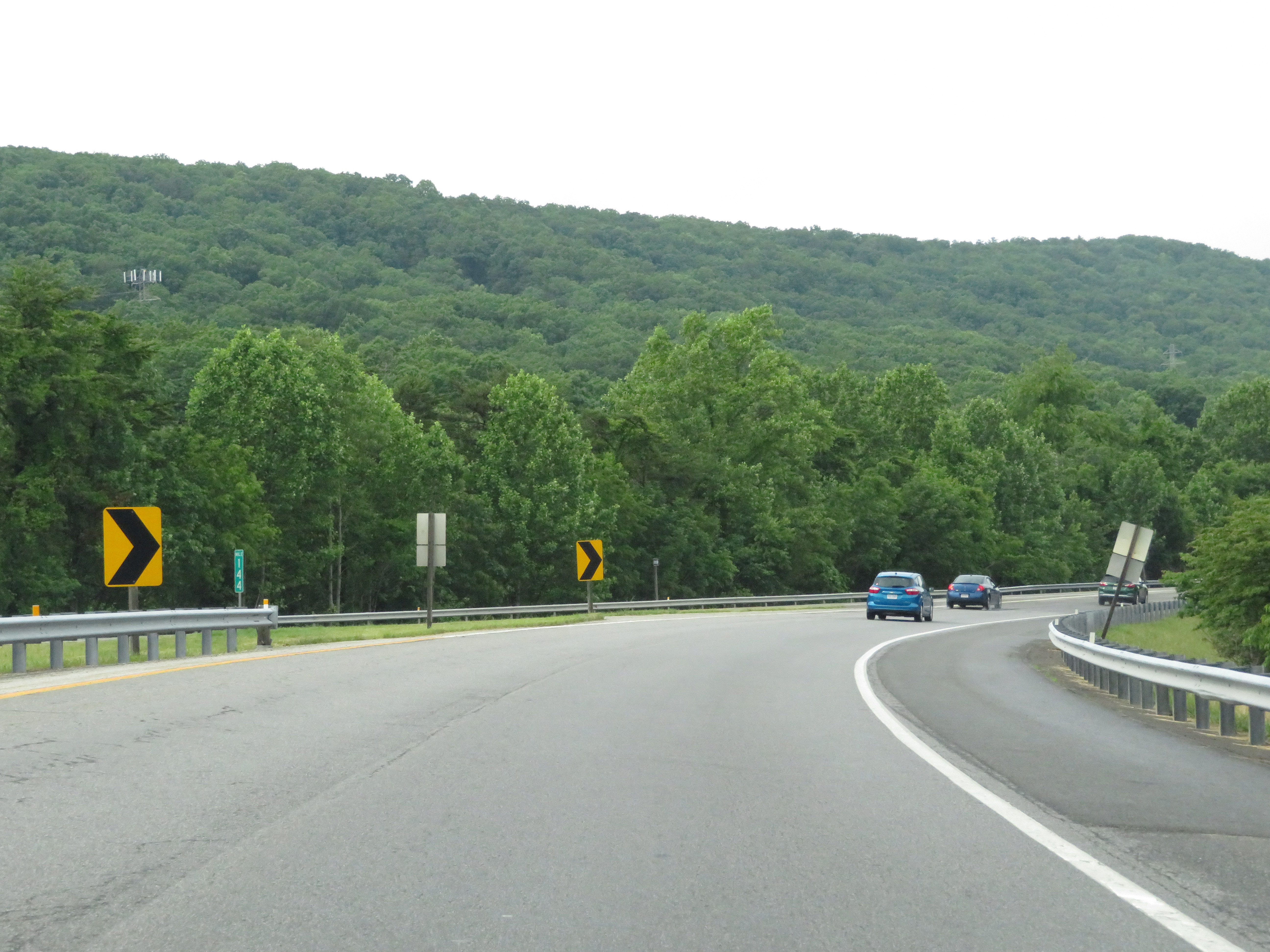 |
View on the ramp to Interstate 81 North from Interstate 581 North, as it prepares to join the northbound lanes of I-81 at mile marker 144. (Photo taken 5/26/18). |