Road Information |
||
 |
||
| Total Mileage in State: | 22 miles | |
| Counterclockwise End: | At District of Columbia line | |
| Clockwise End: | At Maryland state line | |
| Mileage covered in Photos: | 22 miles | |
| Counties covered in Photos: | Fairfax, City of Alexandria | |
| Major Junctions in Photos: | I-66 West, in Tysons Corner I-95, in Springfield I-395, in Springfield |
|
| Control Cities in Photos: | Tysons Corner, Annandale, Springfield, Alexandria | |
Outer Loop
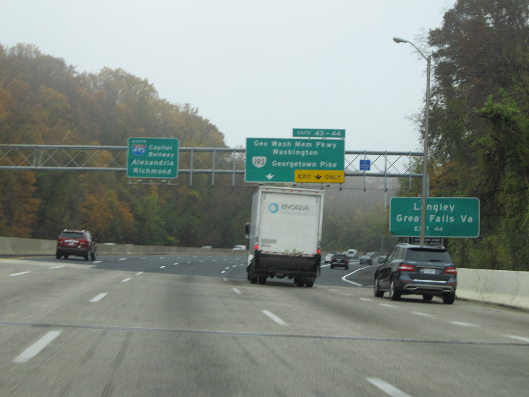 |
Interstate 495 Outer Loop (South) as it crosses the Potomac River into Virginia from Maryland. Take Exit 44 to Langley and Great Falls. (Photo taken 11/5/15). |
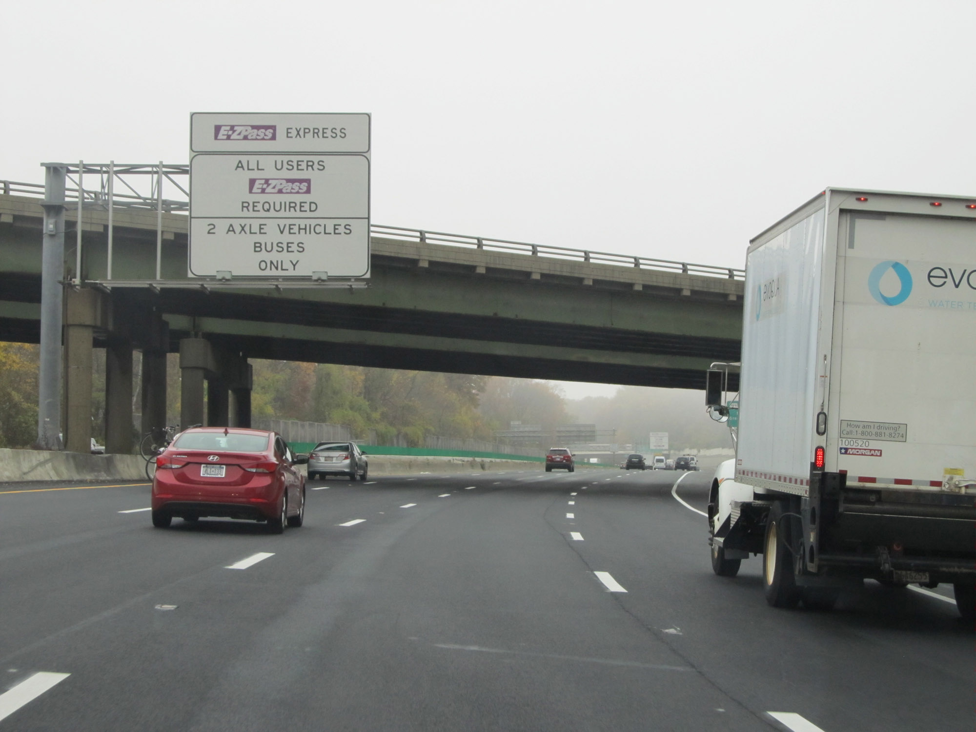 |
Express lanes will appear ahead on Interstate 495 Outer Loop (Capital Beltway) on the left. The express lanes are tolled, and EZ Pass is required for electronic tolling. The lanes are restricted to 2 axle vehicles and buses only - no trucks. (Photo taken 11/5/15). |
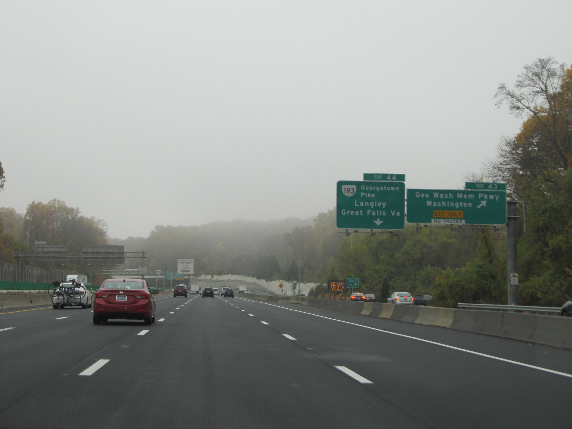 |
Interstate 495 Outer Loop (South) at Exit 43: George Washington Memorial Pkwy / Washington (Photo taken 11/5/15). |
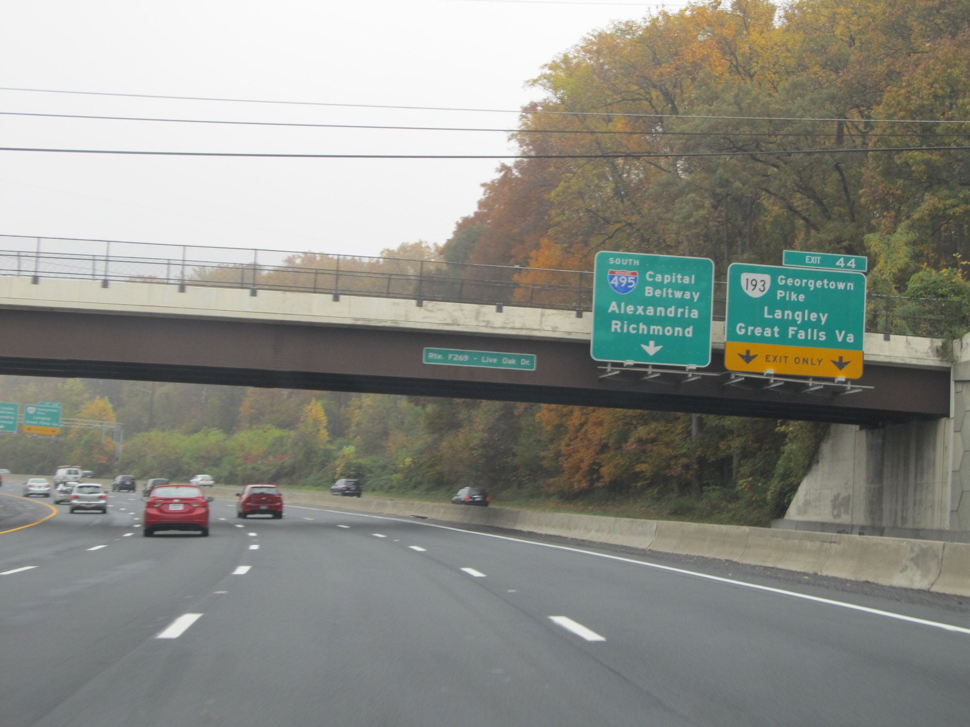 |
Interstate 495 Outer Loop (South) at Exit 44: VA 193 (Georgetown Pike) - Langley / Great Falls, VA (Photo taken 11/5/15). |
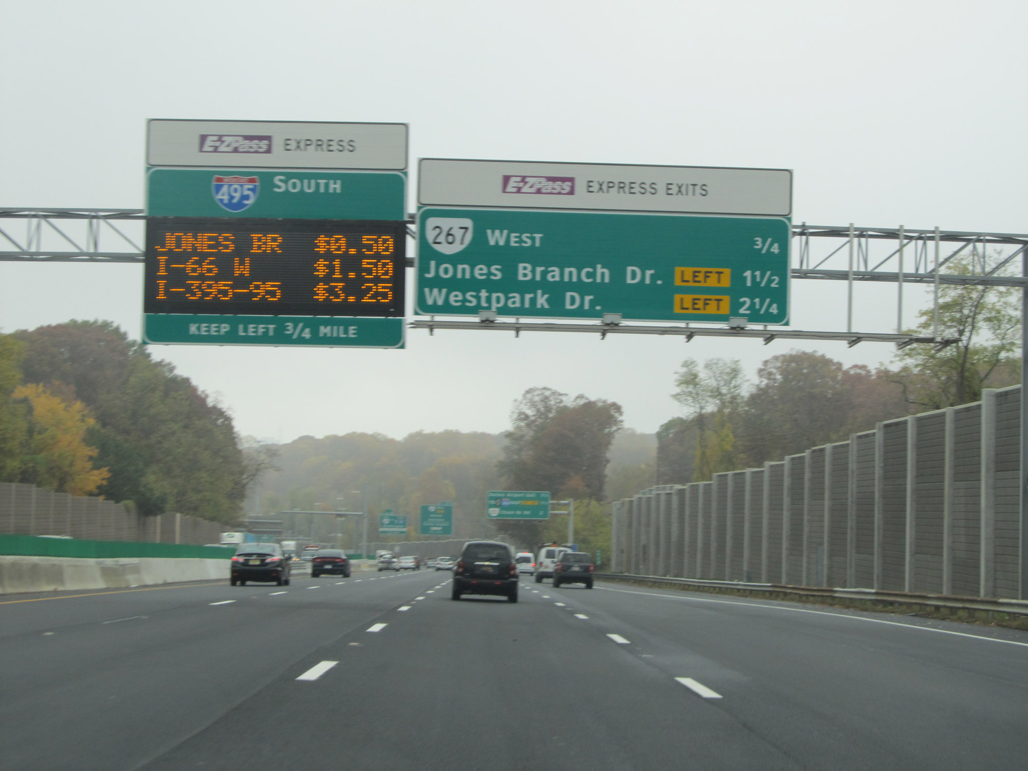 |
Overhead signage listing the distances to the next 3 exits available from the express lanes, as well as the current toll rates to three of the more heavily used interchanges on Interstate 495 Outer Loop (South). The beginning of the express lanes is 3/4 mile ahead, and traffic loooking to use them should keep left. (Photo taken 11/5/15). |
 |
Overhead mileage sign listing the distances to the three upcoming exits on Interstate 495 Outer Loop (South). (Photo taken 11/5/15). |
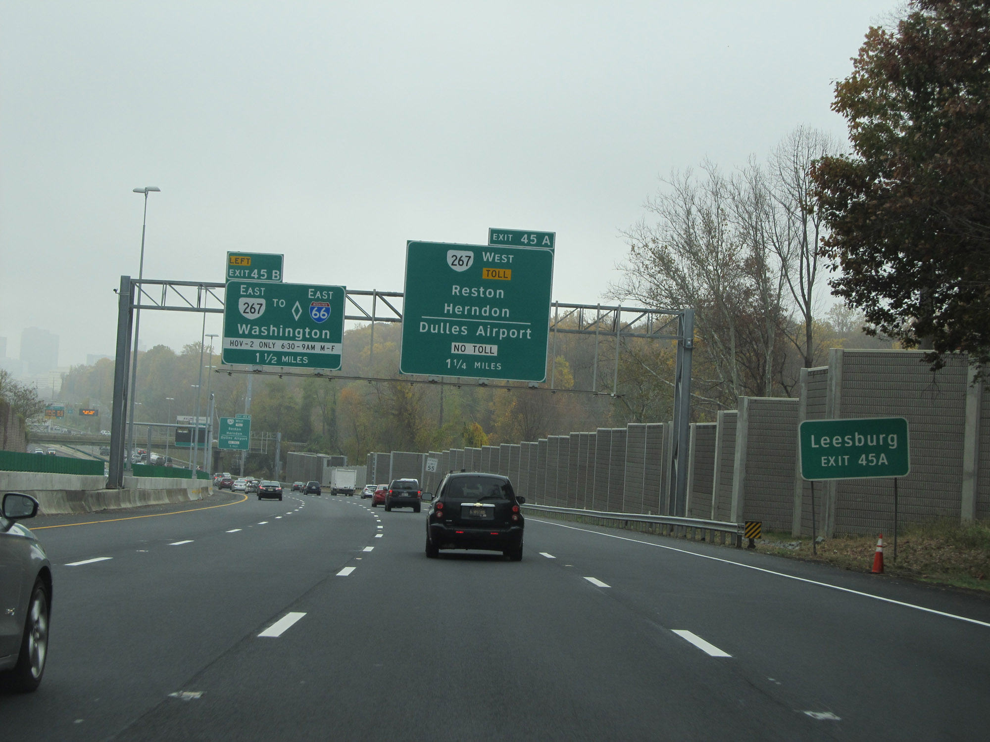 |
Take Exit 45A to Leesburg. (Photo taken 11/5/15). |
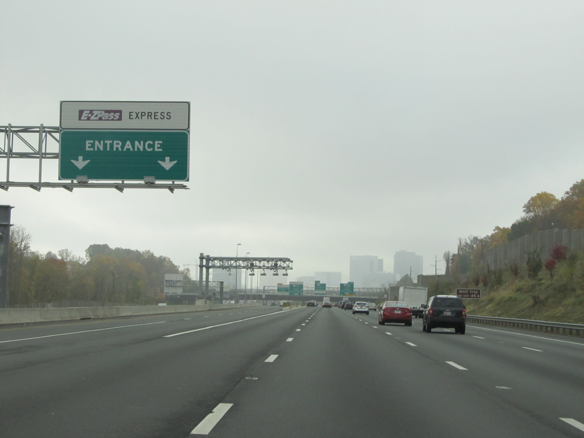 |
Express lane entrance on the left approaching Exit 45A on Interstate 495 Outer Loop (South), as the express lanes begin. (Photo taken 11/5/15). |
 |
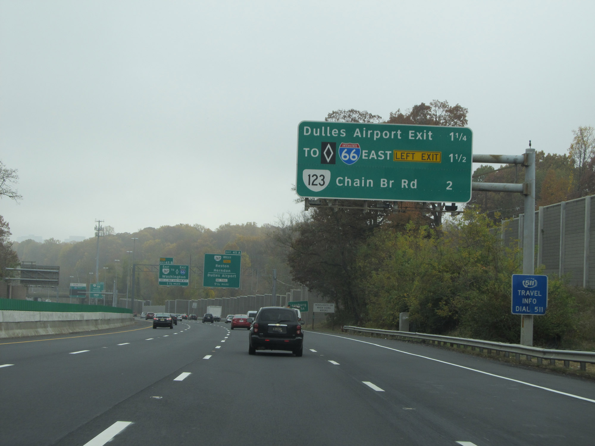
Interstate 495 Outer Loop (South) at Exit 45A: VA 267 Toll West - Reston / Herndon / Dulles Airport. There is no toll to Dulles Airport. (Photo taken 11/5/15). |
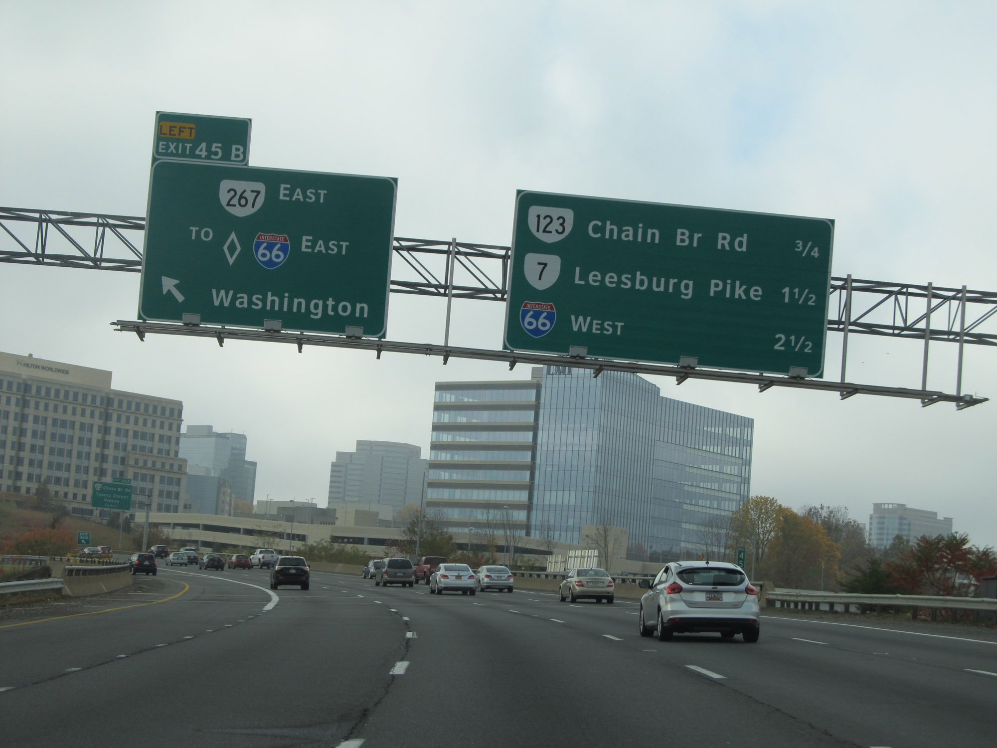 |
Interstate 495 Outer Loop (South) at Exit 45B: VA 267 East / To Interstate 66 East - Washington (Photo taken 11/5/15). |
 |
Interstate 495 Outer Loop (South) at Exit 46A: VA 123 South (Chain Bridge Rd) - Tysons Corner / Vienna (Photo taken 11/5/15). |
 |
Interstate 495 Outer Loop (South) at Exit 46B: VA 123 North (Chain Bridge Rd) - McLean (Photo taken 11/5/15). |
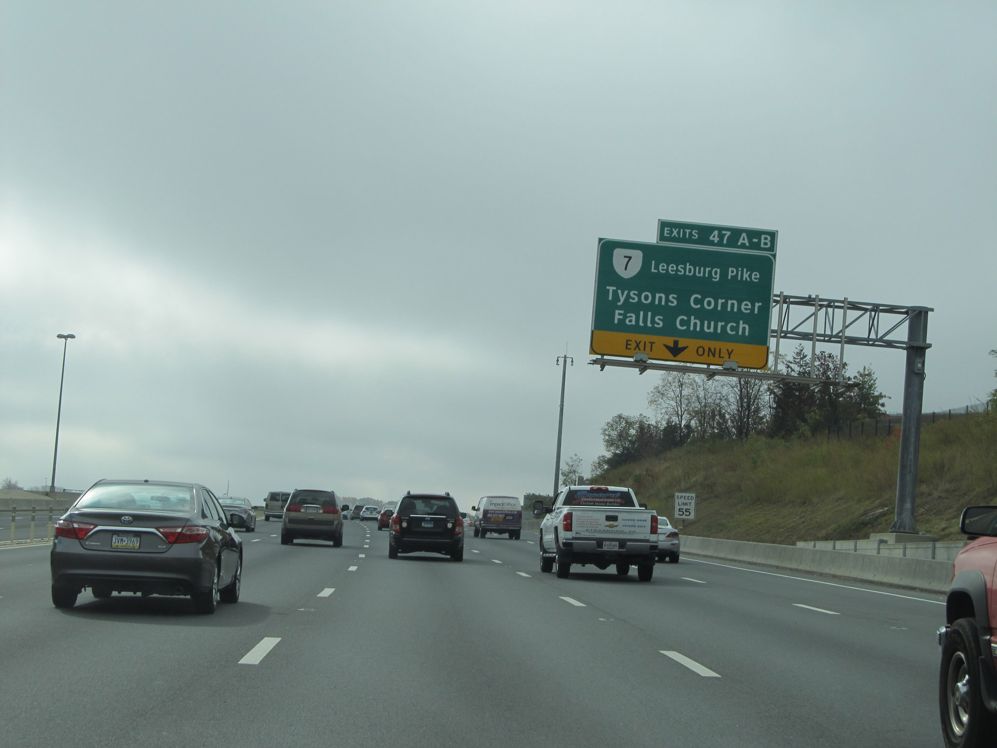 |
Interstate 495 Outer Loop (South) at Exits 47A-B: VA 7 (Leesburg Pike) - Tysons Corner / Falls Church (Photo taken 11/5/15). |
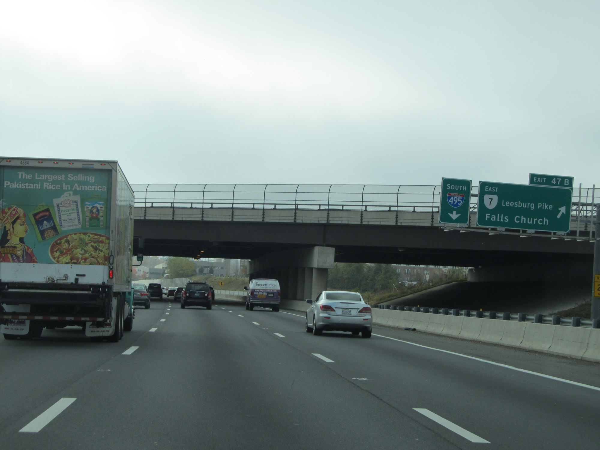 |
Interstate 495 Outer Loop (South) at Exit 47B: VA 7 East (Leesburg Pike) - Falls Church (Photo taken 11/5/15). |
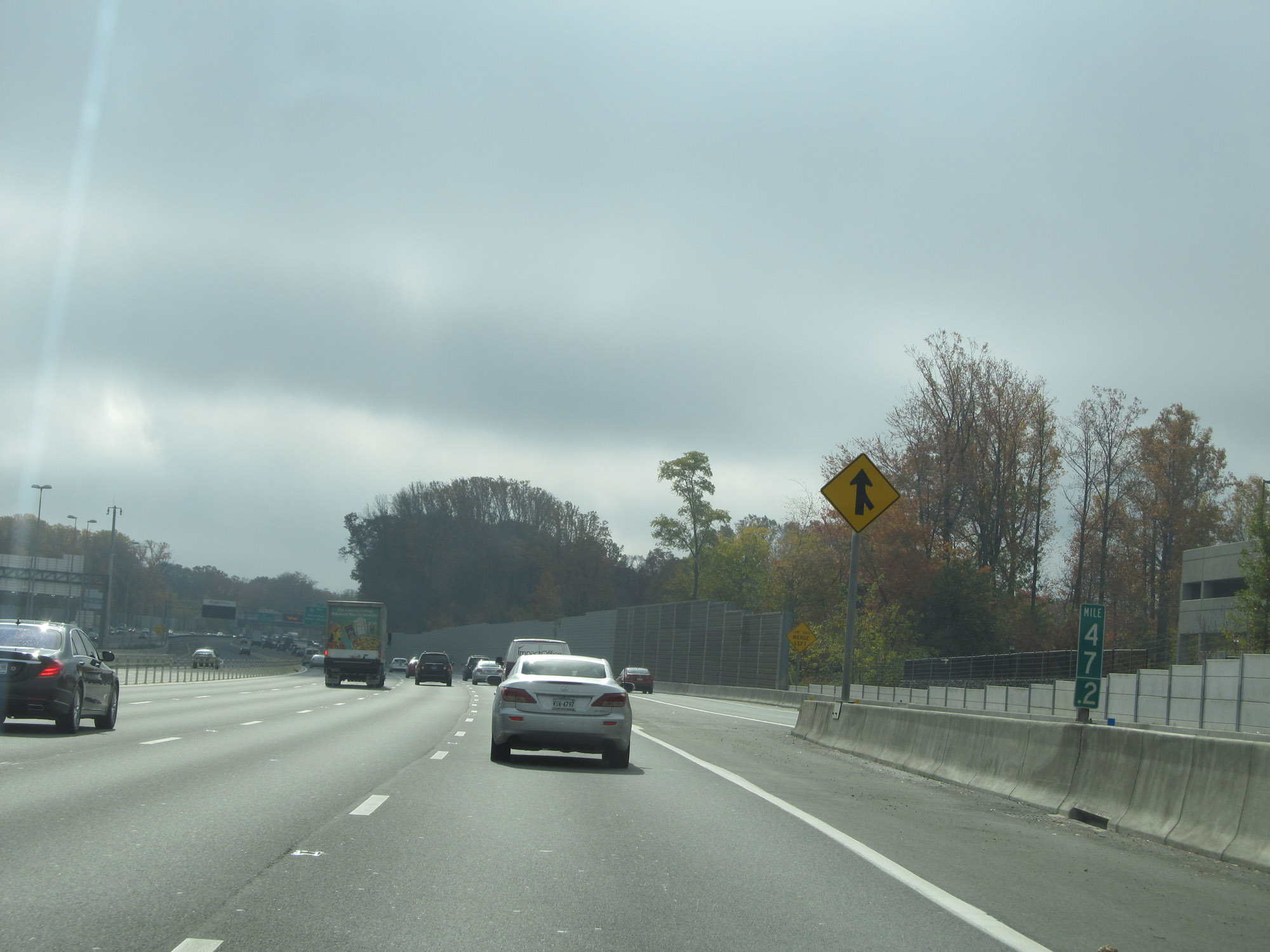 |
View on Interstate 495 Outer Loop (South) at mile marker 47.2. (Photo taken 11/5/15). |
 |
Interstate 495 Outer Loop (South) approaching Exit 49 - 3/4 mile. (Photo taken 11/5/15). |
 |
Interstate 495 Outer Loop (South) at Exit 49: Interstate 66 West - Manassas / Front Royal (Photo taken 11/5/15). |
 |
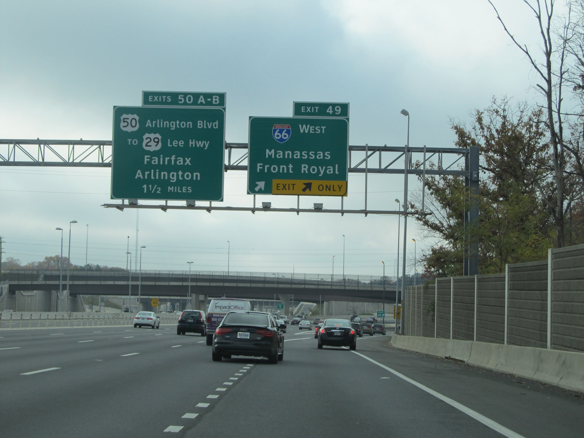
Interstate 495 Outer Loop (South) approaching Exits 50A-B. (Photo taken 11/5/15). |
 |
Interstate 495 Outer Loop (South) at Exits 50A-B: US 50 (Arlington Blvd) / To US 29 (Lee Hwy) - Fairfax / Arlington (Photo taken 11/5/15). |
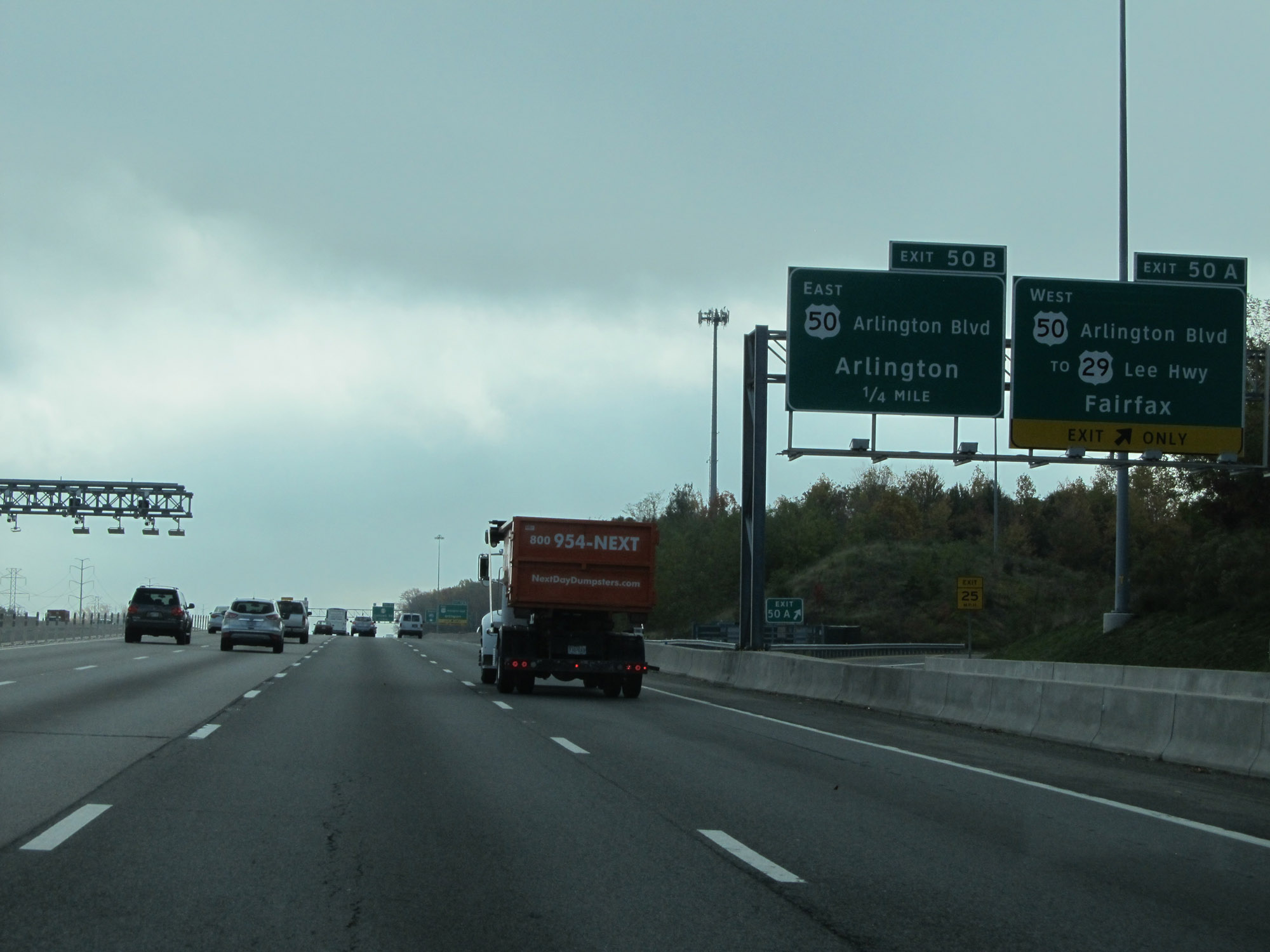 |
Interstate 495 Outer Loop (South) at Exit 50A: US 50 West (Arlington Blvd) / To US 29 (Lee Hwy) - Fairfax (Photo taken 11/5/15). |
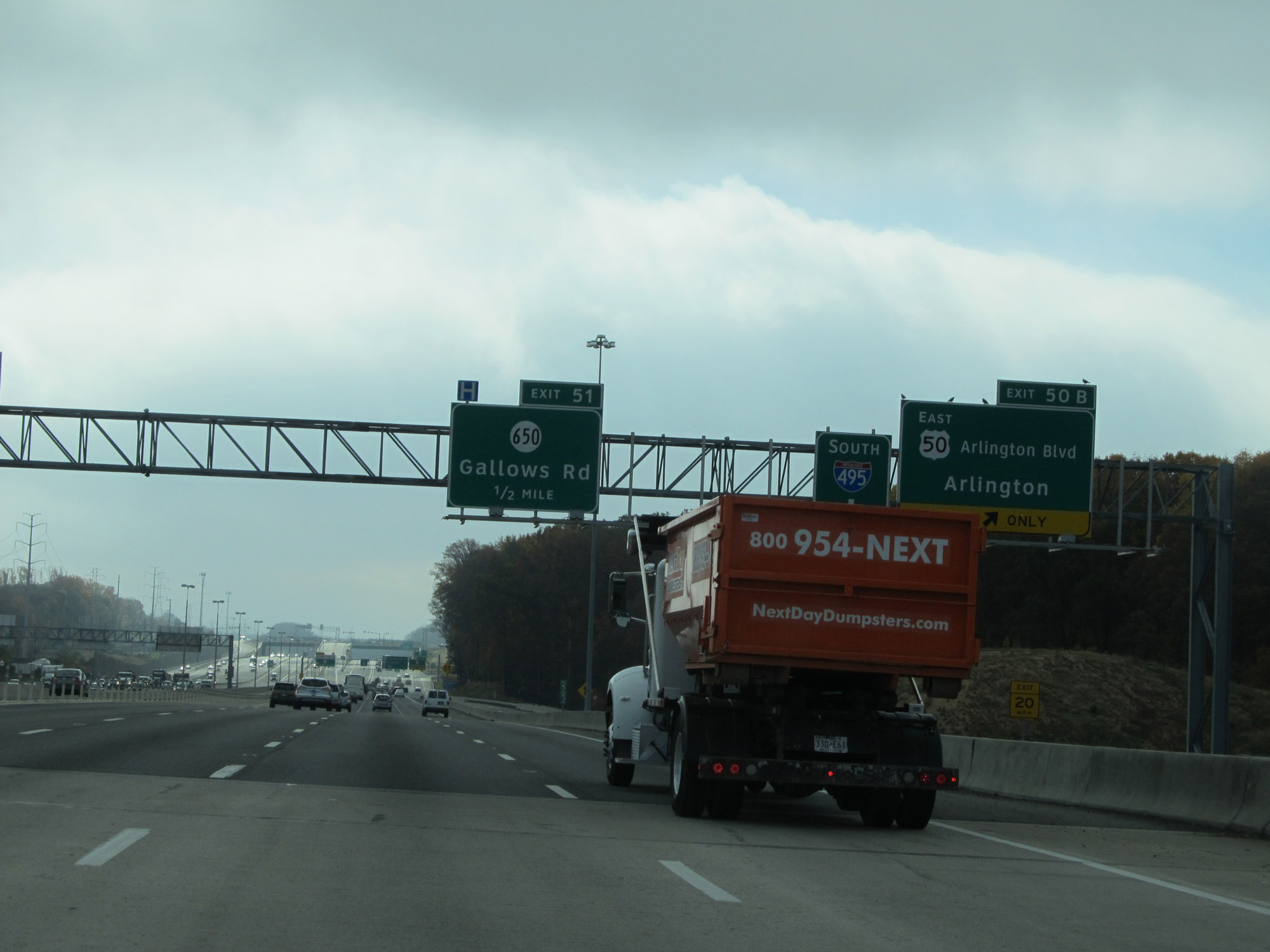 |
Interstate 495 Outer Loop (South) at Exit 50B: US 50 East (Arlington Blvd) - Arlington (Photo taken 11/5/15). |
 |
Interstate 495 Outer Loop (South) at Exit 51: SR 650 - Gallows Rd (Photo taken 11/5/15). |
 |
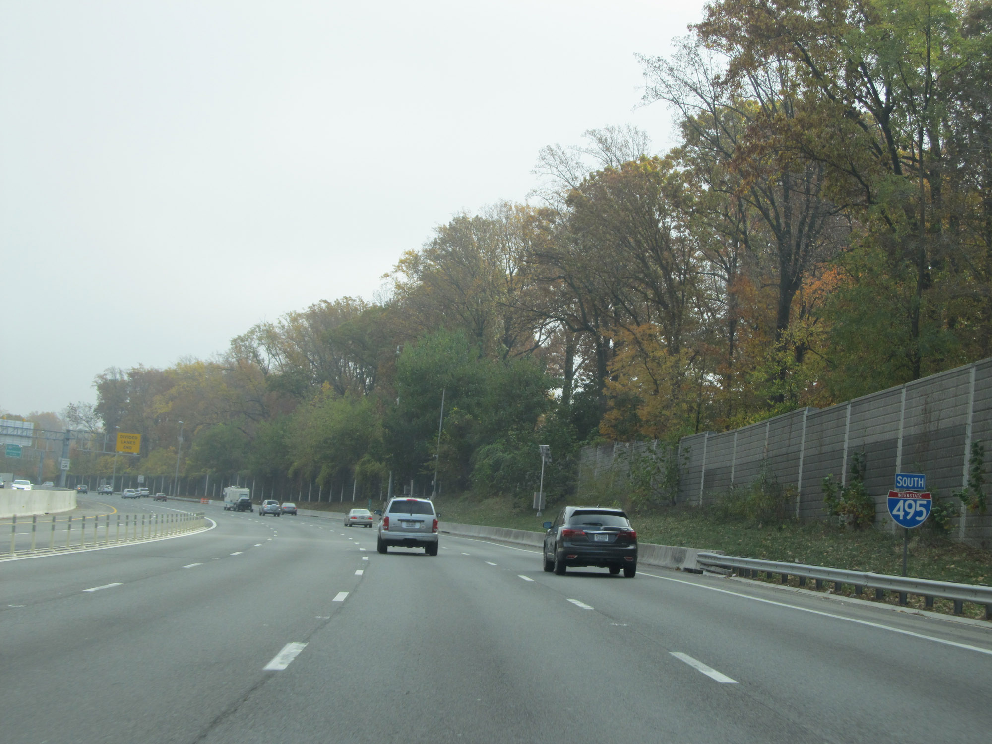
Interstate 495 South reassurance shield. (Photo taken 11/5/15). |
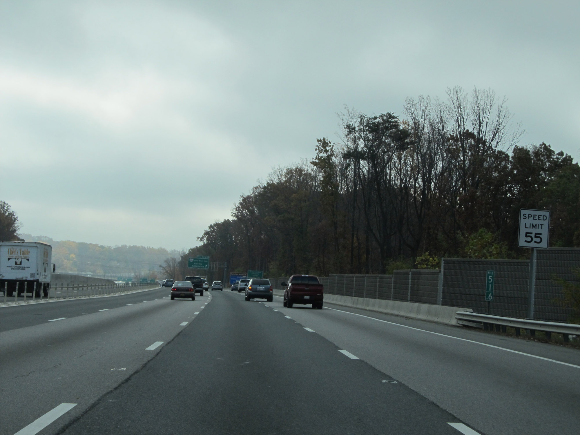 |
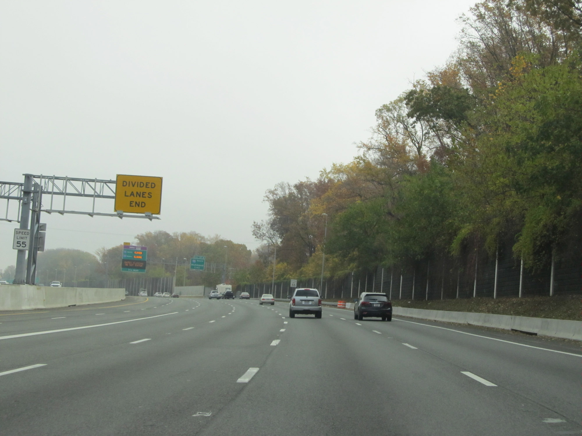
The speed limit remains 55 mph on Interstate 495 Outer Loop (South). In fact, the speed limit is 55 mph for the entirety of the Capital Beltway, in both Virginia, Maryland, and Washington DC. (Photo taken 11/5/15). |
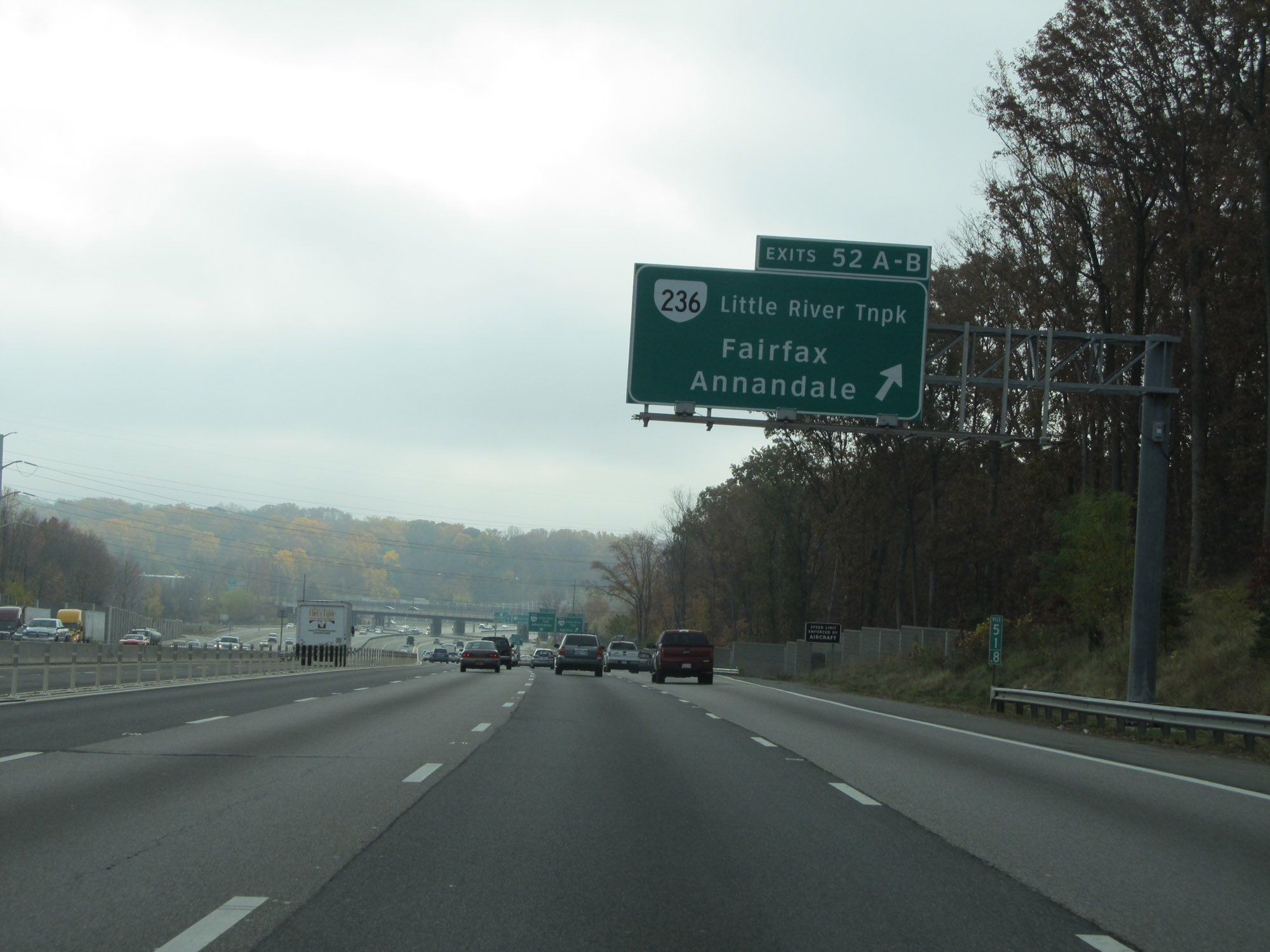 |
Interstate 495 Outer Loop (South) at Exits 52A-B: VA 236 (Little River Tnpk) - Fairfax / Annandale (Photo taken 11/5/15). |
 |
Interstate 495 Outer Loop (South) at Exit 52A: VA 236 West (Little River Tnpk) - Fairfax (Photo taken 11/5/15). |
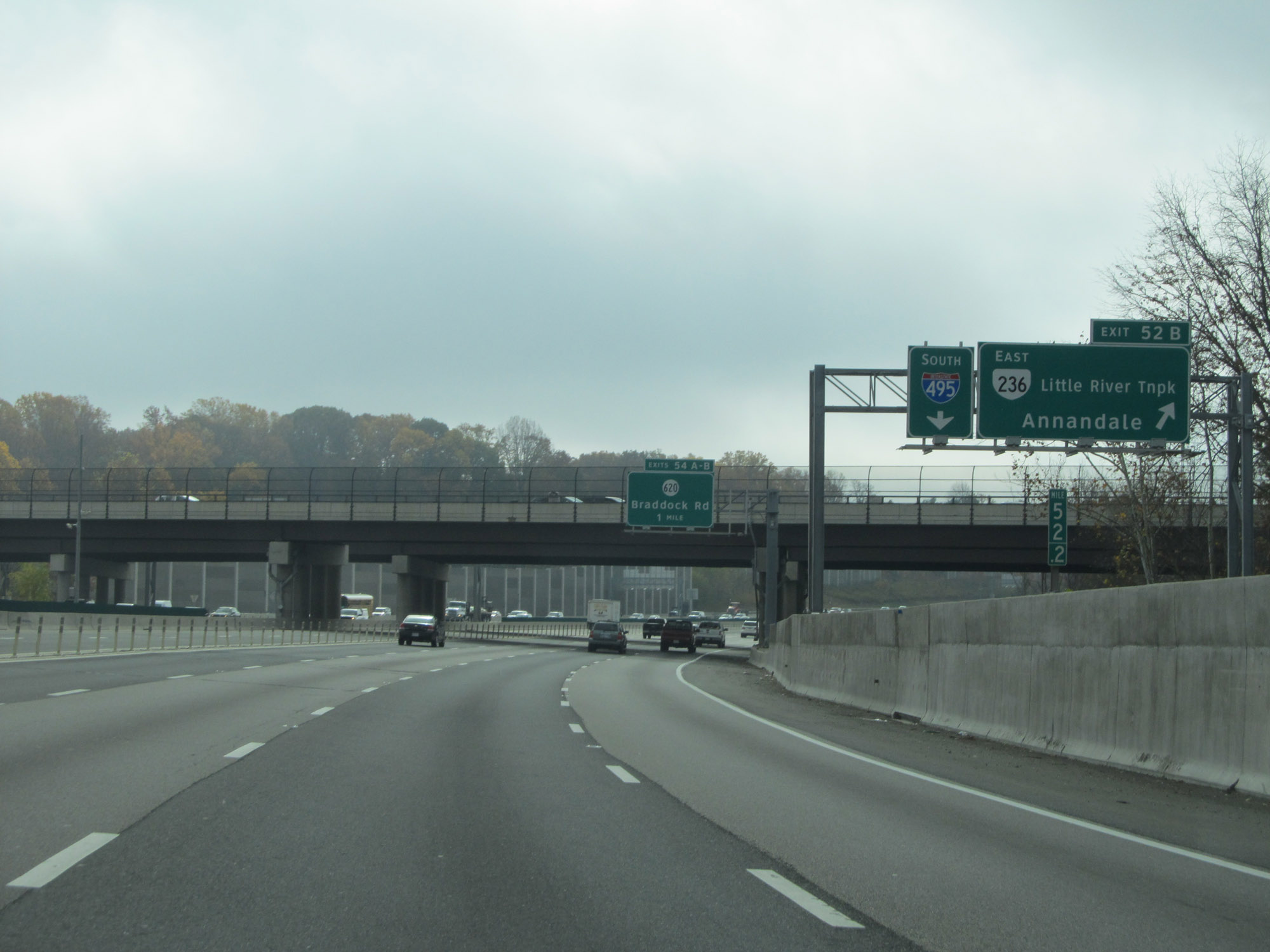 |
Interstate 495 Outer Loop (South) at Exit 52B: VA 236 East (Little River Tnpk) - Annandale (Photo taken 11/5/15). |
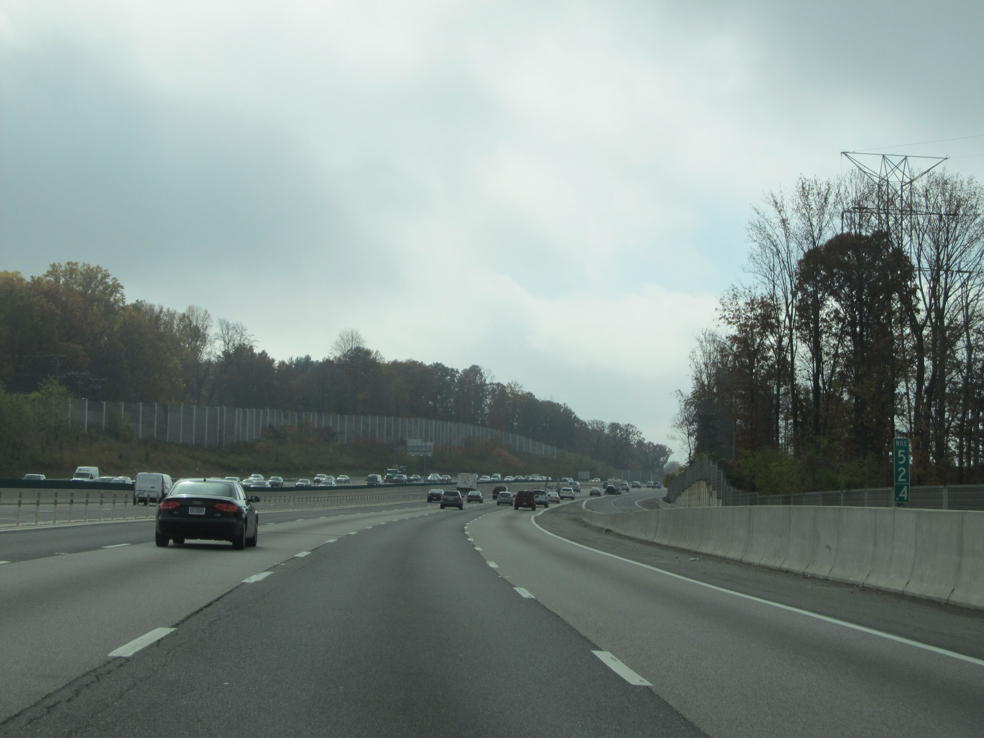 |
View on Interstate 495 Outer Loop (South) at mile marker 52.4. (Photo taken 11/5/15). |
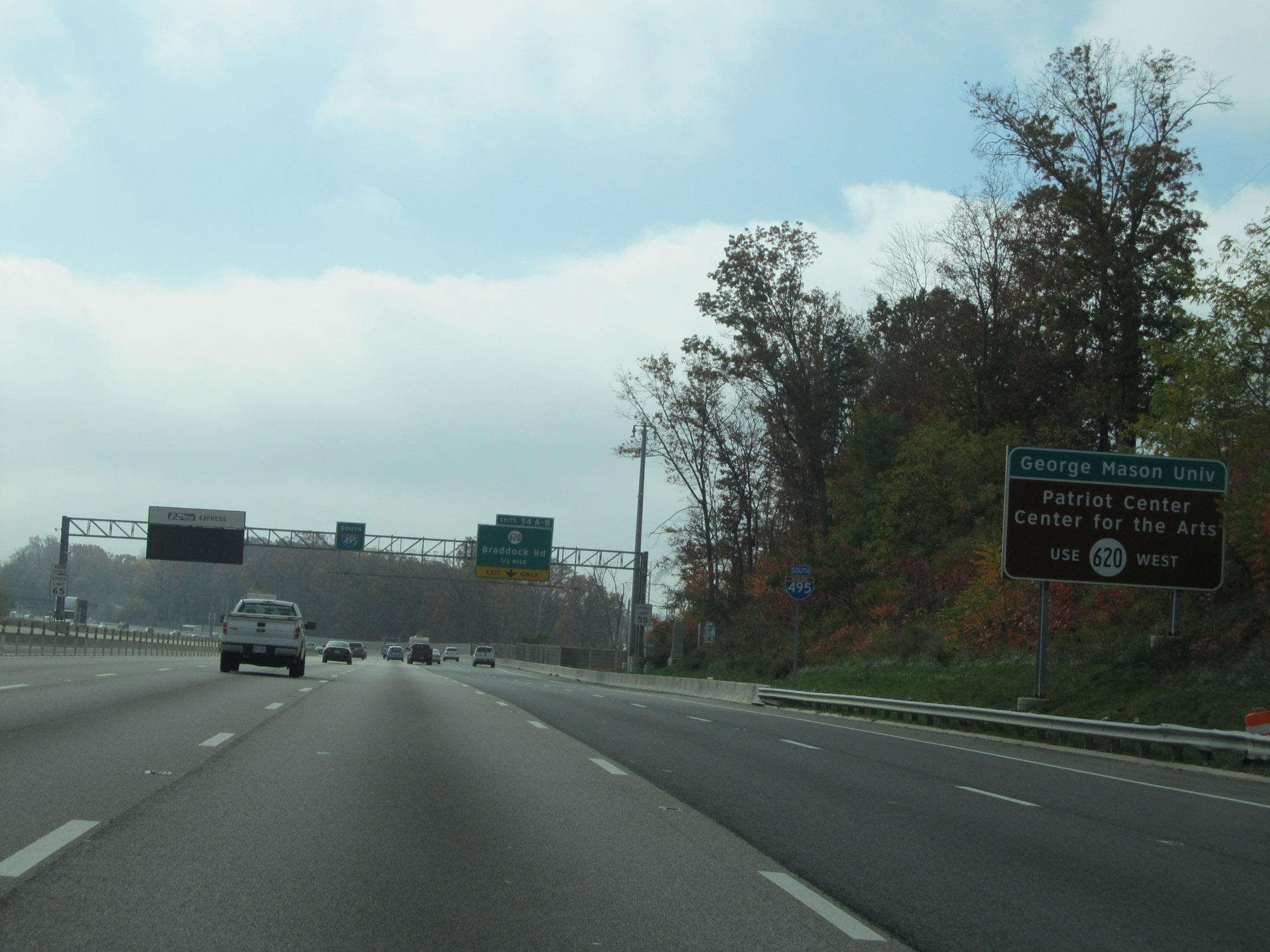 |
Take Exit 54A and follow SR 620 West to George Mason University and Patriot Center for the Arts. (Photo taken 11/5/15). |
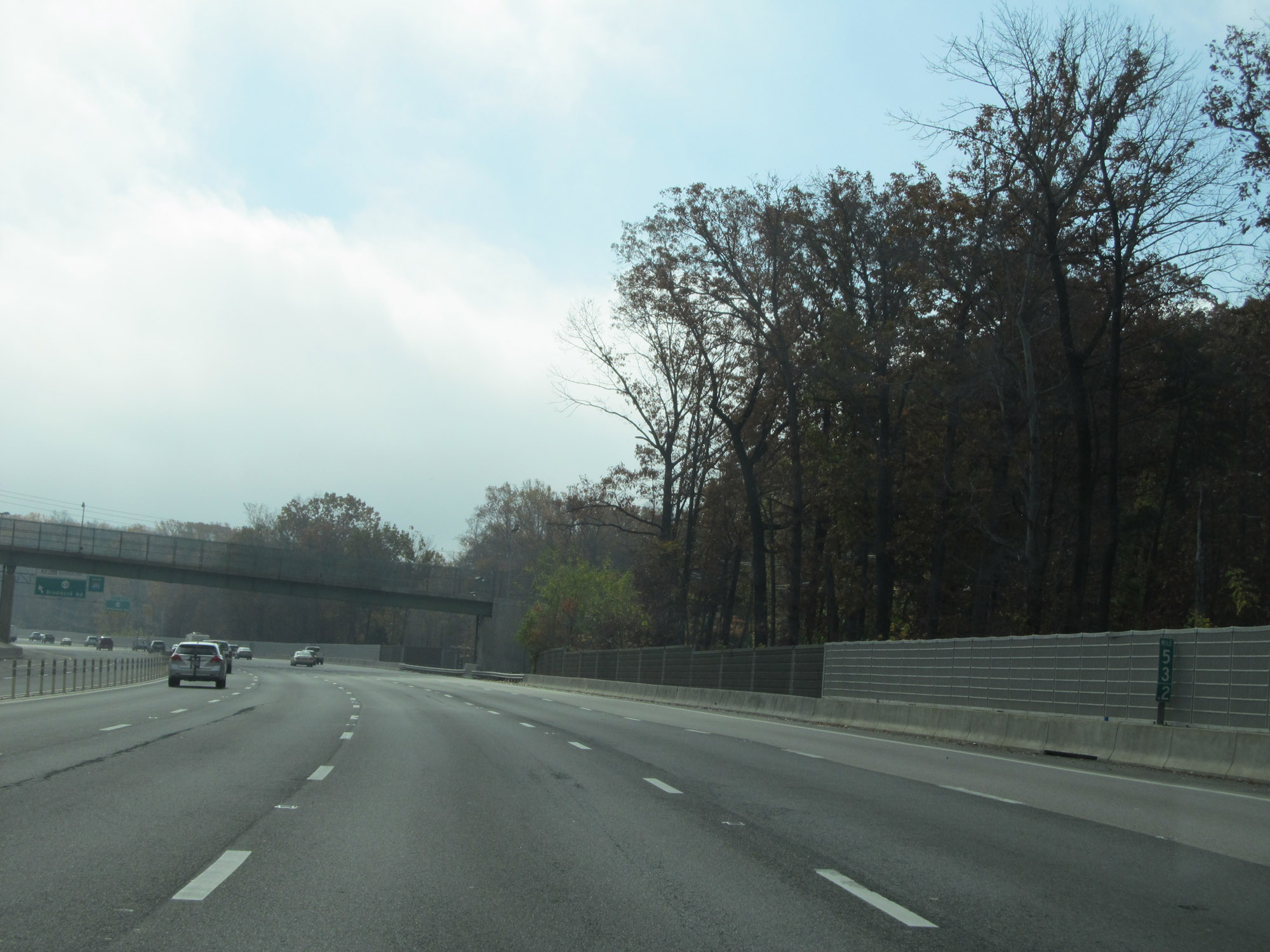 |
View on Interstate 495 Outer Loop (South) at mile marker 53.2. (Photo taken 11/5/15). |
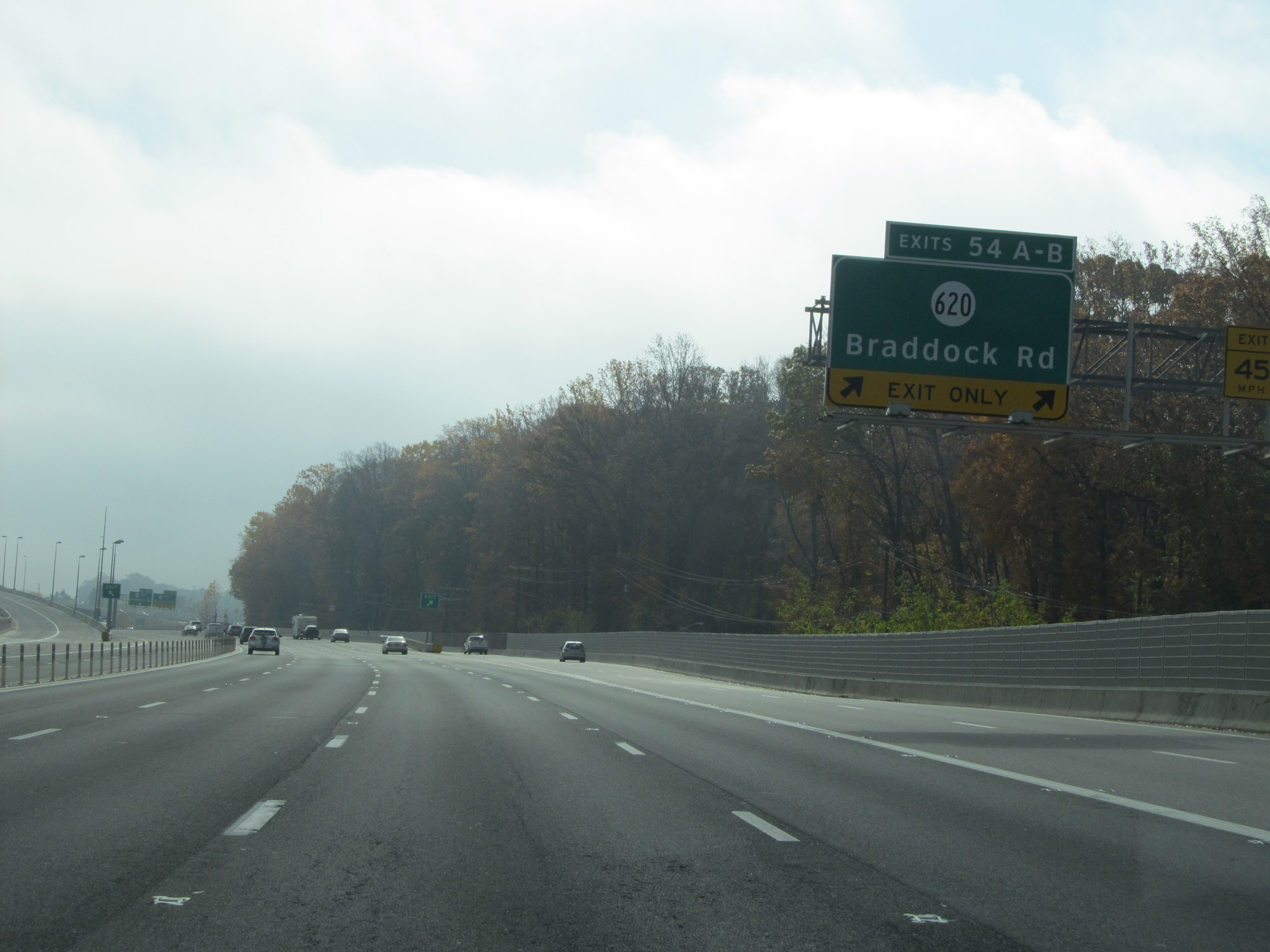 |
Interstate 495 Outer Loop (South) at Exits 54A-B: SR 620 - Braddock Rd (Photo taken 11/5/15). |
 |
View of the ramps for Exits 54A-B. (Photo taken 11/5/15). |
 |
Interstate 495 Outer Loop (South) approaching Exits 57A-B-C - 2 miles. This massive interchange is known as the Springfield Interchange. (Photo taken 11/5/15). |
 |
Overhead mileage sign listing the distances to the three upcoming exits accessible from the express lanes. (Photo taken 11/5/15). |
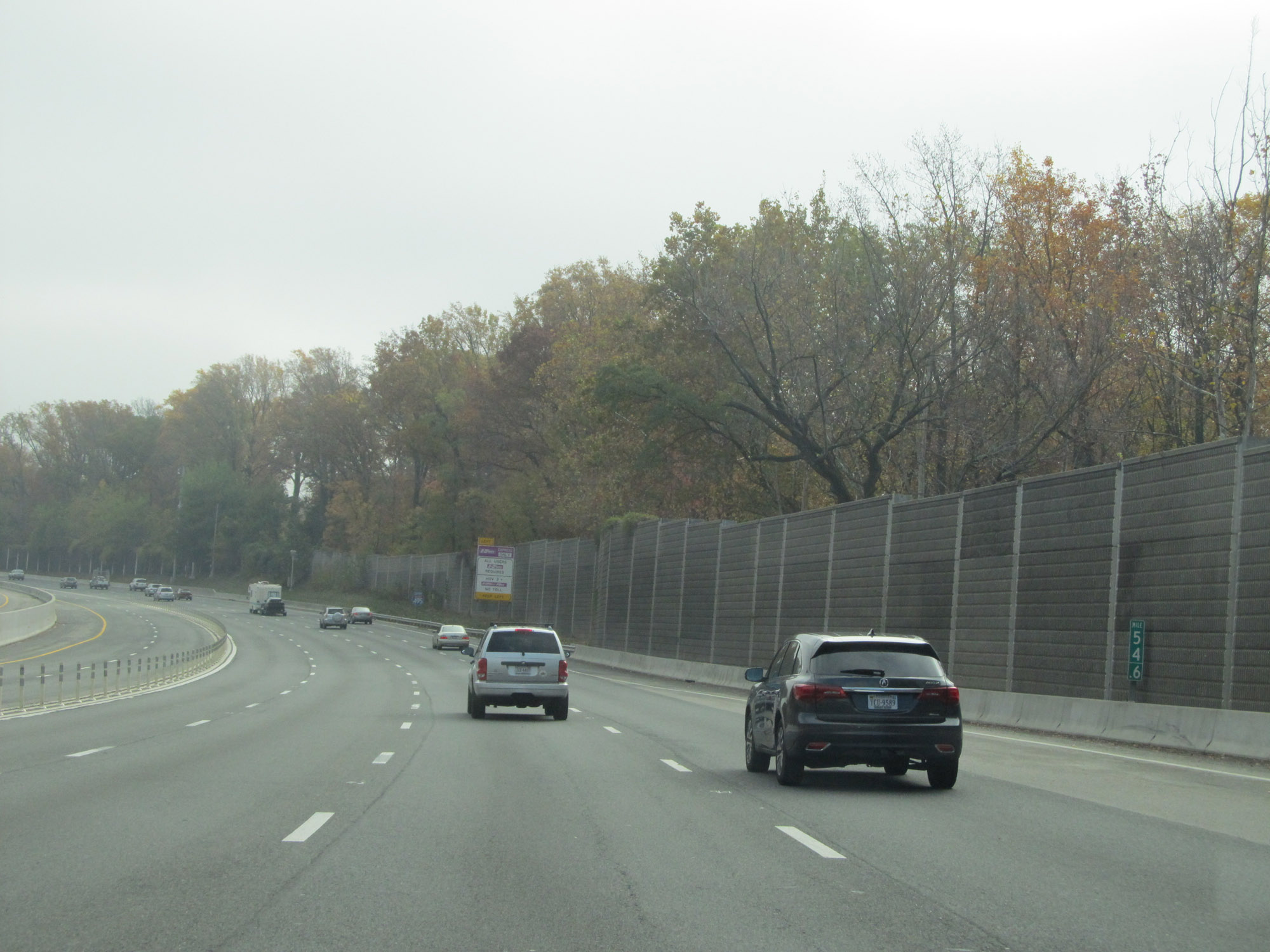 |
View on Interstate 495 Outer Loop (South) at mile marker 54.6, as it begins to curve to the east and head for the Springfield Interchange. (Photo taken 11/5/15). |
 |
Another Interstate 495 South reassurance shield. (Photo taken 11/5/15). |
 |
The division between the express lanes and regular lanes of Interstate 495 Outer Loop come to an end here. (Photo taken 11/5/15). |
 |
Interstate 495 Outer Loop (East) approaching Exit 57A - 1 mile. (Photo taken 11/5/15). |
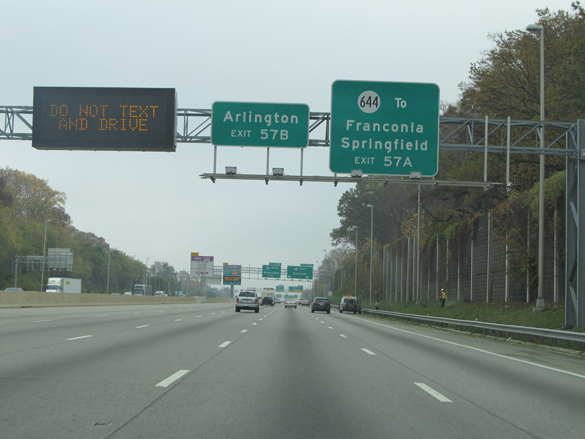 |
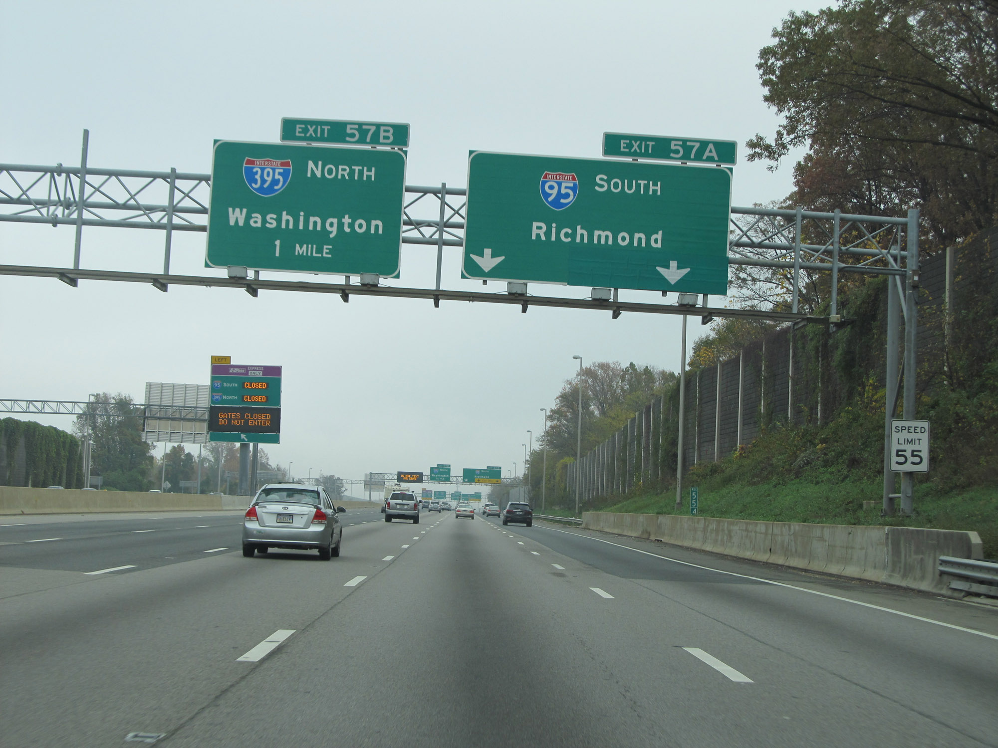
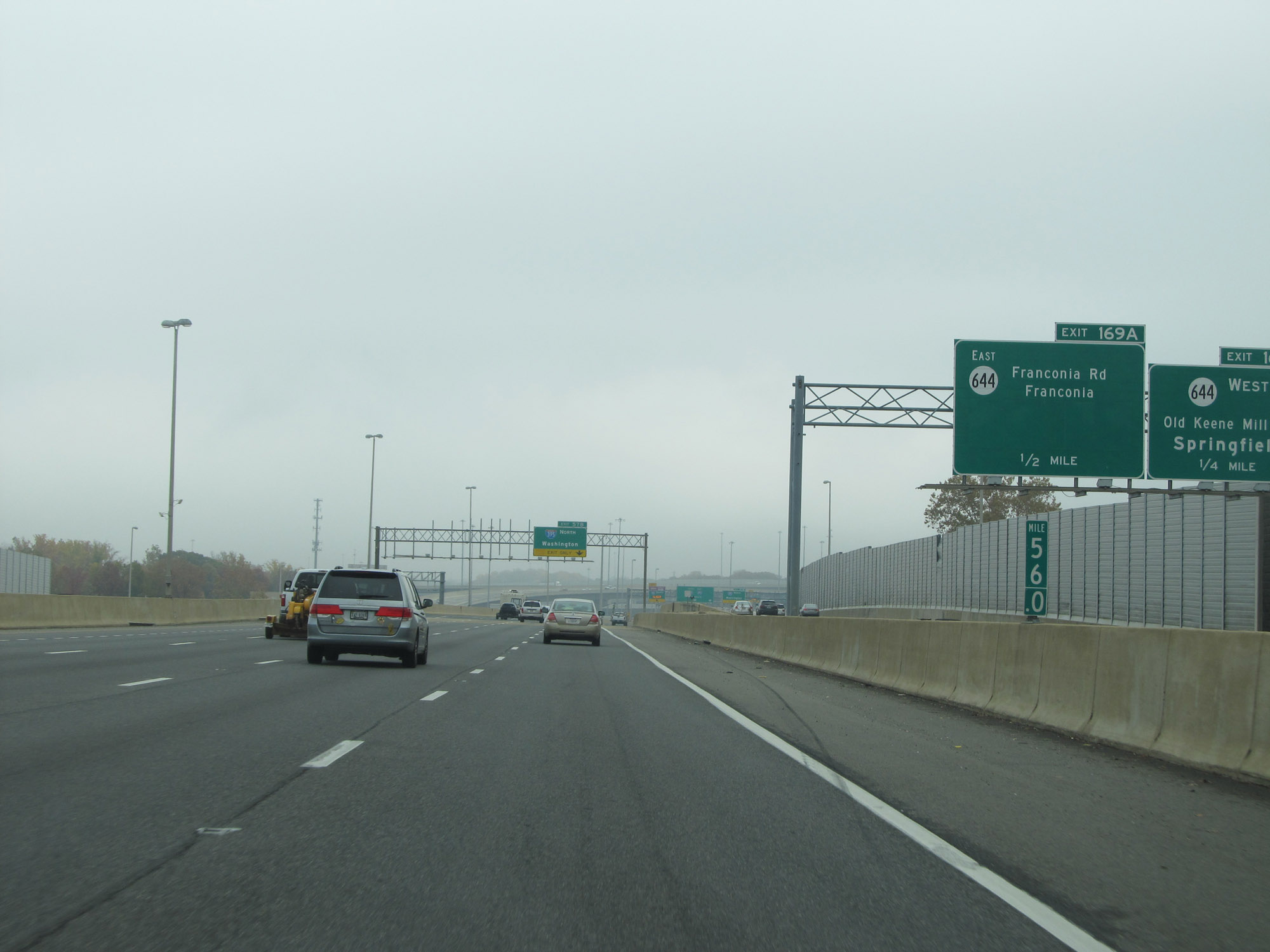
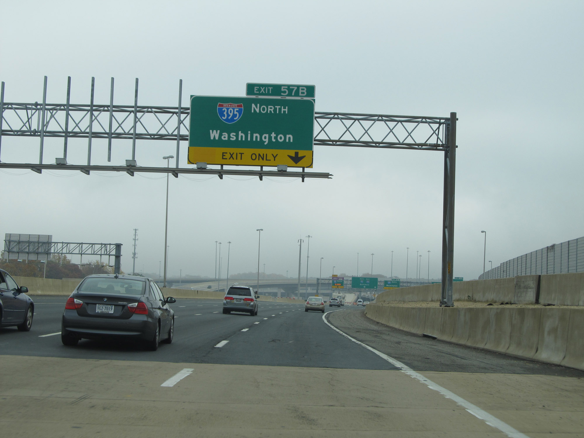
Take Exit 57A (Interstate 95 South) to SR 644 toward Franconia and Springfield. Take Exit 57B (Interstate 395 North) to Arlington. (Photo taken 11/5/15). |
 |
Interstate 495 Outer Loop (East) approaching Exit 57B - 1 mile. (Photo taken 11/5/15). |
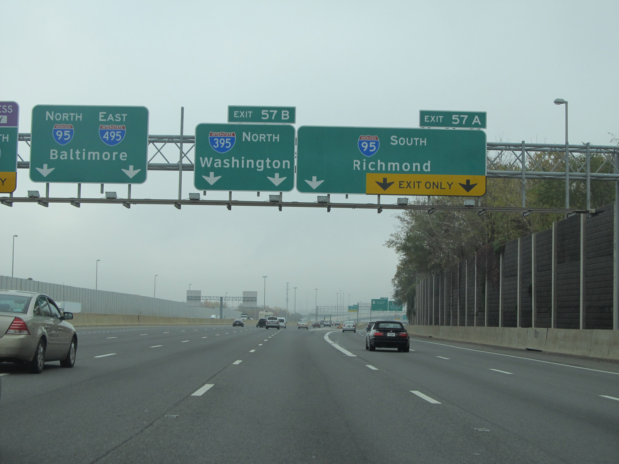 |
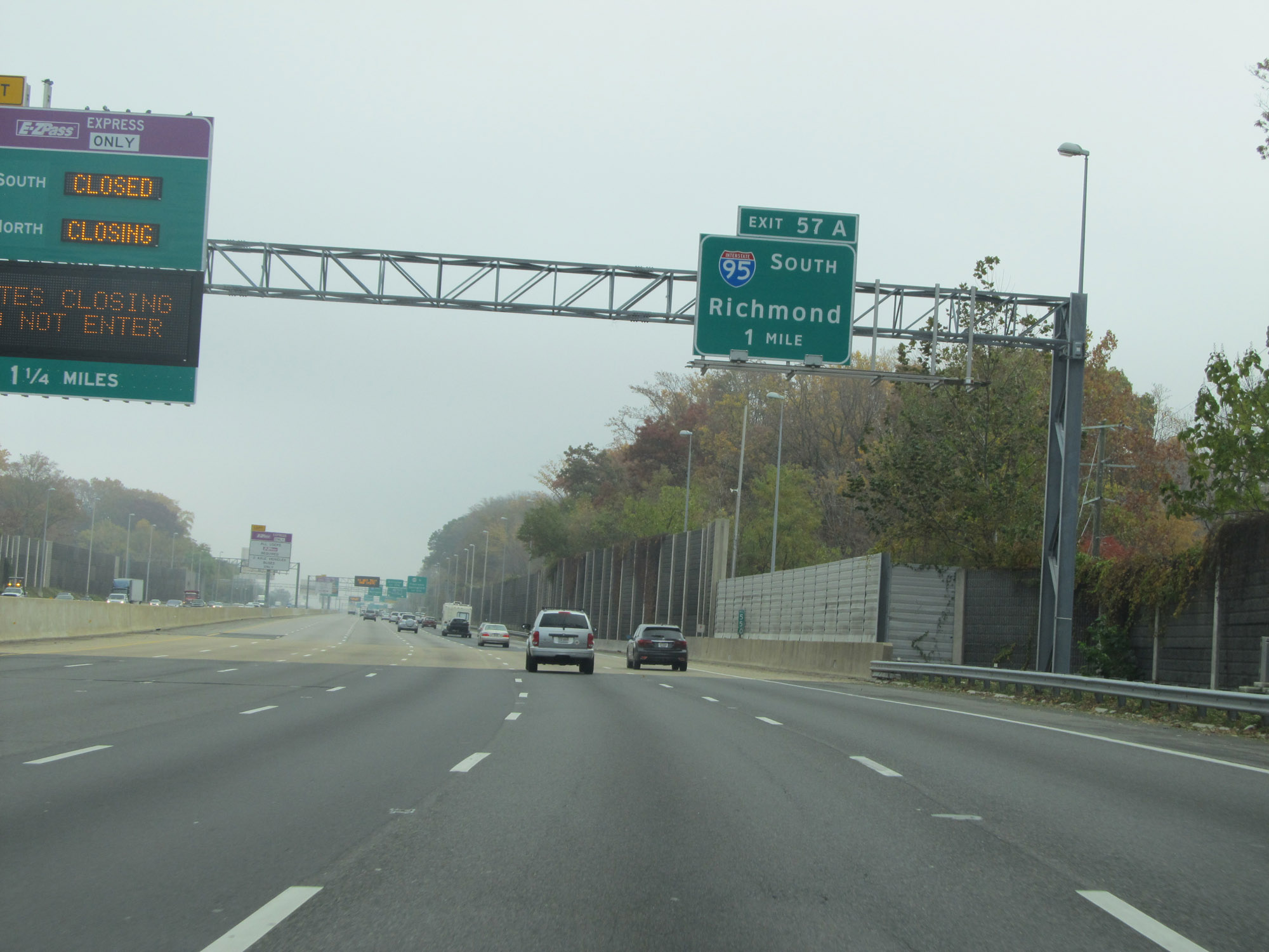
Interstate 495 Outer Loop (East) at Exit 57A: Interstate 95 South - Richmond (Photo taken 11/5/15). |
 |
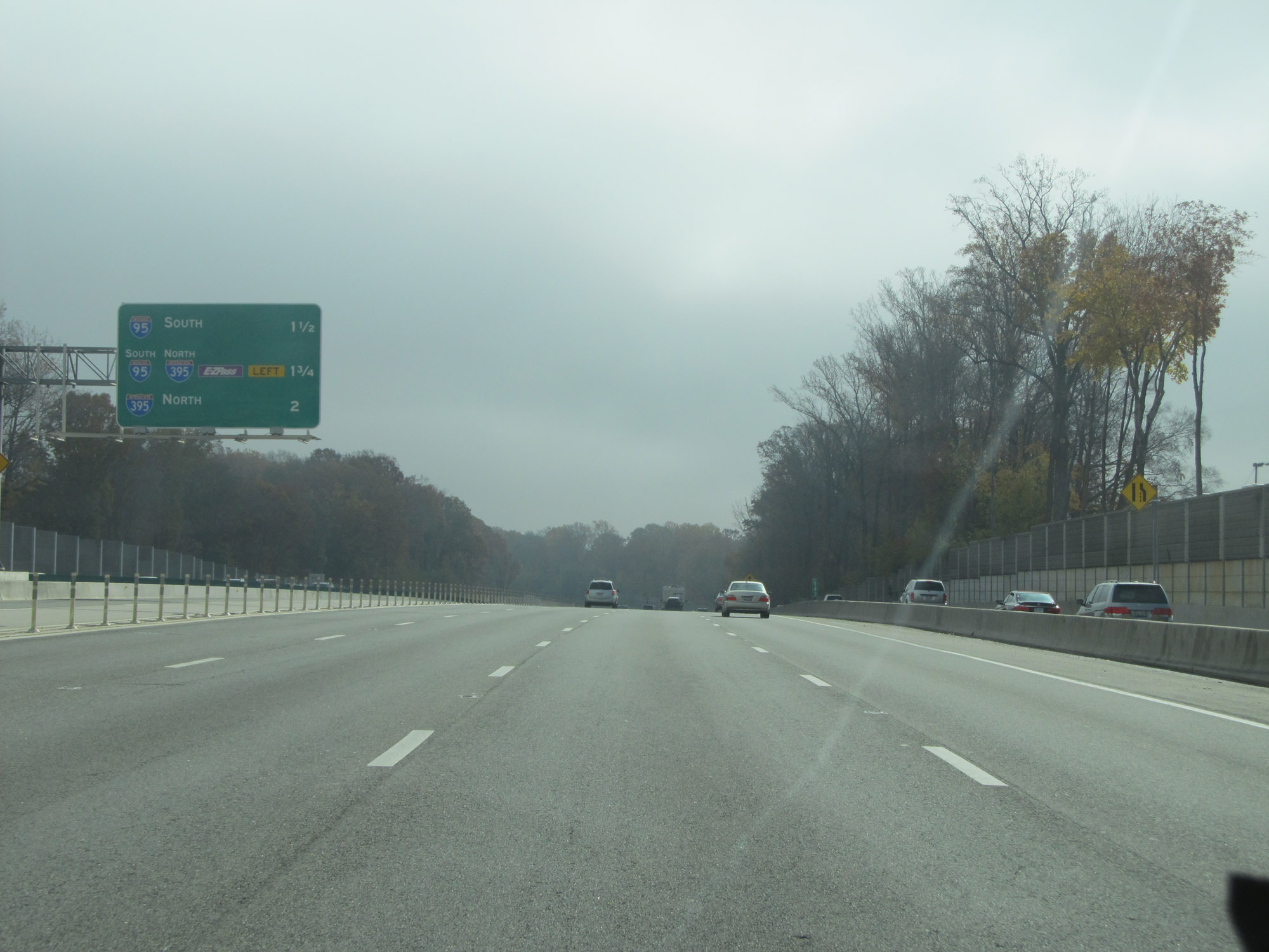
View on Interstate 495 Outer Loop (East) at mile marker 56. On the right, we see the ramp for Exit 57A to Interstate 95 South and advance signage for the first two exits on I-95 South as it departs to the south. (Photo taken 11/5/15). |
 |
Interstate 495 Outer Loop (East) approaching Exit 57B. (Photo taken 11/5/15). |
 |
Interstate 495 Outer Loop (East) at Exit 57B: Interstate 395 North - Washington (Photo taken 11/5/15). |
 |
Just east of the Springfield Interchange, we see this set of Interstate 495 East / Interstate 95 North reassurance shields. I-95 will run concurrently with I-495 into Maryland, before branching off to the northeast toward Balitmore near College Park. (Photo taken 11/9/15). |
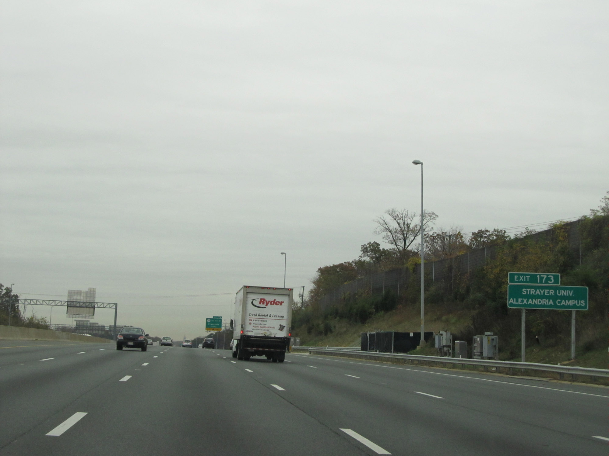 |
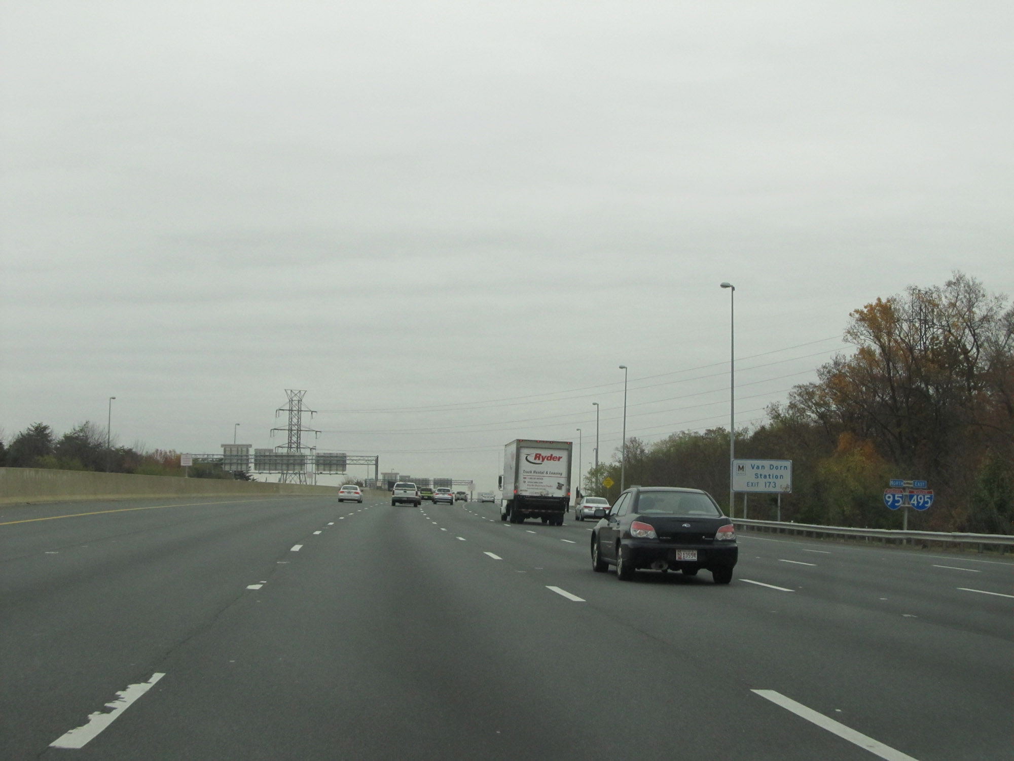
Take Exit 173 to Strayer University Alexandria Campus. During the Interstate 495 / Interstate 95 concurrency in Virginia, the mileposts and exit numbers are based on the mileage of I-95. (Photo taken 11/9/15). |
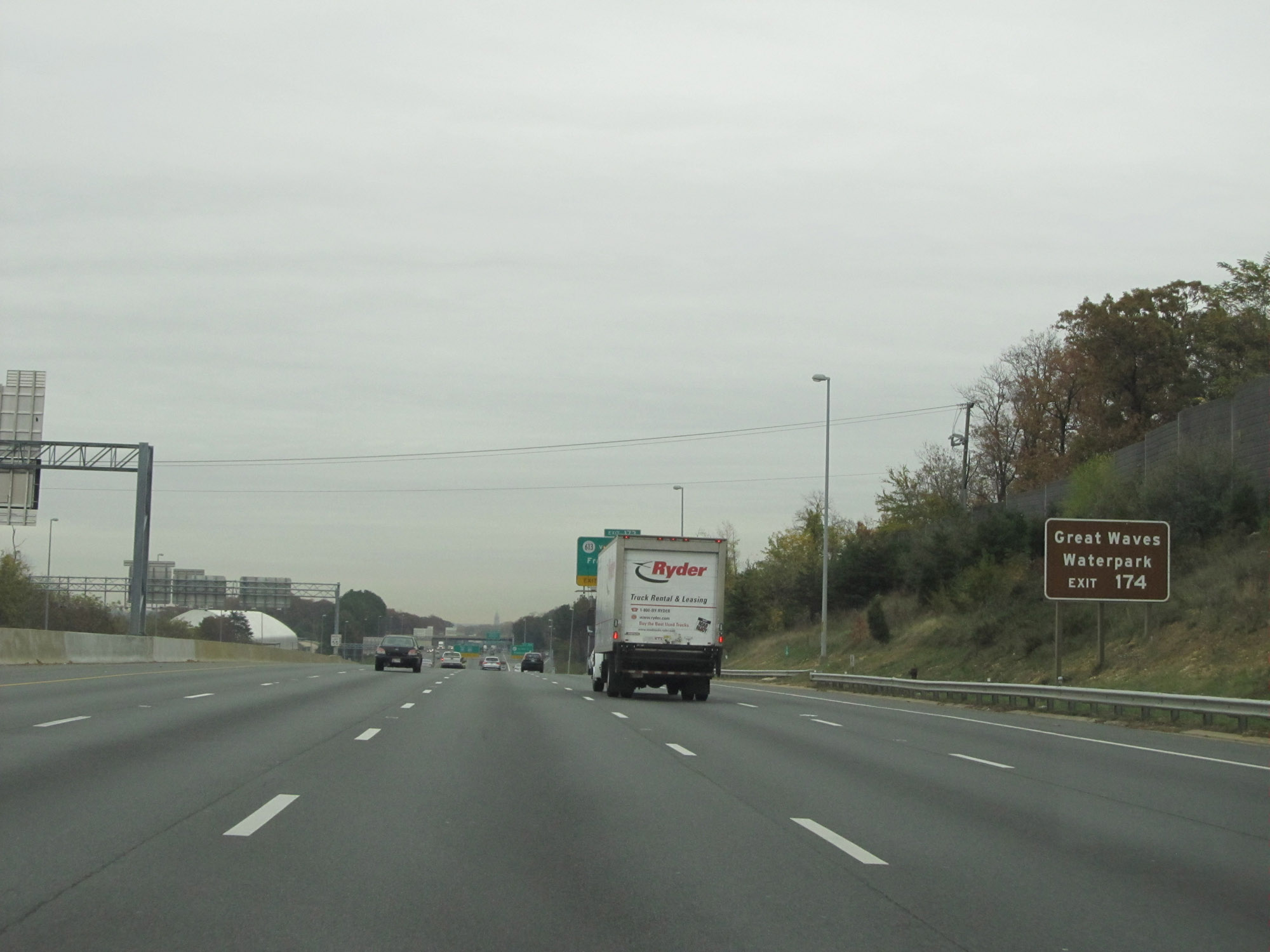 |
Take Exit 174 to Great Waves Waterpark. (Photo taken 11/9/15). |
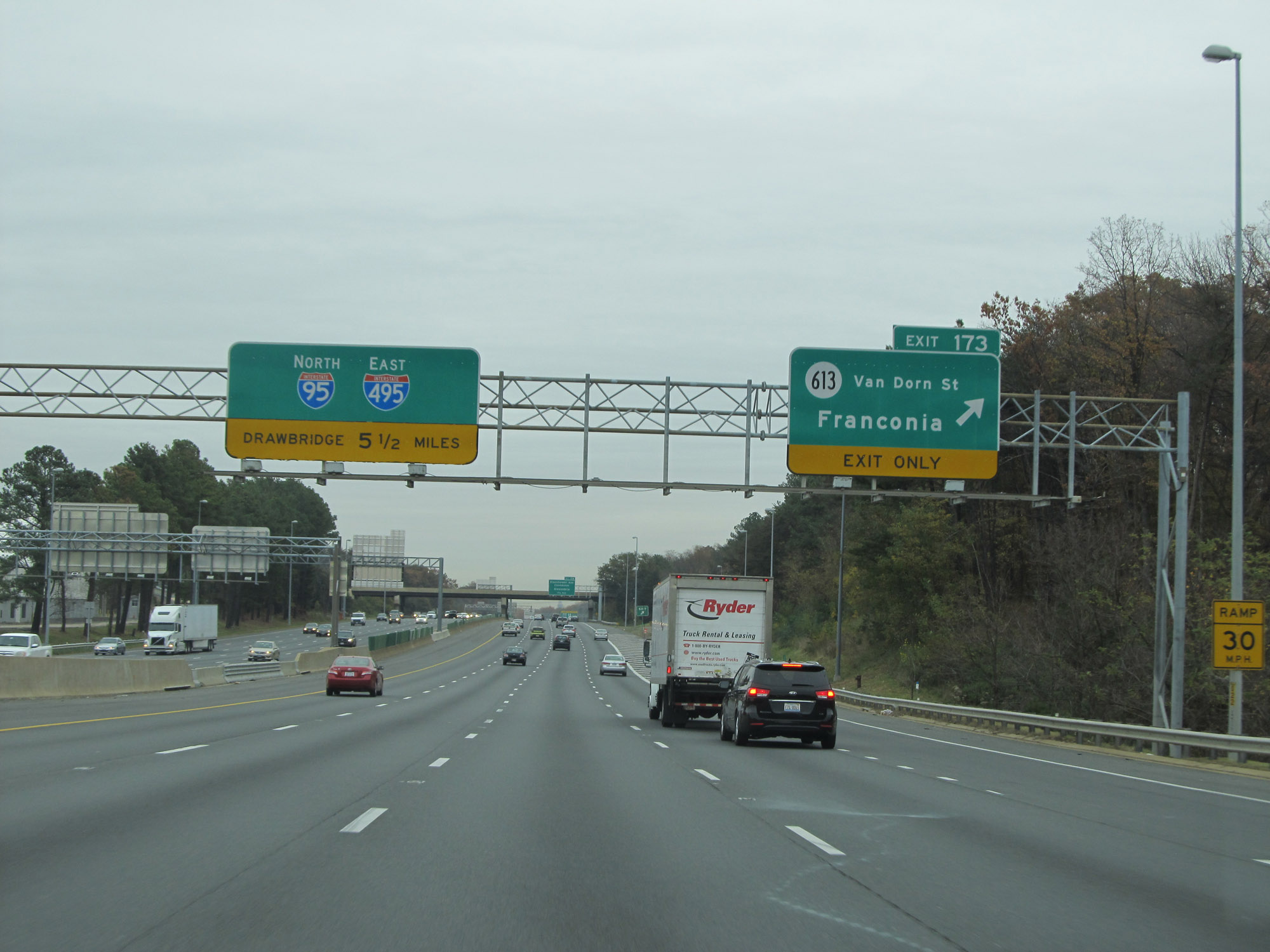 |
Interstate 495 Outer Loop (East) / Interstate 95 North at Exit 173: SR 613 (Van Dorn St) - Franconia (Photo taken 11/9/15). |
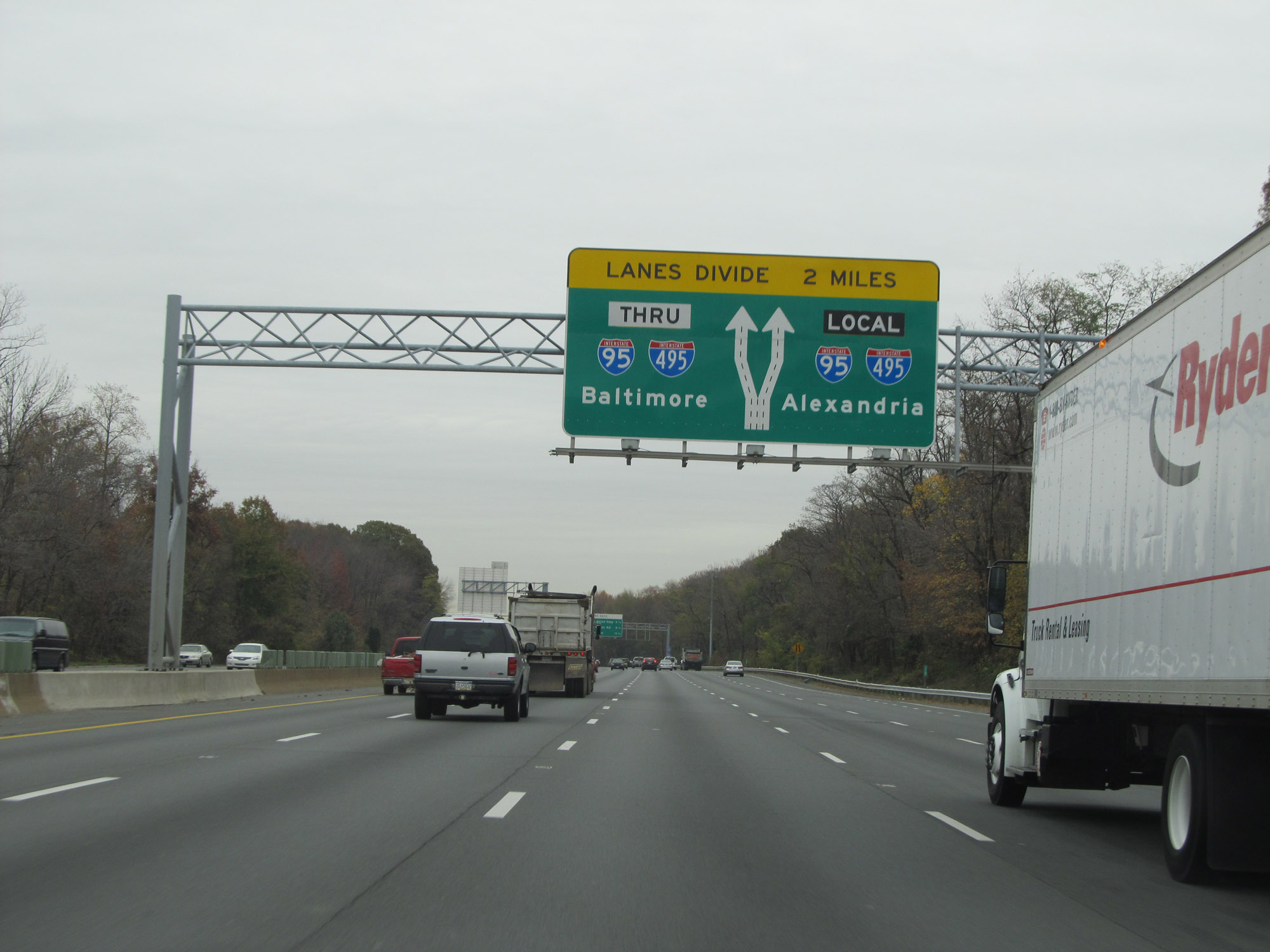 |
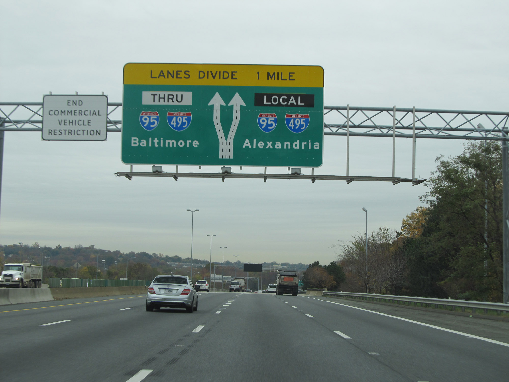
As this overhead sign shows, the lanes of Interstate 495 Outer Loop (East) / Interstate 95 North will divide into local and thru lanes 2 miles ahead. (Photo taken 11/9/15). |
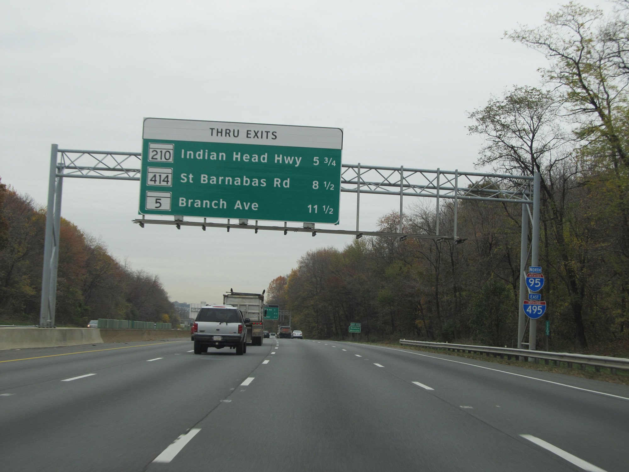 |
This sign lists the distances to the first three exits accessible from the thru lanes of Interstate 495 Outer Loop (East) / Interstate 95 North. All three exits are after crossing the border into Maryland. (Photo taken 11/9/15). |
 |
Take Exit 174 to Stratford University. (Photo taken 11/9/15). |
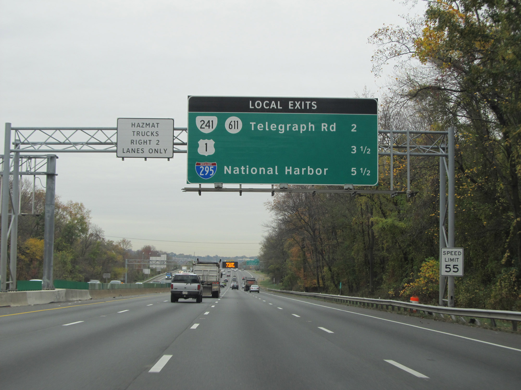 |
This overhead sign lists the distances to the three upcoming exits which are only accessible from the local lanes of Interstate 495 Outer Loop (East) / Interstate 95 North. After the next exit (Exit 174), you will need to take the local lanes to access the remaining exits in Virginia as well as the first one in Maryland. (Photo taken 11/9/15). |
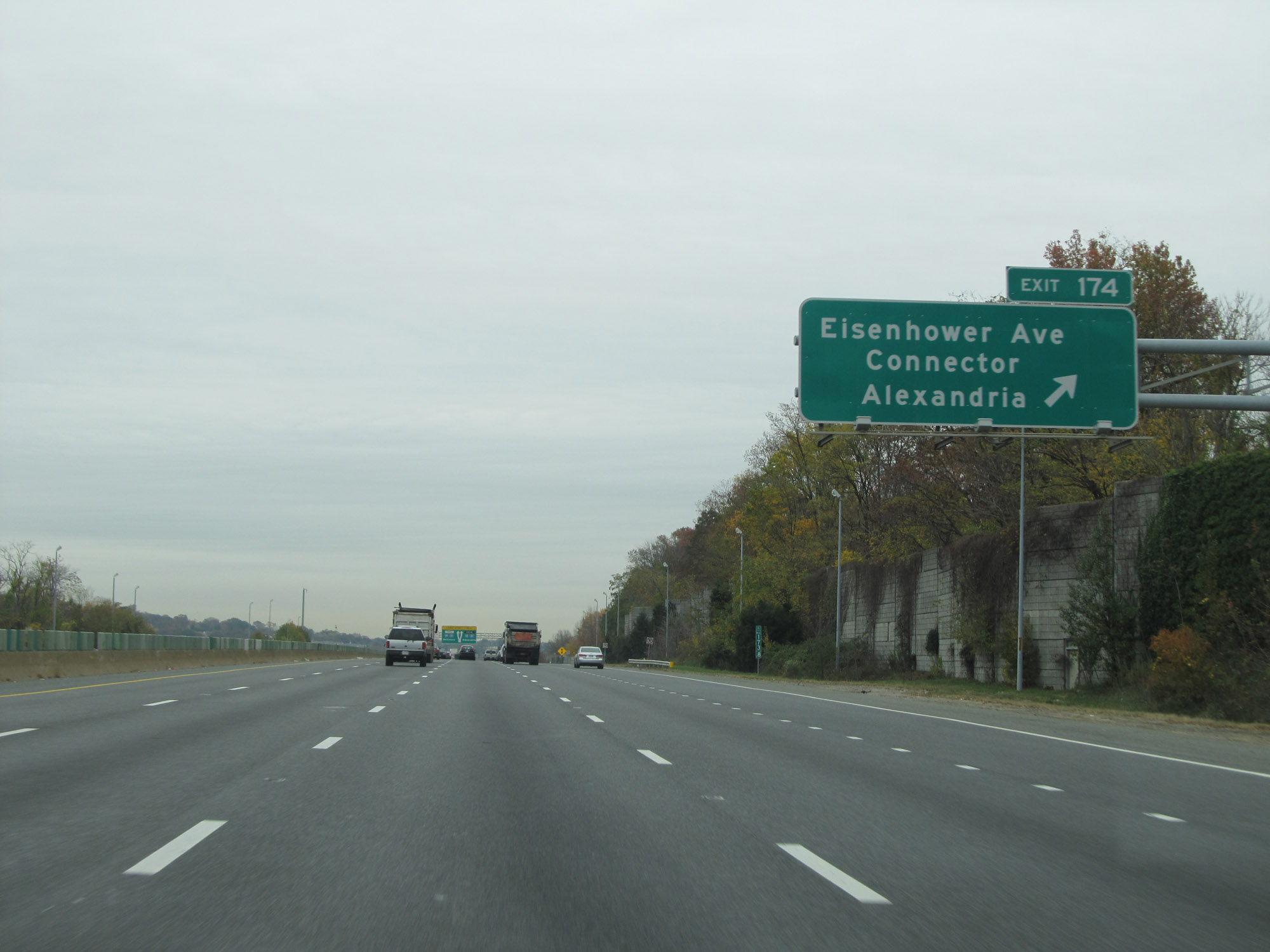 |
Interstate 495 Outer Loop (East) / Interstate 95 North at Exit 174: Eisenhower Ave Connector / Alexandria (Photo taken 11/9/15). |
 |
Interstate 495 Outer Loop (East) / Interstate 95 North approaching the duplex's division into local and thru lanes - 1 mile. (Photo taken 11/9/15). |
 |
Another set of Interstate 495 East / Interstate 95 North reassurance shields. (Photo taken 11/9/15). |
 |
Interstate 495 Outer Loop (East) / Interstate 95 North as they divide into local and thru lanes. All lanes eventually go thru, and merge together again shortly after crossing into Maryland. (Photo taken 11/9/15). |
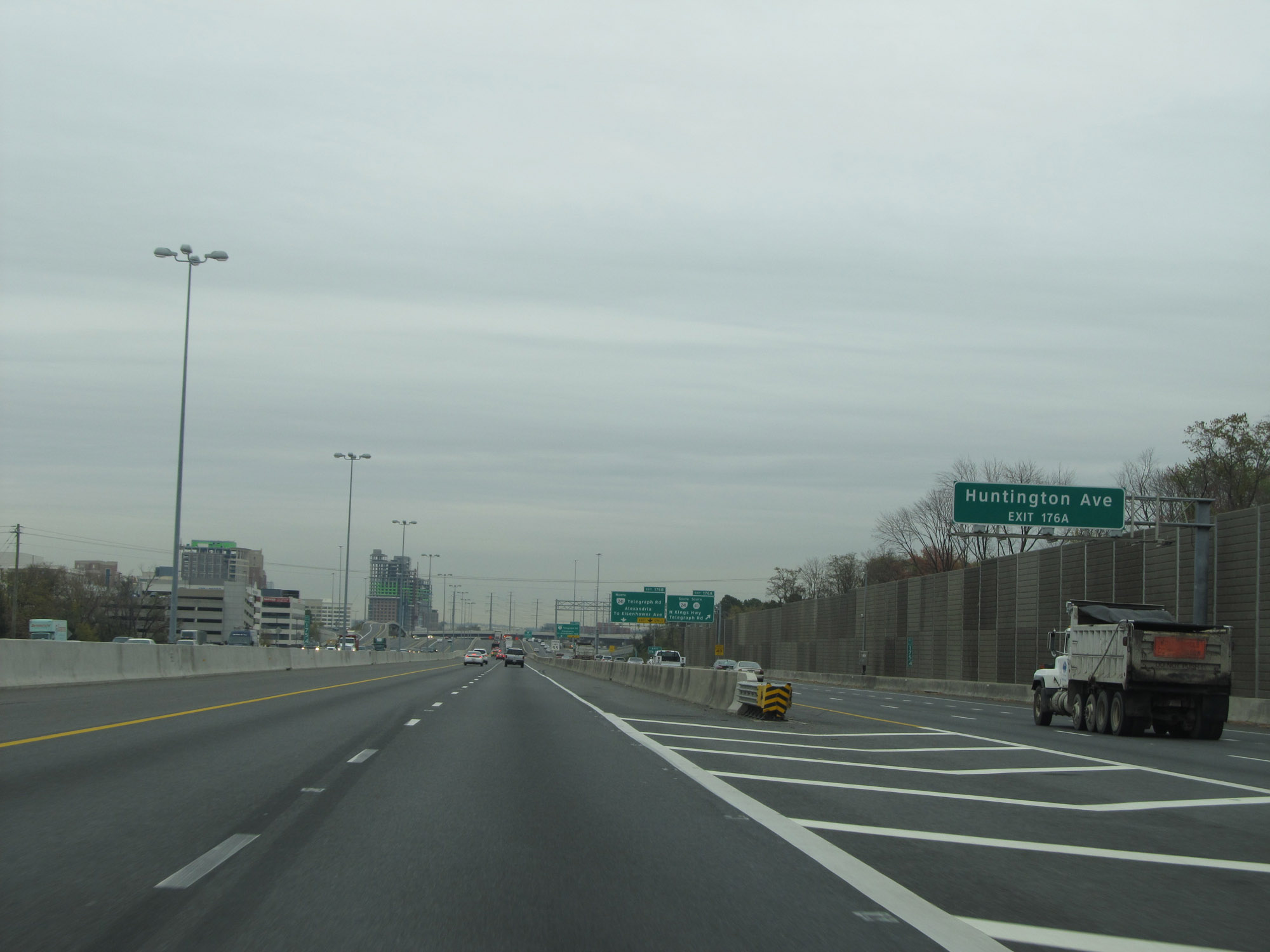 |
Take Exit 176A to Huntington Ave. (Photo taken 11/9/15). |
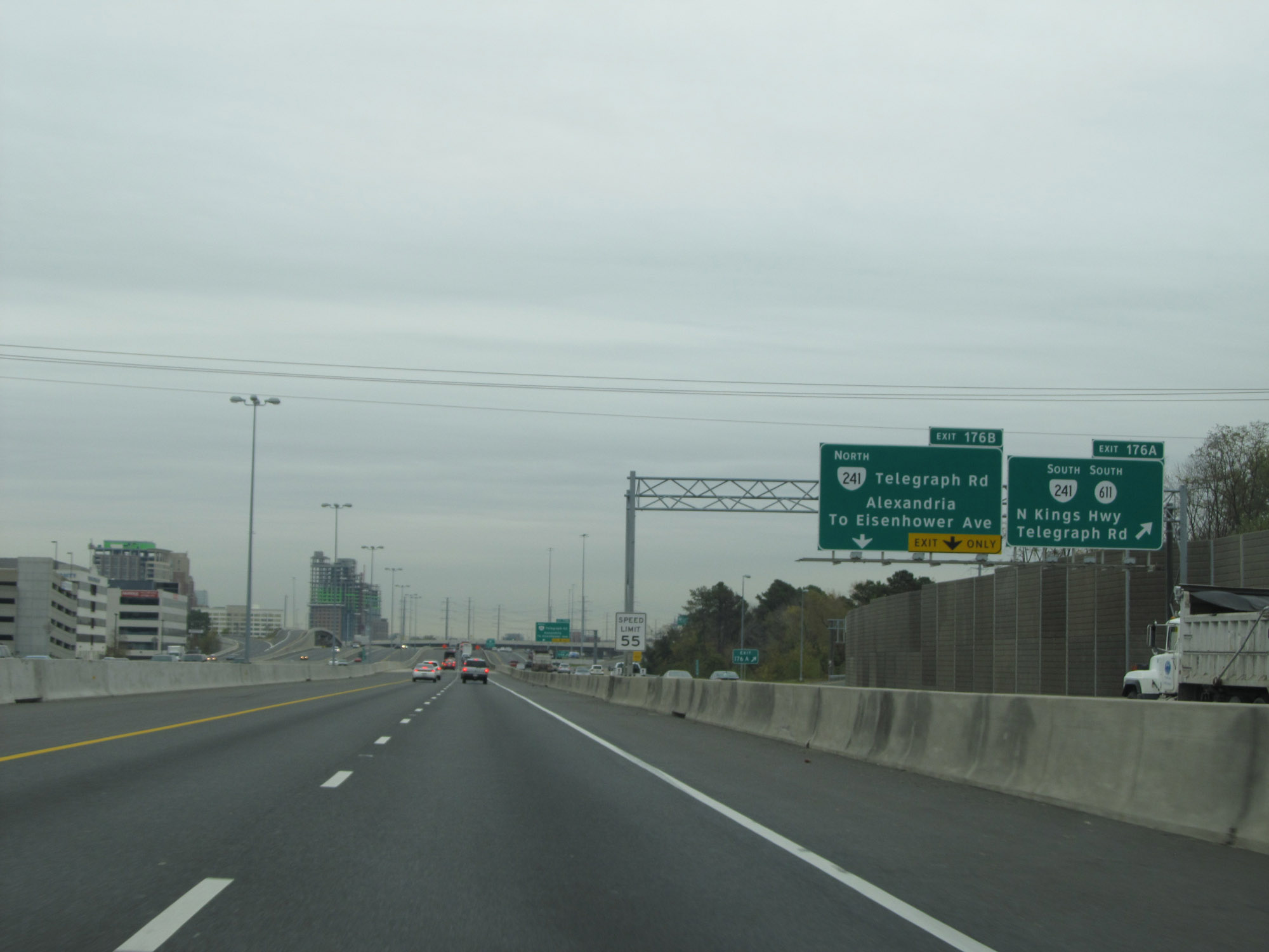 |
Interstate 495 Outer Loop (East) / Interstate 95 North at Exit 176A: VA 241 South / SR 611 South - N Kings Hwy / Telegraph Rd (Photo taken 11/9/15). |
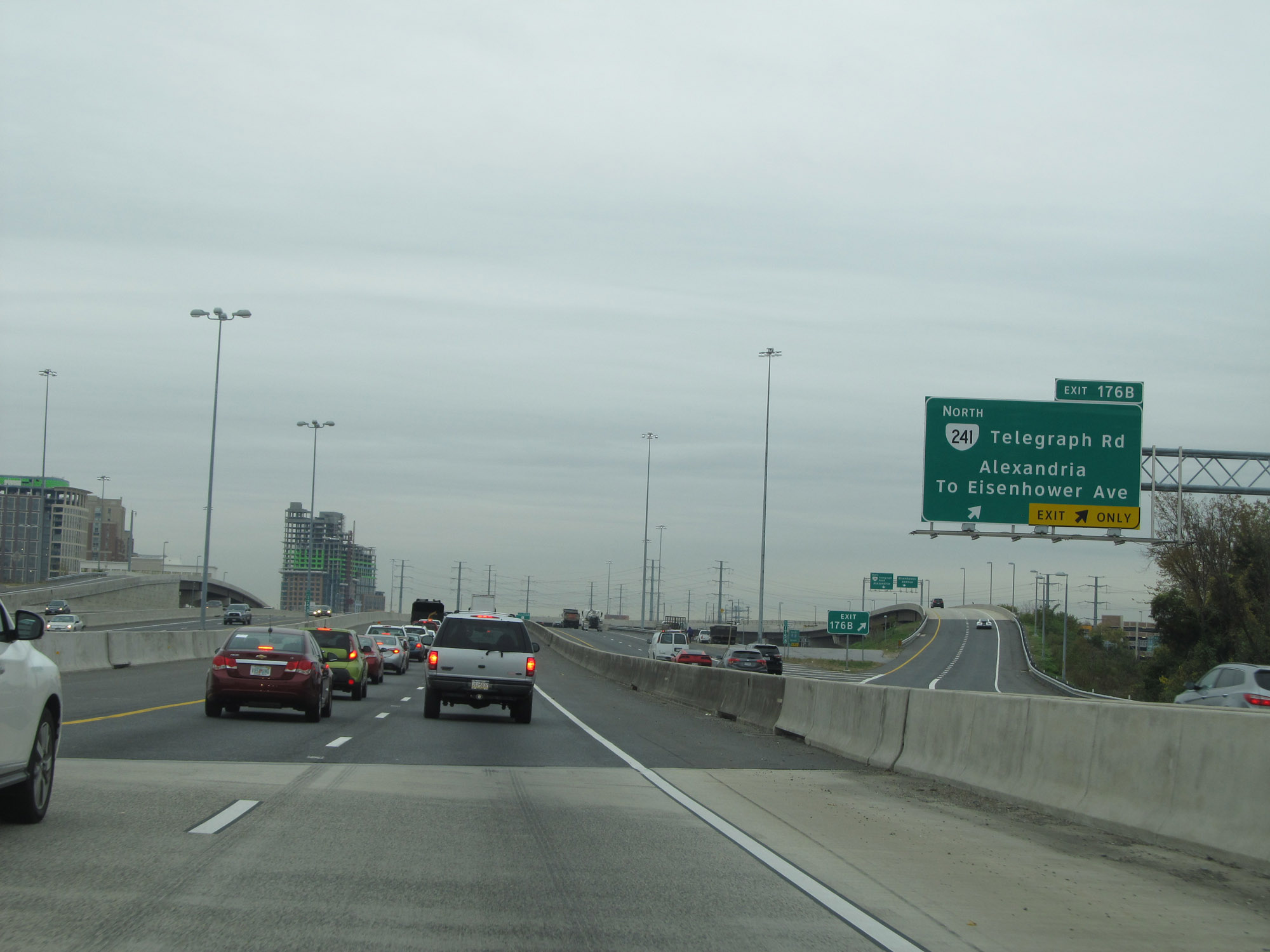 |
Interstate 495 Outer Loop (East) / Interstate 95 North at Exit 176B: VA 241 North (Telegraph Rd) - Alexandria / To Eisenhower Ave (Photo taken 11/9/15). |
 |
Interstate 495 Outer Loop (East) / Interstate 95 North approaching Exits 177A-B - 1 mile. (Photo taken 11/9/15). |
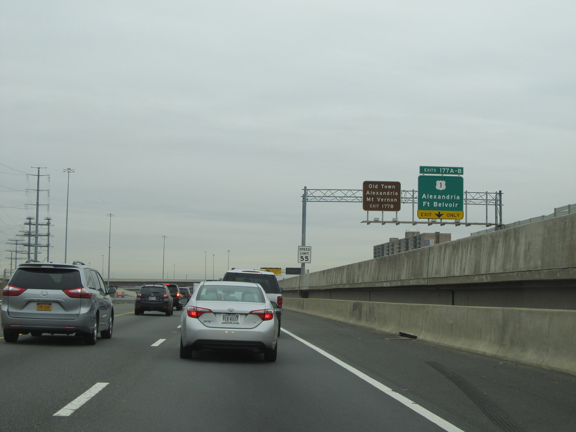 |
Take Exit 177B to Old Town Alexandria and Mt Vernon. (Photo taken 11/9/15). |
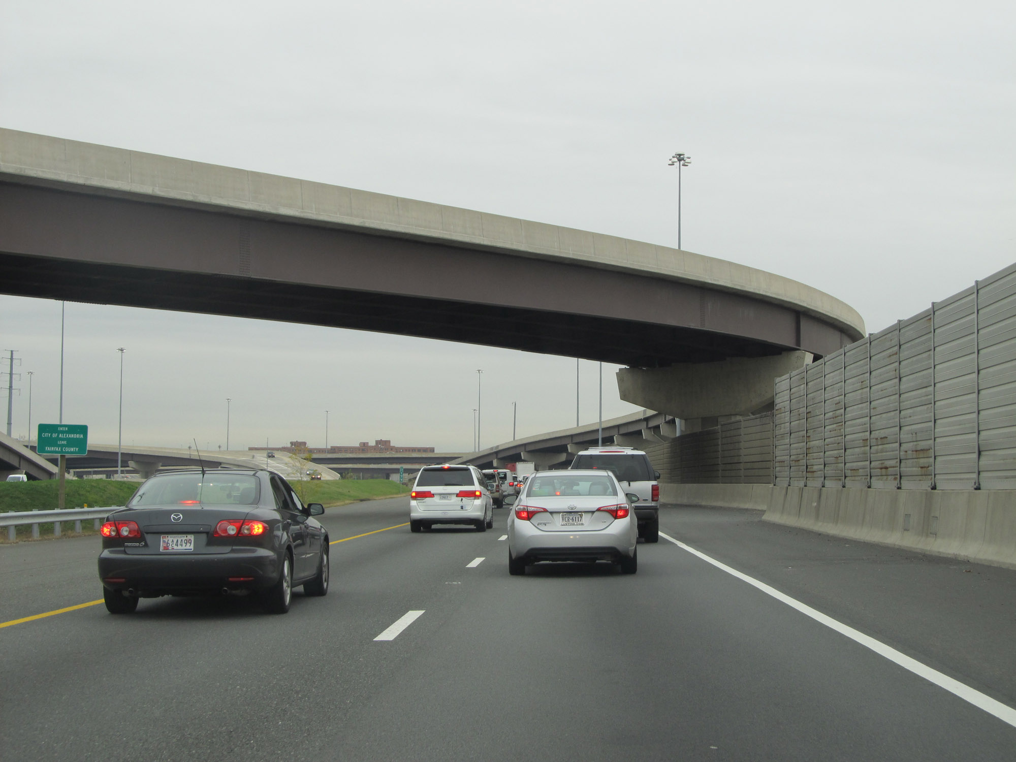 |
Interstate 495 Outer Loop (East) / Interstate 95 North as they enter the City of Alexandria and leave Fairfax County. (Photo taken 11/9/15). |
 |
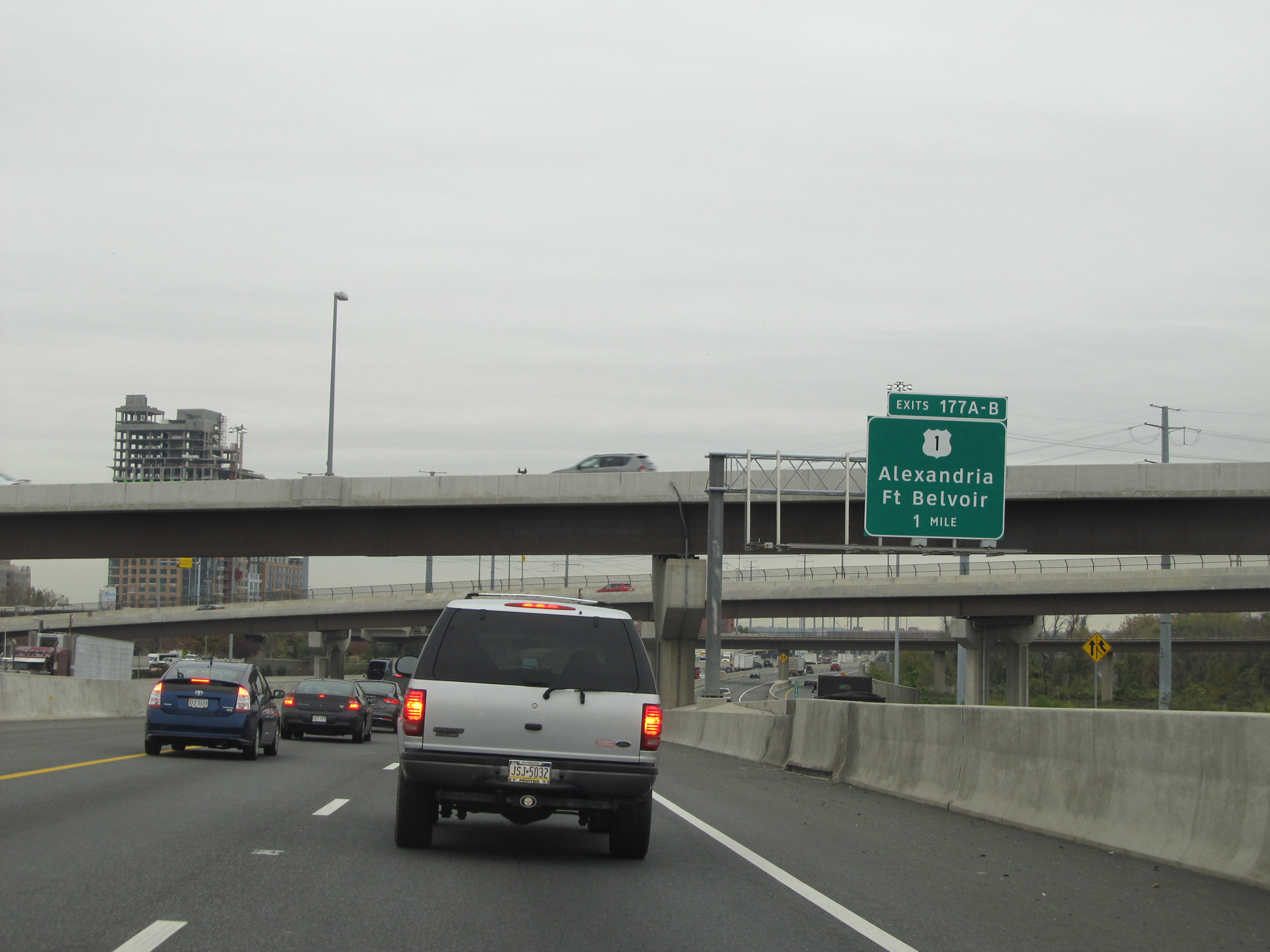
Interstate 495 Outer Loop (East) / Interstate 95 North at Exits 177A-B: US 1 - Alexandria / Ft Belvoir. I really should have taken the local lanes to get this shot. (Photo taken 11/9/15). |
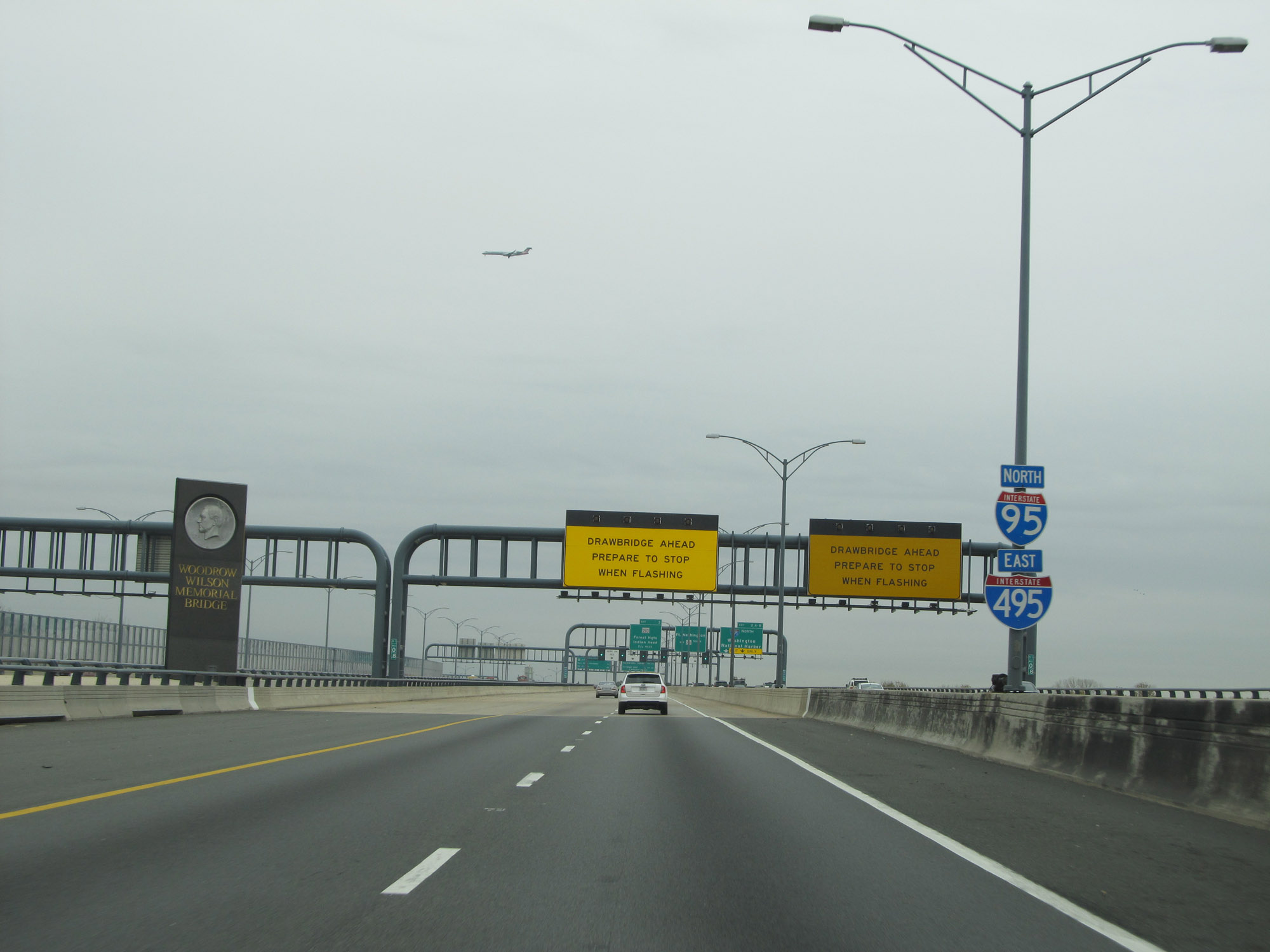 |
Interstate 495 Outer Loop (East) / Interstate 95 North as they start across the Woodrow Wilson Memorial Bridge, which is a drawbridge over the Potomac River to the south of the District of Columbia. The duplex maintains the local/thru lanes pattern across the bridge. Immediately beyond this photo, I-495 / I-95 actually touch into the District of Columbia for about 320 feet, which hardly warrants its own Photo Guide. (Photo taken 11/9/15). |
 |
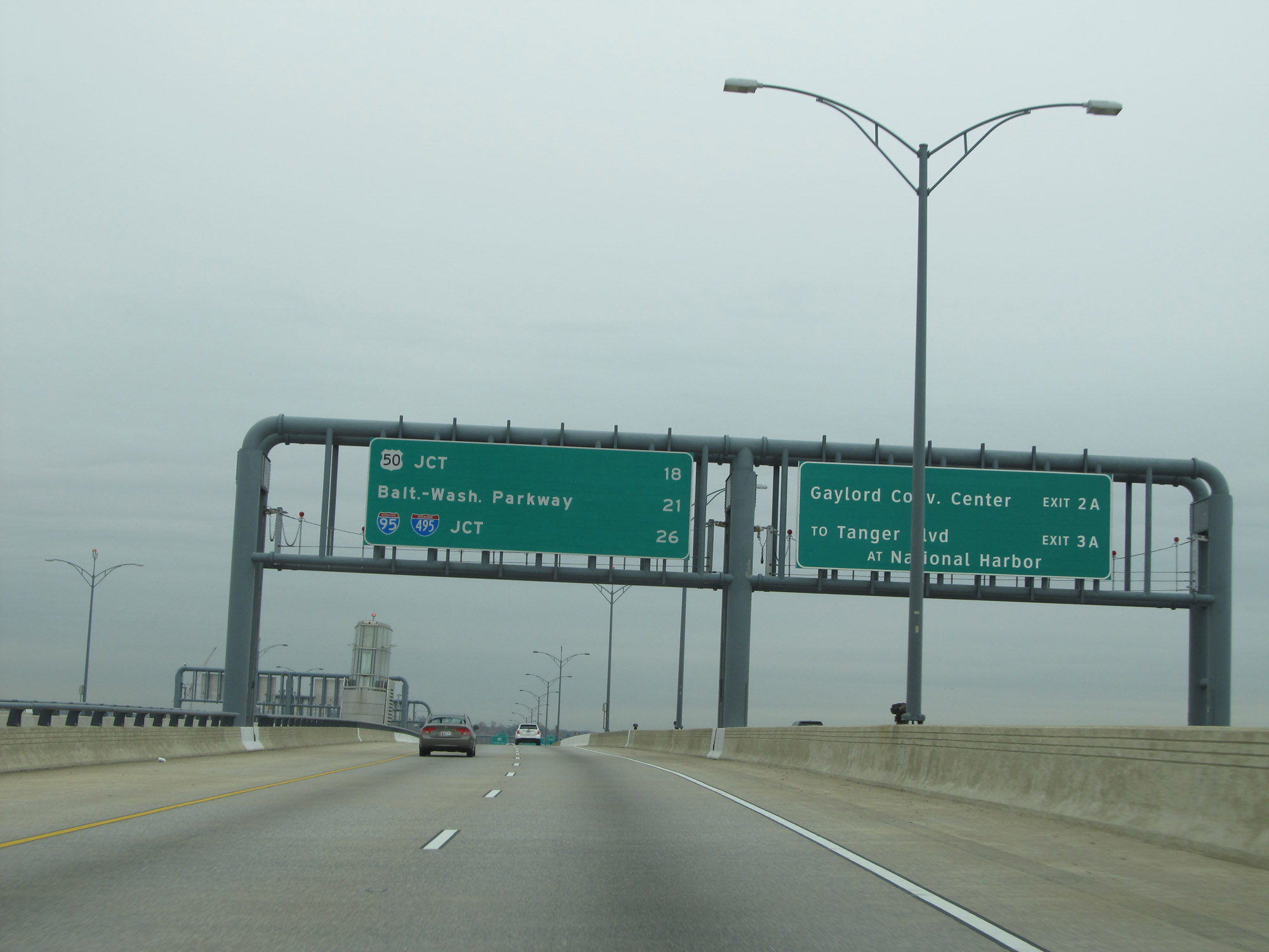
Entering Maryland after a 320-foot jaunt in the District of Columbia on the Woodrow Wilson Memorial Bridge, we see advance signage for the first two exits in Maryland on the other side of the Potomac River. Exits 2A-B are only accessible from the local lanes, while Exit 3 will be accessible to traffic in both the local and thru lanes, albeit through different ramps. (Photo taken 11/9/15). |
 |
Traffic signals in place on the Woodrow Wilson Memorial Bridge over the Potomac River on Interstate 495 Outer Loop (East) / Interstate 95 North in the event that the drawbridge is raised. (Photo taken 11/9/15). |
 |
Overhead mileage sign on Interstate 495 Outer Loop (East) / Interstate 95 North as the duplex continues eastbound into Maryland. (Photo taken 11/9/15). |