Road Information |
||
 |
||
| Total Mileage in State: | 25 miles | |
| Eastern End: | At Parks Ave/21st St/22nd St, in Virginia Beach | |
| Western End: | At I-64/I-664, in Chesapeake | |
| Mileage covered in Photos: | 25 miles | |
| Counties covered in Photos: | Virginia Beach (city), Norfolk (city), Portsmouth (city), Chesapeake (city) | |
| Major Junctions in Photos: | I-64, in Norfolk I-464, in Norfolk I-64/I-664, in Chesapeake |
|
| Control Cities in Photos: | Virginia Beach, Norfolk, Portsmouth, Chesapeake | |
Westbound
 |
Interstate 264 West at mile marker 25, which is its beginning in Virginia Beach. (Photo taken 11/8/15). |
 |
Interstate 264 West assurance shield just beyond mile marker 25. (Photo taken 11/8/15). |
 |
Speed limit sign just beyond mile marker 25. The speed limit starts out at 55 mph on Interstate 264 West. I-264 never sees a speed limit higher than 55 mph, unfortunately. (Photo taken 11/8/15). |
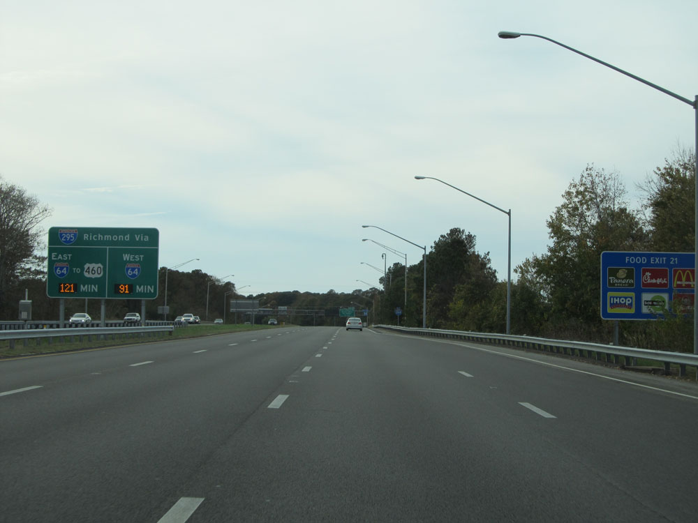 |
This digital sign on the left lists the estimated travel time to Interstate 295 in the Richmond area via I-64 West and I-64 East to US 460. (Photo taken 11/8/15). |
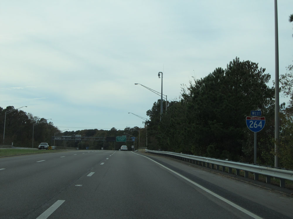 |
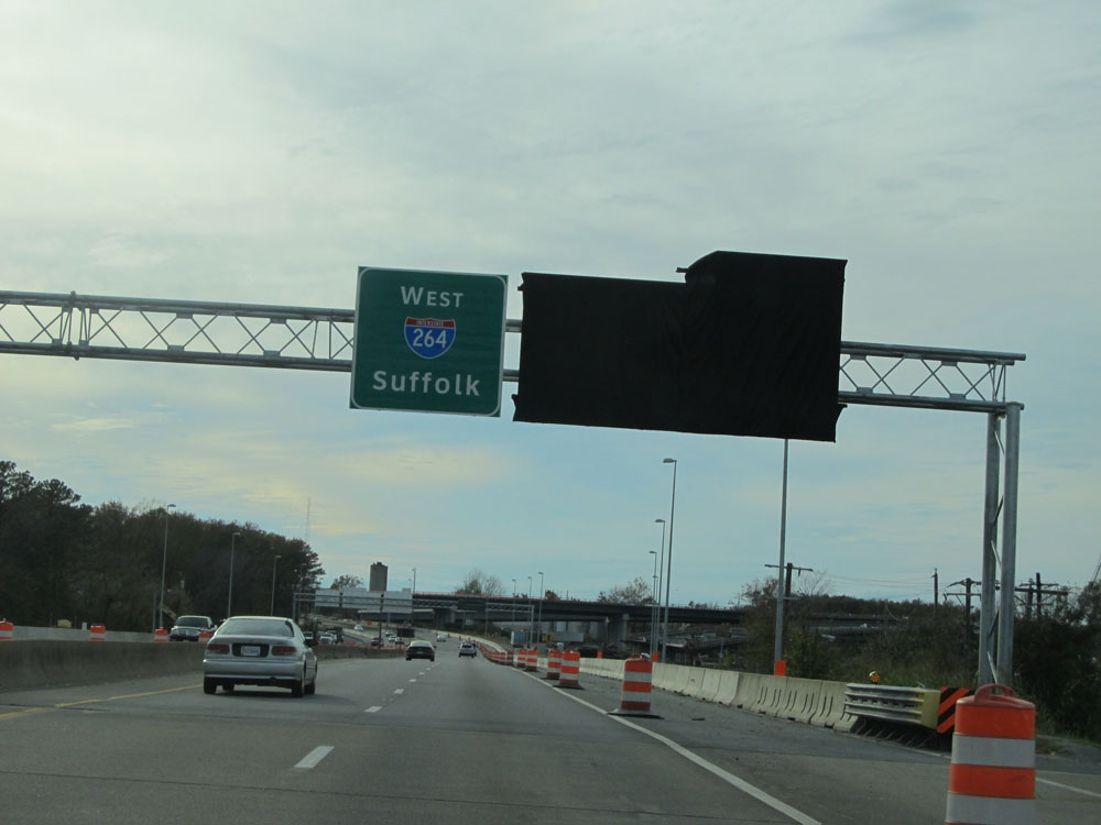
Another Interstate 264 West assurance shield. (Photo taken 11/8/15). |
 |
Interstate 264 West at Exit 21: First Colonial Rd / Oceana Naval Air Station (Photo taken 11/8/15). |
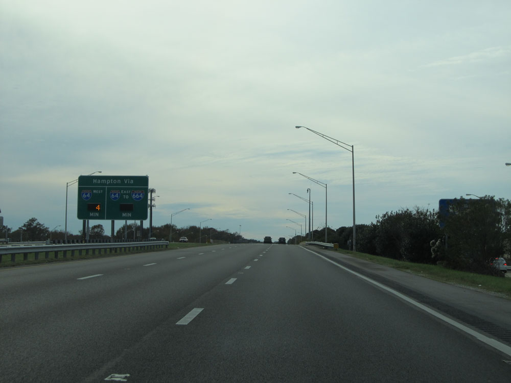 |
A second digital sign estimates the travel times to Hampton via I-64 West and I-64 East to I-664 North. (Photo taken 11/8/15). |
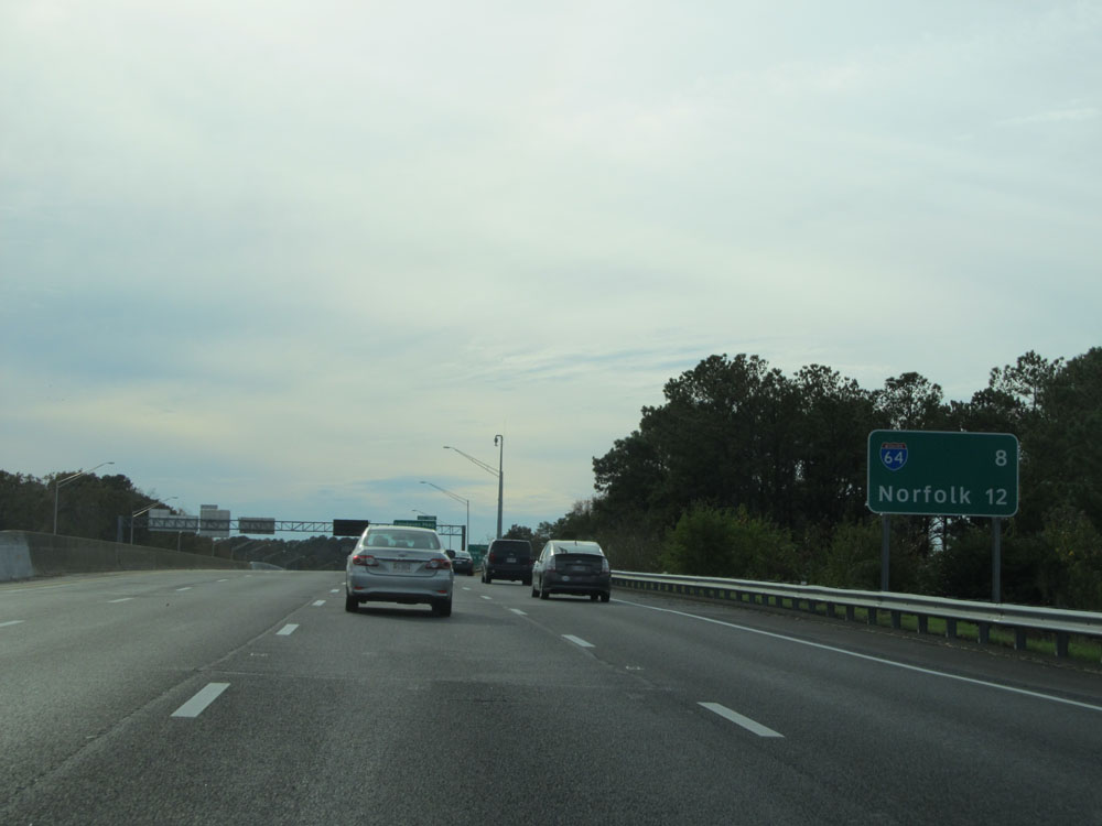 |
Mileage/distance sign on Interstate 264 West. It's 8 miles to the junction of Interstate 64 and 12 miles to Norfolk. (Photo taken 11/8/15). |
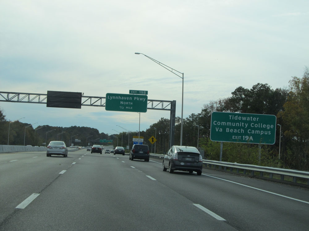 |
Take Exit 19A to Tidewater Community College Virginia Beach Campus. (Photo taken 11/8/15). |
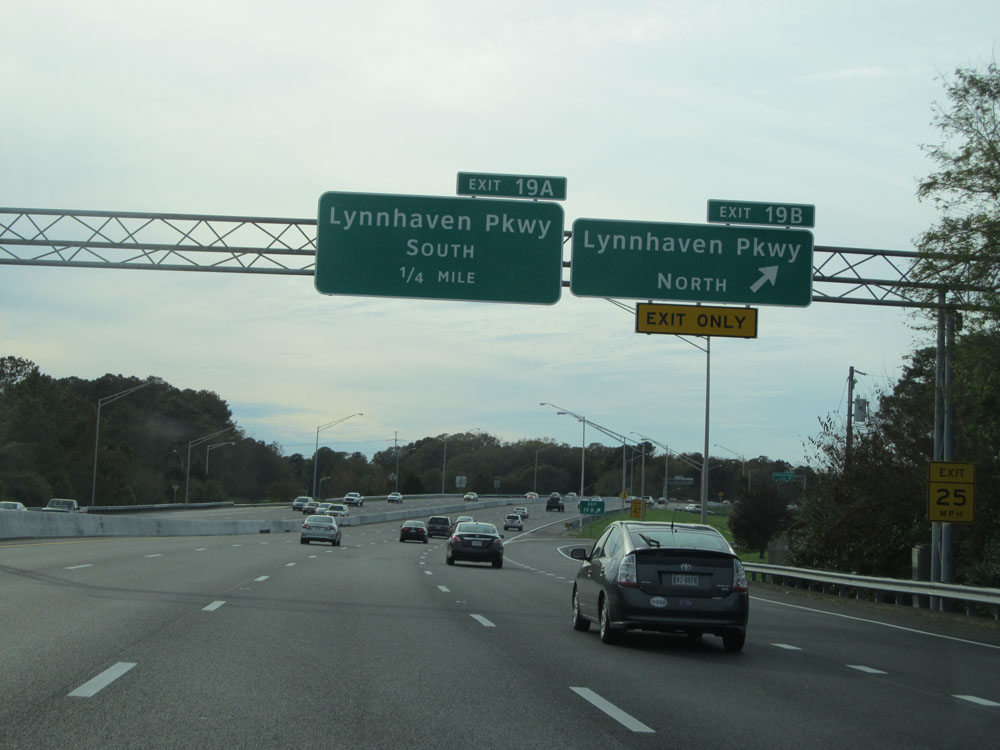 |
Interstate 264 West at Exit 19B: Lynnhaven Pkwy North (Photo taken 11/8/15). |
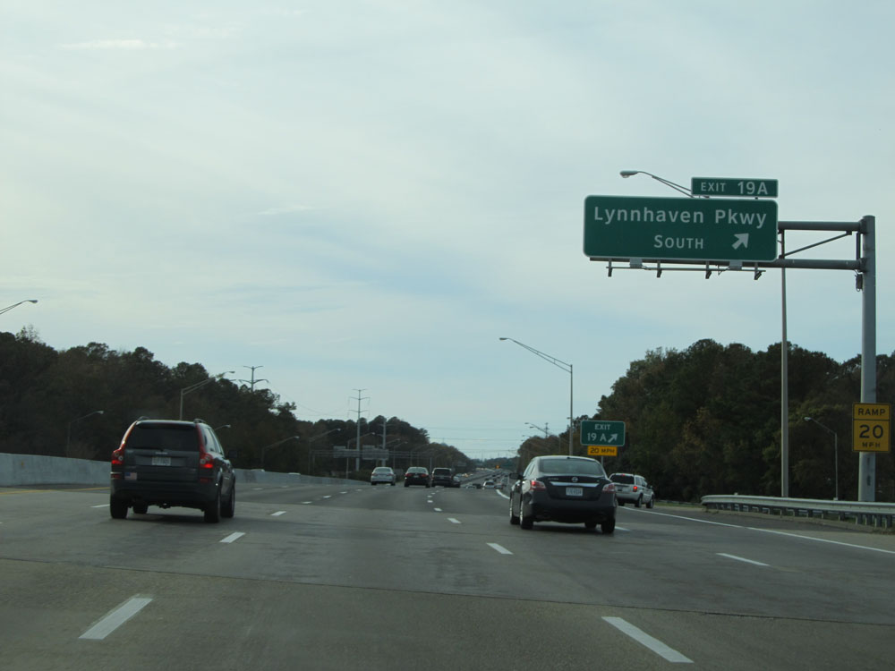 |
Interstate 264 West at Exit 19A: Lynnhaven Pkwy South (Photo taken 11/8/15). |
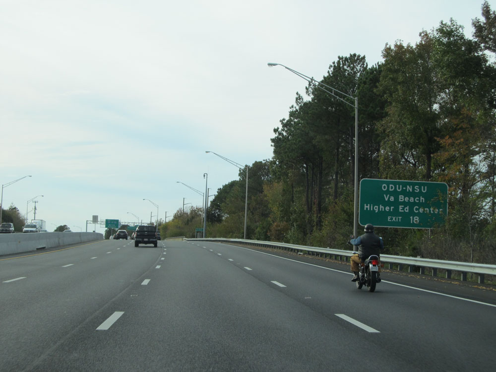 |
Take Exit 18 to ODU-NSU Virginia Beach Higher Ed Center. (Photo taken 11/8/15). |
 |
Interstate 264 West at Exit 18: Rosemont Rd (Photo taken 11/8/15). |
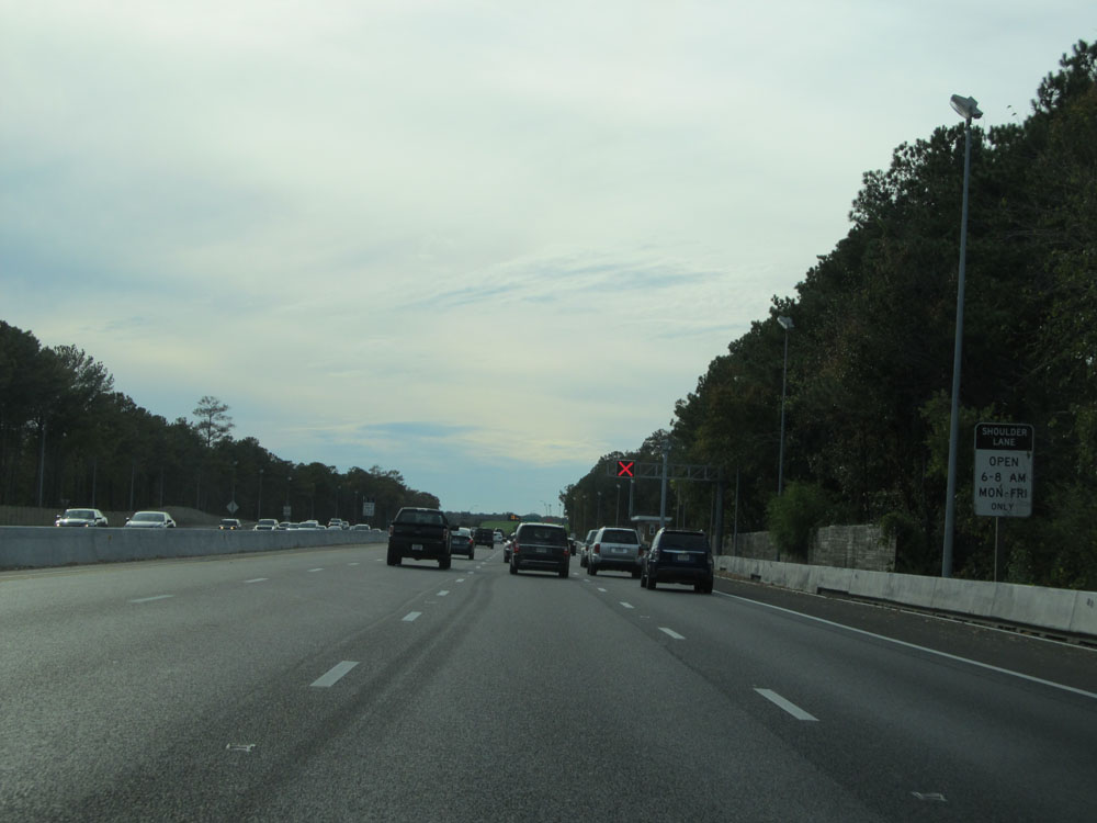 |
Just beyond Exit 18, we see a time/day restricted shoulder lane pop up. This shoulder lane is only open from 6am-8am Monday thru Friday. (Photo taken 11/8/15). |
 |
Take Exit 17A to Bryant & Stratton College and Farm Bureau Live at Virginia Beach. (Photo taken 11/8/15). |
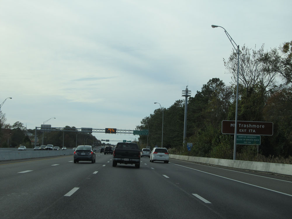 |
Also take Exit 17A to Mt Trashmore. (Photo taken 11/8/15). |
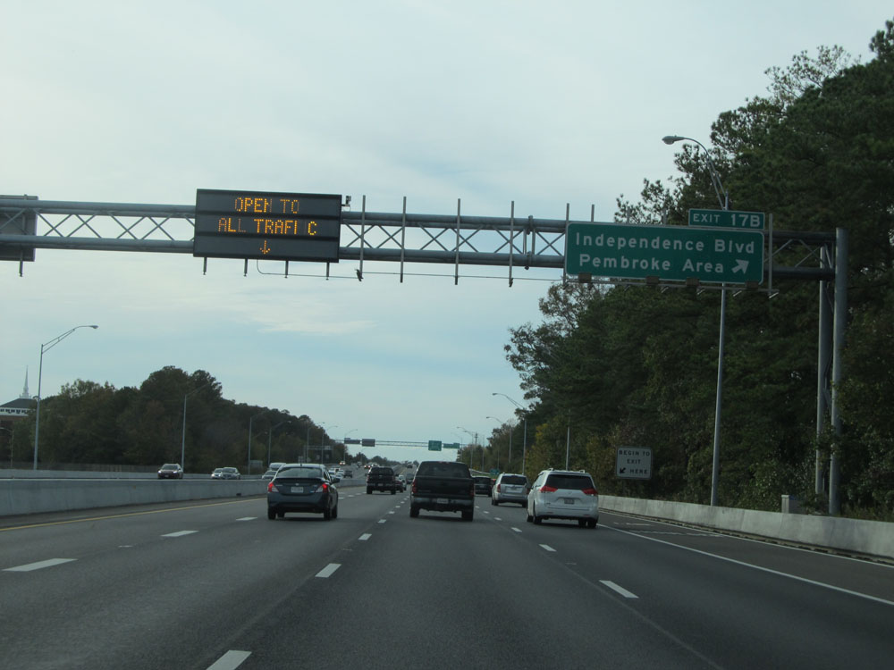 |
Interstate 264 West at Exit 17B: Independence Blvd / Pembroke Area (Photo taken 11/8/15). |
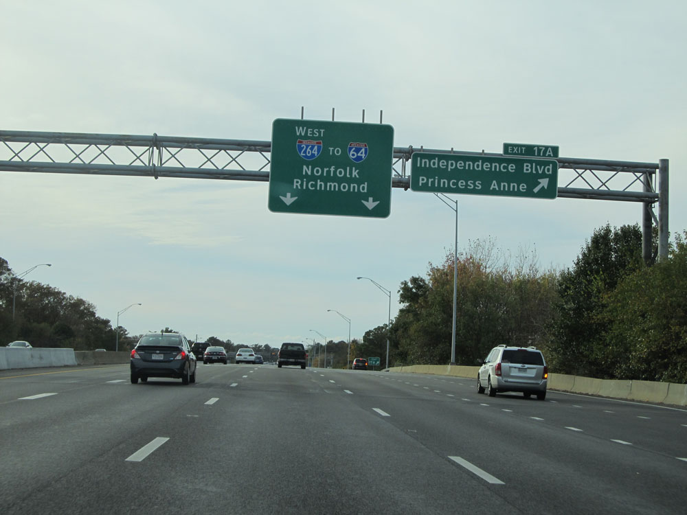 |
Interstate 264 West at Exit 17A: Independence Blvd / Princess Anne (Photo taken 11/8/15). |
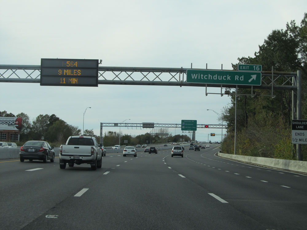 |
Interstate 264 West at Exit 16: Witchduck Rd (Photo taken 11/8/15). |
 |
Interstate 264 West approaching Exits 15, 14, and 13 - 1 mile. (Photo taken 11/8/15). |
 |
Interstate 264 West at mile marker 15. (Photo taken 11/8/15). |
 |
Interstate 264 West approaching Exits 15, 14, and 13 - 1/2 mile. (Photo taken 11/8/15). |
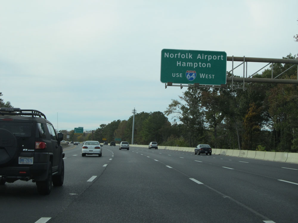 |
Take Exit 14B for Interstate 64 West to Norfolk Airport and Hampton. (Photo taken 11/8/15). |
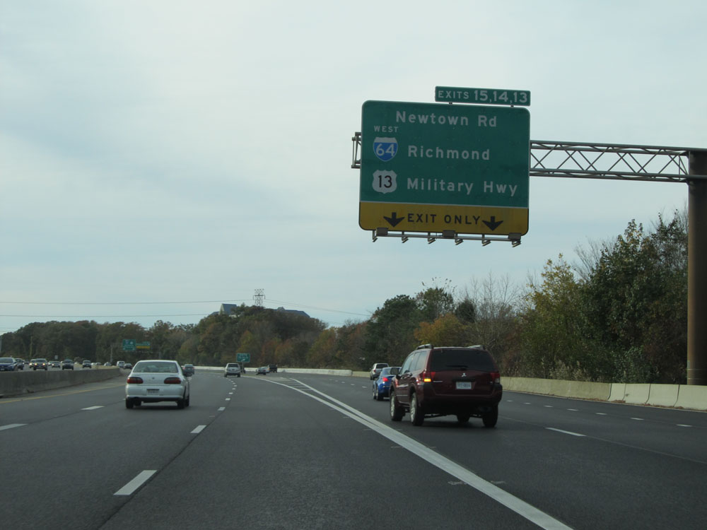 |
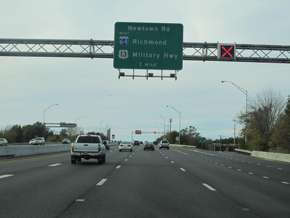
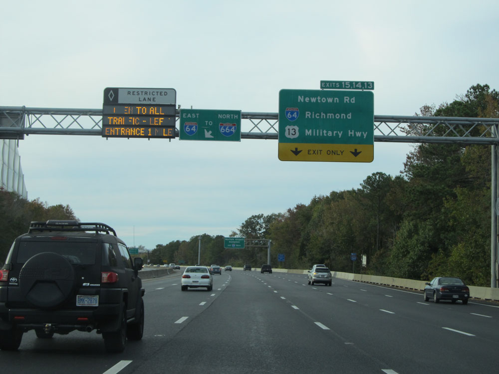
Interstate 264 West at Exits 15-14-13: Newtown Rd / Interstate 64 West - Richmond / US 13 - Military Hwy (Photo taken 11/8/15). |
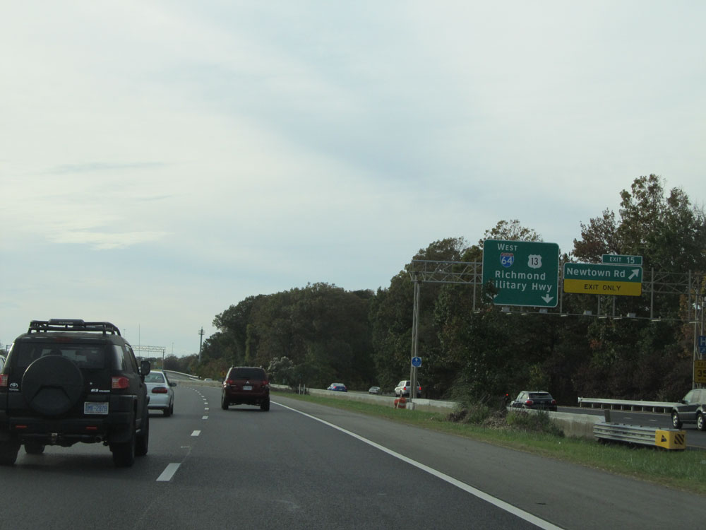 |
Interstate 264 West at Exit 15: Newtown Rd (Photo taken 11/8/15). |
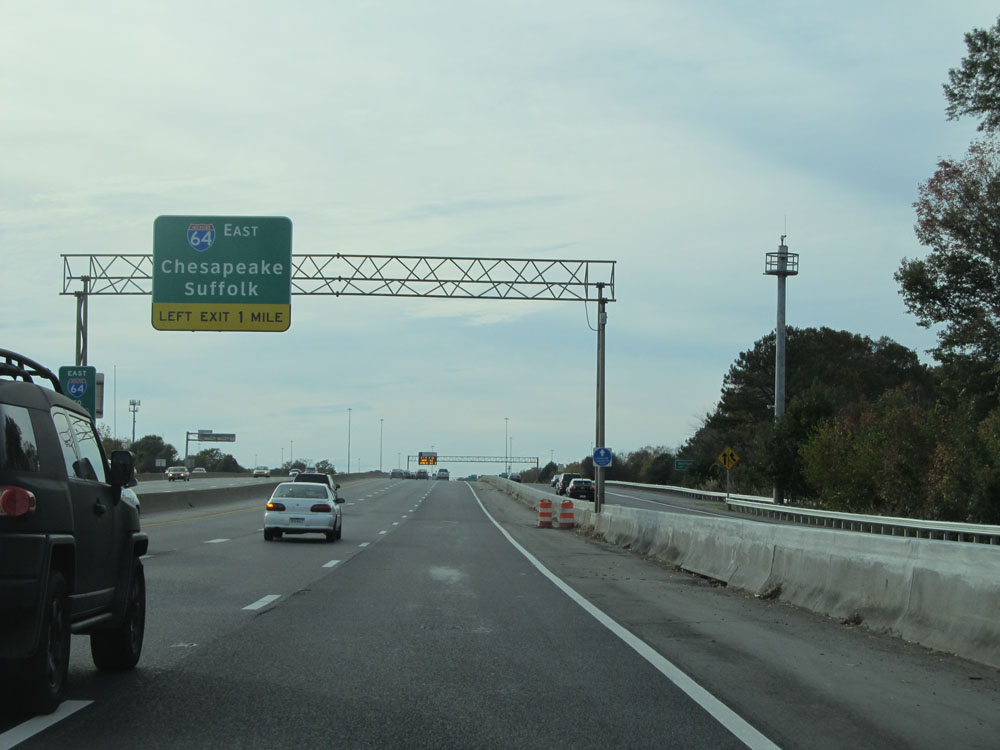 |
Interstate 264 West approaching the junction of Interstate 64 East - 1 mile on the left. (Photo taken 11/8/15). |
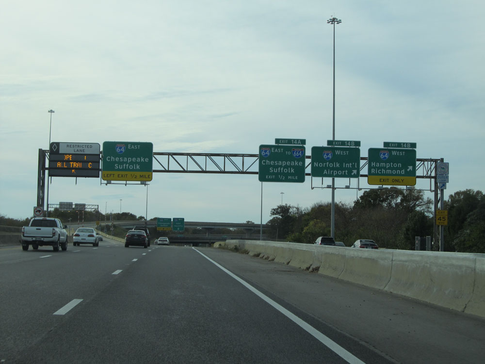 |
Interstate 264 West at Exit 14B: Interstate 64 West - Hampton / Richmond (Photo taken 11/8/15). |
 |
A closer view of the ramp for Exit 14B on the right, as Interstate 264 West approaches the junction of Interstate 64 East toward Chesapeake and Suffolk. (Photo taken 11/8/15). |
 |
Interstate 264 West at Exit 14A: Interstate 64 East - Chesapeake / Suffolk. If you missed getting in the local lanes a mile or so ago, you can still access Interstate 64 East just ahead on the left. (Photo taken 11/8/15). |
 |
Interstate 264 West at its direct interchange for Interstate 64 East toward Chesapeake and Suffolk, on the left. It is given no exit number from the I-264 mainline. (Photo taken 11/8/15). |
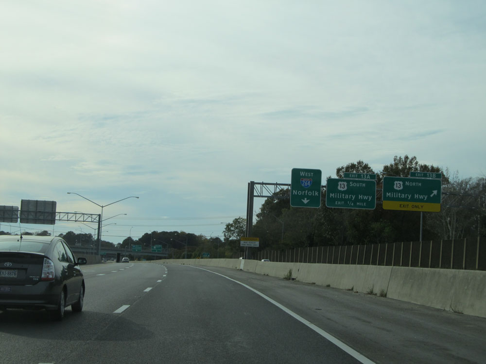 |
Interstate 264 West at Exit 13B: US 13 North - Military Hwy (Photo taken 11/8/15). |
 |
Interstate 264 West at Exit 13A: US 13 South - Military Hwy (Photo taken 11/8/15). |
 |
Overhead sign listing the distances to the three upcoming exits on Interstate 264 West, as the local lanes come to an end on the right and prepare to merge back into the I-264 West mainline. (Photo taken 11/8/15). |
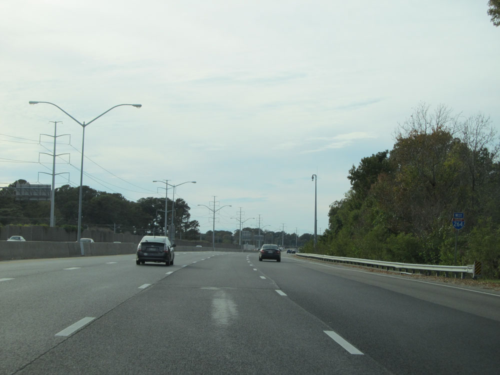 |
Interstate 264 West assurance shield. (Photo taken 11/8/15). |
 |
Speed limit assurance sign on Interstate 264 West. The speed limit remains 55 mph. (Photo taken 11/8/15). |
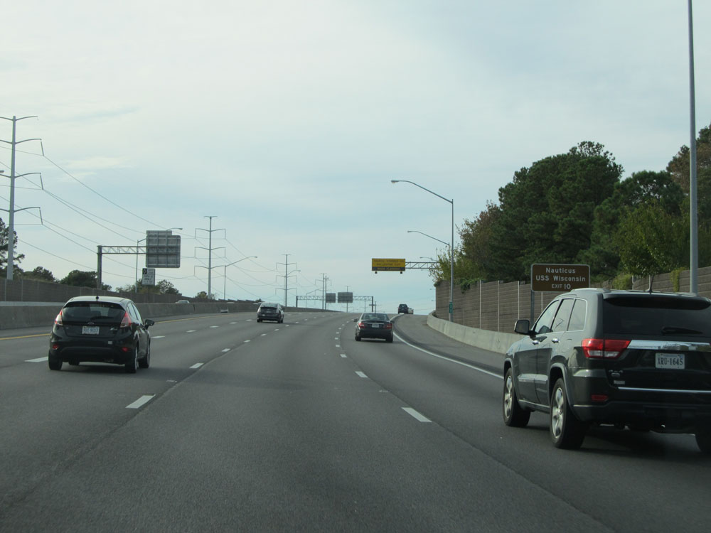 |
Take Exit 10 to Nauticus USS Wisconsin. (Photo taken 11/8/15). |
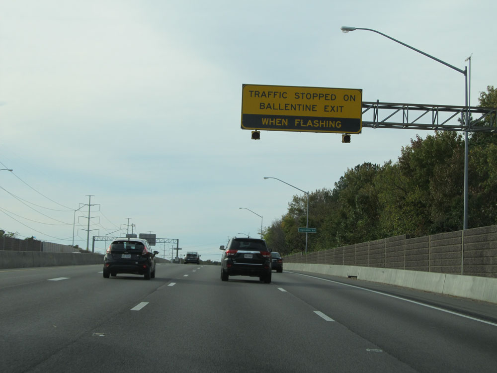 |
The lights on this overhead sign will be flashing if traffic is stopped on the ramp for Exit 12 ahead. (Photo taken 11/8/15). |
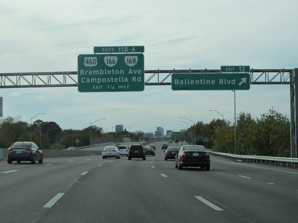 |
Interstate 264 West at Exit 12: Ballentine Blvd (Photo taken 11/8/15). |
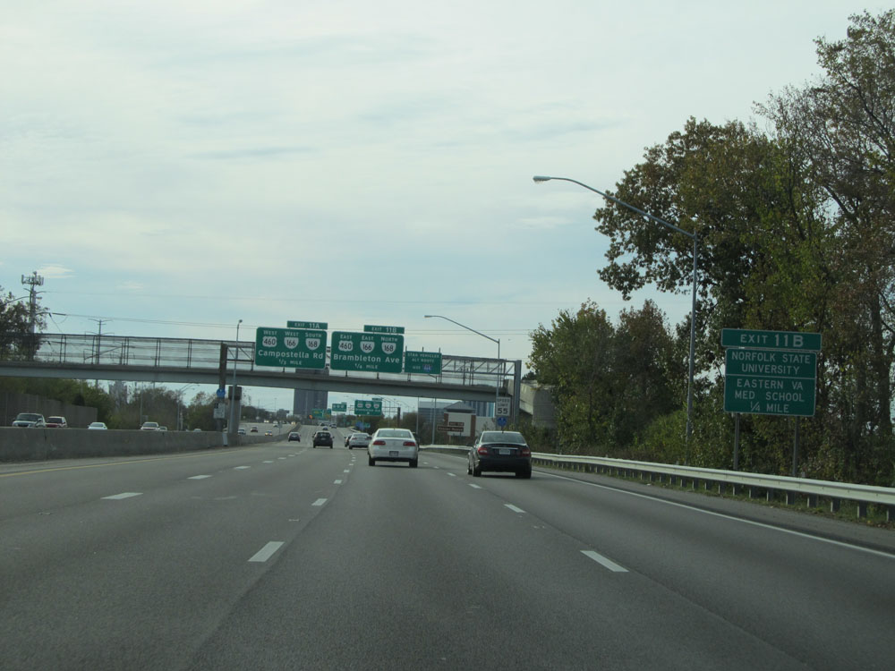 |
Take Exit 11B to Norfolk State University and Eastern VA Med School. (Photo taken 11/8/15). |
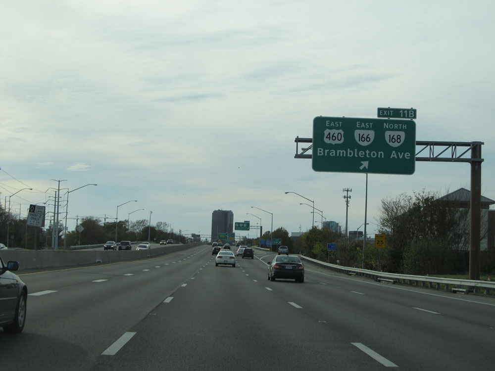 |
Interstate 264 West at Exit 11B: US 460 East / VA 166 East / VA 168 North - Brambleton Ave (Photo taken 11/8/15). |
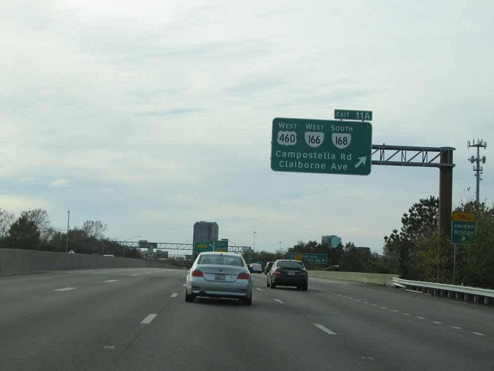 |
Interstate 264 West at Exit 11A: US 460 West / VA 166 West / VA 168 South - Campostella Rd / Claiborne Ave (Photo taken 11/8/15). |
 |
Take Exit 10 to Nauticus / Scope. (Photo taken 11/8/15). |
 |
The speed limit decreases to 45 mph as we approach downtown Norfolk. The Downtown Tunnel lies a few miles ahead, and this overhead sign on the left lists toll payment options and rates. EZ Pass and Pay-by-plate are the only options for toll payment for the tunnel. (Photo taken 11/8/15). |
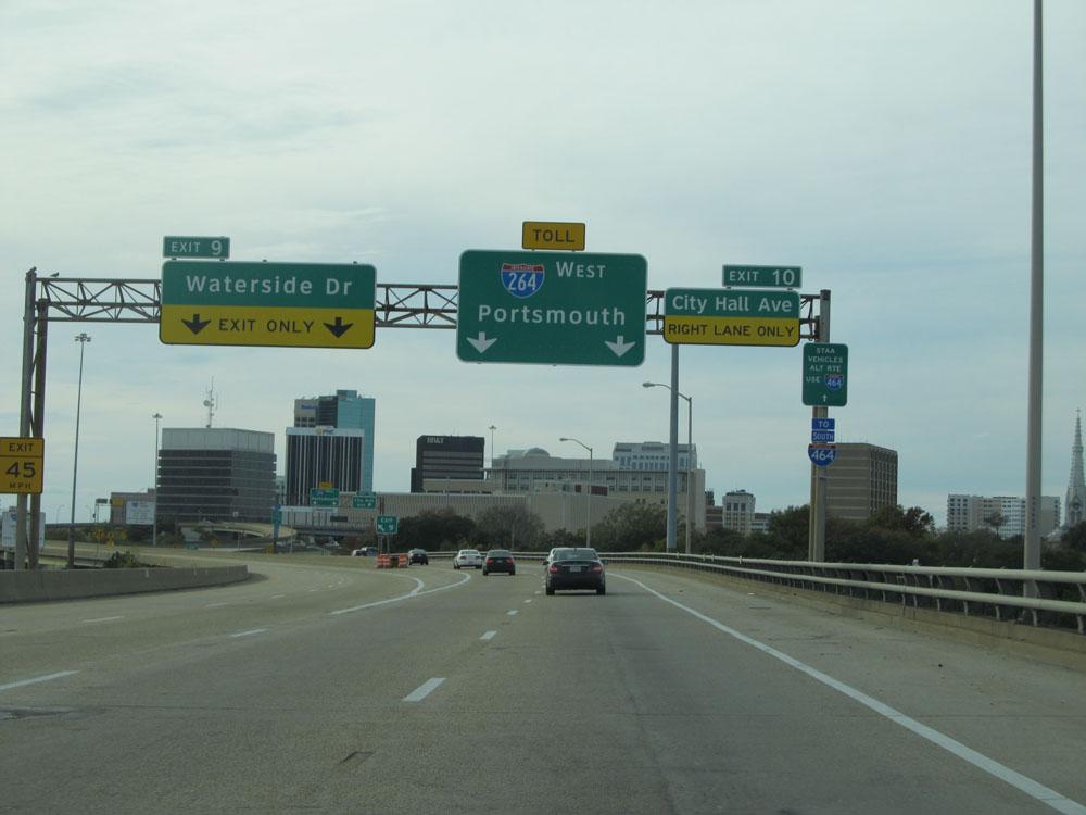 |
Interstate 264 West at Exit 9: Waterside Dr (Photo taken 11/8/15). |
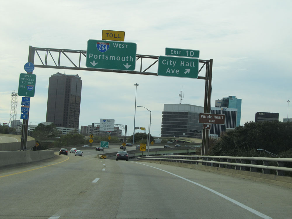 |
Interstate 264 West at Exit 10: City Hall Ave (Photo taken 11/8/15). |
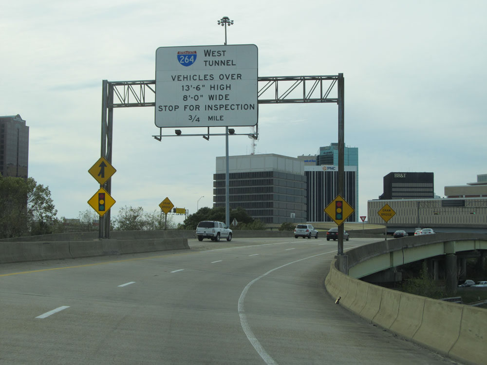 |
This overhead sign states that all vehicles over 13'6" in height and/or 8'0" in width must stop for inspection 3/4 mile ahead before entering the Downtown Tunnel on Interstate 264 West. (Photo taken 11/8/15). |
 |
Vehicles carrying hazardous materials and/or bottled gas must also stop for inspection 1/2 mile ahead before entering the downtown tunnel on Interstate 264 West. (Photo taken 11/8/15). |
 |
Interstate 264 West approaching Exit 8 - 1/4 mile. As the sign says, this is the final exit before the Downtown Tunnel toll. (Photo taken 11/8/15). |
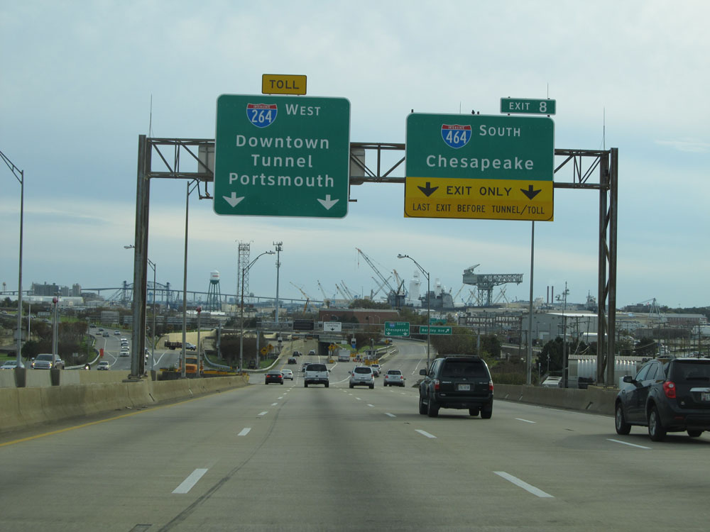 |
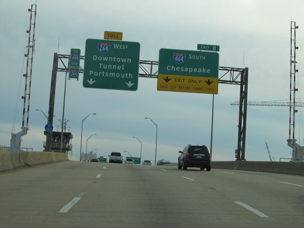
Interstate 264 West at Exit 8: Interstate 464 South - Chesapeake (Photo taken 11/8/15). |
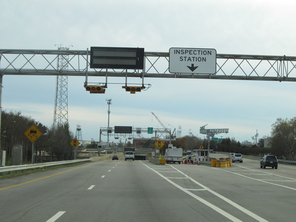 |
Interstate 264 West at the Inspection Station prior to entering the Downtown Tunnel. The toll gantry for EZ Pass customers entering the tunnel lies just ahead. (Photo taken 11/8/15). |
 |
Interstate 264 West as it prepares to enter the Downtown Tunnel. (Photo taken 11/8/15). |
 |
Entering the tunnel, we see this overhead advance mileage sign for Exit 7, which is immediately on the west side of the tunnel. (Photo taken 11/8/15). |
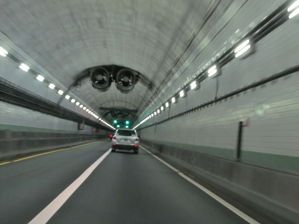 |
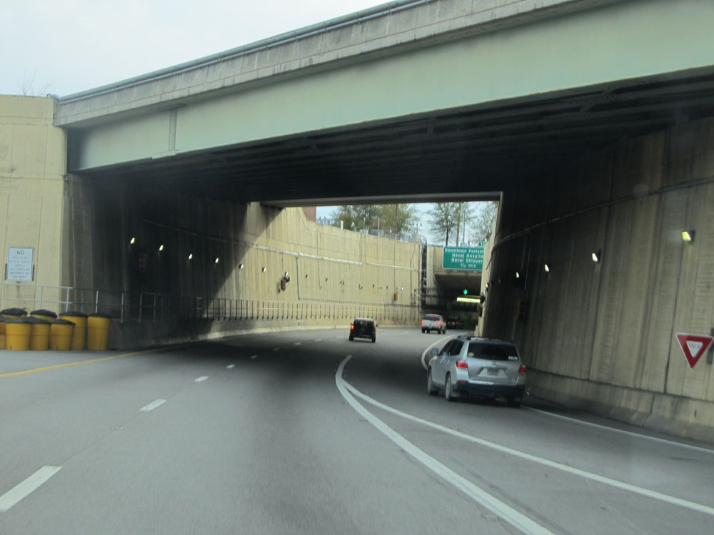
View from inside the Downtown Tunnel. (Photo taken 11/8/15). |
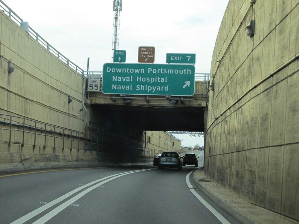 |
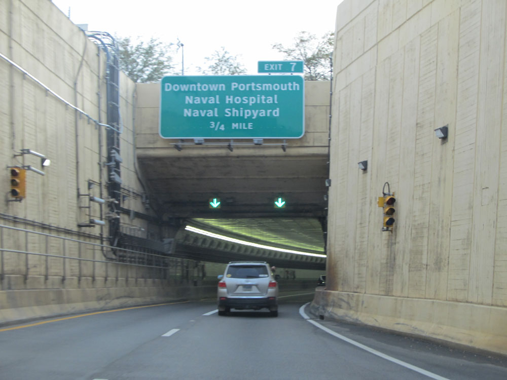
Interstate 264 West at Exit 7: Downtown Portsmouth / Naval Hospital / / Naval Shipyard. Also, upon exiting the tunnel to the west, the speed limit increases to 55 mph. (Photo taken 11/8/15). |
 |
A closer view of the ramp for Exit 7 as Interstate 264 West enters the Portsmouth city limits. (Photo taken 11/8/15). |
 |
Interstate 264 West assurance shield just beyond Exit 7. (Photo taken 11/8/15). |
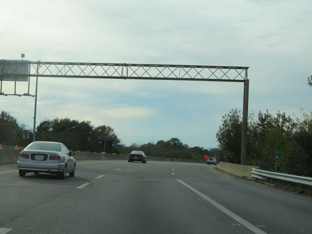 |
Interstate 264 West at mile marker 6. (Photo taken 11/8/15). |
 |
Overhead sign listing the distances to the three upcoming exits on Interstate 264 West. (Photo taken 11/8/15). |
 |
Interstate 264 West at a future interchange for the Midtown Tunnel. (Photo taken 11/8/15). |
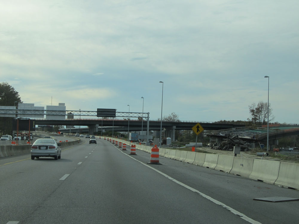 |
A view of the ramp construction for this future interchange. (Photo taken 11/8/15). |
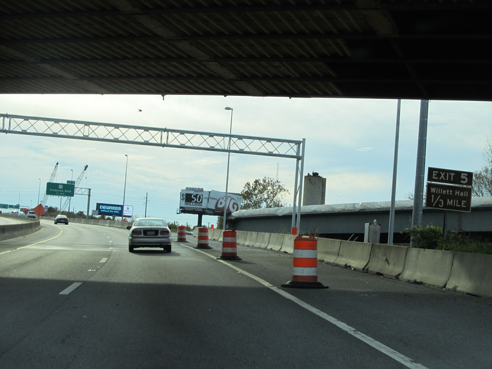 |
Take Exit 5 to Willett Hall. (Photo taken 11/8/15). |
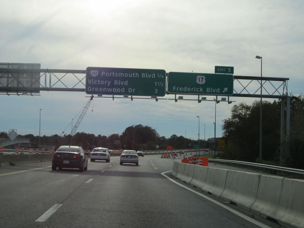 |
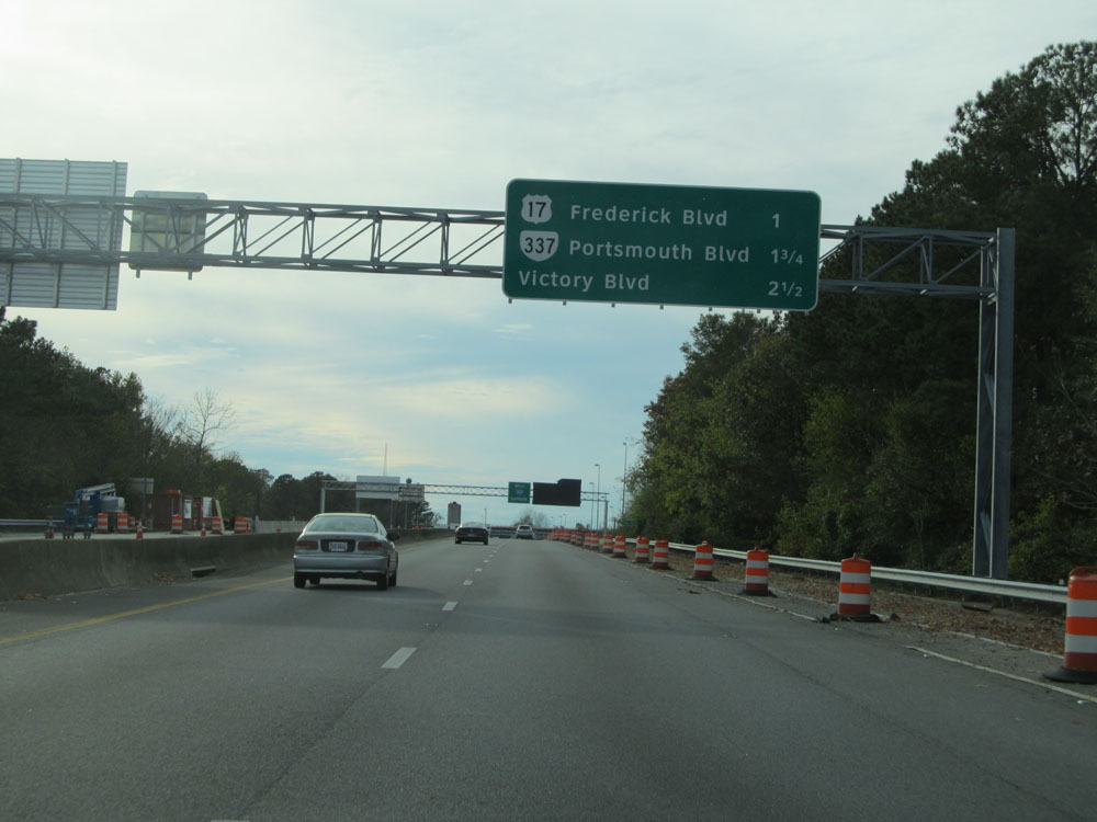
Interstate 264 West at Exit 5: US 17 - Frederick Blvd (Photo taken 11/8/15). |
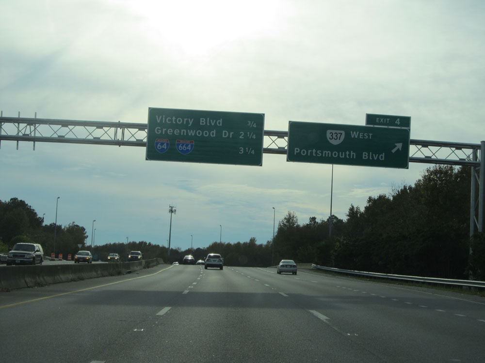 |
Interstate 264 West at Exit 4: VA 337 West - Portsmouth Blvd (Photo taken 11/8/15). |
 |
Take Exit 3 to Tidewater Community College Portsmouth Campus. (Photo taken 11/8/15). |
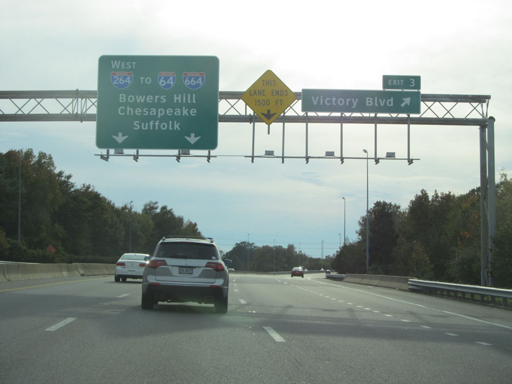 |
Interstate 264 West at Exit 3: Victory Blvd (Photo taken 11/8/15). |
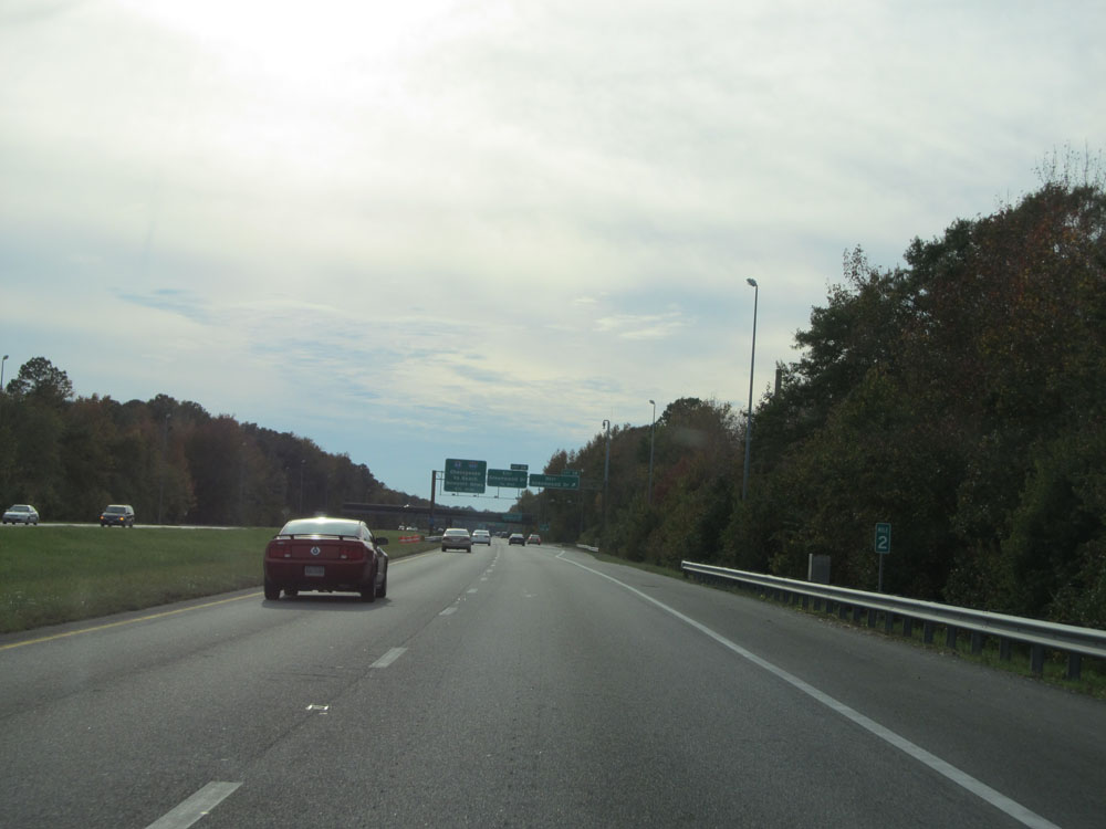 |
Interstate 264 West at mile marker 2. (Photo taken 11/8/15). |
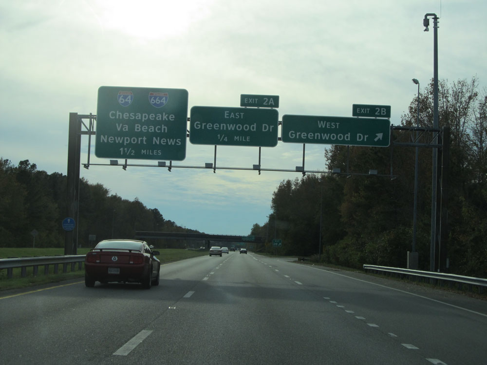 |
Interstate 264 West at Exit 2B: Greenwood Dr West (Photo taken 11/8/15). |
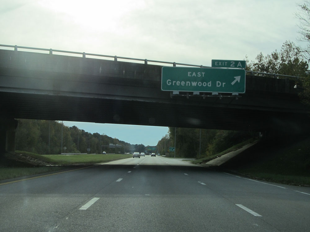 |
Interstate 264 West at Exit 2A: Greenwood Dr East (Photo taken 11/8/15). |
 |
Interstate 264 West approaching its western terminus at the junction of Interstate 64 / Interstate 664 - 1/2 mile. Keep to the left to access Interstate 64 ahead. (Photo taken 11/8/15). |
 |
Interstate 264 West at mile marker 1. (Photo taken 11/8/15). |
 |
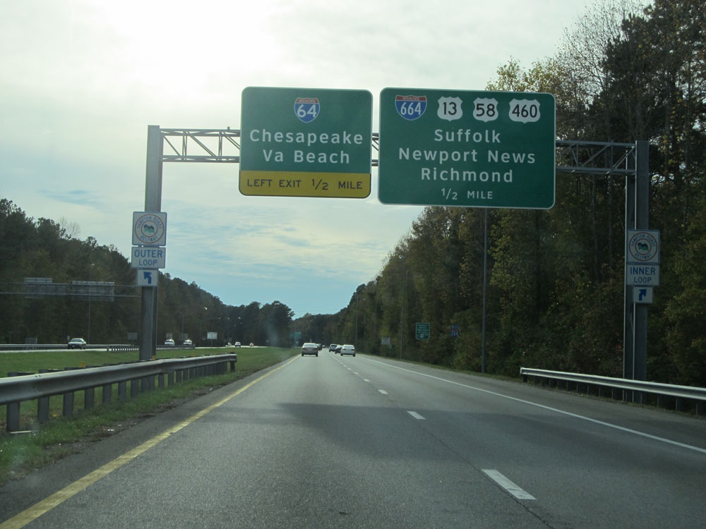
Interstate 264 West at its western terminus. Keep to the right to go onto Interstate 664 North. Keep to the left here to get to Interstate 64. (Photo taken 11/8/15). |
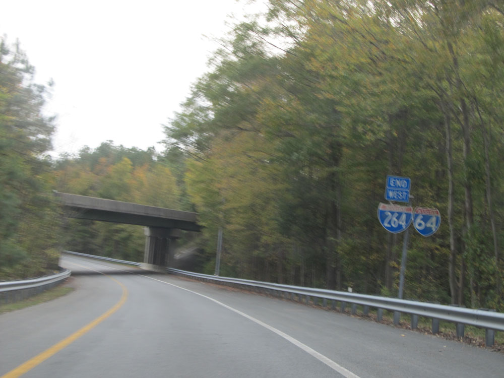 |
On the ramp to Interstate 64, we see this Interstate 264 West End sign. Sorry about the quality of the photo, though. (Photo taken 11/8/15). |