Road Information |
||
 |
||
| Total Mileage in State: | 67 miles | |
| Beginning/End: | At I-77/US 21, near Pineville | |
| Mileage covered in Photos: | 67 miles | |
| Counties covered in Photos: | Mecklenburg | |
| Major Junctions in Photos: | I-85, near Belmont I-77, in Huntersville I-85, near Concord US 74, in Matthews I-77, near Pineville |
|
| Control Cities in Photos: | Charlotte, Huntersville, Concord, Matthews, Pineville | |
Inner Loop
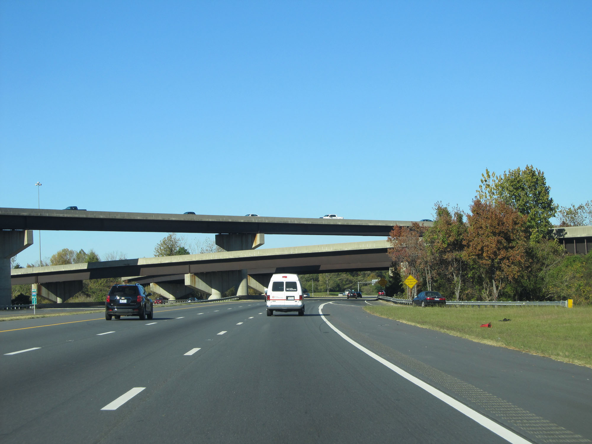 |
Interstate 485 Inner Loop (West) at its beginning/end to the south of downtown Charlotte, as it prepares to pass under the ramps to and from Interstate 77. (Photo taken 11/12/16). |
 |
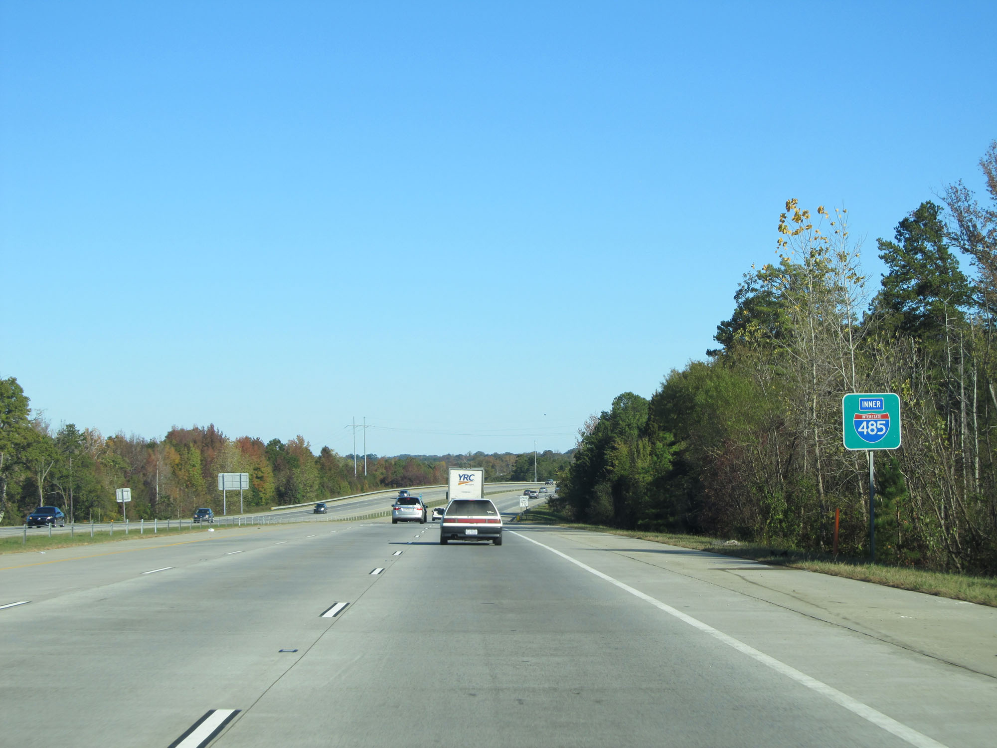
Interstate 485 Inner Loop reassurance shield. (Photo taken 11/12/16). |
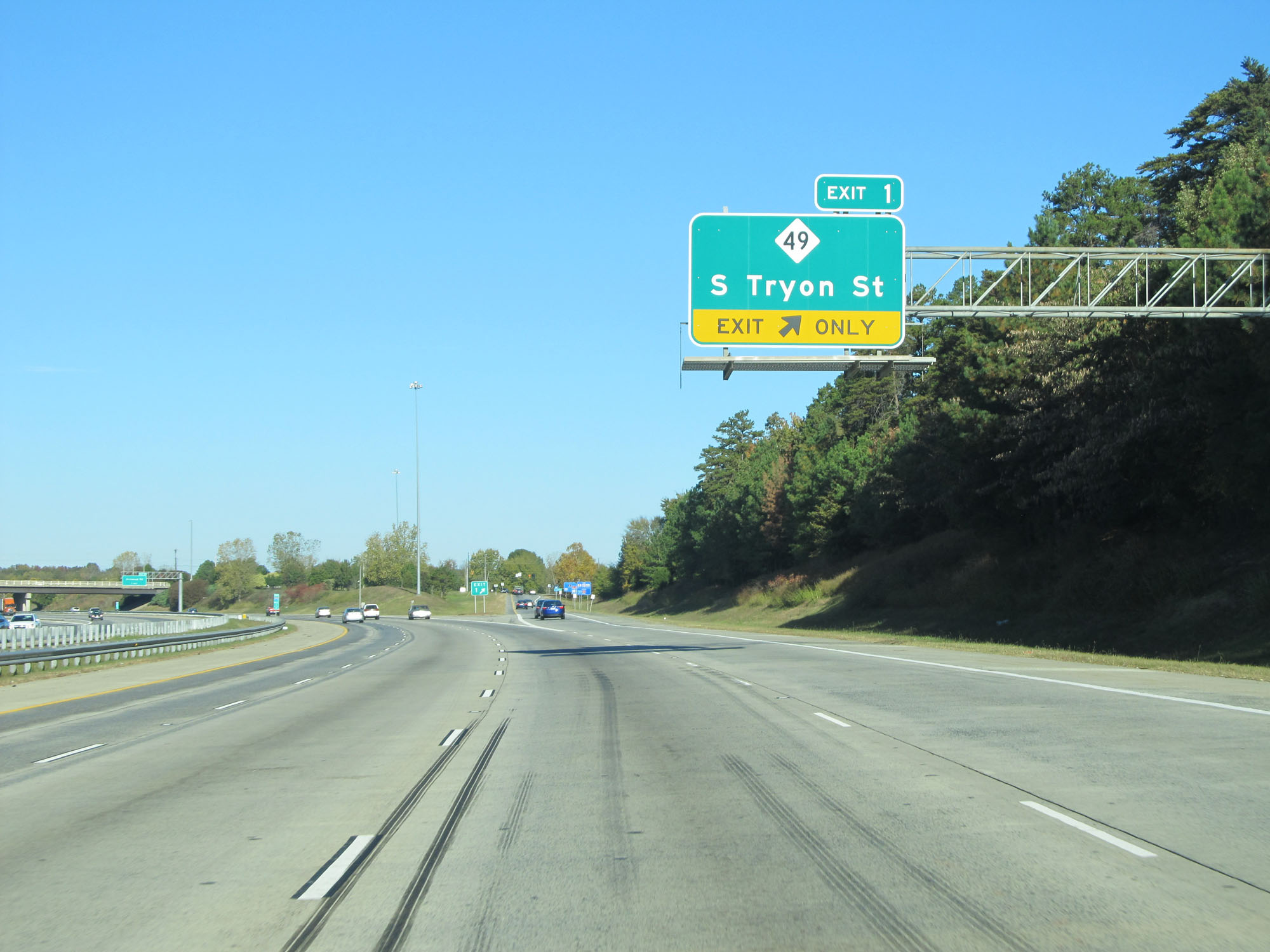 |
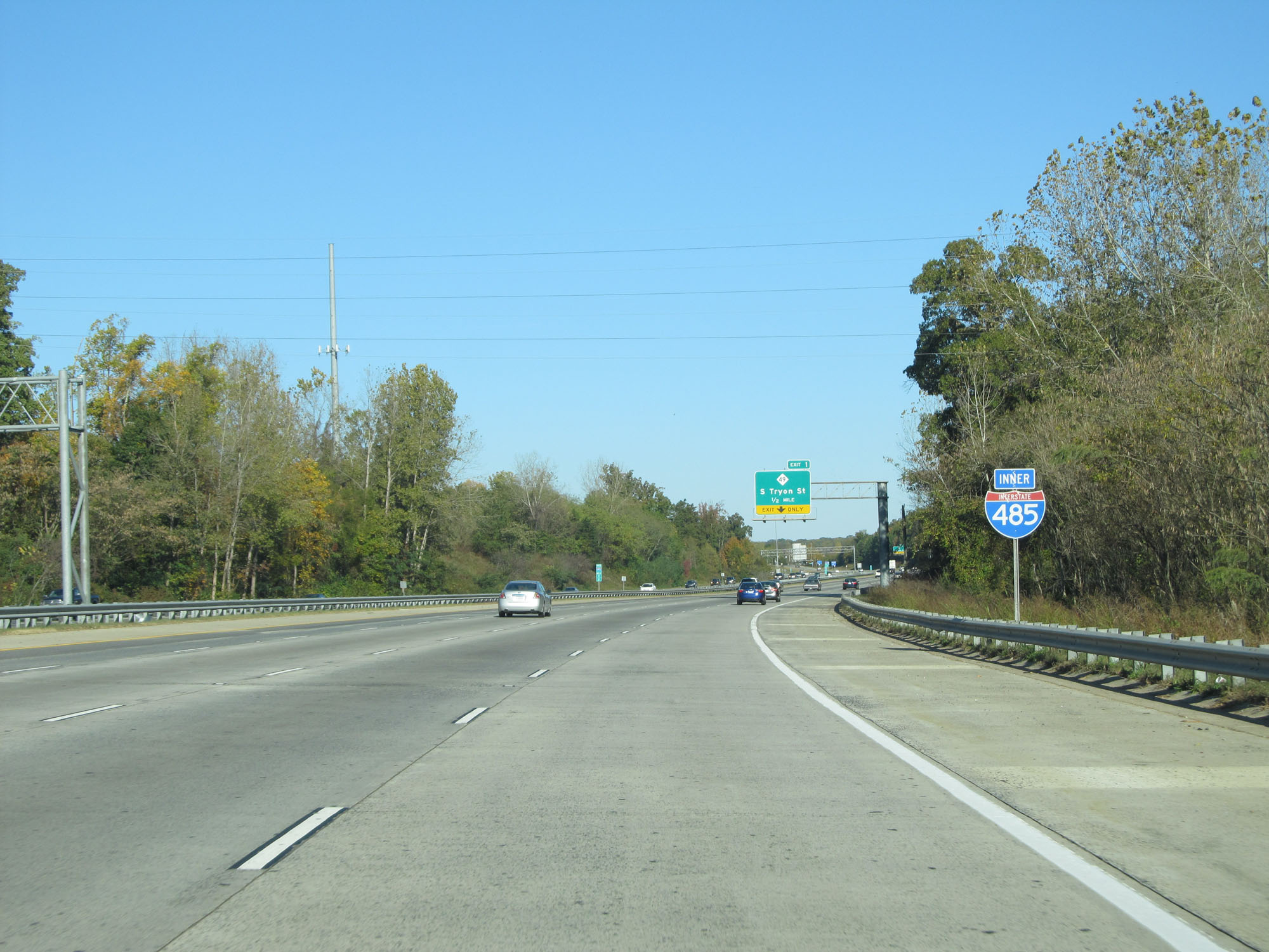
Interstate 485 Inner Loop (West) at Exit 1: NC 49 - S Tryon St (Photo taken 11/12/16). |
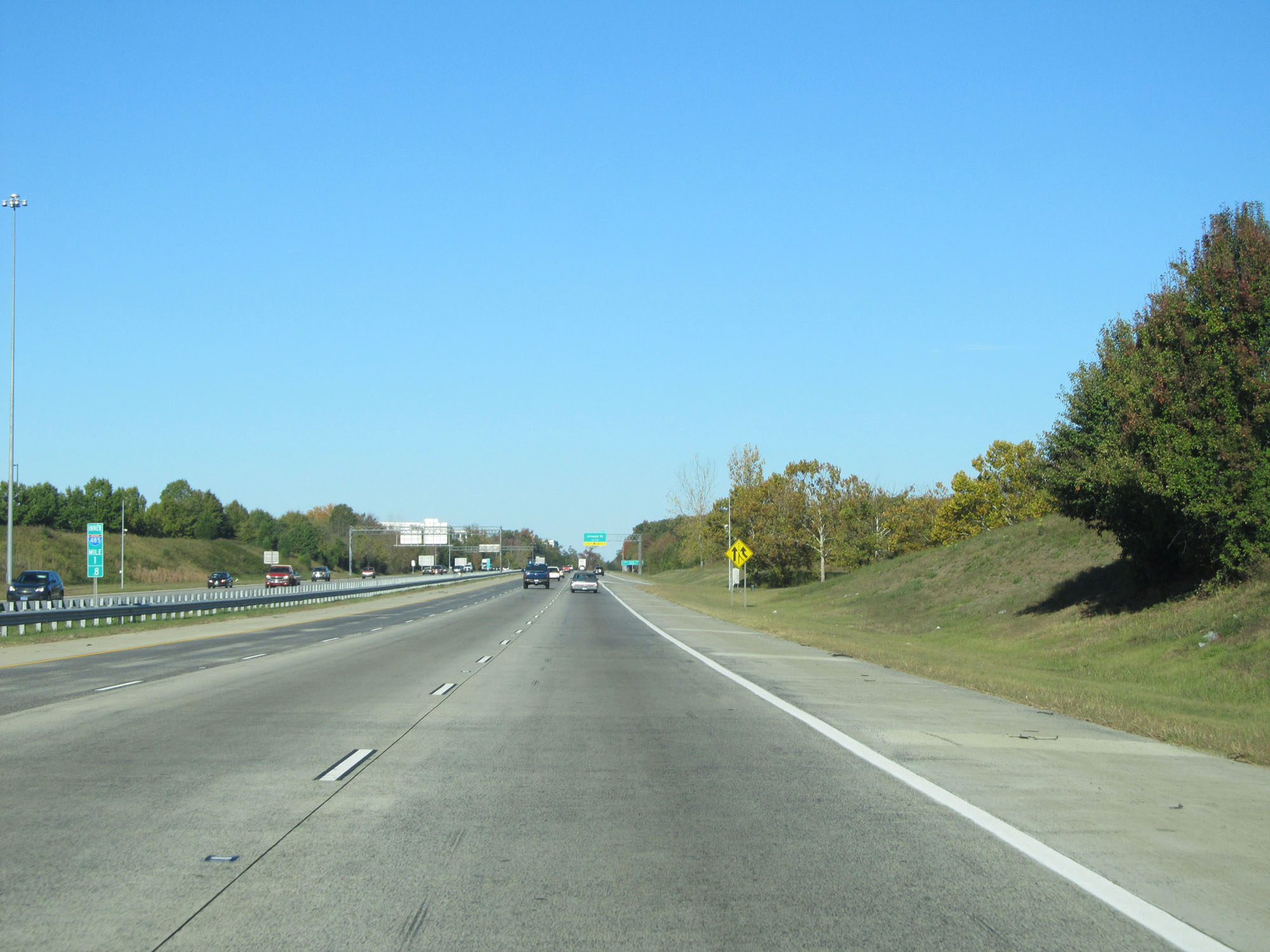 |
Interstate 485 Inner Loop (West) at mile marker 1.8. (Photo taken 11/12/16). |
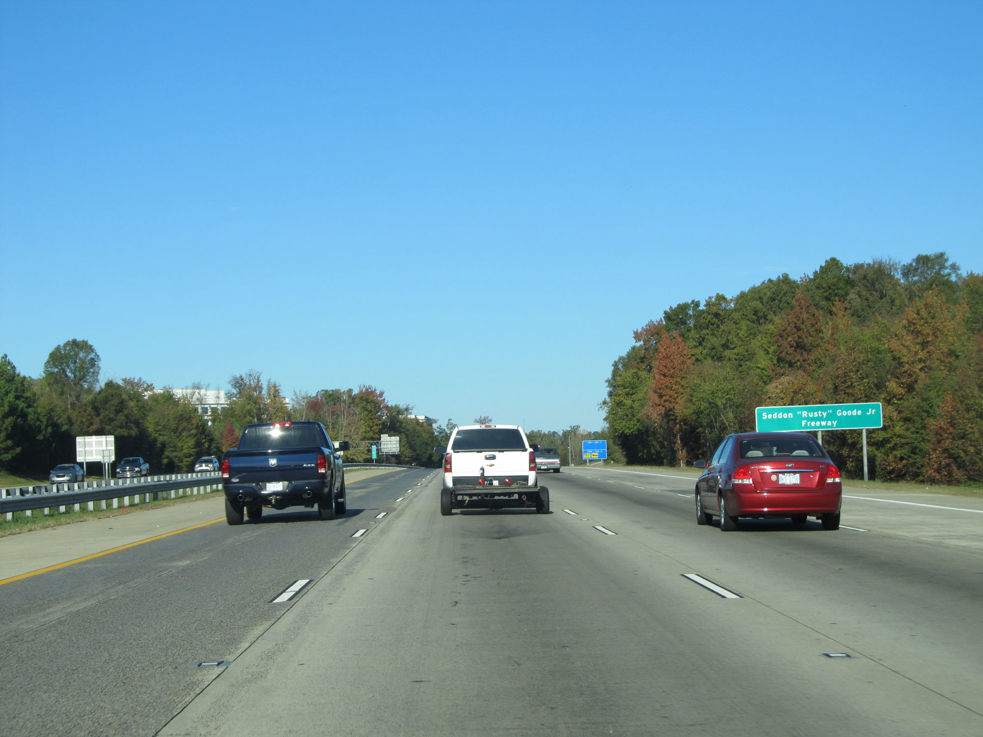 |
Interstate 485 is also known as Seddon "Rusty" Goode Jr Freeway, as this sign reads. (Photo taken 11/12/16). |
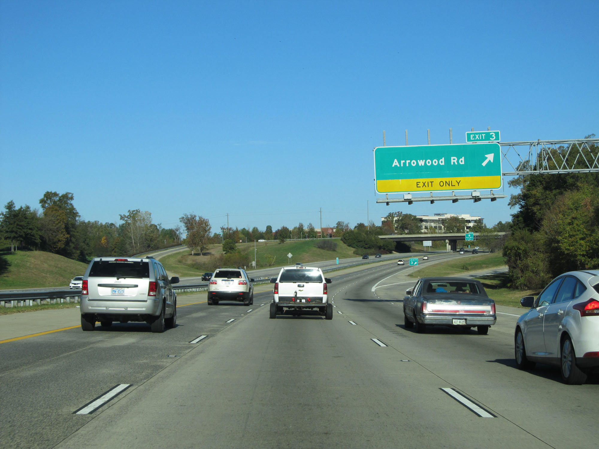 |
Interstate 485 Inner Loop (West) at Exit 3: Arrowood Rd (Photo taken 11/12/16). |
 |
Another Interstate 485 Inner Loop reassurance shield. (Photo taken 11/12/16). |
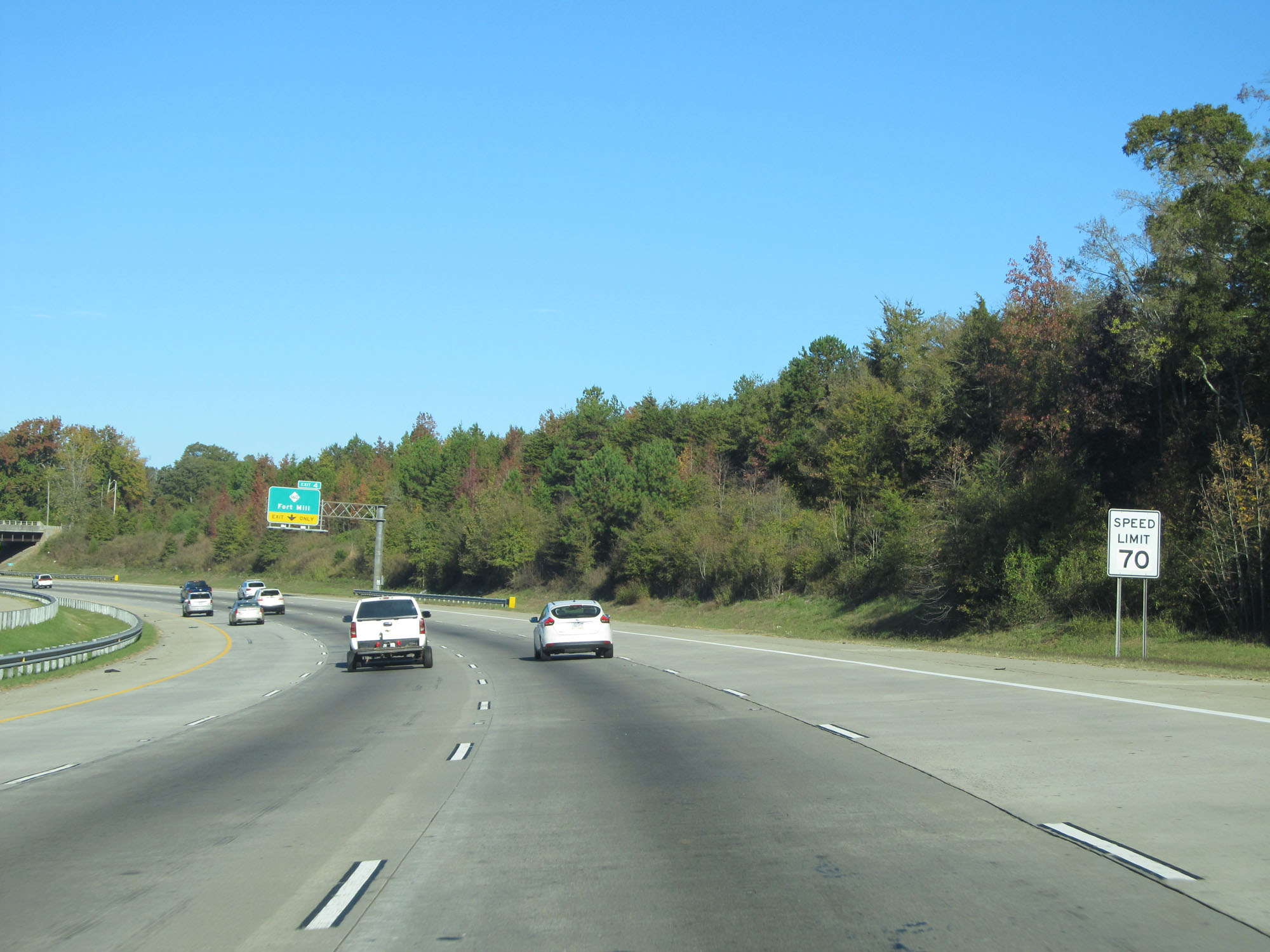 |
The speed limit on Interstate 485 is 70 mph. This is the standard speed limit on most rural Interstate highways in North Carolina. (Photo taken 11/12/16). |
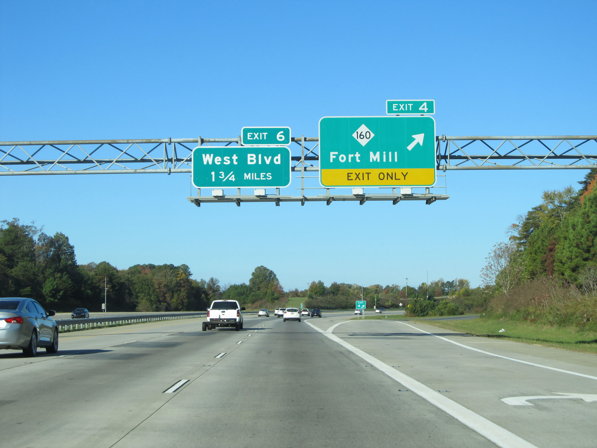 |
Interstate 485 Inner Loop (West) at Exit 4: NC 160 - Fort Mill (Photo taken 11/12/16). |
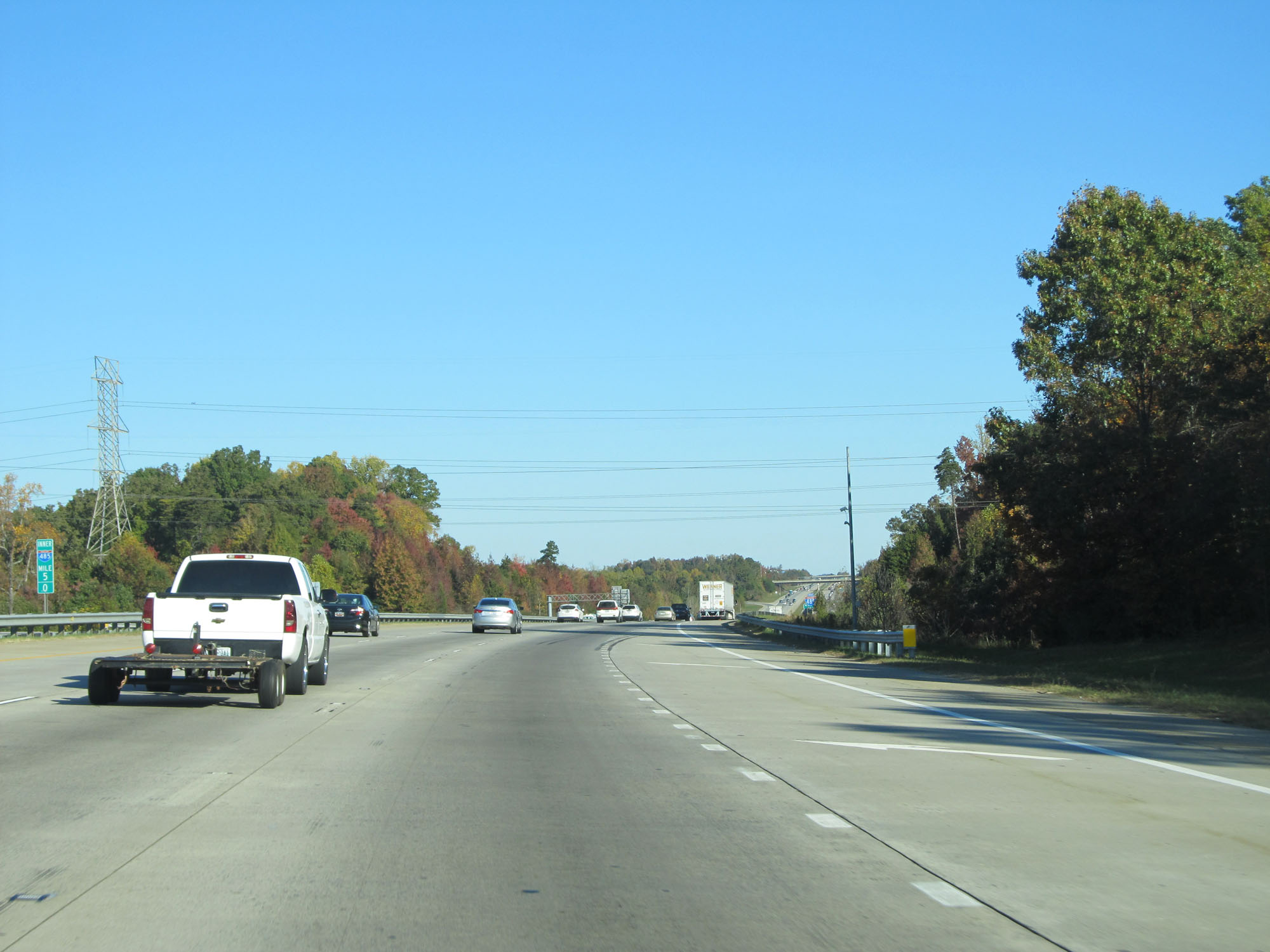 |
Interstate 485 Inner Loop (North) at mile marker 5. (Photo taken 11/12/16). |
 |
Take Exit 6 to Air Cargo Center. (Photo taken 11/12/16). |
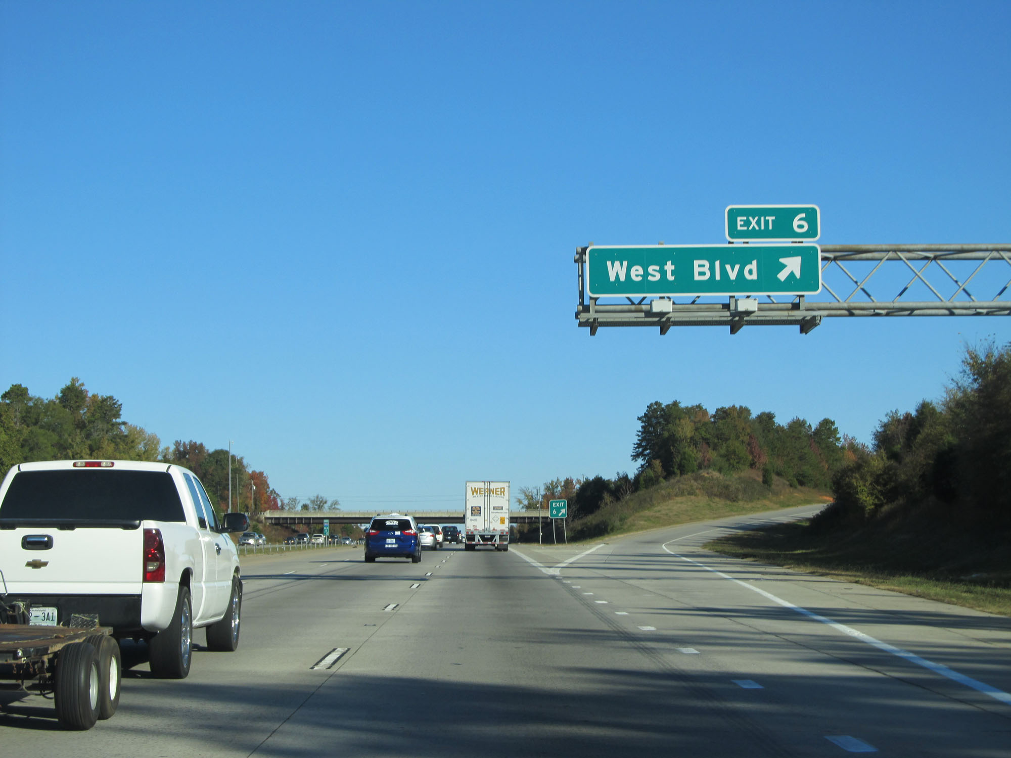 |
Interstate 485 Inner Loop (North) at Exit 6: West Blvd (Photo taken 11/12/16). |
 |
Interstate 485 Inner Loop (North) approaching Exit 10 - 3/4 mile. (Photo taken 11/12/16). |
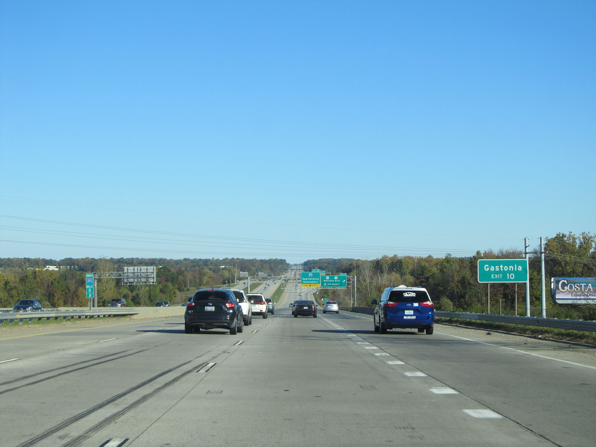 |
Take Exit 10 to Gastonia. (Photo taken 11/12/16). |
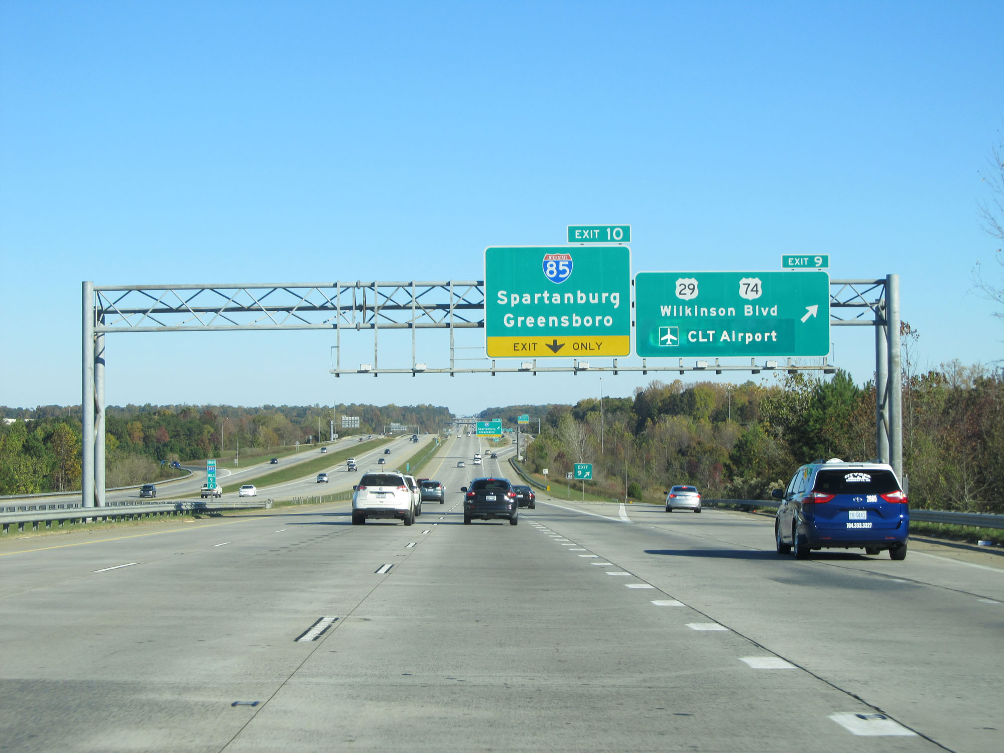 |
Interstate 485 Inner Loop (North) at Exit 9: US 29 / US 74 / Wilkinson Blvd / CLT Airport (Photo taken 11/12/16). |
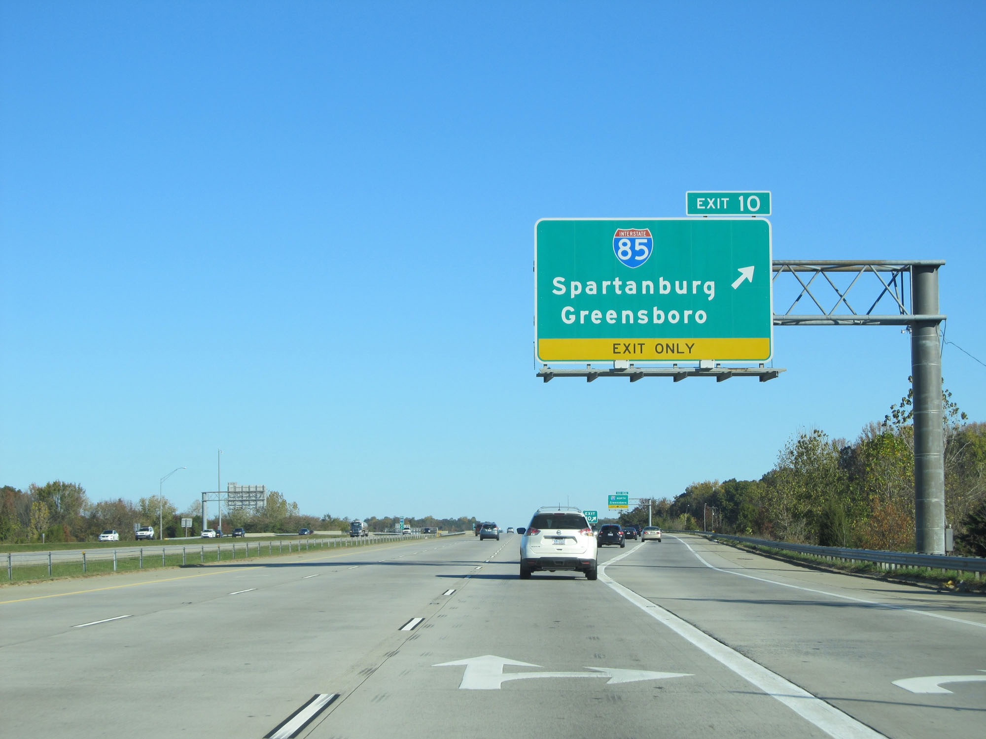 |
Interstate 485 Inner Loop (North) at Exit 10: Interstate 85 - Spartanburg / Greensboro (Photo taken 11/12/16). |
 |
View of the ramps for Exits 10A-B. (Photo taken 11/12/16). |
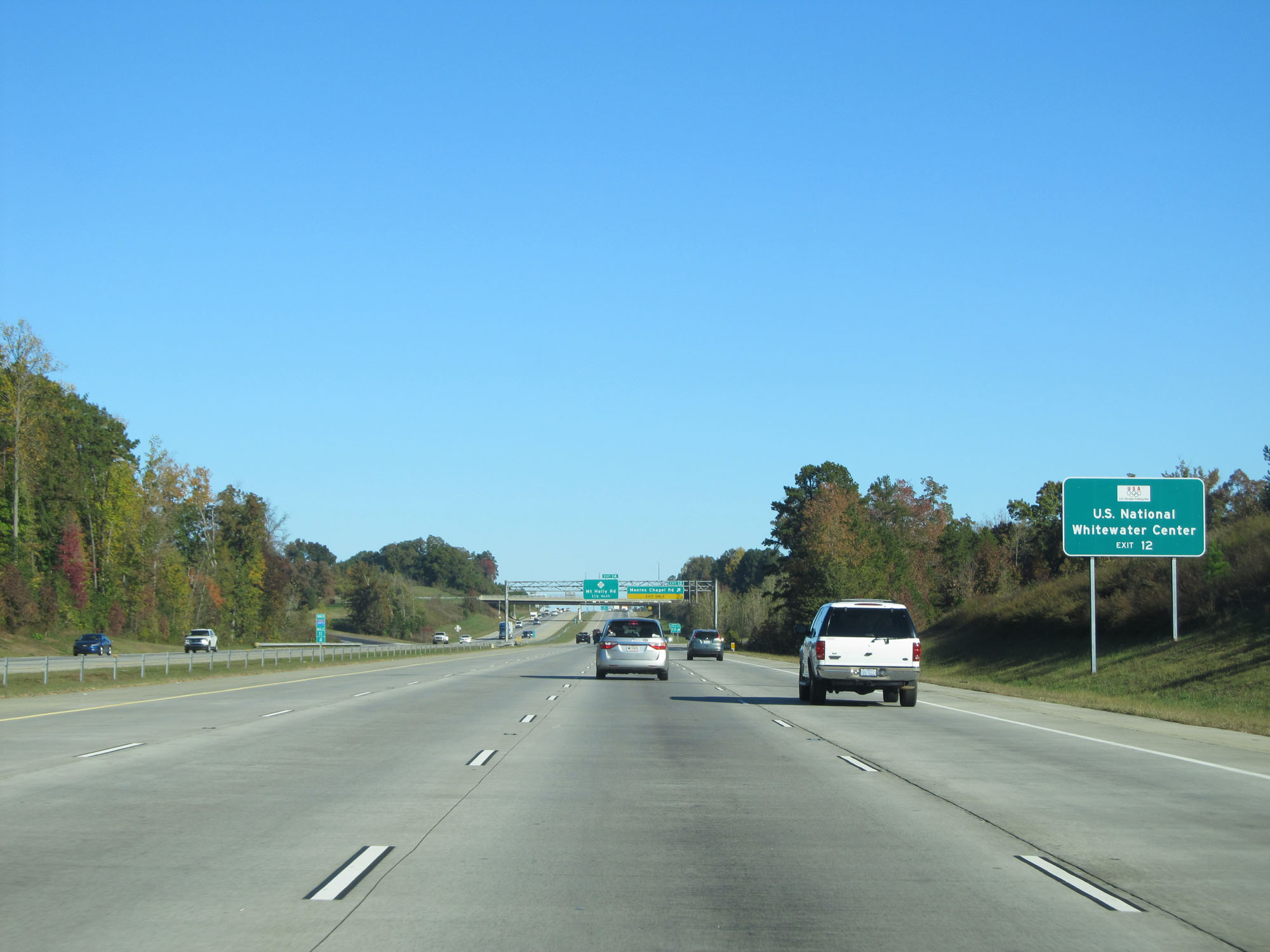 |
Take Exit 12 to U.S. National Whitewater Center. (Photo taken 11/12/16). |
 |
Interstate 485 Inner Loop (North) at Exit 12: Moores Chapel Rd (Photo taken 11/12/16). |
 |
Interstate 485 Inner Loop reassurance shield. (Photo taken 11/12/16). |
 |
Interstate 485 Inner Loop (North) at Exit 14: NC 27 - Mt Holly Rd (Photo taken 11/12/16). |
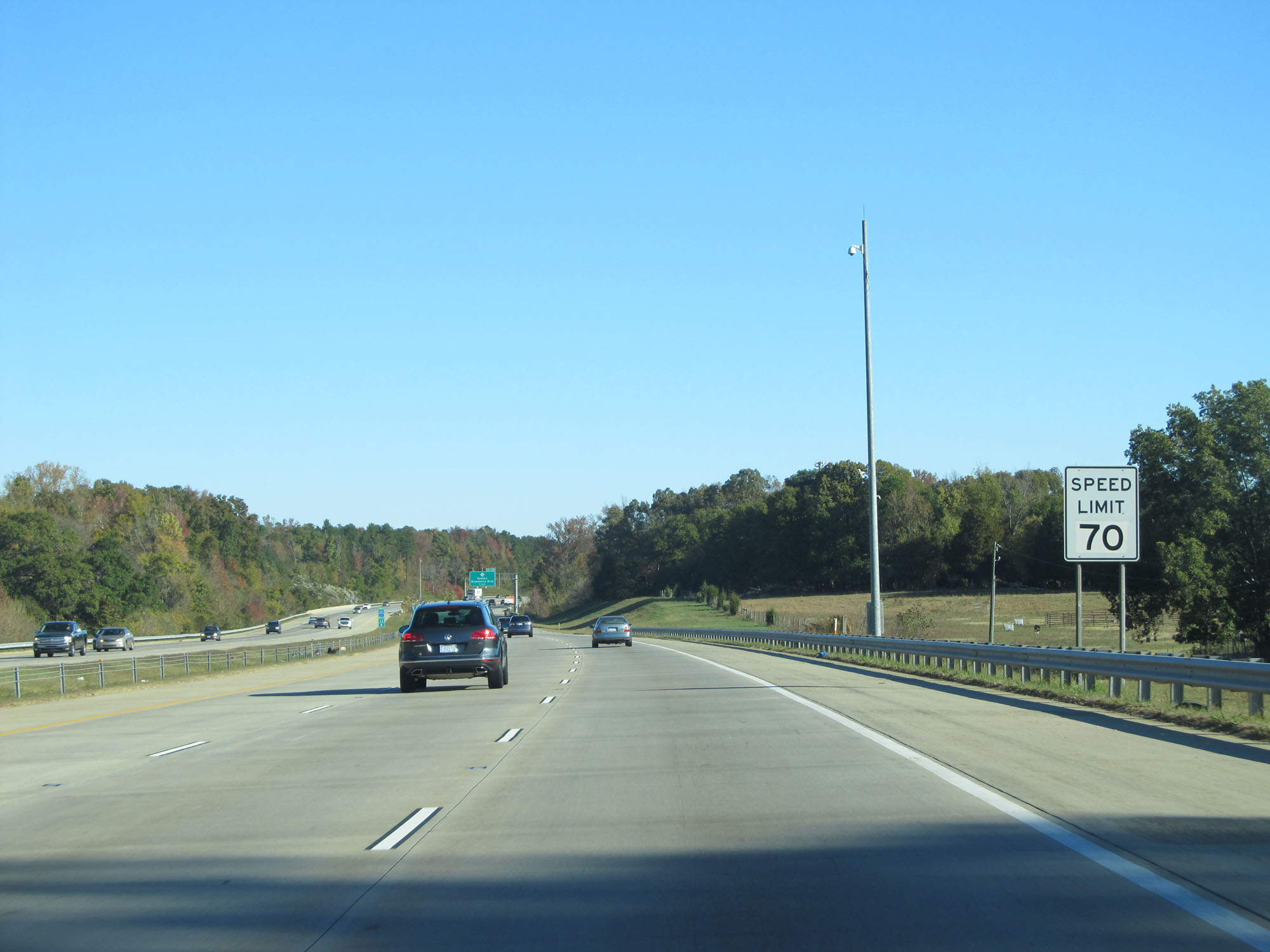 |
The speed limit remains 70 mph on Interstate 485 Inner Loop (North). (Photo taken 11/12/16). |
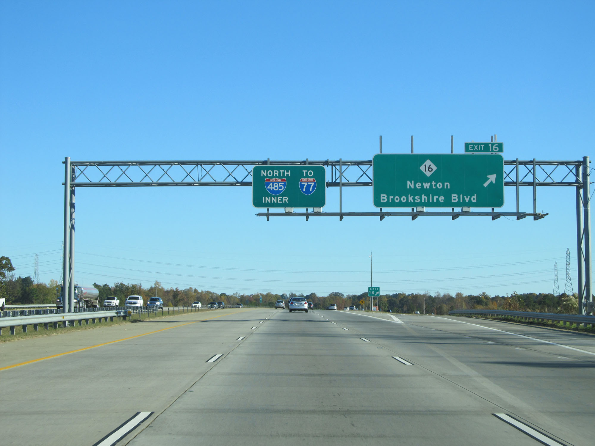 |
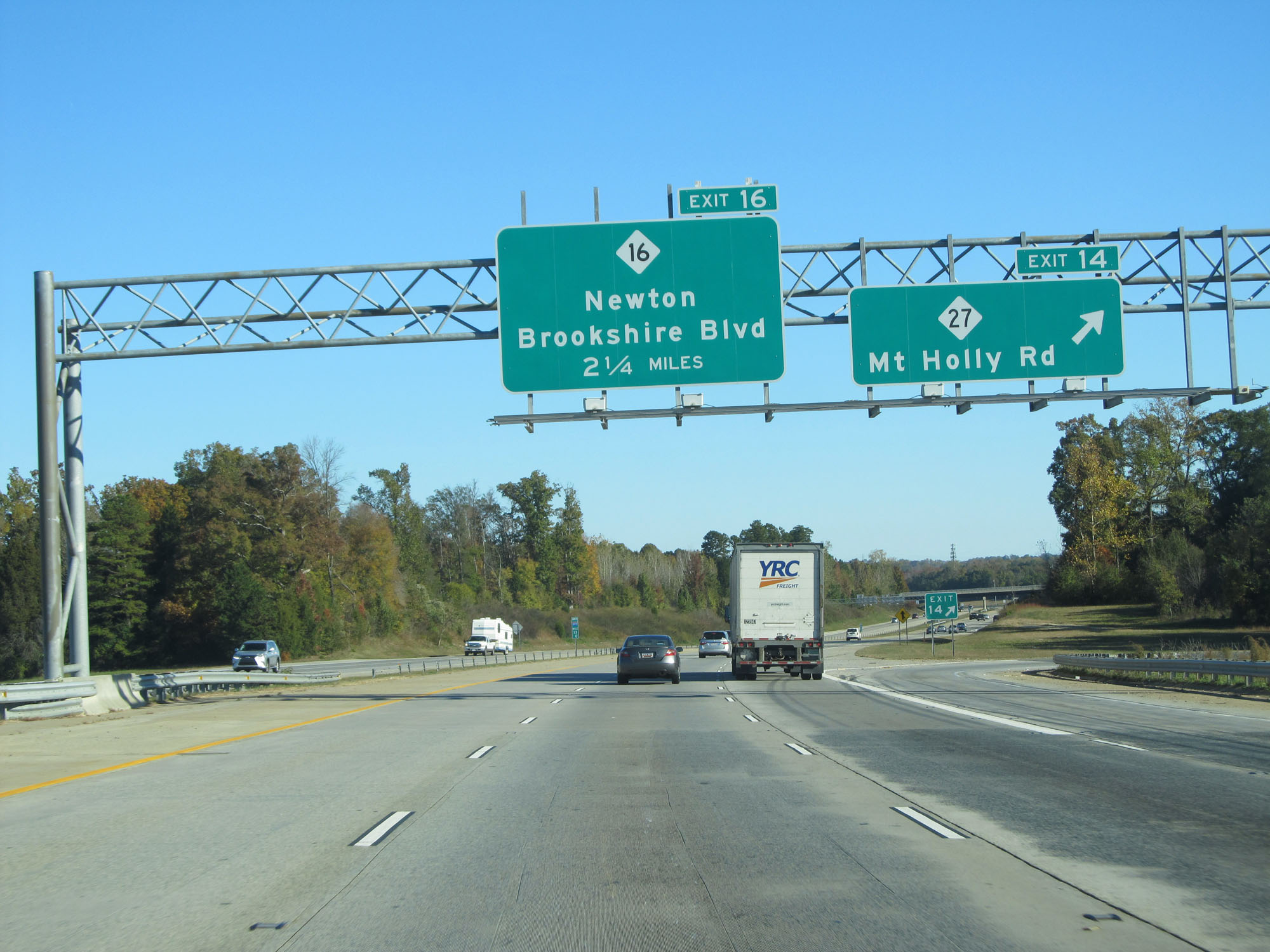
Interstate 485 Inner Loop (North) at Exit 16: NC 16 - Newton / Brookshire Blvd (Photo taken 11/12/16). |
 |
Interstate 485 Inner Loop (North) at mile marker 17.8. (Photo taken 11/12/16). |
 |
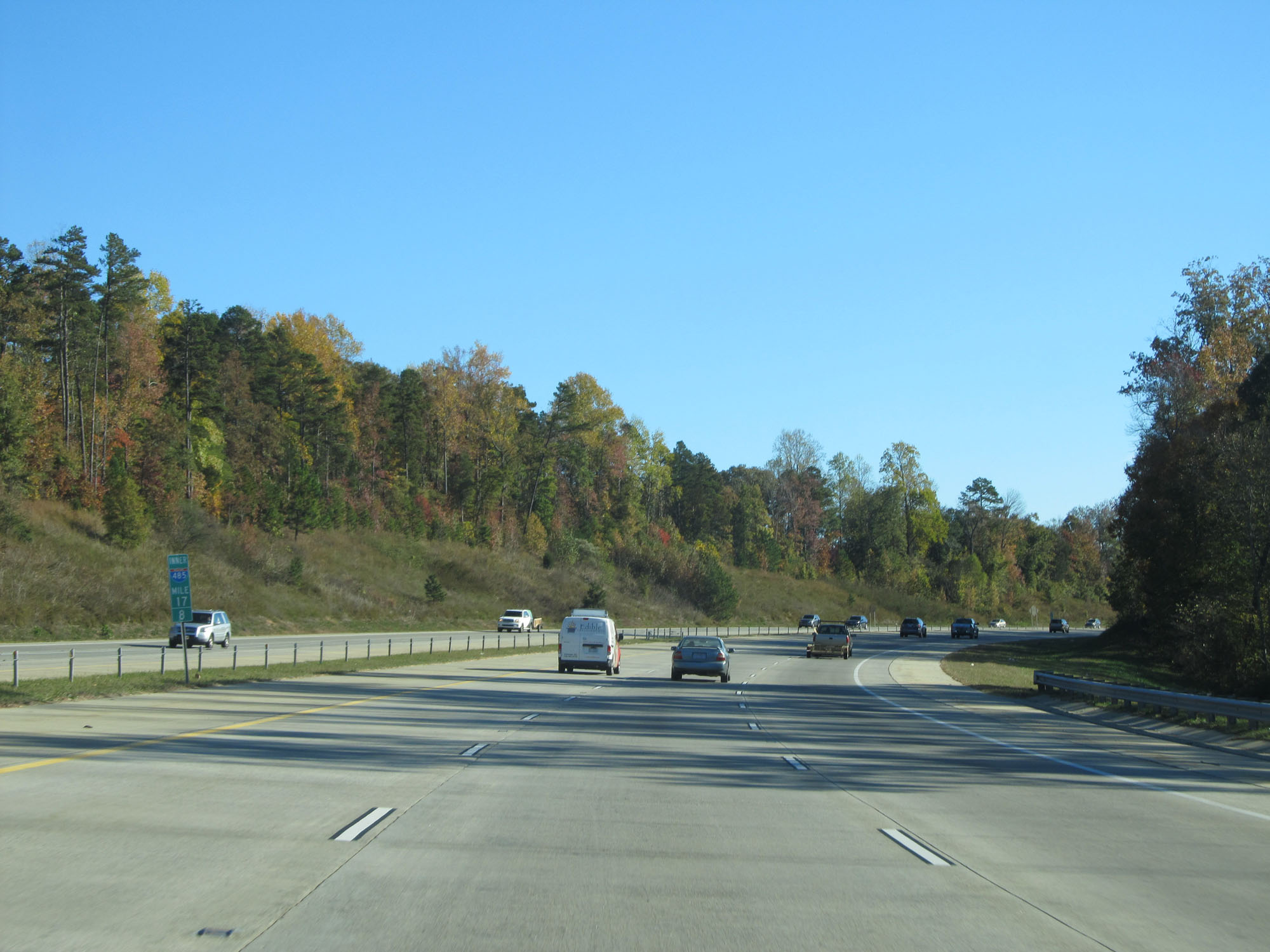
Interstate 485 Inner Loop (North) at mile marker 19. (Photo taken 11/12/16). |
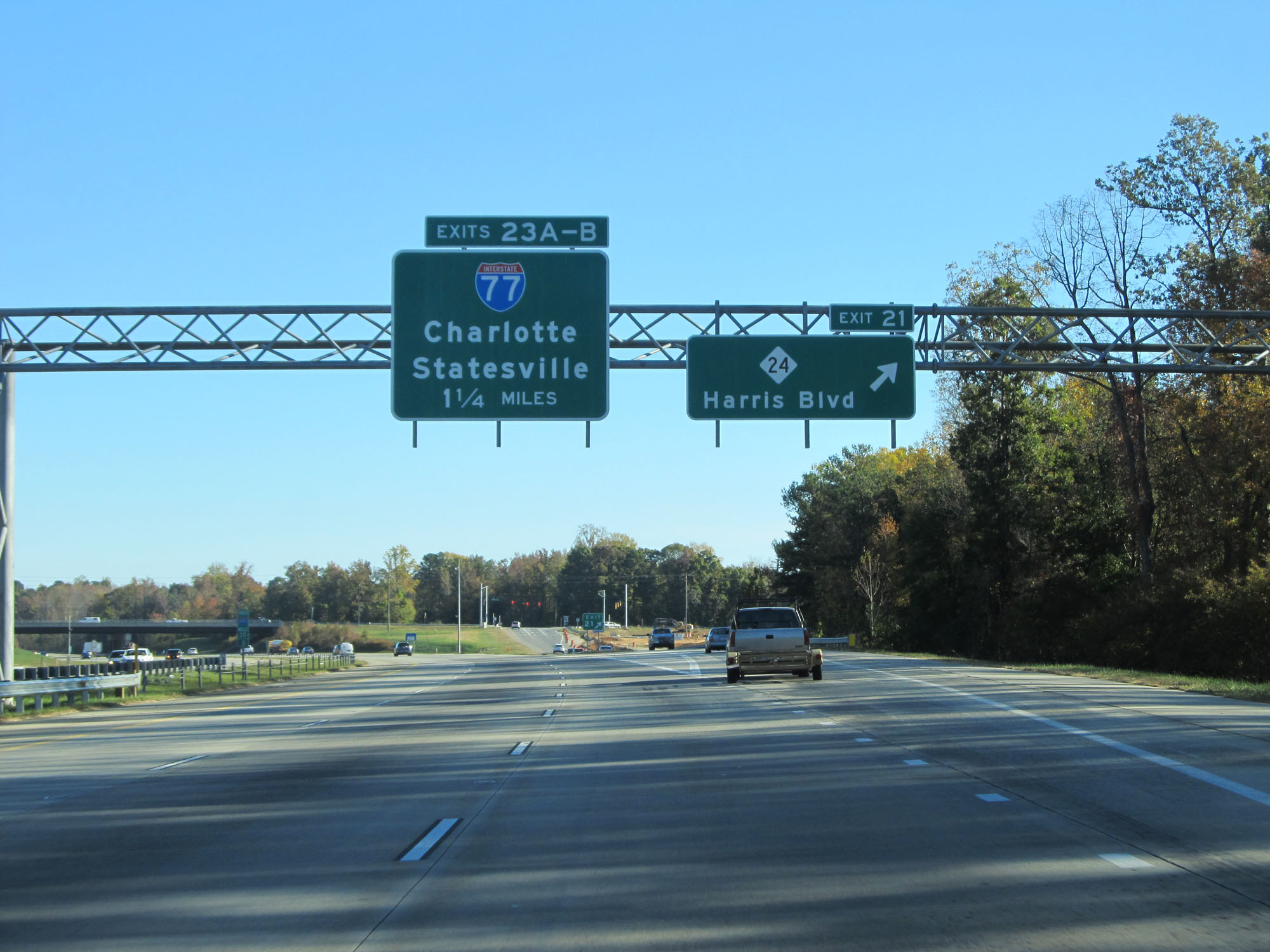 |
Interstate 485 Inner Loop (North) at Exit 21: NC 24 - Harris Blvd (Photo taken 11/12/16). |
 |
Interstate 485 Inner Loop (North) approaching Exits 23 A-B - 1/2 mile. (Photo taken 11/12/16). |
 |
Interstate 485 Inner Loop (North) at mile marker 21. (Photo taken 11/12/16). |
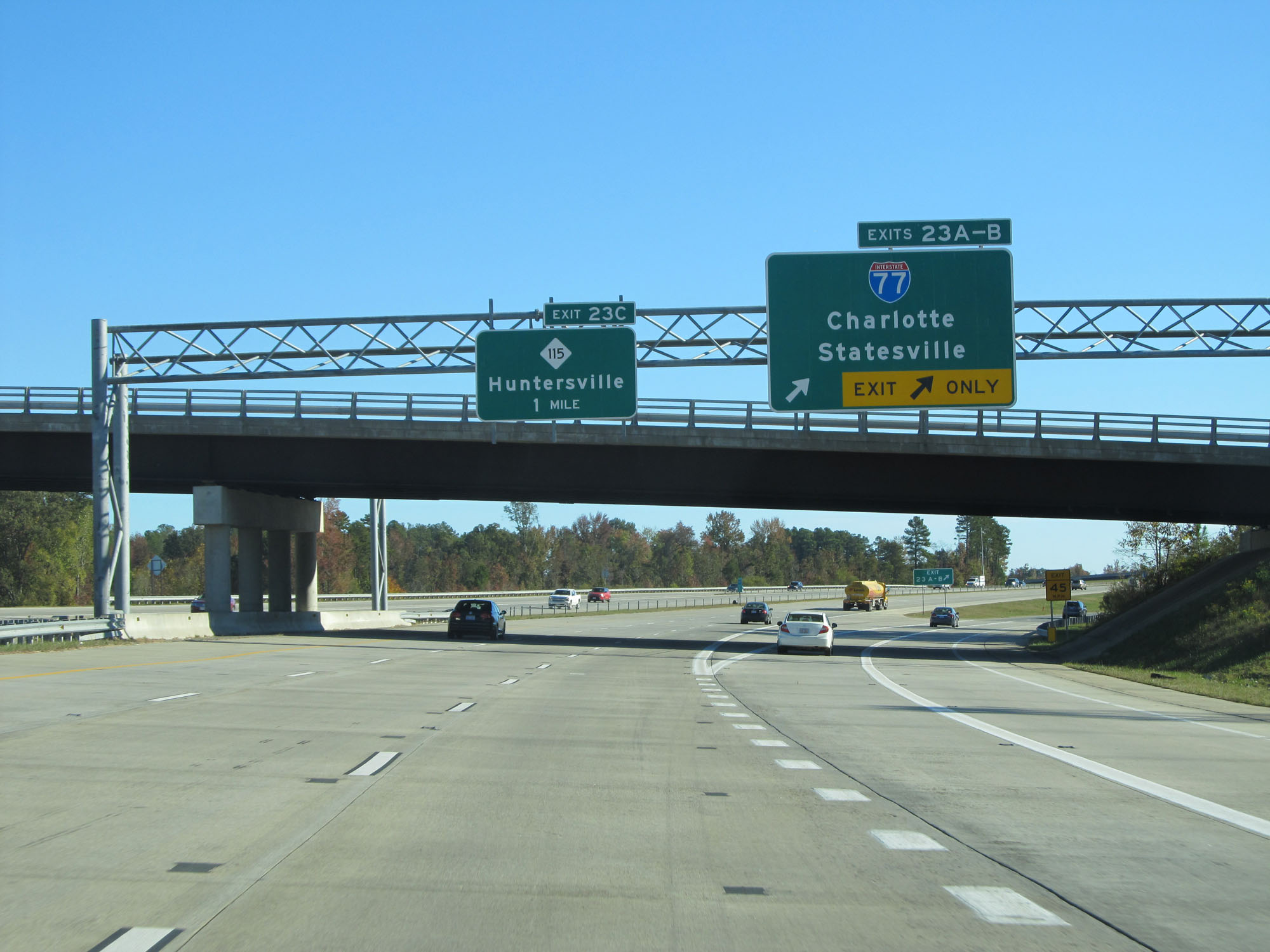 |
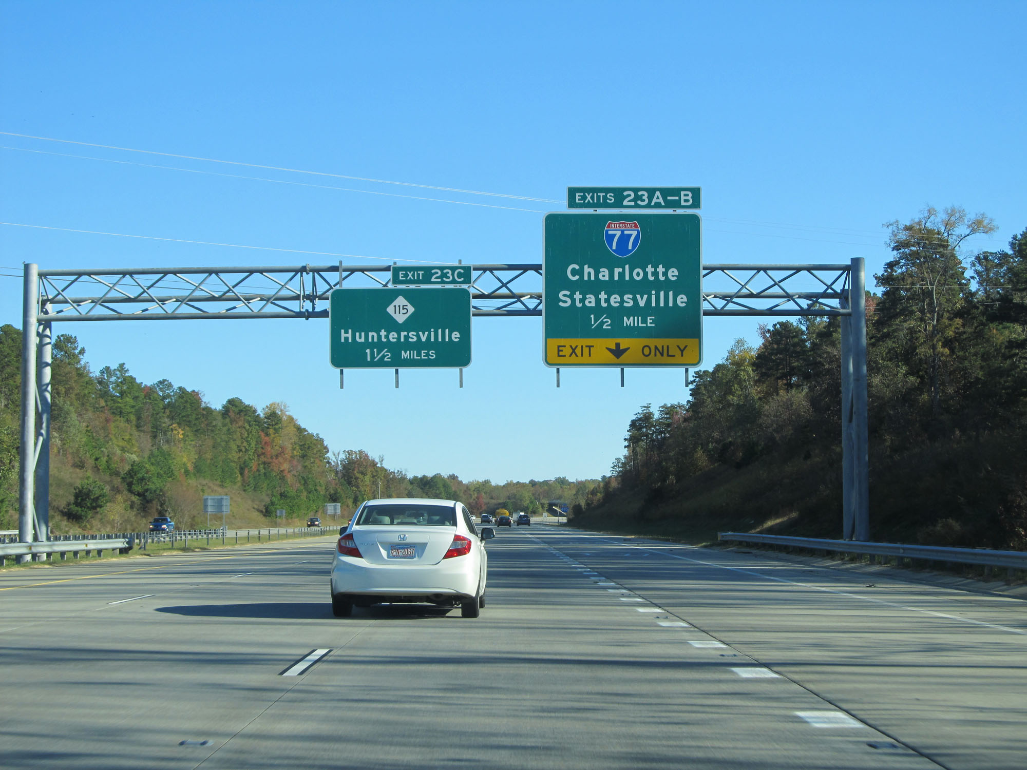
Interstate 485 Inner Loop (North) at Exits 23A-B: Interstate 77 - Charlotte / Statesville (Photo taken 11/12/16). |
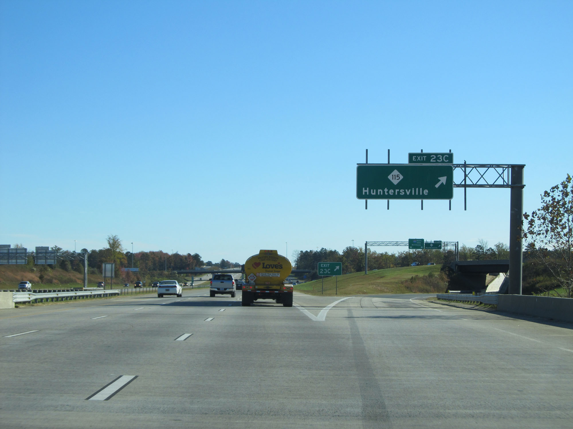 |
Interstate 485 Inner Loop (North) at Exit 23C: NC 115 - Huntersville (Photo taken 11/12/16). |
 |
The speed limit remains 70 mph. (Photo taken 11/12/16). |
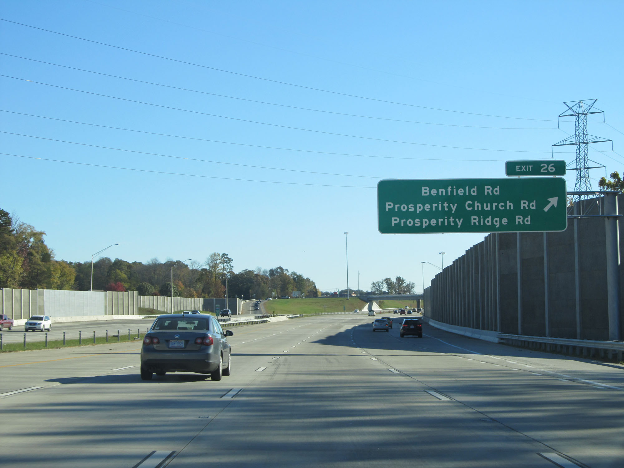 |
Interstate 485 Inner Loop (East) at Exit 26: Benfield Rd / Prosperity Church Rd / Prosperity Ridge Rd (Photo taken 11/12/16). |
 |
Interstate 485 Inner Loop (East) at Exit 28: Mallard Creed Rd (Photo taken 11/12/16). |
 |
Interstate 485 Inner Loop (East) approaching Exit 30 - 1/4 mile. (Photo taken 11/12/16). |
 |
Interstate 485 Inner Loop (East) at Exit 30: Interstate 85 - Greensboro / Spartanburg (Photo taken 11/12/16). |
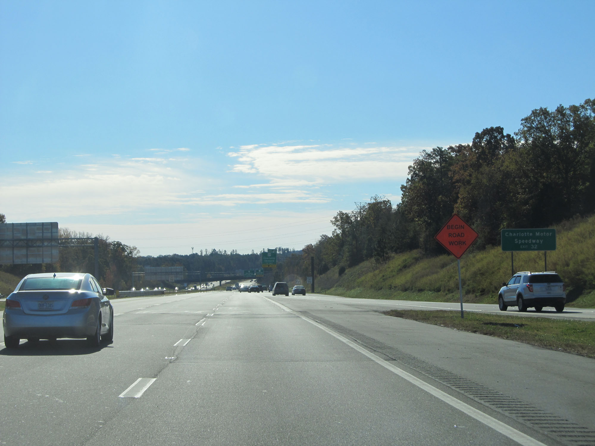 |
Take Exit 32 to Charlotte Motor Speedway. (Photo taken 11/12/16). |
 |
Interstate 485 Inner Loop (East) at Exit 32: US 29 - Charlotte / Concord (Photo taken 11/12/16). |
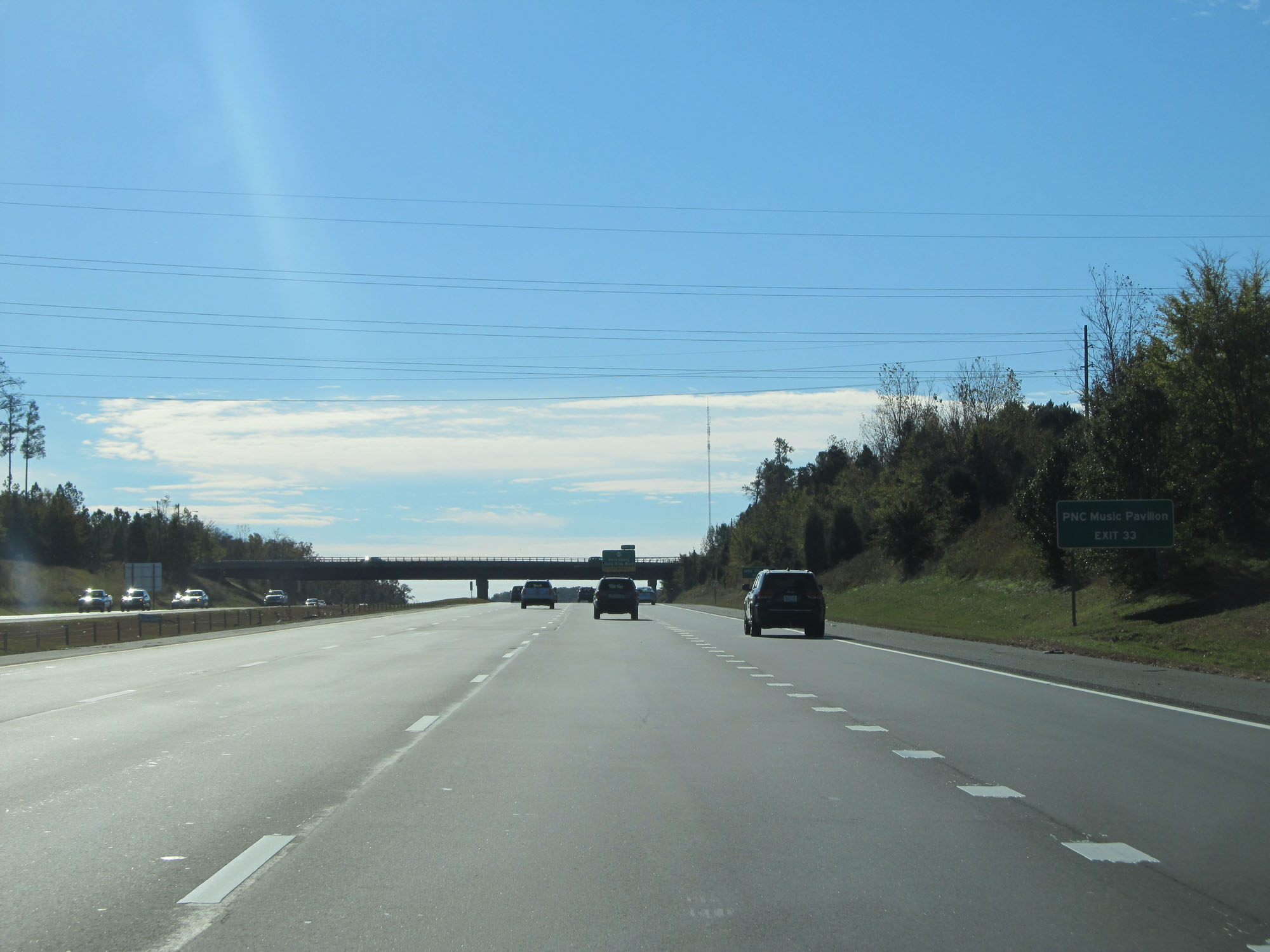 |
Take Exit 33 to PNC Music Pavilion. (Photo taken 11/12/16). |
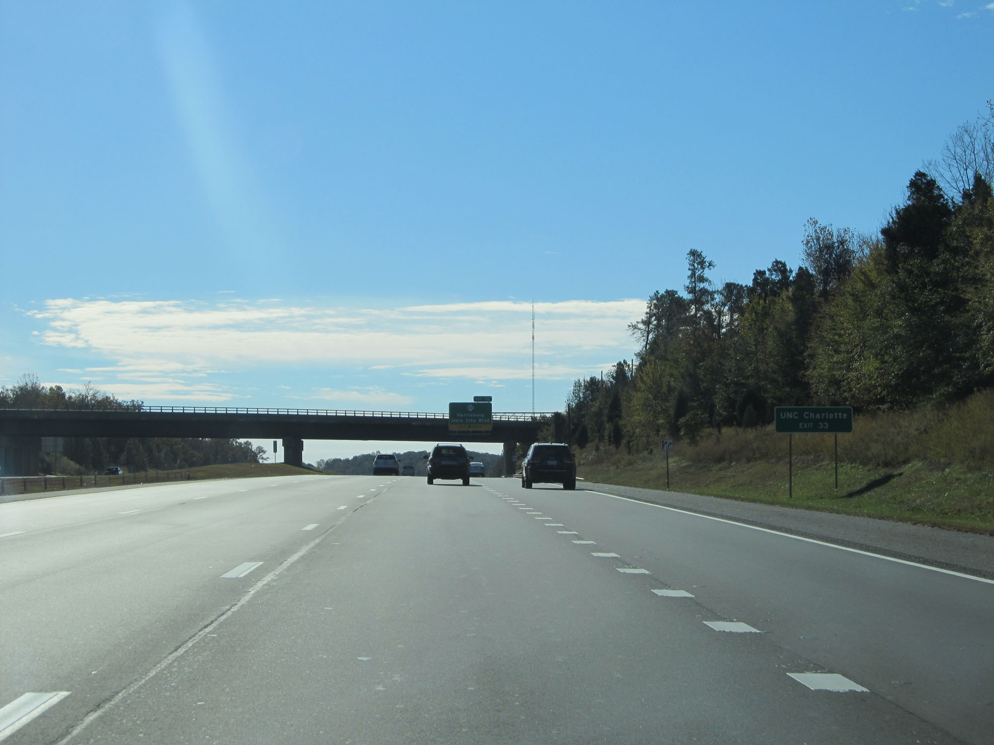 |
Also take Exit 33 to UNC Charlotte. (Photo taken 11/12/16). |
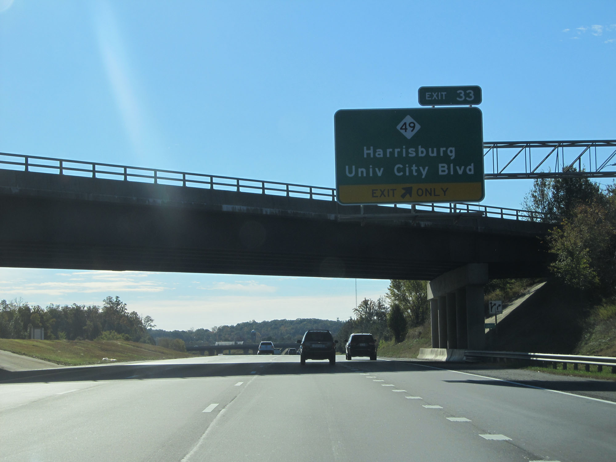 |
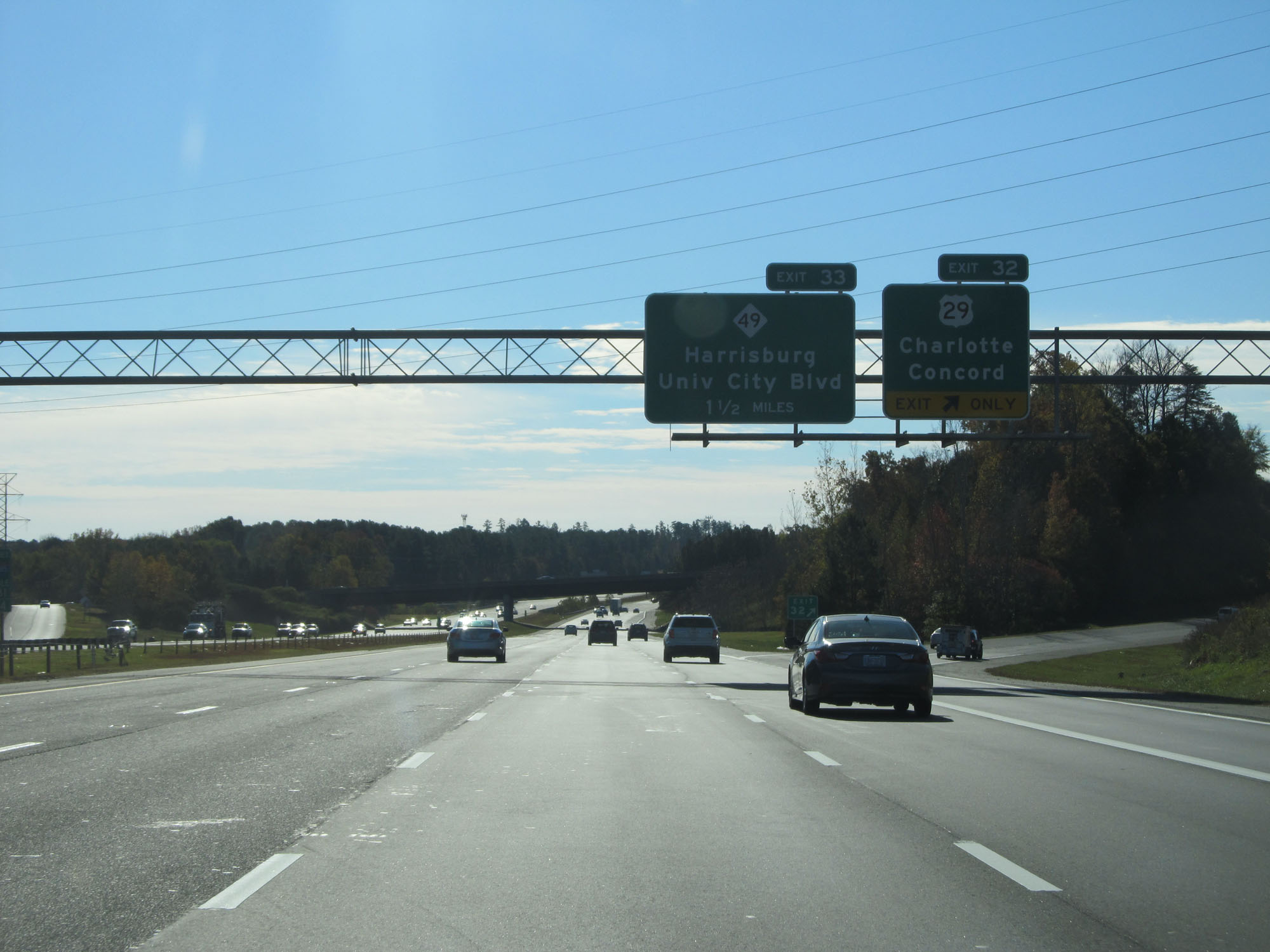
Interstate 485 Inner Loop (East) at Exit 33: NC 49 - Harrisburg / University City Blvd (Photo taken 11/12/16). |
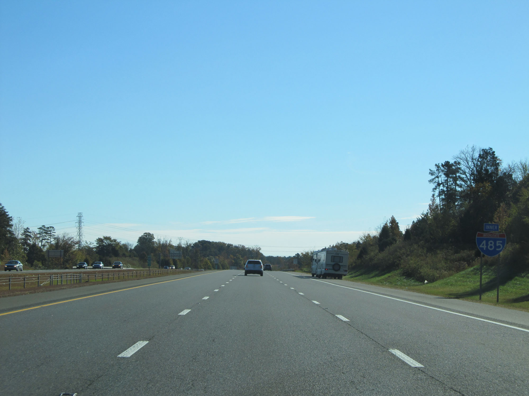 |
Another Interstate 485 Inner Loop reassurance shield. (Photo taken 11/12/16). |
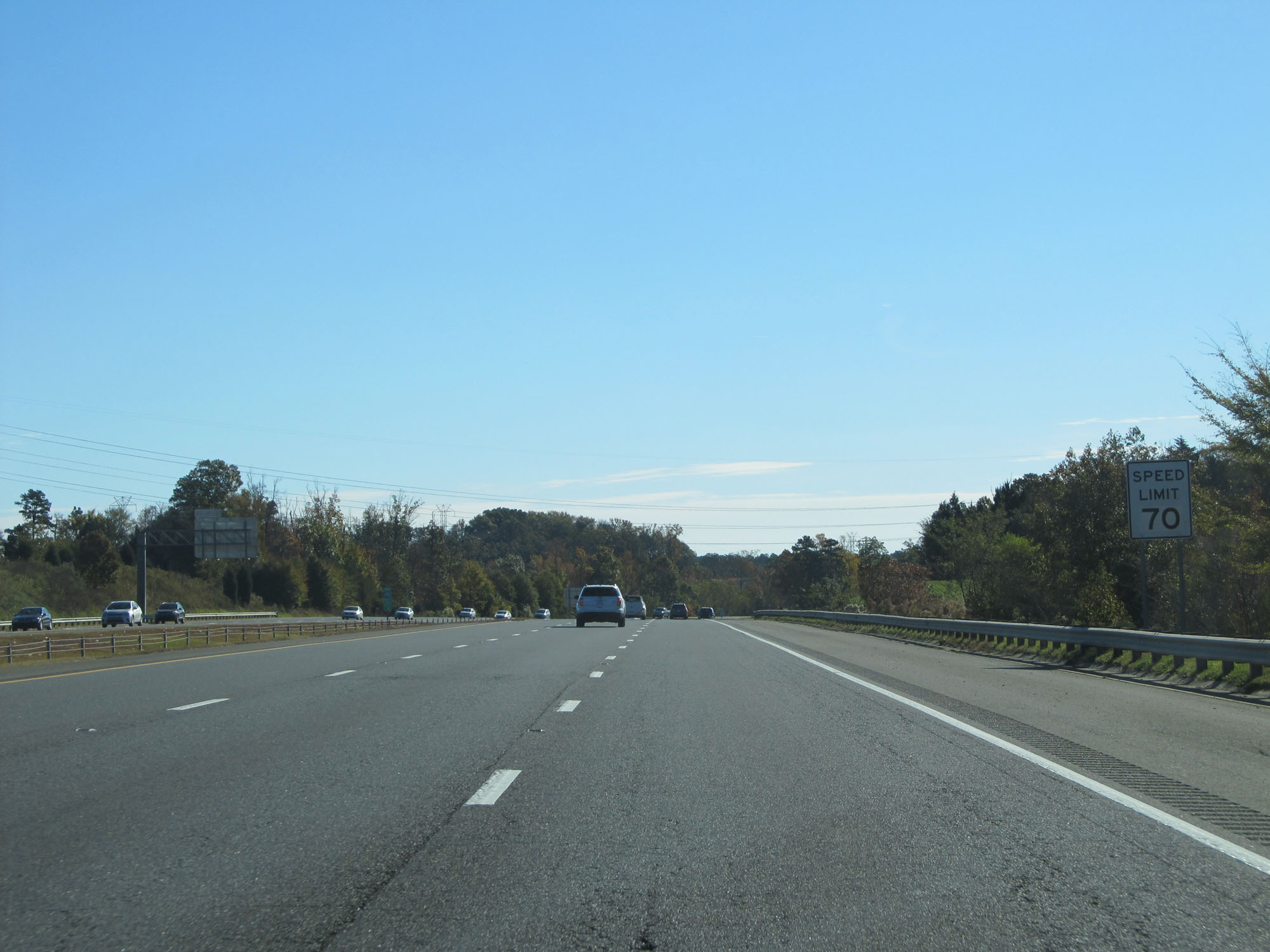 |
The speed limit remains 70 mph. (Photo taken 11/12/16). |
 |
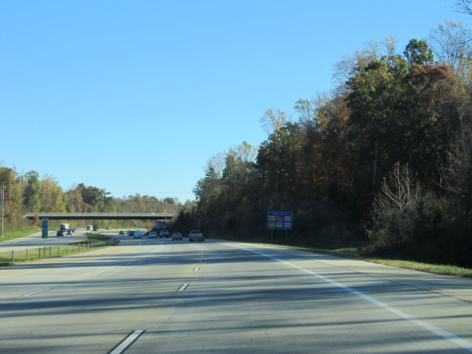
Interstate 485 Inner Loop (East) at mile marker 34.6. (Photo taken 11/12/16). |
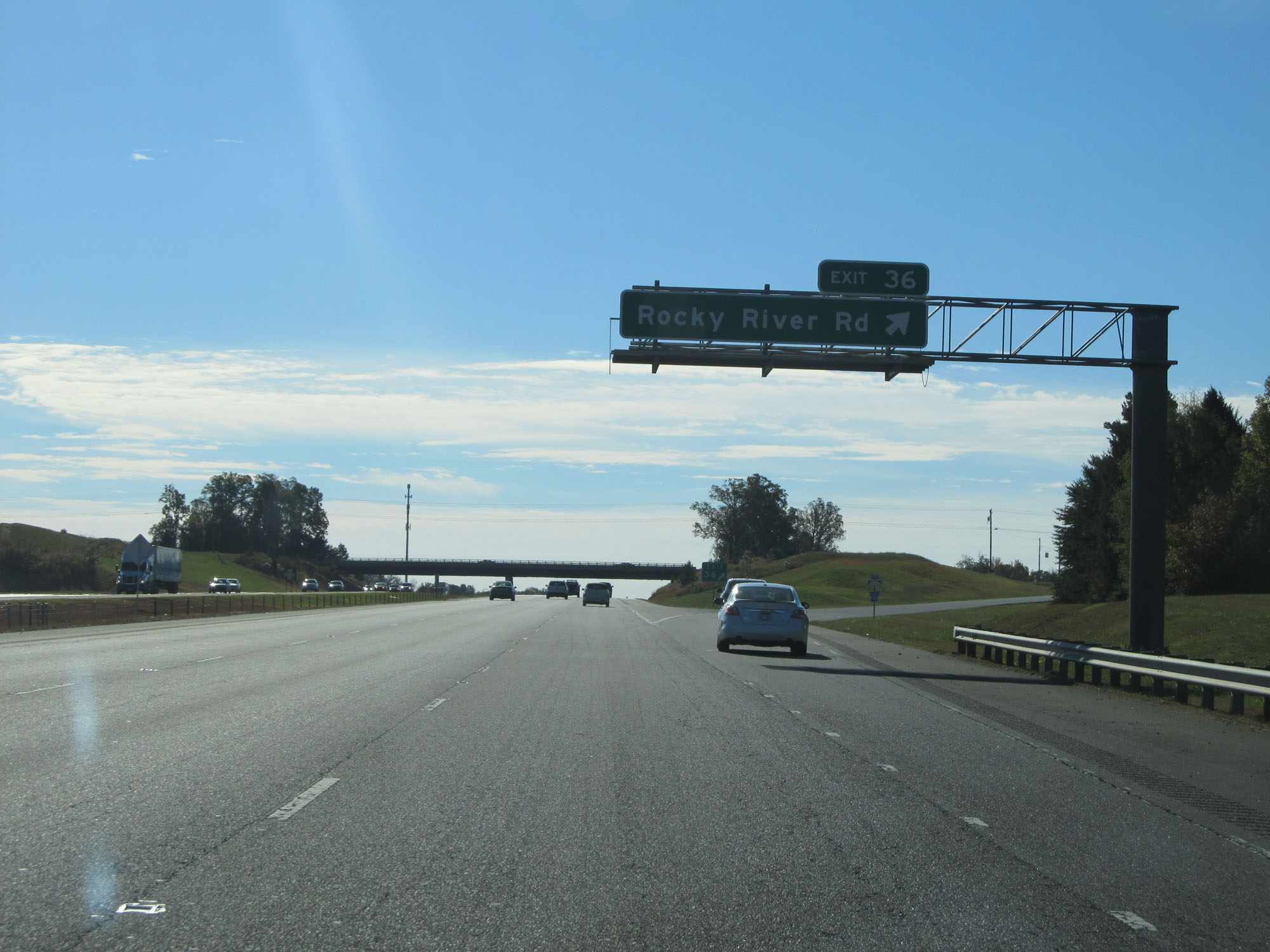 |
Interstate 485 Inner Loop (East) at Exit 36: Rocky River Rd (Photo taken 11/12/16). |
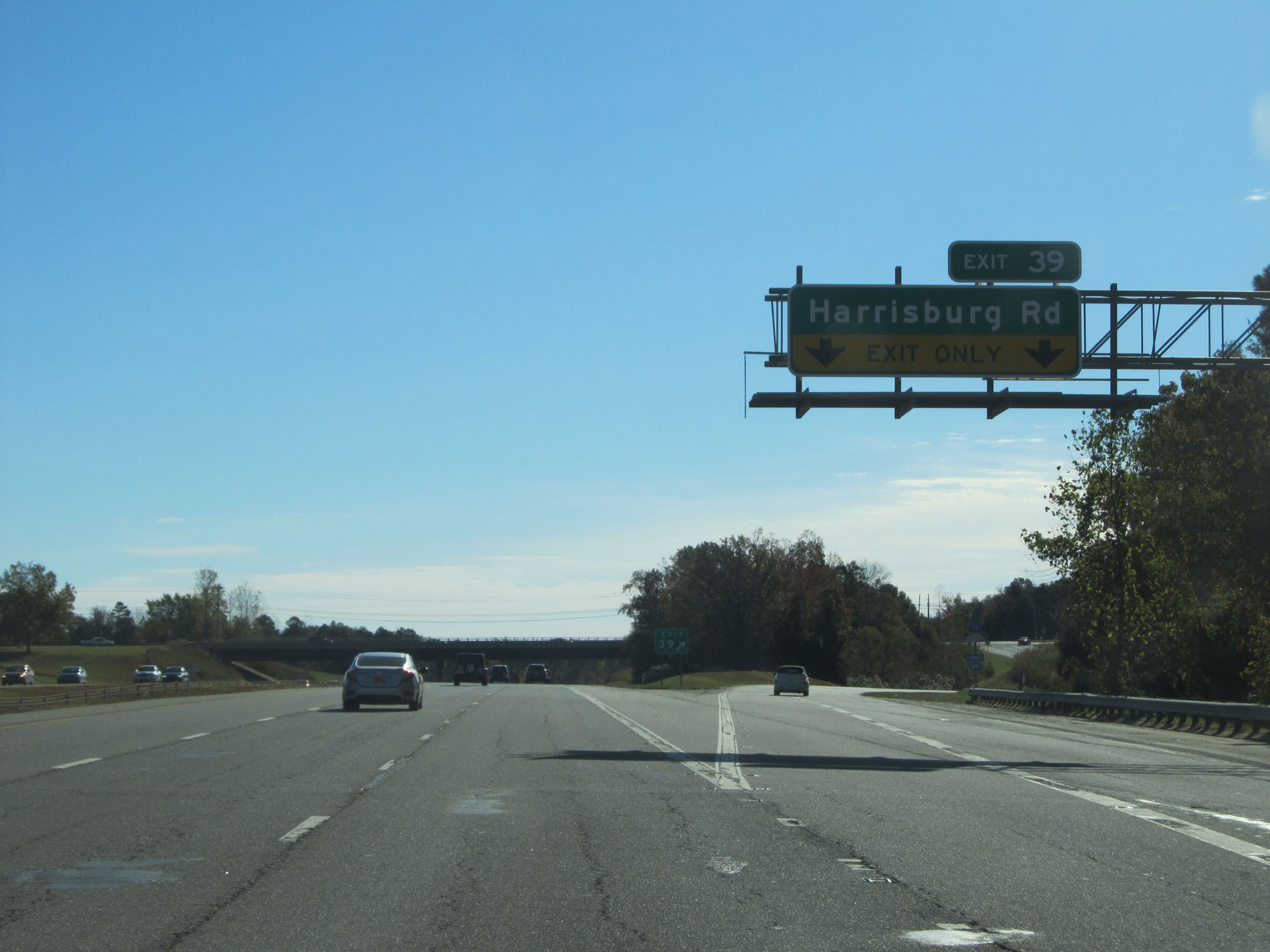 |
Interstate 485 Inner Loop (East) at Exit 39: Harrisburg Rd (Photo taken 11/12/16). |
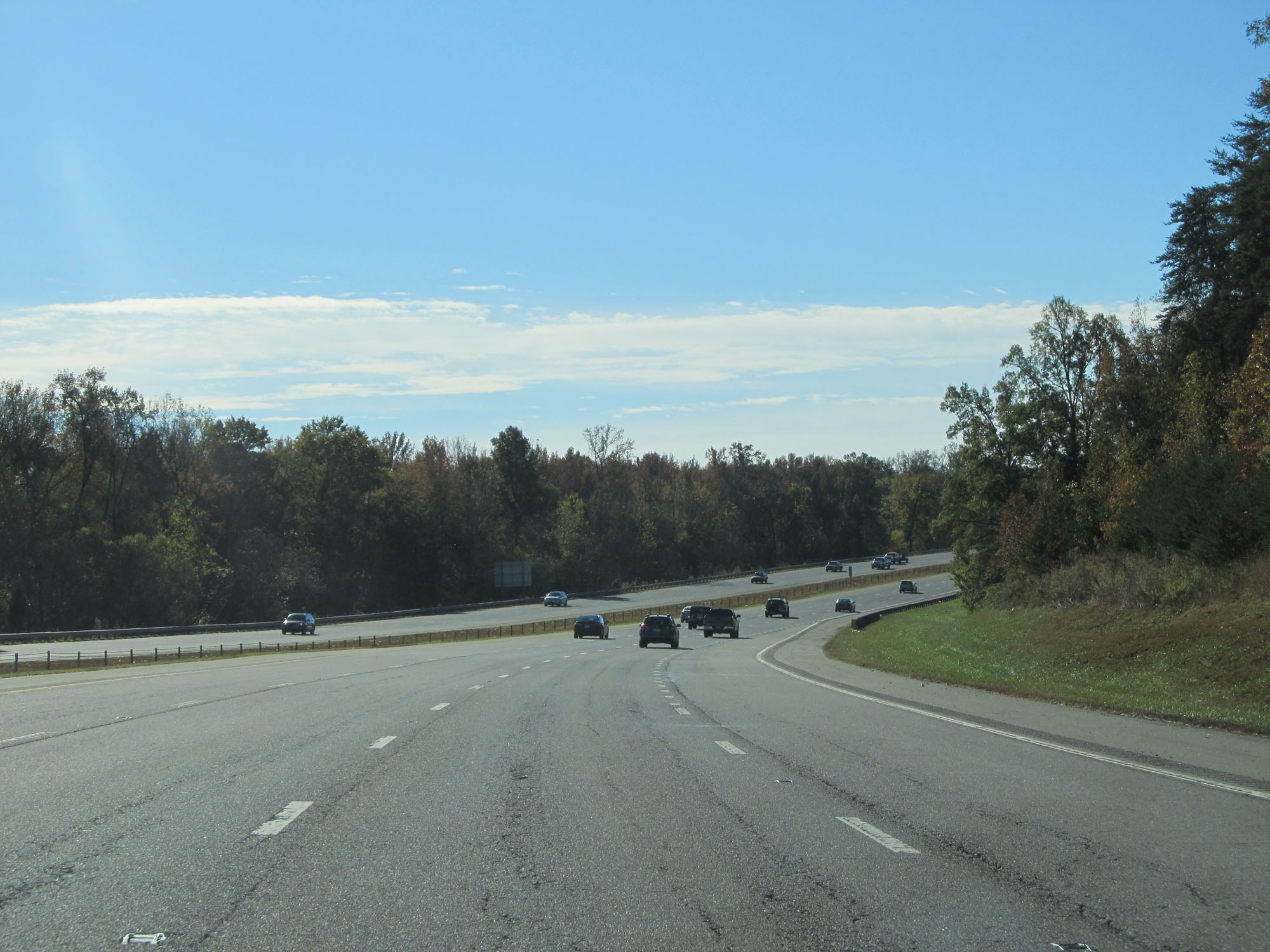 |
View on Interstate 485 Inner Loop (East) as it curves to the south on the northeastern side of the Charlotte metro area. (Photo taken 11/12/16). |
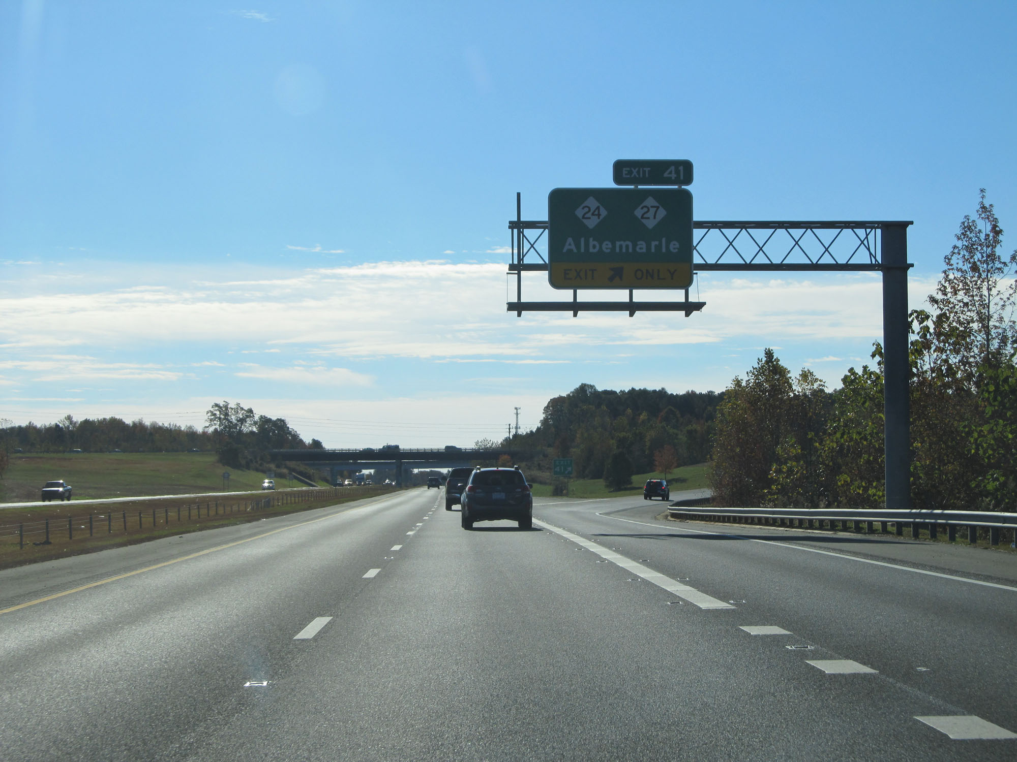 |
Interstate 485 Inner Loop (East) at Exit 41: NC 24 / NC 27 - Albemarle (Photo taken 11/12/16). |
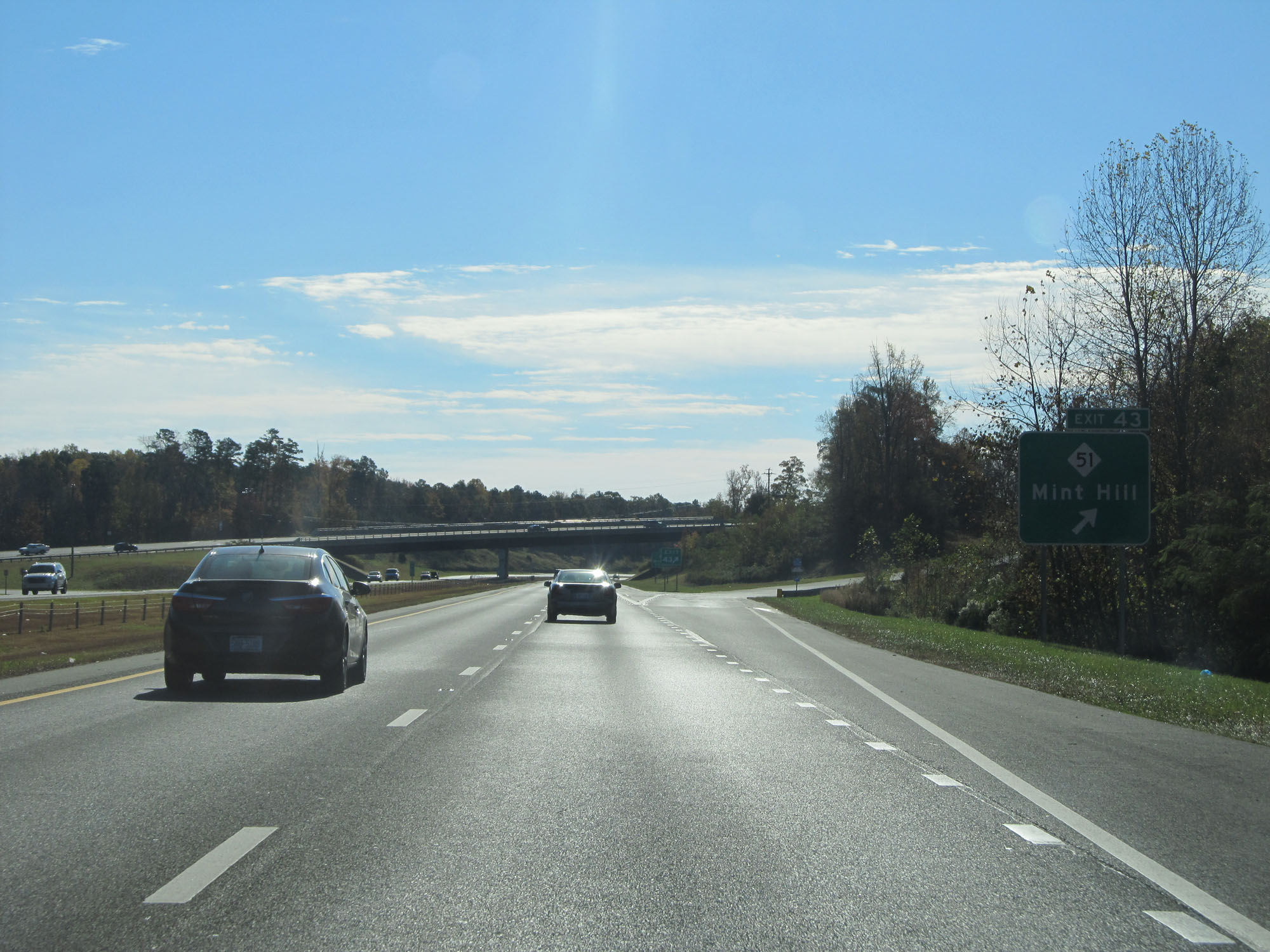 |
Interstate 485 Inner Loop (South) at Exit 43: NC 51 - Mint Hill (Photo taken 11/12/16). |
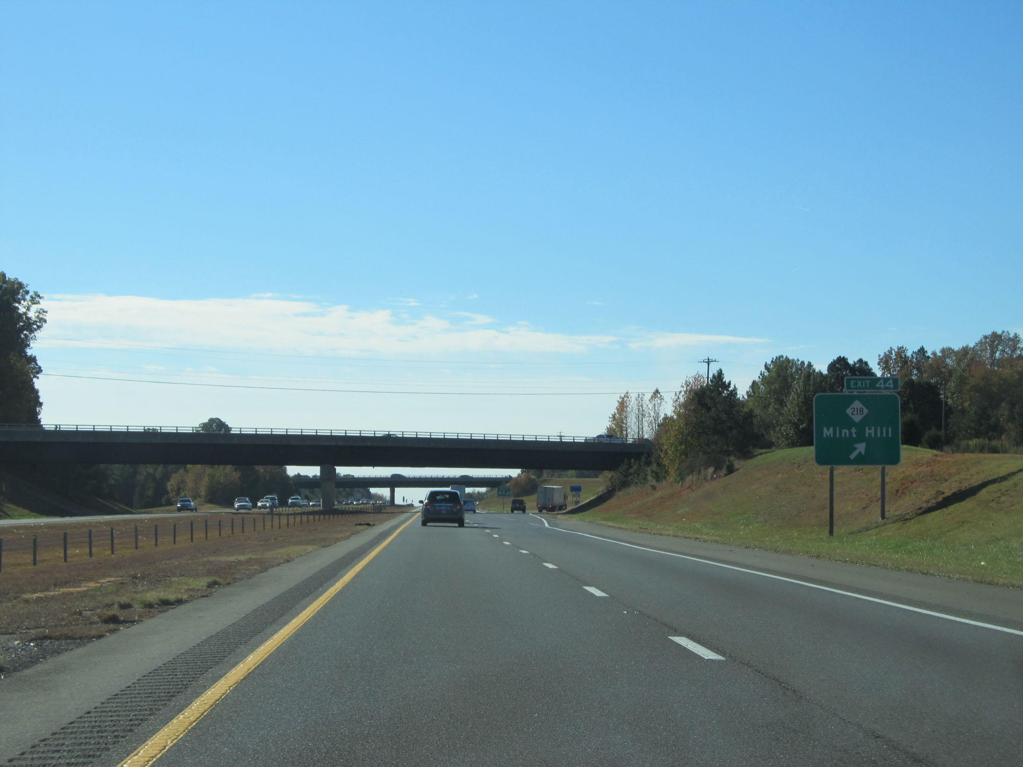 |
Interstate 485 Inner Loop (South) at Exit 44: NC 218 - Mint Hill (Photo taken 11/12/16). |
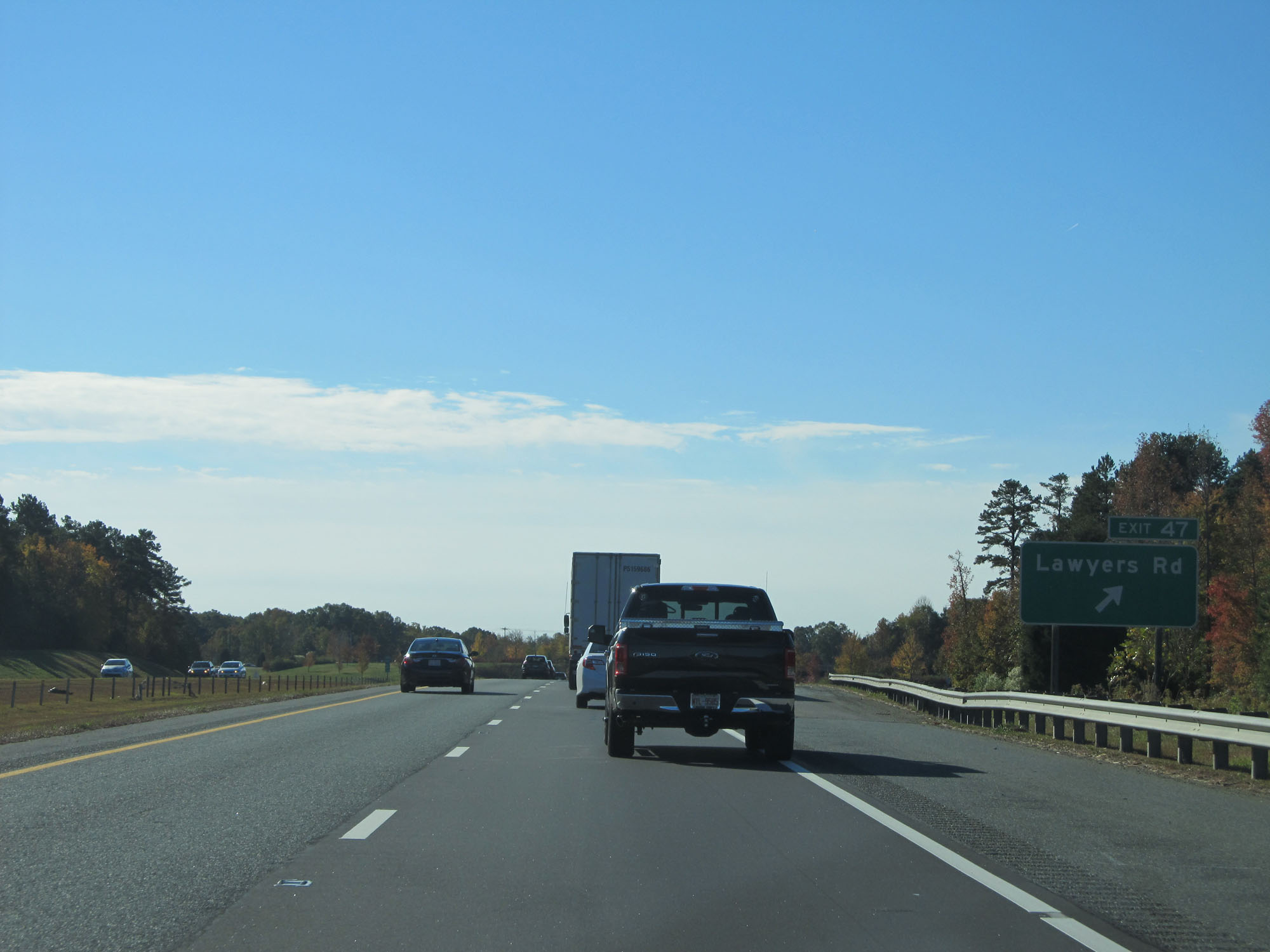 |
Interstate 485 Inner Loop (South) at Exit 47: Lawyers Rd (Photo taken 11/12/16). |
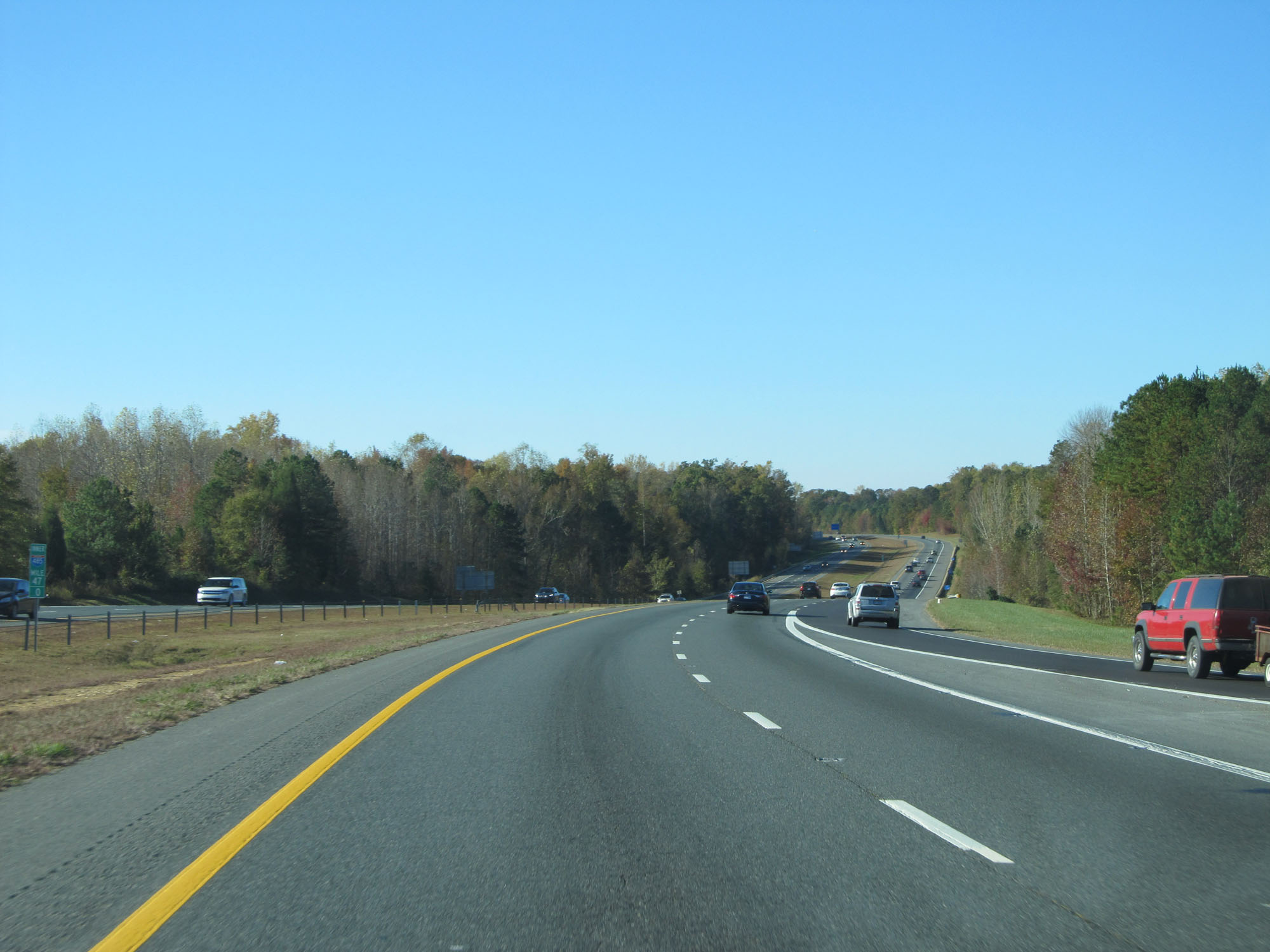 |
Interstate 485 Inner Loop (South) at mile marker 47. (Photo taken 11/12/16). |
 |
Interstate 485 Inner Loop (South) at Exit 49: Idlewild Rd (Photo taken 11/12/16). |
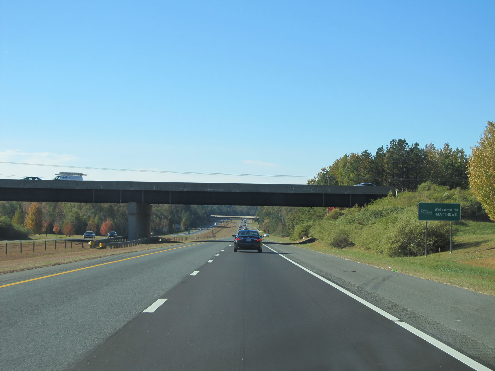 |
Sign welcoming you to Matthews as Interstate 485 Inner Loop (South) enters the city limits. (Photo taken 11/12/16). |
 |
Interstate 485 Inner Loop (South) approaching Exits 51A-B - 1 mile. (Photo taken 11/12/16). |
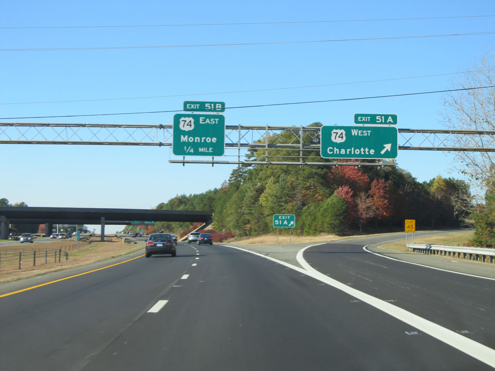 |
Interstate 485 Inner Loop (South) at Exit 51A: US 74 West - Charlotte (Photo taken 11/12/16). |
 |
Interstate 485 Inner Loop (South) at Exit 51B: US 74 East - Monroe (Photo taken 11/12/16). |
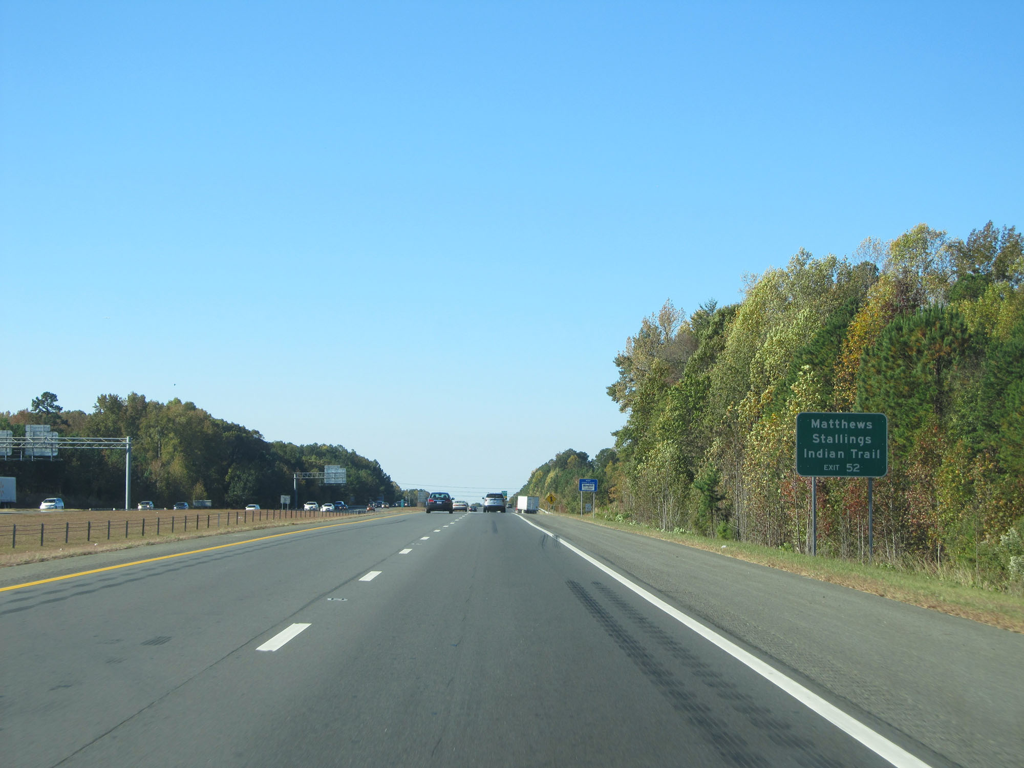 |
Take Exit 52 to Matthews, Stallings, and Indian Trail. (Photo taken 11/12/16). |
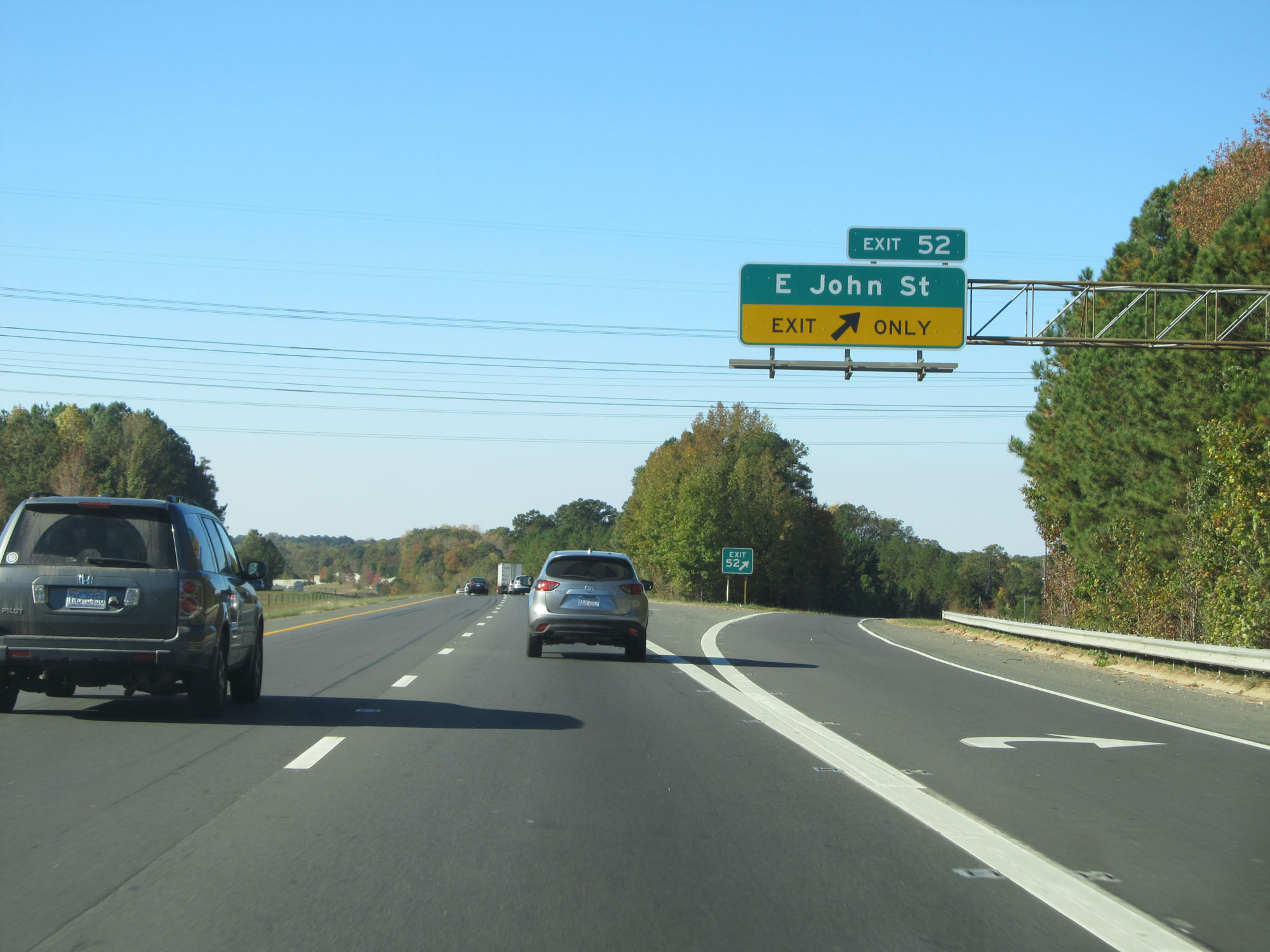 |
Interstate 485 Inner Loop (South) at Exit 52: E John St (Photo taken 11/12/16). |
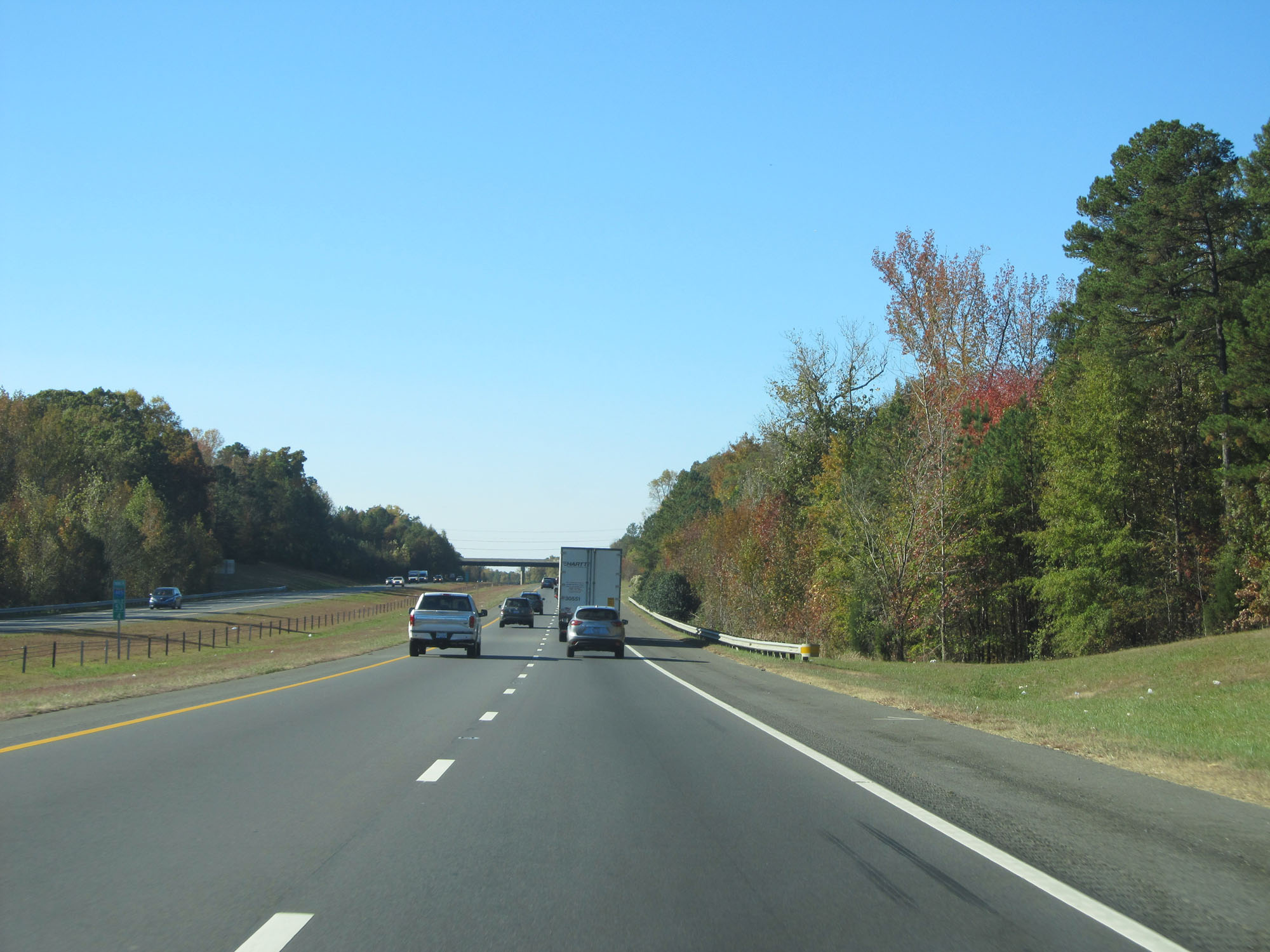 |
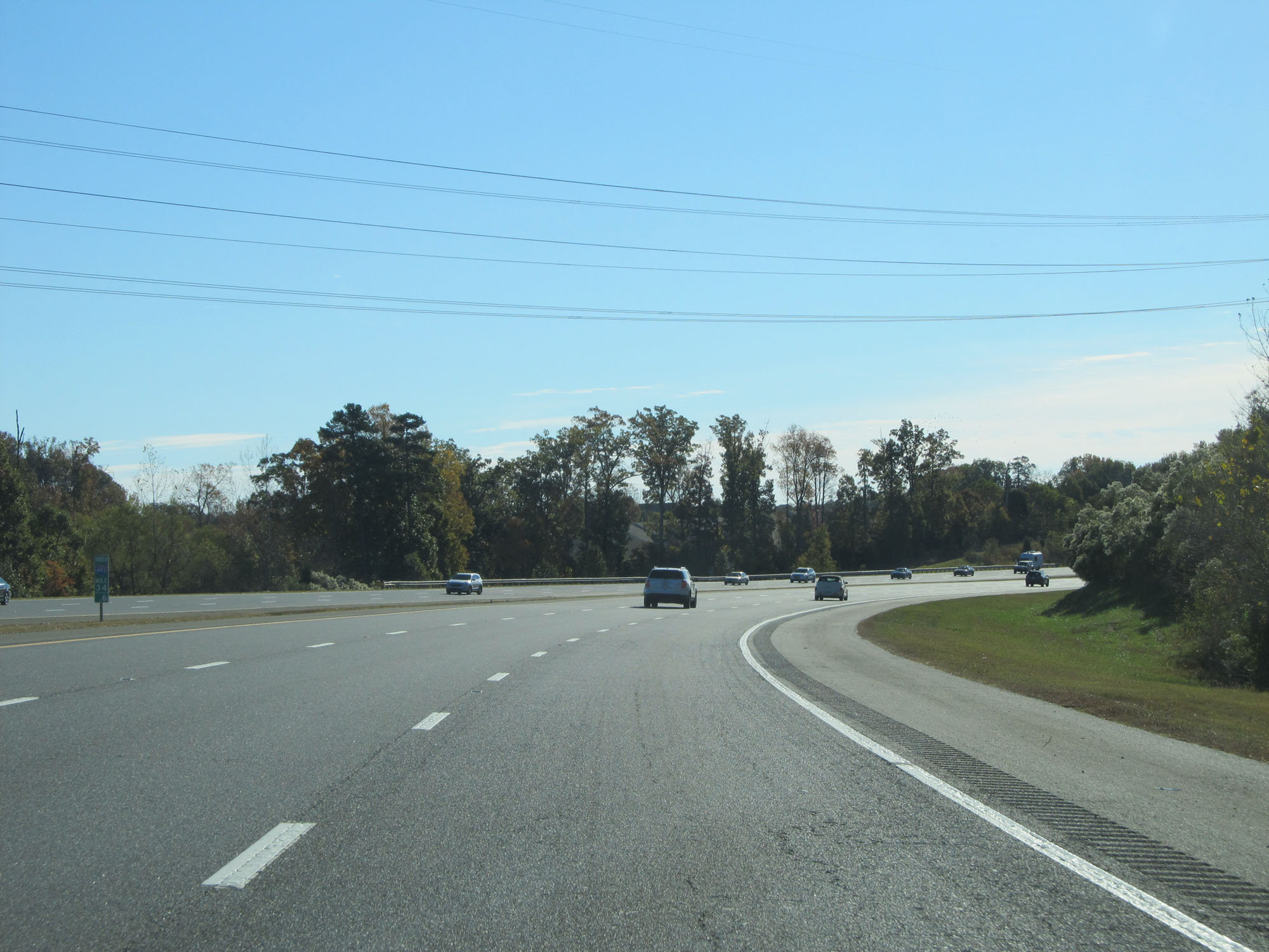
Interstate 485 Inner Loop (South) at mile marker 53.4. (Photo taken 11/12/16). |
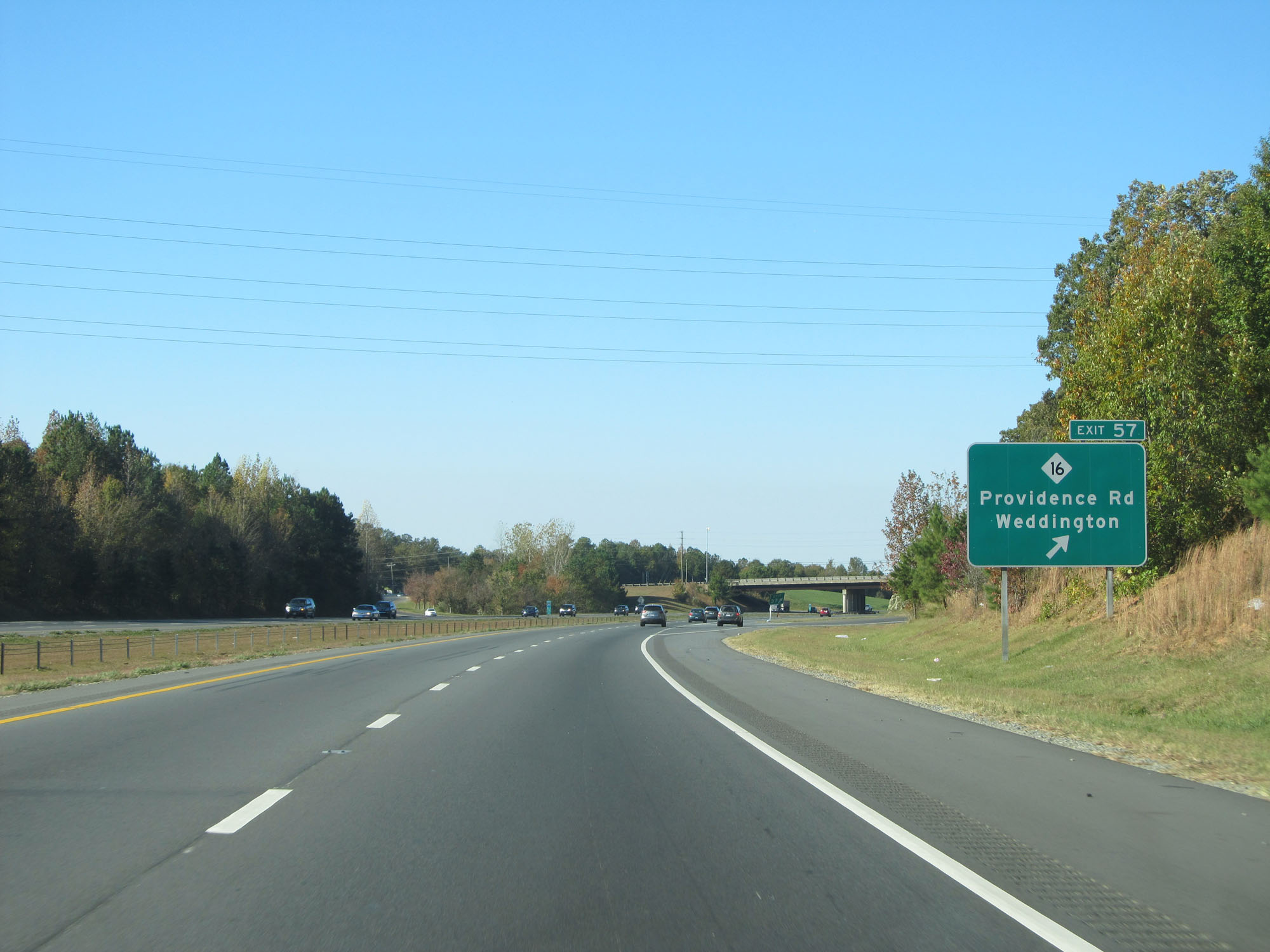 |
Interstate 485 Inner Loop (South) at Exit 57: NC 16 - Providence Rd / Weddington (Photo taken 11/12/16). |
 |
Interstate 485 Inner Loop (West) at Exit 59: Rea Rd (Photo taken 11/12/16). |
 |
Interstate 485 Inner Loop (West) at Exit 61A: Johnston Rd North (Photo taken 11/12/16). |
 |
Interstate 485 Inner Loop (West) at Exit 61B: US 521 South - Johnston Rd (Photo taken 11/12/16). |
 |
Take Exits 64A-B to Pineville. (Photo taken 11/12/16). |
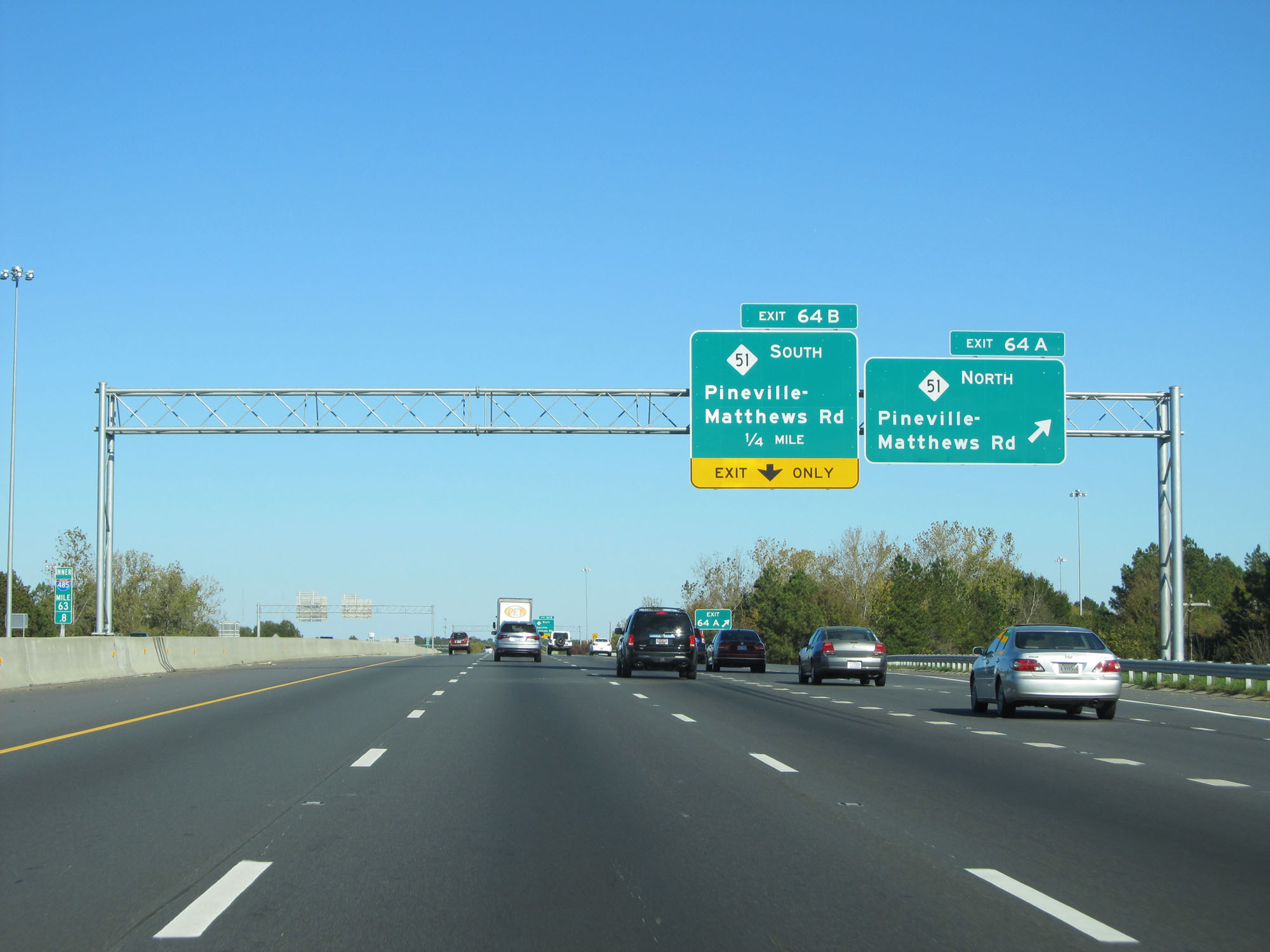 |
Interstate 485 Inner Loop (West) at Exit 64A: NC 51 North - Pineville-Matthews Rd (Photo taken 11/12/16). |
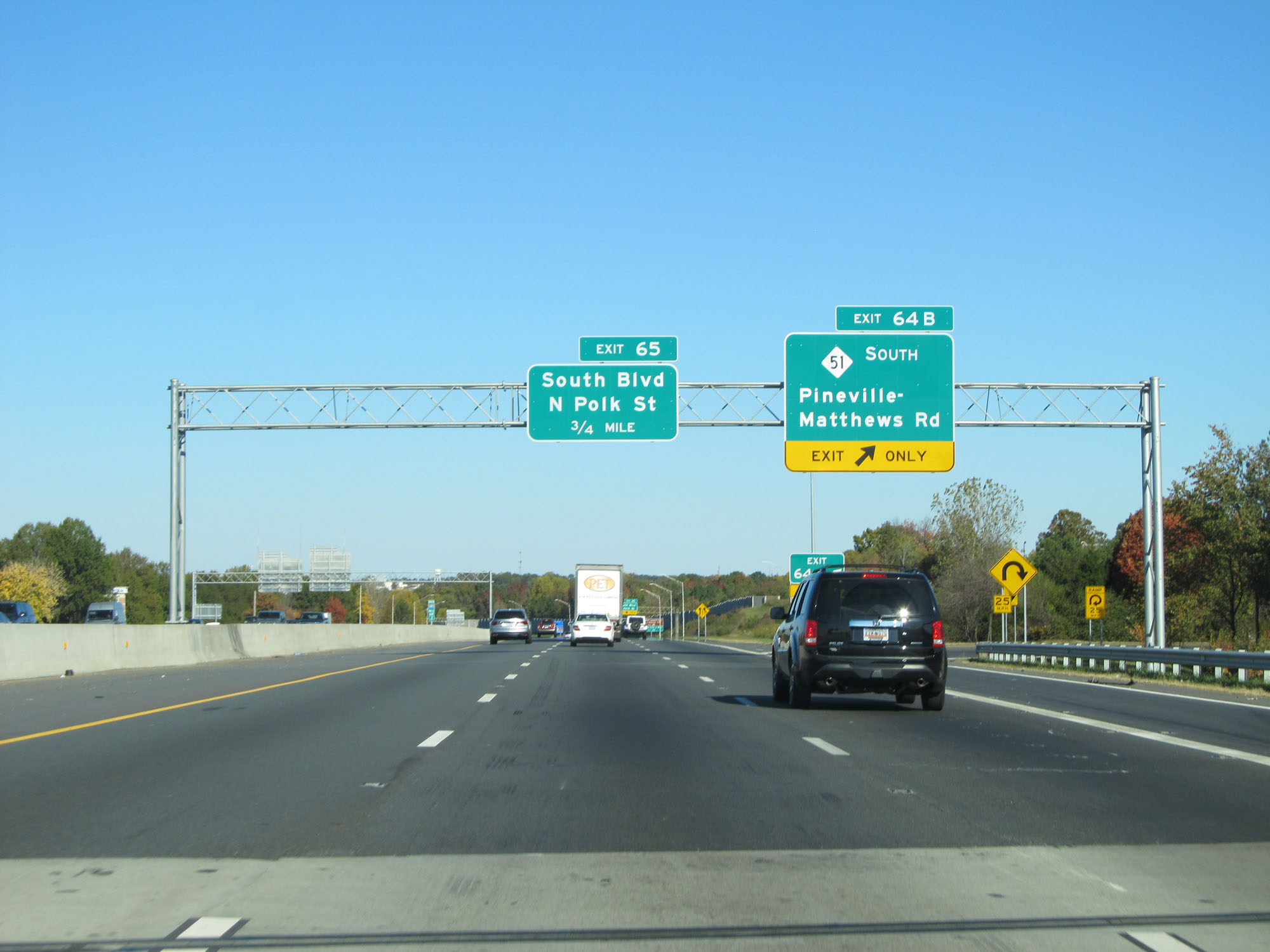 |
Interstate 485 Inner Loop (West) at Exit 64B: NC 51 South - Pineville-Matthews Rd (Photo taken 11/12/16). |
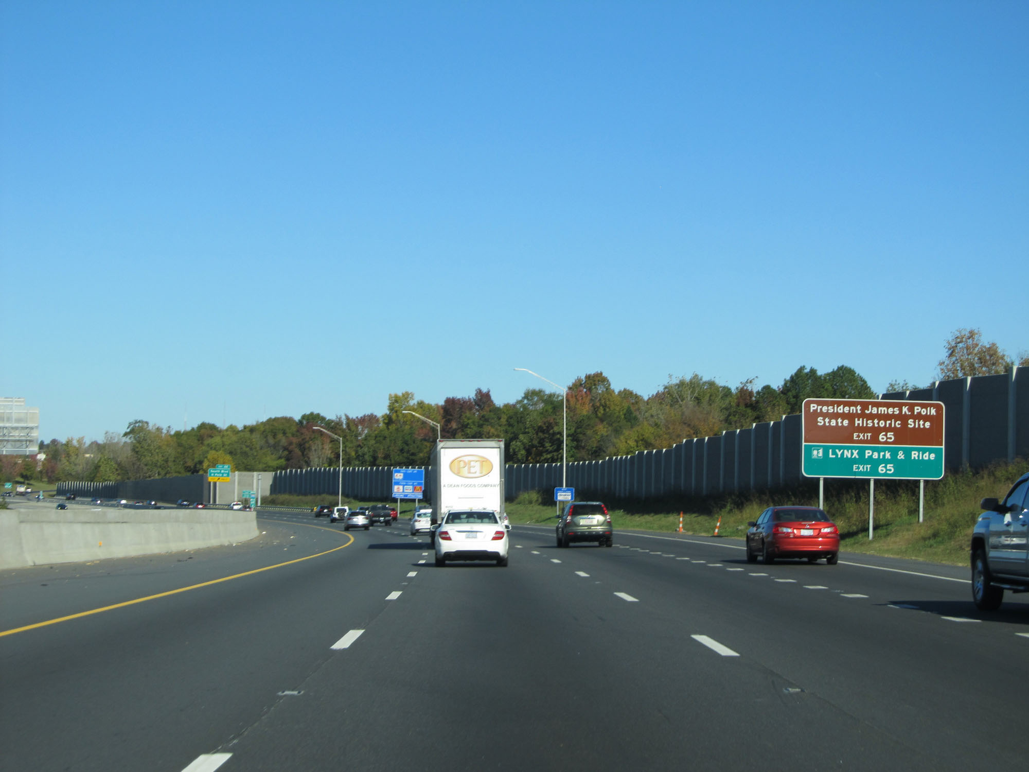 |
Take Exit 65 to President James K. Polk Historic Site and LYNX Park & Ride. (Photo taken 11/12/16). |
 |
Interstate 485 Inner Loop (West) entering the Charlotte city limits. (Photo taken 11/12/16). |
 |
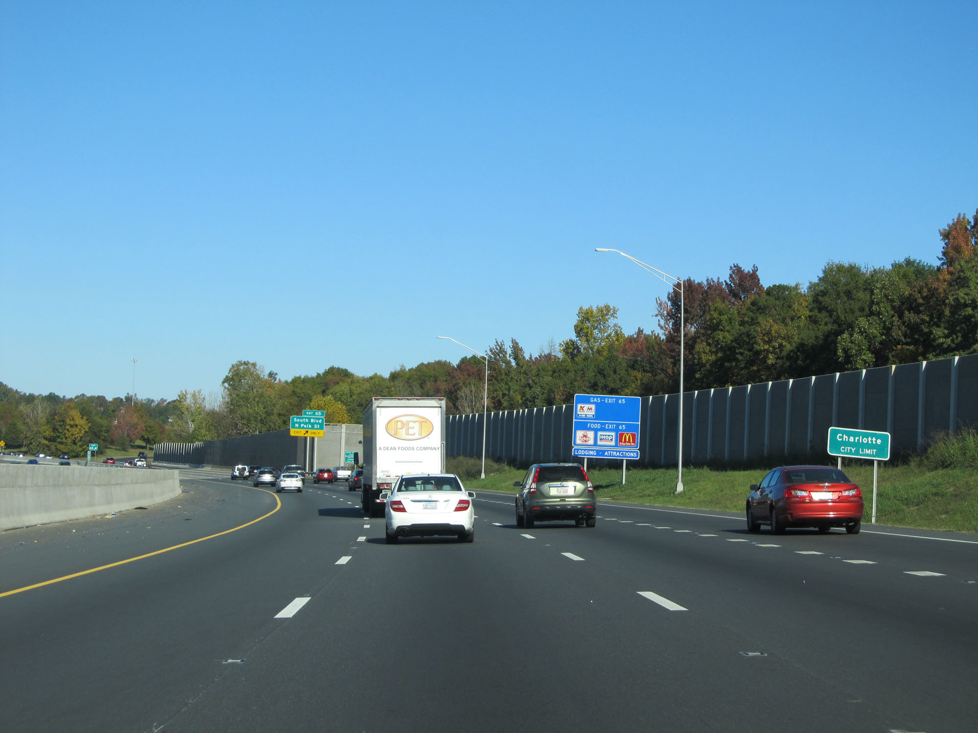
Interstate 485 Inner Loop (West) at Exit 65: South Blvd / N Polk St (Photo taken 11/12/16). |
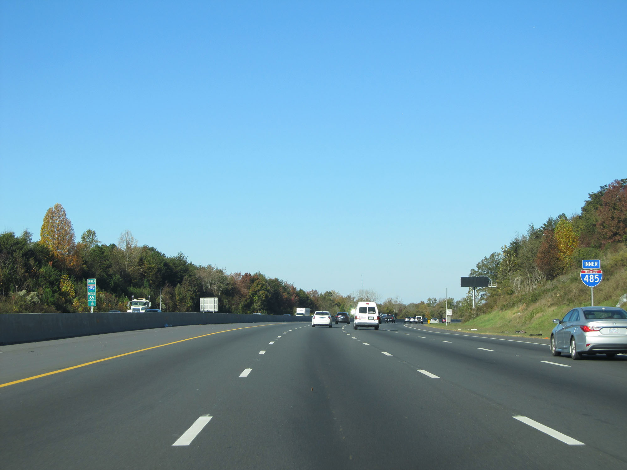 |
Interstate 485 Inner Loop (West) at mile marker 65.6. (Photo taken 11/12/16). |
 |
Interstate 485 Inner Loop (West) approaching Exit 67 - 1 mile. (Photo taken 11/12/16). |
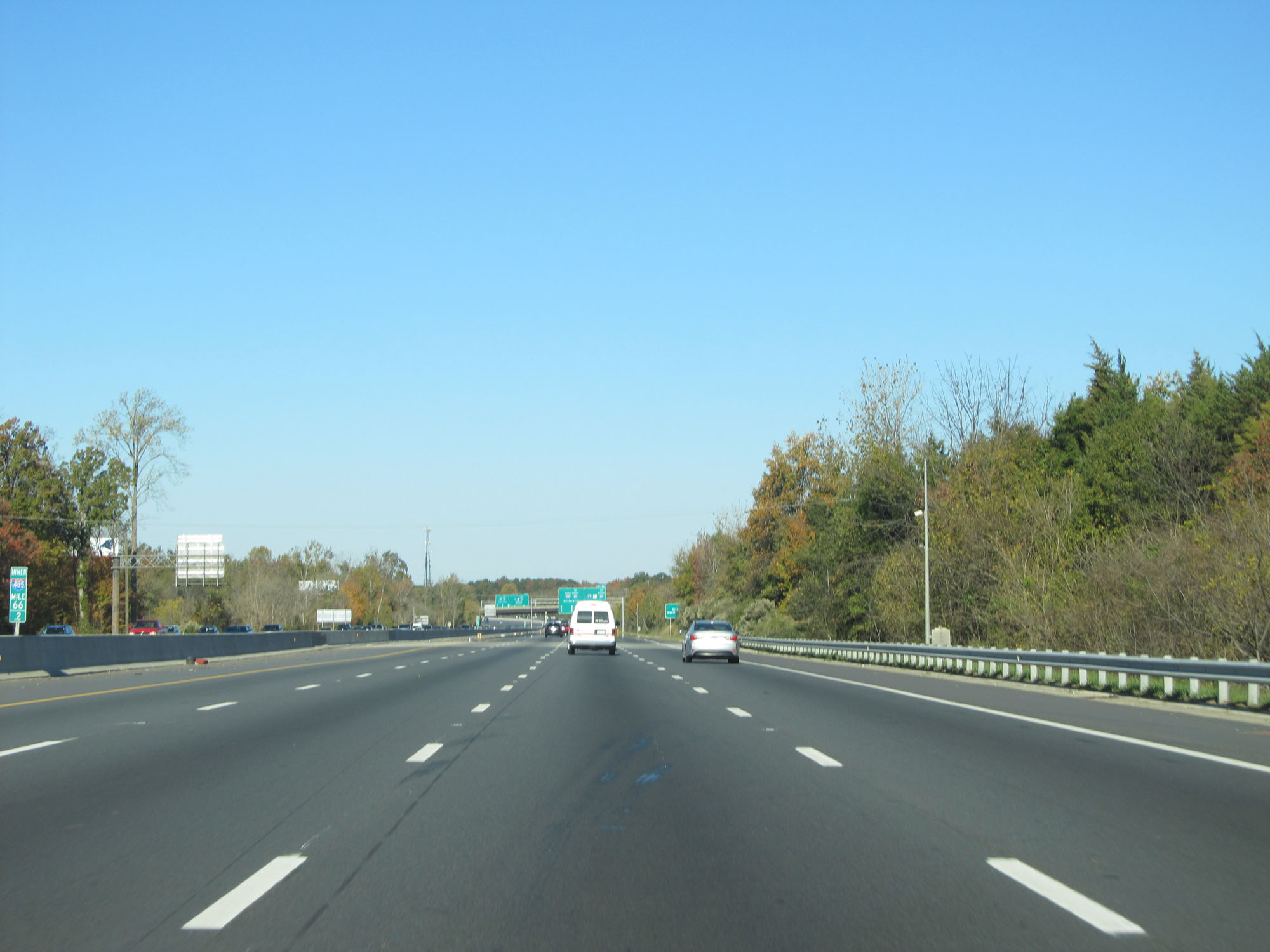 |
Interstate 485 Inner Loop (West) at mile marker 66.2. (Photo taken 11/12/16). |
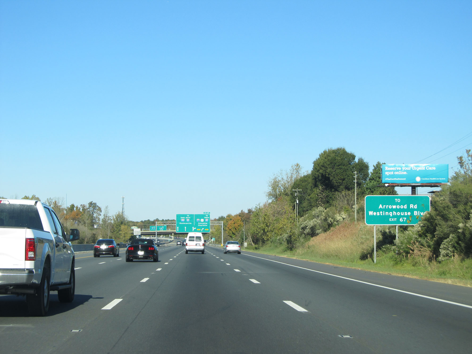 |
Take Exit 67 to Arrowood Rd and Westinghouse Blvd. (Photo taken 11/12/16). |
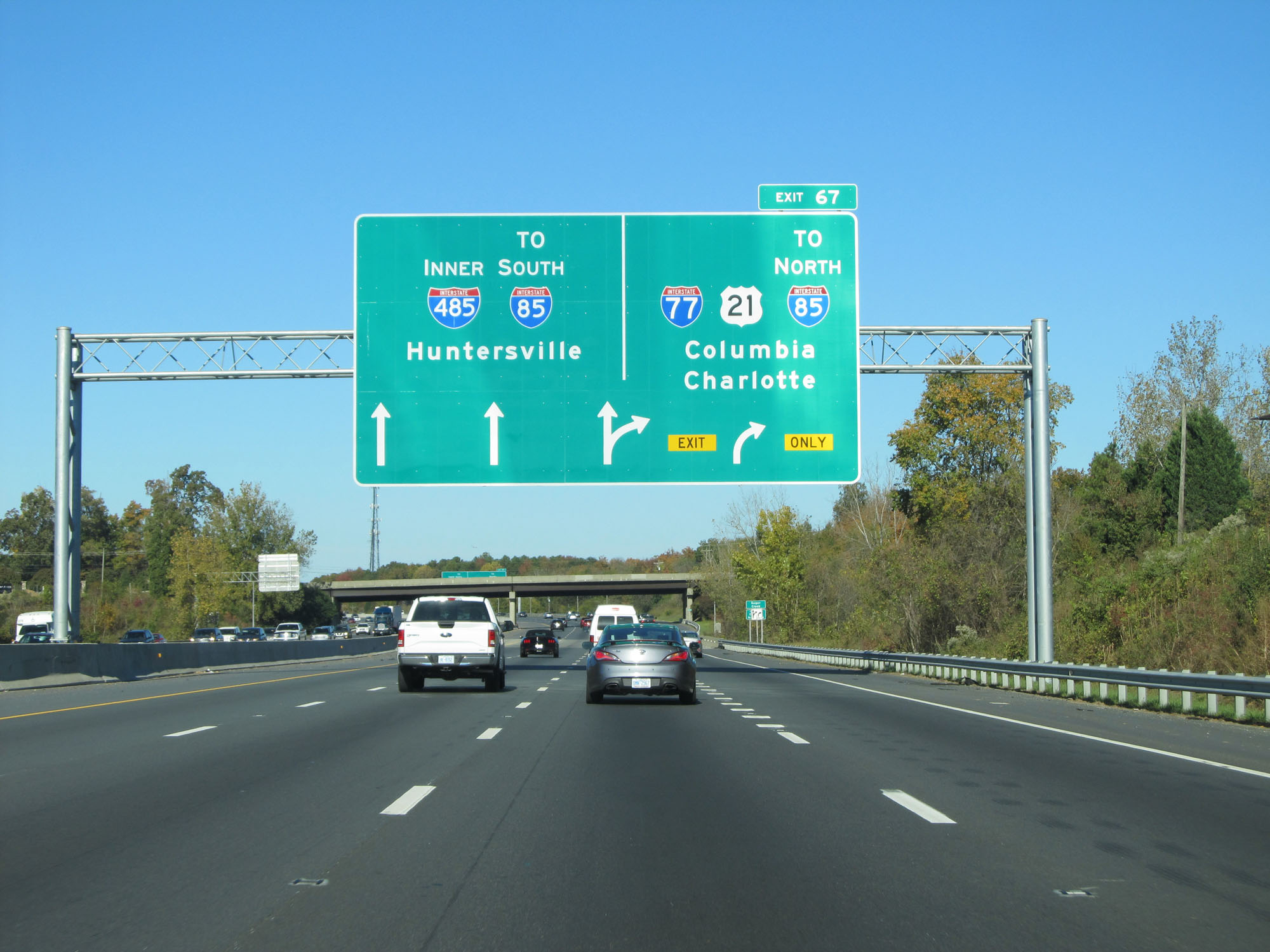 |
Interstate 485 Inner Loop (West) approaching Exit 67 - 1/4 mile. The interchange with Interstate 77 marks the beginning/end of I-485 based on its mileage and exit numbers. (Photo taken 11/12/16). |
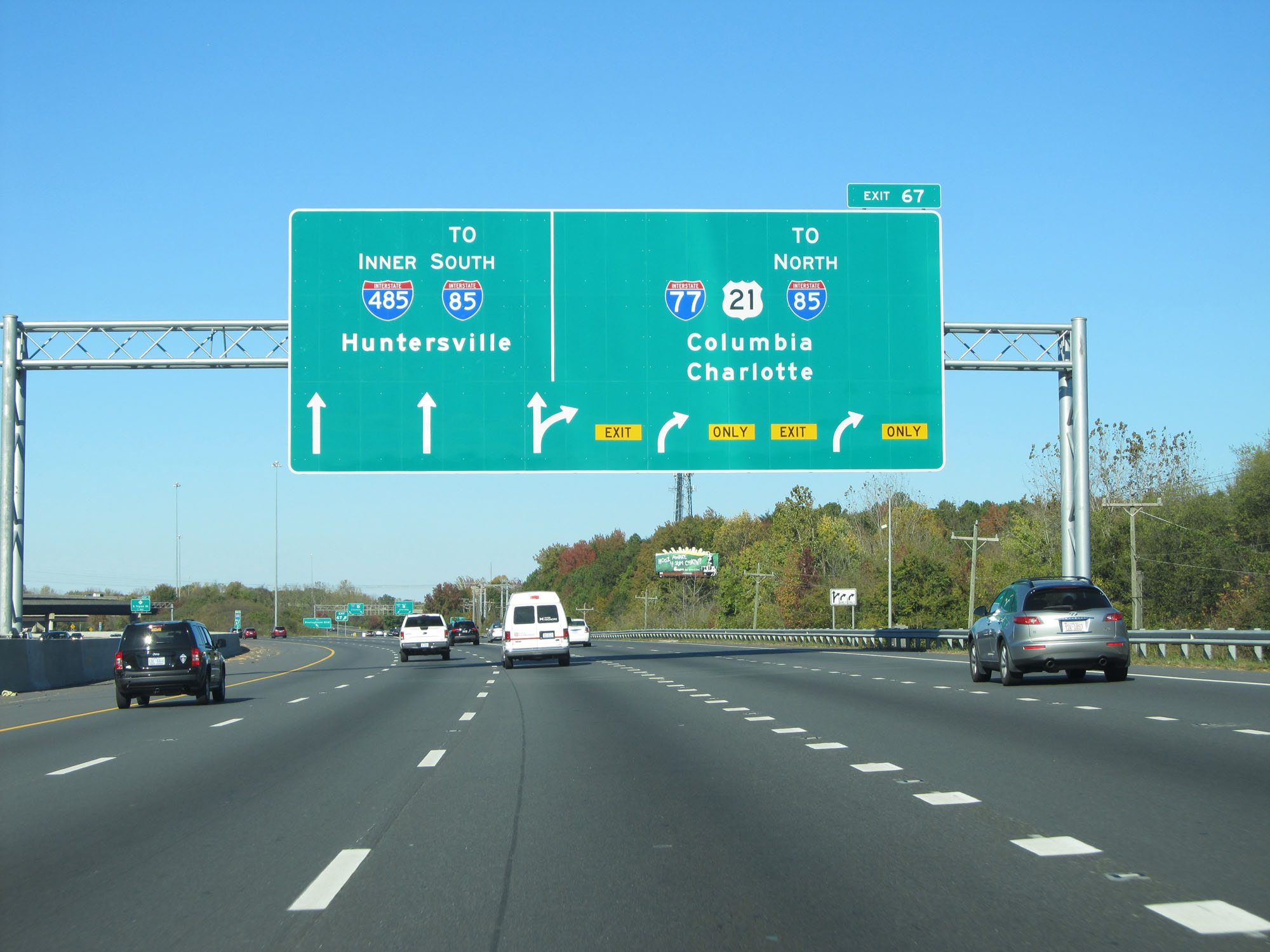 |
Interstate 485 Inner Loop (West) at Exit 67: Interstate 77 / US 21 / To Interstate 85 North - Columbia / Charlotte (Photo taken 11/12/16). |