Road Information |
||
 |
||
| Total Mileage in State: | 37 miles | |
| Eastern End: | At I-90 (NYS Thruway), in Victor | |
| Western End: | At I-90 (NYS Thruway), in Le Roy | |
| Mileage covered in Photos: | 37 miles | |
| Counties covered in Photos: | Genesee, Monroe, Ontario | |
| Major Junctions in Photos: | I-390, in Gates I-590, in Rochester |
|
| Control Cities in Photos: | Gates, Rochester, Brighton | |
Eastbound
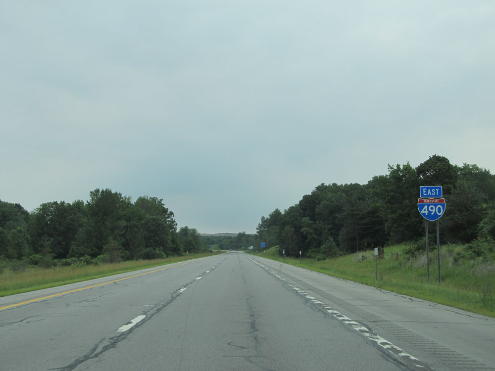 |
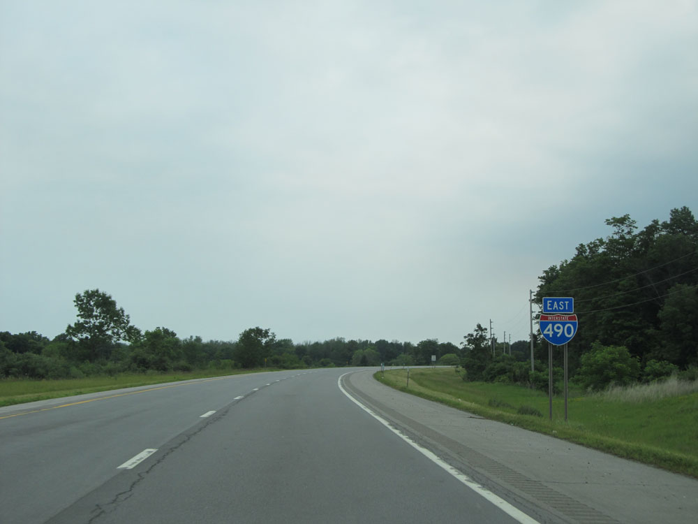
Interstate 490 East shield after the toll plaza from the New York State Thruway. (Photo taken 7/4/15). |
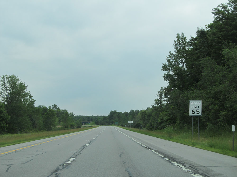 |
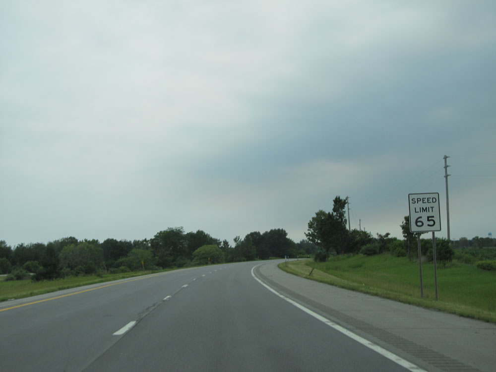
The speed limit on Interstate 490 East starts out at 65 mph. (Photo taken 7/4/15). |
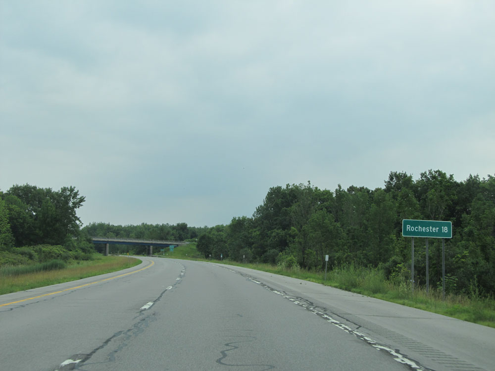 |
As this sign reads, Rochester lies 18 miles ahead on Interstate 490 East. (Photo taken 7/4/15). |
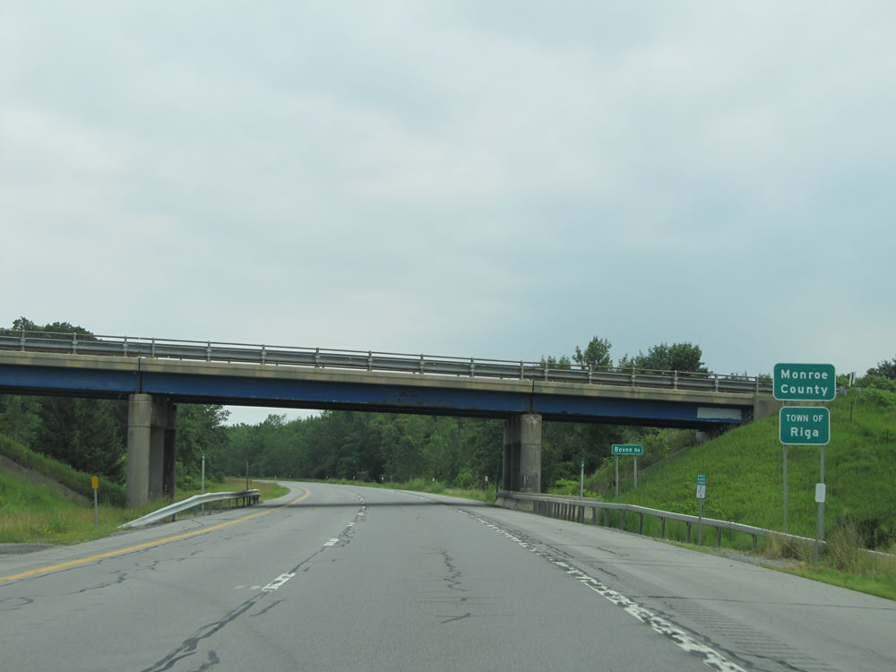 |
Interstate 490 East as it enters Monroe County. (Photo taken 7/4/15). |
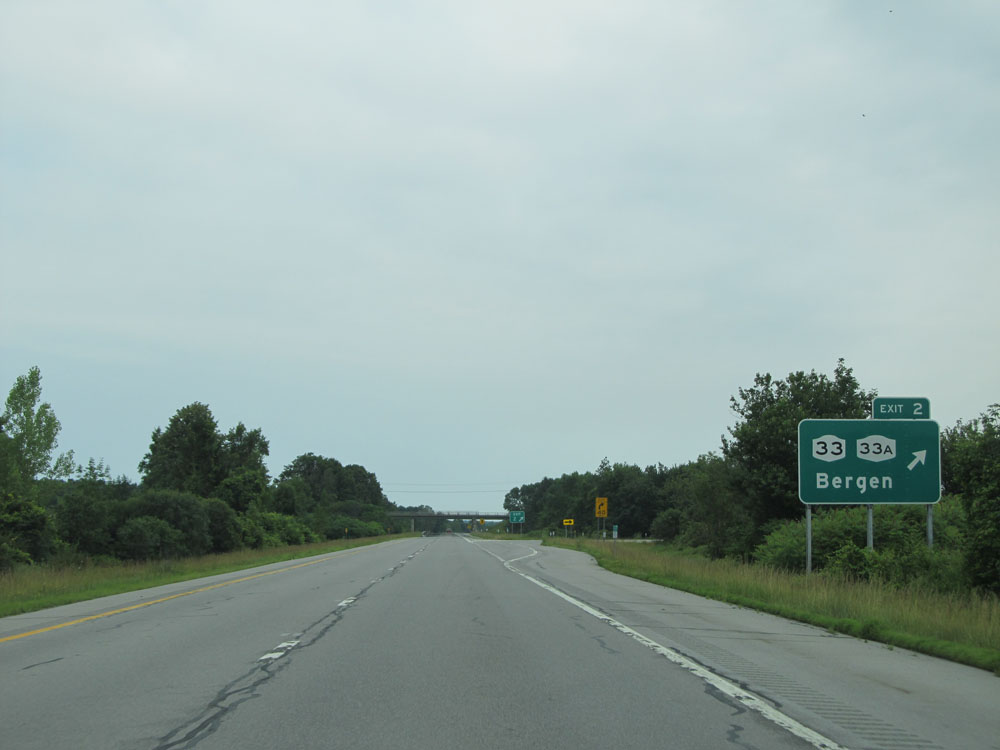 |
Interstate 490 East at Exit 2: NY 33 / NY 33A - Bergen (Photo taken 7/4/15). |
 |
Interstate 490 East assurance shield located just past Exit 2. (Photo taken 7/4/15). |
 |
Speed limit assurance sign. Speed Limit - 65 mph. (Photo taken 7/4/15). |
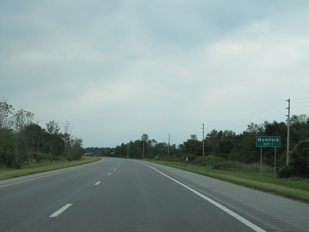 |
Take Exit 3 to Mumford. (Photo taken 7/4/15). |
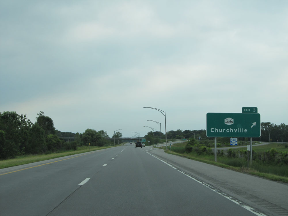 |
Interstate 490 East at Exit 3: NY 36 - Churchville (Photo taken 7/4/15). |
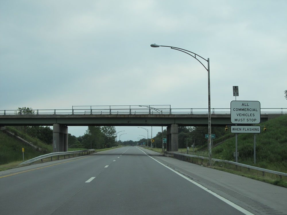 |
All commercial vehicles must enter the Inspection Station ahead when the lights on this sign are flashing. (Photo taken 7/4/15). |
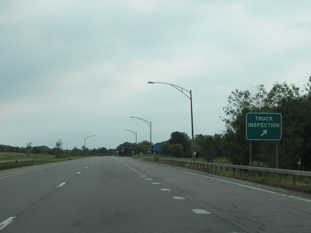 |
Interstate 490 East at the Truck Inspection Station located near mile marker 7. (Photo taken 7/4/15). |
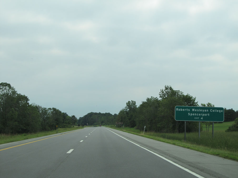 |
Take Exit 4 to Roberts Wesleyan College and Spencerport. (Photo taken 7/4/15). |
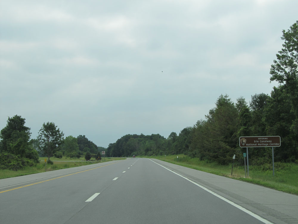 |
Interstate 490 East entering the Erie Canalway National Heritage Corridor. (Photo taken 7/4/15). |
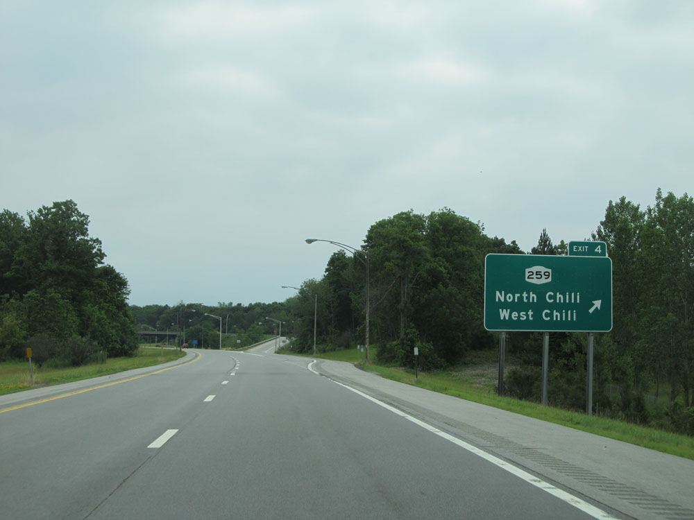 |
Interstate 490 East at Exit 4: NY 259 - North Chili / West Chili (Photo taken 7/4/15). |
 |
Interstate 490 East: Road view from mile marker 12. (Photo taken 7/4/15). |
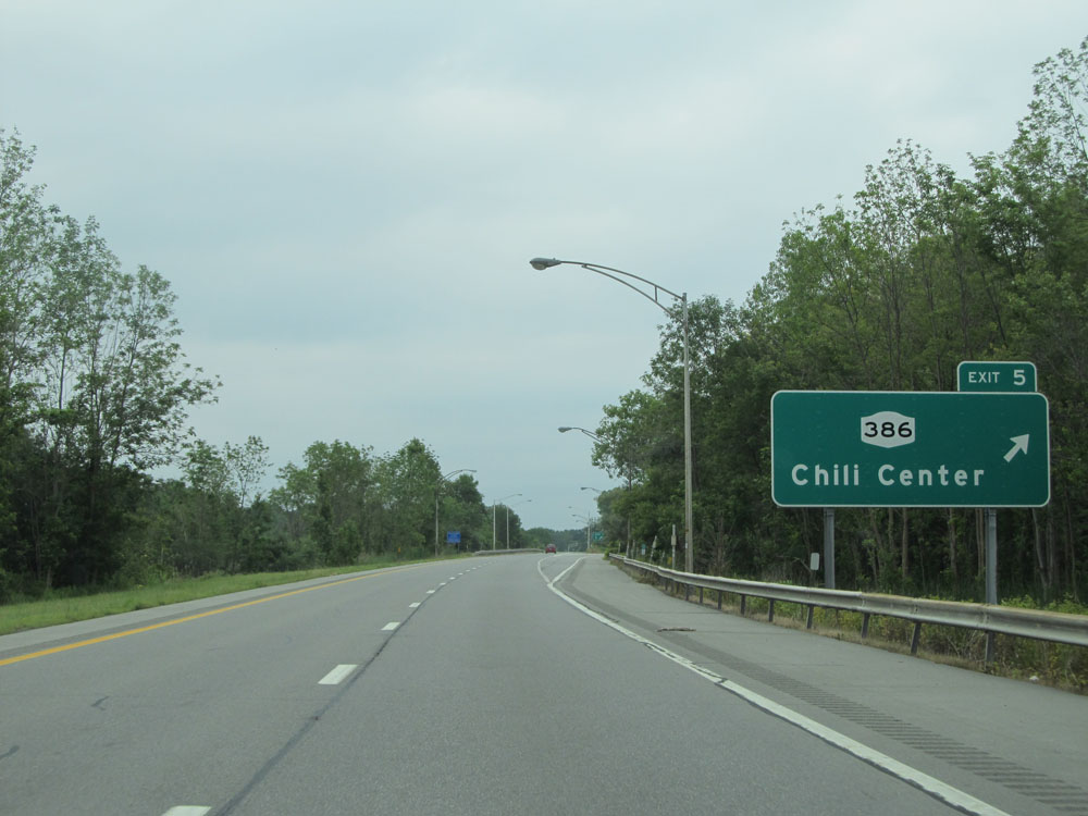 |
Interstate 490 East at Exit 5: NY 386 - Chili Center (Photo taken 7/4/15). |
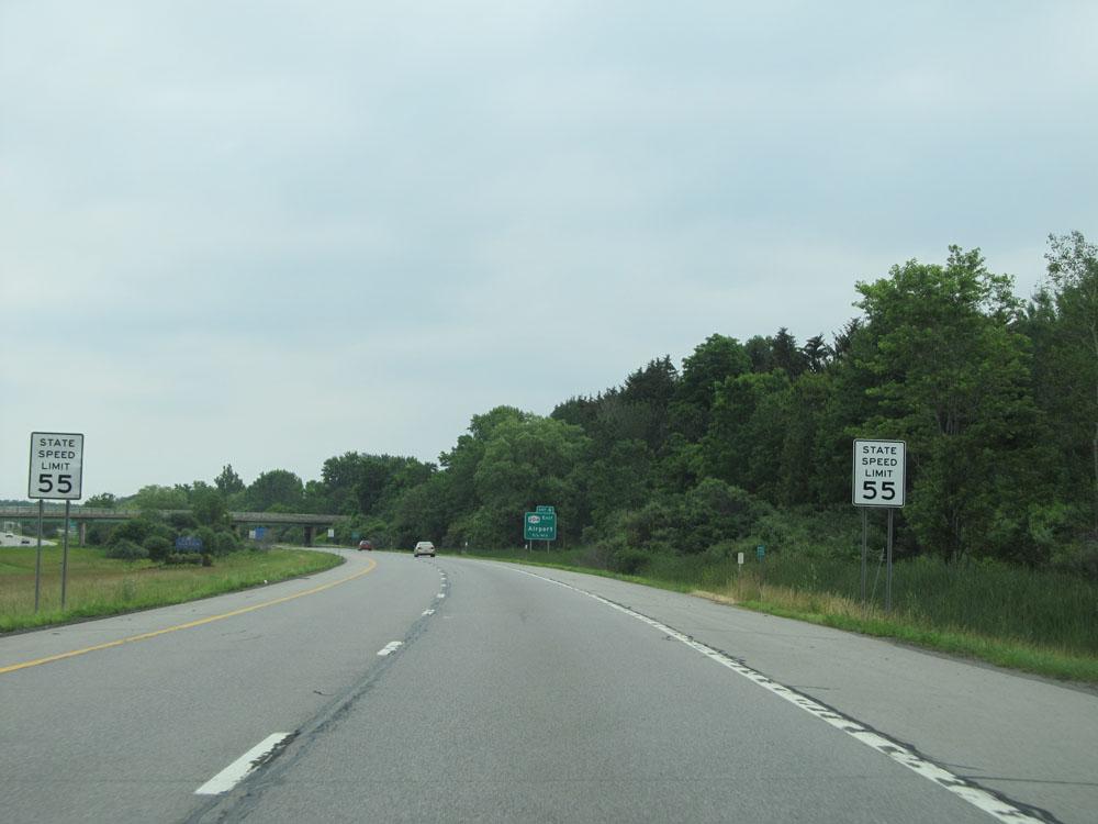 |
Approaching Exit 6, the speed limit decreases to 55 mph as we near the outskirts of Rochester. (Photo taken 7/4/15). |
 |
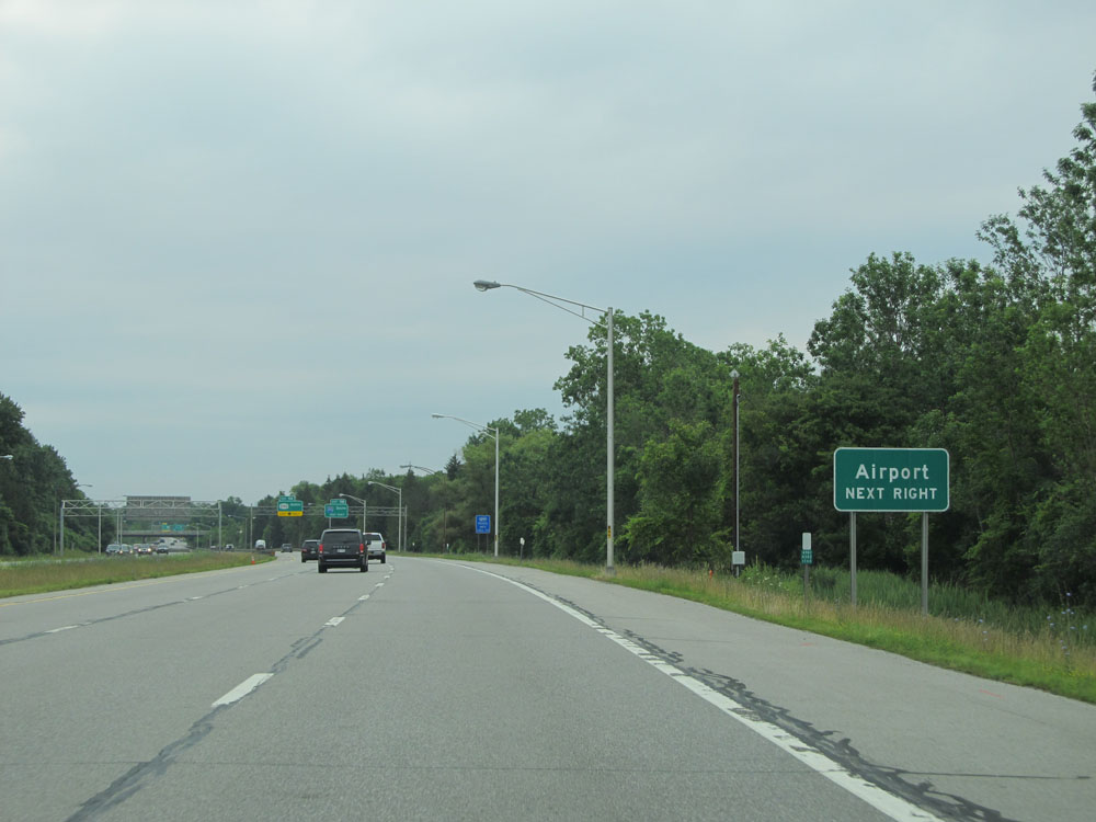
Interstate 490 East at Exit 6: NY 204 East - Airport (Photo taken 7/4/15). |
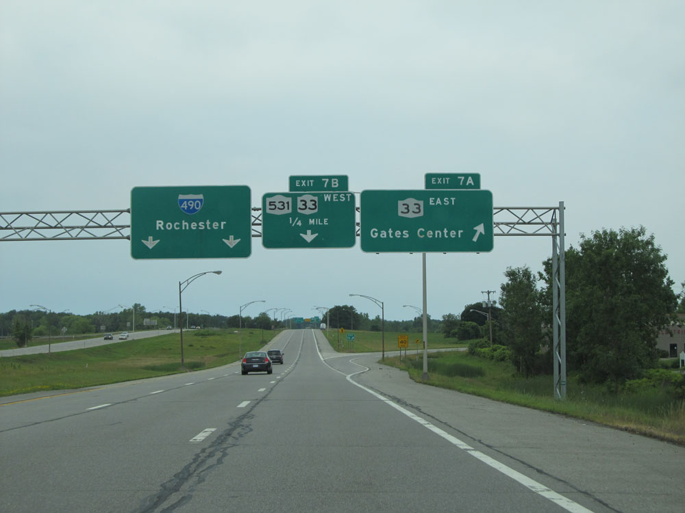 |
Interstate 490 East at Exit 7A: NY 33 East - Gates Center (Photo taken 7/4/15). |
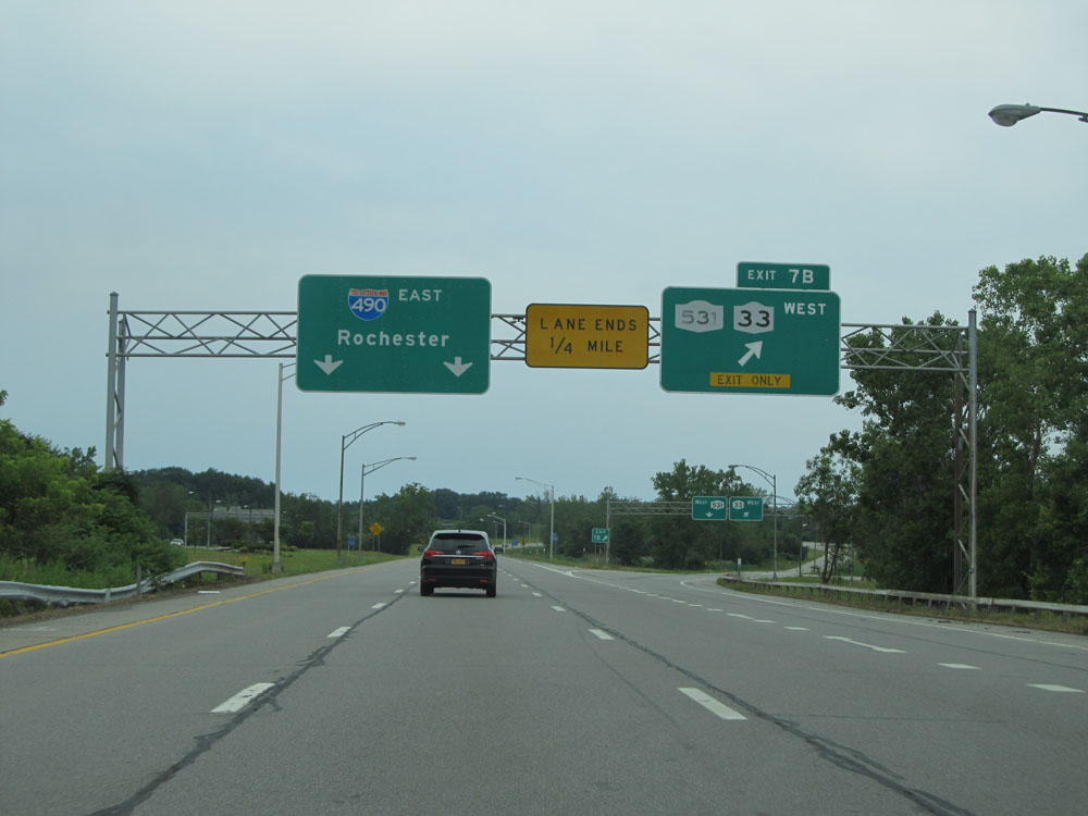 |
Interstate 490 East at Exit 7B: NY 531 / NY 33 West (Photo taken 7/4/15). |
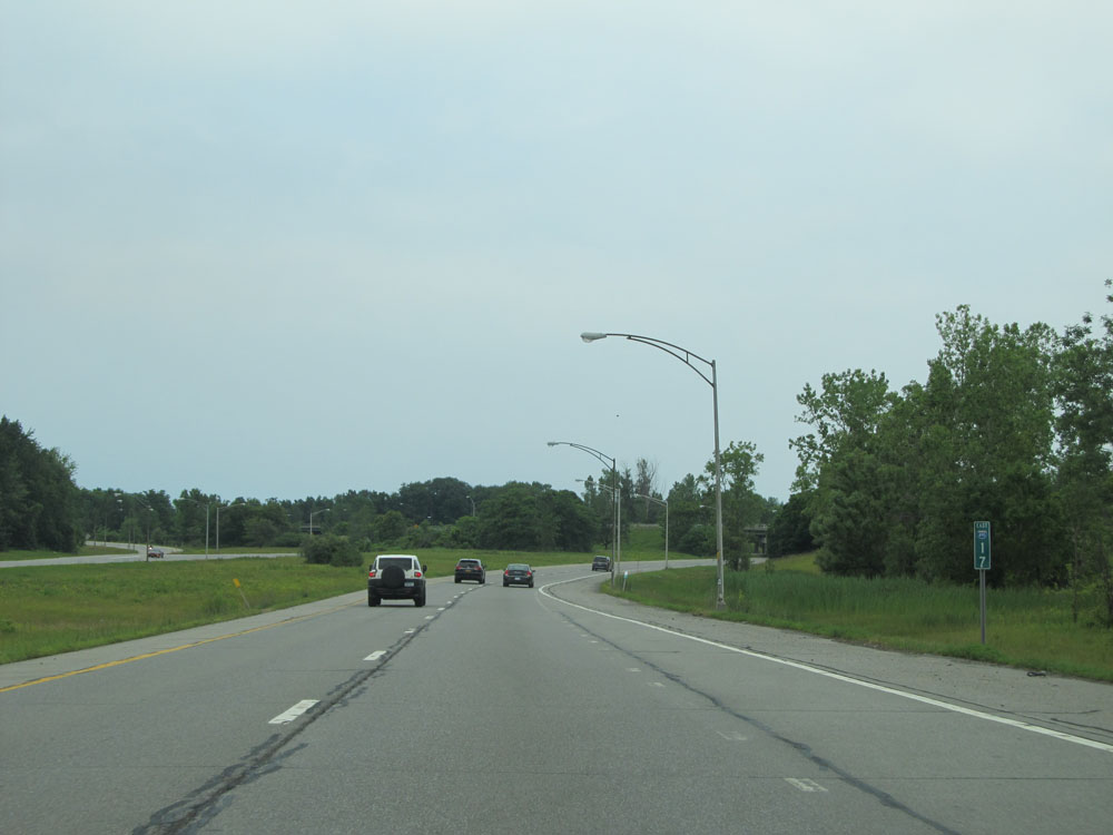 |
Interstate 490 East at mile marker 17. (Photo taken 7/4/15). |
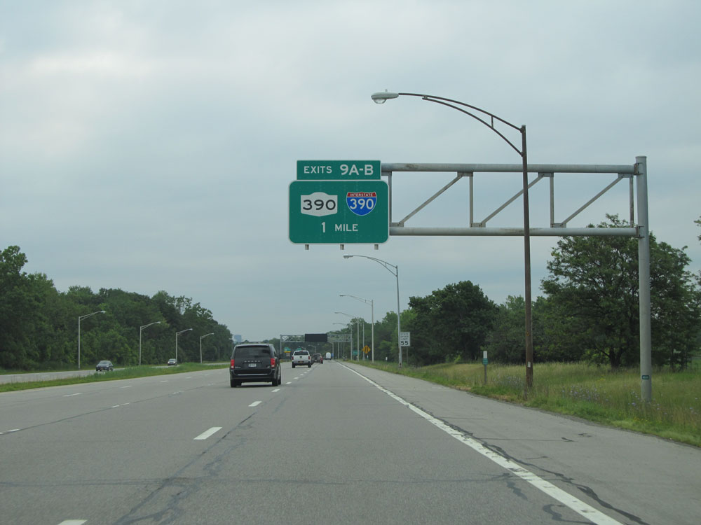 |
Interstate 490 East approaching Exits 9A-B - 1 mile. (Photo taken 7/4/15). |
 |
Take Exit 9B to the Airport. (Photo taken 7/4/15). |
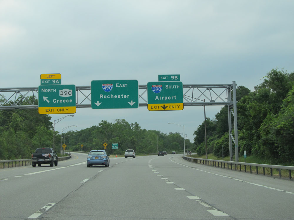 |
Interstate 490 East at Exit 9A: NY 390 North - Greece (Photo taken 7/4/15). |
 |
Interstate 490 East at Exit 9B: Interstate 390 South - Airport (Photo taken 7/4/15). |
 |
Interstate 490 East at Exit 10: Mt Read Blvd (Photo taken 7/4/15). |
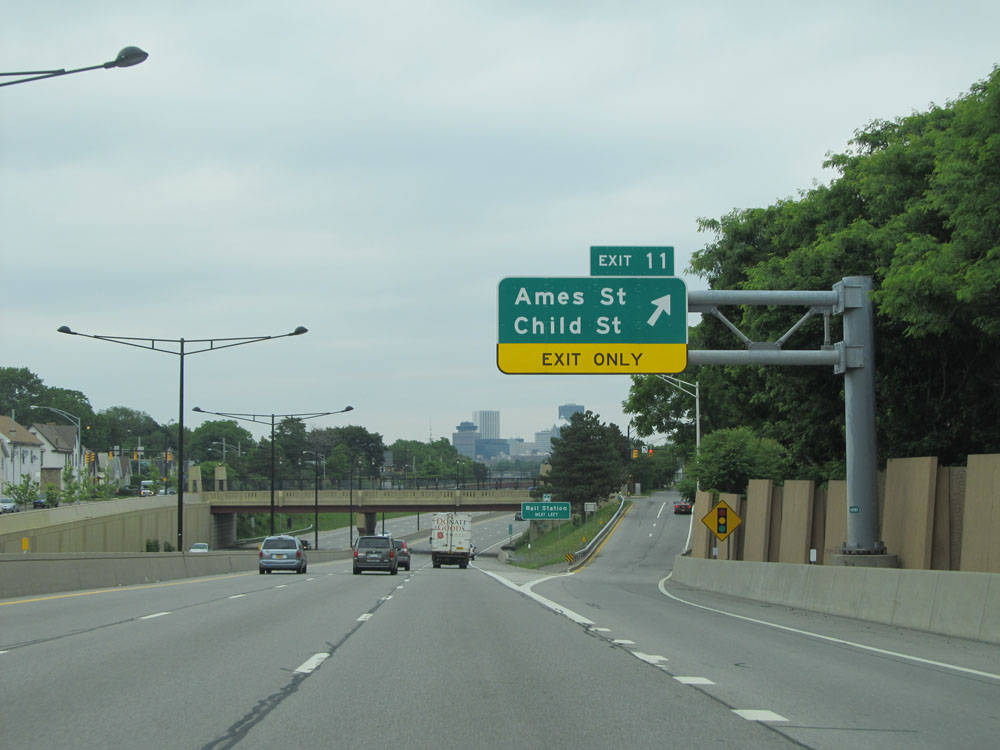 |
Interstate 490 East at Exit 11: Ames St / Child St (Photo taken 7/4/15). |
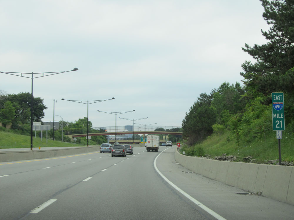 |
Interstate 490 East at mile marker 21. (Photo taken 7/4/15). |
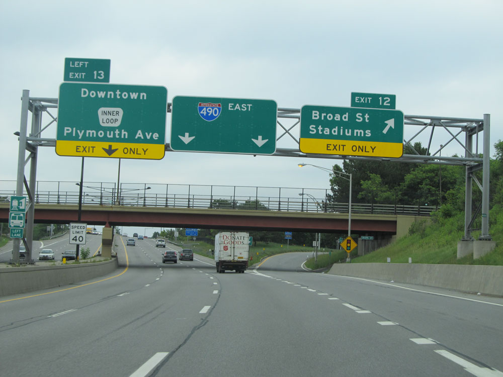 |
Interstate 490 East at Exit 12: Broad St / Stadiums. Also at this point, the speed limit decreases to 40 mph as we pass through downtown Rochester. (Photo taken 7/4/15). |
 |
Interstate 490 East approaching Exit 13 (on the left). (Photo taken 7/4/15). |
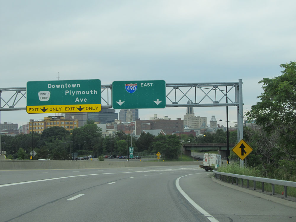 |
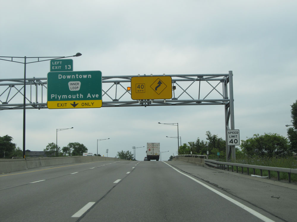
Interstate 490 East at Exit 13: Downtown / Plymouth Ave (Photo taken 7/4/15). |
 |
Take Exit 15 to Strong Museum. (Photo taken 7/4/15). |
 |
Take Exit 15 or 18 to NY 31 - Monroe Ave. (Photo taken 7/4/15). |
 |
Interstate 490 East approaching the Frederick Douglass / Susan B. Anthony Memorial Bridge. (Photo taken 7/4/15). |
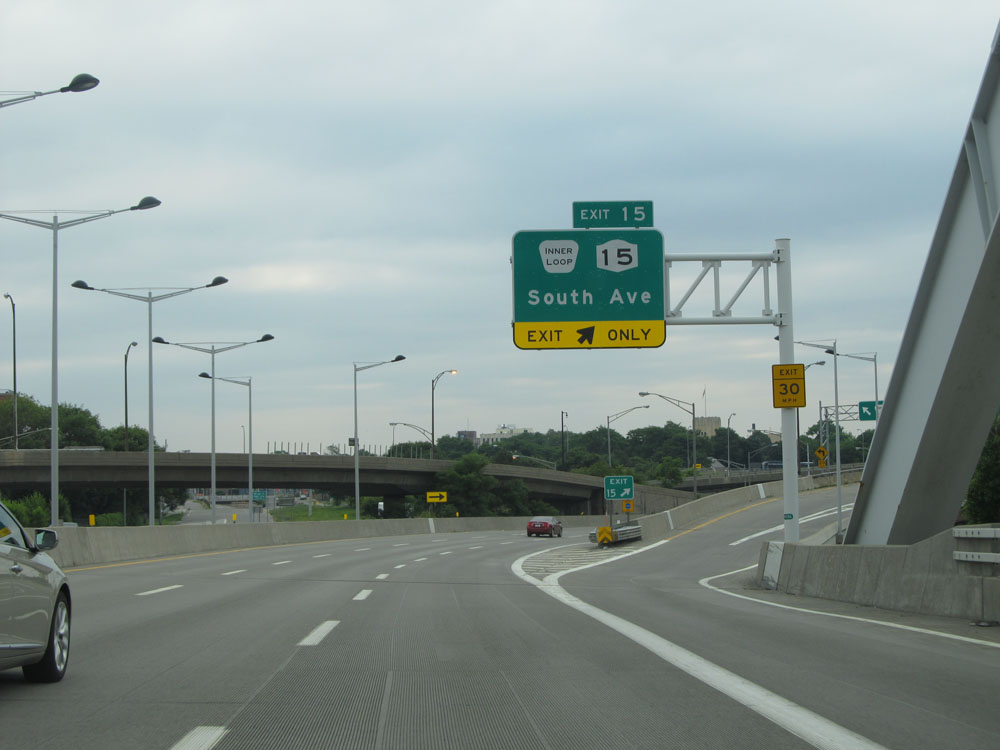 |
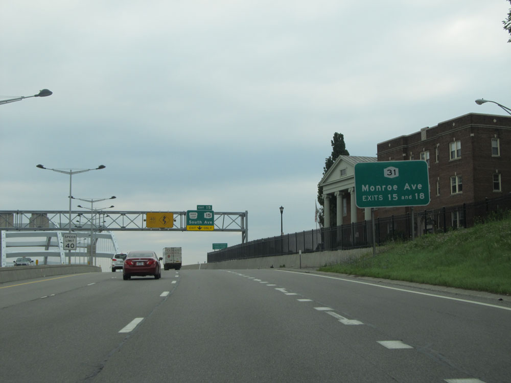
Interstate 490 East at Exit 15: NY 15 - South Ave (Photo taken 7/4/15). |
 |
Approaching Exit 17, the speed limit increases to 55 mph once again. (Photo taken 7/4/15). |
 |
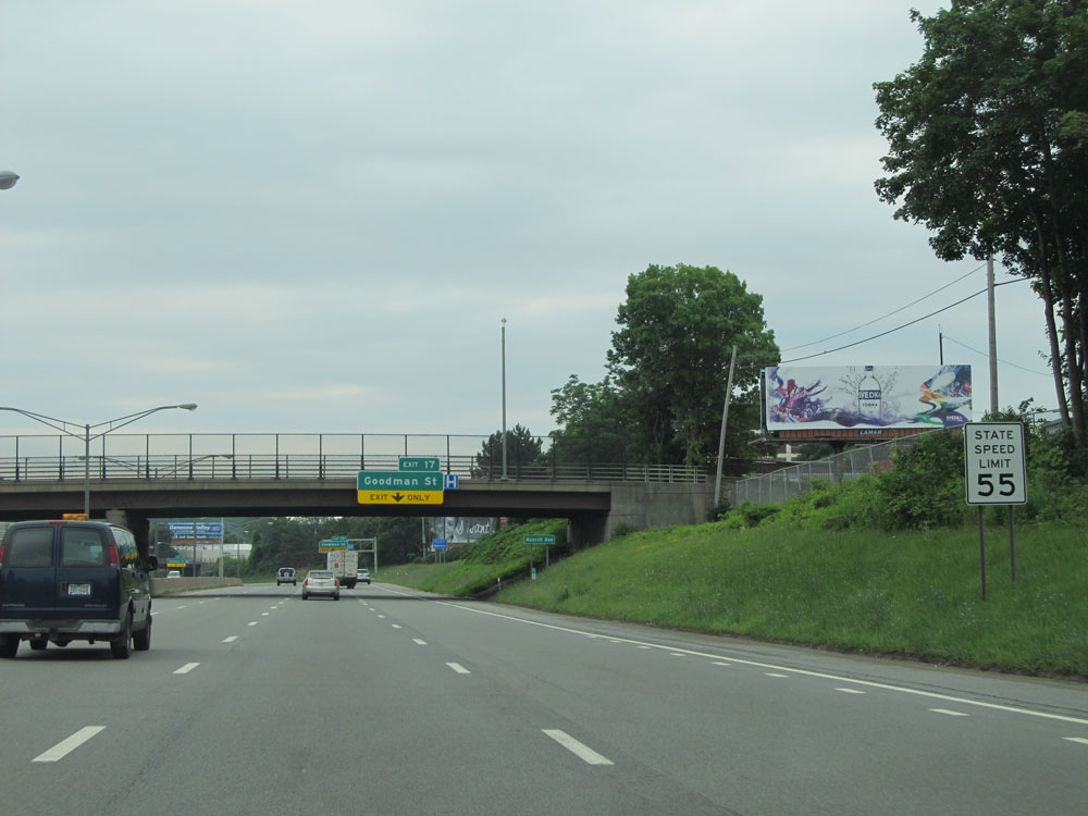
Interstate 490 East at Exit 17: Goodman St (Photo taken 7/4/15). |
 |
Interstate 490 East at Exit 18: NY 31 - Monroe Ave (Photo taken 7/4/15). |
 |
Interstate 490 East at Exit 19: Culver Rd (Photo taken 7/4/15). |
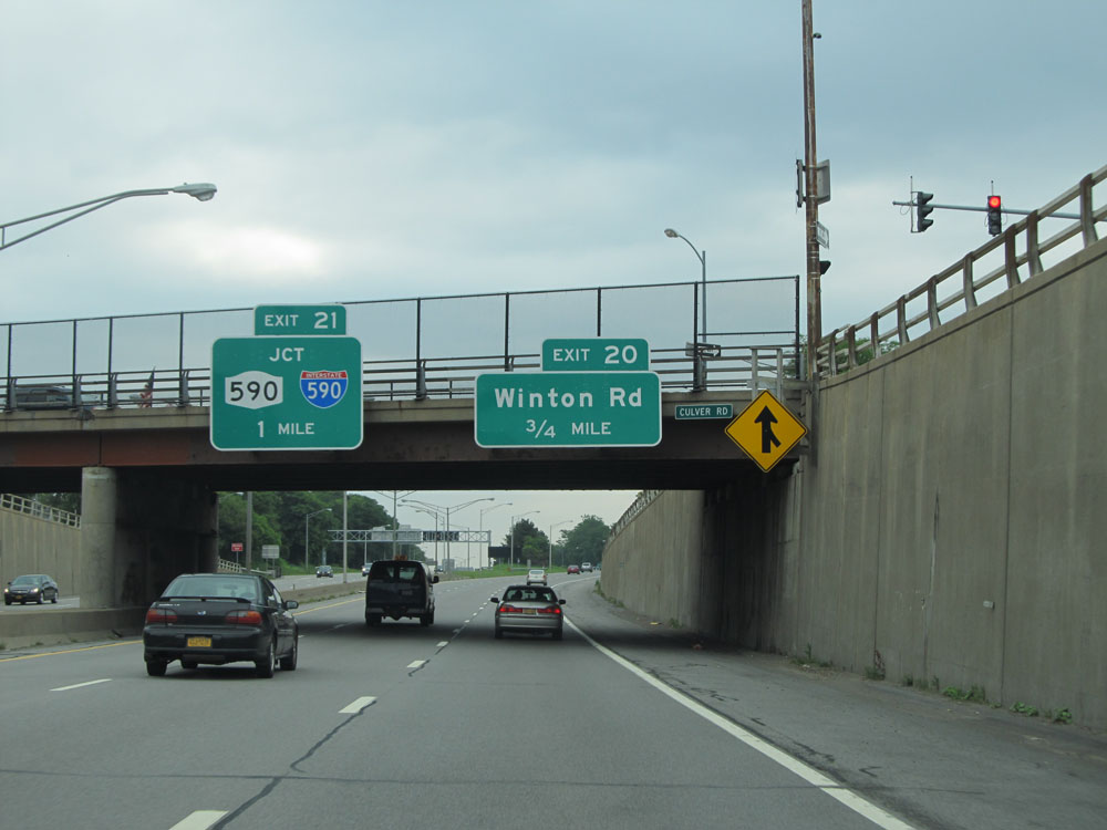 |
Interstate 490 East approaching Exit 21 - 1 mile. (Photo taken 7/4/15). |
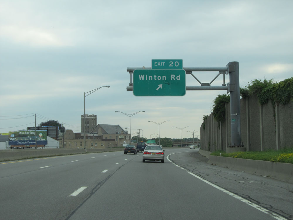 |
Interstate 490 East at Exit 20: Winton Rd (Photo taken 7/4/15). |
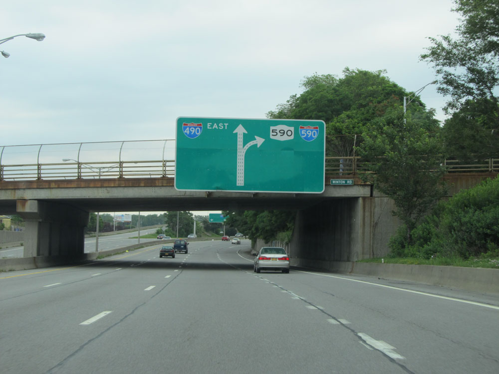 |
Interstate 490 East approaching Exit 21. Stay in the two rightmost lanes to exit. (Photo taken 7/4/15). |
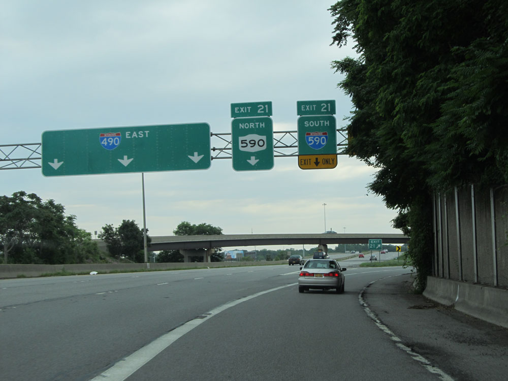 |
Interstate 490 East at Exit 21: NY 590 North / Interstate 590 South. This interchange was once known locally as "The Can of Worms". (Photo taken 7/4/15). |
 |
Take Exit 23 to Penfield. (Photo taken 7/4/15). |
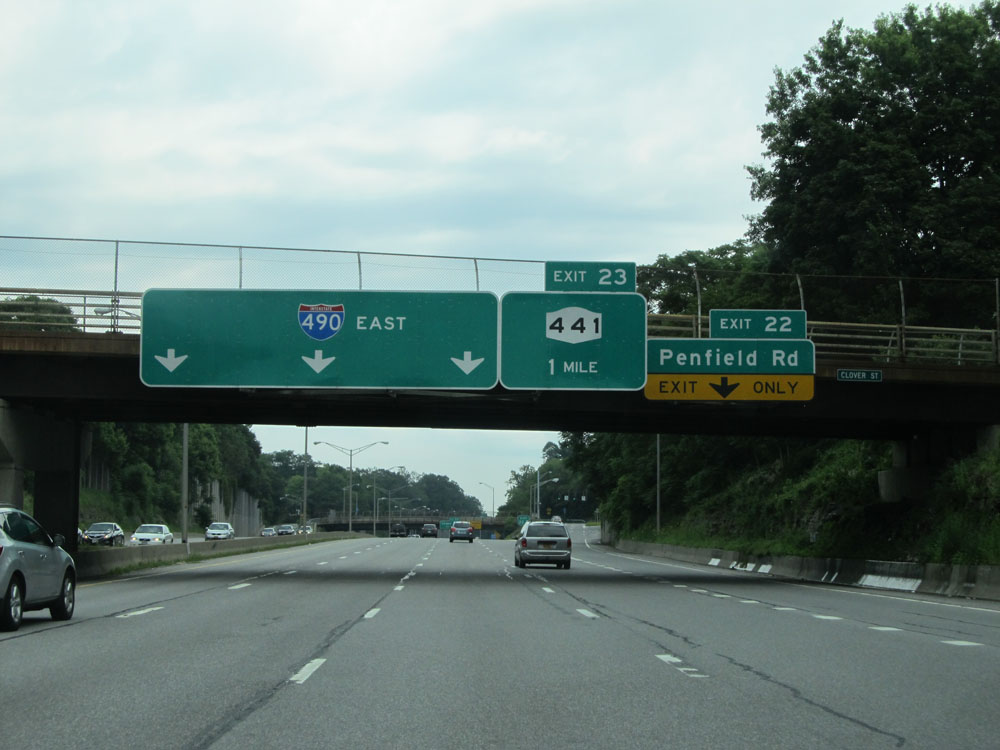 |
Interstate 490 East at Exit 22: Penfield Rd (Photo taken 7/4/15). |
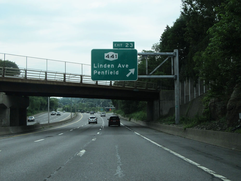 |
Interstate 490 East at Exit 23: NY 441 - Linden Ave / Penfield (Photo taken 7/4/15). |
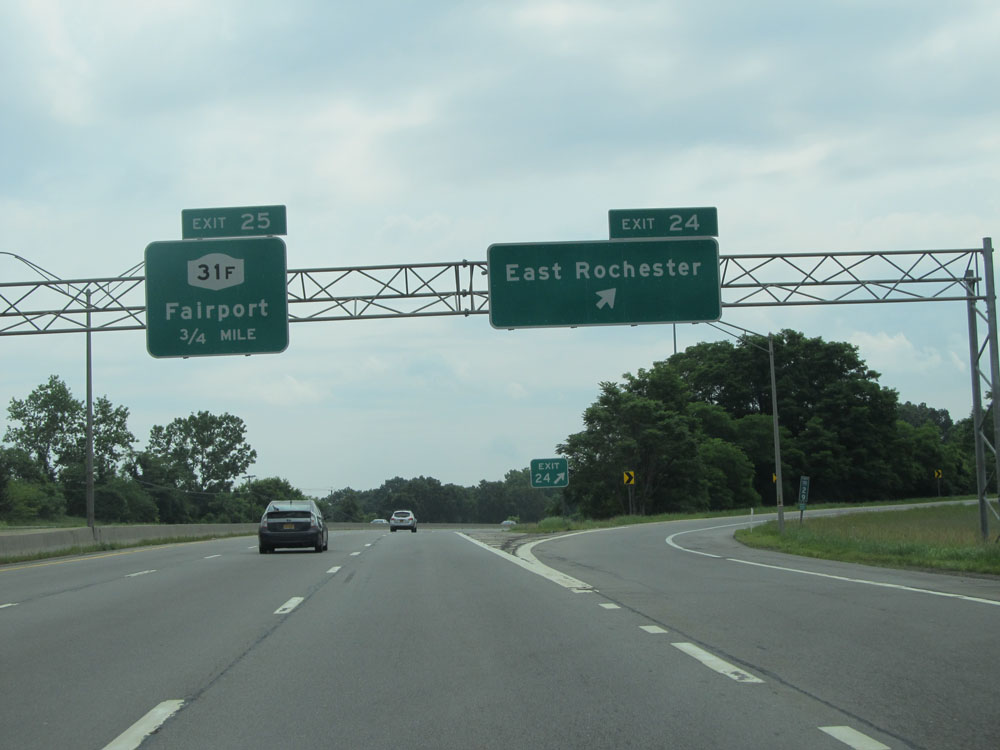 |
Interstate 490 East at Exit 24: East Rochester (Photo taken 7/4/15). |
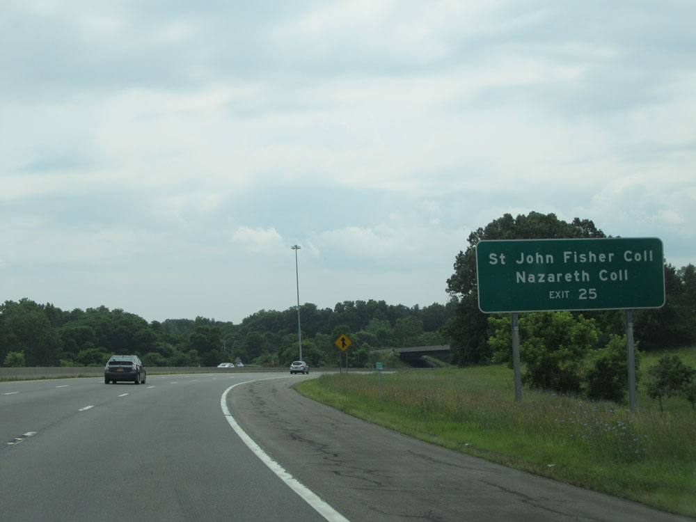 |
Take Exit 25 to St John Fisher College and Nazareth College. (Photo taken 7/4/15). |
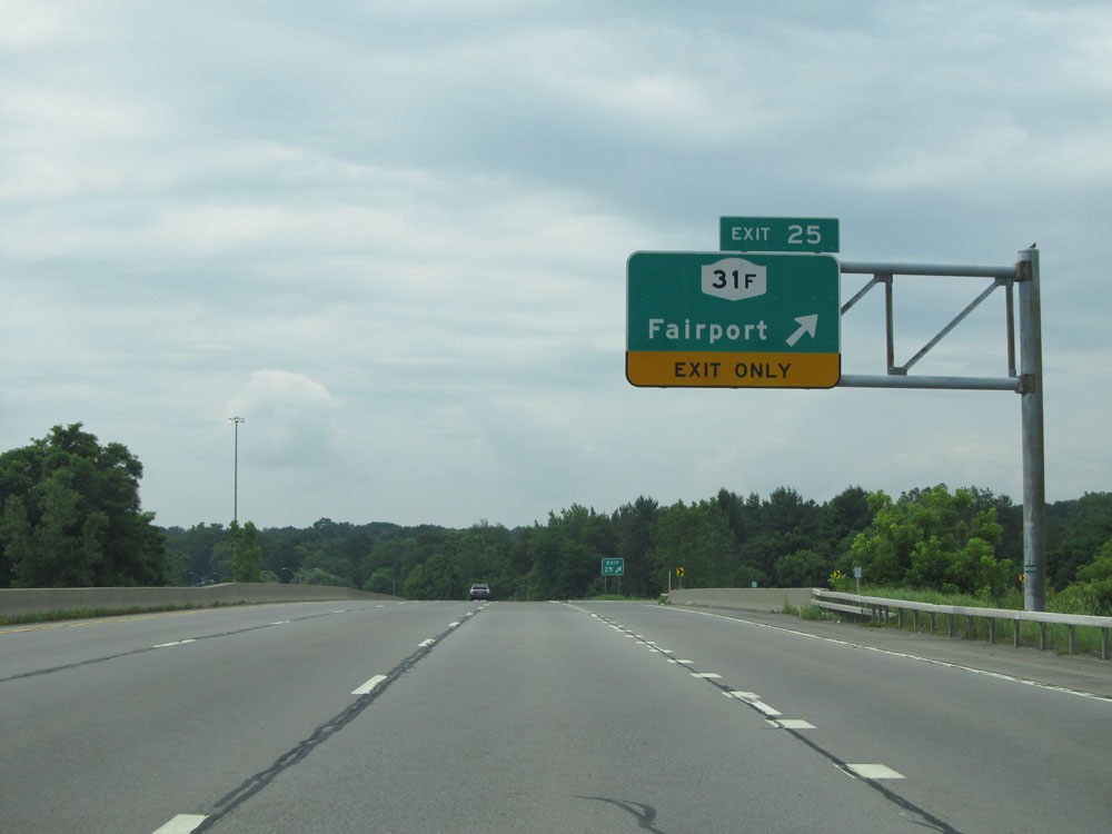 |
Interstate 490 East at Exit 25: NY 31F - Fairport (Photo taken 7/4/15). |
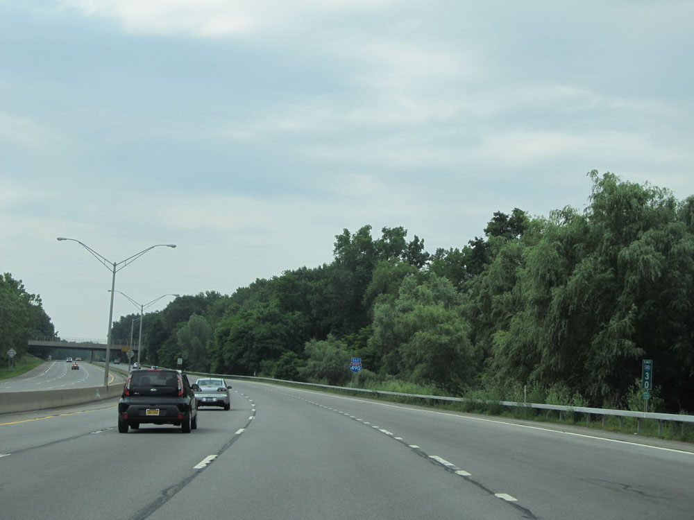 |
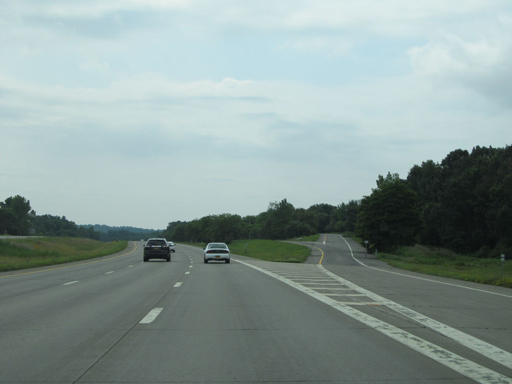
Interstate 490 East: Road view from mile marker 30. (Photo taken 7/4/15). |
 |
Just past mile marker 30, the standard speed limit of 65 mph resumes. (Photo taken 7/4/15). |
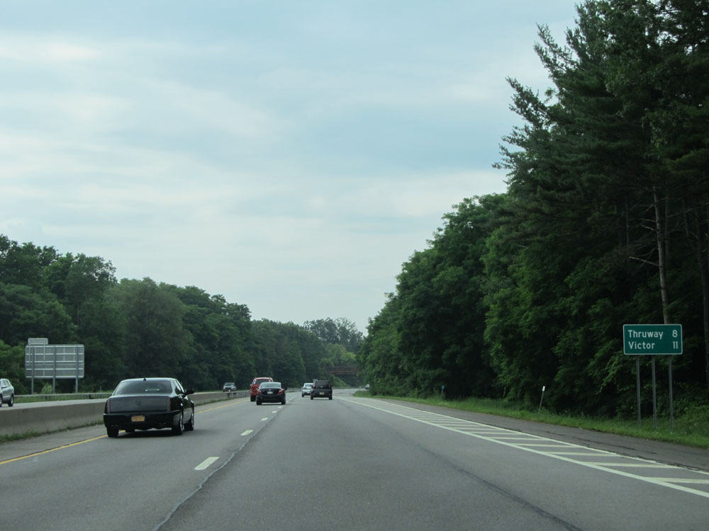 |
Mileage sign on Interstate 490 East. It's 8 miles to the interchange for Interstate 90 (NYS Thruway and eastern terminus of I-490) and 11 miles to Victor. (Photo taken 7/4/15). |
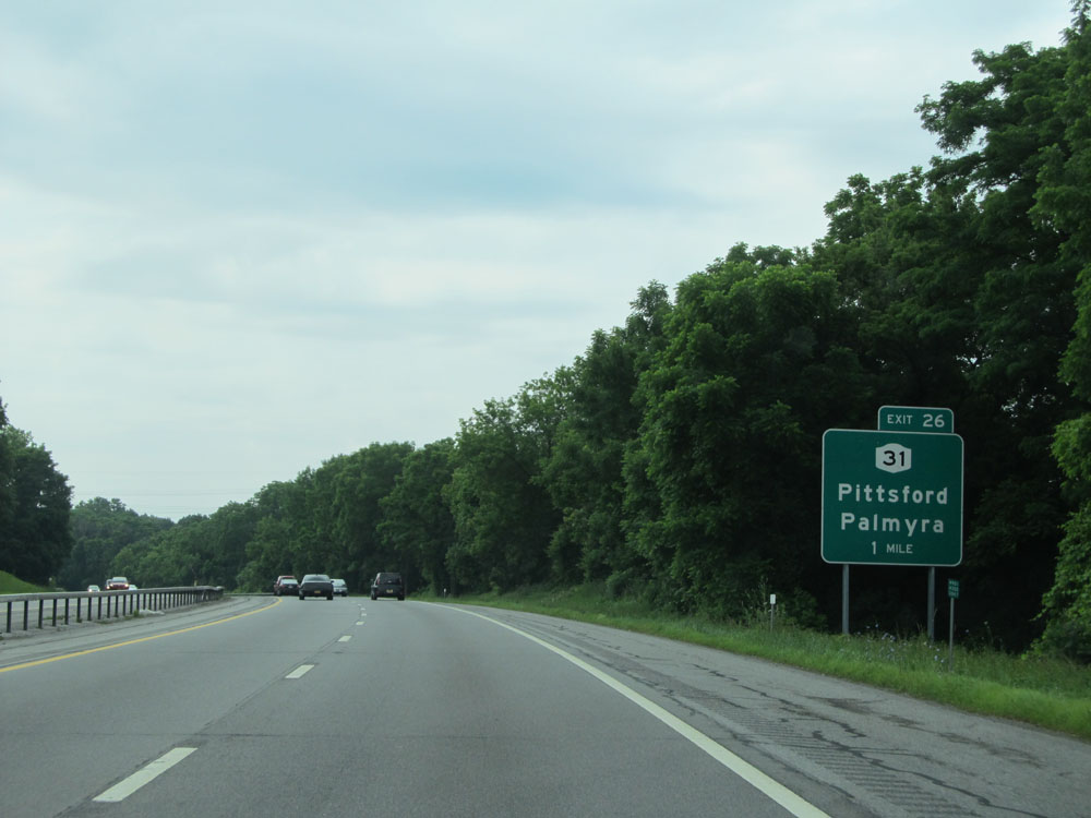 |
Interstate 490 East approaching Exit 26 - 1 mile. (Photo taken 7/4/15). |
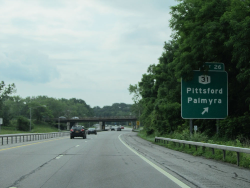 |
Interstate 490 East at Exit 26: NY 31 - Pittsford / Palmyra (Photo taken 7/4/15). |
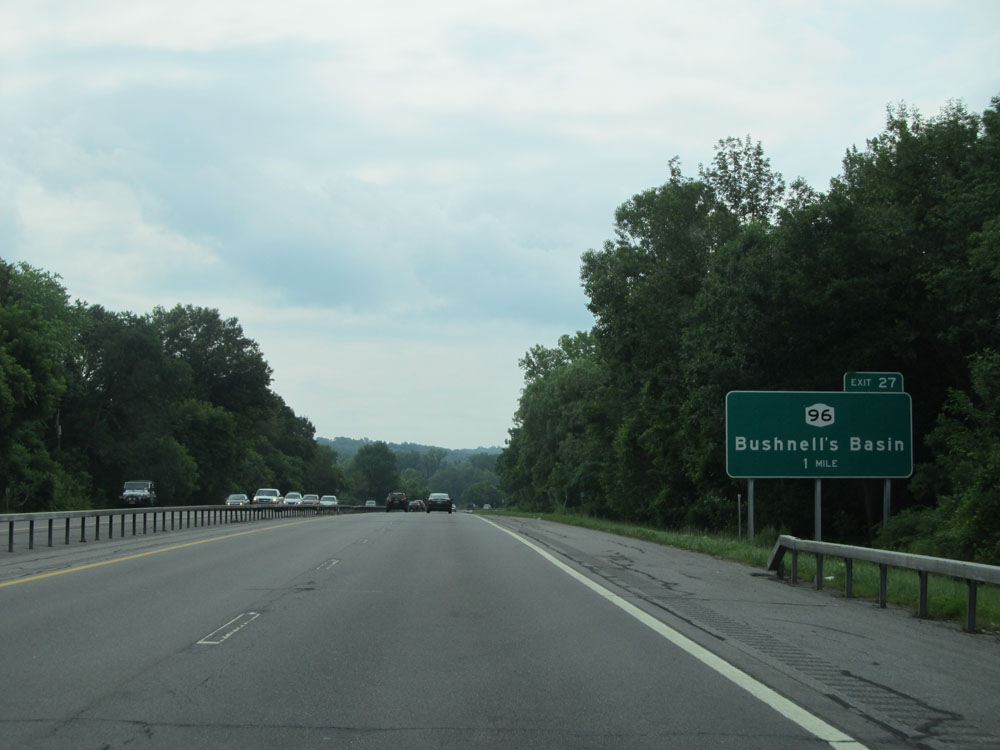 |
Interstate 490 East approaching Exit 27 - 1 mile. (Photo taken 7/4/15). |
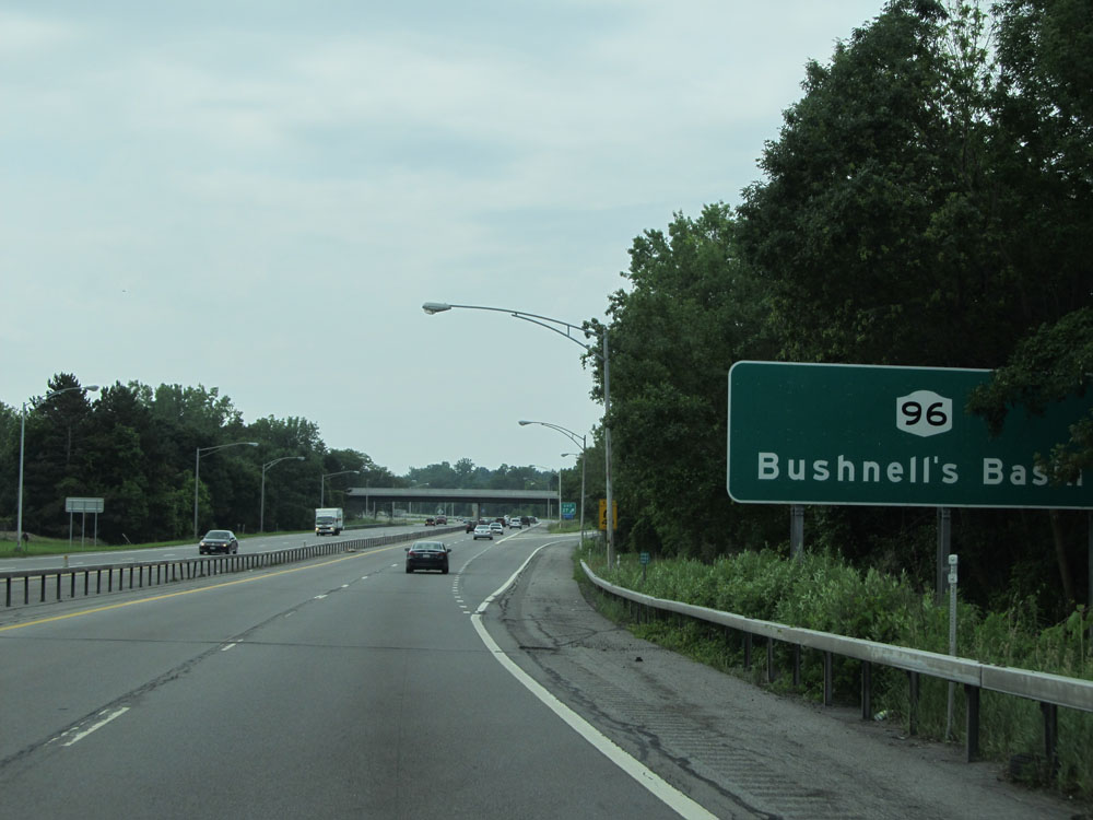 |
Interstate 490 East at Exit 27: NY 96 - Bushnell's Basin (Photo taken 7/4/15). |
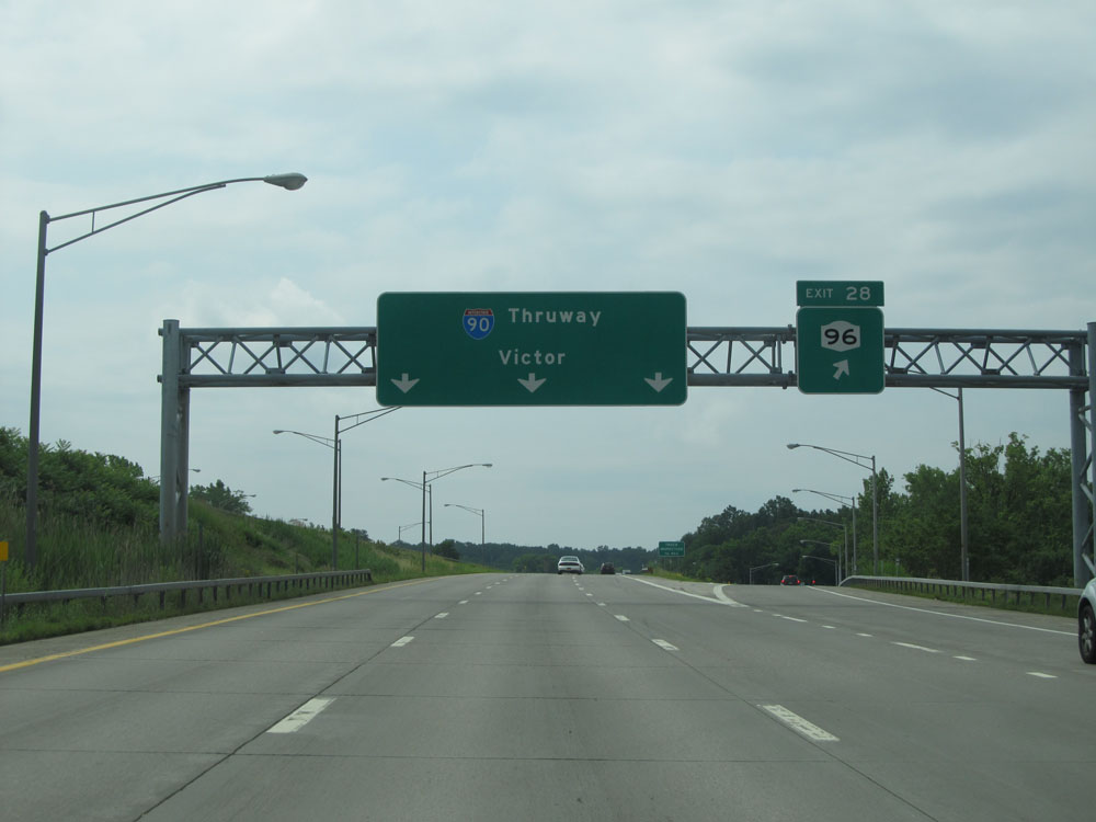 |
Interstate 490 East at Exit 28: NY 96 (Photo taken 7/4/15). |
 |
Approaching another Truck Inspection Station, the same rule of thumb applies; all commercial vehicles must enter when the lights on this sign are flashing. (Photo taken 7/4/15). |
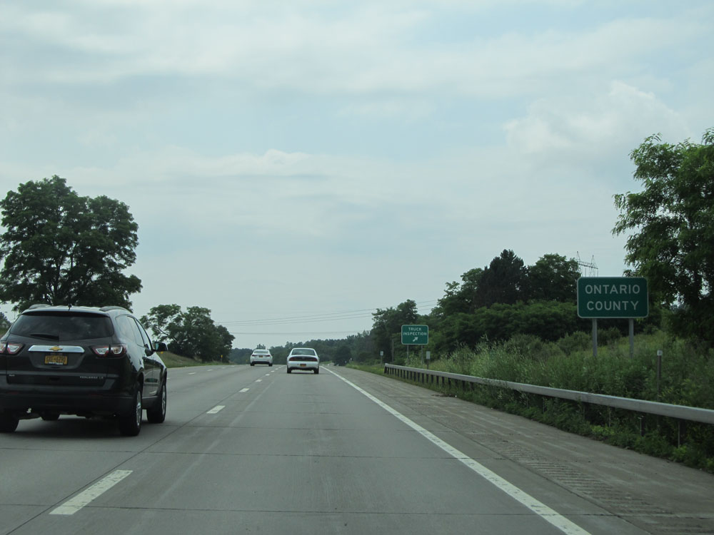 |
Interstate 490 East as it enters Ontario County. (Photo taken 7/4/15). |
 |
Interstate 490 East at the Truck Inspection Station located near mile marker 35. (Photo taken 7/4/15). |
 |
Interstate 490 East approaching the toll plaza for the junction of Interstate 90 (NYS Thruway) - 1 mile. (Photo taken 7/4/15). |
 |
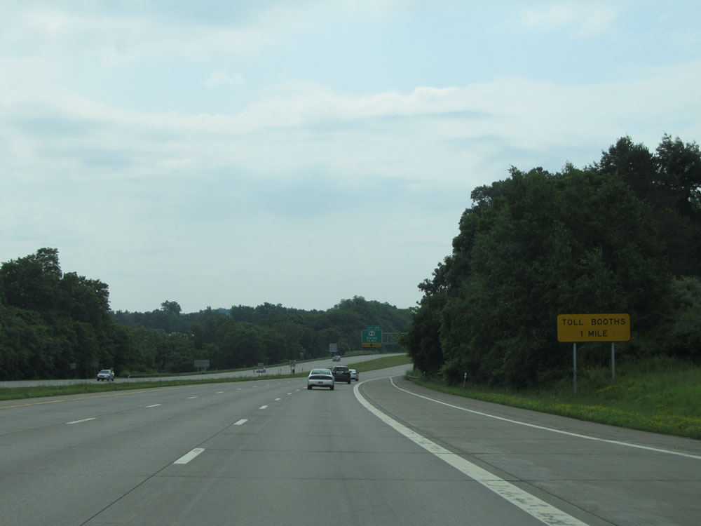
Exit 29 ahead is the final exit before the toll plaza. (Photo taken 7/4/15). |
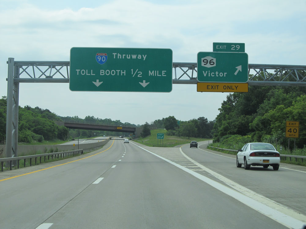 |
Interstate 490 East at Exit 29: NY 96 - Victor (Photo taken 7/4/15). |
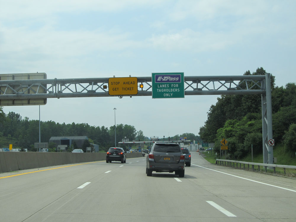 |
Interstate 490 East approaching the toll plaza and the eastern terminus of I-490. (Photo taken 7/4/15). |
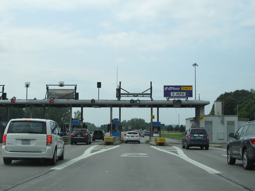 |
A closer view of the toll plaza, as Interstate 490 East comes to an end. (Photo taken 7/4/15). |