Road Information |
||
 |
||
| Total Mileage in State: | 120 miles | |
| Northern End: | At I-95, in Salisbury | |
| Southern End: | At I-195/MA 25, in Wareham | |
| Mileage covered in Photos: | 120 miles | |
| Counties covered in Photos: | Essex, Middlesex, Worcester, Middlesec, Worcester, Middlesex, Worcester, Norfolk, Bristol, Plymouth | |
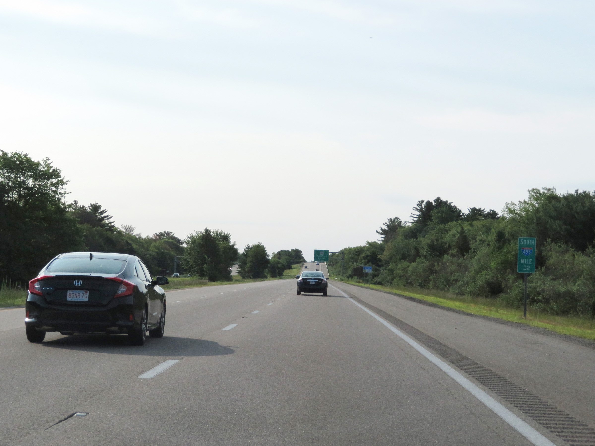
| Major Junctions in Photos: | I-93, in Andover I-290, in Marlboro I-90 (Mass Pike), in Hopkinton I-95, in Foxboro I-195, in Wareham |
|
| Control Cities in Photos: | Salisbury, Haverhill, Andover, Lowell, Littleton, Marlboro, Mansfield, Wareham | |
Southbound
- Section 1: Interstate 95 to Littleton (Exit 31)
- Section 2: Littleton (Exit 31) to Franklin (Exit 16)
- Section 3: Franklin (Exit 16) to Interstate 195
Section 1: Interstate 95 to Littleton (Exit 31)
 |
Merging onto Interstate 495 South from Interstate 95 South via Exit 59 in Salisbury. (Photo taken 8/6/17). |
 |
Interstate 495 South reassurance shield as the alignment begins. (Photo taken 8/6/17). |
 |
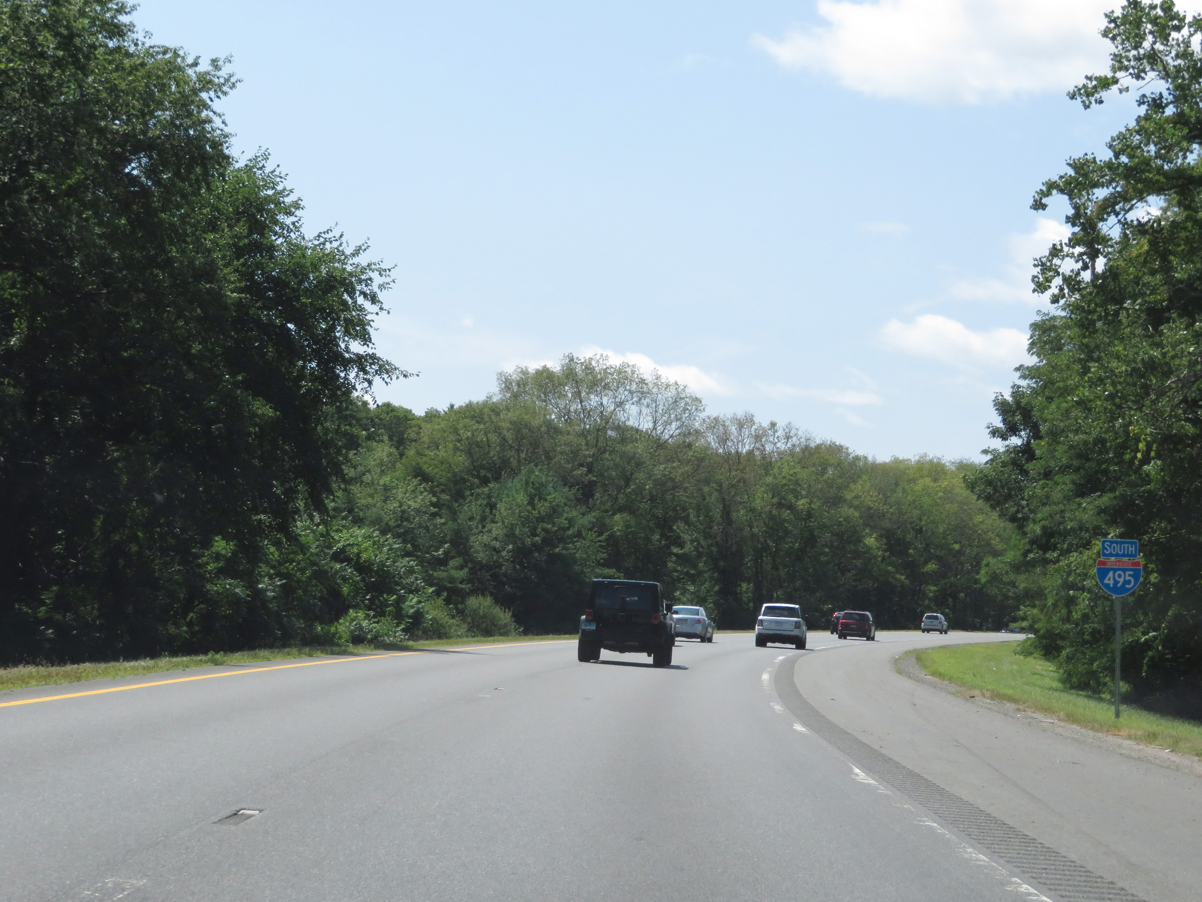
Interstate 495 BEGIN marker, posted after the above reassurance shield. (Photo taken 8/6/17). |
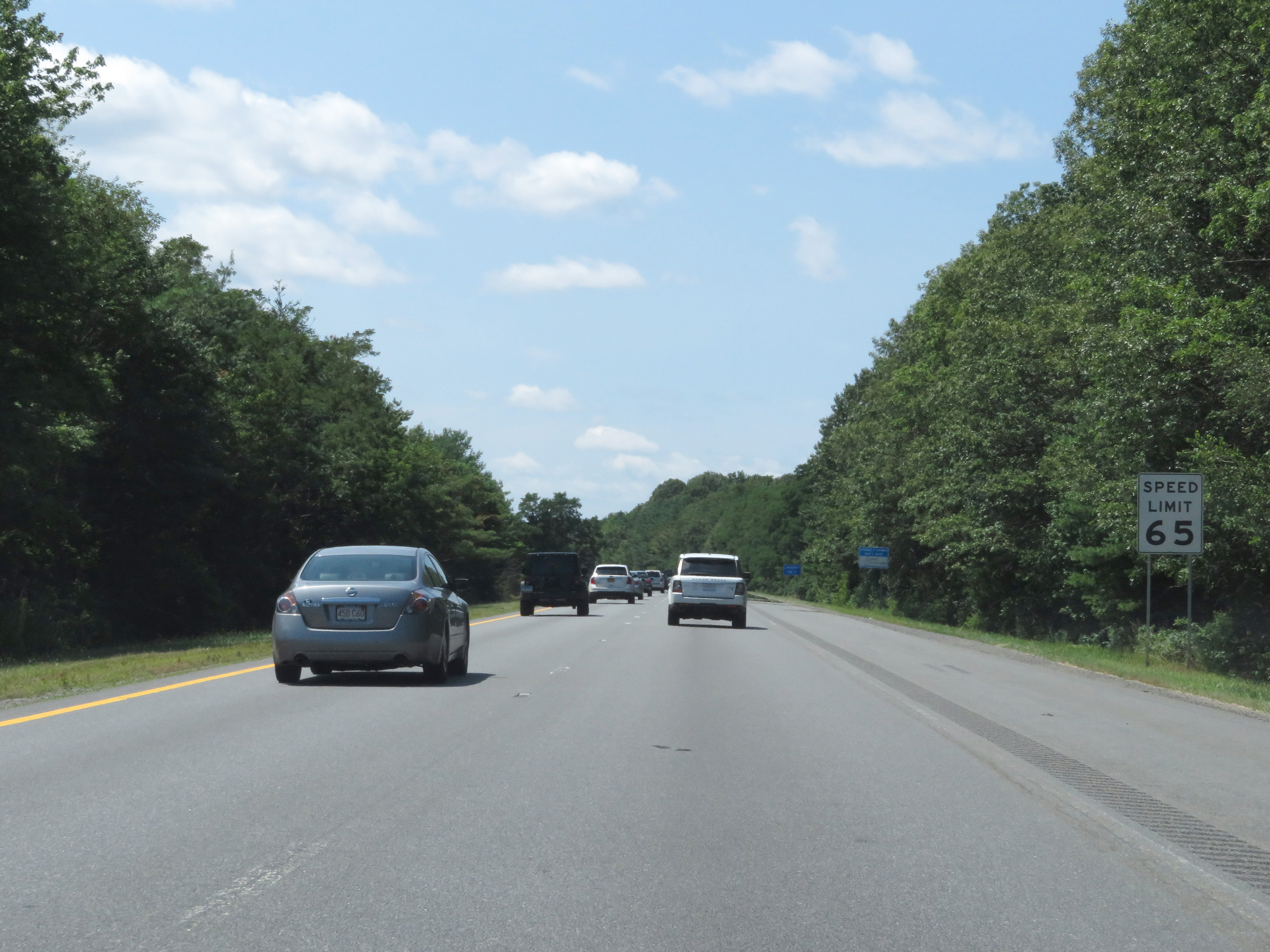 |
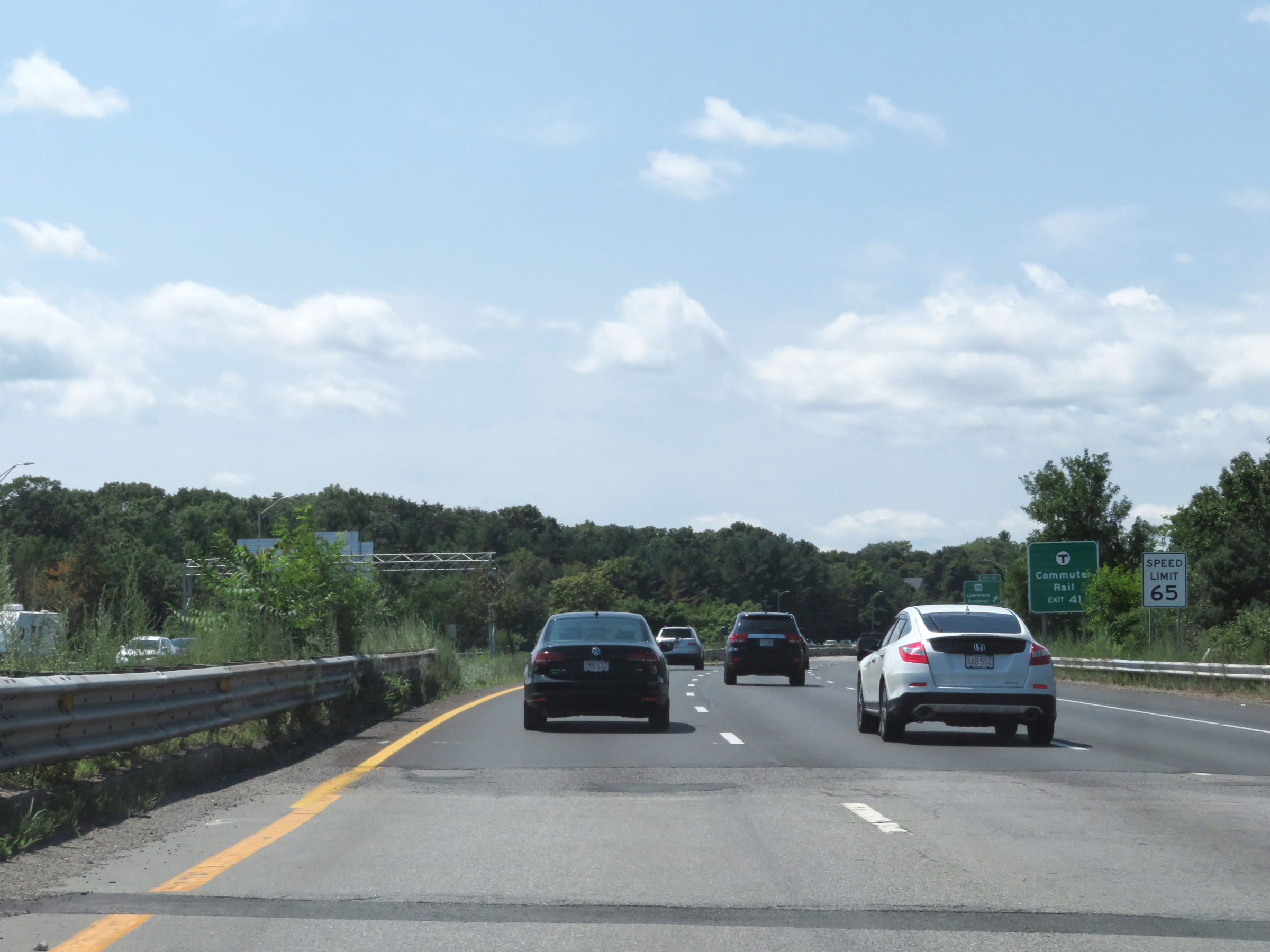
The speed limit on Interstate 495 South starts at 65 mph. This is the standard speed limit on most rural Interstate highways in Massachusetts. (Photo taken 8/6/17). |
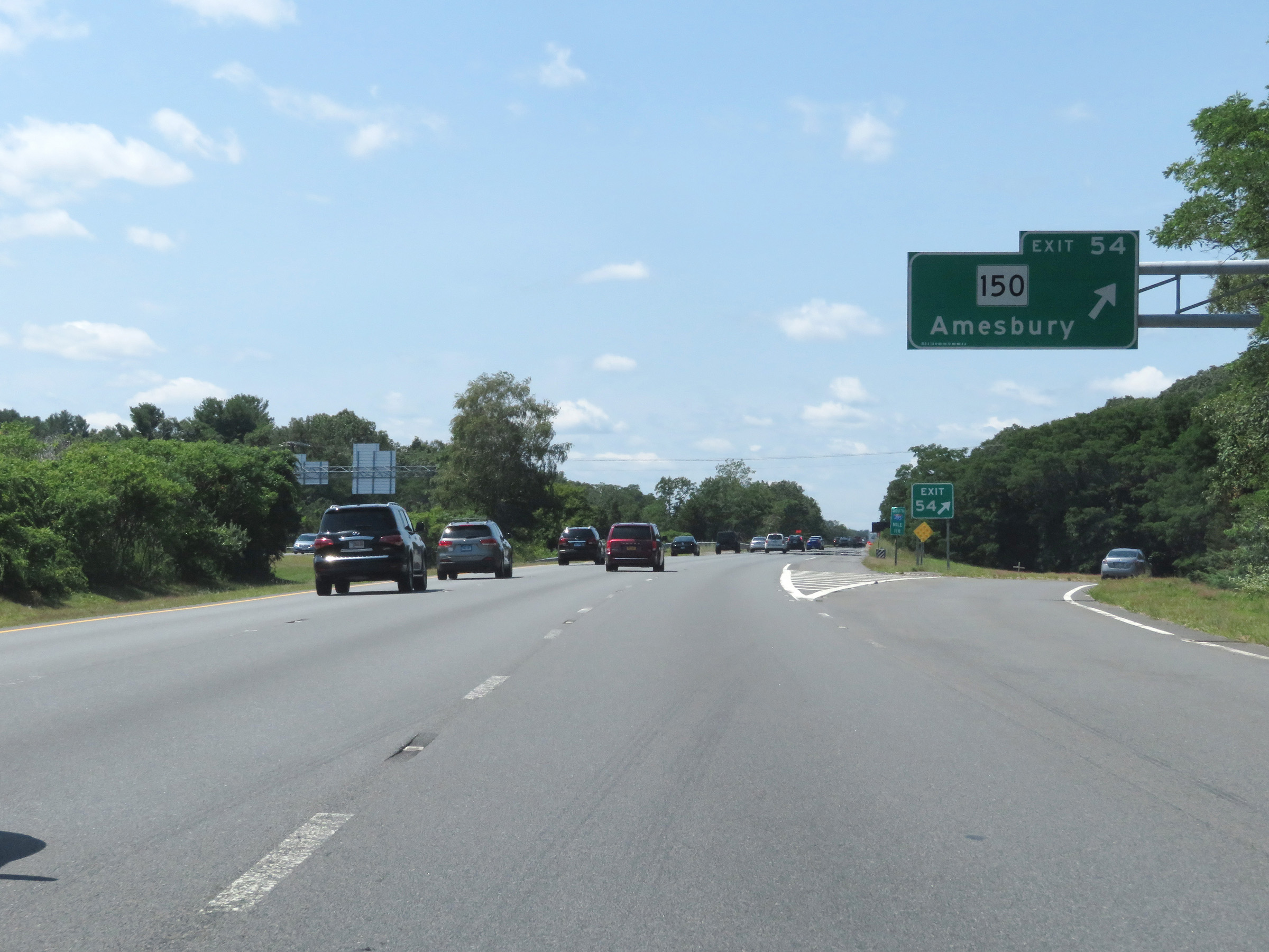 |
Interstate 495 South at Exit 54: MA 150 - Amesbury (Photo taken 8/6/17). |
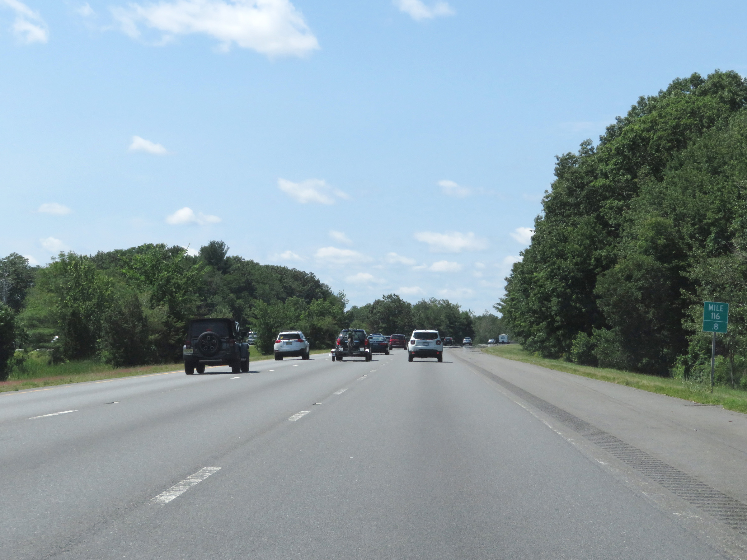 |
View on Interstate 495 South at mile marker 116.8. (Photo taken 8/6/17). |
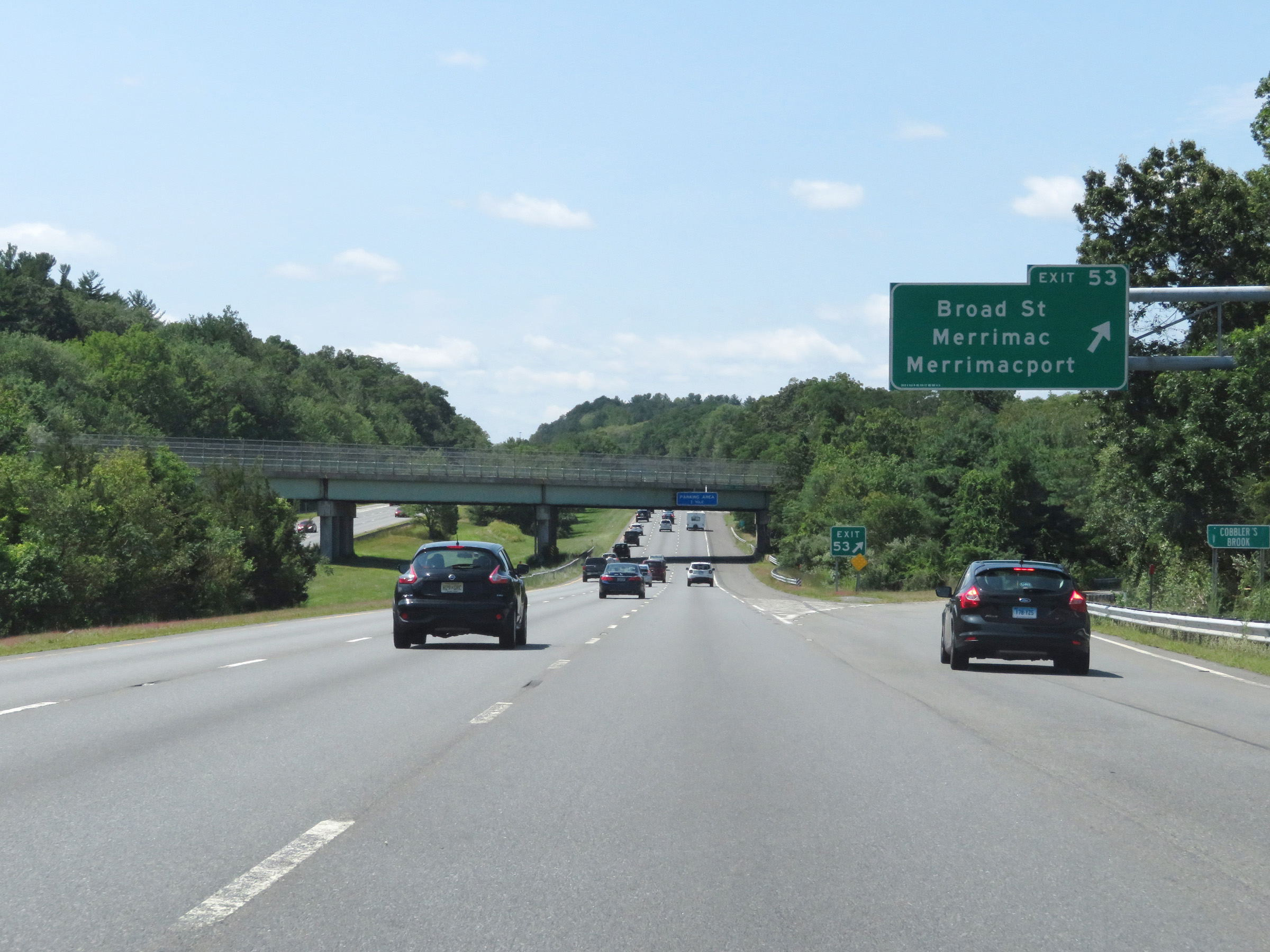 |
Interstate 495 South at Exit 53: Broad St / Merrimac / Merrimacport (Photo taken 8/6/17). |
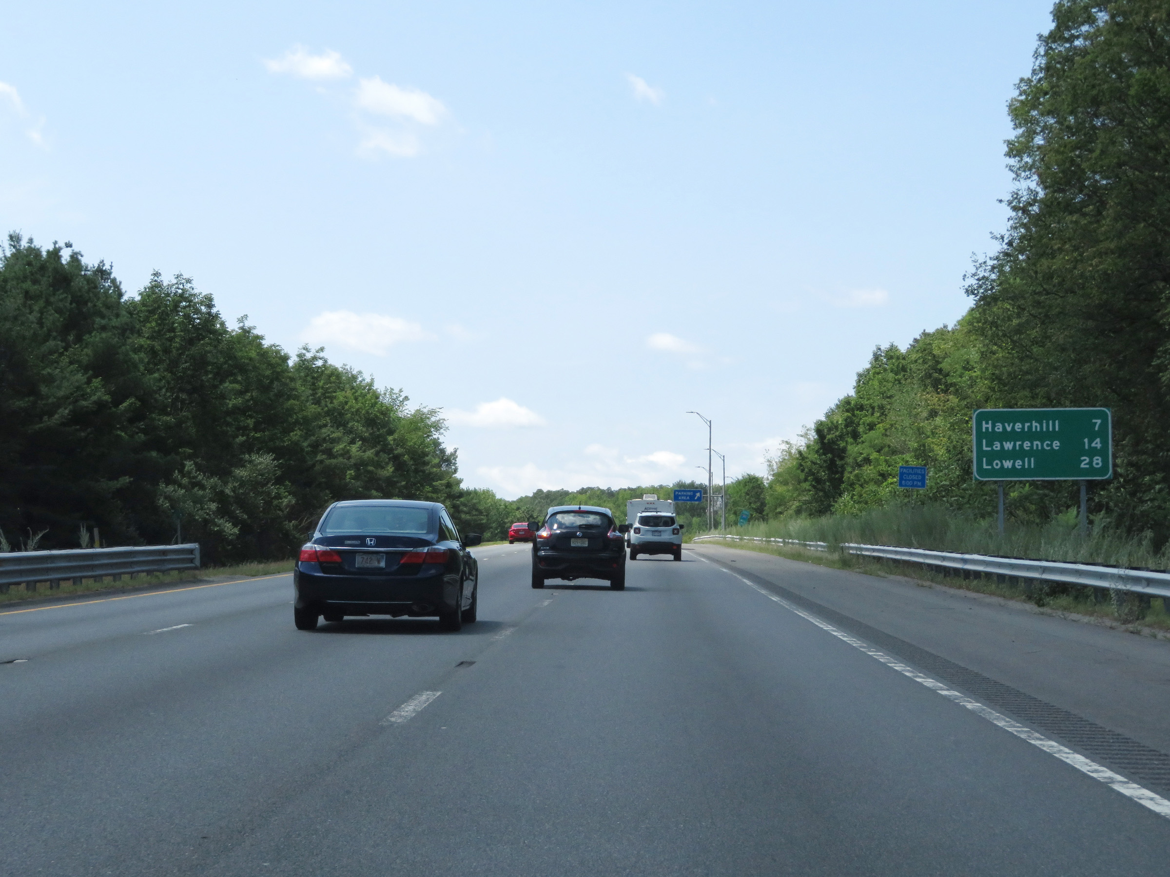 |
Mileage sign on Interstate 495 South. It's 7 miles to Haverhill, 14 miles to Lawrence, and 28 miles to Lowell. (Photo taken 8/6/17). |
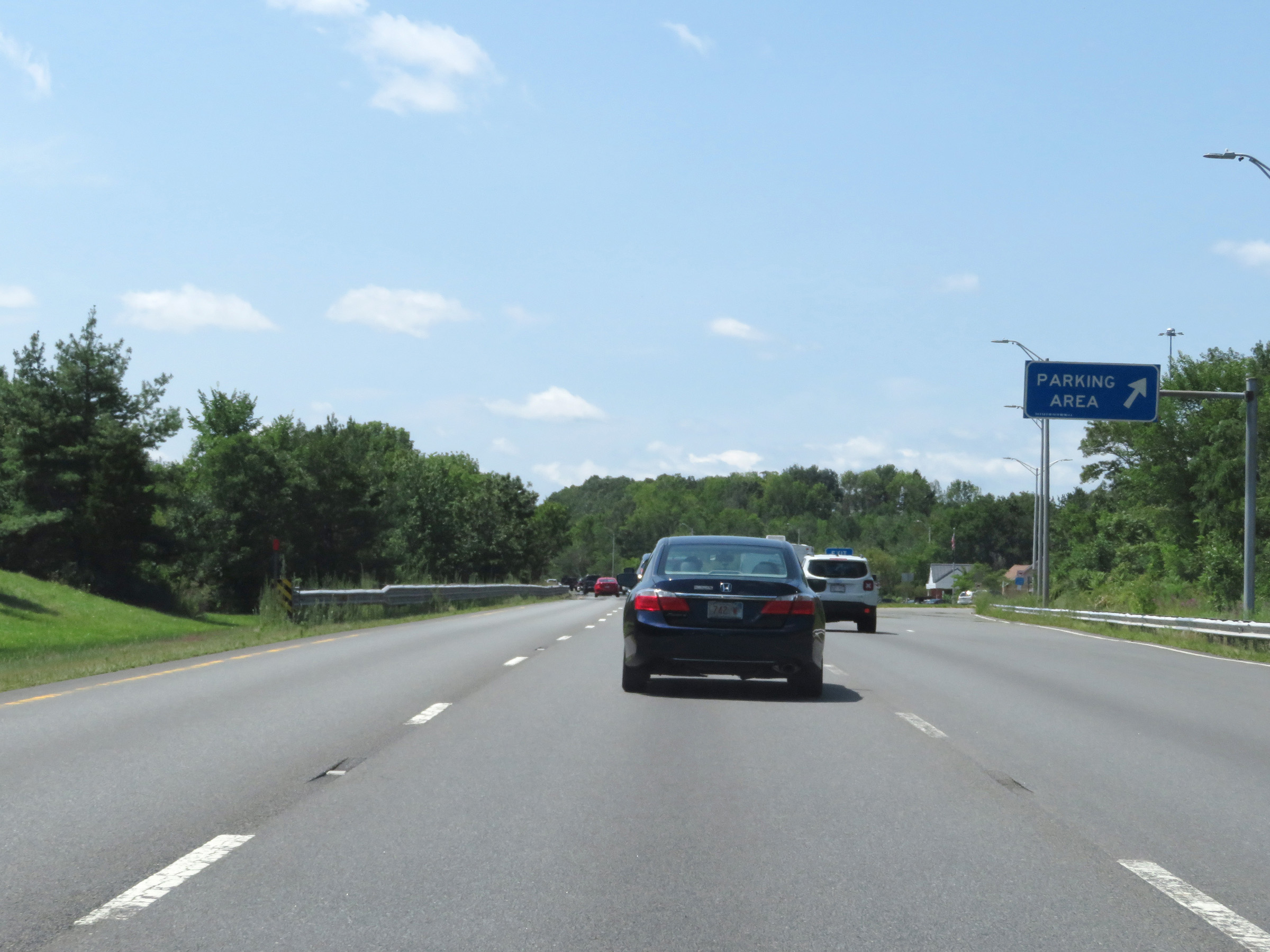 |
Parking Area on Interstate 495 South in Essex County. (Photo taken 8/6/17). |
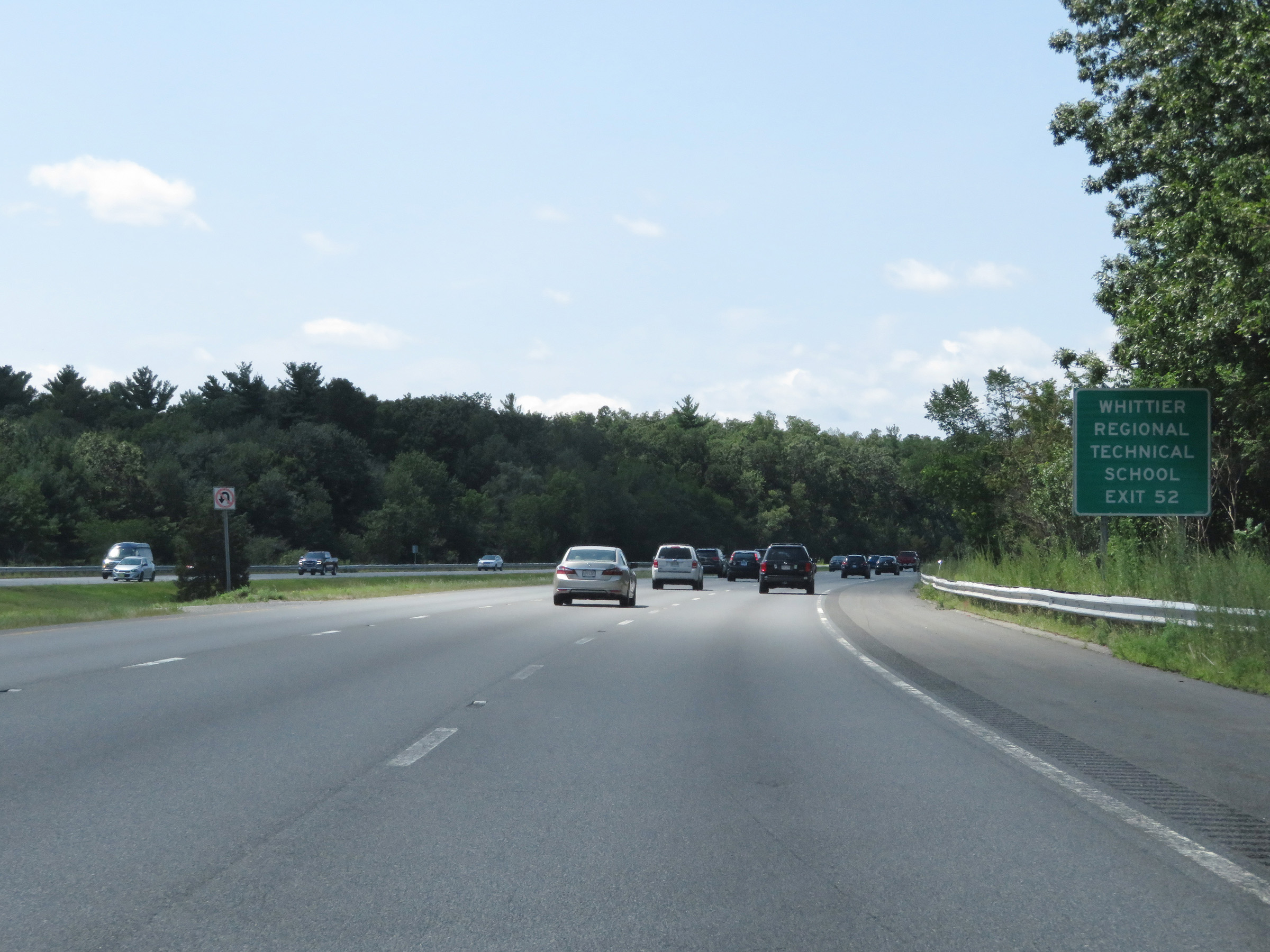 |
Take Exit 52 to Whittier Regional Technical School. (Photo taken 8/6/17). |
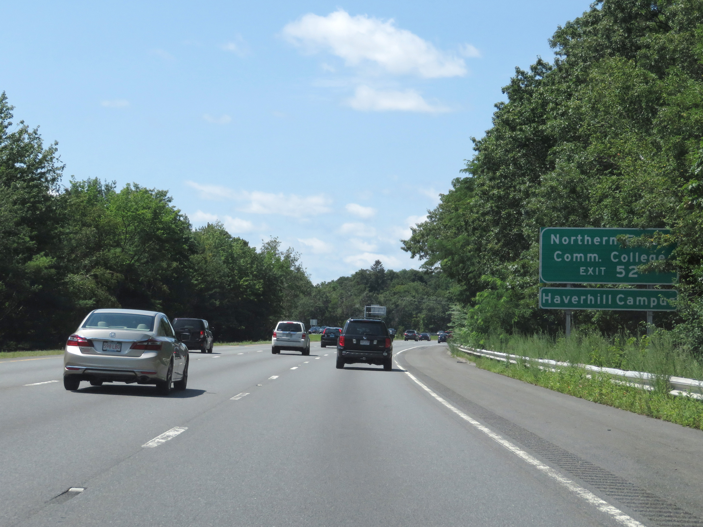 |
Also take Exit 52 to Northern Essex Community College. (Photo taken 8/6/17). |
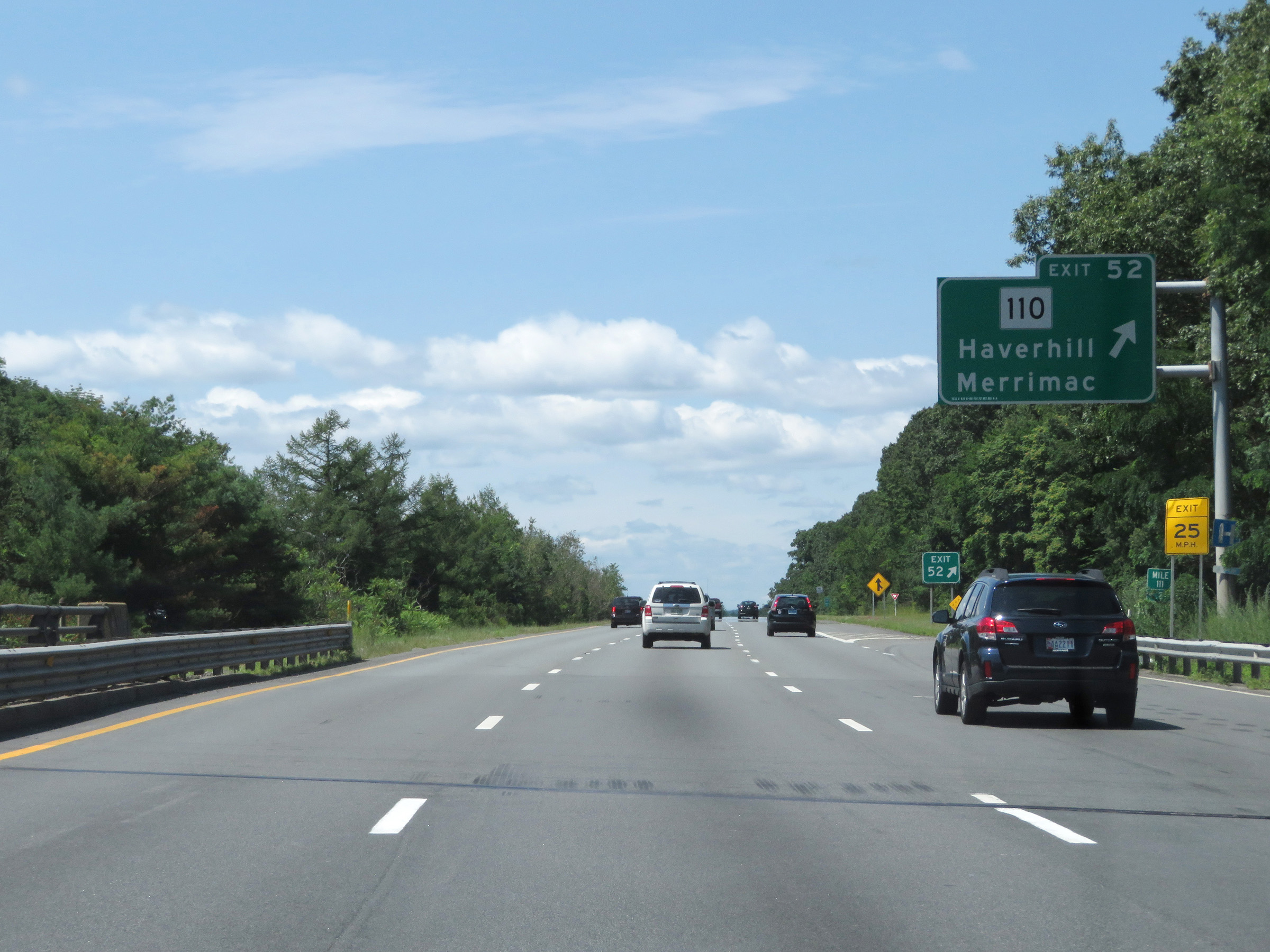 |
Interstate 495 South at Exit 52: MA 110 - Haverhill / Merrimac (Photo taken 8/6/17). |
 |
Interstate 495 South reassurance shield at mile marker 110.8. (Photo taken 8/6/17). |
 |
Overhead mileage sign listing the distances to the three upcoming exits to downtown Haverhill. (Photo taken 8/6/17). |
 |
Interstate 495 South at Exit 51: MA 125 - Plaistow, NH / Haverhill (Photo taken 8/6/17). |
 |
Interstate 495 South at Exit 51B: MA 125 North - Plaistow, NH (Photo taken 8/6/17). |
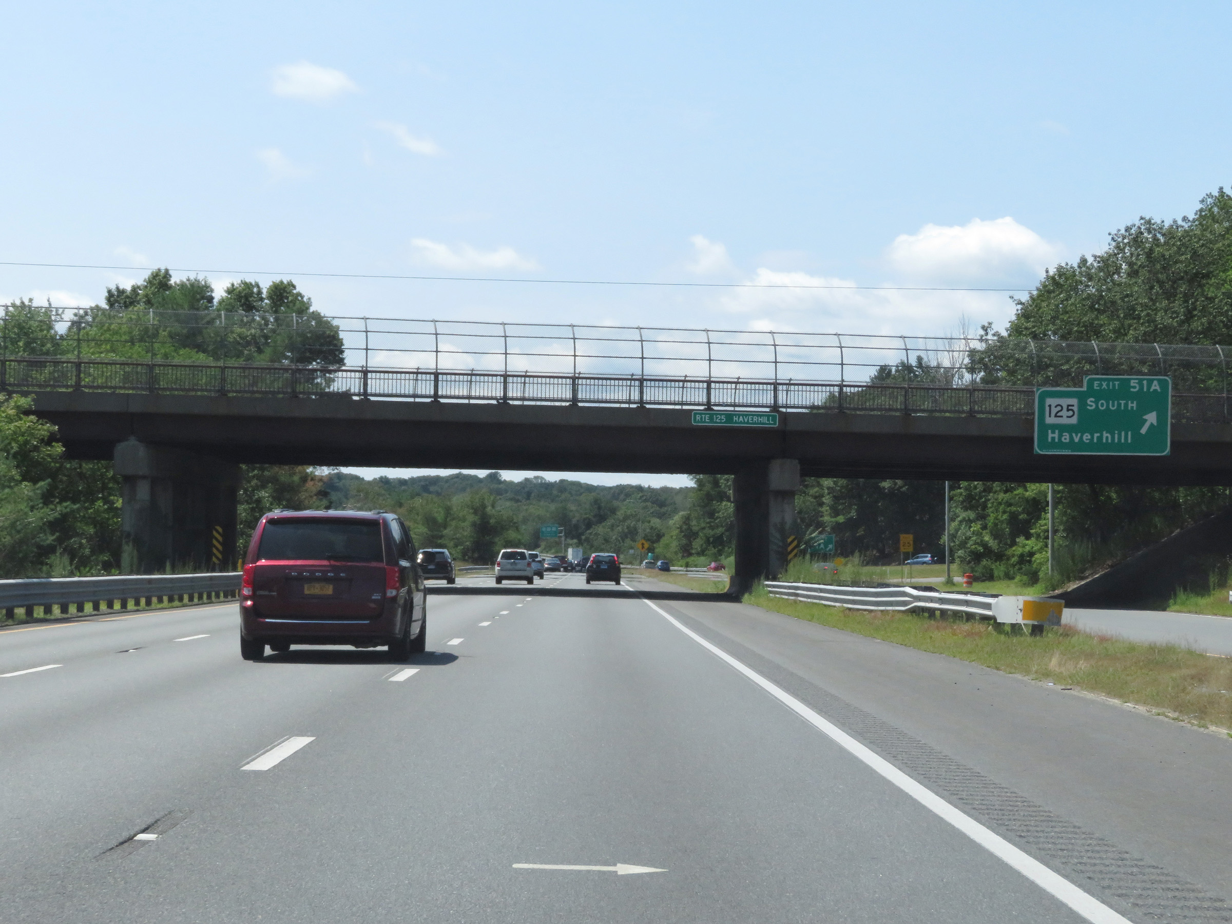 |
Interstate 495 South at Exit 51A: MA 125 South - Haverhill (Photo taken 8/6/17). |
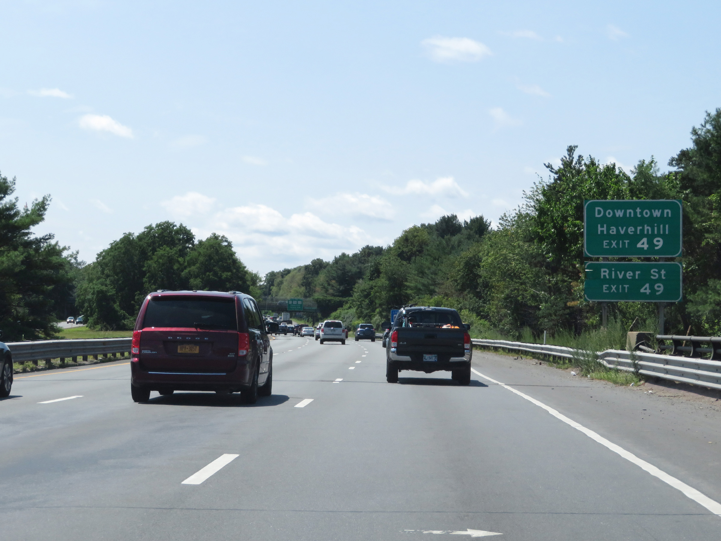 |
Take Exit 49 to Downtown Haverhill and River St. (Photo taken 8/6/17). |
 |
Interstate 495 South at Exits 50-49: MA 97 / MA 110 / MA 113 - Haverhill / Salem, NH (Photo taken 8/6/17). |
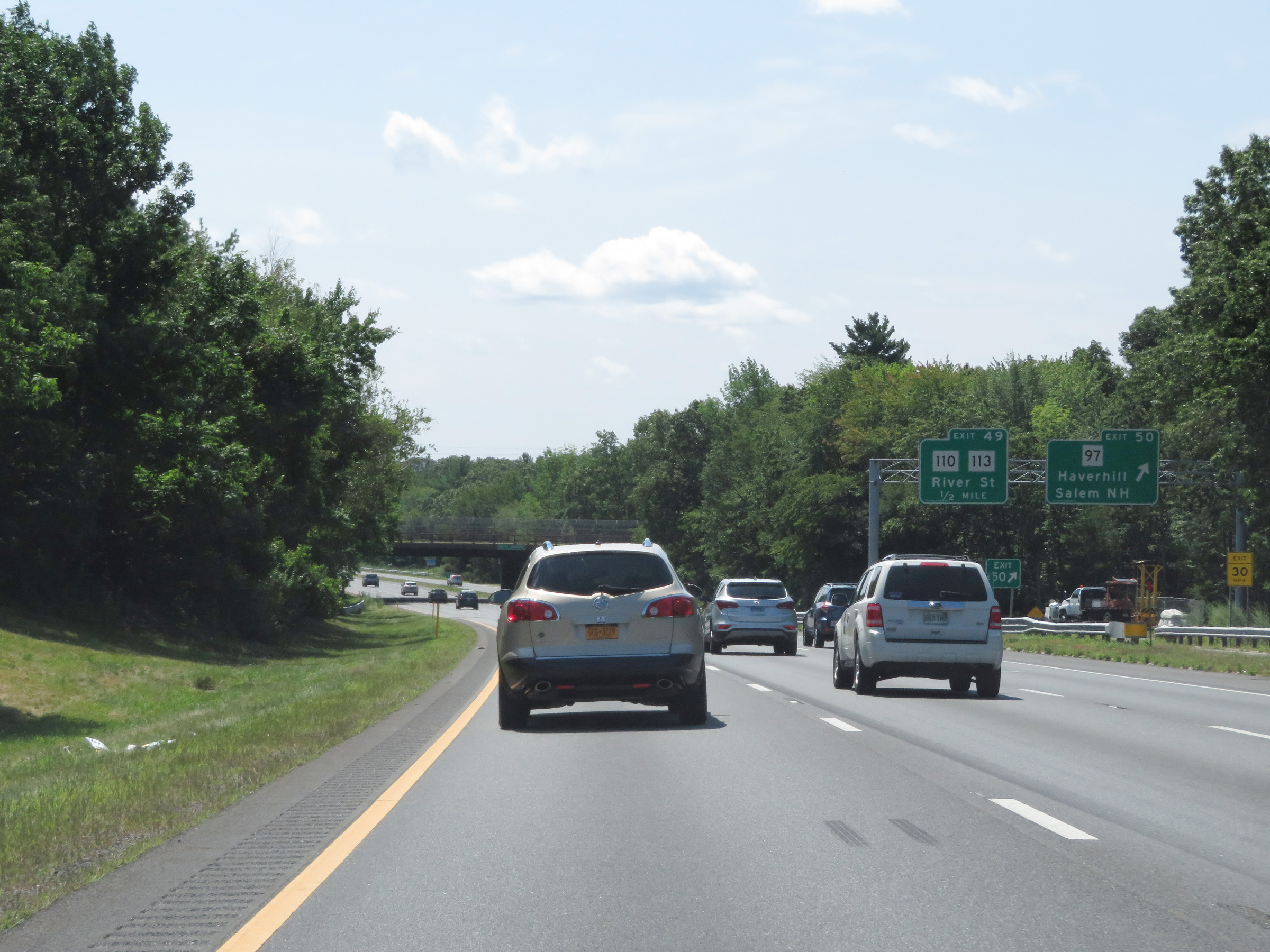 |
Interstate 495 South at Exit 50: MA 97 - Haverhill / Salem, NH (Photo taken 8/6/17). |
 |
Interstate 495 South at Exit 49: MA 110 / MA 113 - River St (Photo taken 8/6/17). |
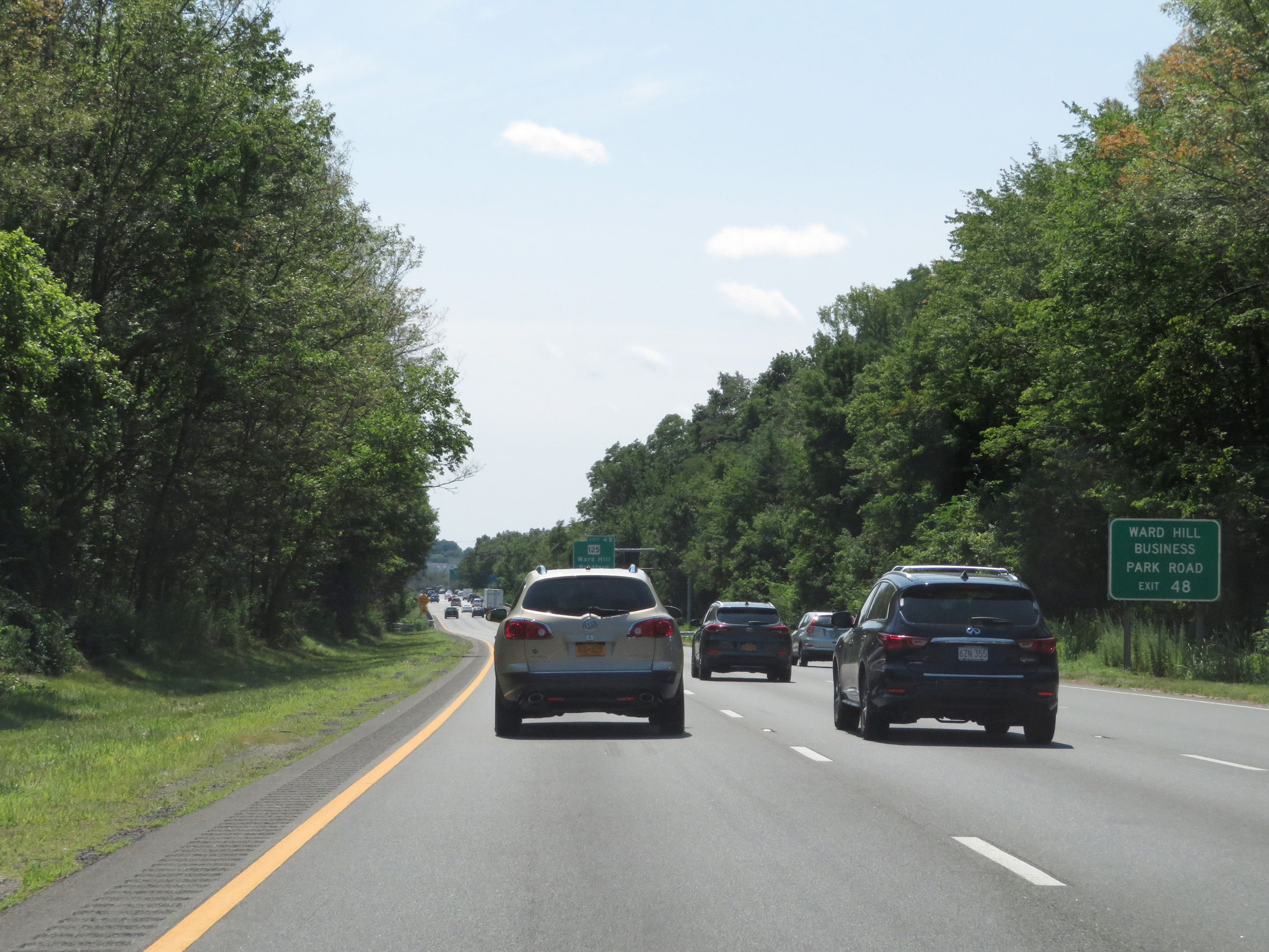 |
Take Exit 48 to Ward Hill Business Park Road. (Photo taken 8/6/17). |
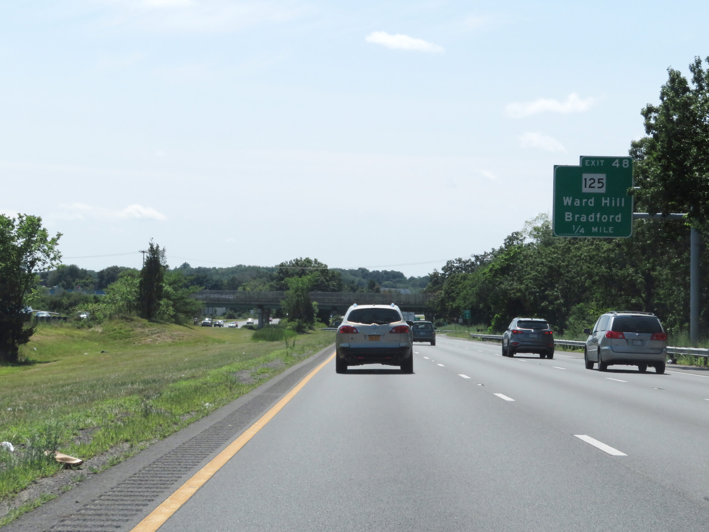 |
Interstate 495 South approaching Exit 48 - 1/4 mile. (Photo taken 8/6/17). |
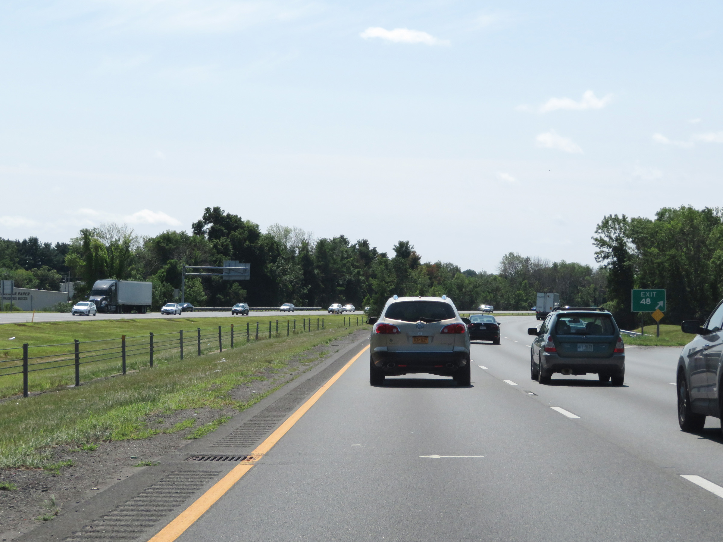 |
Interstate 495 South at Exit 48: MA 125 - Ward Hill / Bradford (Photo taken 8/6/17). |
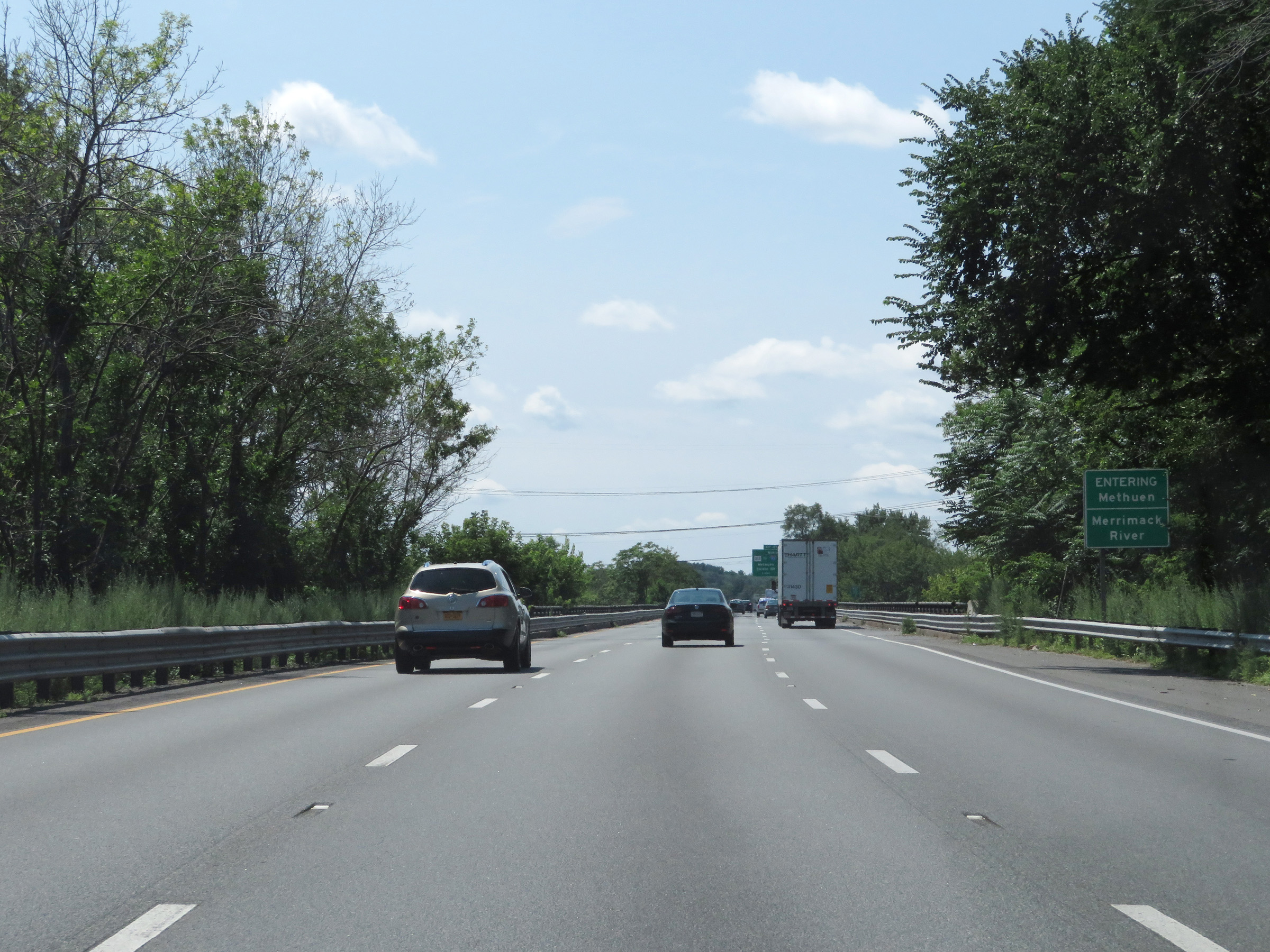 |
Interstate 495 South as it crosses the Merrimack River. (Photo taken 8/6/17). |
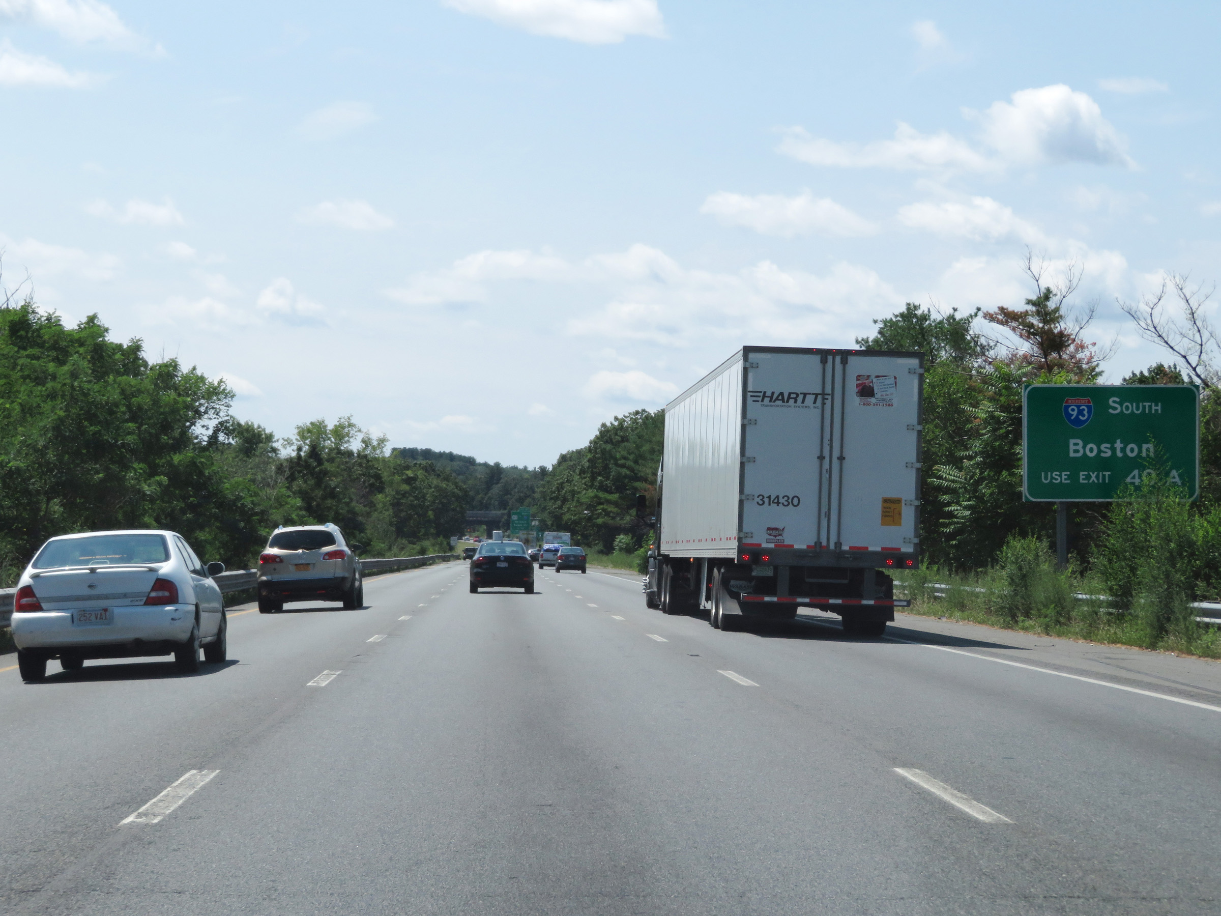 |
Traffic to Boston should use Interstate 93 South via Exit 40A. (Photo taken 8/6/17). |
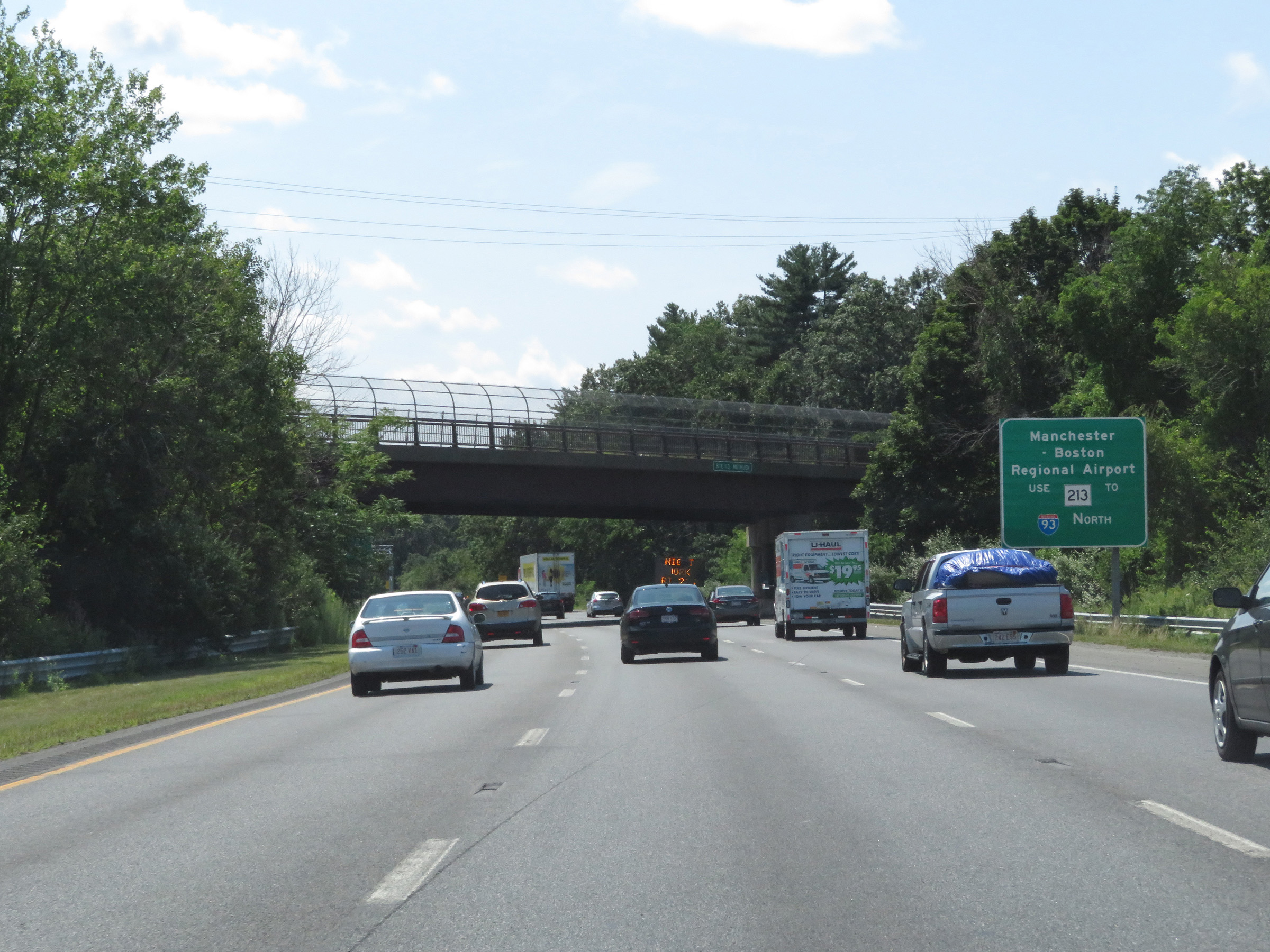 |
Take Exit 47 and follow MA 213 West to Interstate 93 North to get to Manchester-Boston Regional Airport. (Photo taken 8/6/17). |
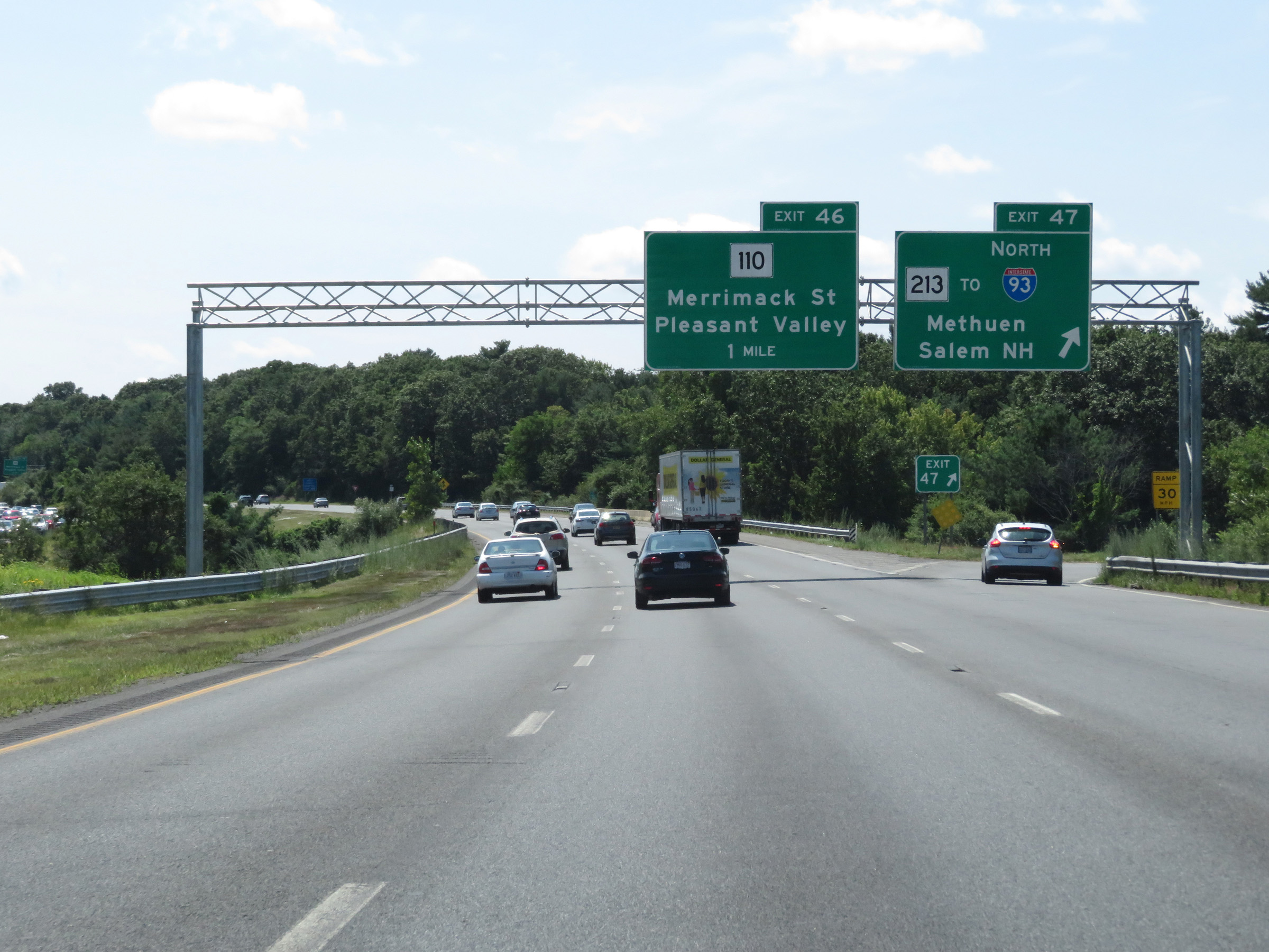 |
Interstate 495 South at Exit 47: MA 213 / To Interstate 93 North - Methuen / Salem, NH (Photo taken 8/6/17). |
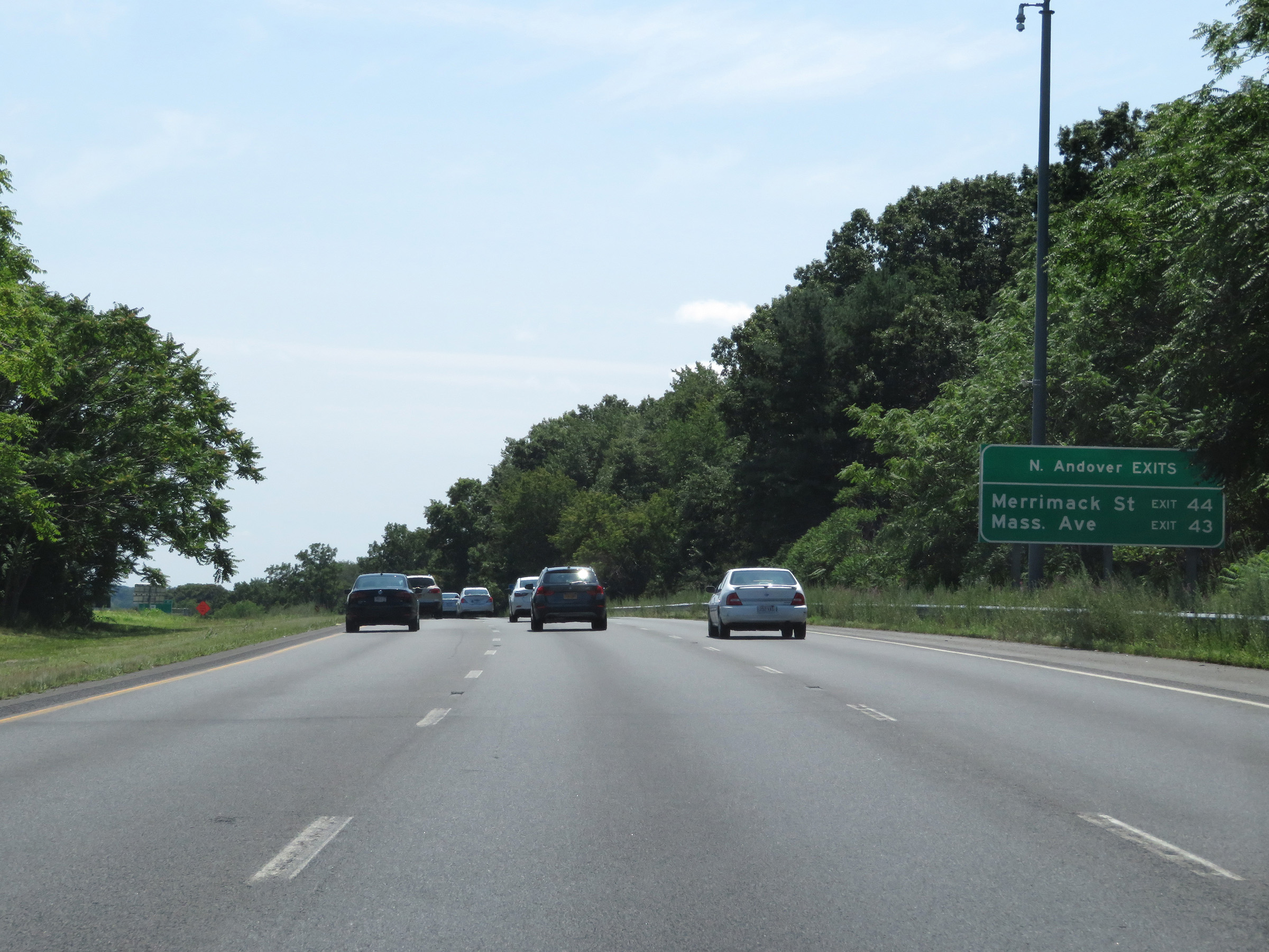 |
This sign displays the two upcoming exits to take to North Andover. (Photo taken 8/6/17). |
 |
Interstate 495 South at Exit 46: MA 110 - Merrimack St / Pleasant Valley (Photo taken 8/6/17). |
 |
Mileage sign listing the distances to the four upcoming exits to Lawrence. (Photo taken 8/6/17). |
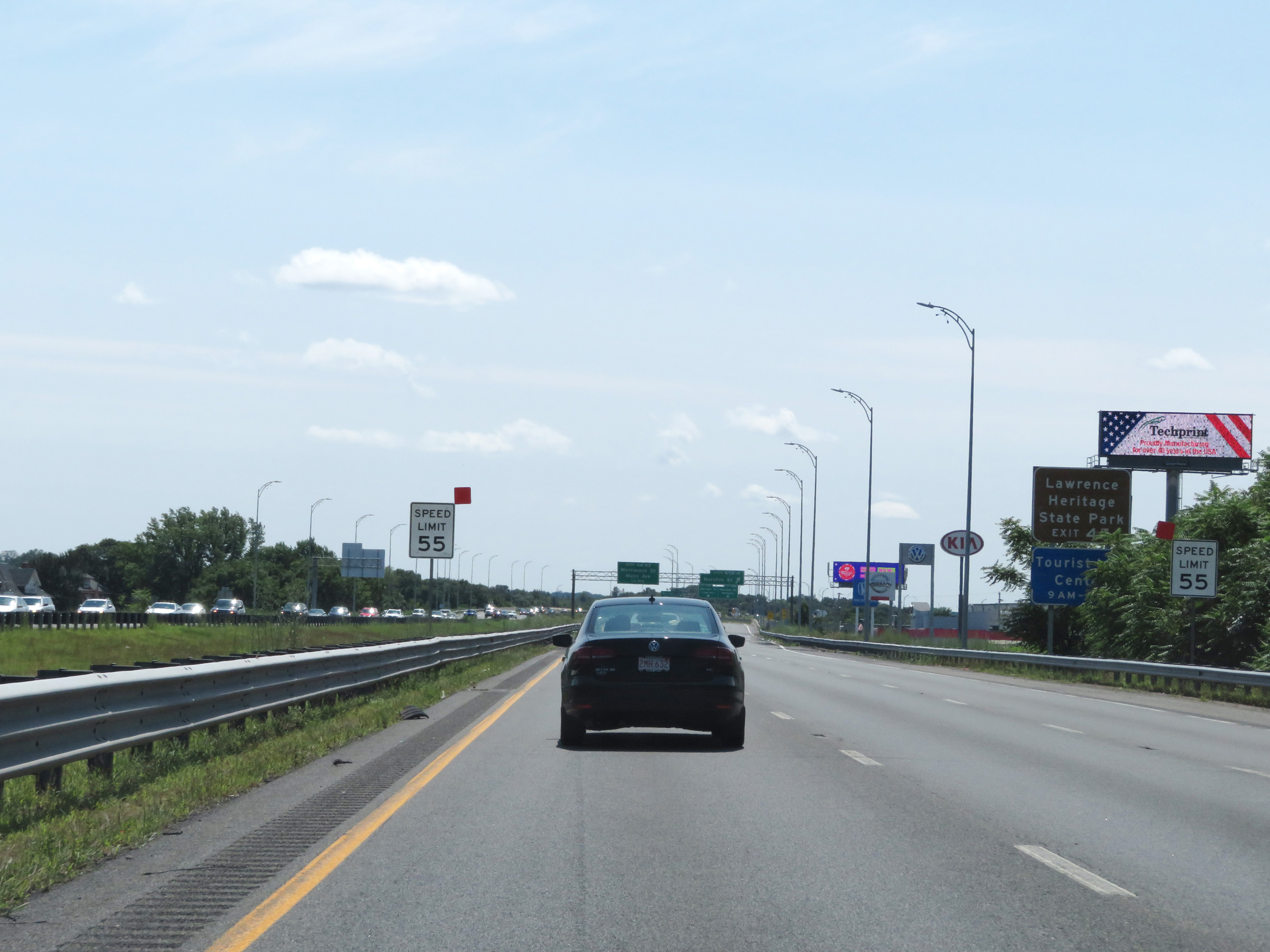 |
Approaching Exits 45B-A, the speed limit decreases to 55 mph. Take Exit 45A to Lawrence Heritage State Park. (Photo taken 8/6/17). |
 |
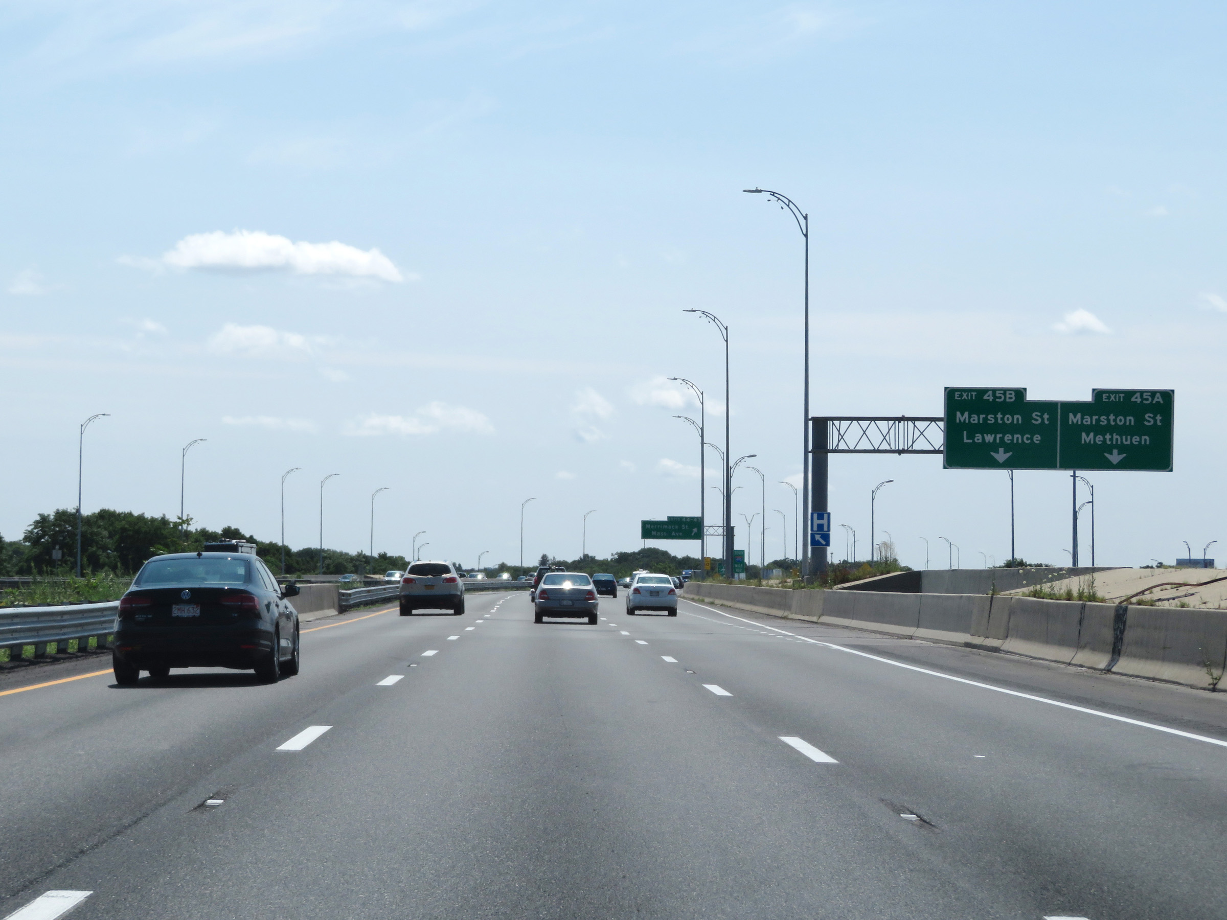
Interstate 495 South at Exits 45B-A: Marston St (Photo taken 8/6/17). |
 |
The ramp splits into two separate ramps for Exit 45B and Exit 45A here. (Photo taken 8/6/17). |
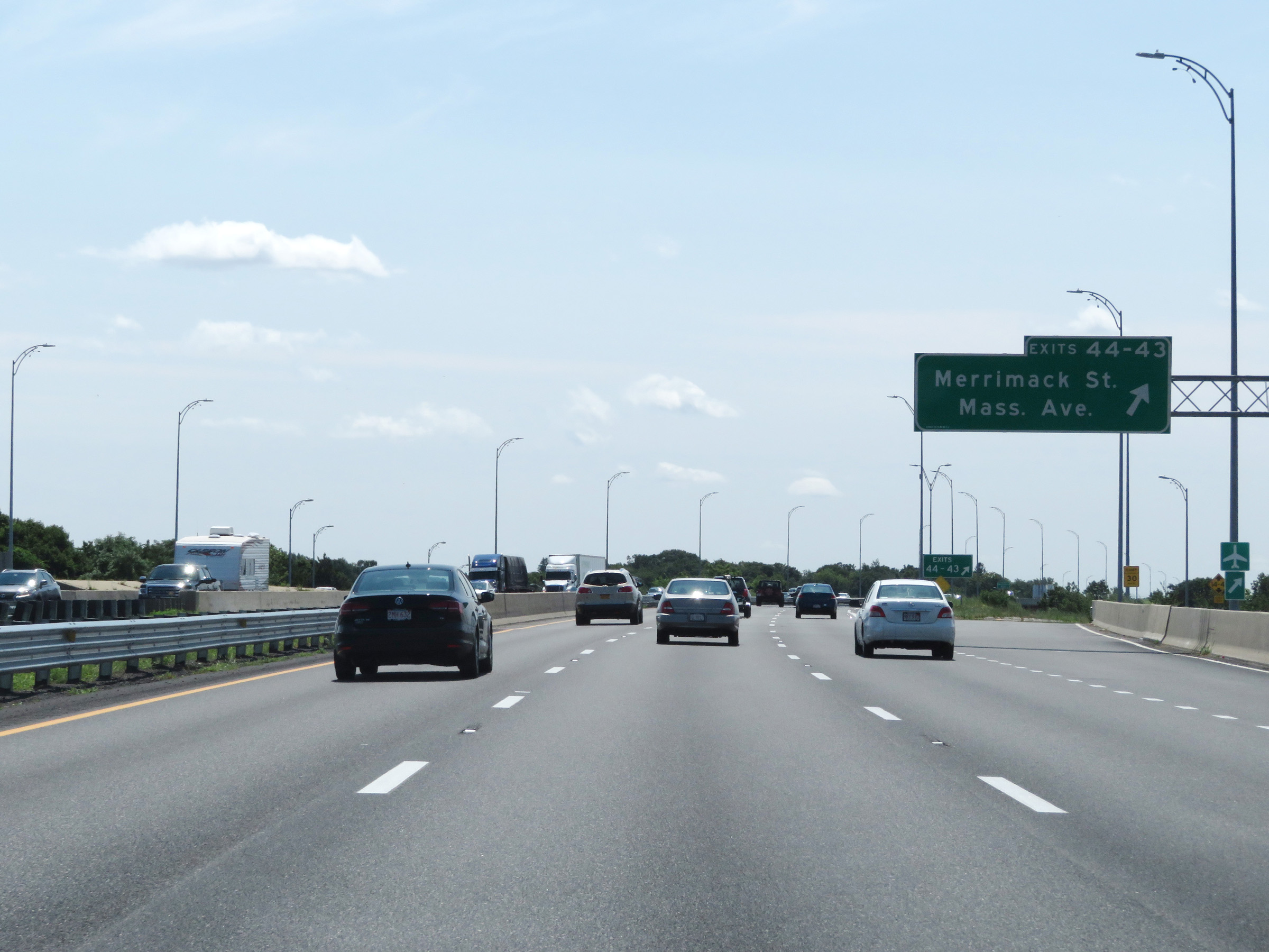 |
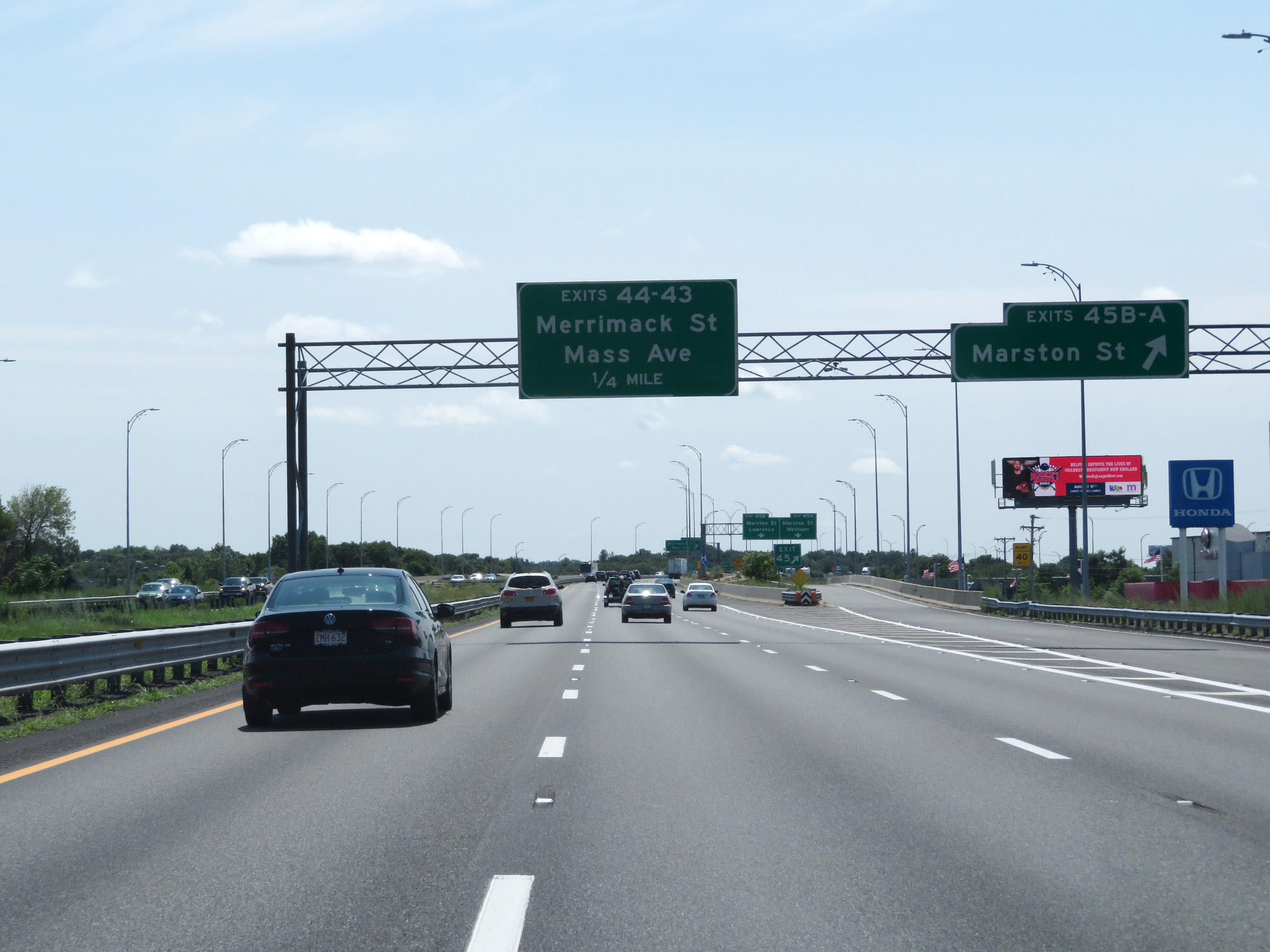
Interstate 495 South at Exits 44-43: Merrimack St / Massachusetts Ave (Photo taken 8/6/17). |
 |
Interstate 495 South at Exit 42B: MA 114 West - South Lawrence (Photo taken 8/6/17). |
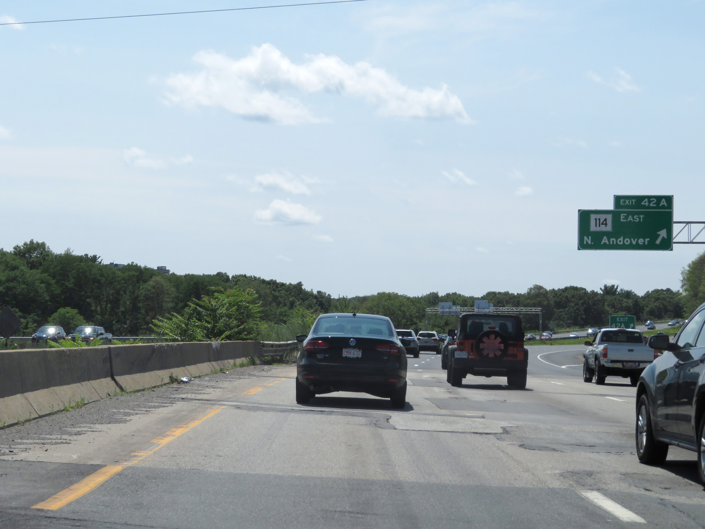 |
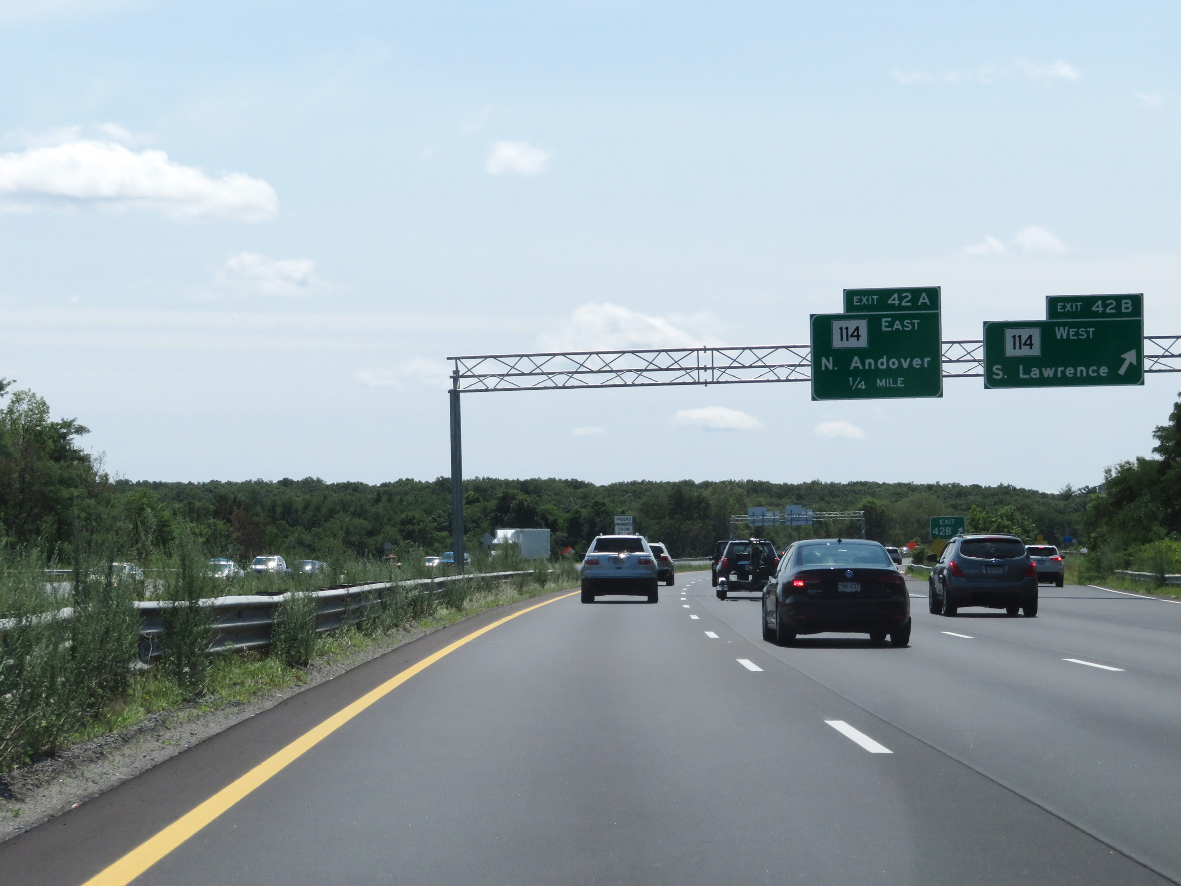
Interstate 495 South at Exit 42A: MA 114 East - North Andover (Photo taken 8/6/17). |
 |
Beyond Exit 42A, the speed limit increases to 65 mph once again. (Photo taken 8/6/17). |
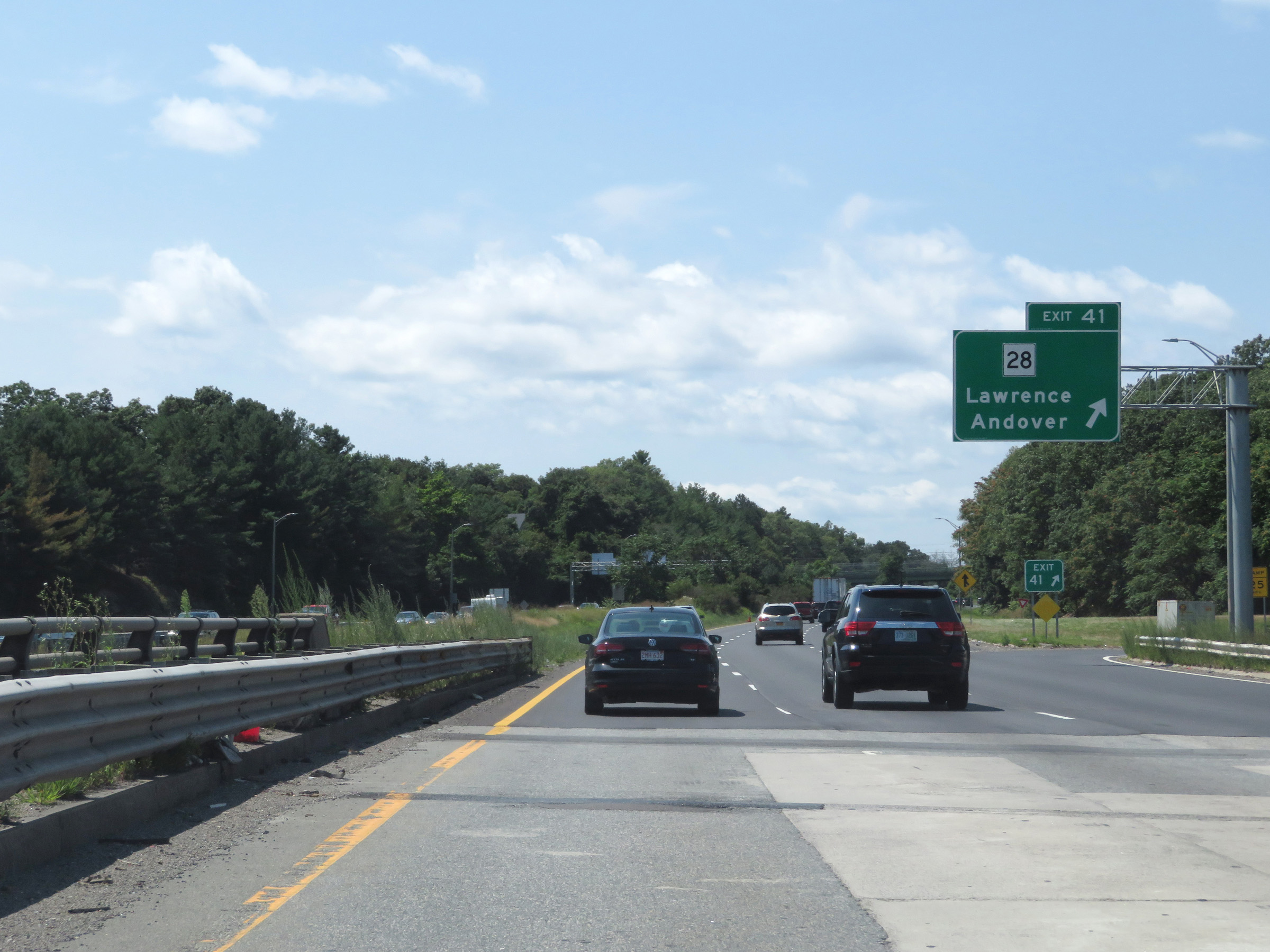 |
Interstate 495 South at Exit 41: MA 28 - Lawrence / Andover (Photo taken 8/6/17). |
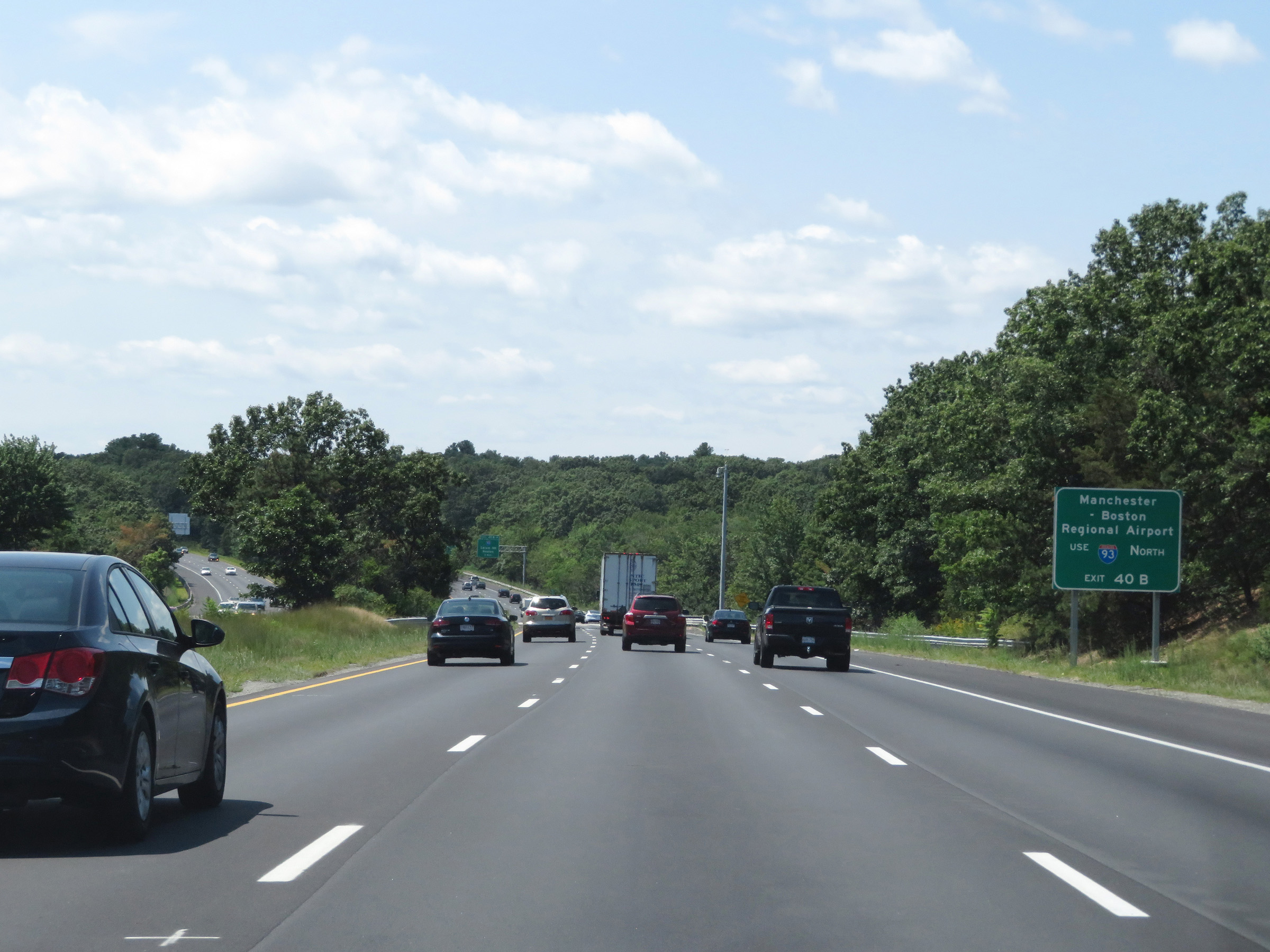 |
Take Exit 40B (Interstate 93 North) to Manchester-Boston Regional Airport. (Photo taken 8/6/17). |
 |
Interstate 495 South approaching Exits 40B-A - 1 mile. (Photo taken 8/6/17). |
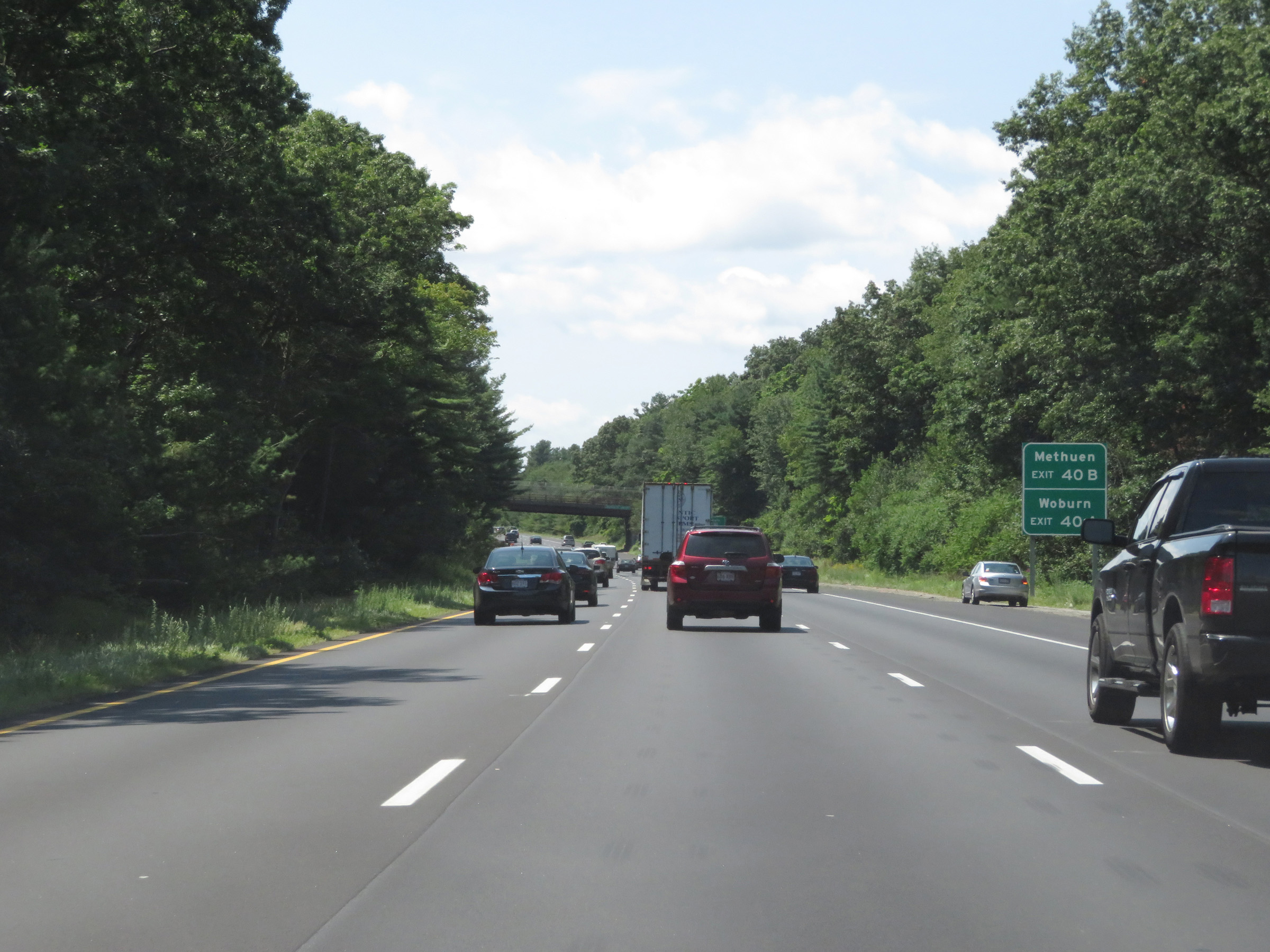 |
Take Exit 40B (Interstate 93 North) to Methuen. Take Exit 40A (Interstate 93 South) to Woburn. (Photo taken 8/6/17). |
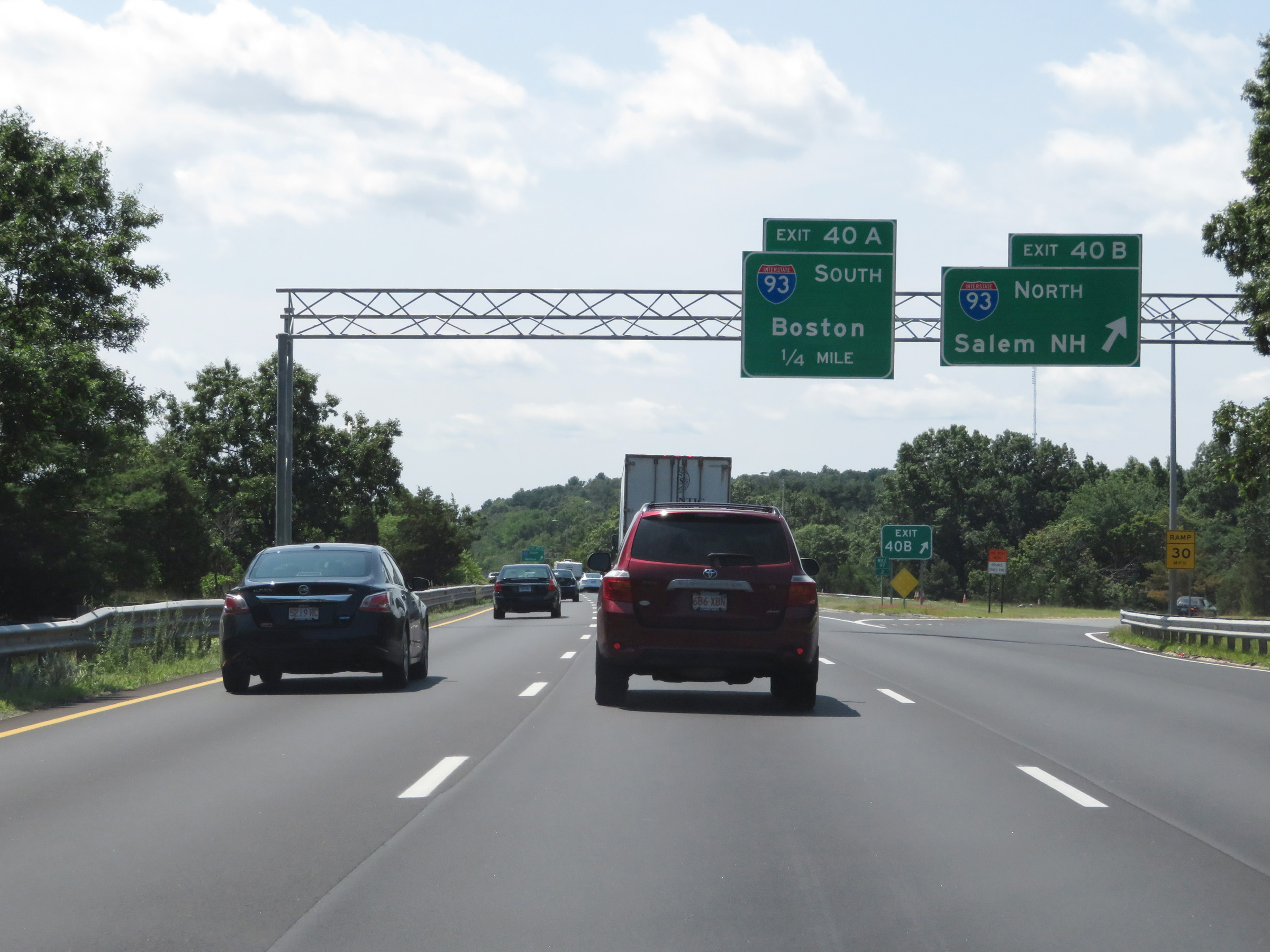 |
Interstate 495 South at Exit 40B: Interstate 93 North - Salem, NH (Photo taken 8/6/17). |
 |
Interstate 495 South at Exit 40A: Interstate 93 South - Boston (Photo taken 8/6/17). |
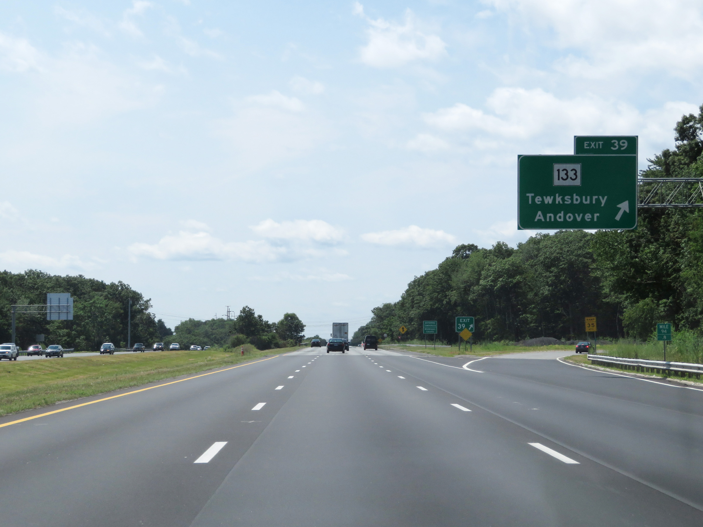 |
Interstate 495 South at Exit 39: MA 133 - Tewksbury / Andover (Photo taken 8/6/17). |
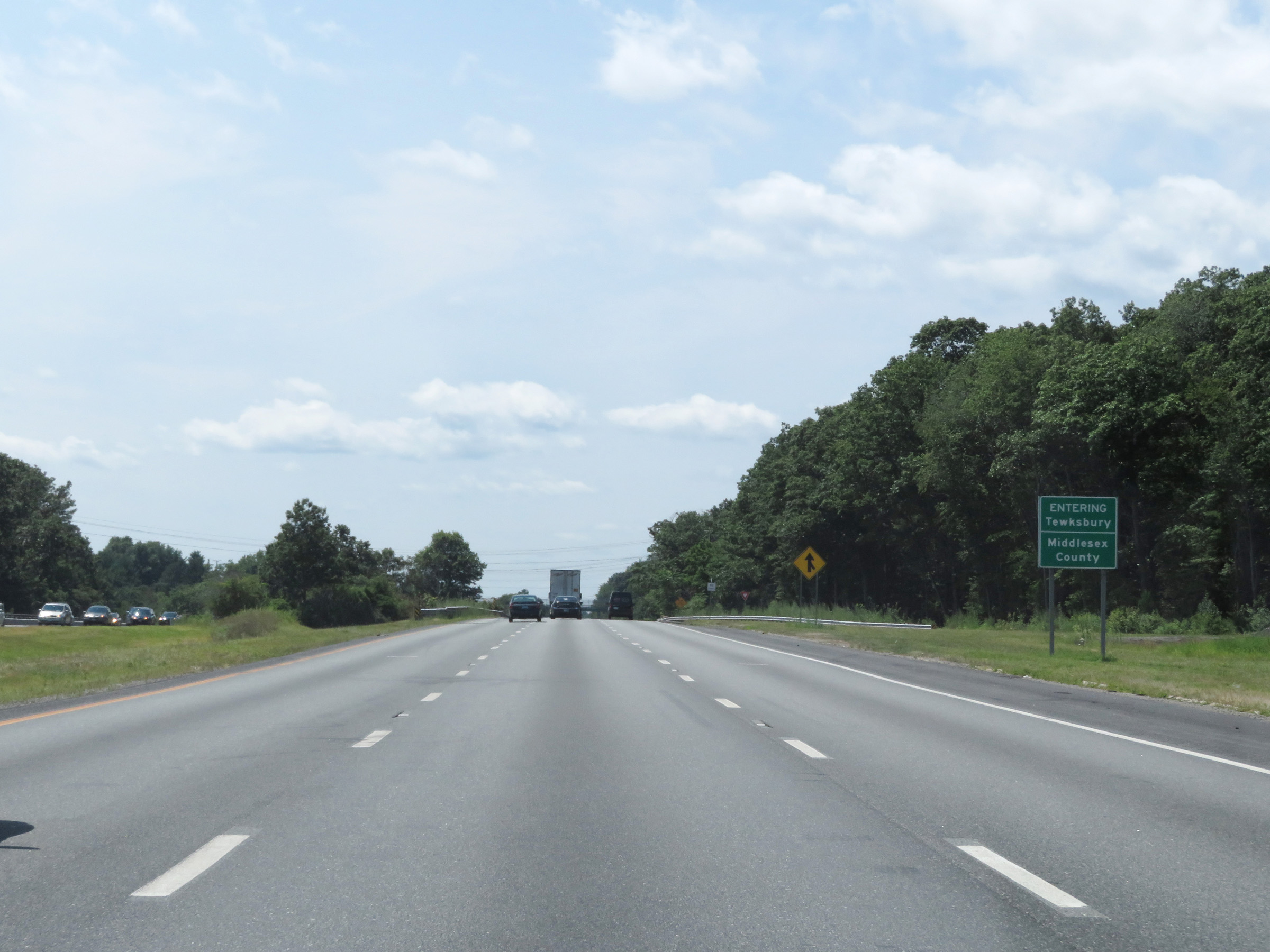 |
View on Interstate 495 South as it enters Middlesex County. (Photo taken 8/6/17). |
 |
View on Interstate 495 South at mile marker 93. (Photo taken 8/6/17). |
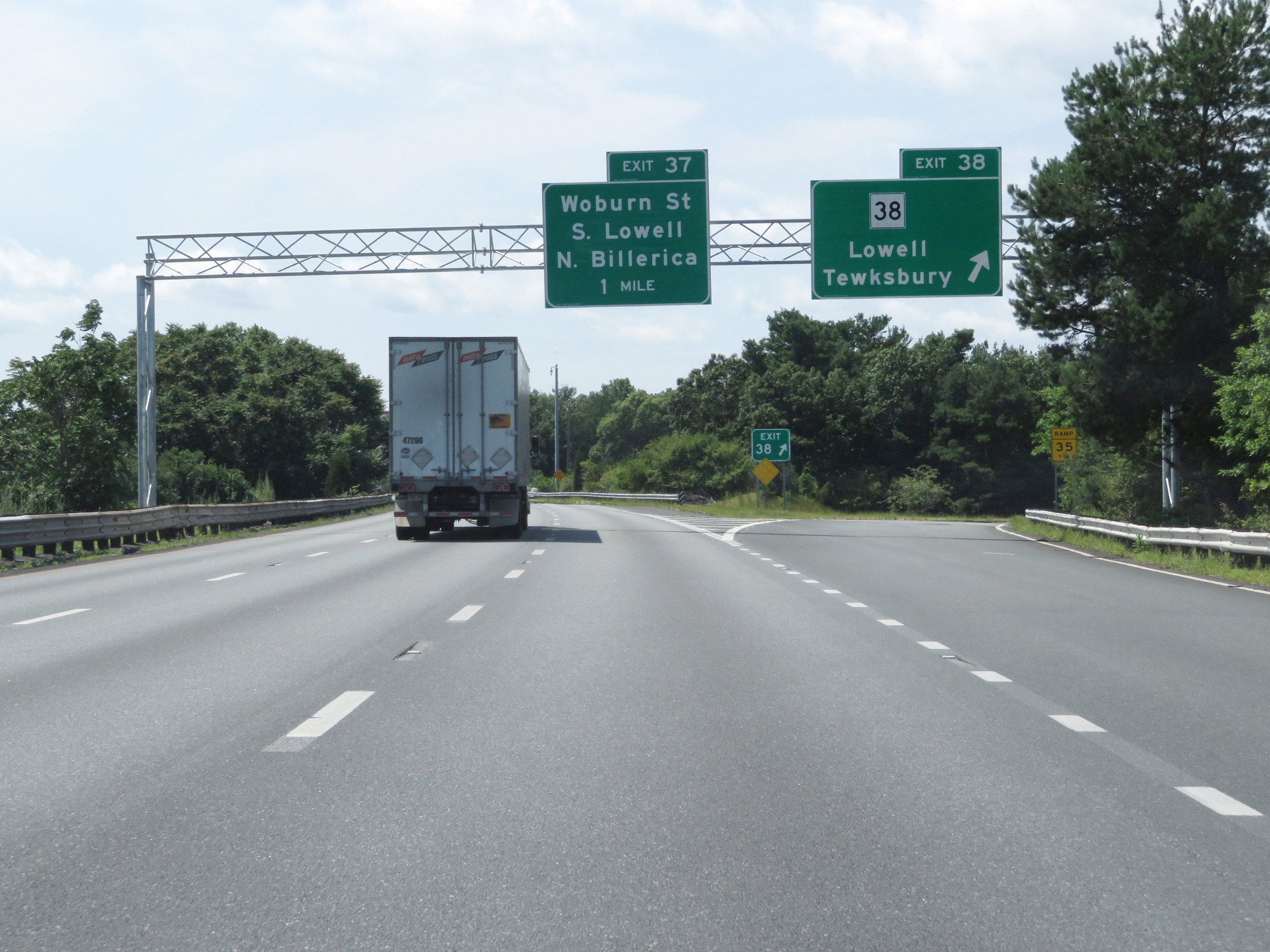 |
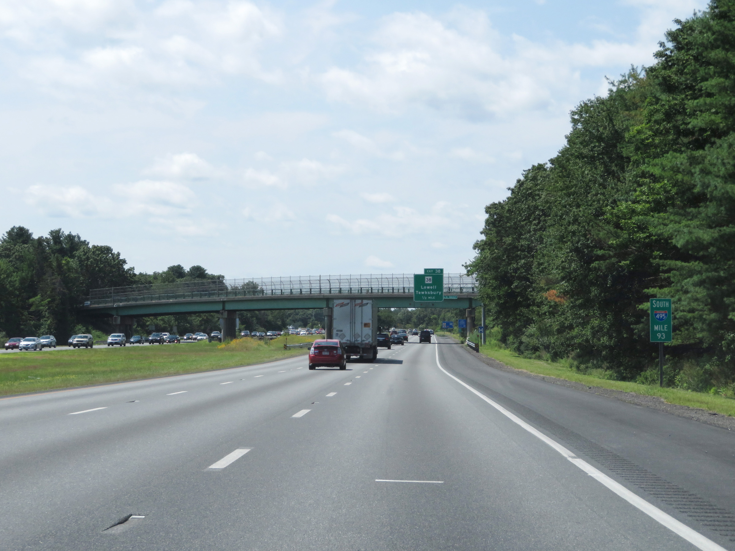
Interstate 495 South at Exit 38: MA 38 - Lowell / Tewksbury (Photo taken 8/6/17). |
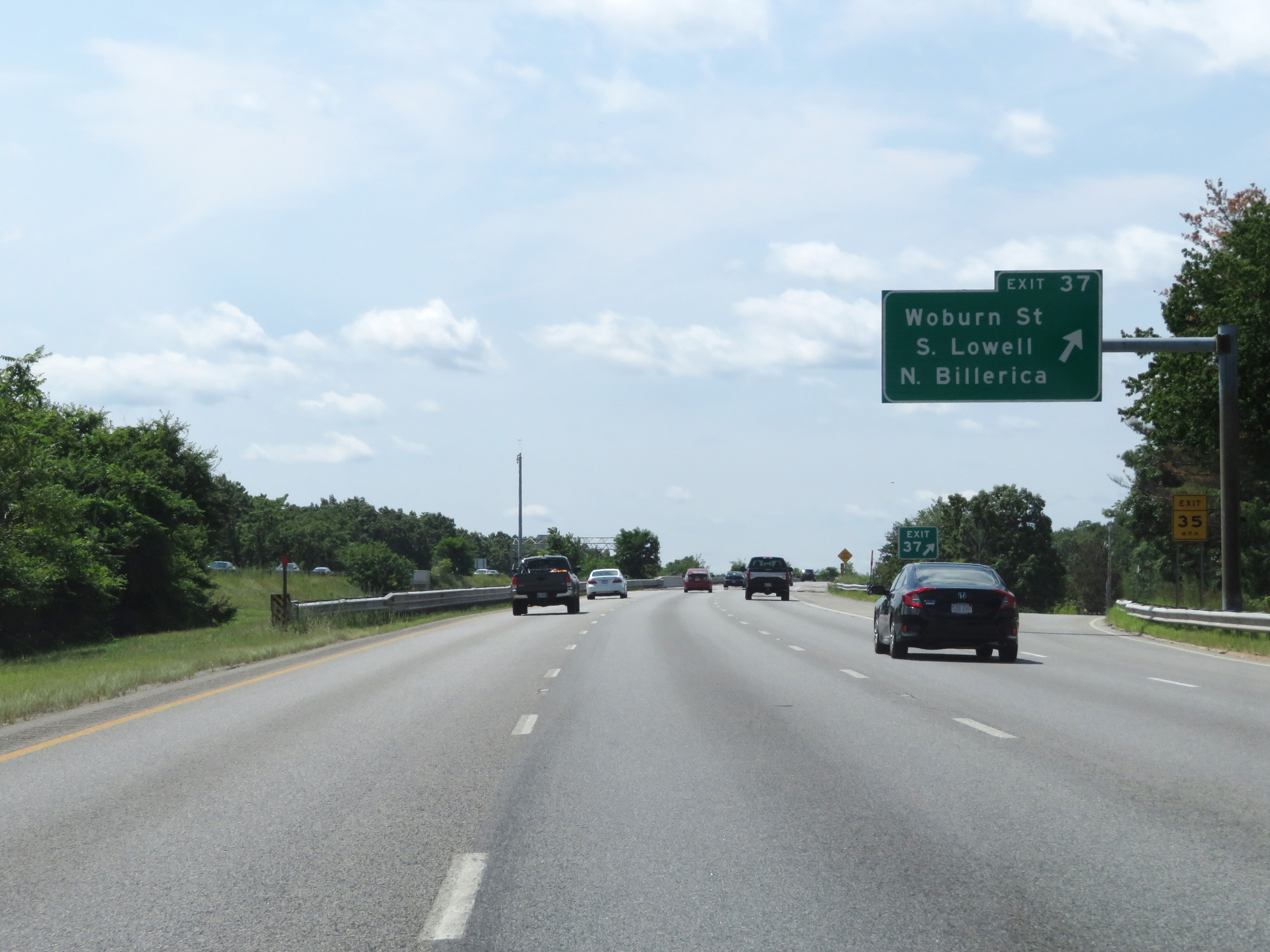 |
Interstate 495 South at Exit 37: Woburn St / South Lowell / North Billerica (Photo taken 8/6/17). |
 |
Another Interstate 495 South reassurance shield. (Photo taken 8/6/17). |
 |
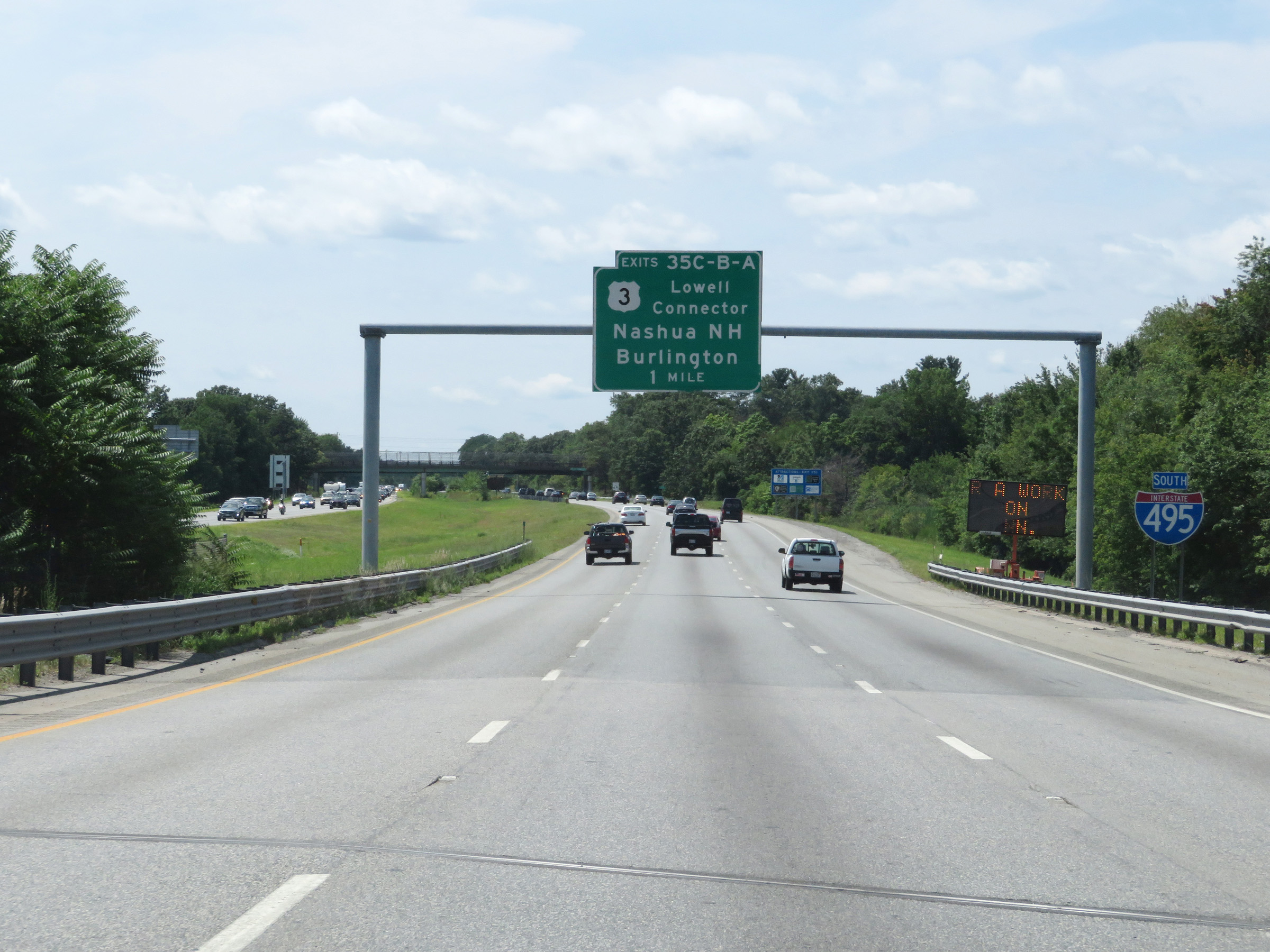
Interstate 495 South at Exits 35C-B-A: US 3 - Lowell Connector / Nashua, NH / Burlington (Photo taken 8/6/17). |
 |
Interstate 495 South at Exit 35C: Lowell Connector (Photo taken 8/6/17). |
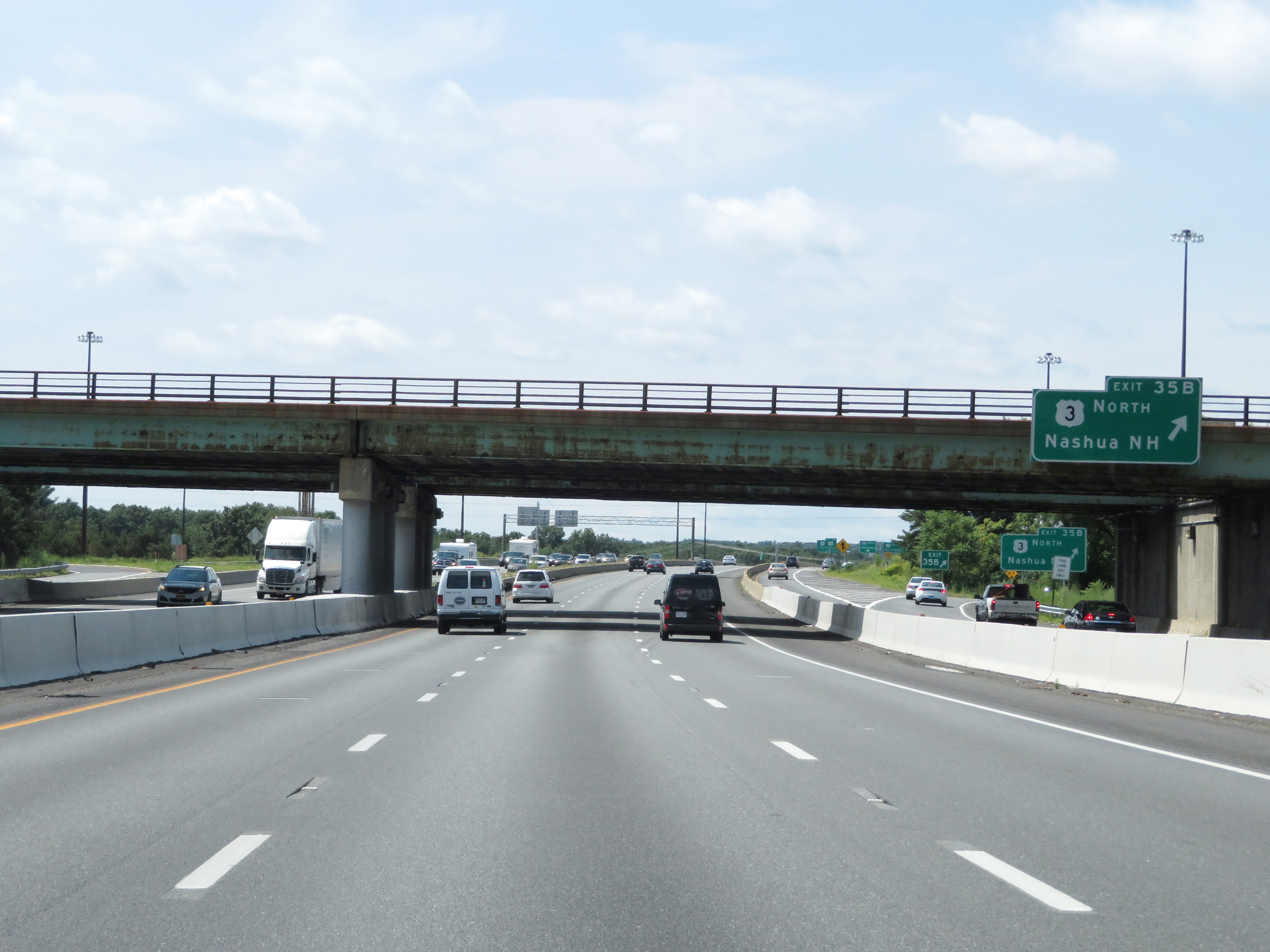 |
Interstate 495 South at Exit 35B: US 3 North - Nashua, NH (Photo taken 8/6/17). |
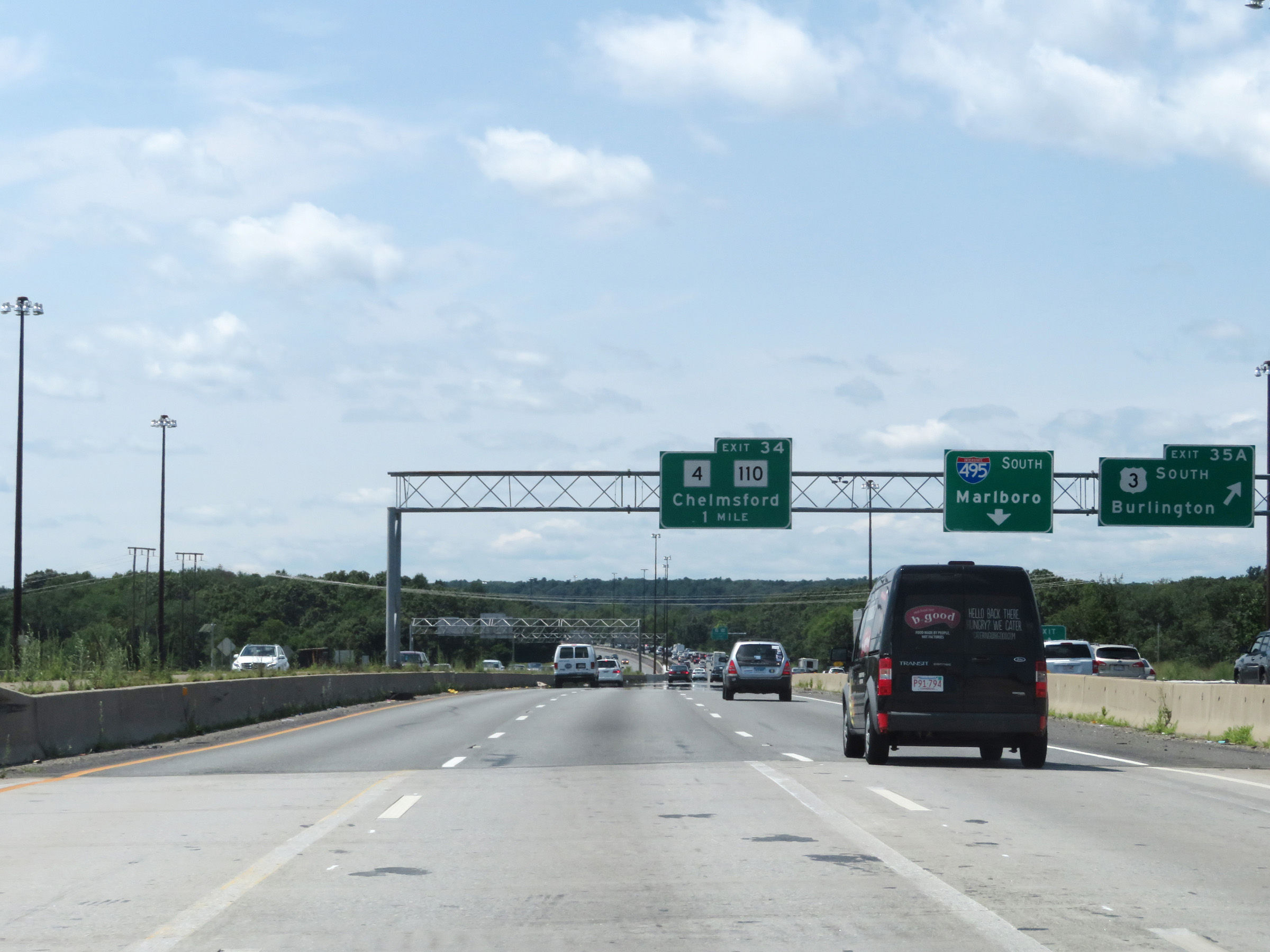 |
Interstate 495 South at Exit 35A: US 3 South - Burlington (Photo taken 8/6/17). |
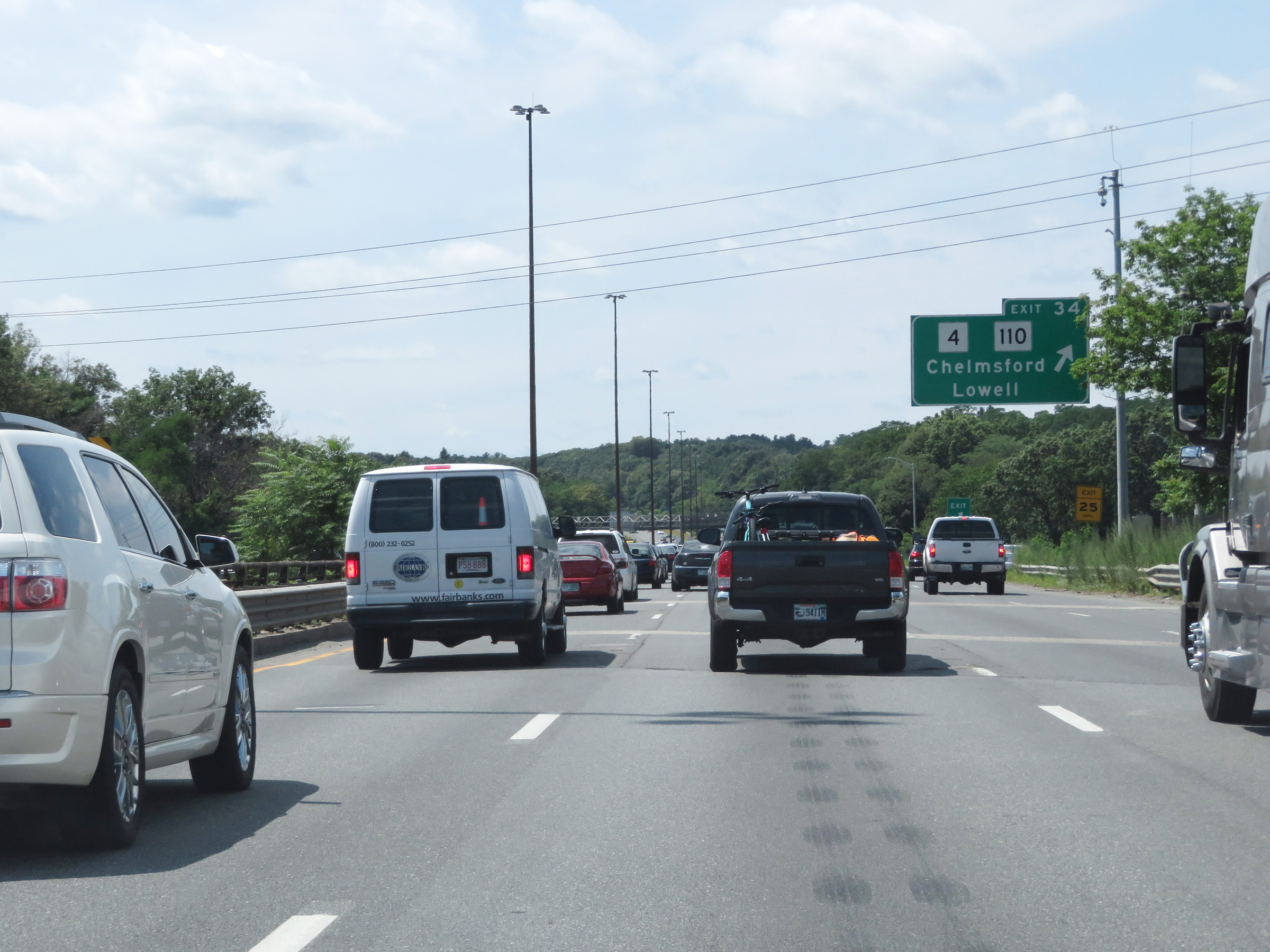 |
Interstate 495 South at Exit 34: MA 4 / MA 110 - Chelmsford / Lowell (Photo taken 8/6/17). |
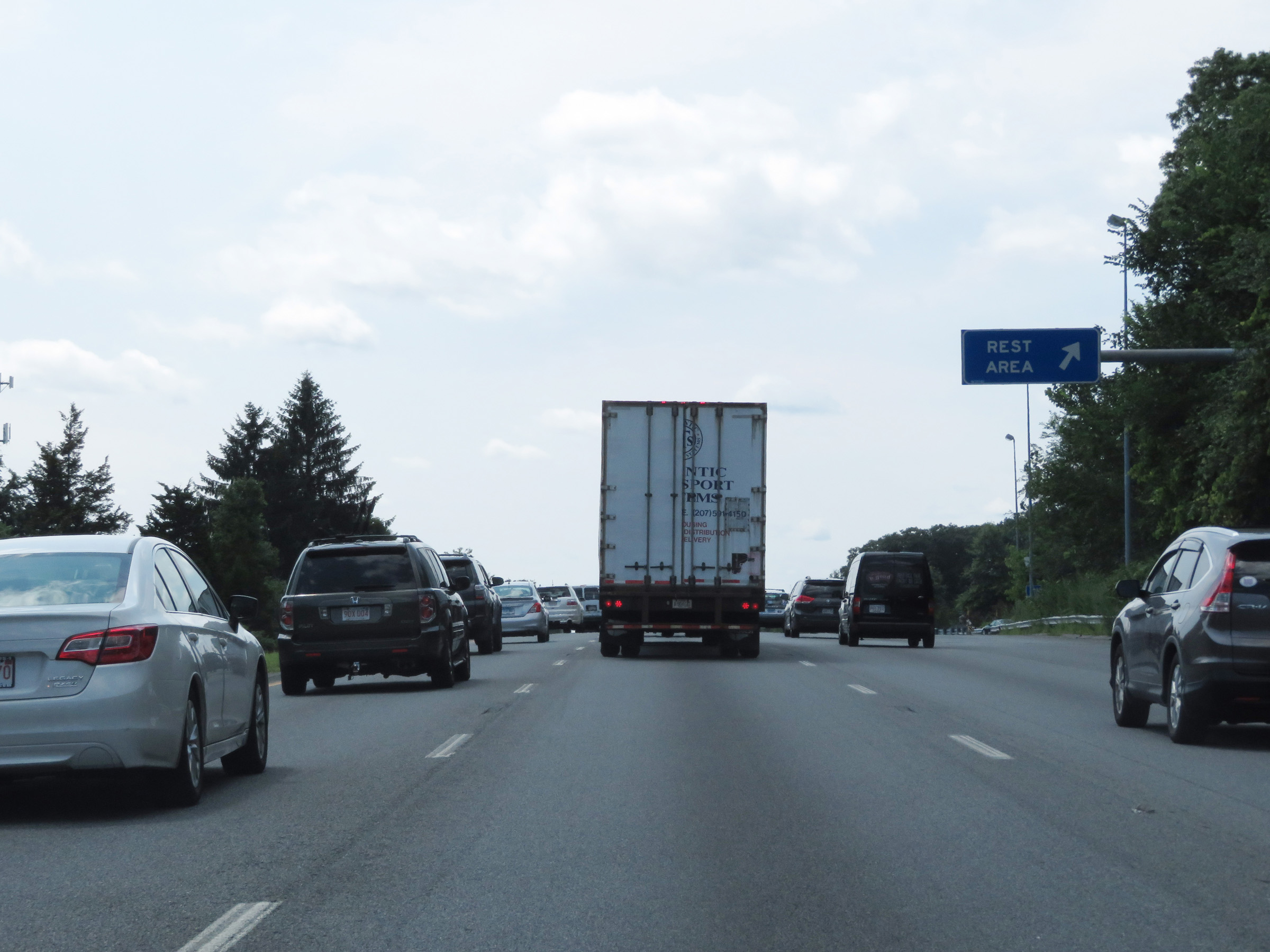 |
Rest Area on Interstate 495 South in Middlesex County. (Photo taken 8/6/17). |
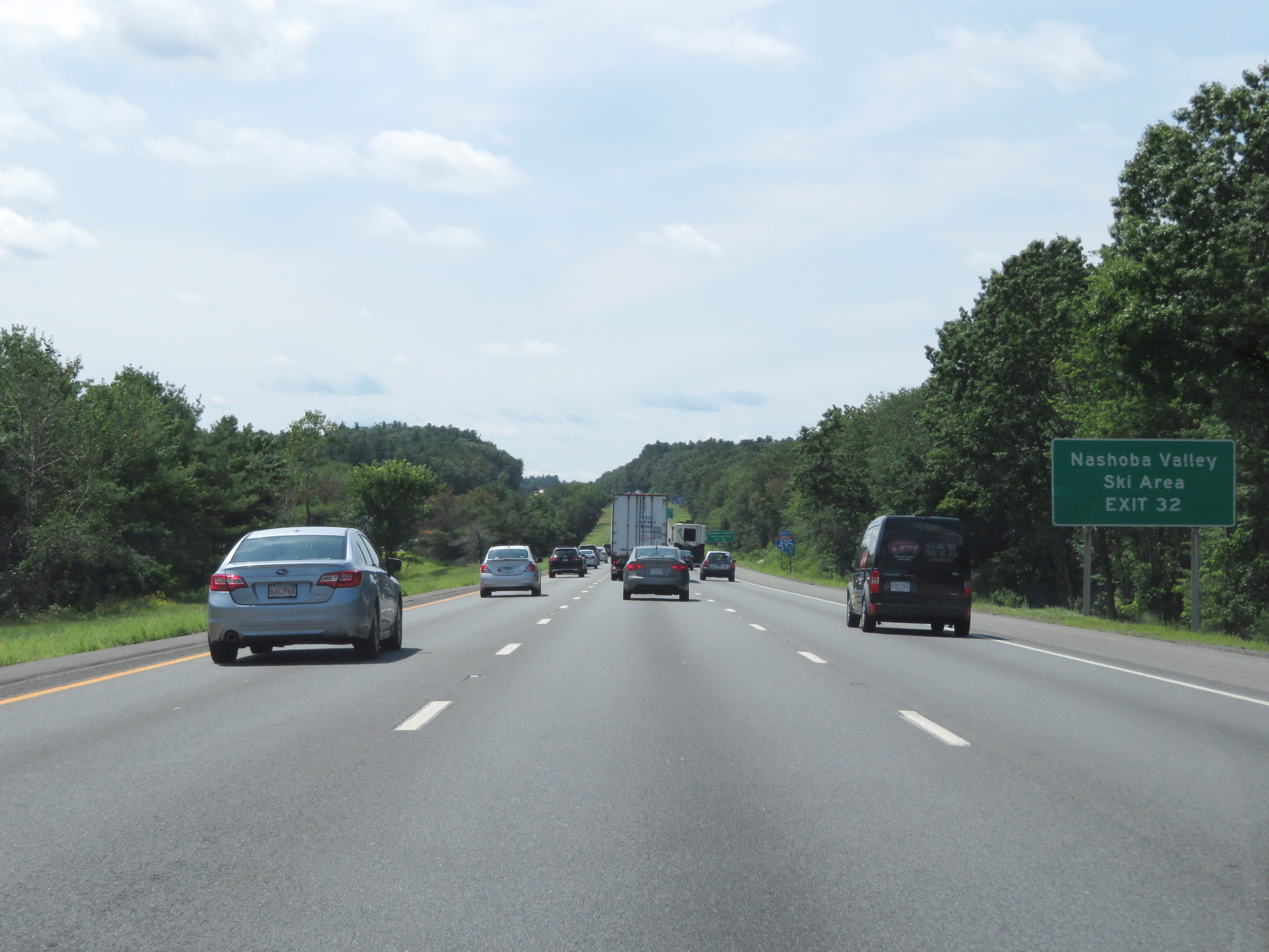 |
Take Exit 32 to Nashoba Valley Ski Area. (Photo taken 8/6/17). |
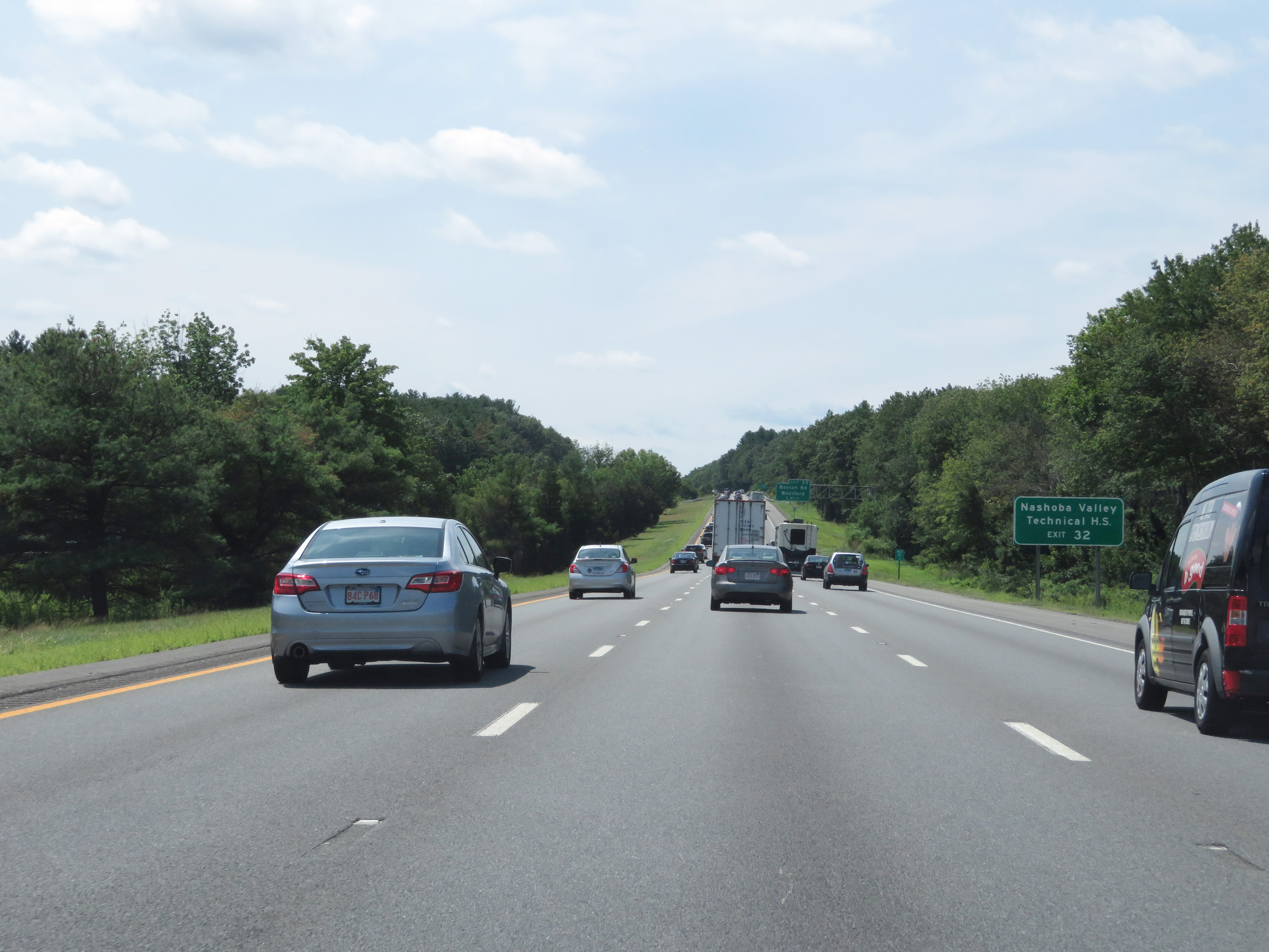 |
Also take Exit 32 to Nashoba Valley Technical High School. (Photo taken 8/6/17). |
 |
Take Exit 32 to MA 225 as well. (Photo taken 8/6/17). |
 |
Interstate 495 South at Exit 32: Boston Rd / Westford (Photo taken 8/6/17). |
 |
Another mileage sign on Interstate 495 South. It's 5 miles to Littleton, 22 miles to Marlboro, and 66 miles to Taunton. (Photo taken 8/6/17). |
 |
Electronic mileage sign which dynamically displays the current estimated travel times to the junctions of MA 2 and Interstate 290 / MA 85 alongside the distances to each interchange. (Photo taken 8/6/17). |
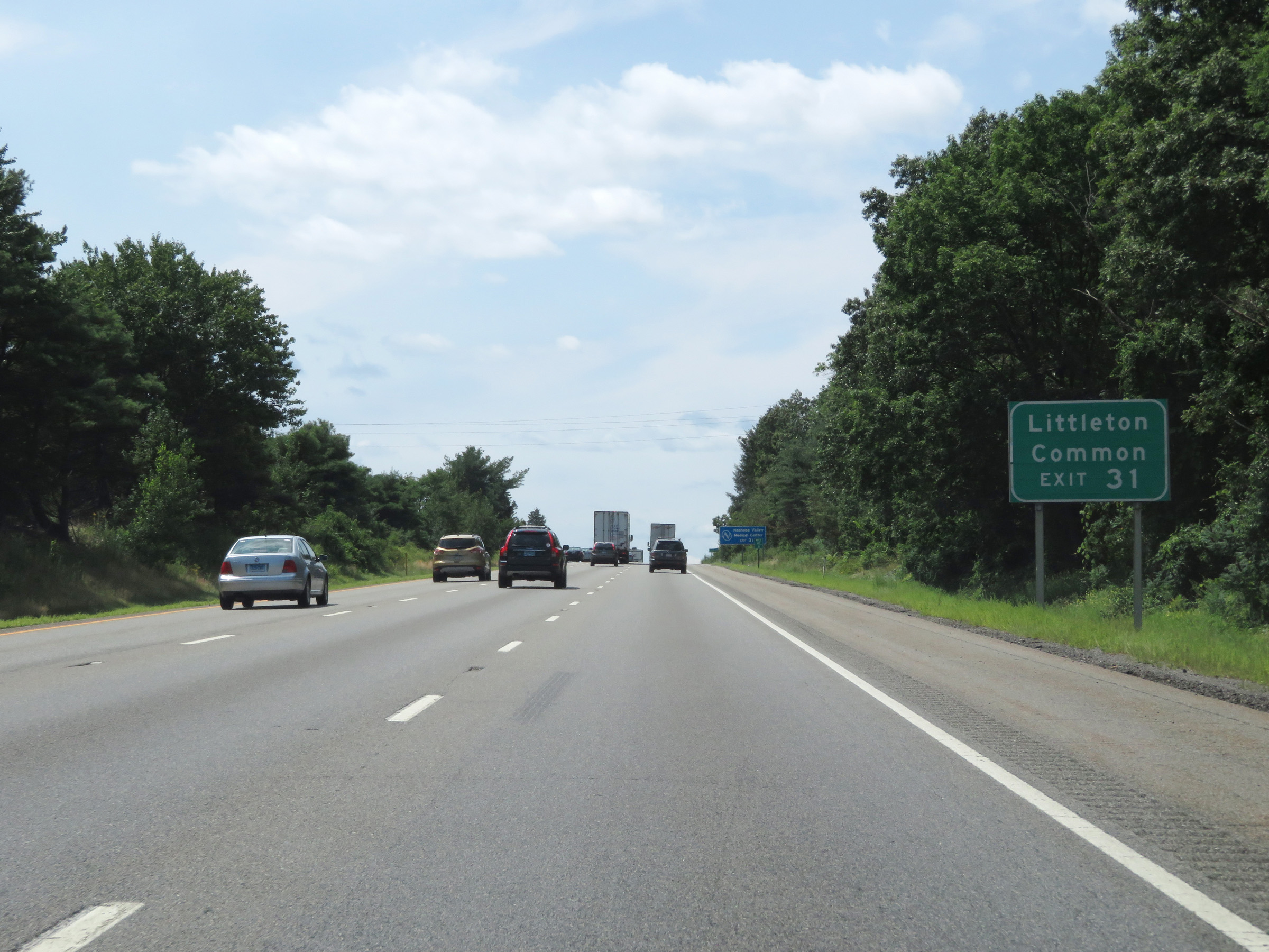 |
Take Exit 31 to Littleton Common. (Photo taken 8/6/17). |
 |
Interstate 495 South at Exit 31: MA 119 - Groton / Acton (Photo taken 8/6/17). |
Section 2: Littleton (Exit 31) to Franklin (Exit 16)
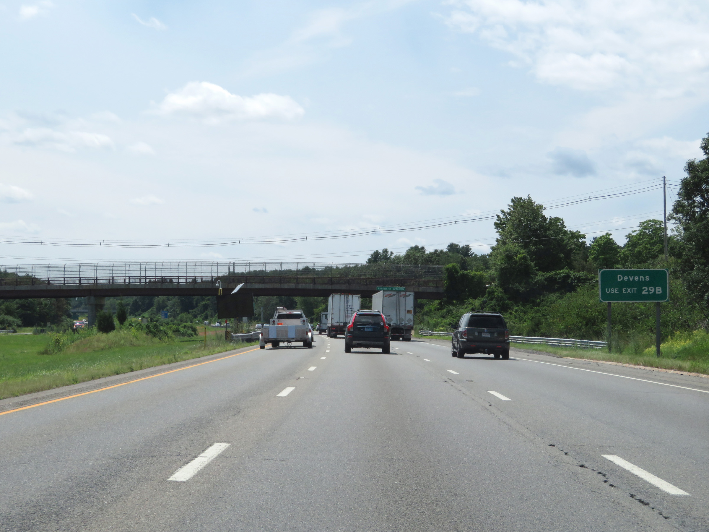 |
Take Exit 29B to Devens. (Photo taken 8/6/17). |
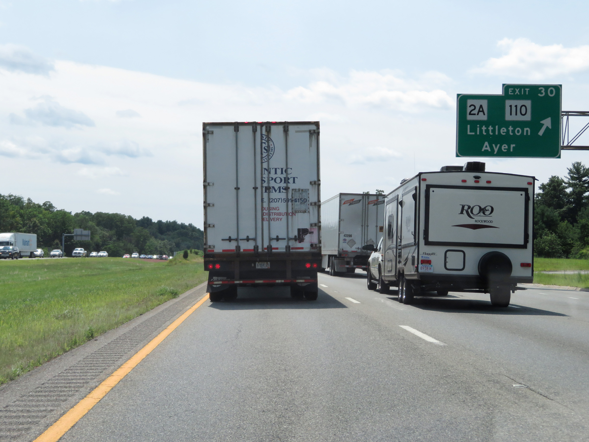 |
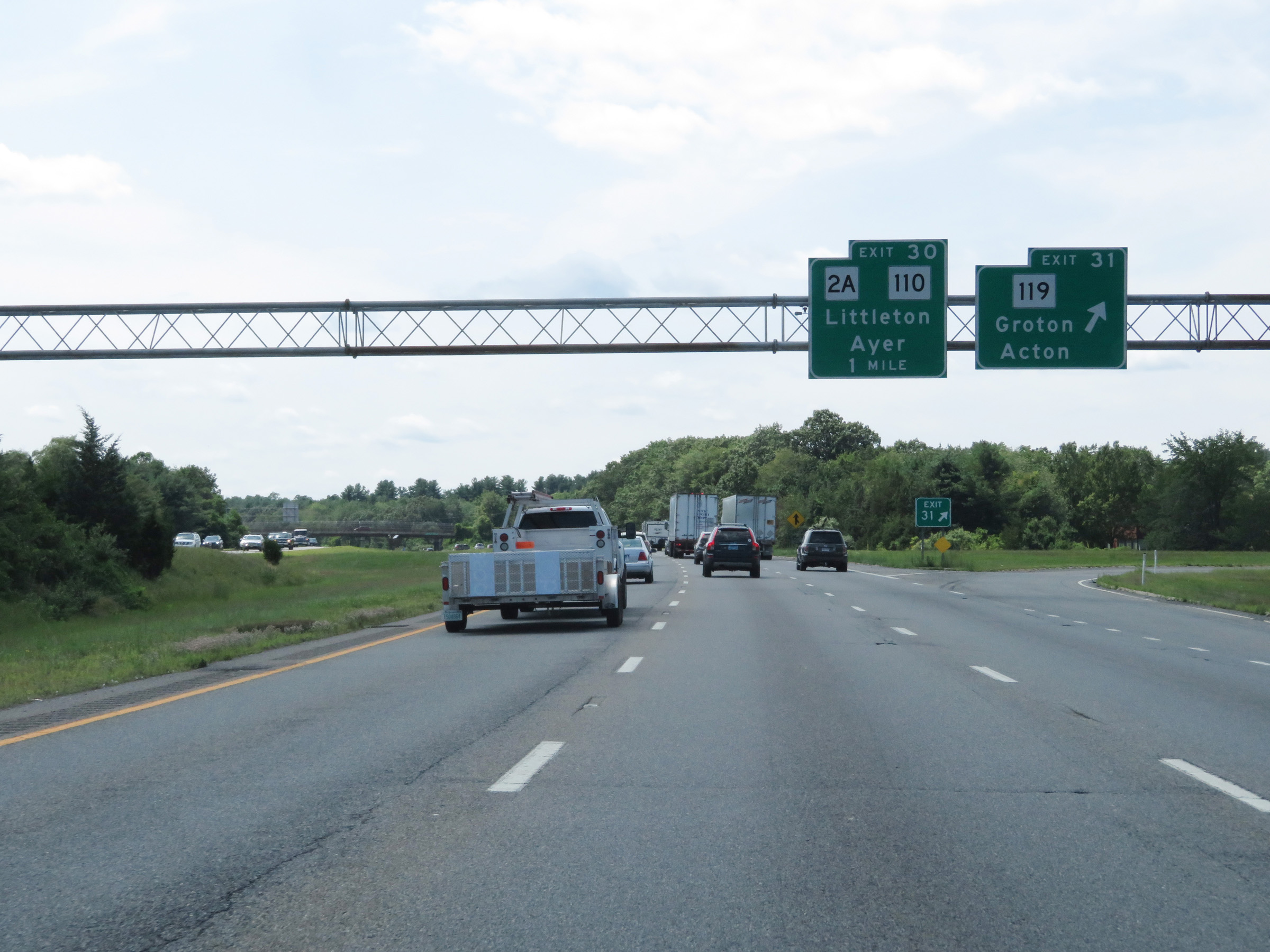
Interstate 495 South at Exit 30: MA 2A / MA 110 - Littleton / Ayer (Photo taken 8/6/17). |
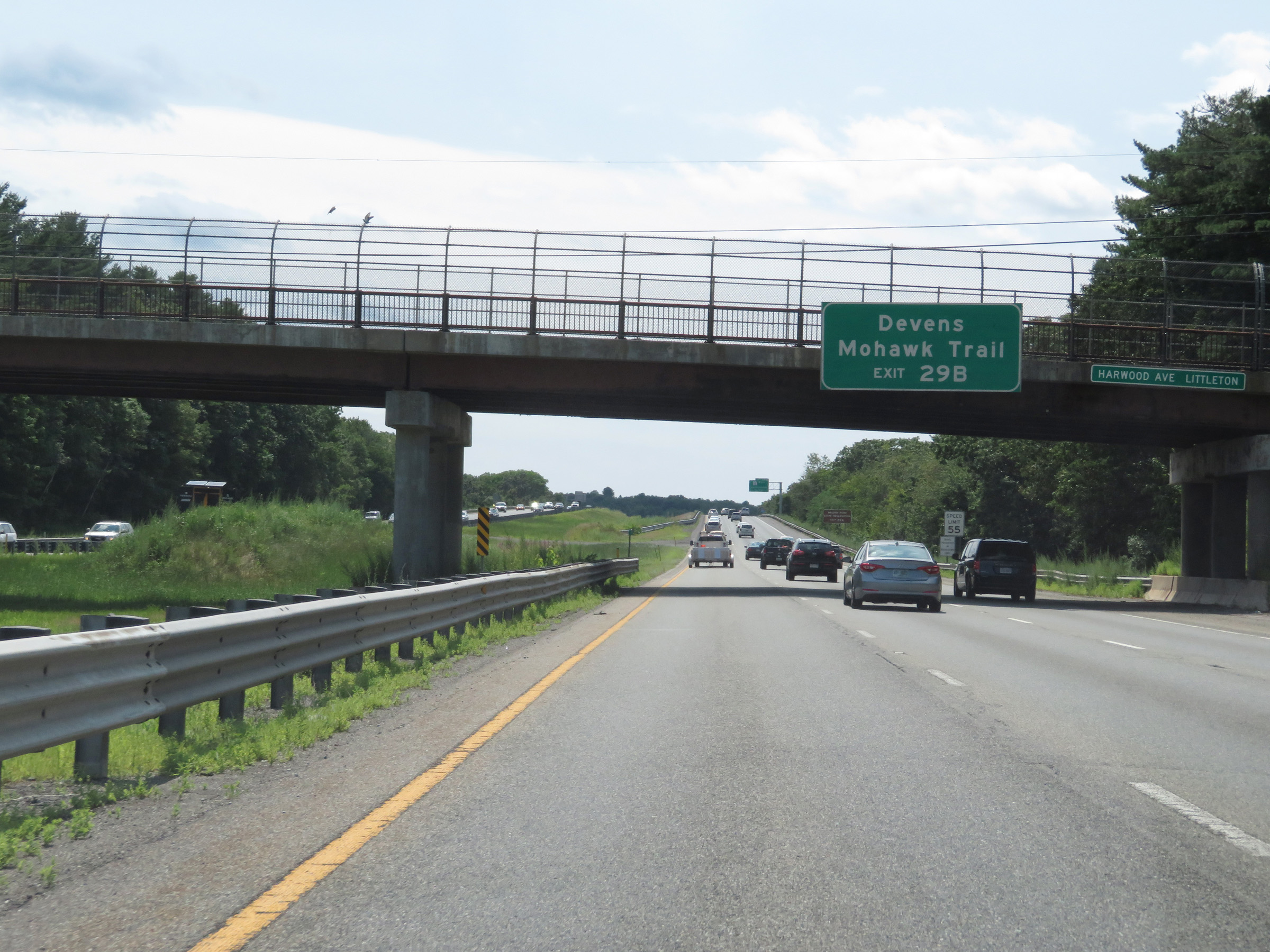 |
Take Exit 29B to Devens and Mohawk Trail. (Photo taken 8/6/17). |
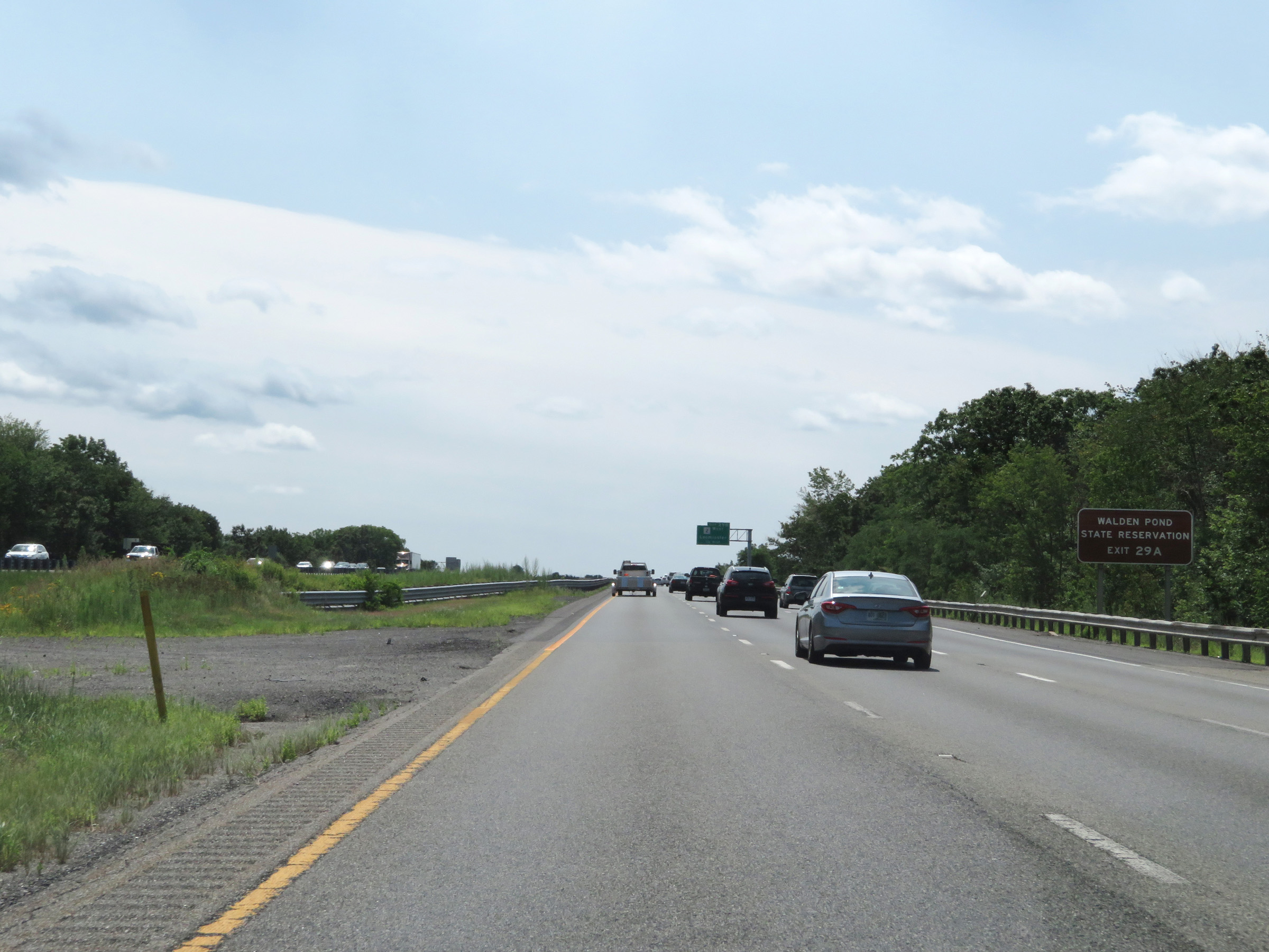 |
Take Exit 29A to Walden Pond State Reservation. (Photo taken 8/6/17). |
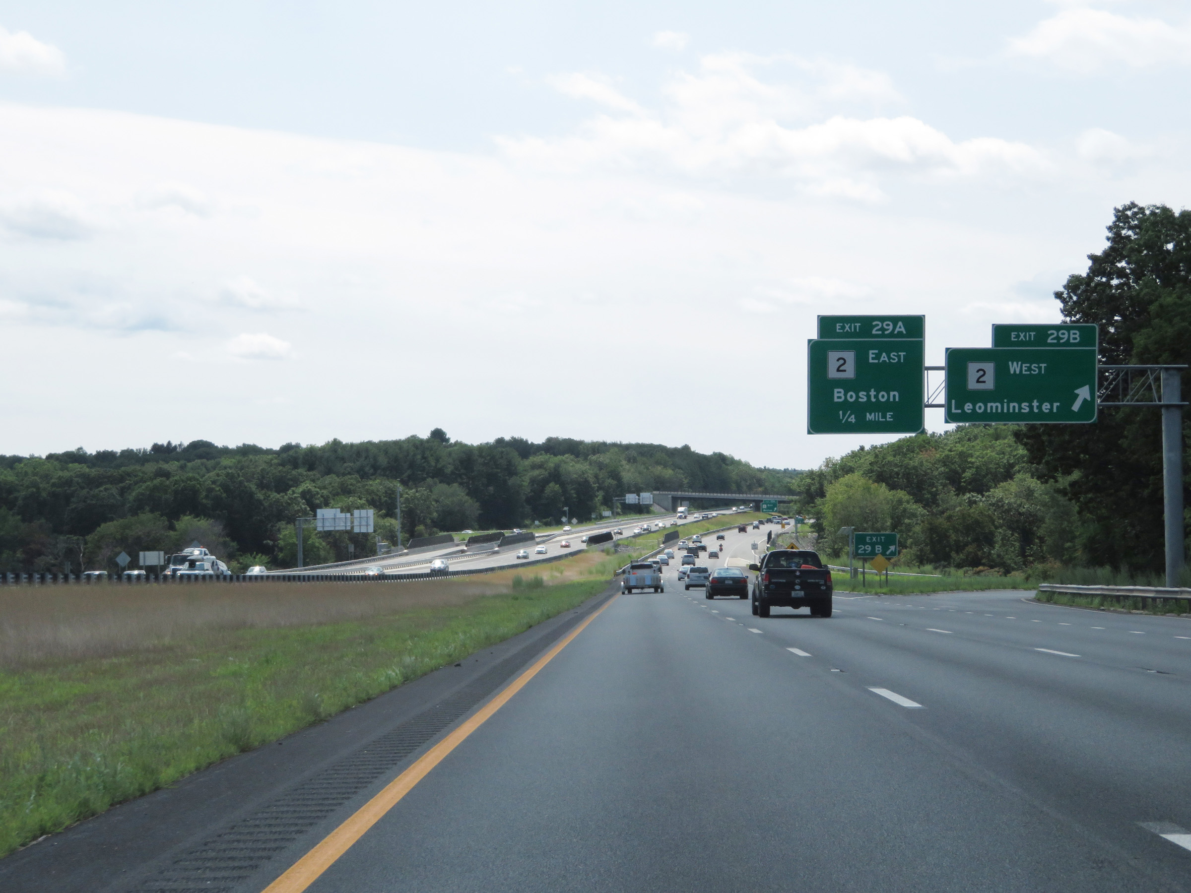 |
Interstate 495 South at Exit 29B: MA 2 West - Leominster (Photo taken 8/6/17). |
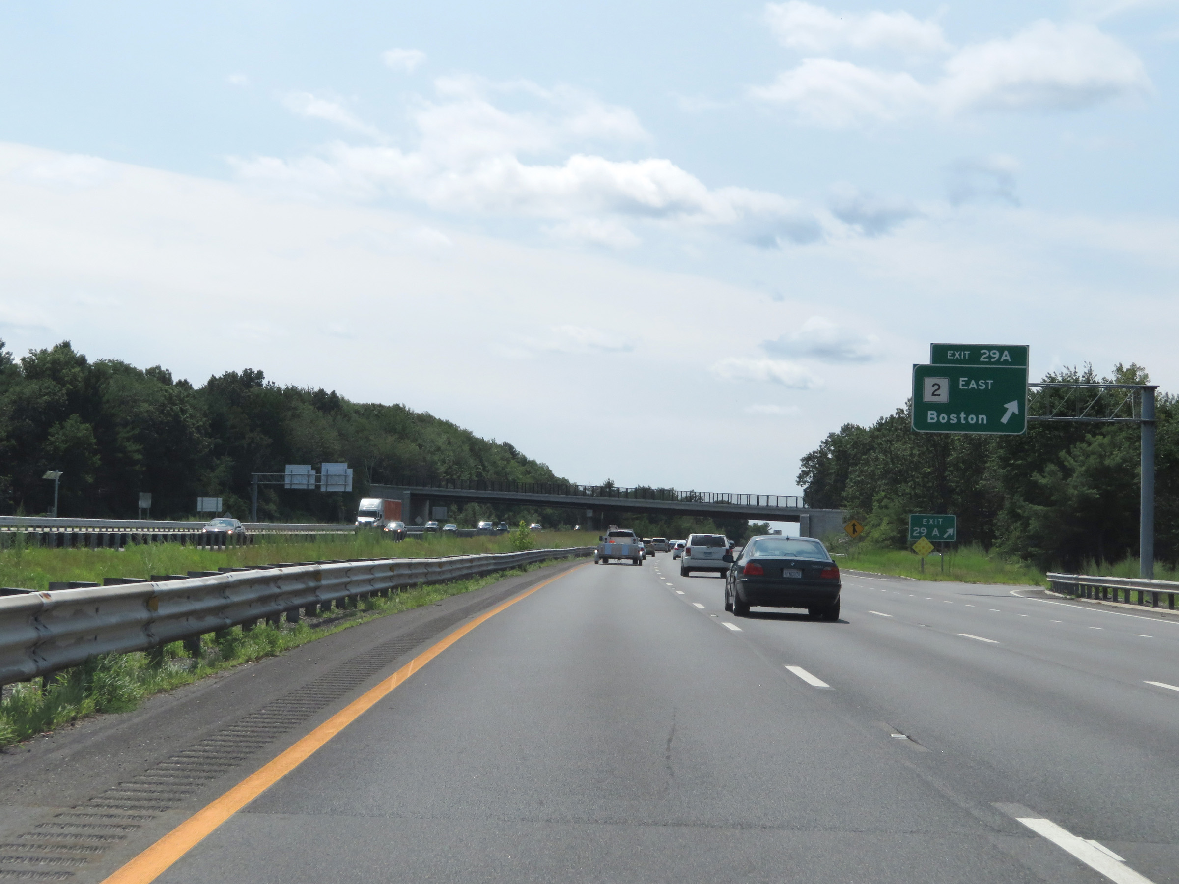 |
Interstate 495 South at Exit 29A: MA 2 East - Boston (Photo taken 8/6/17). |
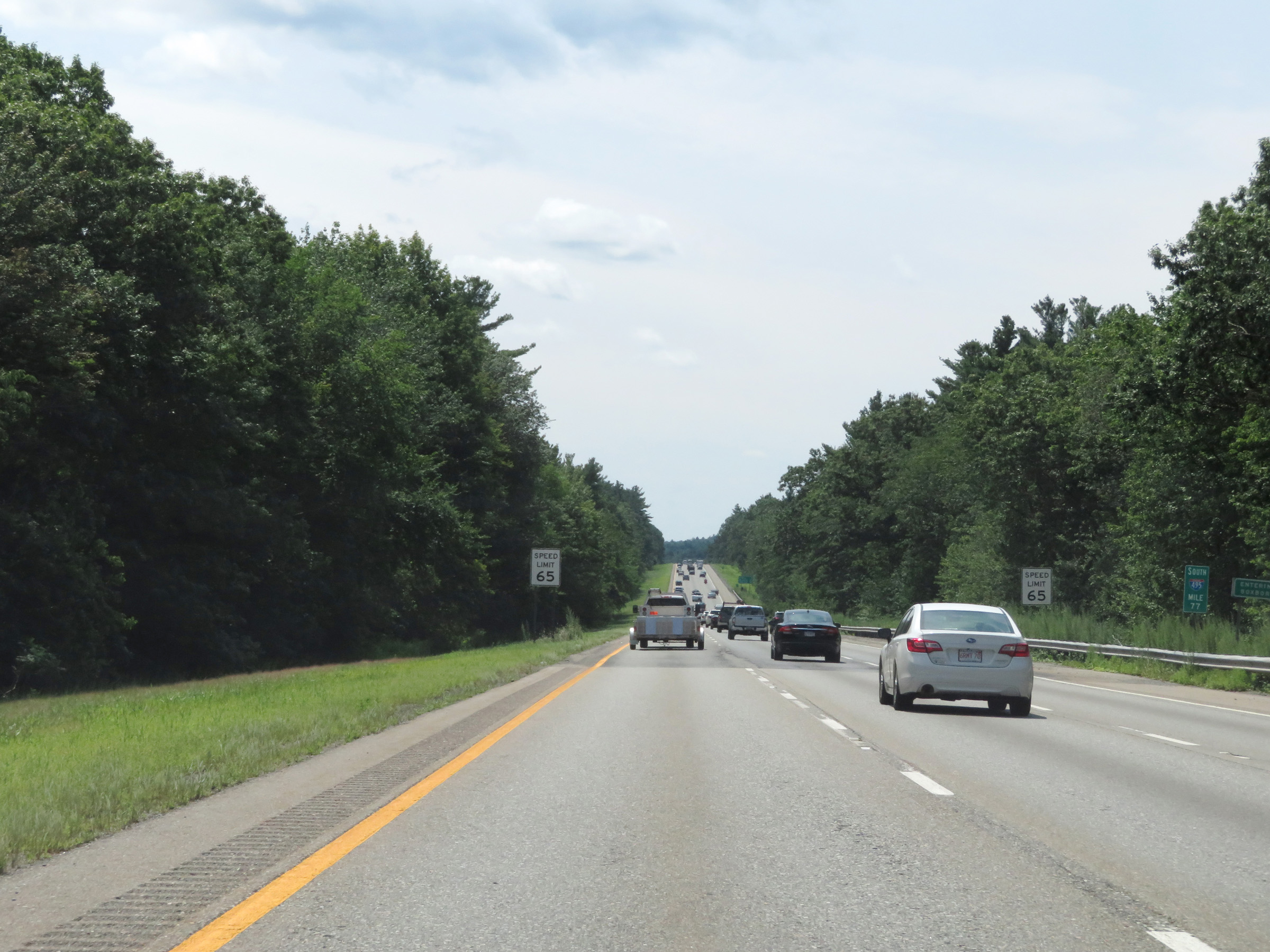 |
View on Interstate 495 South at mile marker 77. (Photo taken 8/6/17). |
 |
Mile marker 76 on Interstate 495 South in Middlesex County. (Photo taken 8/6/17). |
 |
Interstate 495 South at Exit 28: MA 111 - Boxboro / Harvard (Photo taken 8/6/17). |
 |
View on Interstate 495 South at mile marker 72. (Photo taken 8/6/17). |
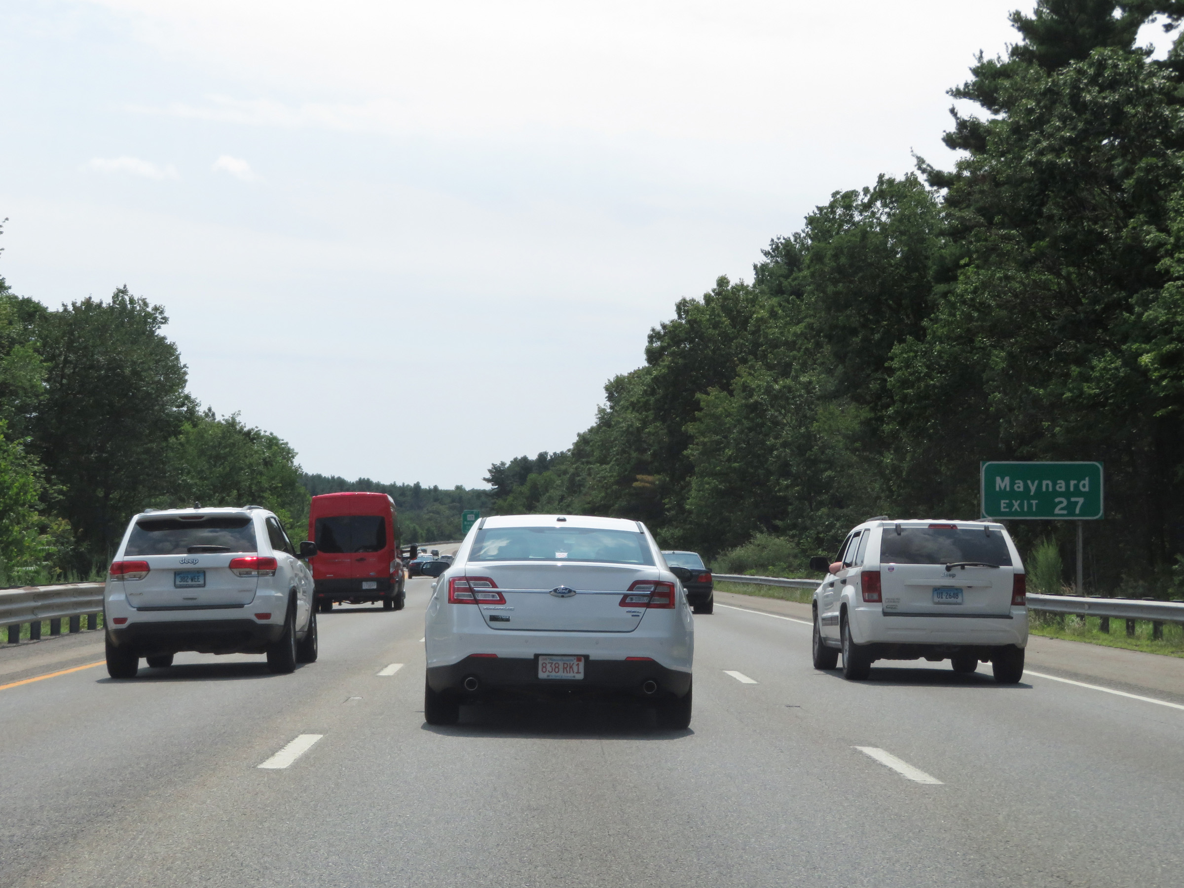 |
Take Exit 27 to Maynard. (Photo taken 8/6/17). |
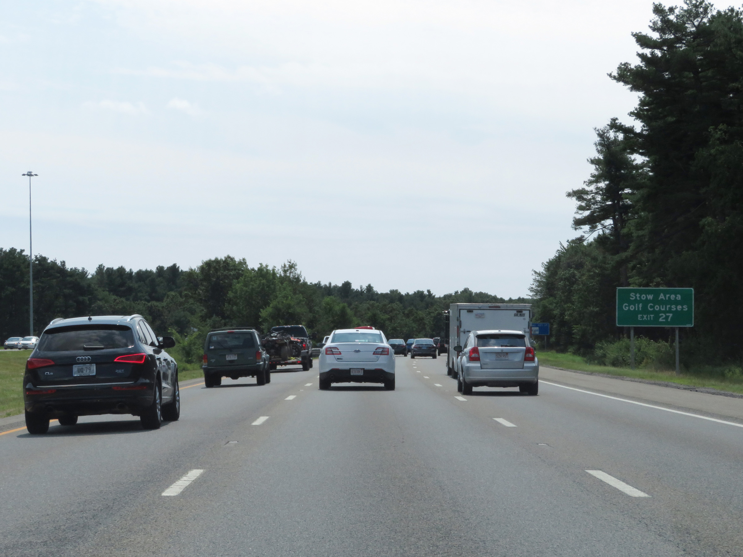 |
Also take Exit 27 to the Stow Area Golf Courses. (Photo taken 8/6/17). |
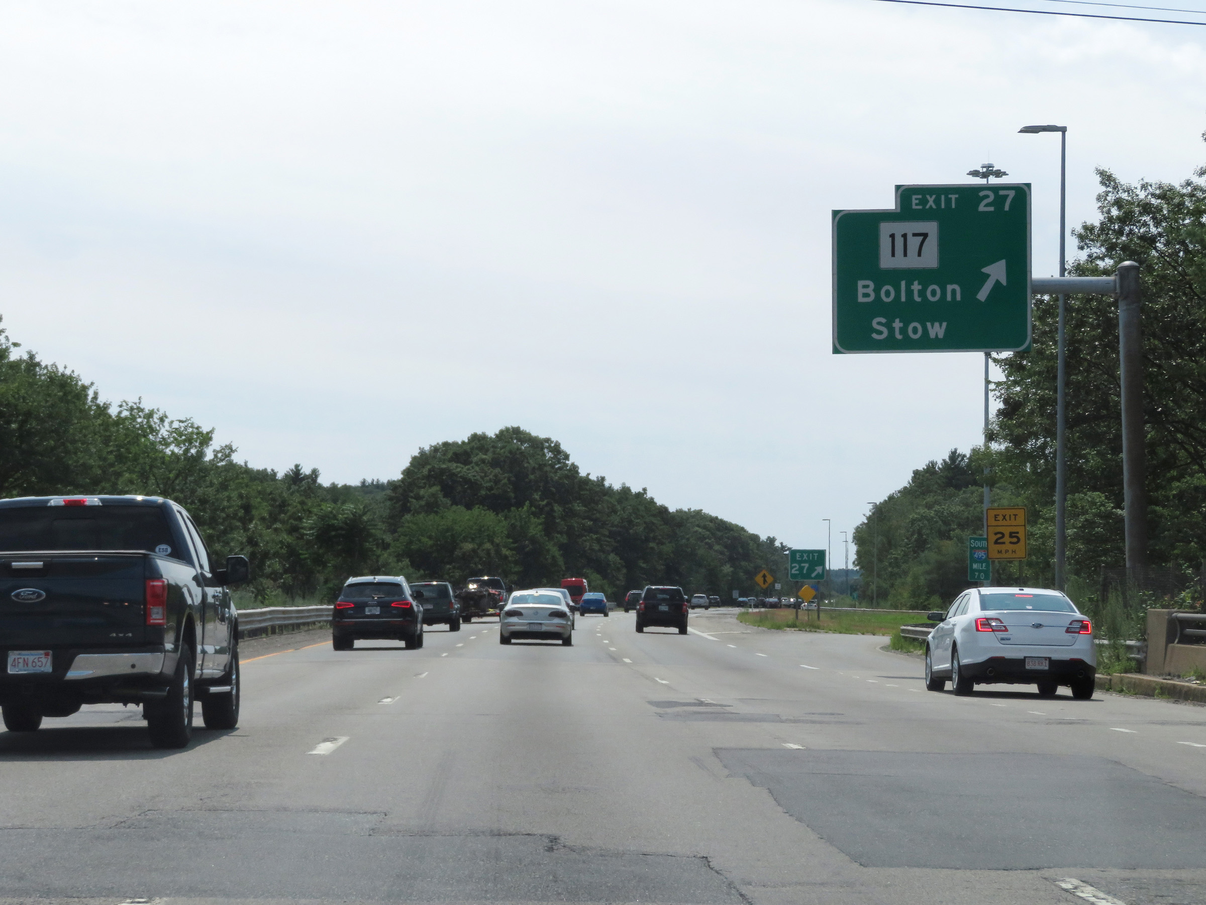 |
Interstate 495 South at Exit 27: MA 117 - Bolton / Stow (Photo taken 8/6/17). |
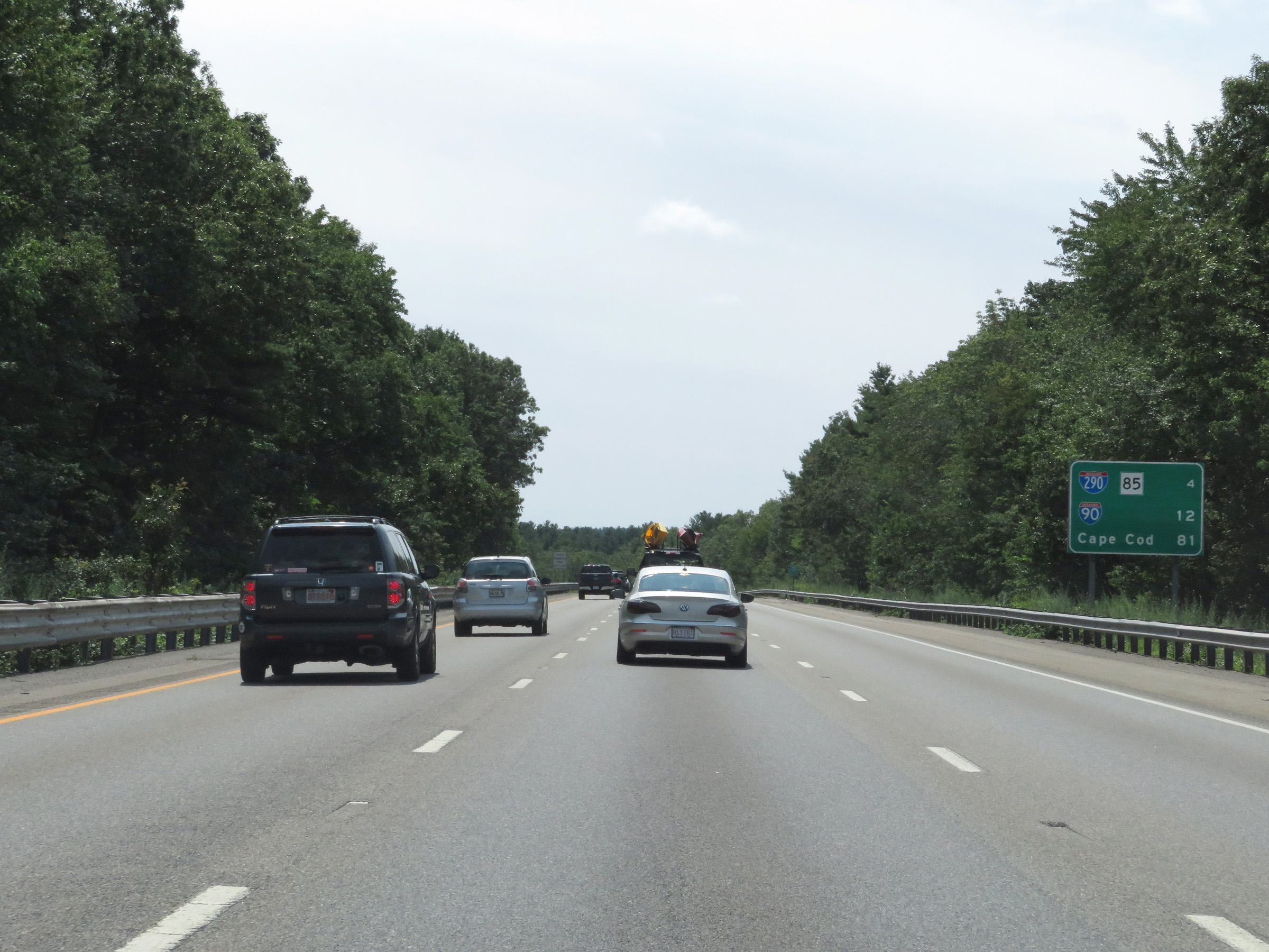 |
Mileage sign on Interstate 495 South. It's 4 miles to the junction of Interstate 290 / MA 85, 12 miles to the junction of Interstate 90, and 81 miles to Cape Cod. (Photo taken 8/6/17). |
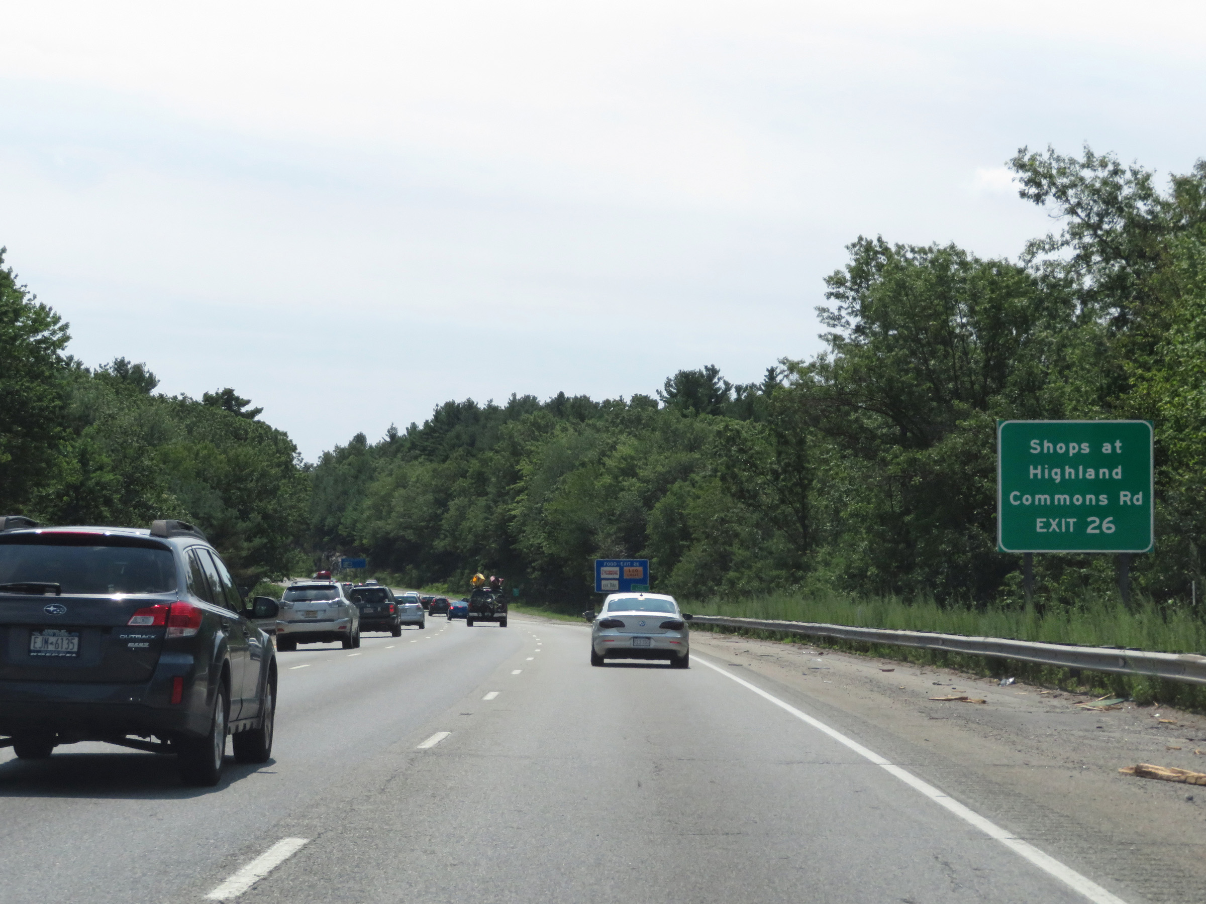 |
Take Exit 26 to the Shops at Highland and Commons Rd. (Photo taken 8/6/17). |
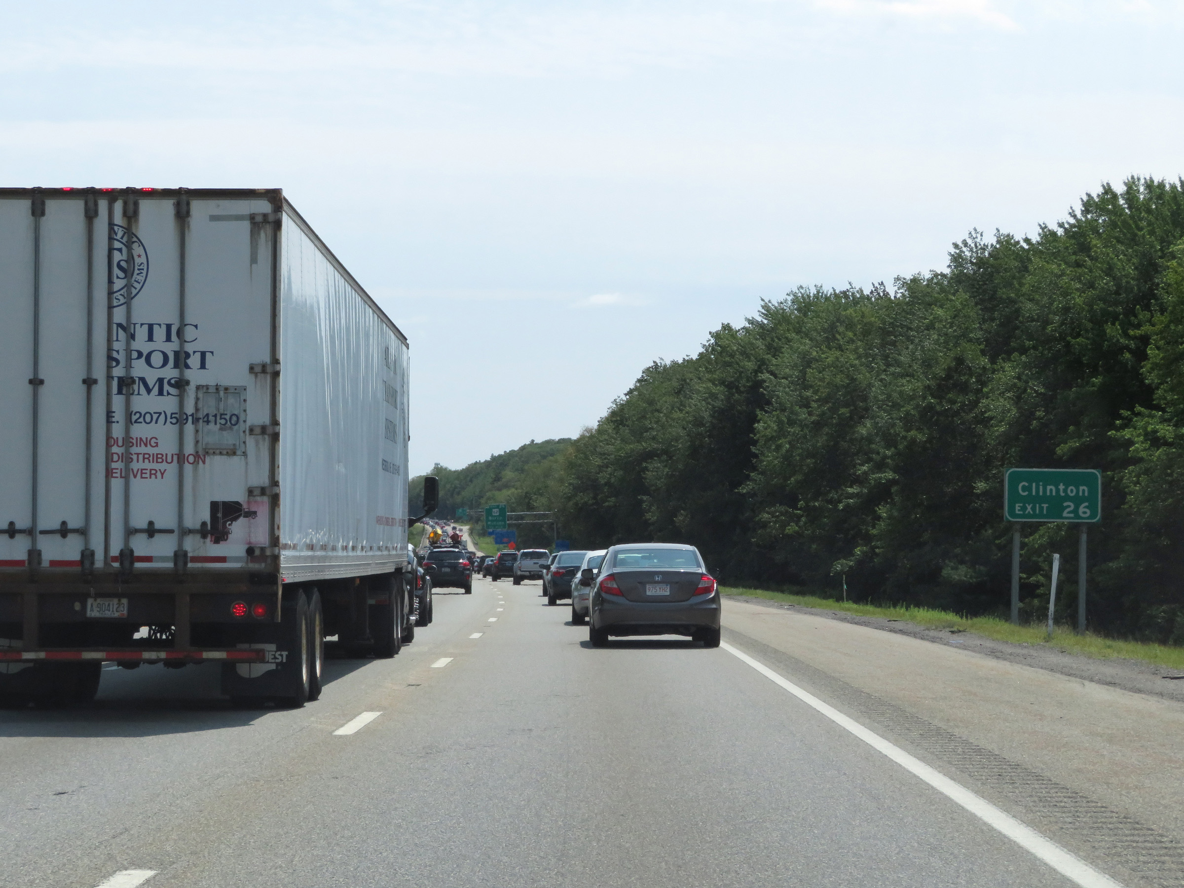 |
Also take Exit 26 to Clinton. (Photo taken 8/6/17). |
 |
Interstate 495 South at Exit 26: MA 62 - Berlin / Hudson (Photo taken 8/6/17). |
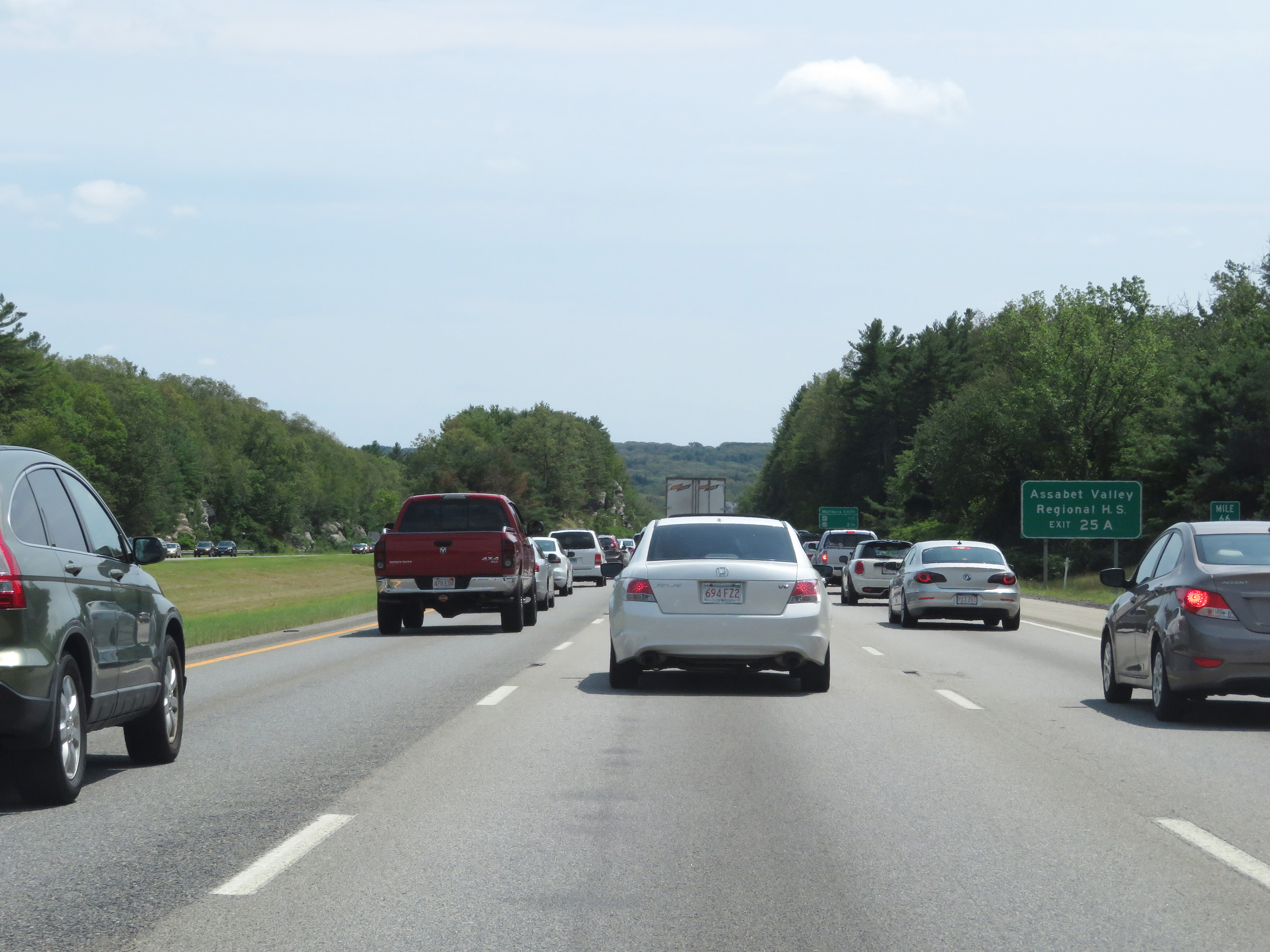 |
Take Exit 25A to Assabet Valley Regional High School. (Photo taken 8/6/17). |
 |
Interstate 495 South approaching Exits 25B-A - 1 mile. (Photo taken 8/6/17). |
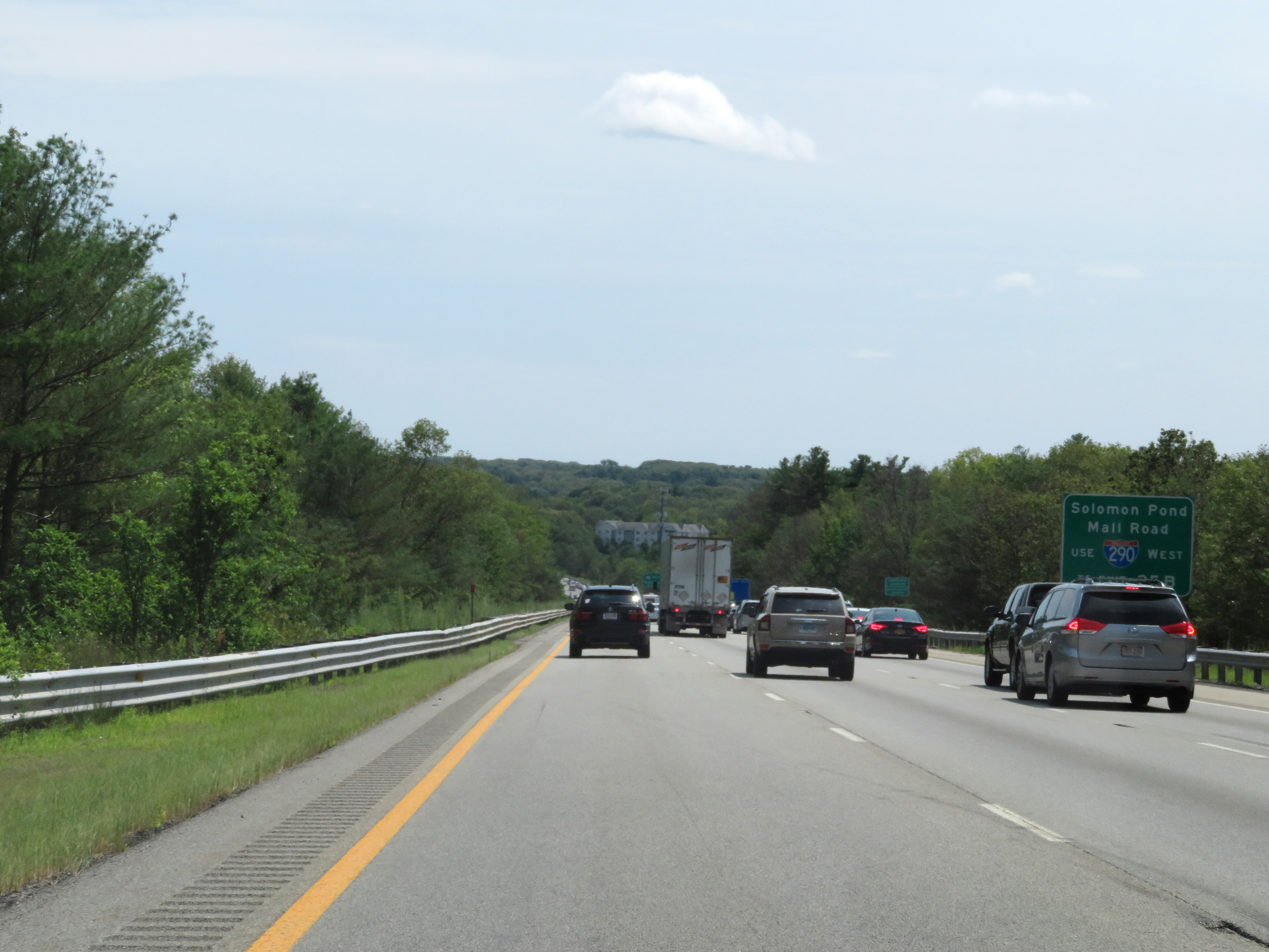 |
All traffic to Solomon Pond Mall Road should use Interstate 290 West via Exit 25B. (Photo taken 8/6/17). |
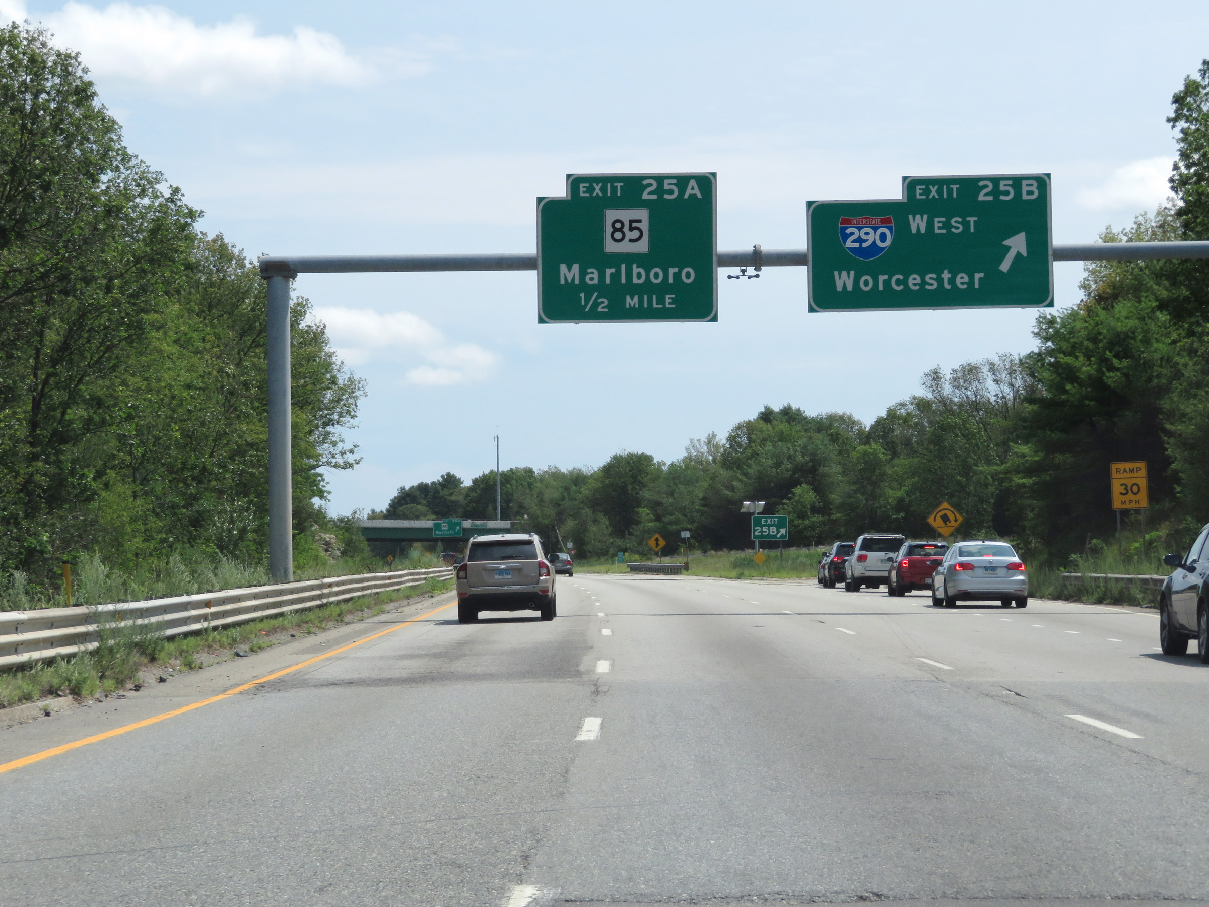 |
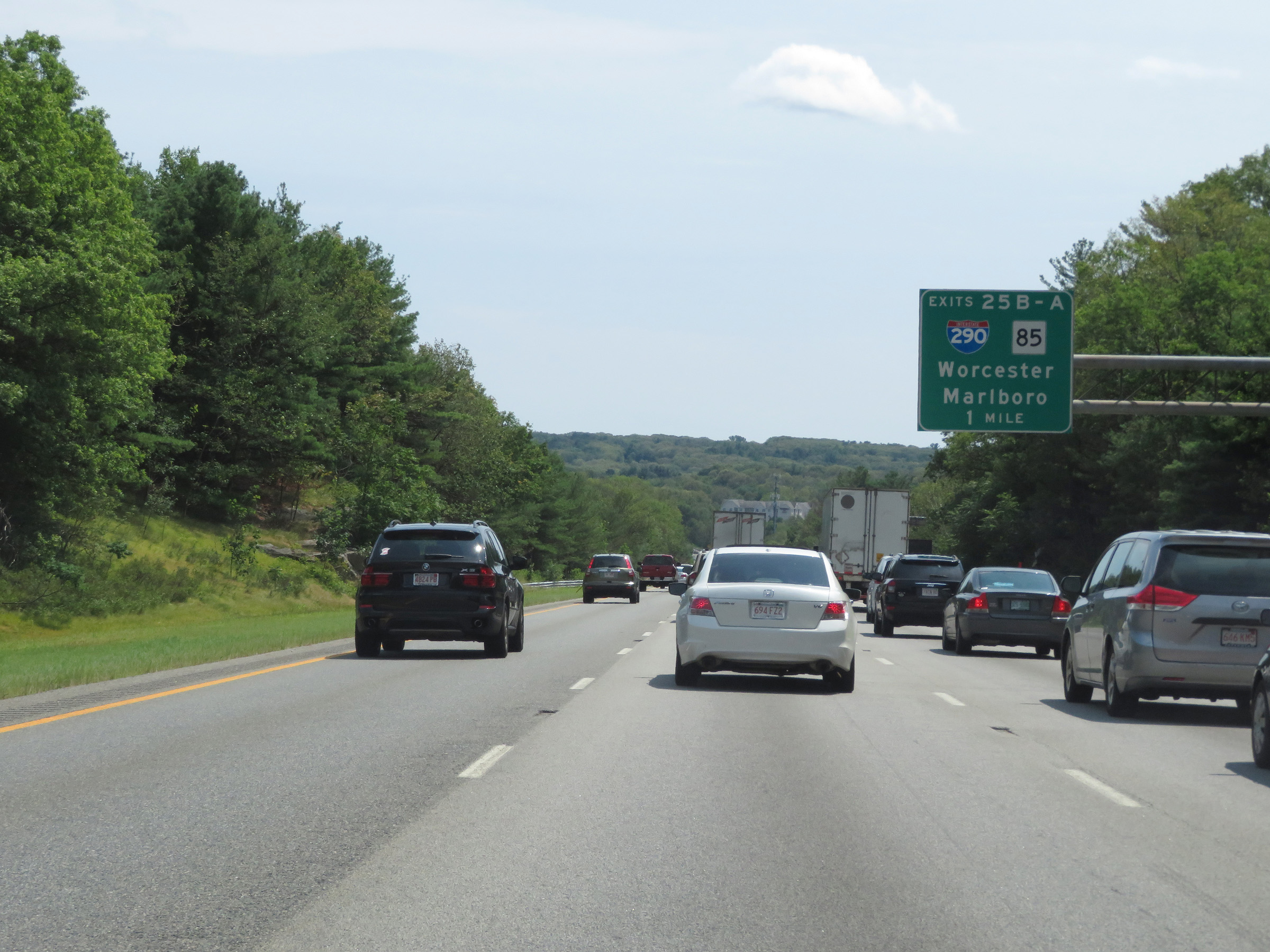
Interstate 495 South at Exit 25B: Interstate 290 West - Worcester (Photo taken 8/6/17). |
 |
Interstate 495 South at Exit 25A: MA 85 - Marlboro (Photo taken 8/6/17). |
 |
View on Interstate 495 South at mile marker 64. (Photo taken 8/6/17). |
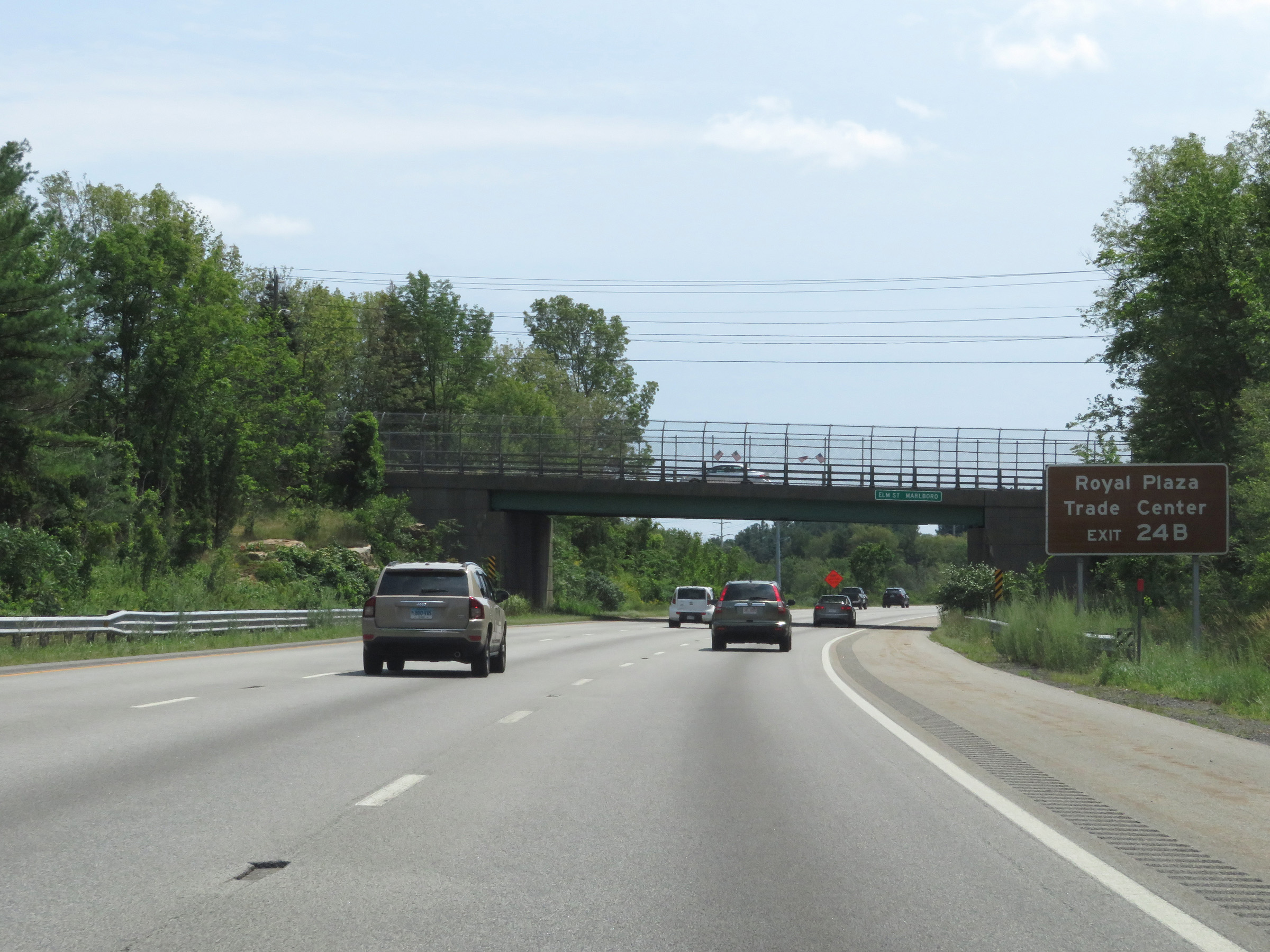 |
Take Exit 24B to Royal Plaza Trade Center. (Photo taken 8/6/17). |
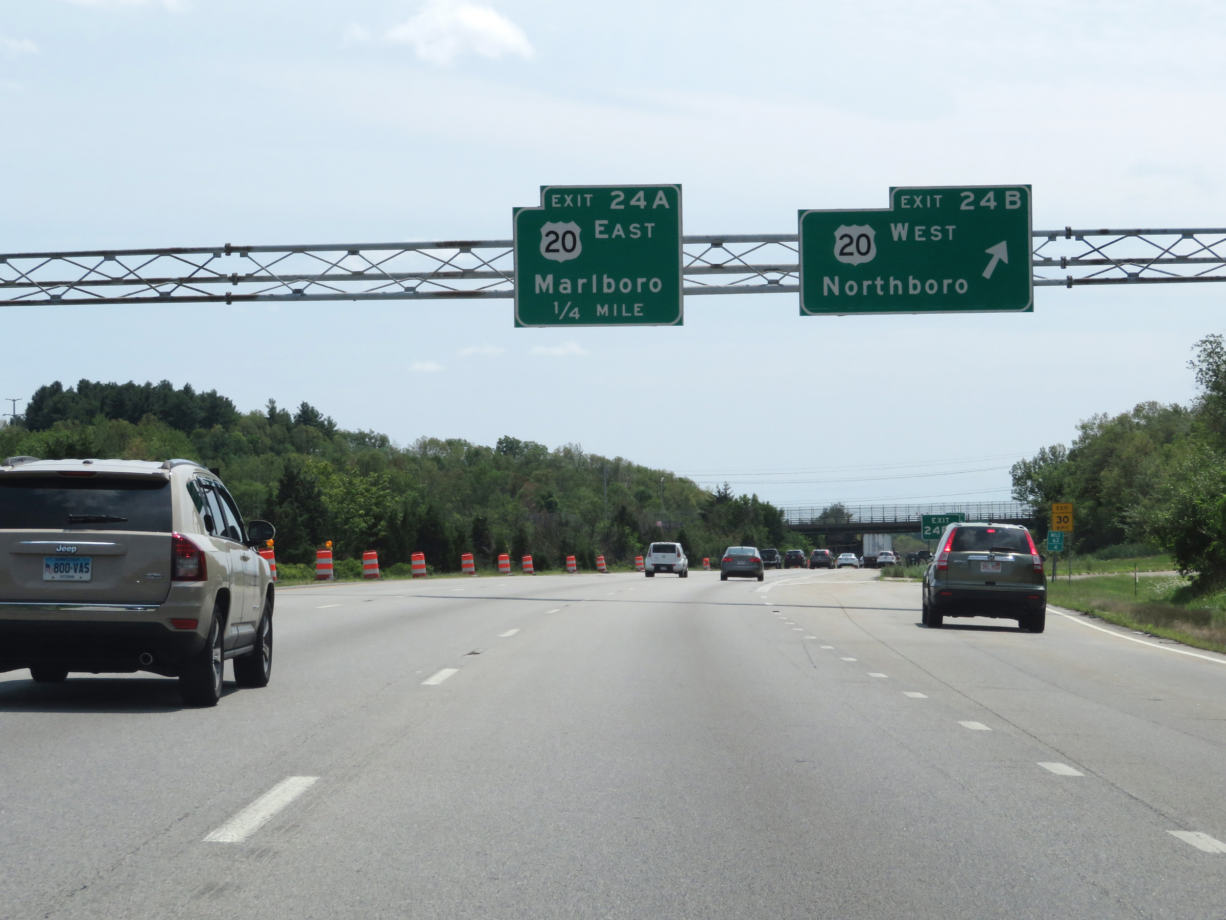 |
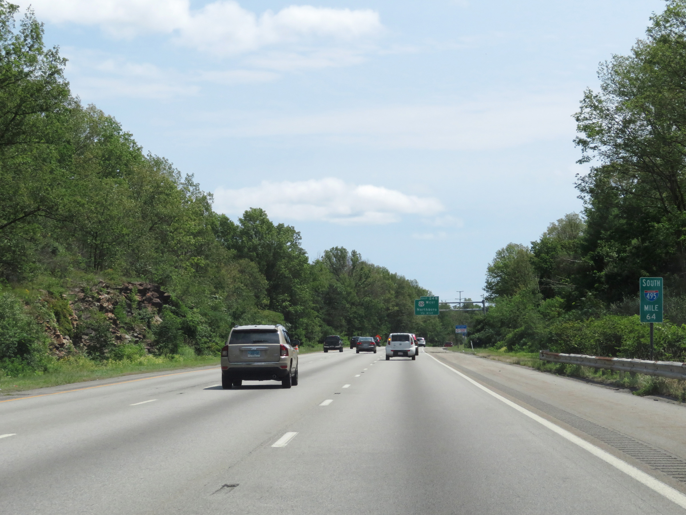
Interstate 495 South at Exit 24B: US 20 West - Northboro (Photo taken 8/6/17). |
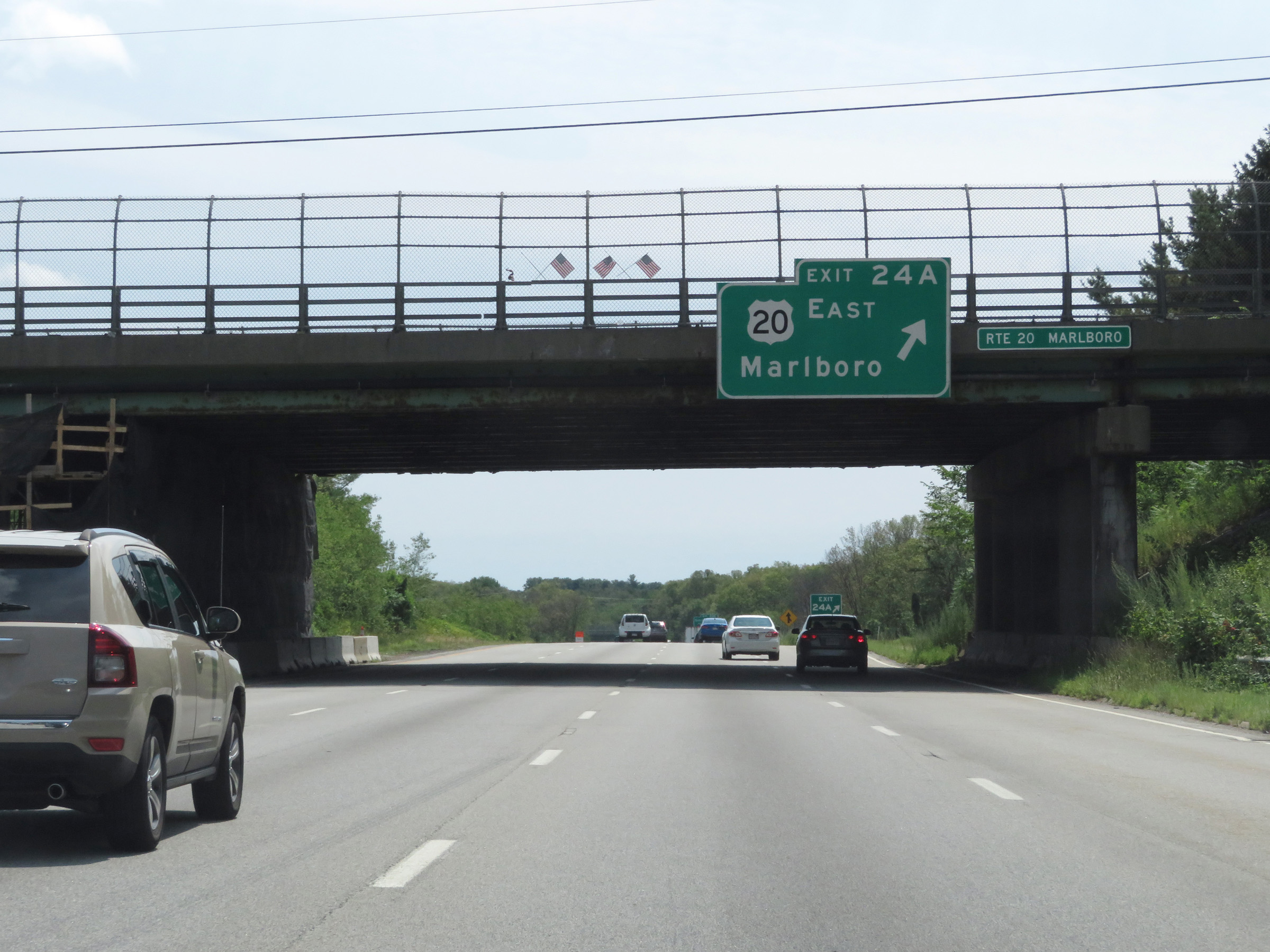 |
Interstate 495 South at Exit 24A: US 20 East - Marlboro (Photo taken 8/6/17). |
 |
Take Exit 23C to Simarano Dr via Joseph A. Ferrecchia Connector Rd. (Photo taken 8/6/17). |
 |
Interstate 495 South at Exit 23C: Simarano Dr / Marlboro / Southboro (Photo taken 8/6/17). |
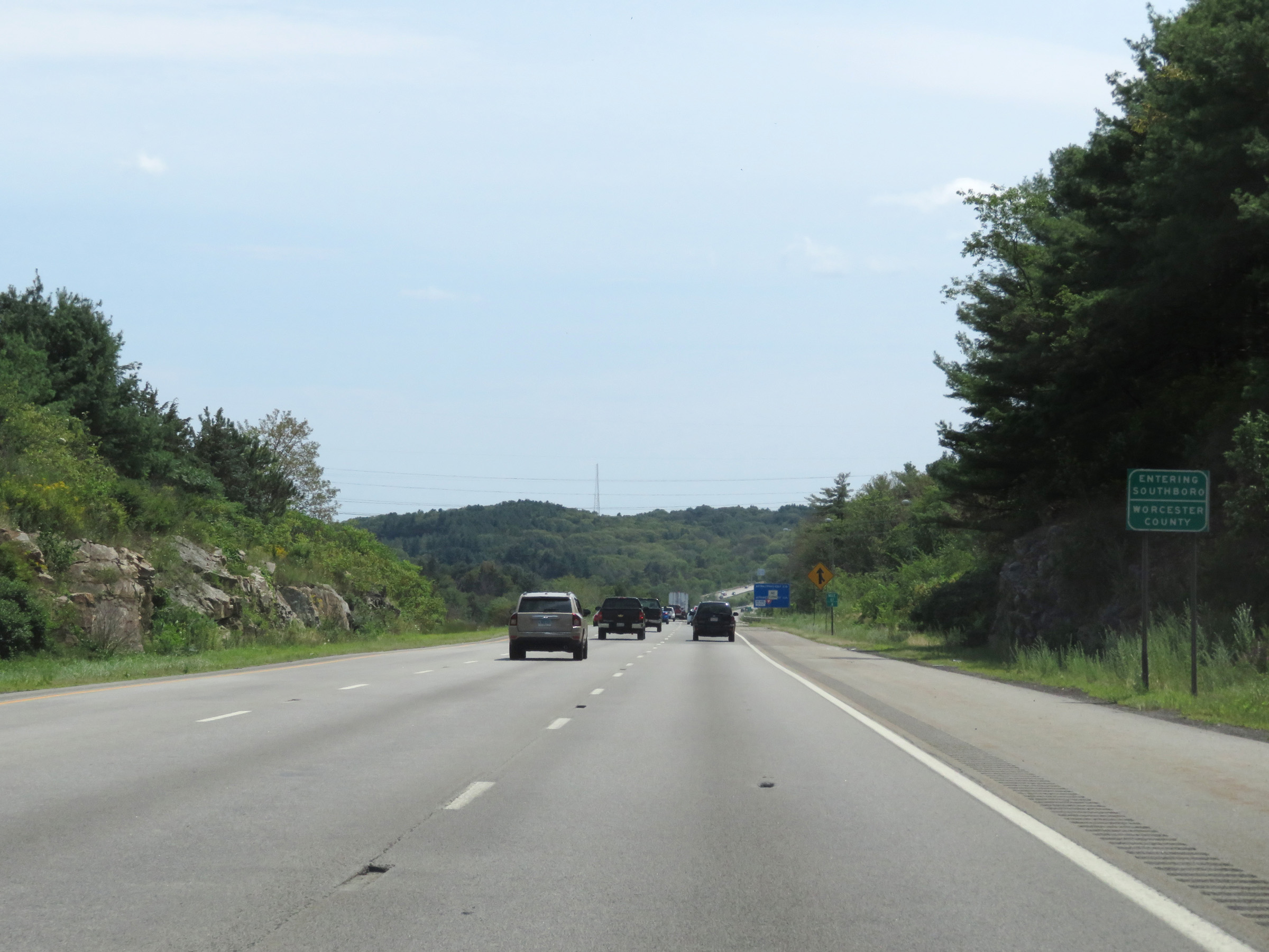 |
Interstate 495 South as it enters Worcester County for the second time. (Photo taken 8/6/17). |
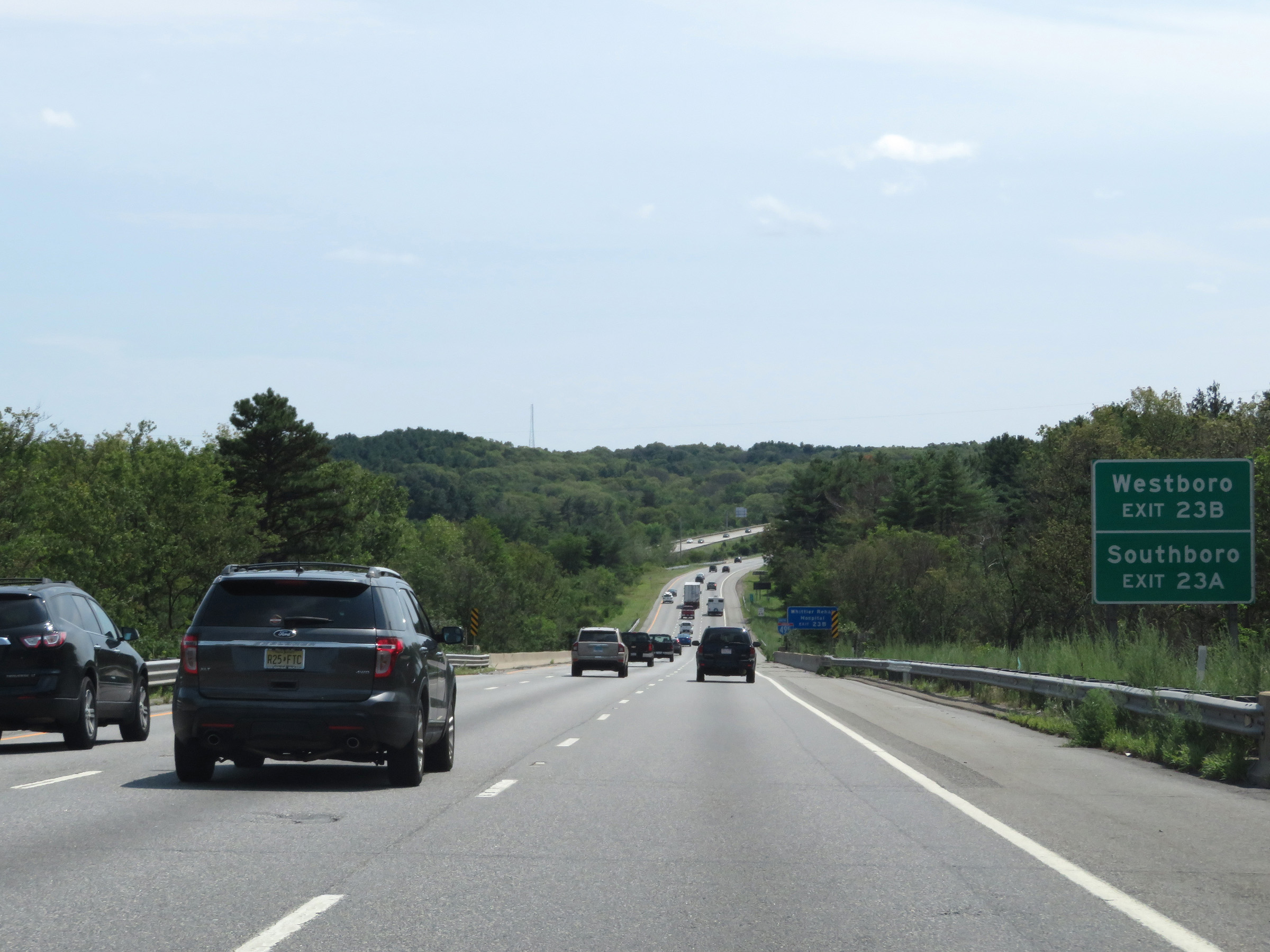 |
Take Exit 23B to Westboro. Take Exit 23A to Southboro. (Photo taken 8/6/17). |
 |
View on Interstate 495 South at mile marker 61. (Photo taken 8/6/17). |
 |
Interstate 495 South at Exit 23B: MA 9 West - Worcester (Photo taken 8/6/17). |
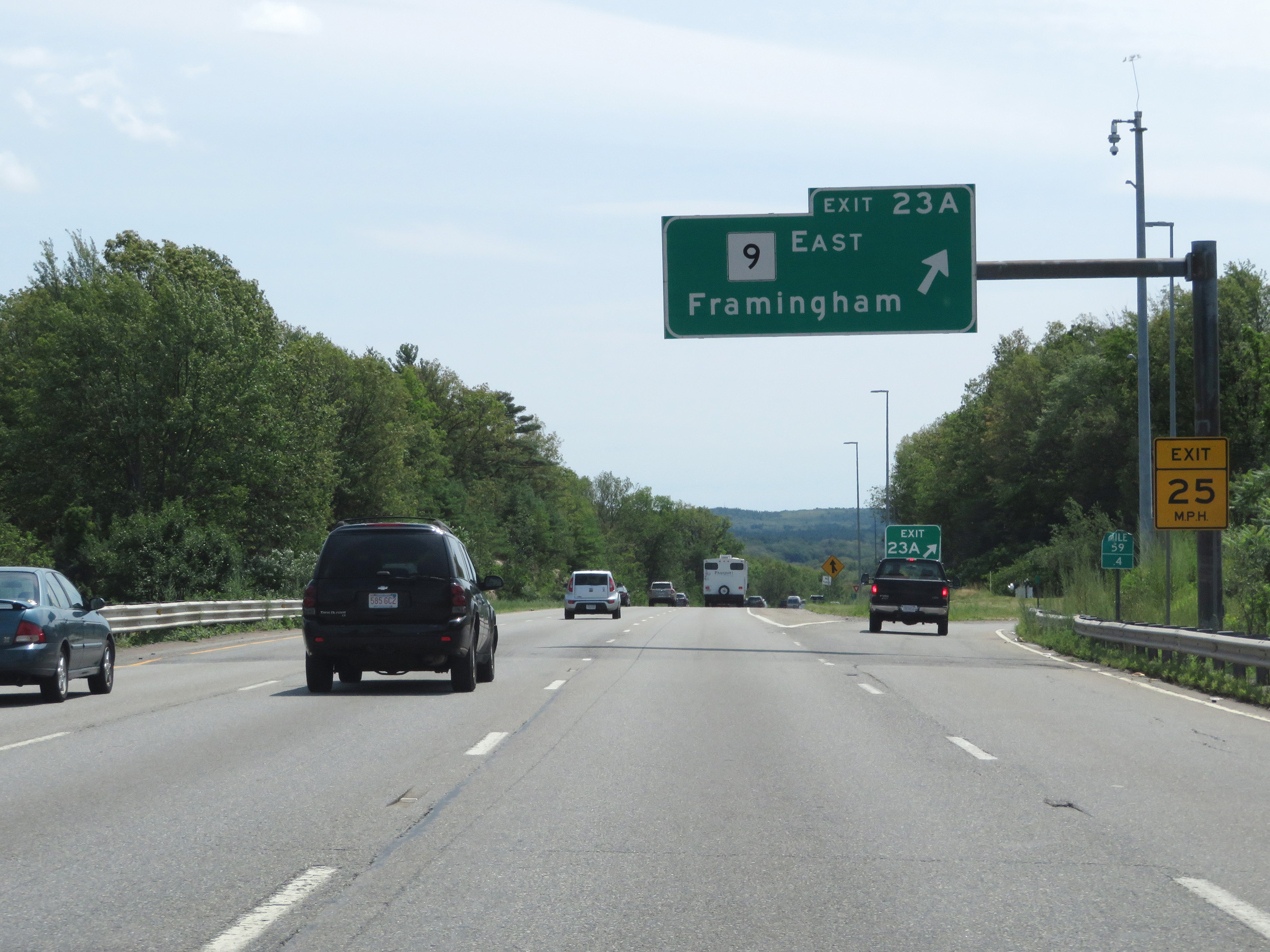 |
Interstate 495 South at Exit 23A: MA 9 East - Framingham (Photo taken 8/6/17). |
 |
Interstate 495 South approaching Exit 22 - 1 mile. (Photo taken 8/6/17). |
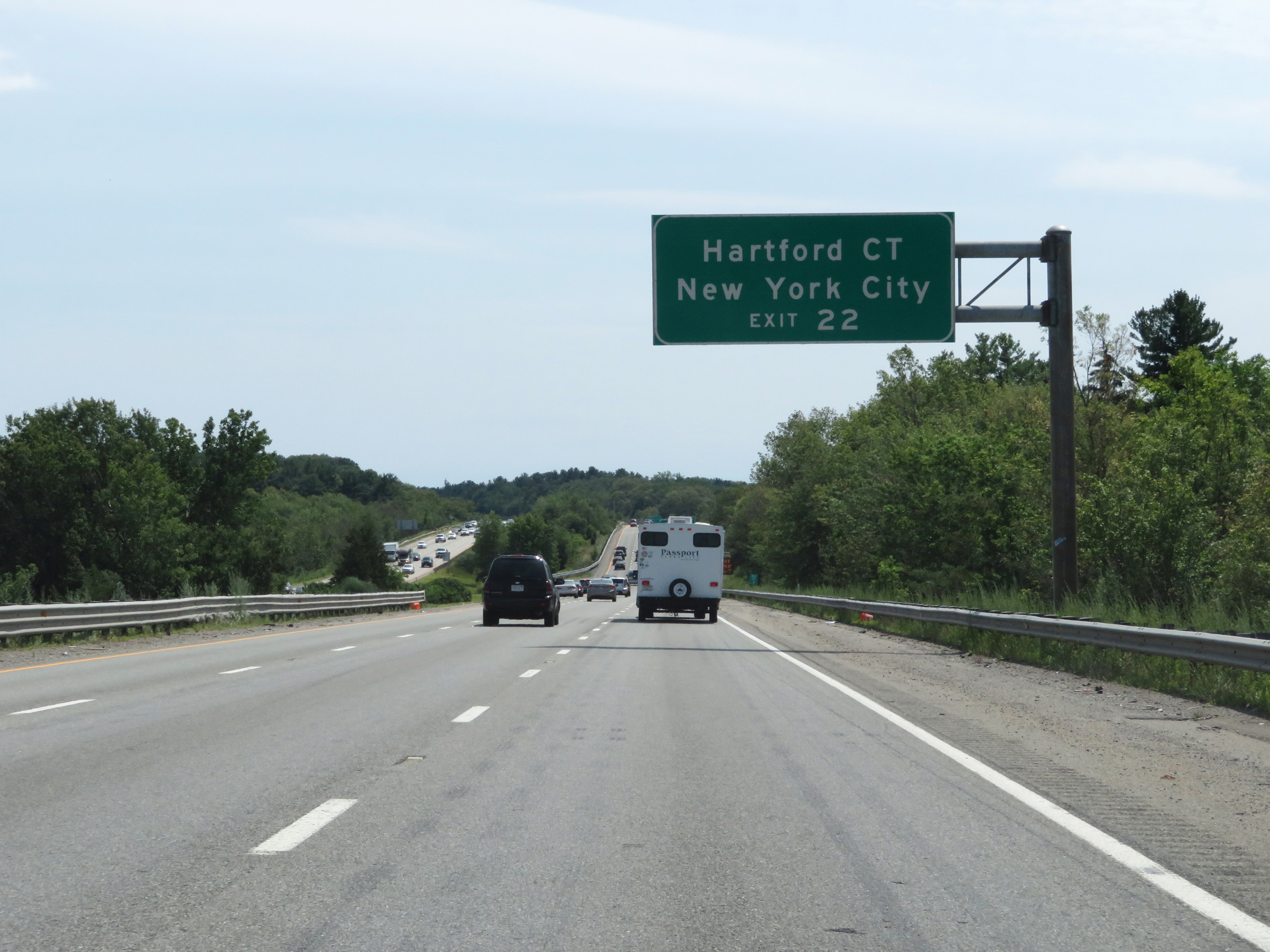 |
Take Exit 22 to Hartford, CT and New York City. (Photo taken 8/6/17). |
 |
Interstate 495 South as it re-enters Middlesex County. (Photo taken 8/6/17). |
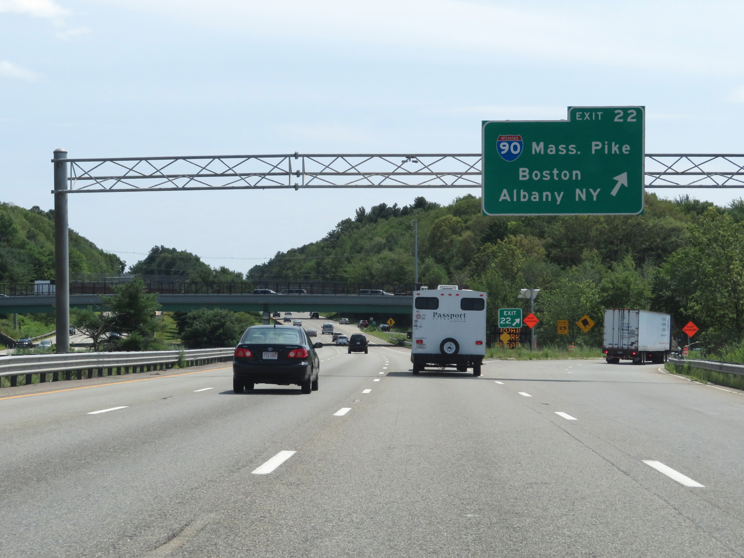 |
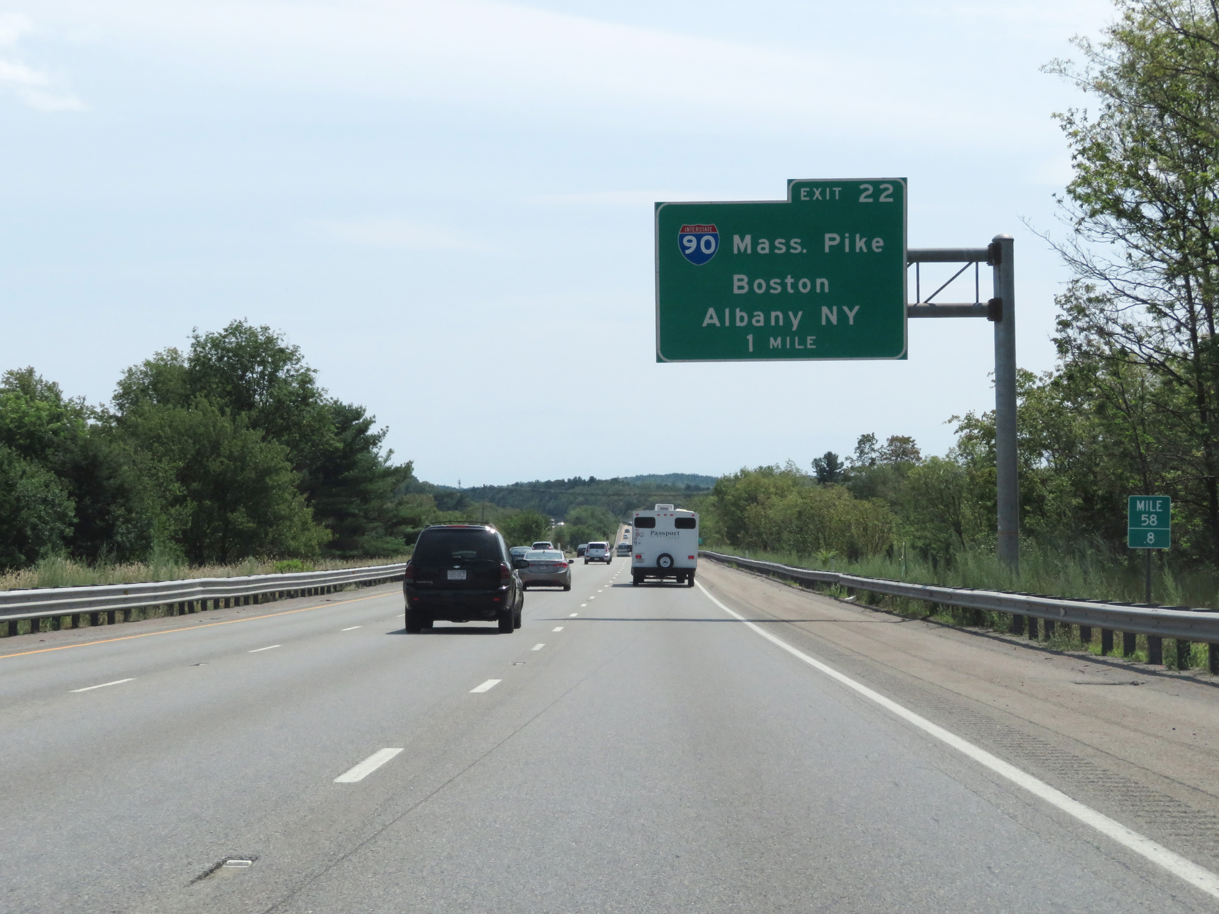
Interstate 495 South at Exit 22: Interstate 90 (Mass Pike) - Boston / Albany, NY (Photo taken 8/6/17). |
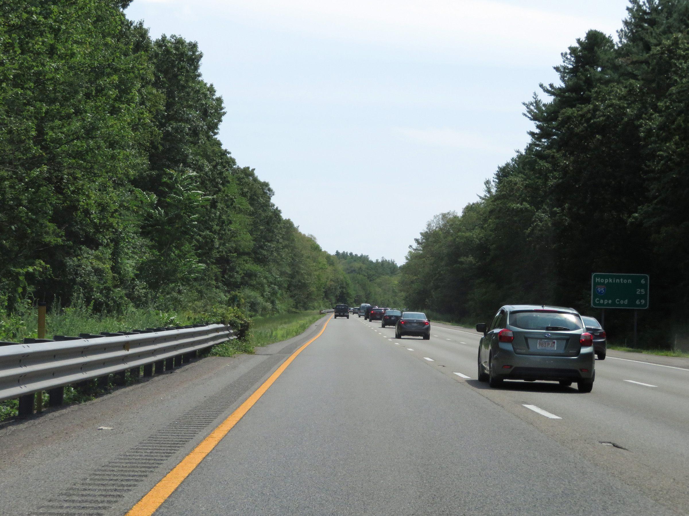 |
Mileage sign on Interstate 495 South. It's 6 miles to Hopkinton, 25 miles to the junction of Interstate 95, and 69 miles to Cape Cod. (Photo taken 8/6/17). |
 |
View on Interstate 495 South at mile marker 56. (Photo taken 8/6/17). |
 |
Take Exit 21B to South St and Hopkinton. Take Exit 21A to Ashland. (Photo taken 8/6/17). |
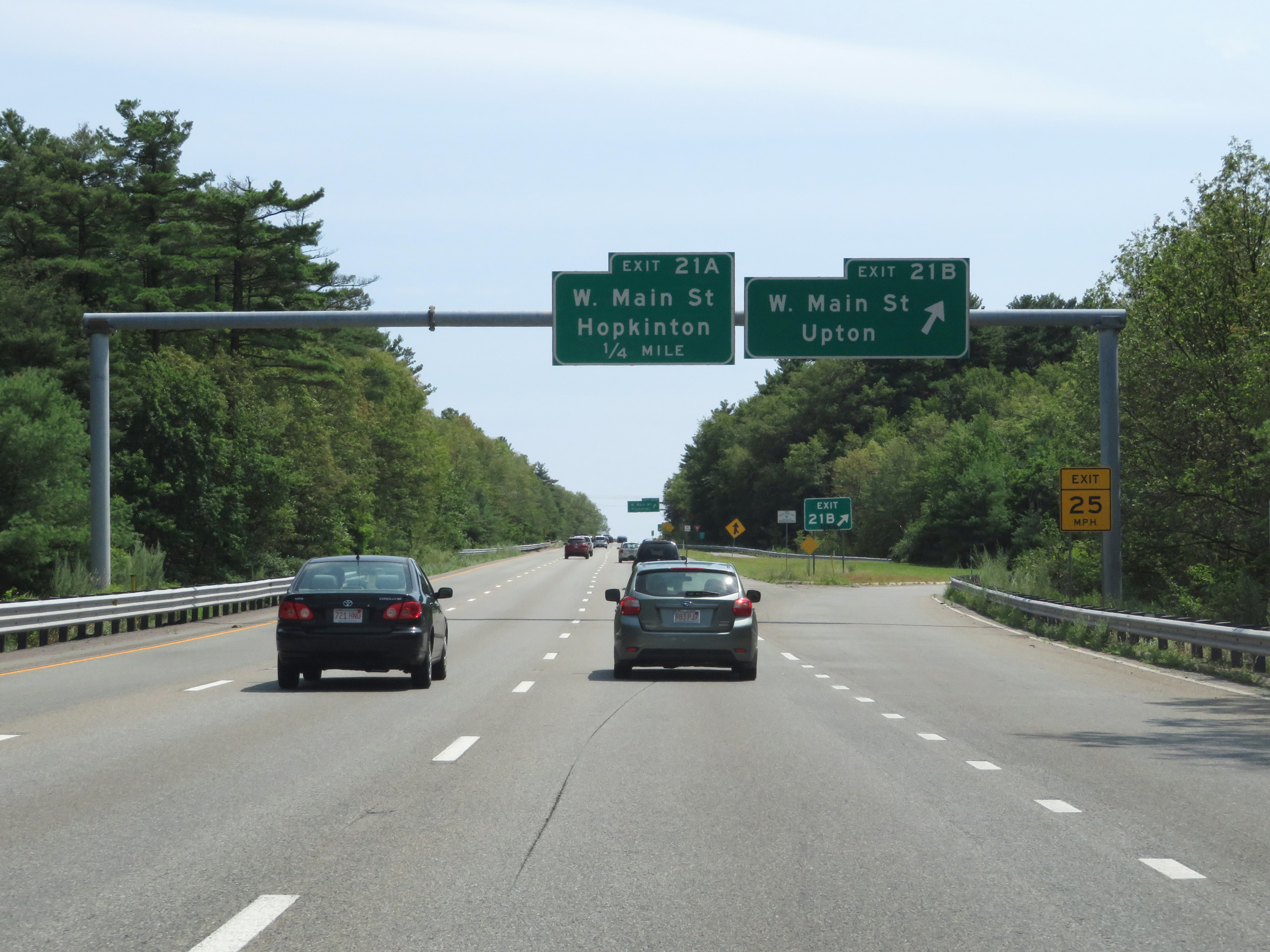 |
Interstate 495 South at Exit 21B: West Main St / Upton (Photo taken 8/6/17). |
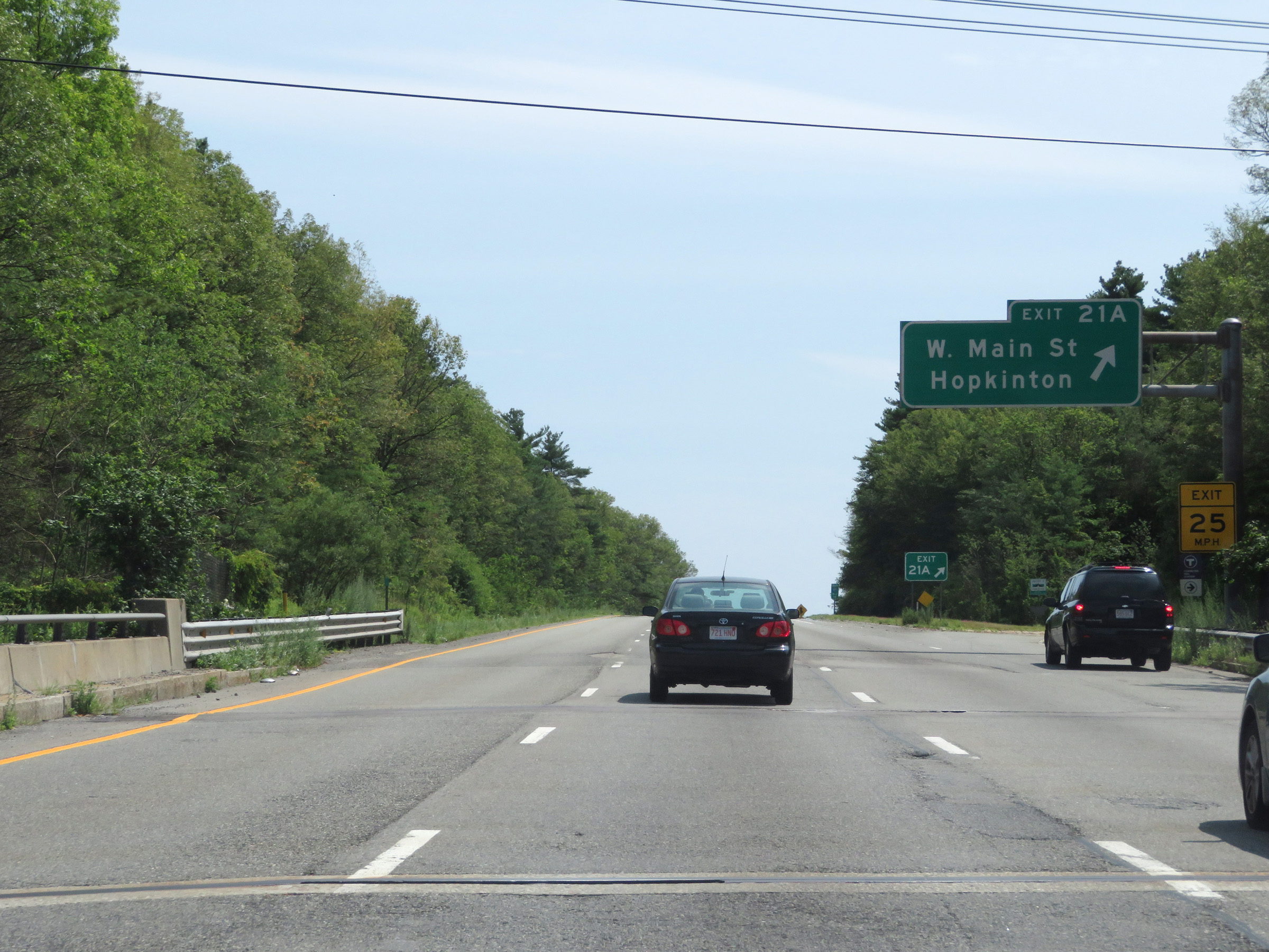 |
Interstate 495 South at Exit 21A: West Main St / Hopkinton (Photo taken 8/6/17). |
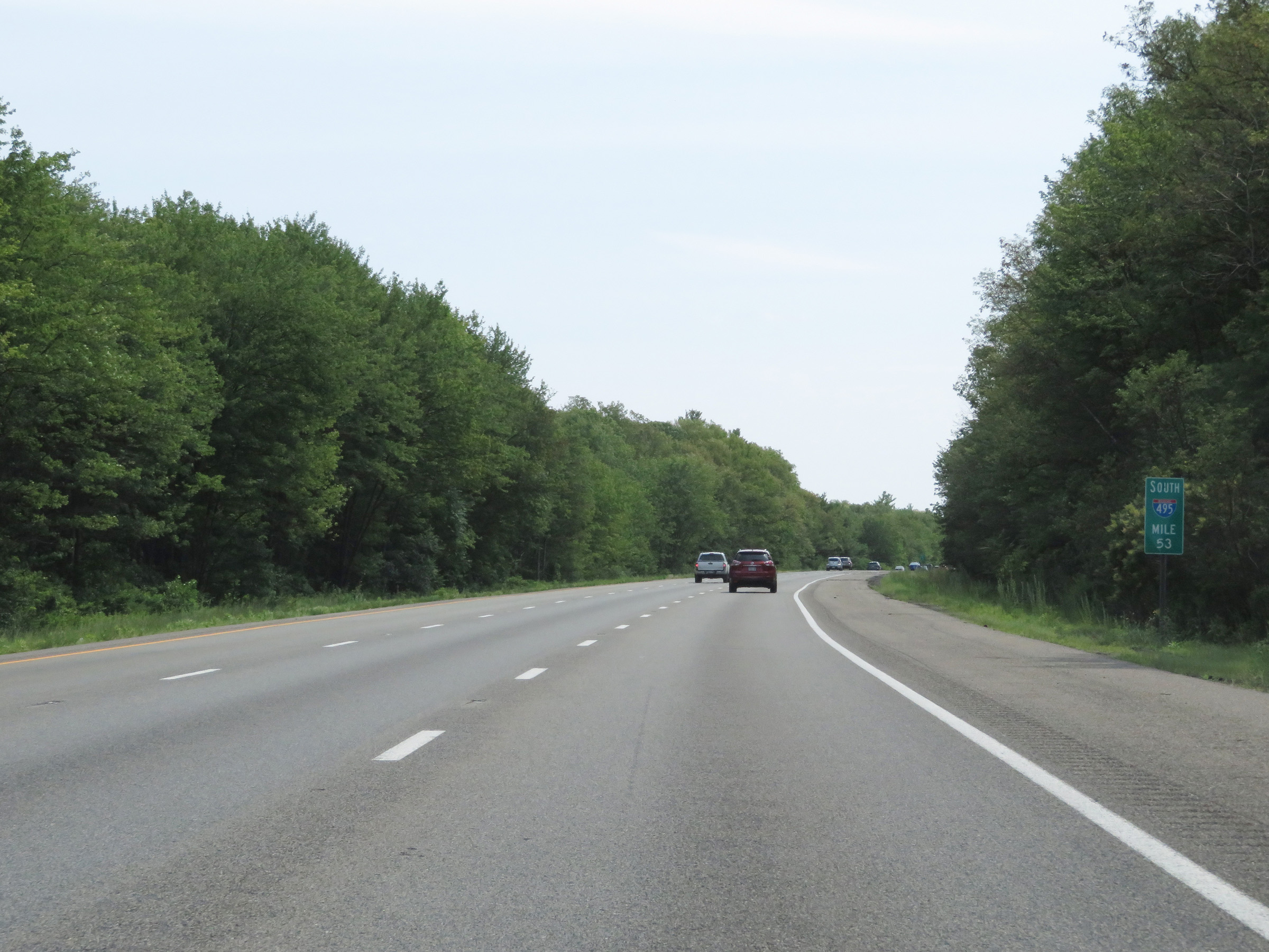 |
View on Interstate 495 South at mile marker 53. (Photo taken 8/6/17). |
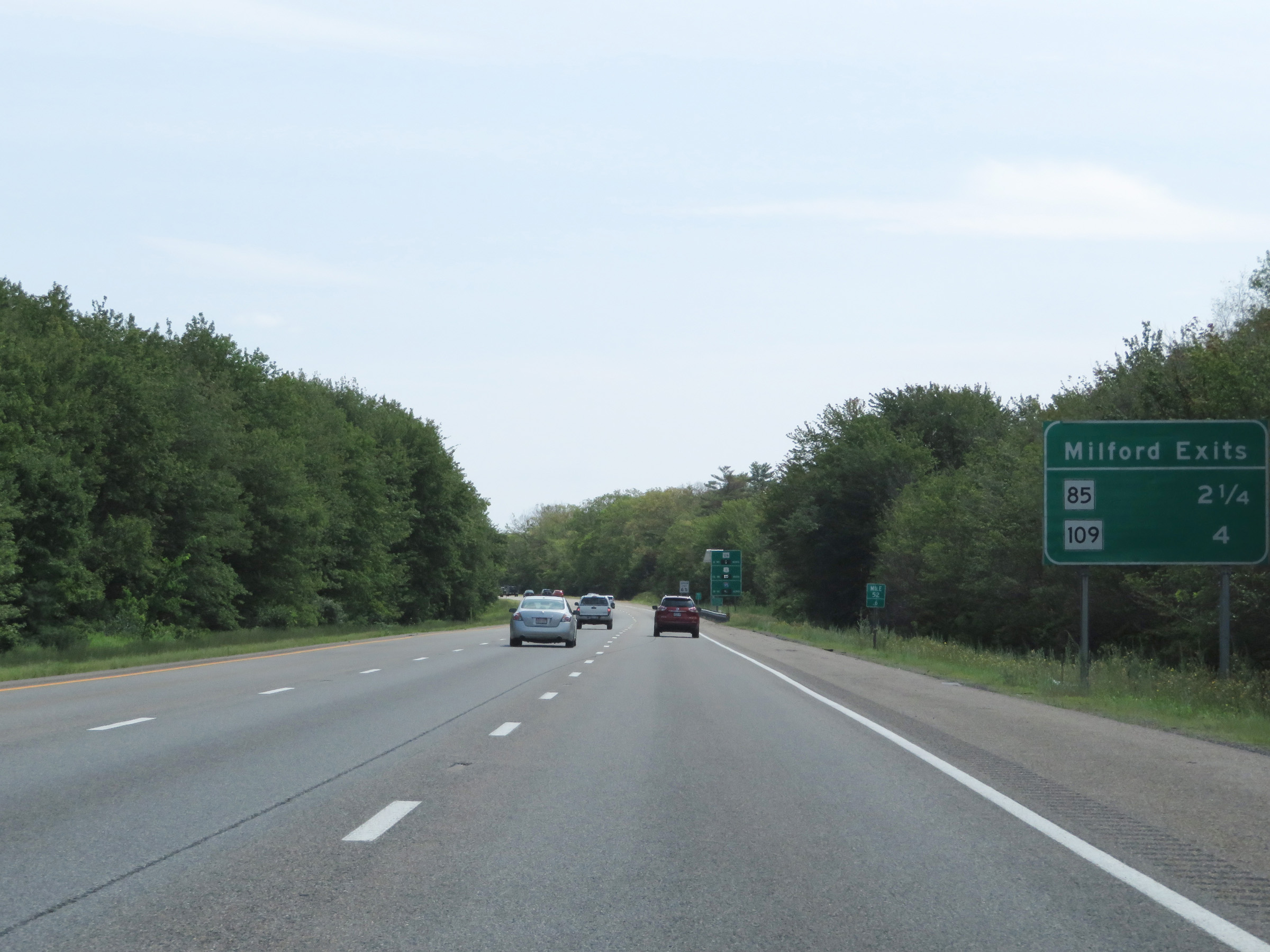 |
Mileage sign listing the distances to the two upcoming exits to Milford. (Photo taken 8/6/17). |
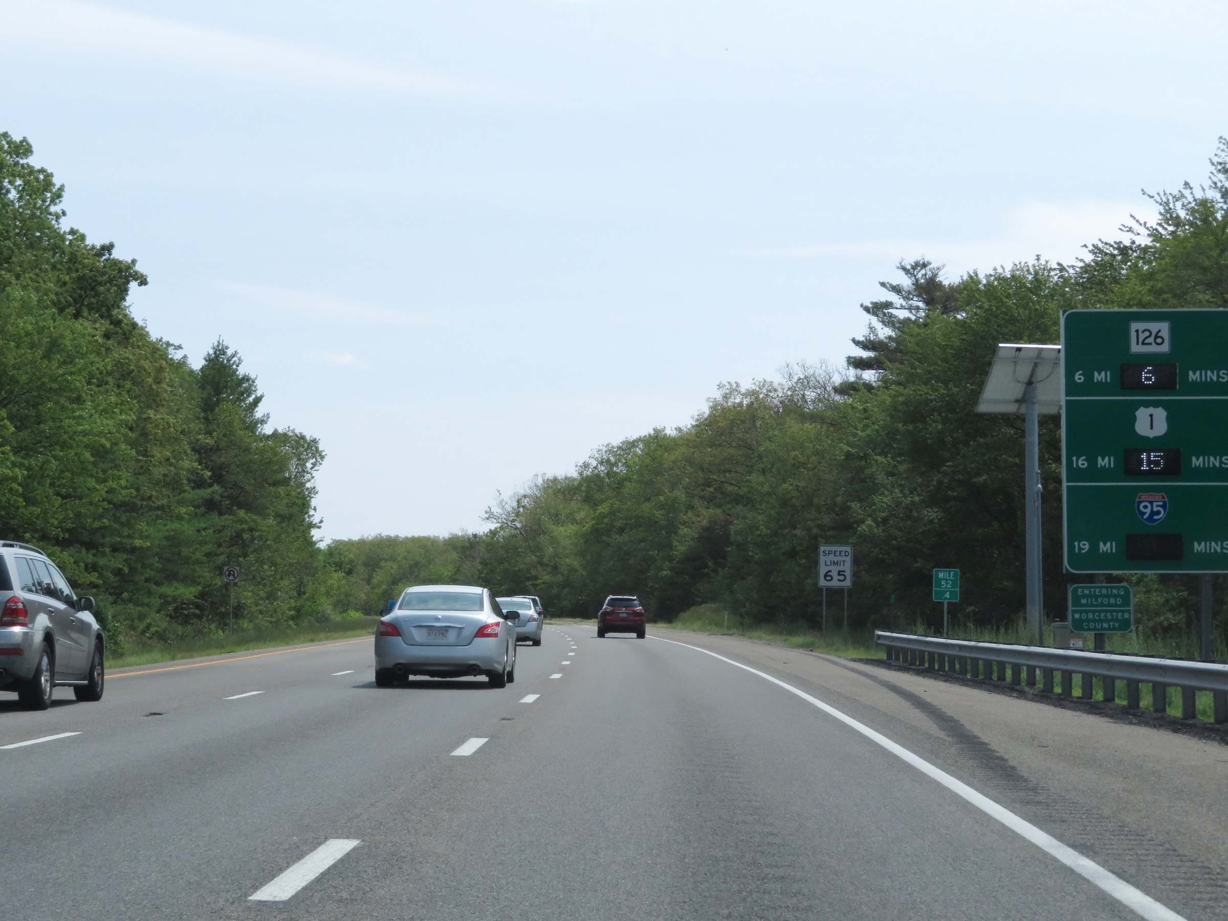 |
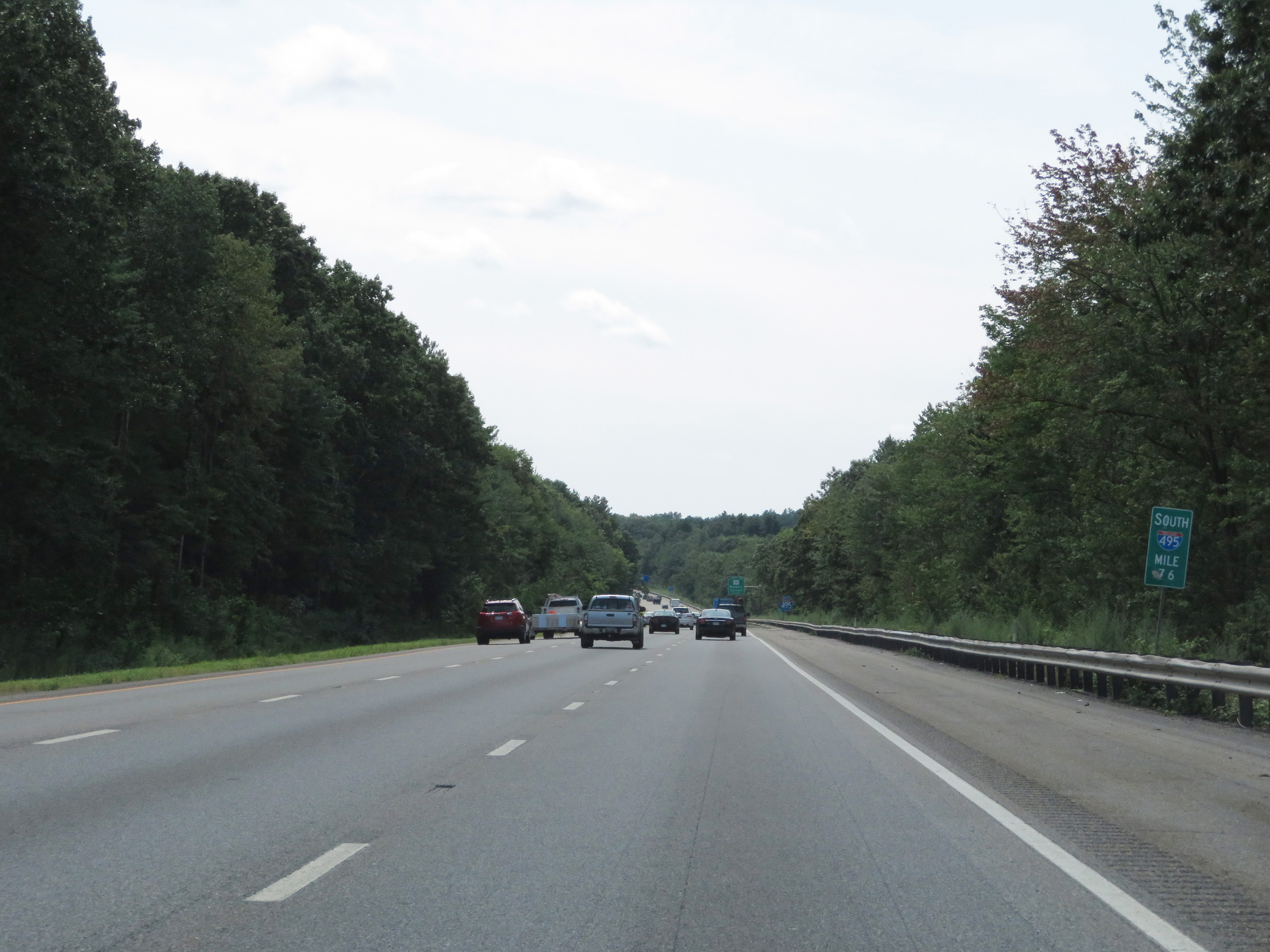
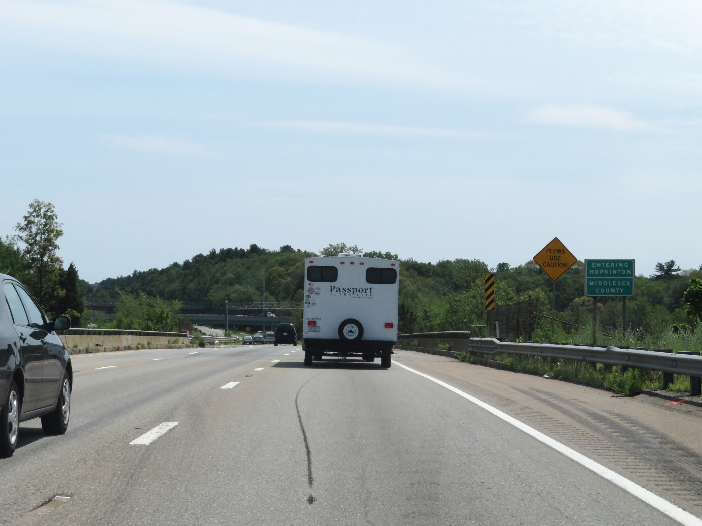
Interstate 495 South as it enters Worcester County once again at mile marker 52.4. (Photo taken 8/6/17). |
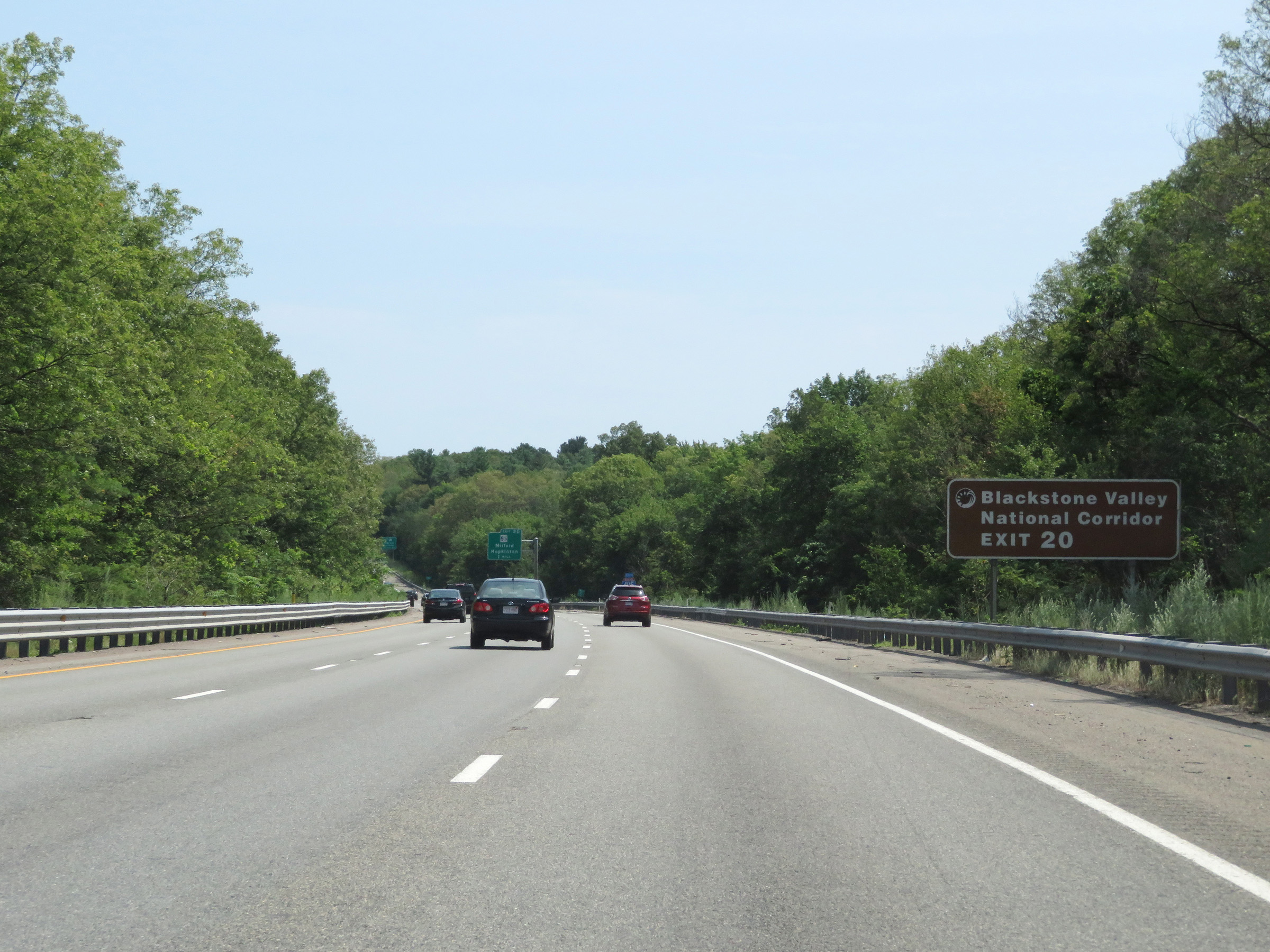 |
Take Exit 20 to Blackstone Valley National Corridor. (Photo taken 8/6/17). |
 |
Also take Exit 20 to MA 16 toward Uxbridge and Holliston. (Photo taken 8/6/17). |
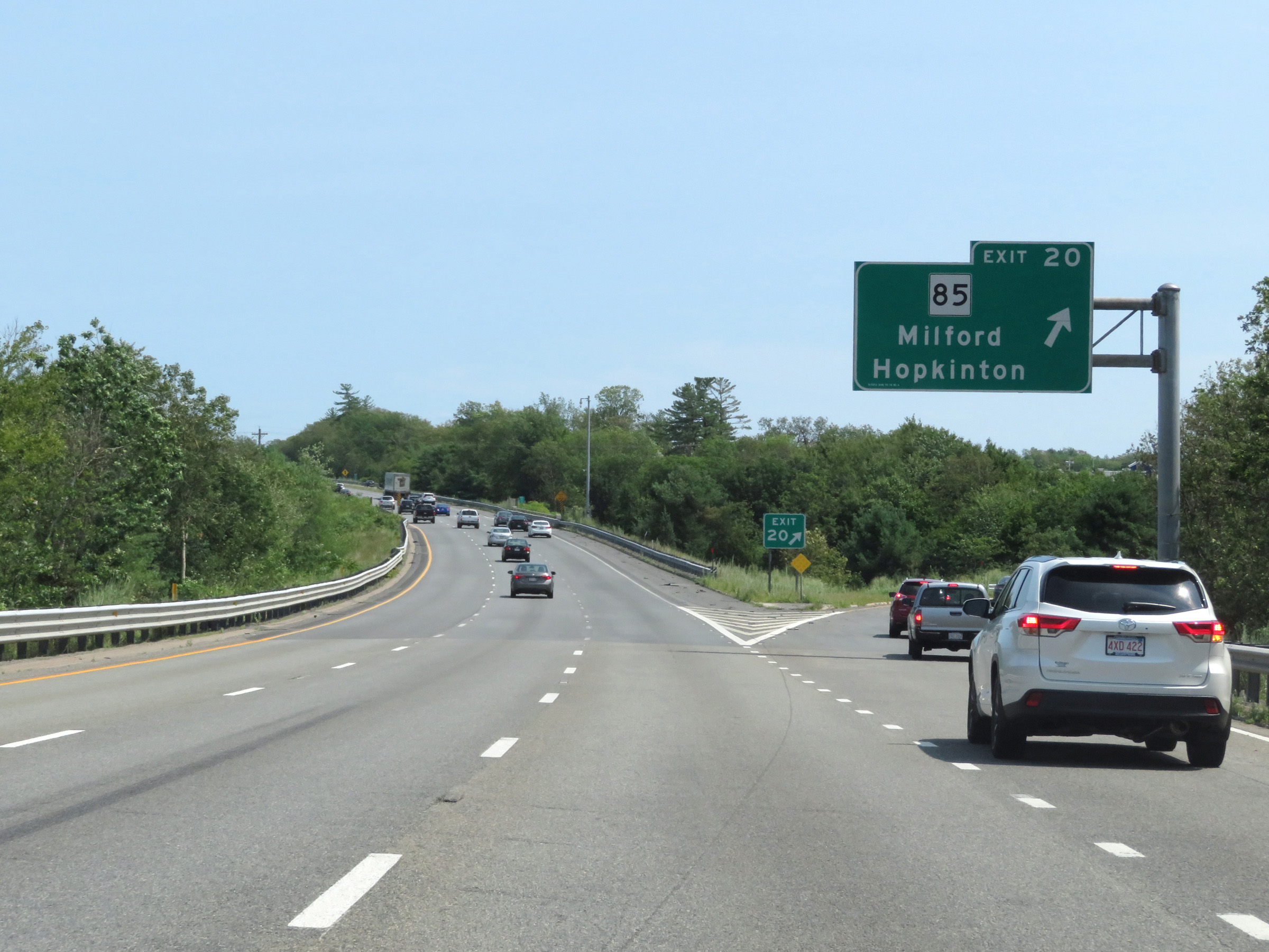 |
Interstate 495 South at Exit 20: MA 85 - Milford / Hopkinton (Photo taken 8/6/17). |
 |
This sign lists the distances to the two upcoming Medway exits. (Photo taken 8/6/17). |
 |
Interstate 495 South at Exit 19: MA 109 - Milford / Medway (Photo taken 8/6/17). |
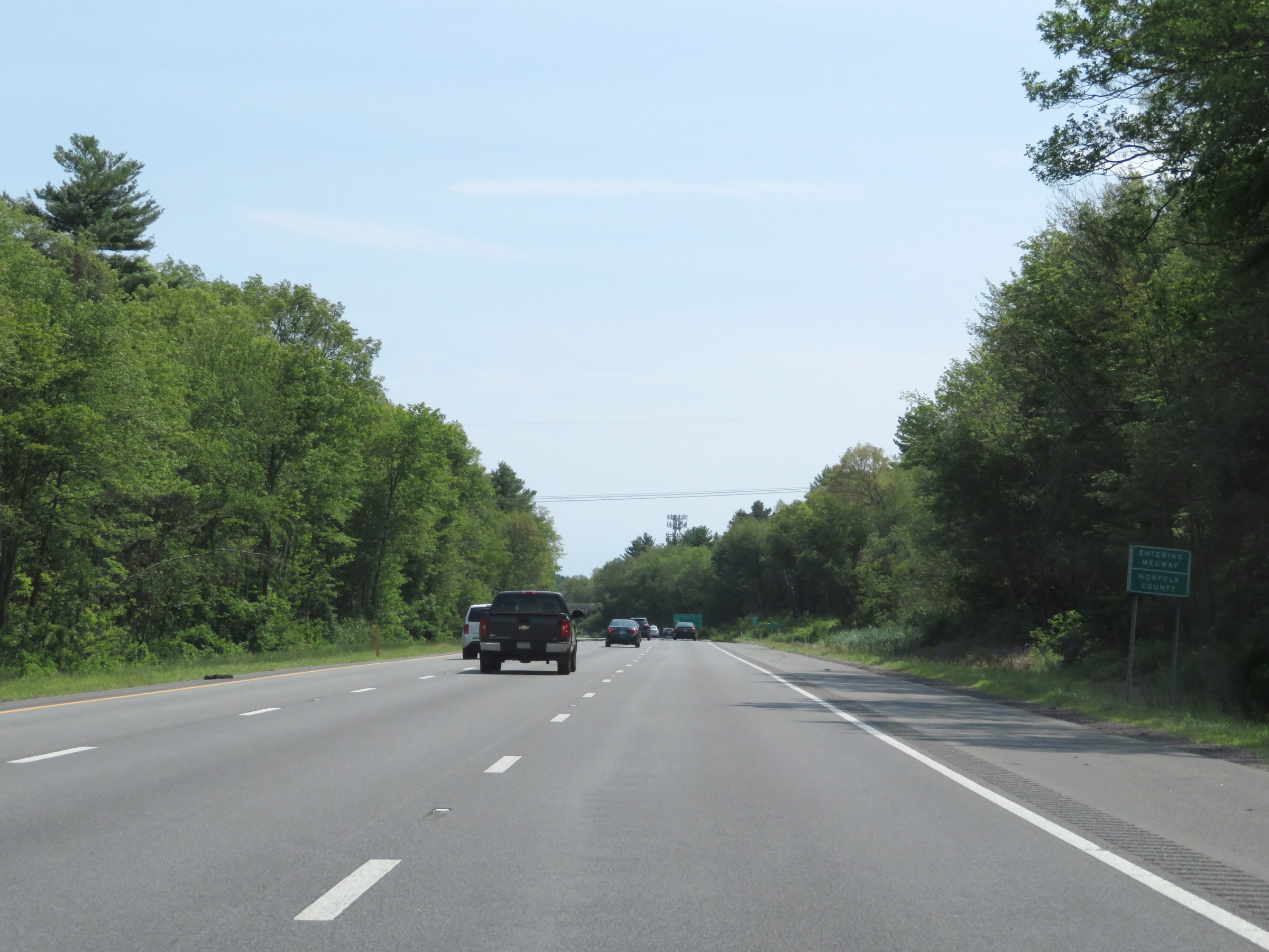 |
Interstate 495 South as it enters Norfolk County. (Photo taken 8/6/17). |
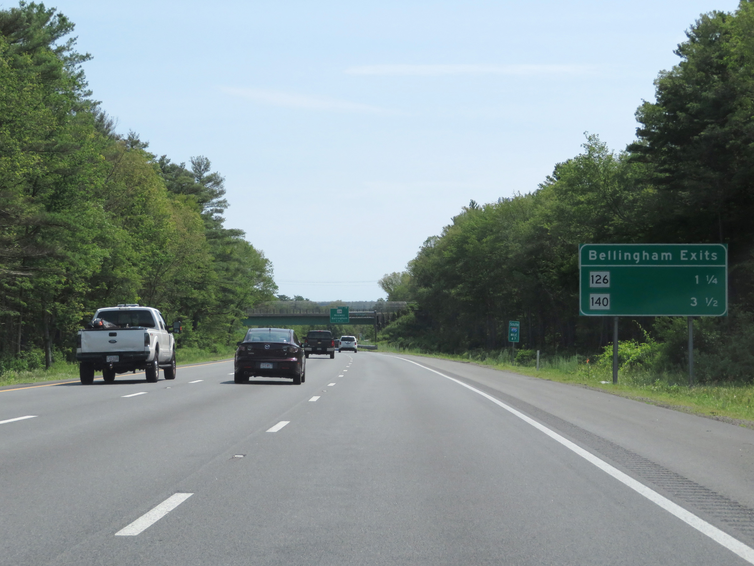 |
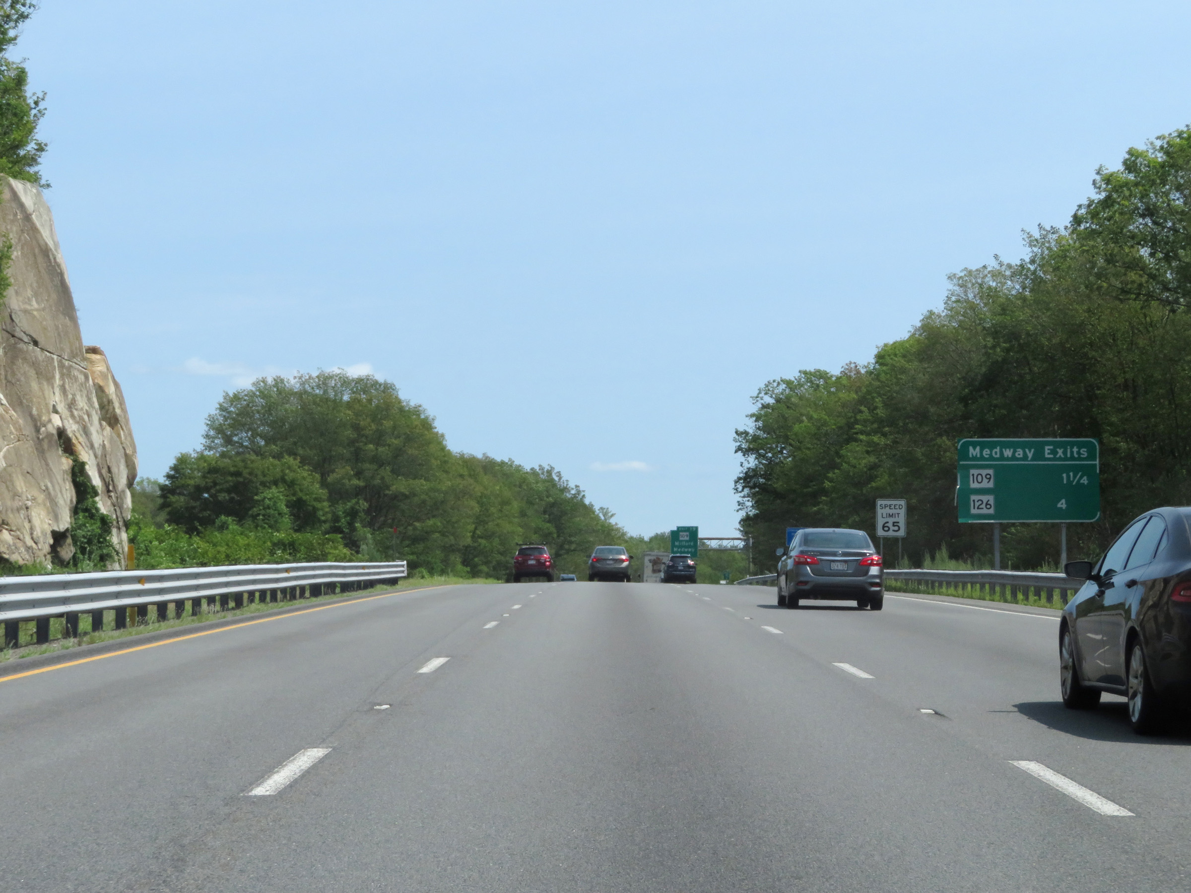
Mileage sign at mile marker 47 listing the distances to the two upcoming exits to Bellingham. (Photo taken 8/6/17). |
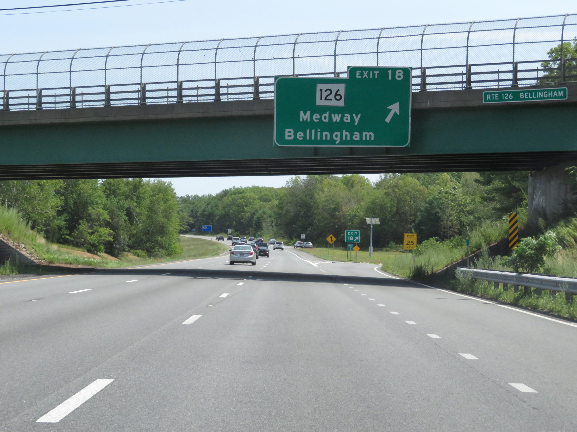 |
Interstate 495 South at Exit 18: MA 126 - Medway / Bellingham (Photo taken 8/6/17). |
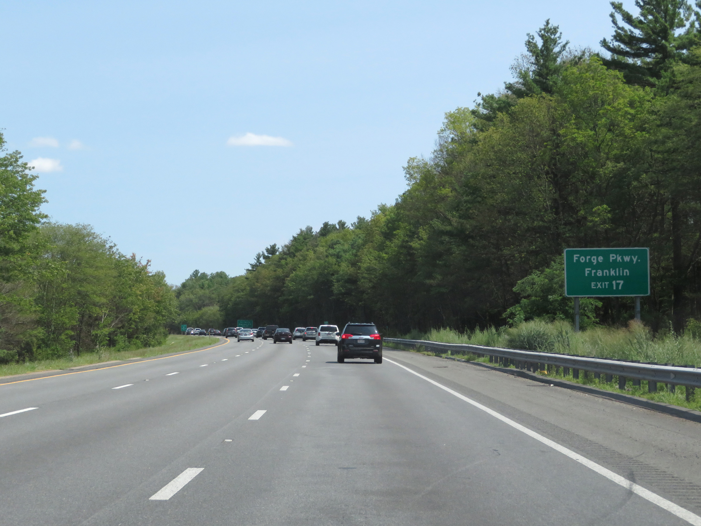 |
Take Exit 17 to Forge Pkwy and Franklin. (Photo taken 8/6/17). |
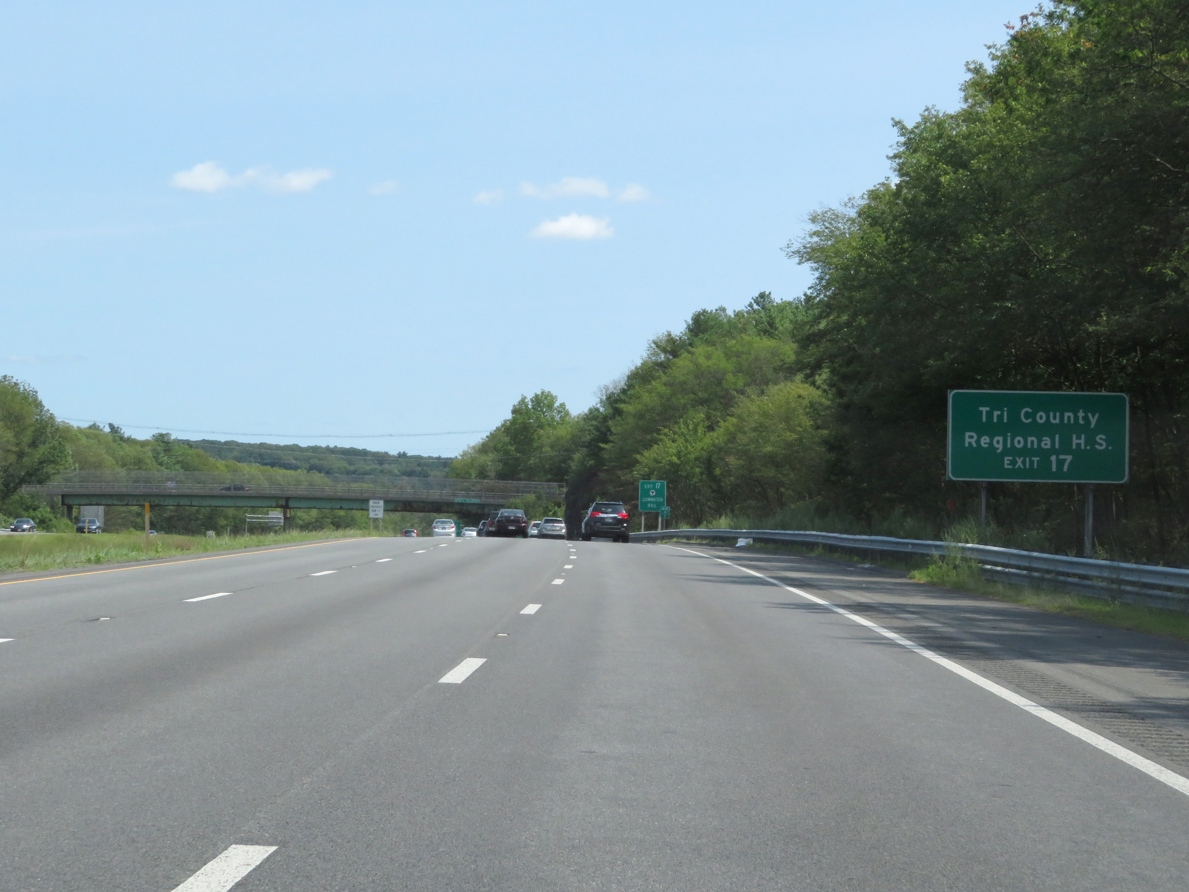 |
Also take Exit 17 to Tri County Regional High School. (Photo taken 8/6/17). |
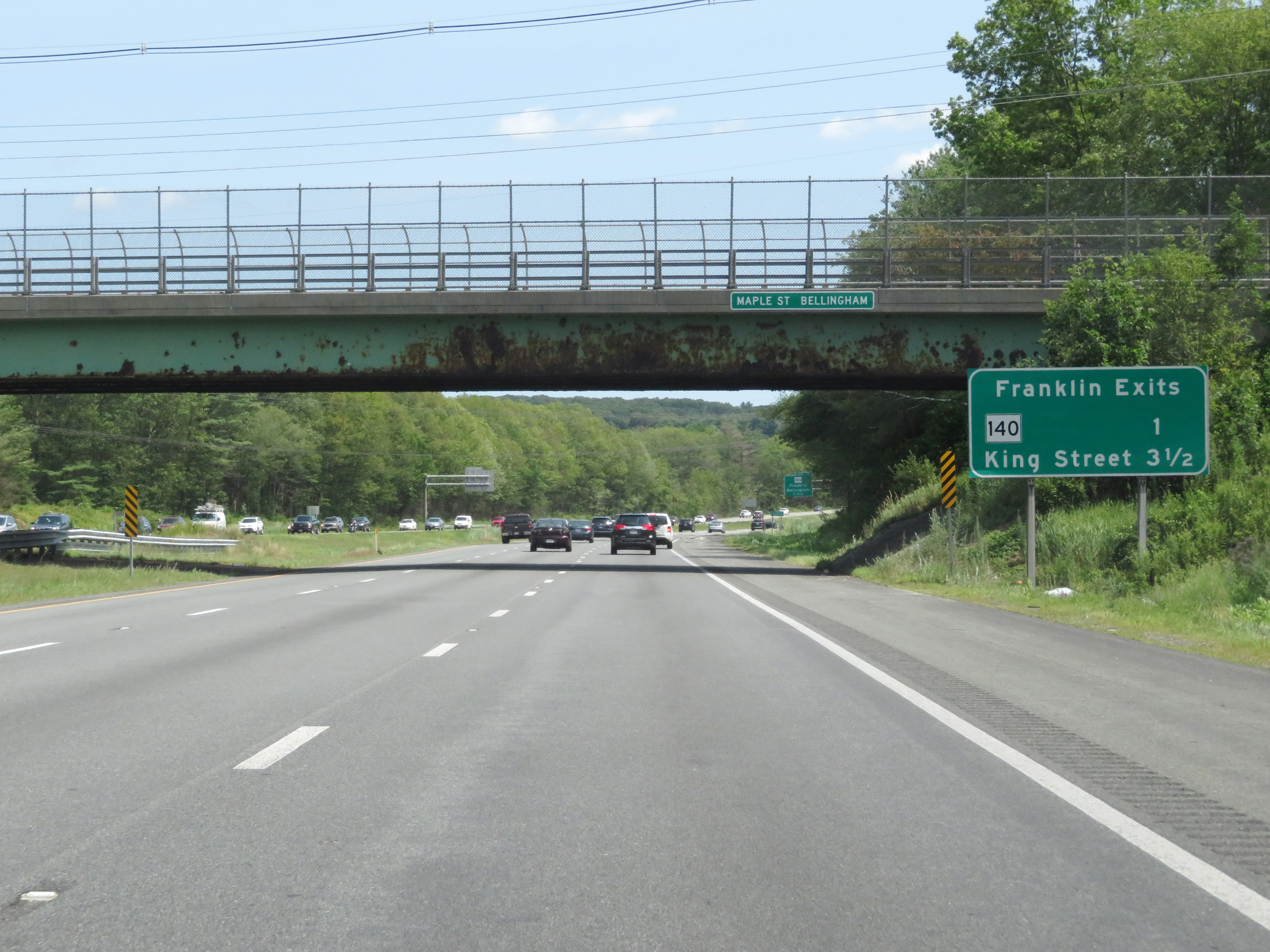 |
This sign lists the distances to the two upcoming Franklin exits. (Photo taken 8/6/17). |
 |
Take Exit 17 to Dean College as well. (Photo taken 8/6/17). |
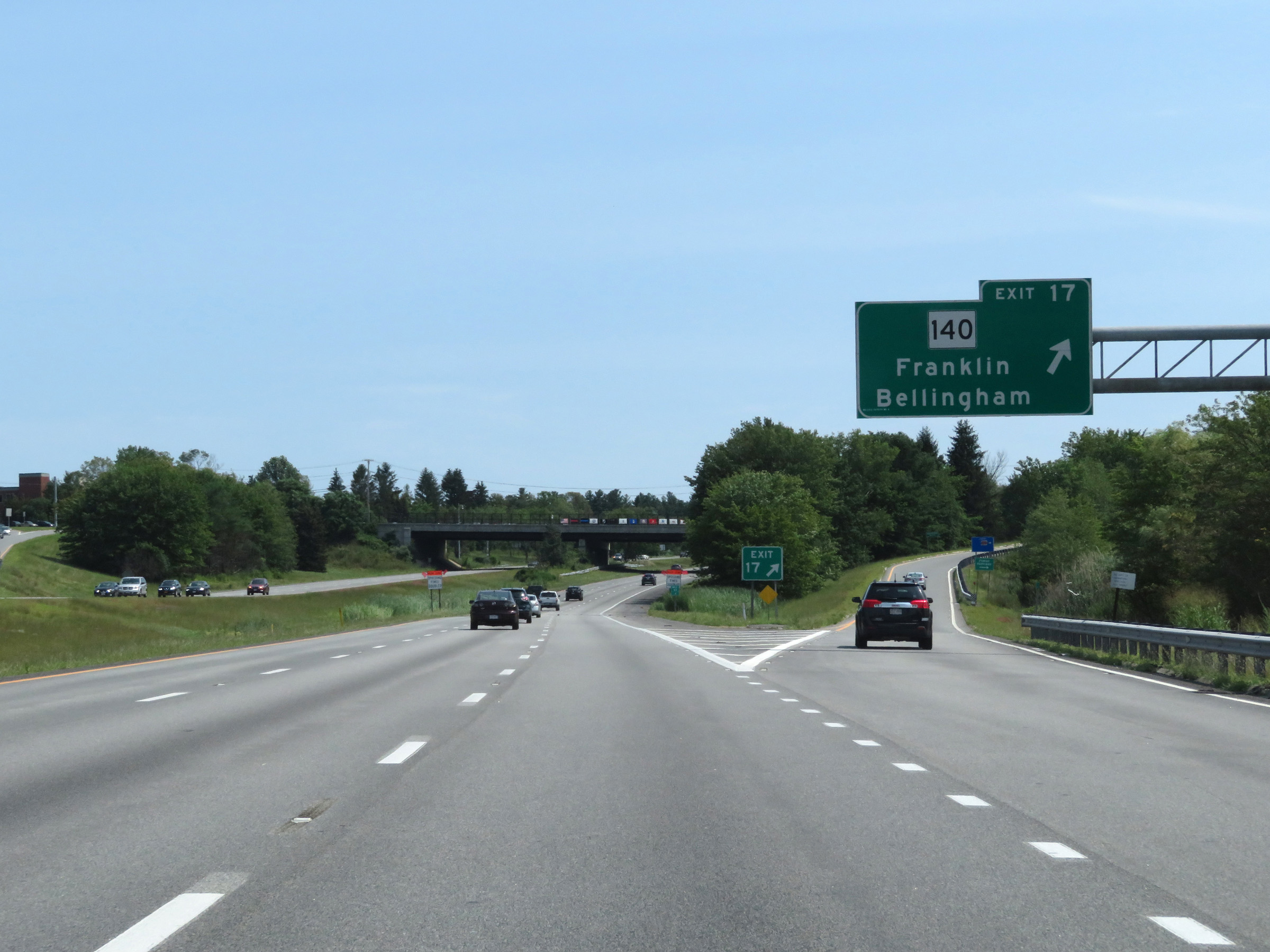 |
Interstate 495 South at Exit 17: MA 140 - Franklin / Bellingham (Photo taken 8/6/17). |
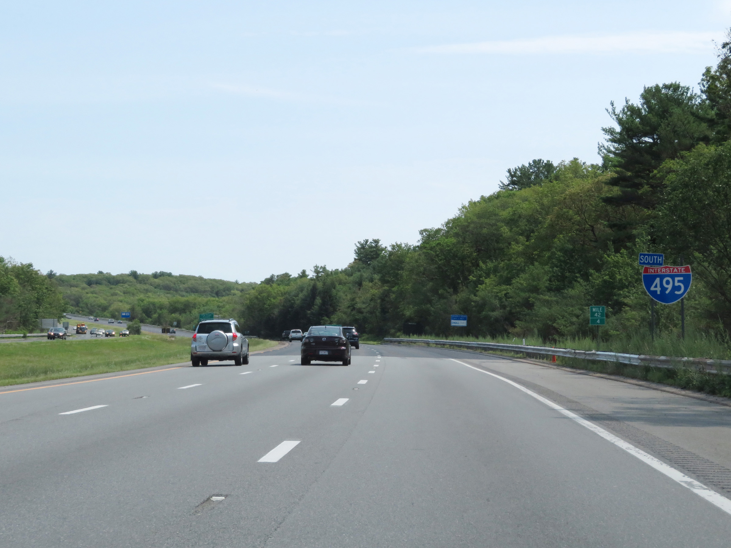 |
Interstate 495 South reassurance shield at mile marker 42.4. (Photo taken 8/6/17). |
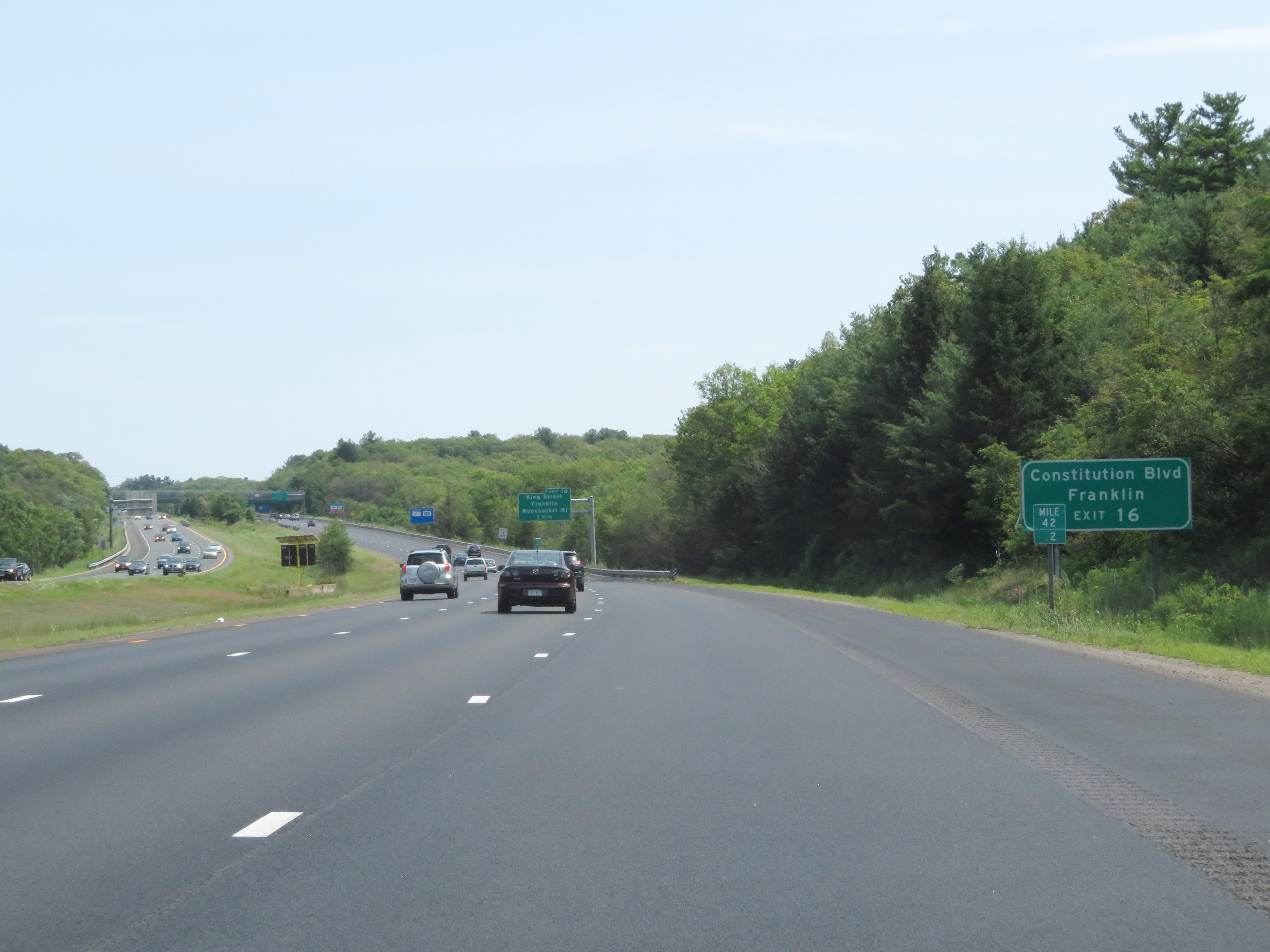 |
Take Exit 16 to Constitution Blvd and Franklin. (Photo taken 8/6/17). |
 |
Interstate 495 South at Exit 16: King Street / Franklin / Woonsocket, RI (Photo taken 8/6/17). |
Section 3: Franklin (Exit 16) to Interstate 195
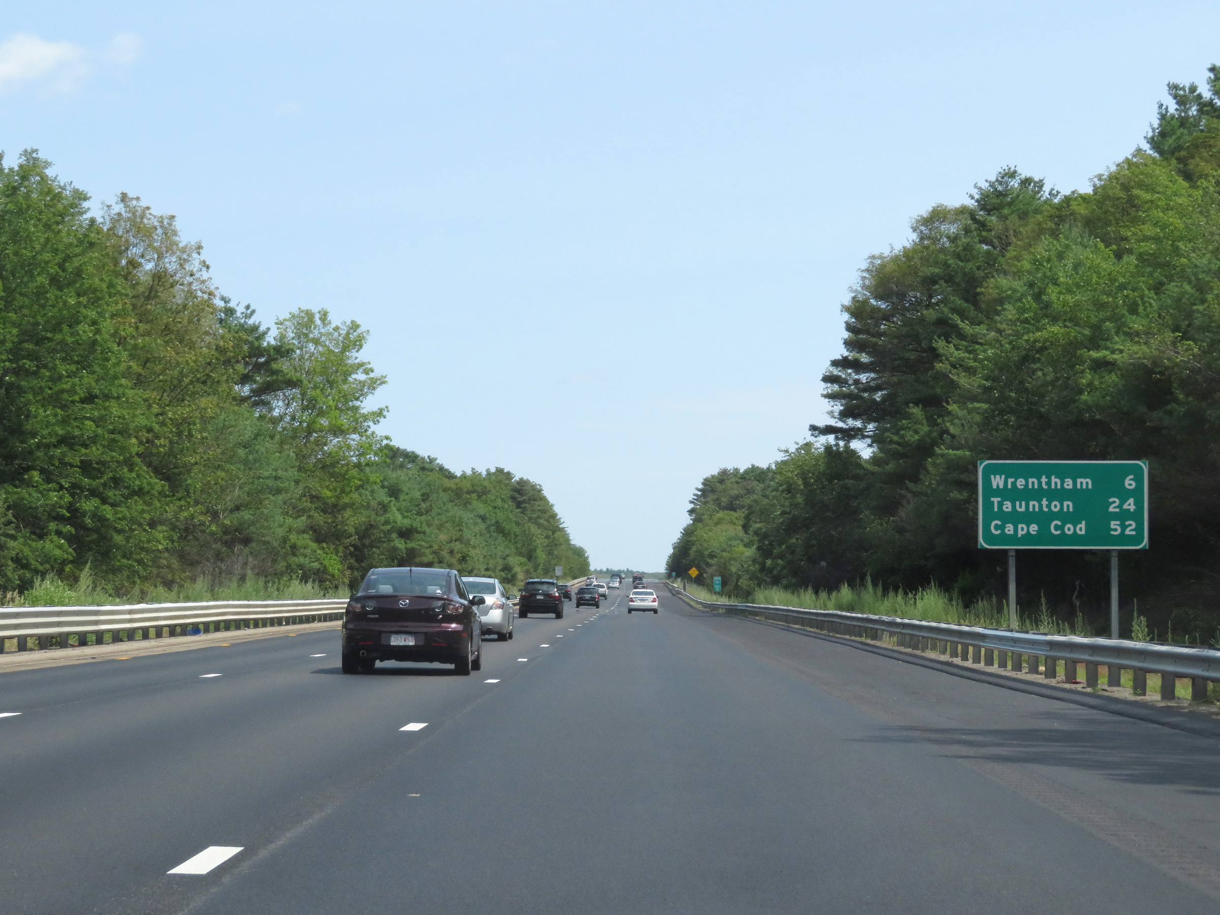 |
Mileage sign on Interstate 495 South. It's 6 miles to Wrentham, 24 miles to Taunton, and 52 miles to Cape Cod. (Photo taken 8/6/17). |
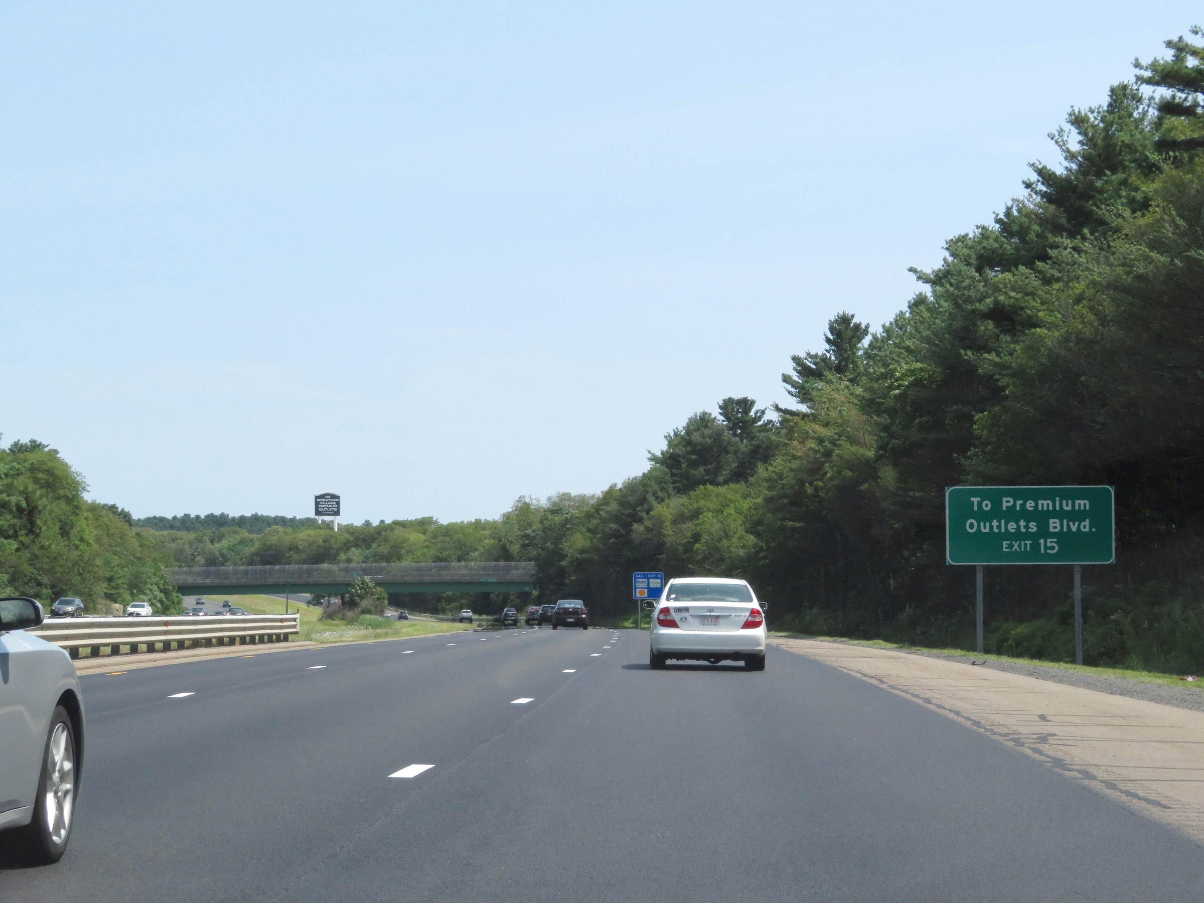 |
Take Exit 15 to Premium Outlets Blvd. (Photo taken 8/6/17). |
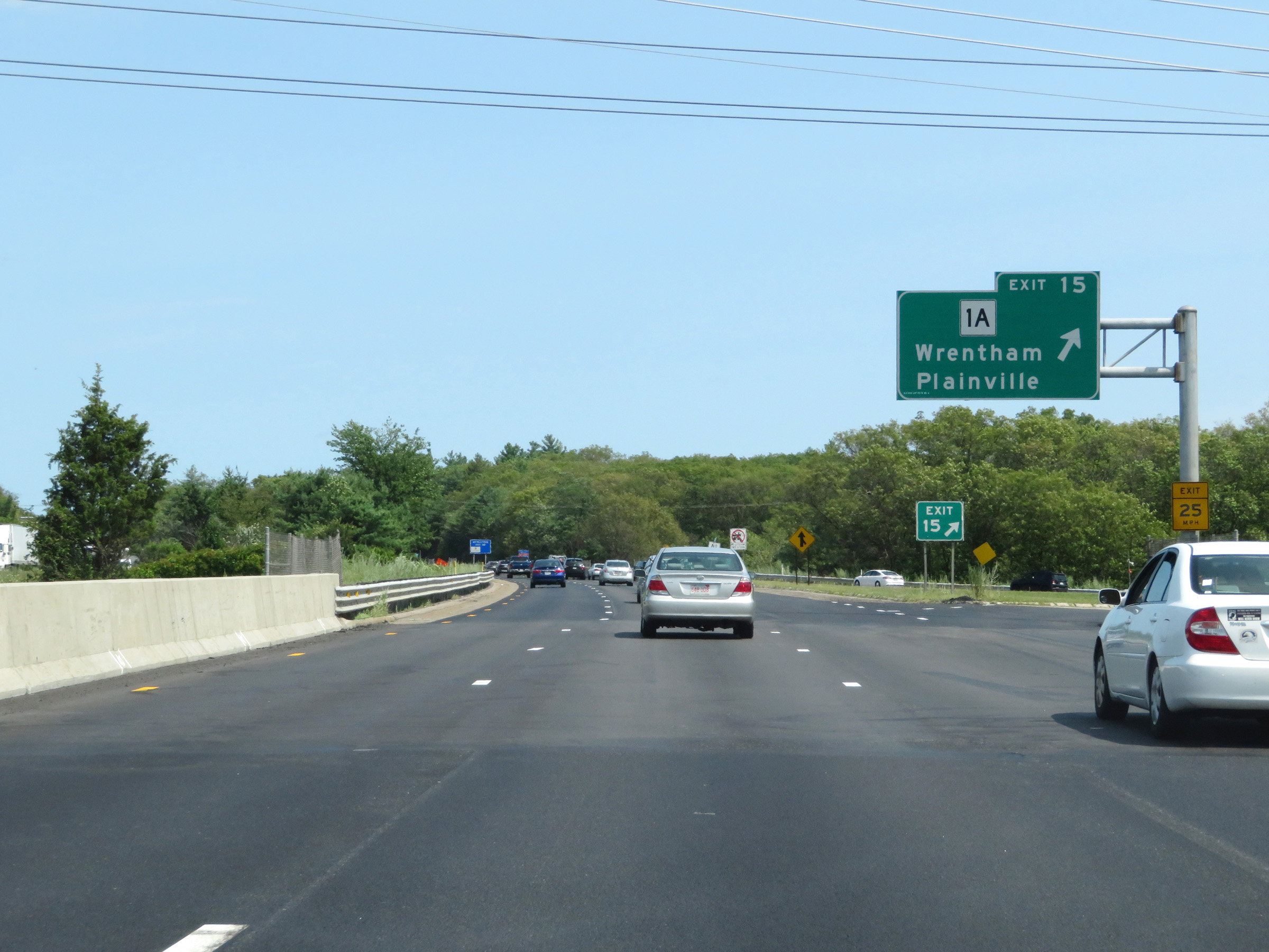 |
Interstate 495 South at Exit 15: MA 1A - Wrentham / Plainville (Photo taken 8/6/17). |
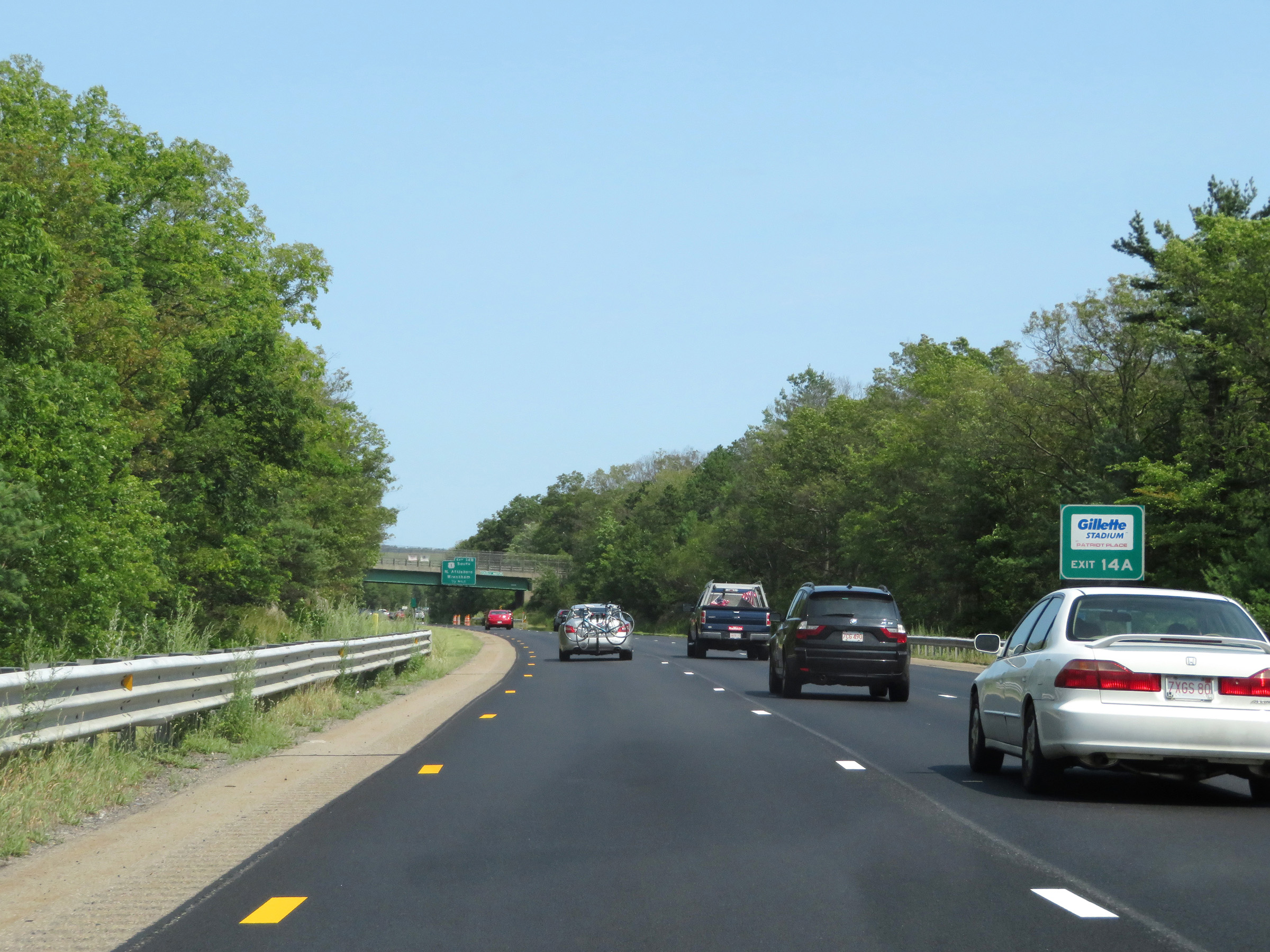 |
Take Exit 14A to Gillette Stadium, home of the New England Patriots. (Photo taken 8/6/17). |
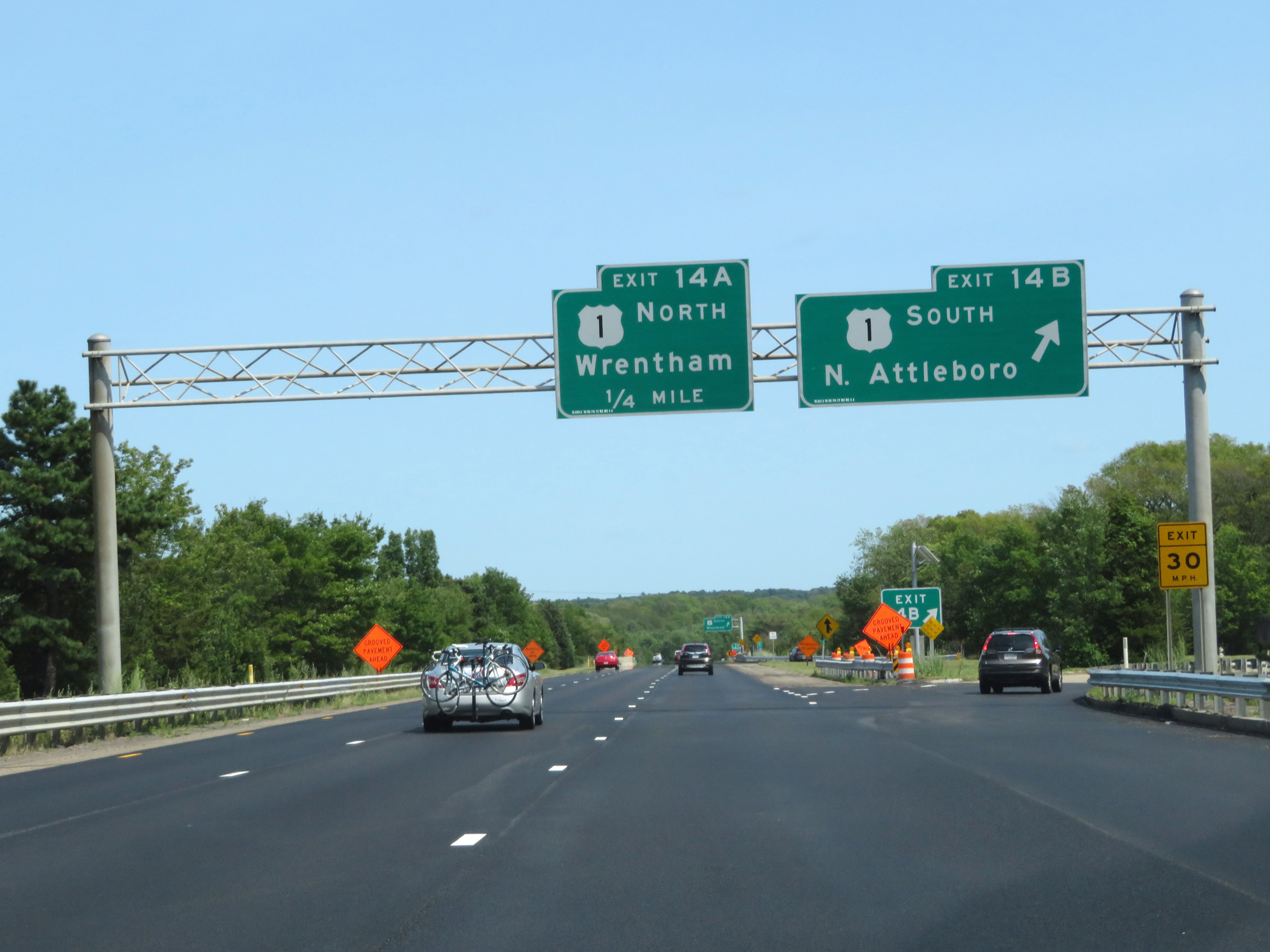 |
Interstate 495 South at Exit 14B: US 1 South - North Attleboro (Photo taken 8/6/17). |
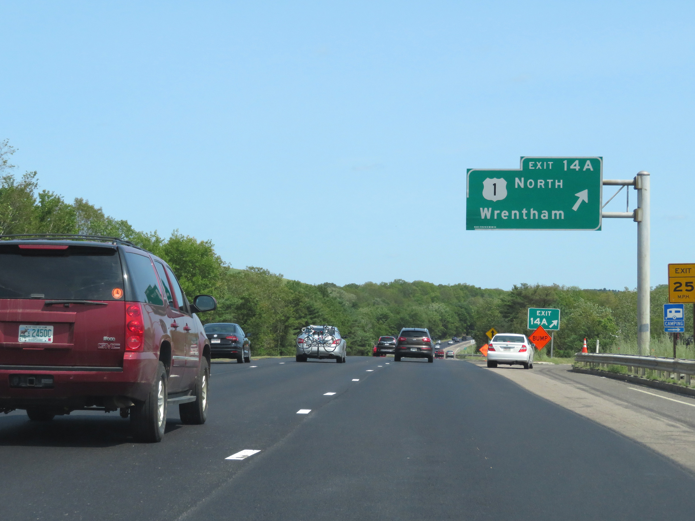 |
Interstate 495 South at Exit 14A: US 1 North - Wrentham (Photo taken 8/6/17). |
 |
The speed limit remains 65 mph on Interstate 495 South. This is the standard speed limit on most rural Interstate highways in Massachusetts. (Photo taken 8/6/17). |
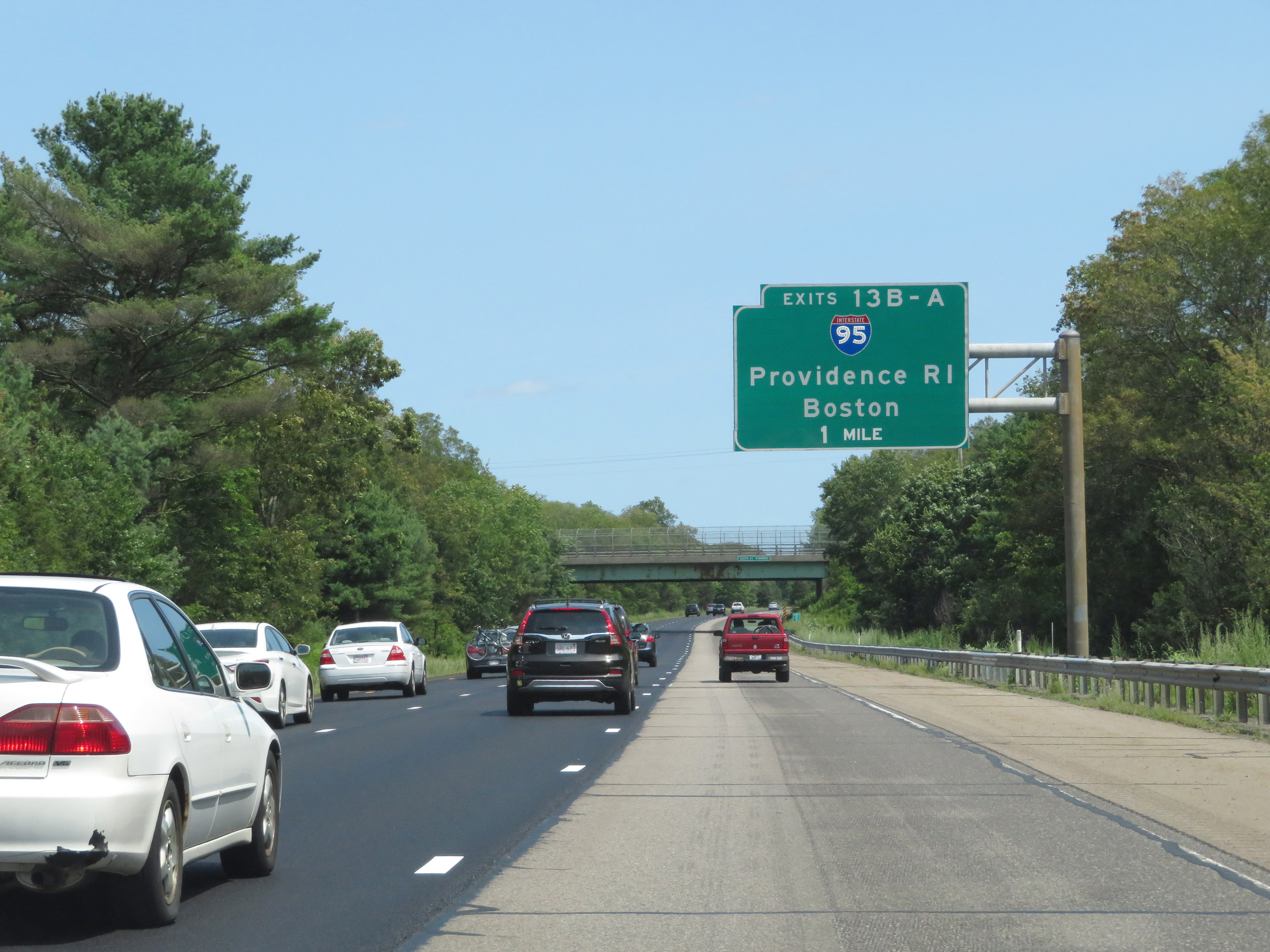 |
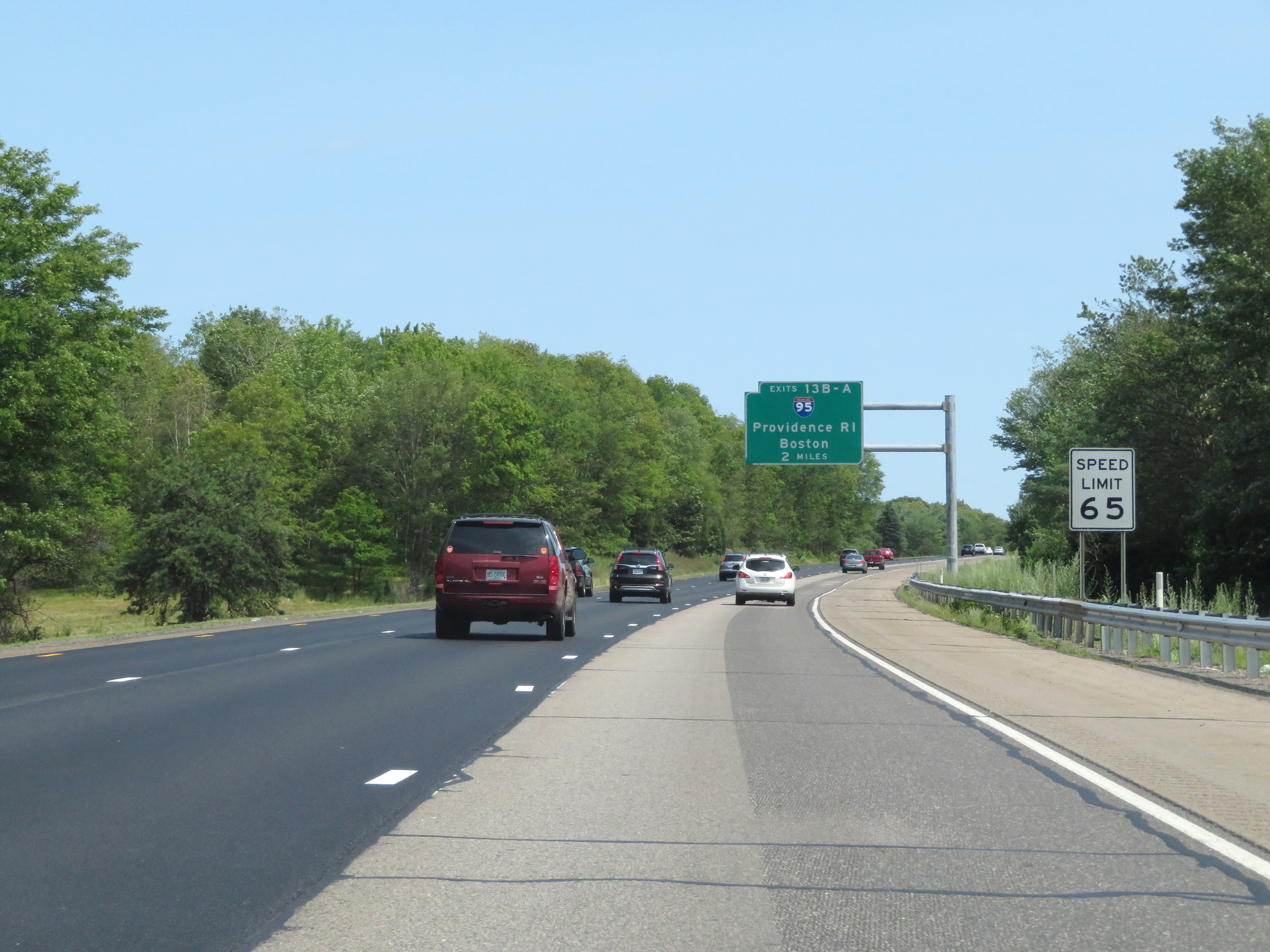
Interstate 495 South approaching Exits 13B-A - 1 mile. (Photo taken 8/6/17). |
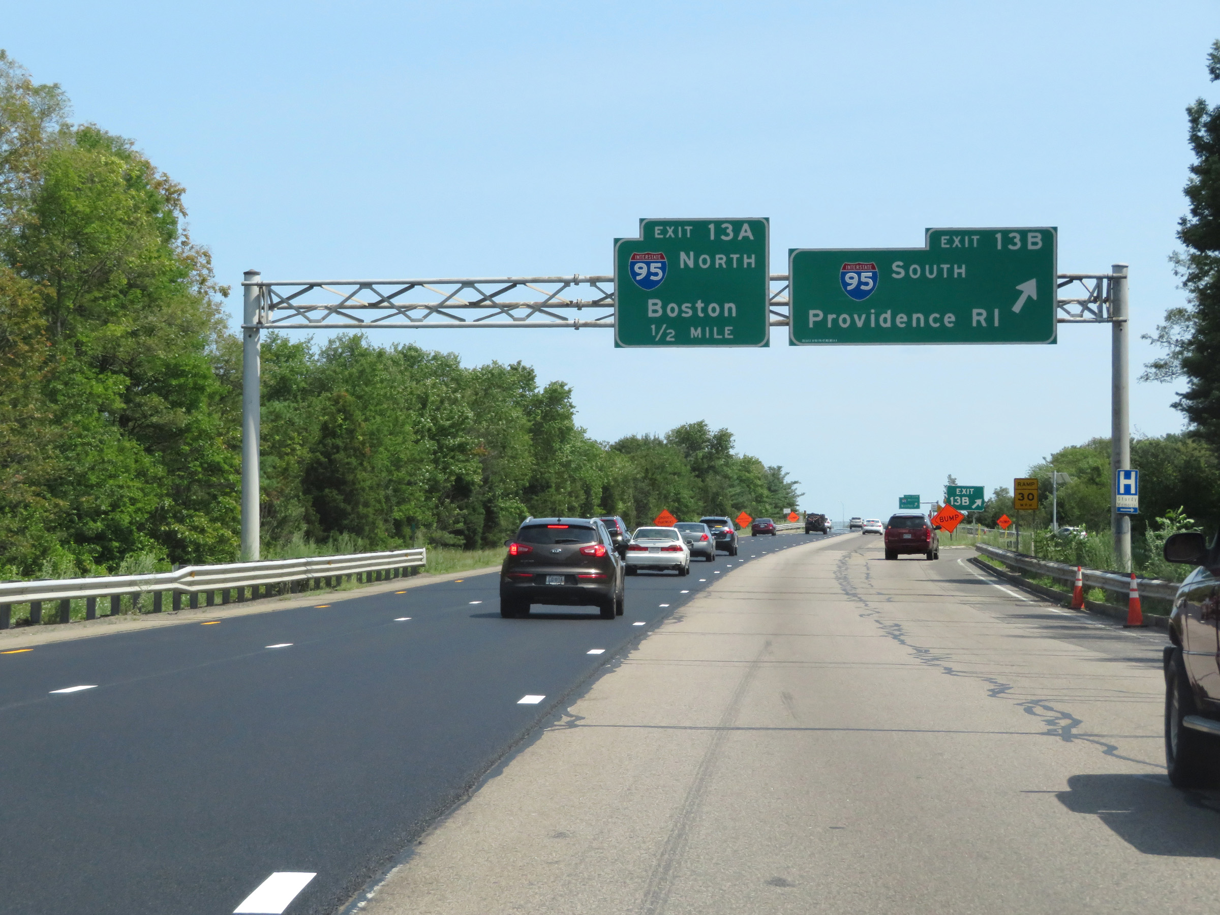 |
Interstate 495 South at Exit 13B: Interstate 95 South - Providence, RI (Photo taken 8/6/17). |
 |
As Interstate 495 South prepares to pass over Interstate 95, it enters Bristol County. (Photo taken 8/6/17). |
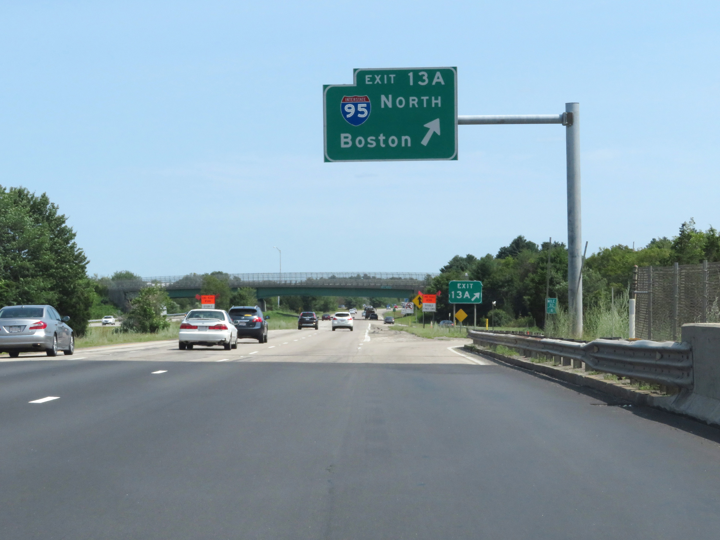 |
Interstate 495 South at Exit 13A: Interstate 95 North - Boston (Photo taken 8/6/17). |
 |
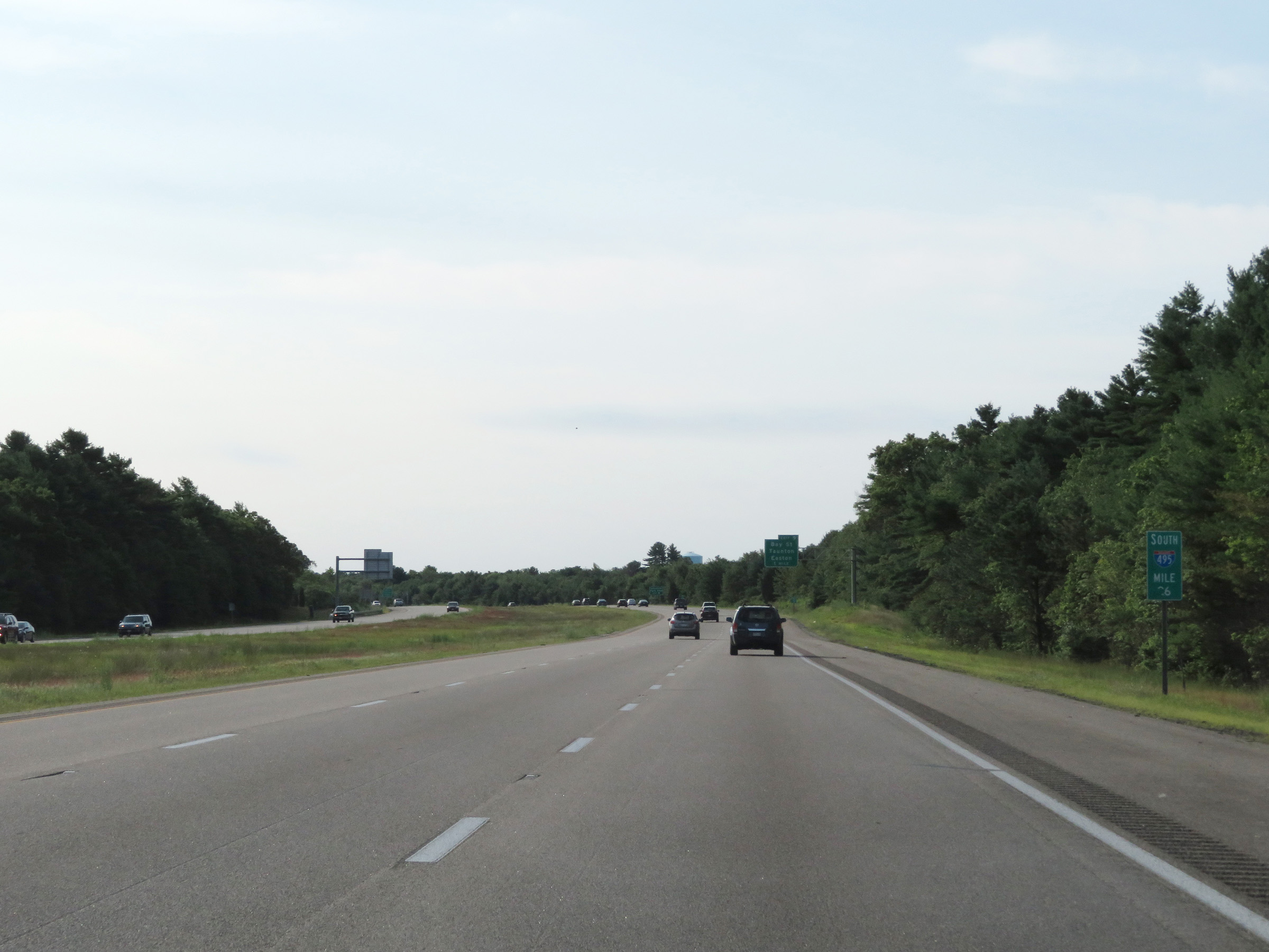
View on Interstate 495 South at mile marker 32. (Photo taken 8/6/17). |
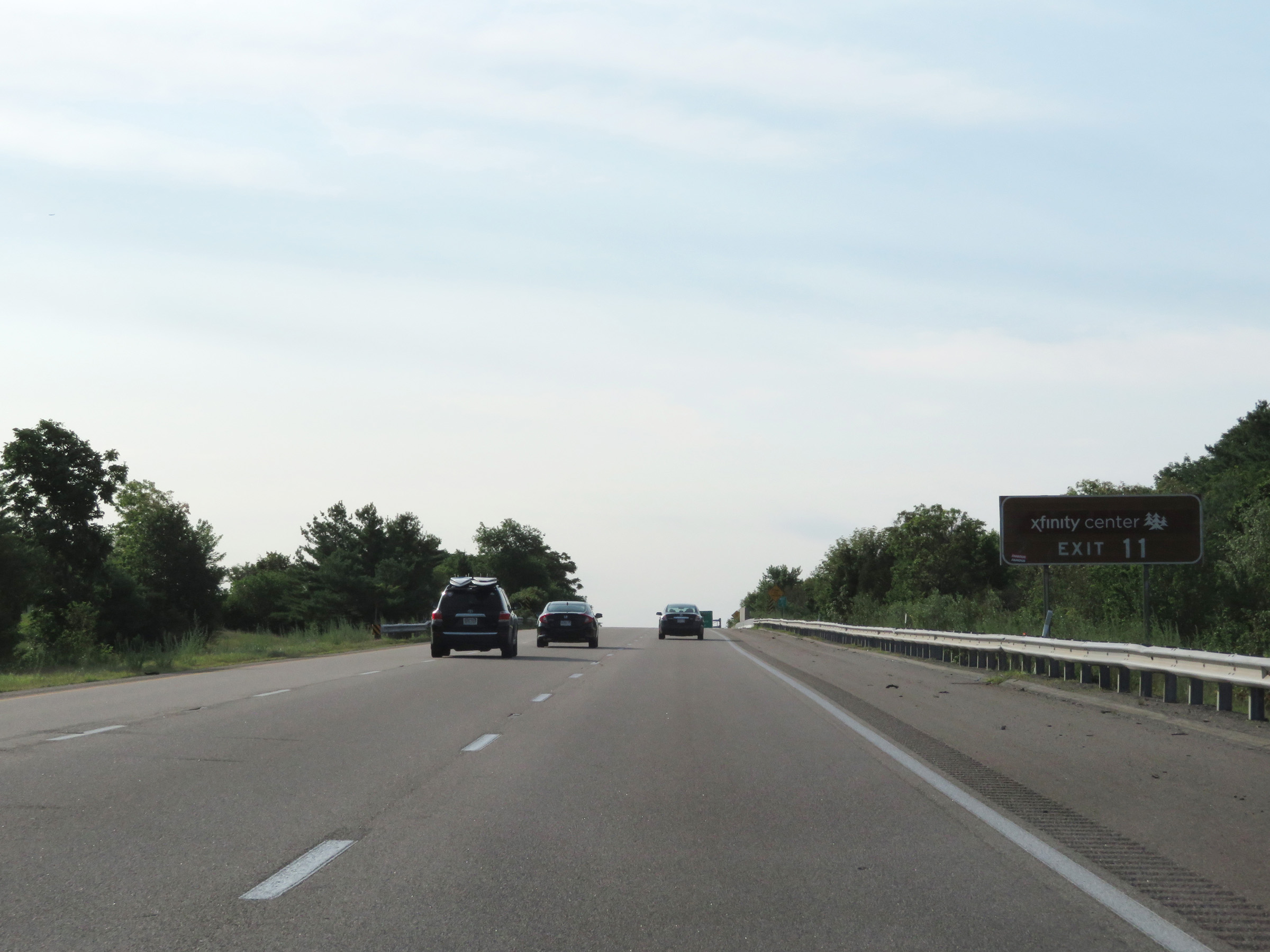 |
Take Exit 11 to the Xfinity Center. (Photo taken 8/6/17). |
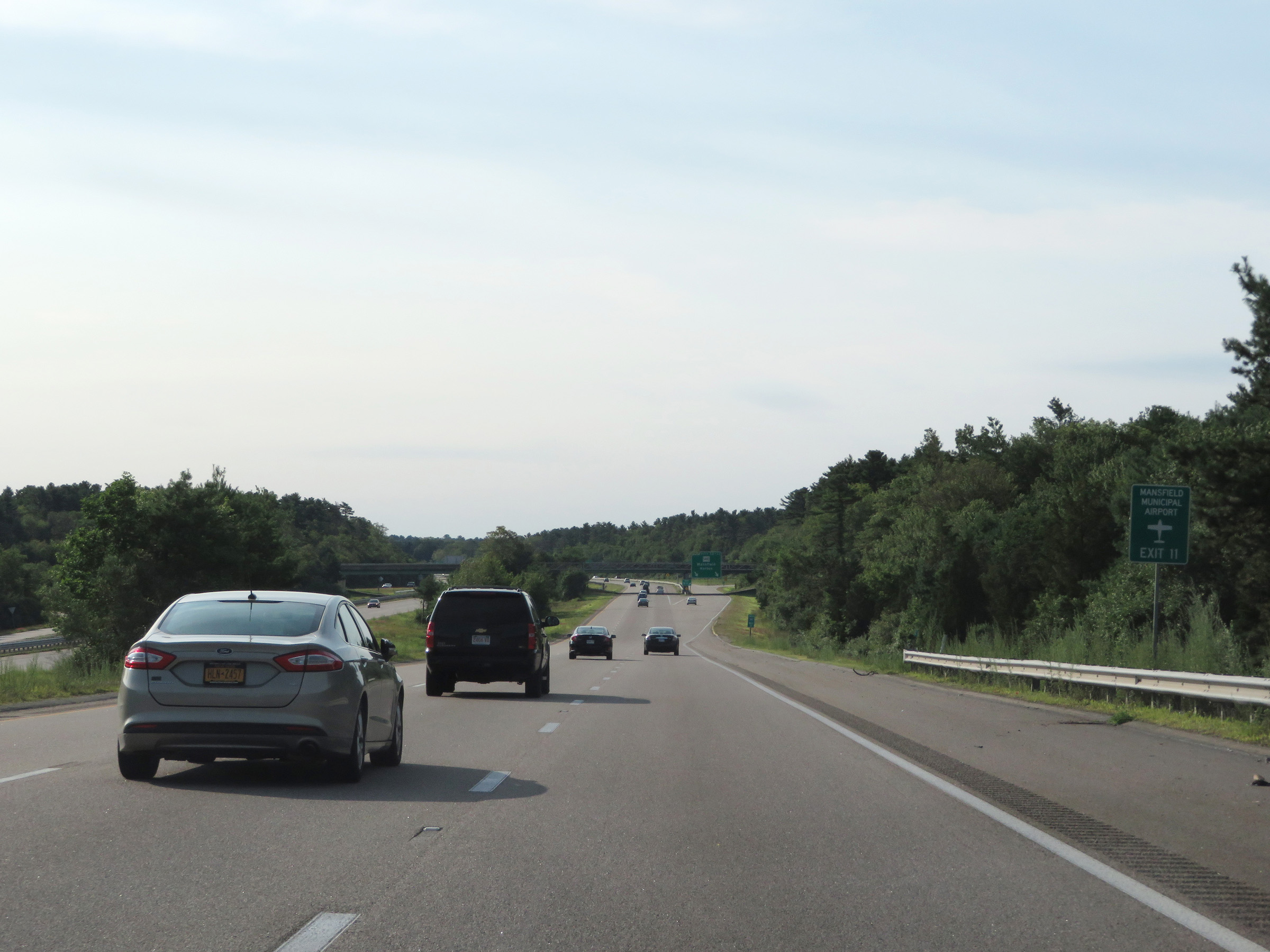 |
Also take Exit 11 to Mansfield Municipal Airport. (Photo taken 8/6/17). |
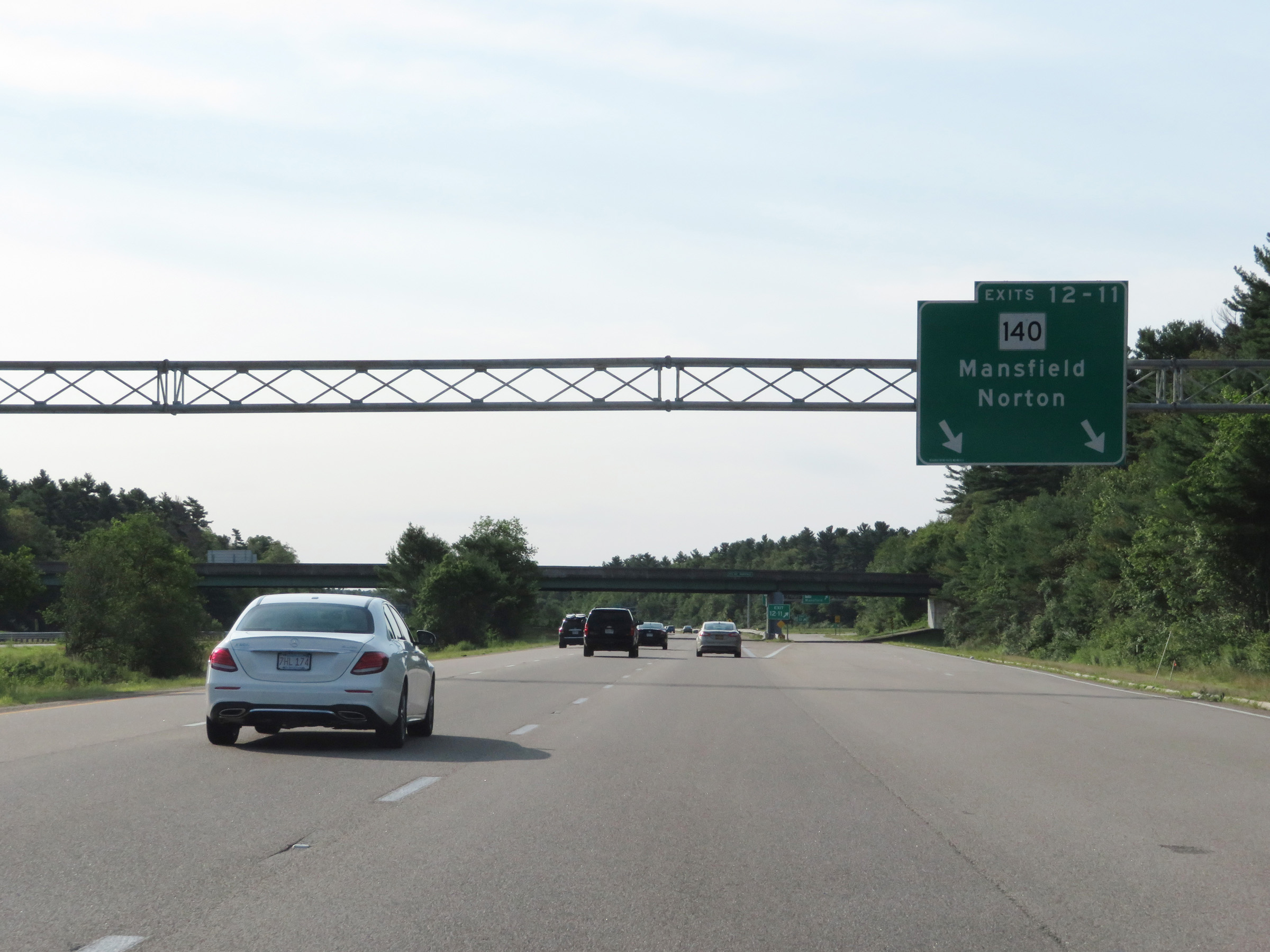 |
Interstate 495 South at Exits 12-11: MA 140 - Mansfield / Norton (Photo taken 8/6/17). |
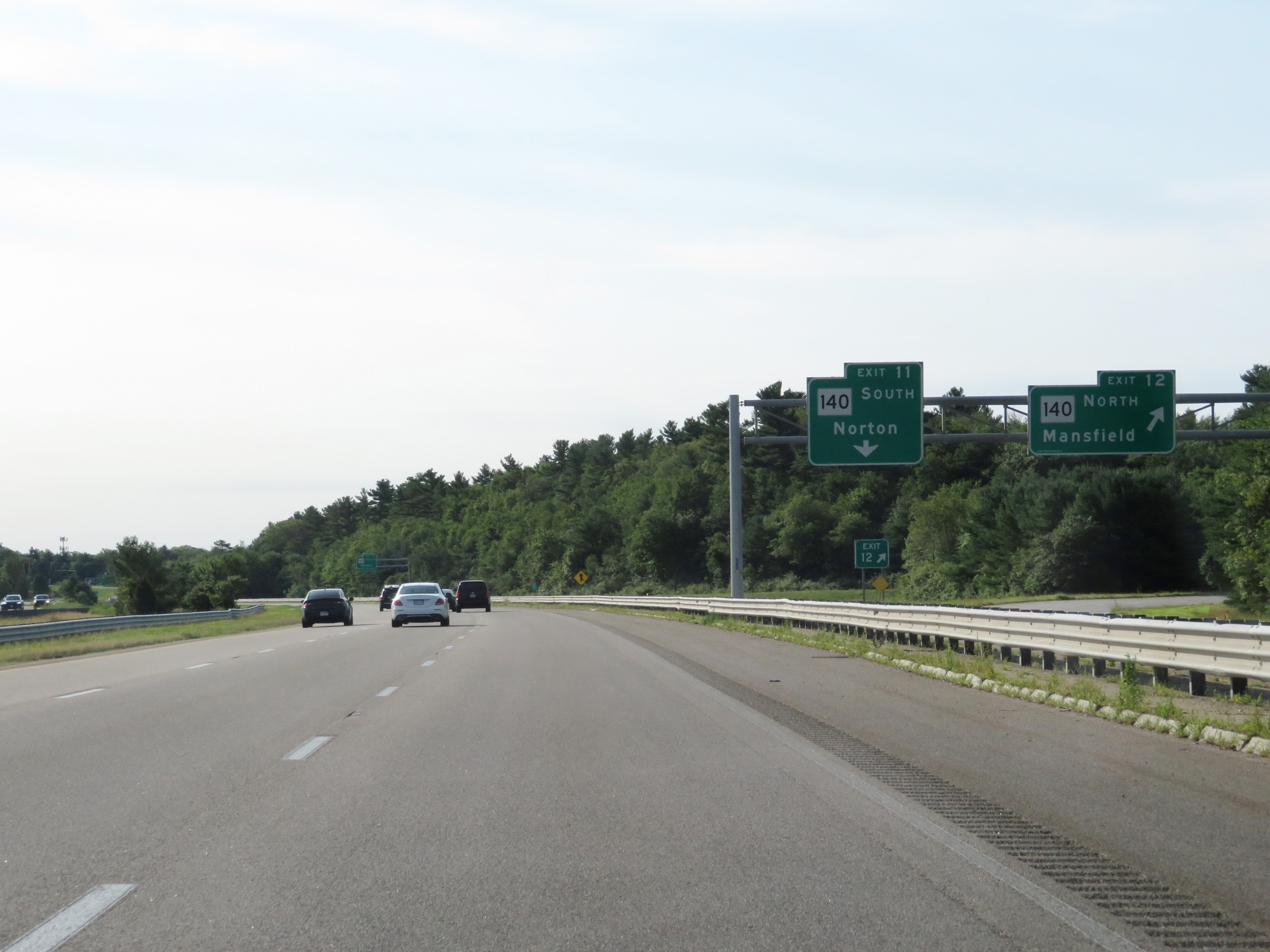 |
Interstate 495 South at Exit 12: MA 140 North - Mansfield (Photo taken 8/6/17). |
 |
Interstate 495 South at Exit 11: MA 140 South - Norton (Photo taken 8/6/17). |
 |
Take Exit 10 to Wheaton College. (Photo taken 8/6/17). |
 |
Interstate 495 South at Exit 10: MA 123 - Norton / Easton (Photo taken 8/6/17). |
 |
View on Interstate 495 South at mile marker 26. (Photo taken 8/6/17). |
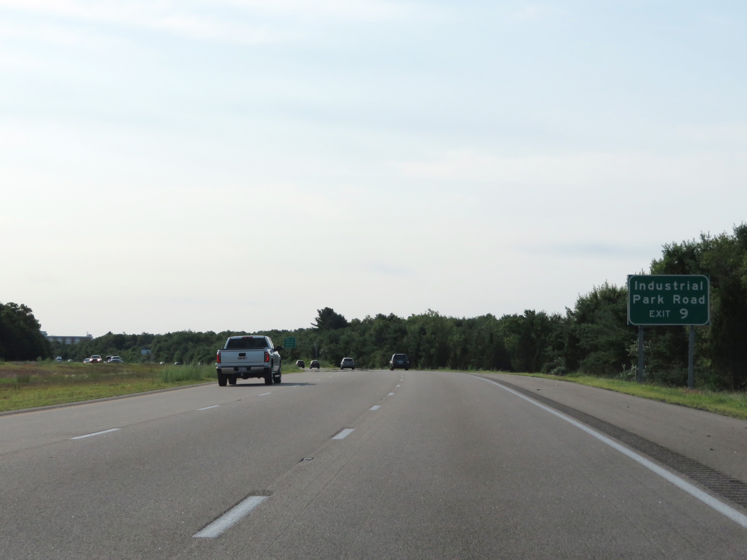 |
Take Exit 9 to Industrial Park Road. (Photo taken 8/6/17). |
 |
Interstate 495 South at Exit 9: Bay St / Taunton / Easton (Photo taken 8/6/17). |
 |
View on Interstate 495 South at mile marker 23. (Photo taken 8/6/17). |
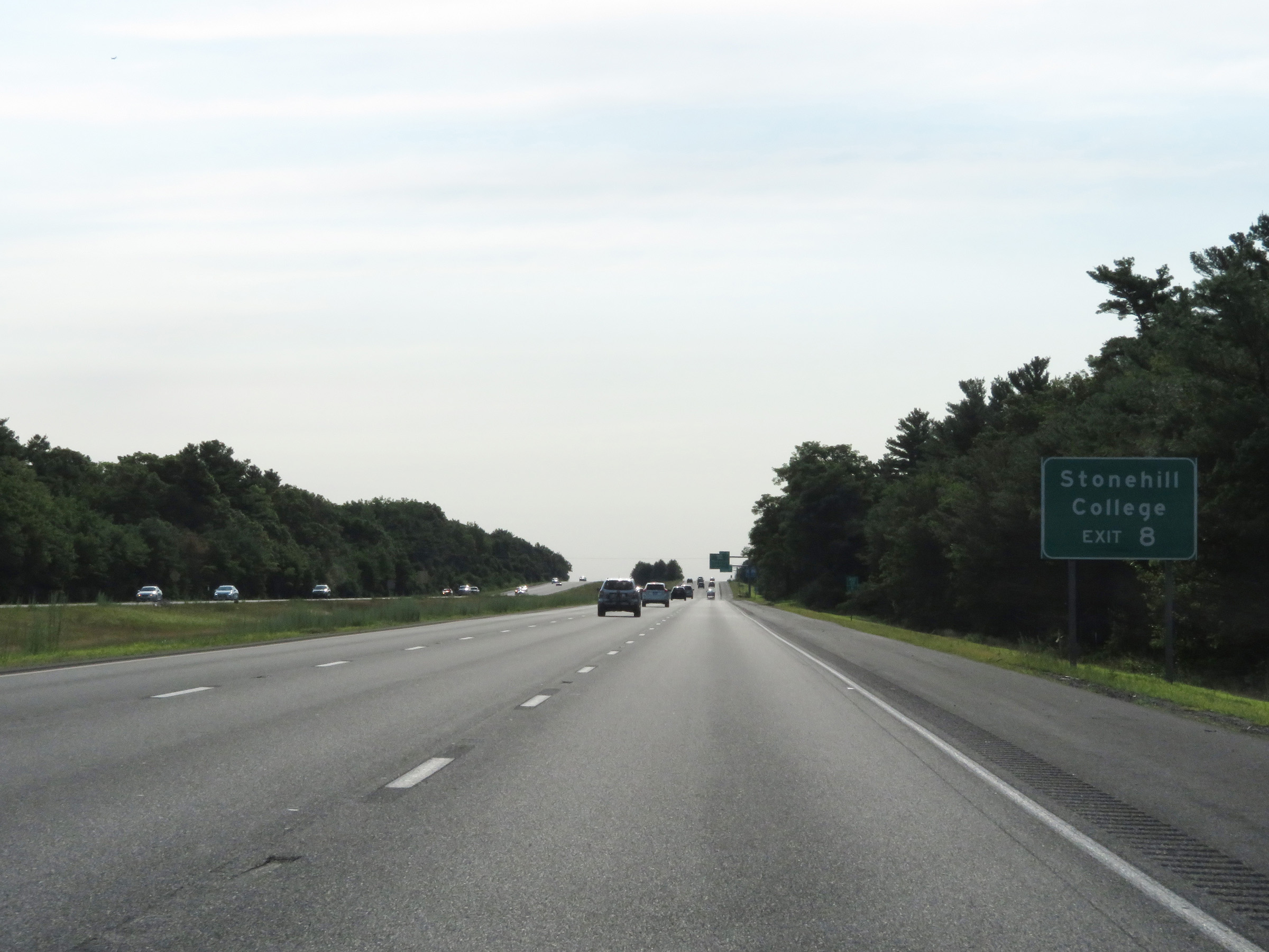 |
Take Exit 8 to Stonehill College. (Photo taken 8/6/17). |
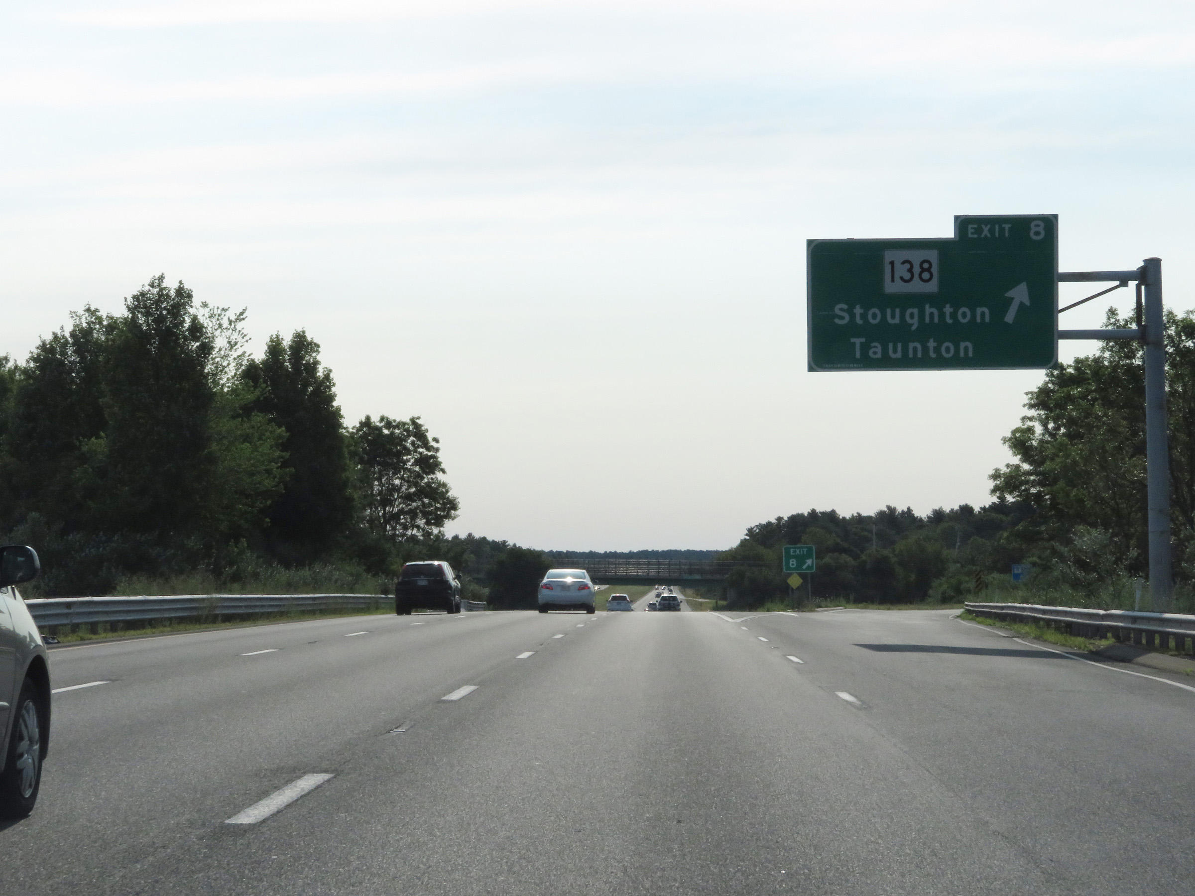 |
Interstate 495 South at Exit 8: MA 138 - Stoughton / Taunton (Photo taken 8/6/17). |
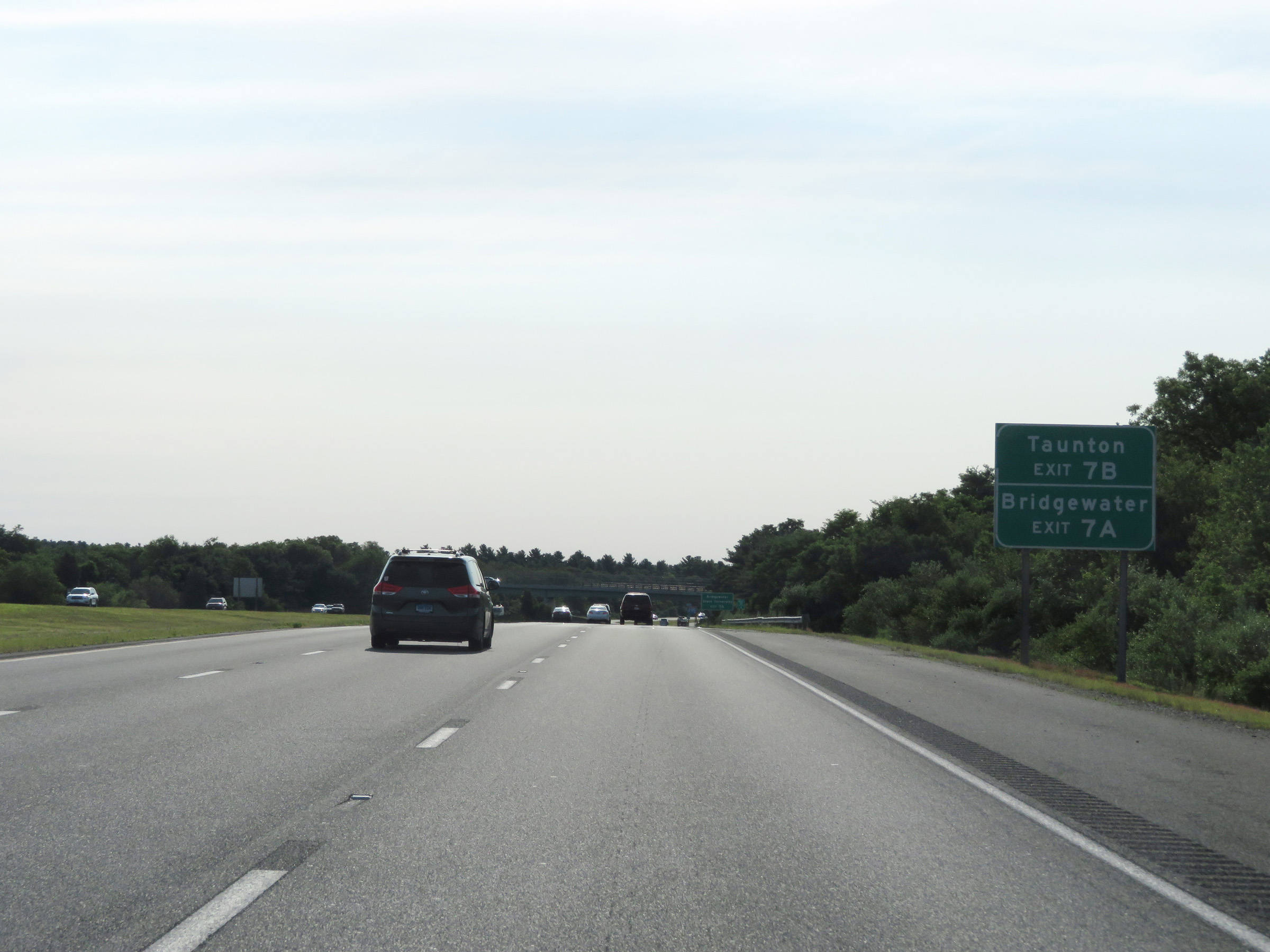 |
Take Exit 7B to Taunton. Take Exit 7A to Bridgewater. (Photo taken 8/6/17). |
 |
Also take Exit 7A to Bridgewater State University. (Photo taken 8/6/17). |
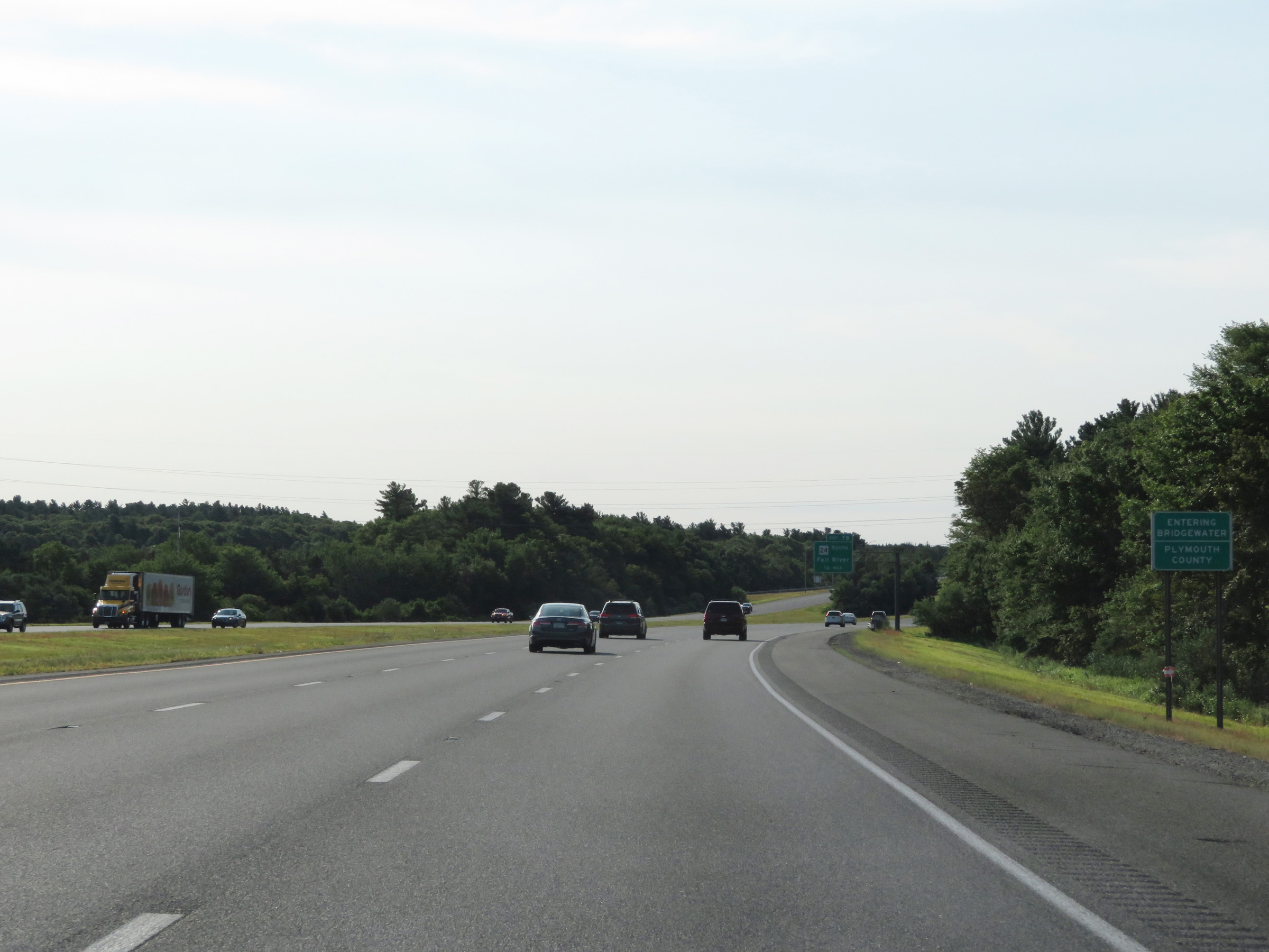 |
Interstate 495 South as it enters Plymouth County. (Photo taken 8/6/17). |
 |
Interstate 495 South at Exit 7B: MA 24 South - Fall River (Photo taken 8/6/17). |
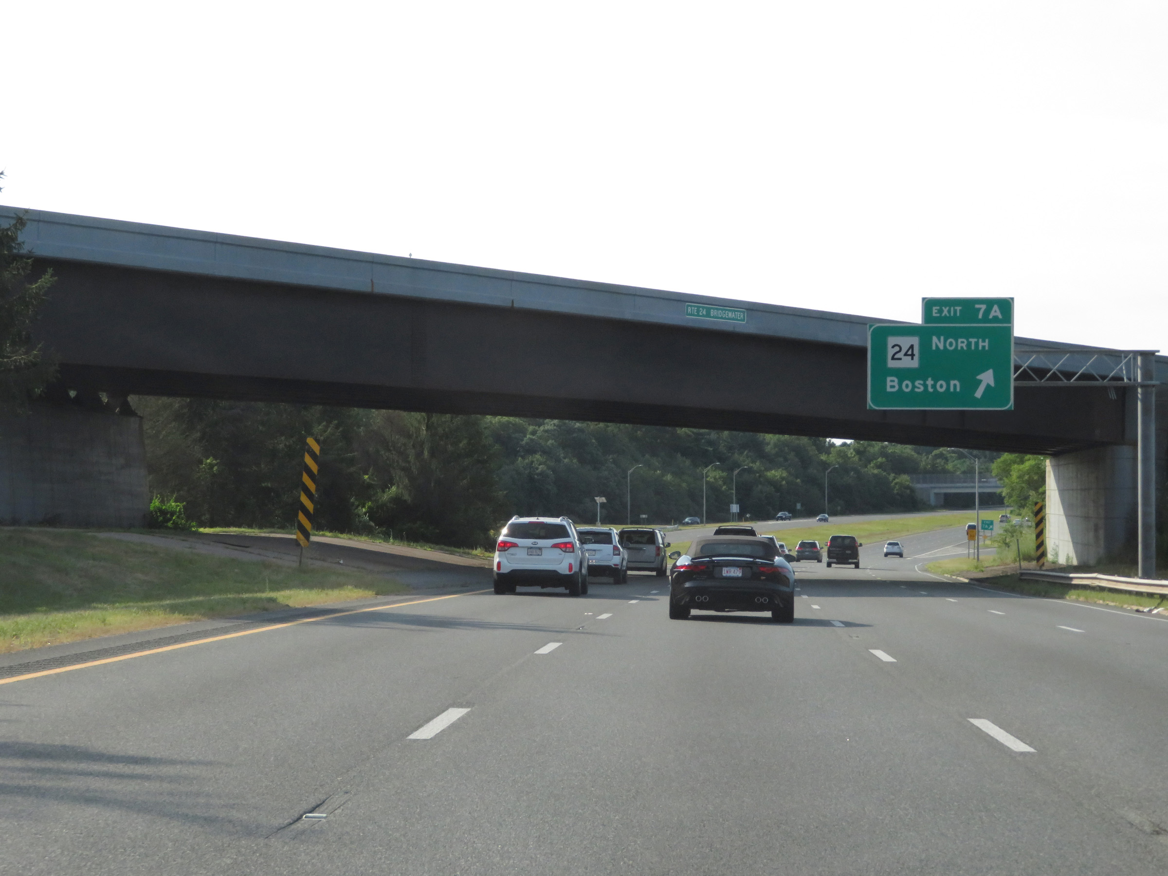 |
Interstate 495 South at Exit 7A: MA 24 North - Boston (Photo taken 8/6/17). |
 |
Weigh Station on Interstate 495 South in Plymouth County. (Photo taken 8/6/17). |
 |
View on Interstate 495 South at mile marker 16. (Photo taken 8/6/17). |
 |
Take Exit 5 to Massasoit State Park. (Photo taken 8/6/17). |
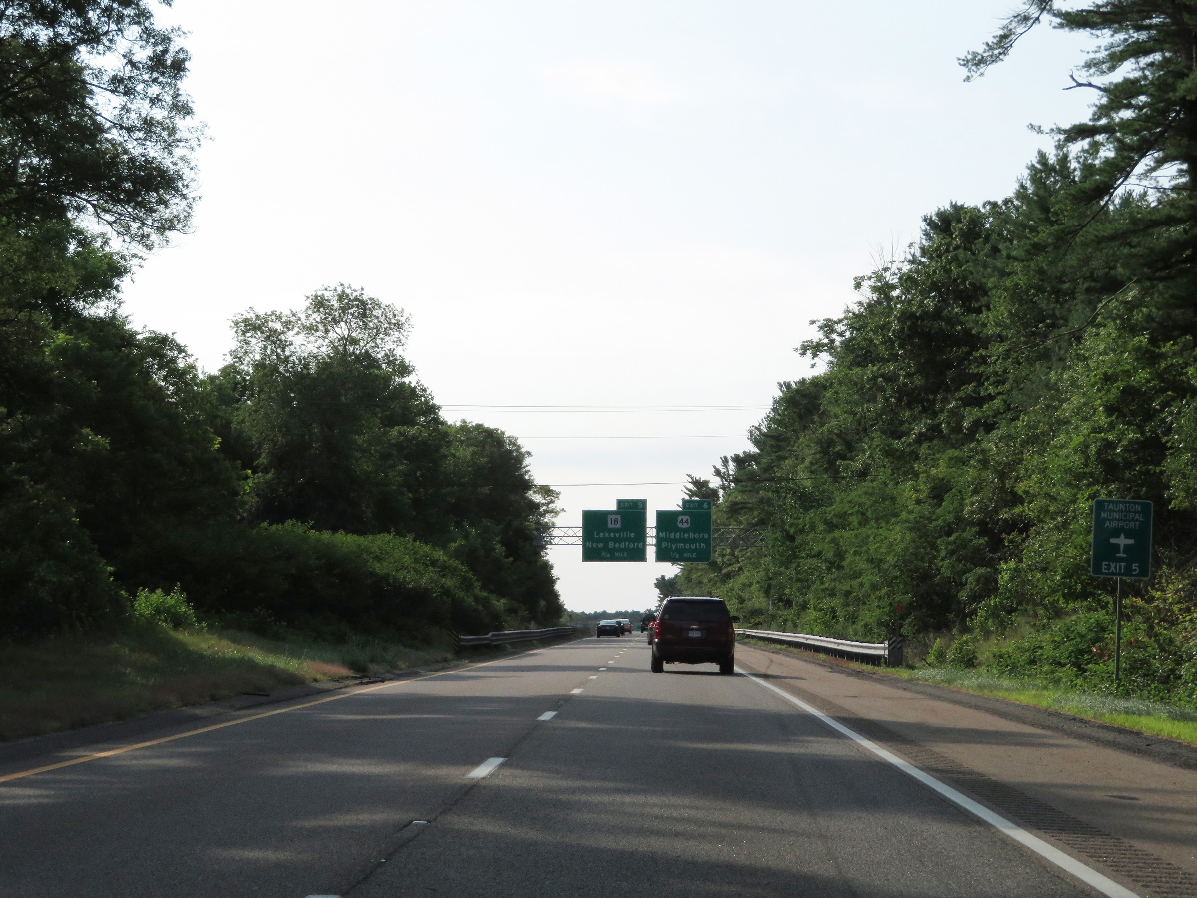 |
Also take Exit 5 to Taunton Municipal Airport. (Photo taken 8/6/17). |
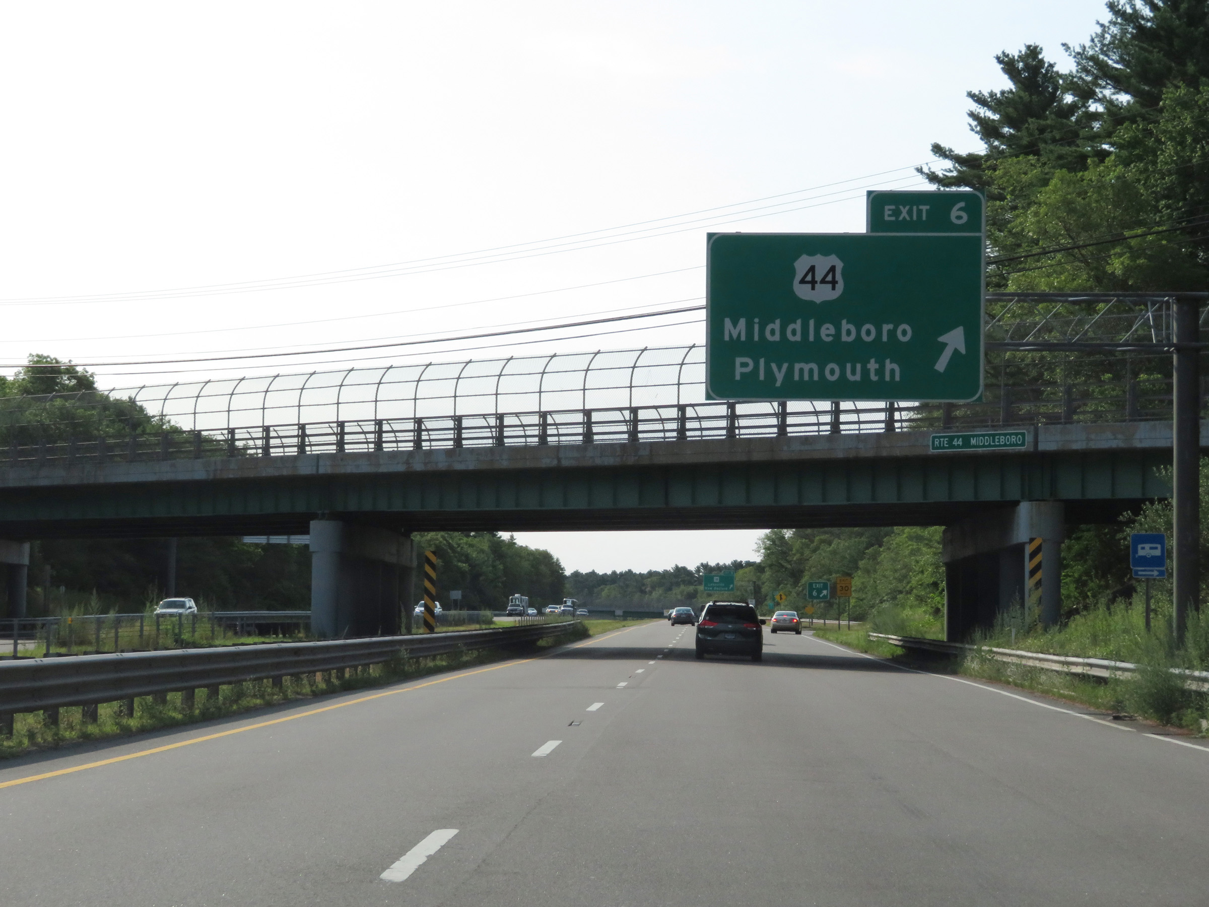 |
Interstate 495 South at Exit 6: US 44 - Middleboro / Plymouth (Photo taken 8/6/17). |
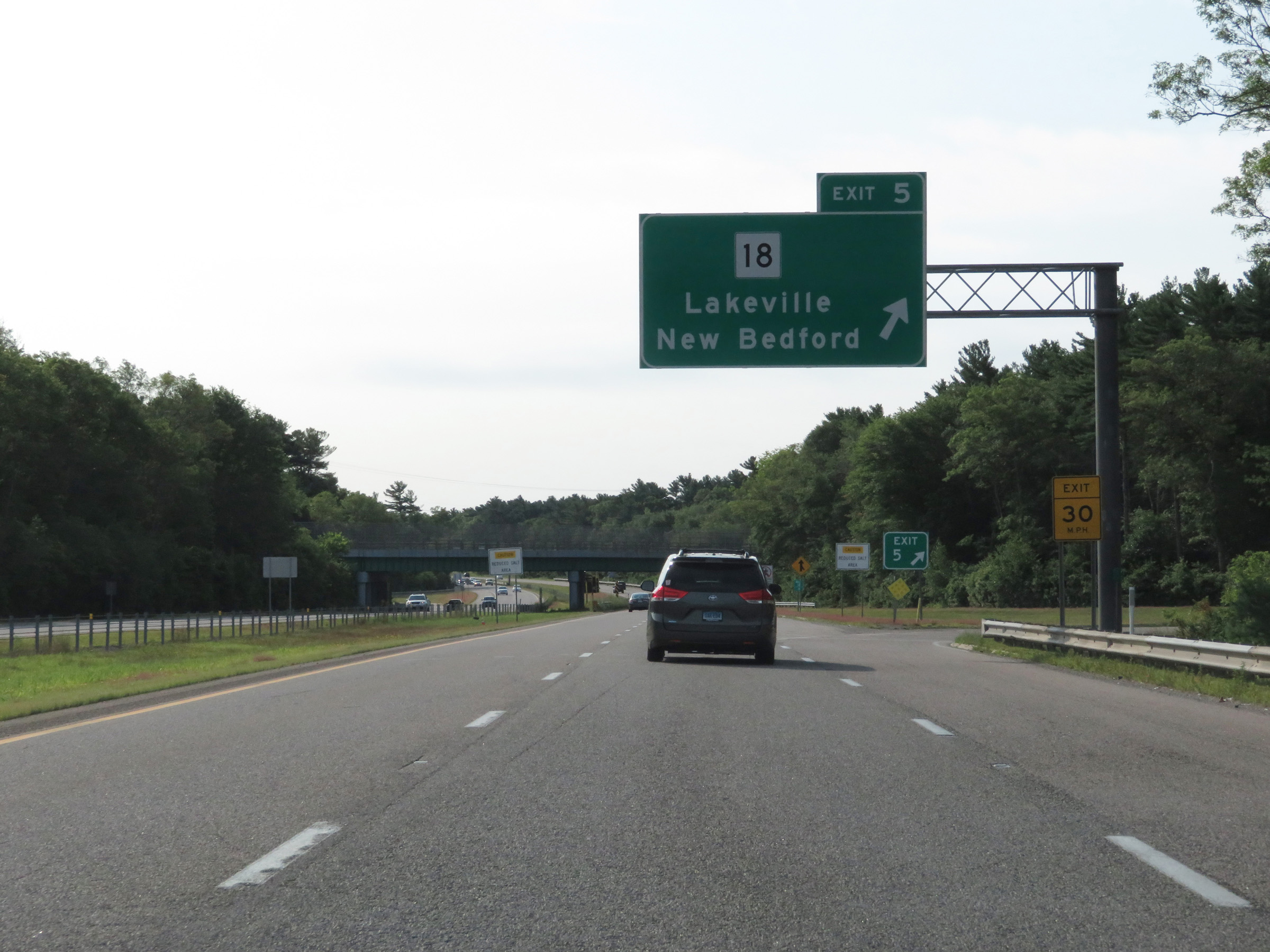 |
Interstate 495 South at Exit 5: MA 18 - Lakeville / New Bedford (Photo taken 8/6/17). |
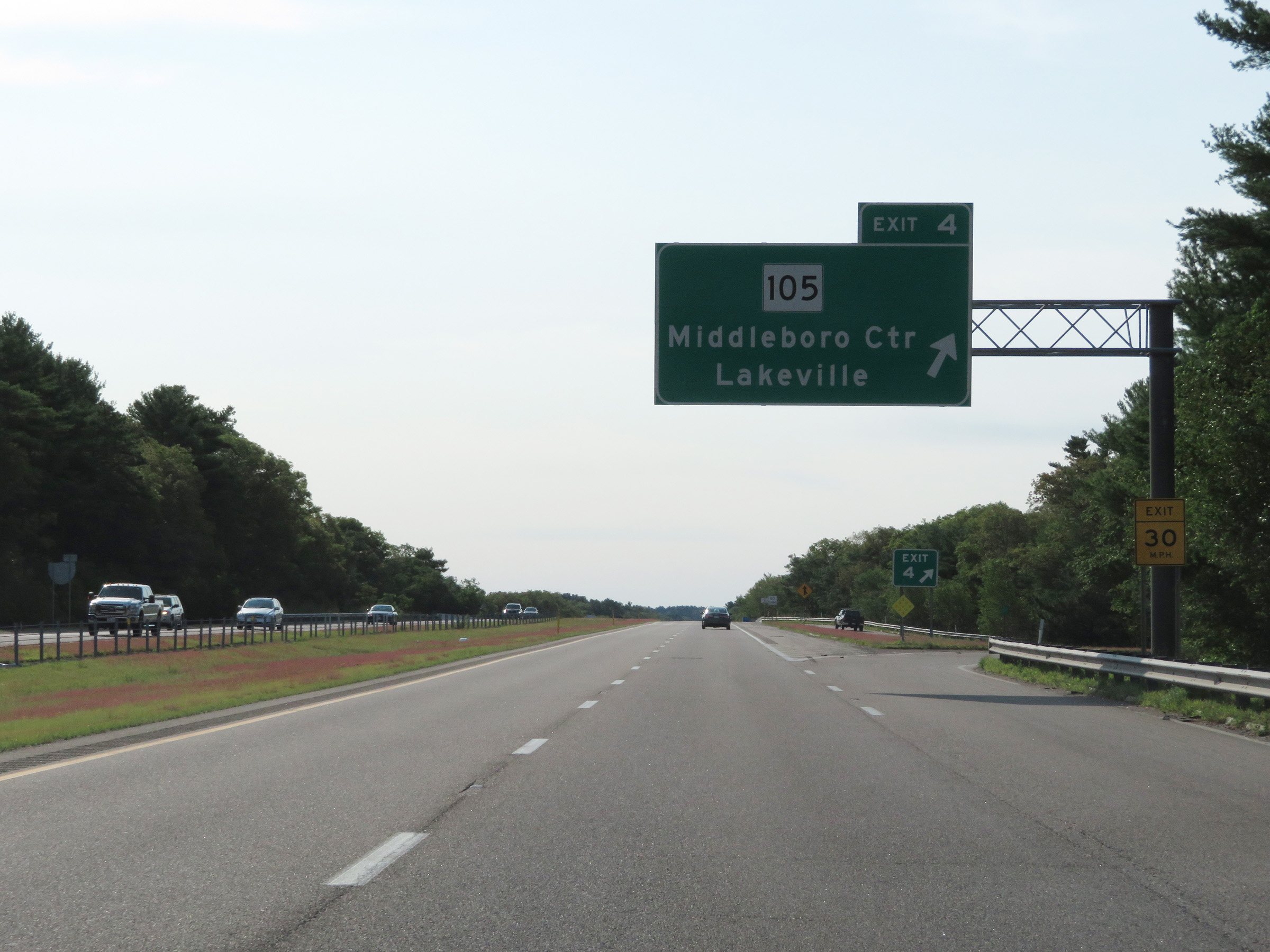 |
Interstate 495 South at Exit 4: MA 105 - Middleboro Center / Lakeville (Photo taken 8/6/17). |
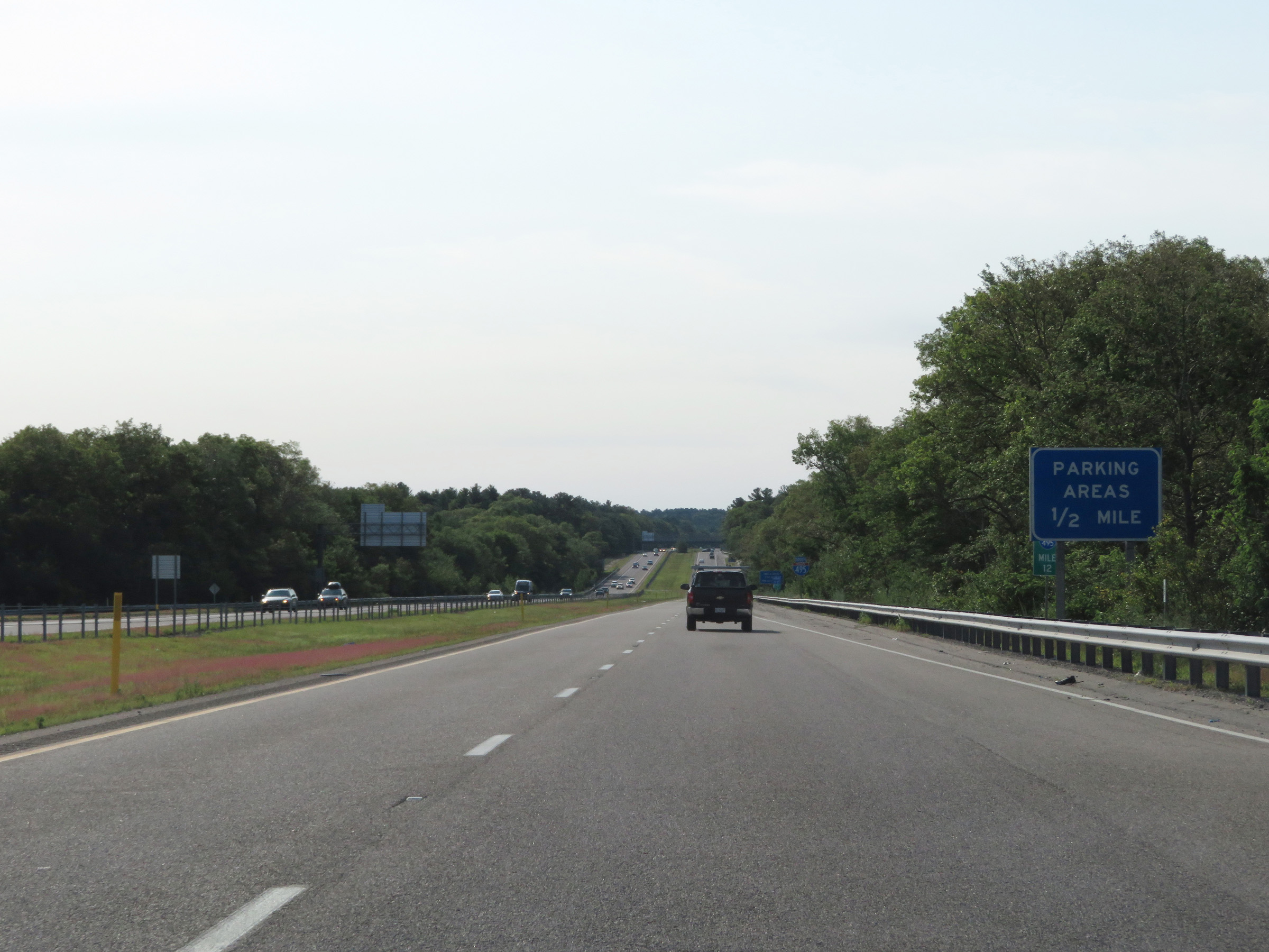 |
At mile marker 12, this advance signage shows that there will be two consecutive Parking Areas 1/2 mile ahead on Interstate 495 South. (Photo taken 8/6/17). |
 |
The first Parking Area on Interstate 495 South in Plymouth County. (Photo taken 8/6/17). |
 |
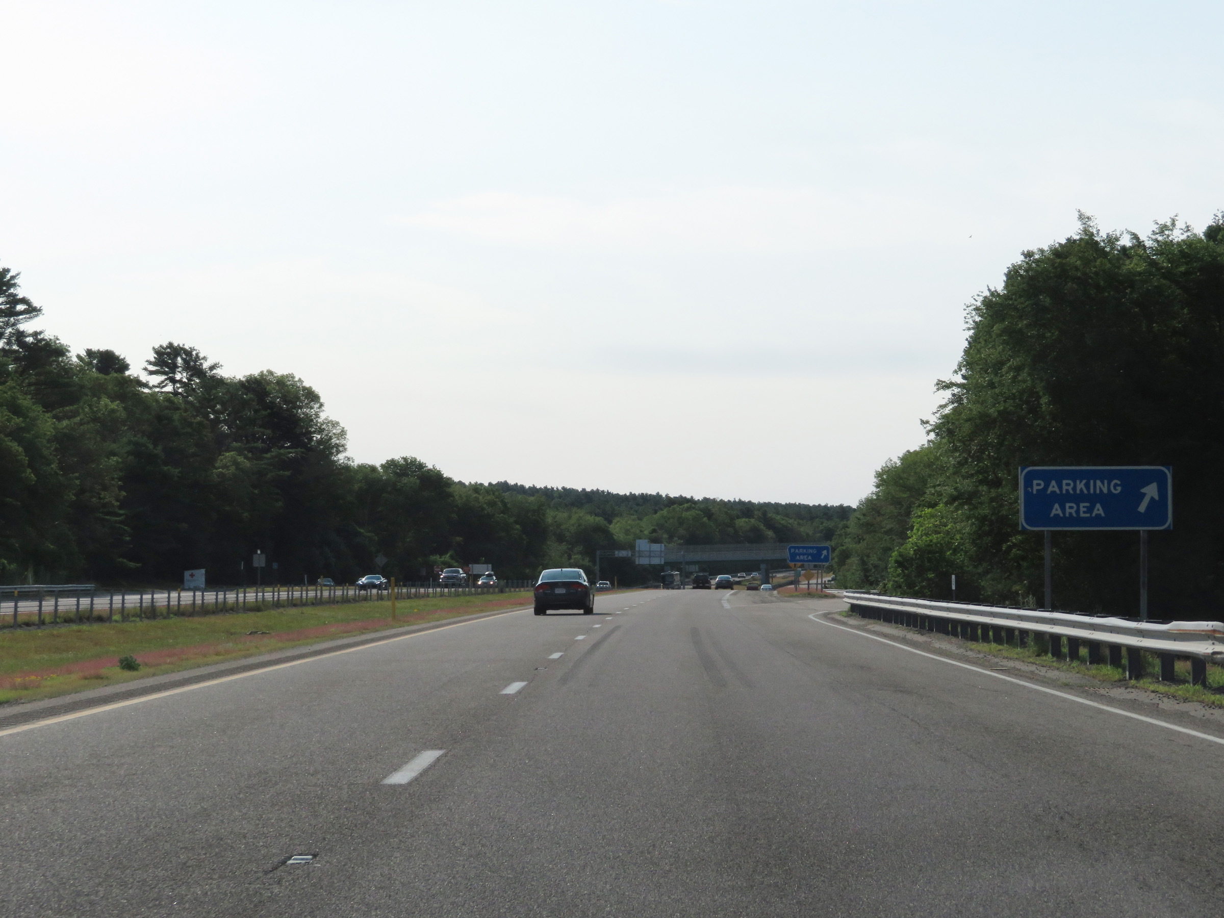
The second Parking Area is 1/4 mile ahead. (Photo taken 8/6/17). |
 |
Interstate 495 South at the second consecutive Parking Area in Plymouth County. (Photo taken 8/6/17). |
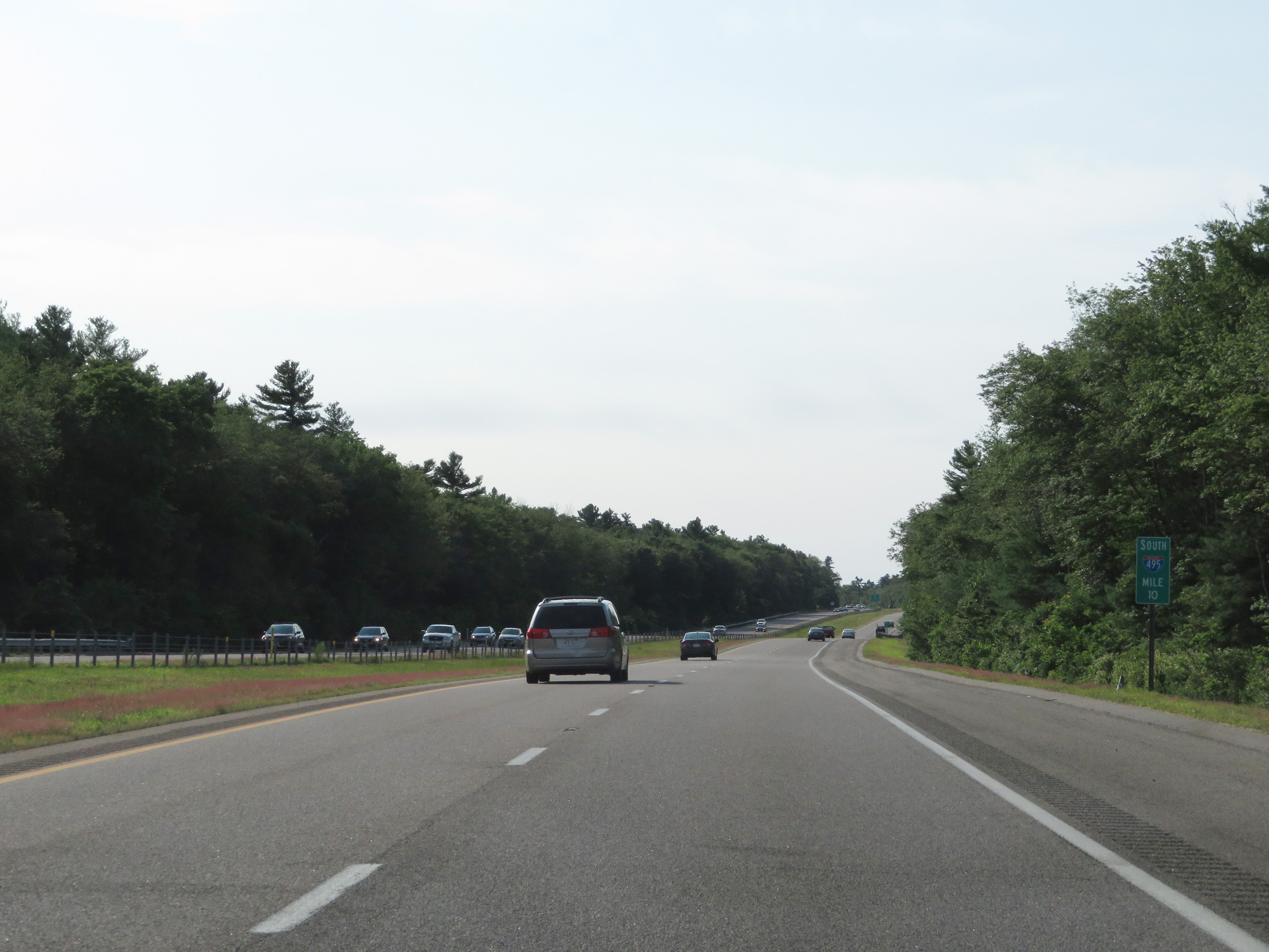 |
View on Interstate 495 South at mile marker 10. (Photo taken 8/6/17). |
 |
Interstate 495 South at Exit 3: MA 28 - Rock Village / South Middleboro (Photo taken 8/6/17). |
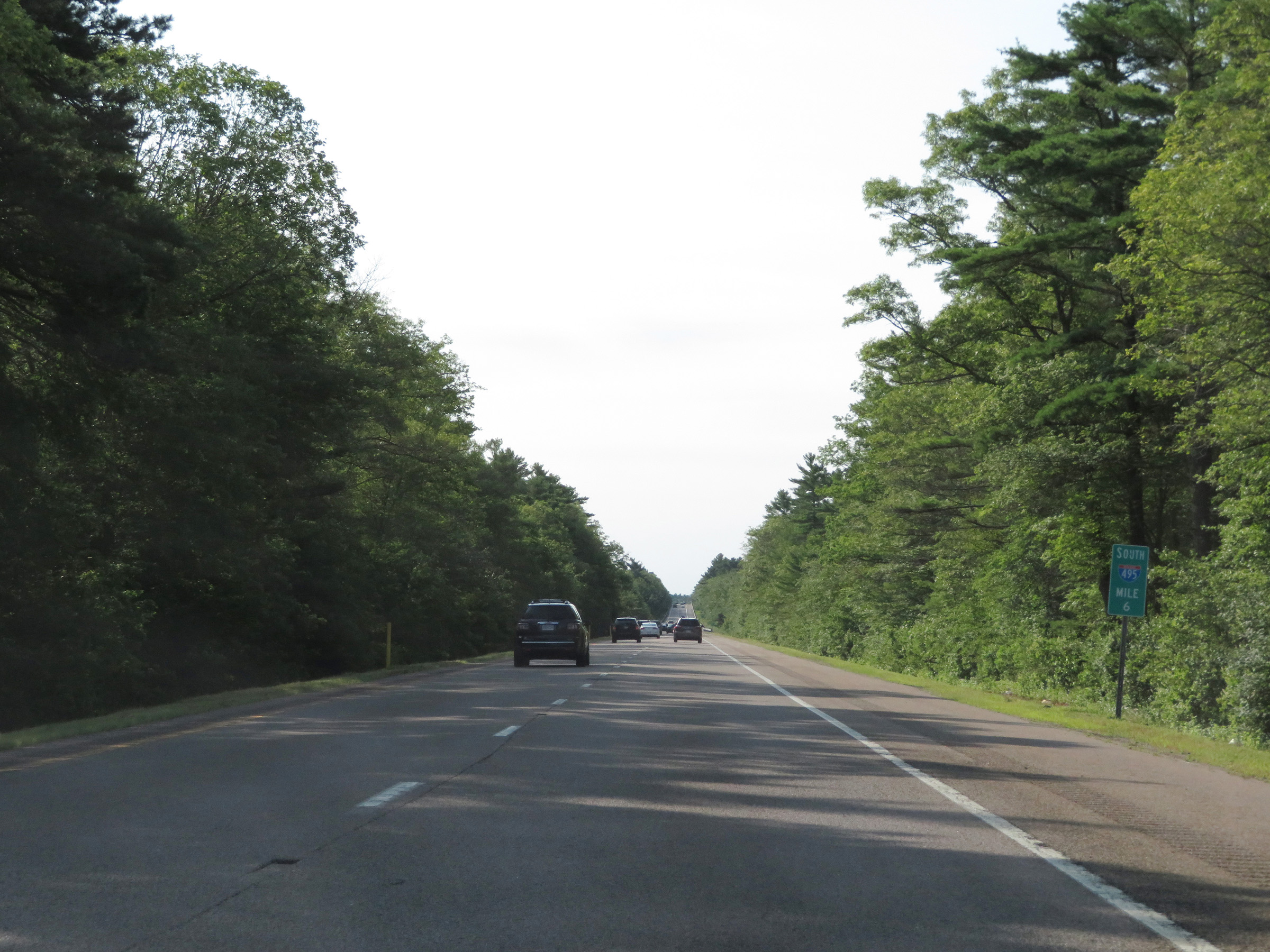 |
Interstate 495 South at mile marker 6. (Photo taken 8/6/17). |
 |
The speed limit remains the rural standard 65 mph on Interstate 495 South. (Photo taken 8/6/17). |
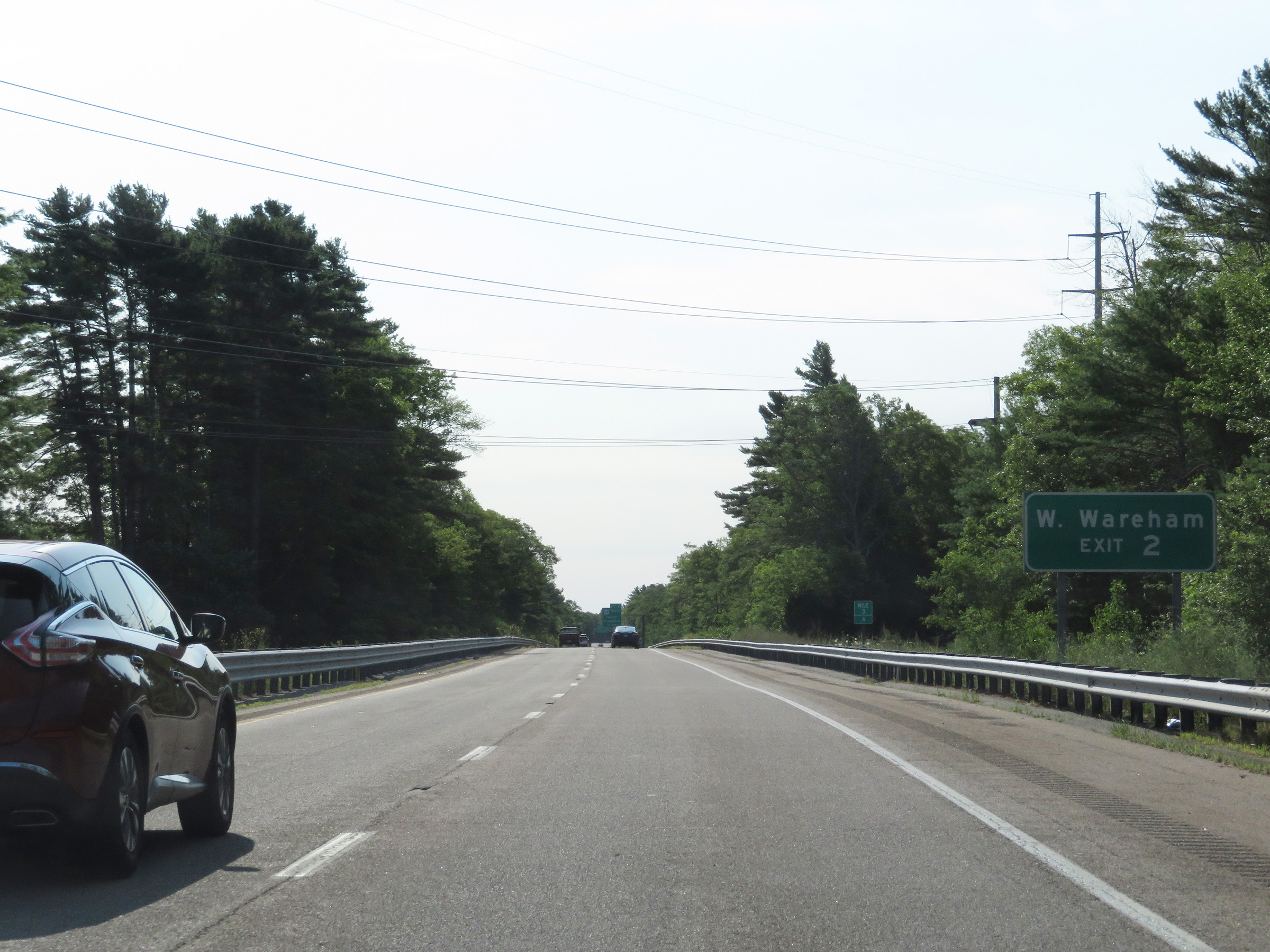 |
Take Exit 2 to West Wareham. (Photo taken 8/6/17). |
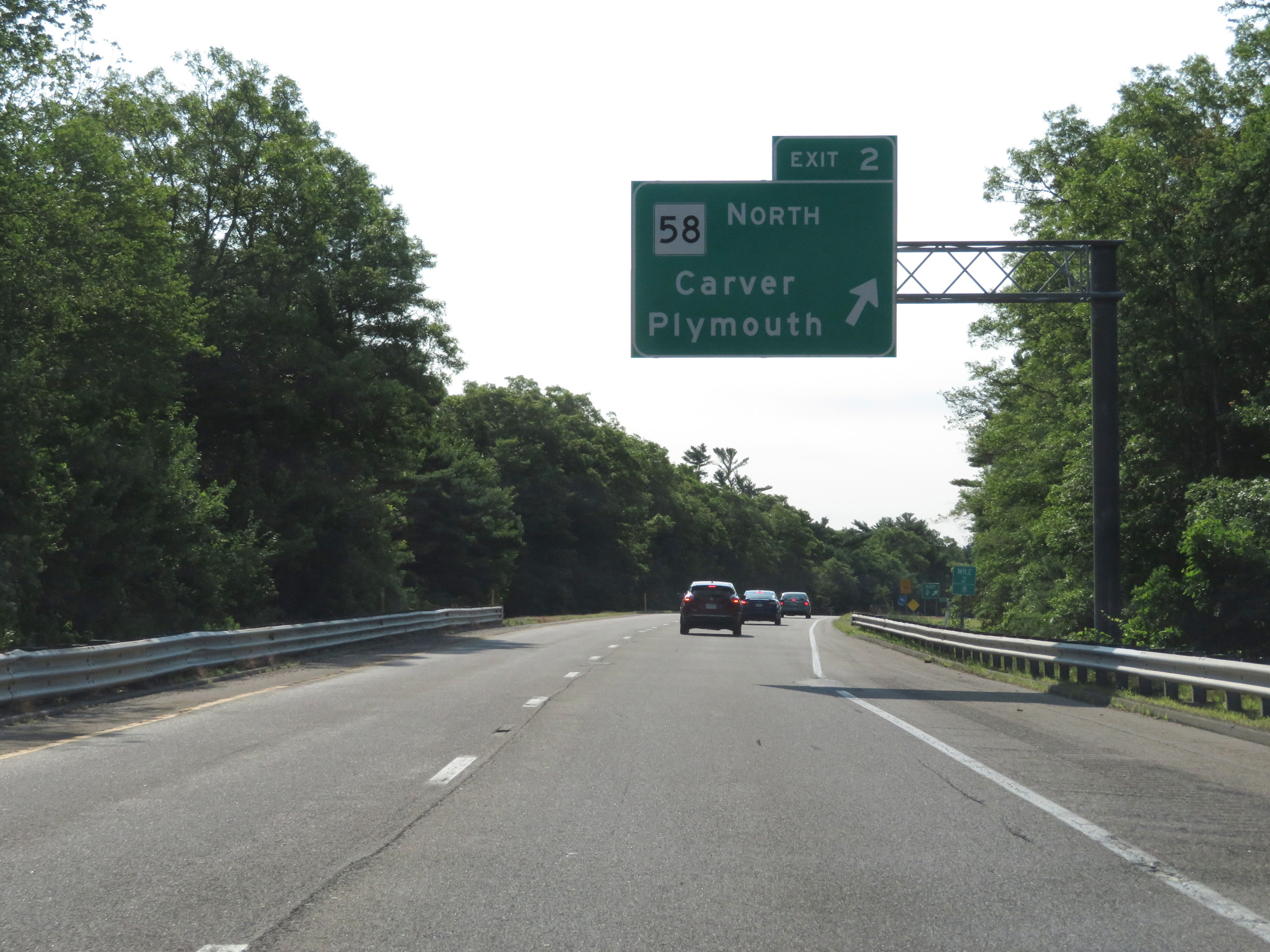 |
Interstate 495 South at Exit 2: MA 58 North - Carver / Plymouth (Photo taken 8/6/17). |
 |
Interstate 495 South approaching the junction of Interstate 195 West and MA 25 East, which will mark the southern terminus of I-495 2 miles ahead. (Photo taken 8/6/17). |
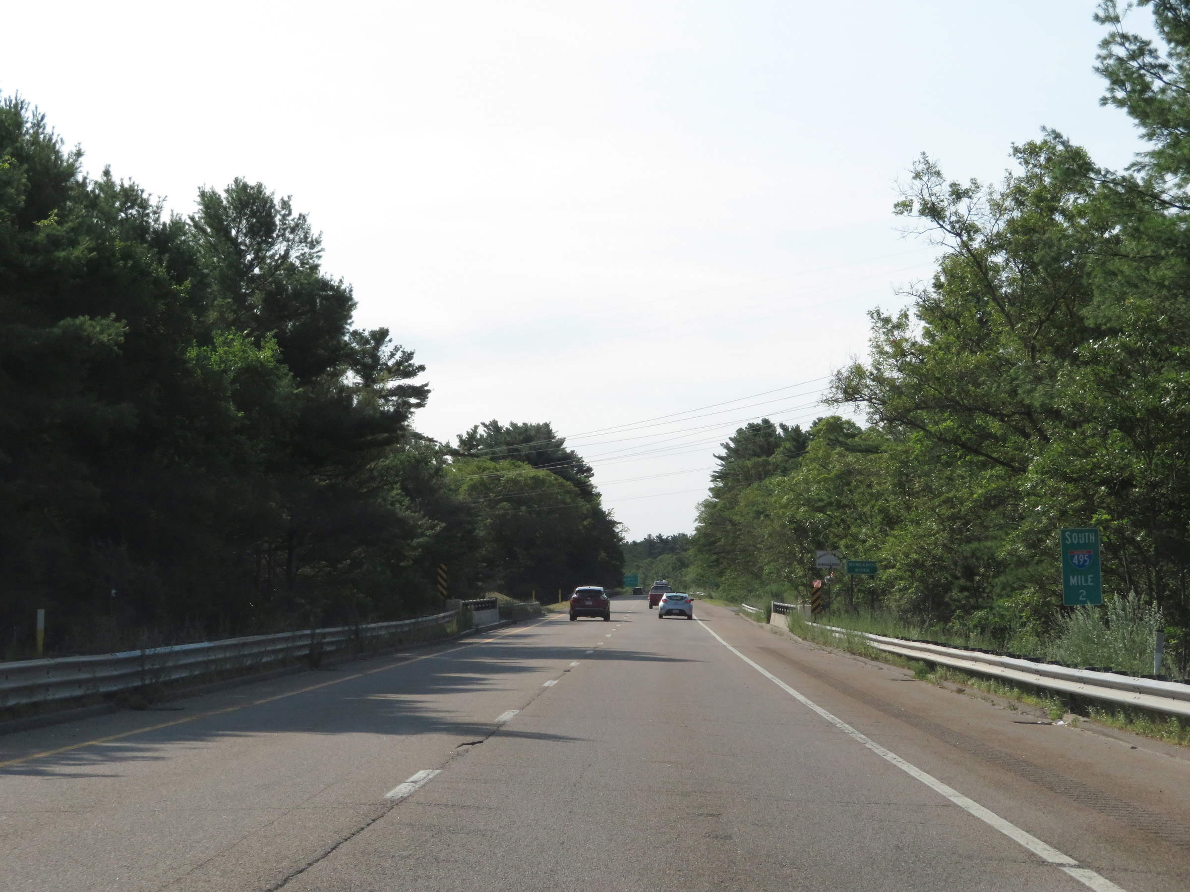 |
View on Interstate 495 South at mile marker 2. (Photo taken 8/6/17). |
 |
The southern terminus of Interstate 495 is now just 1 mile ahead. (Photo taken 8/6/17). |
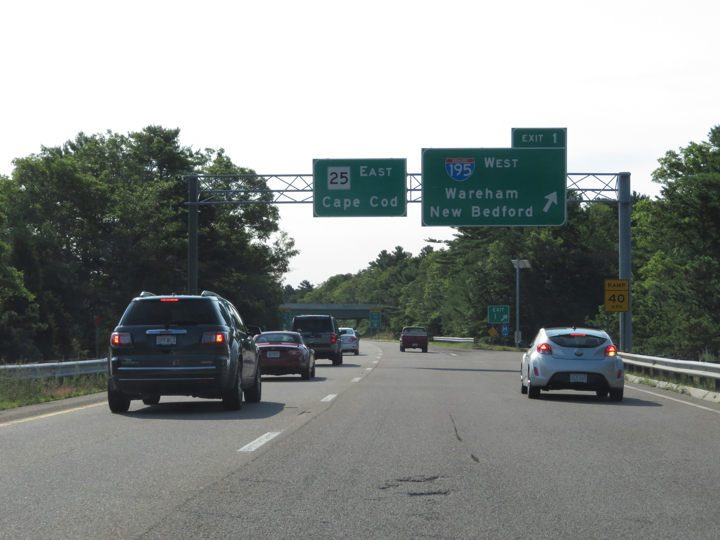 |
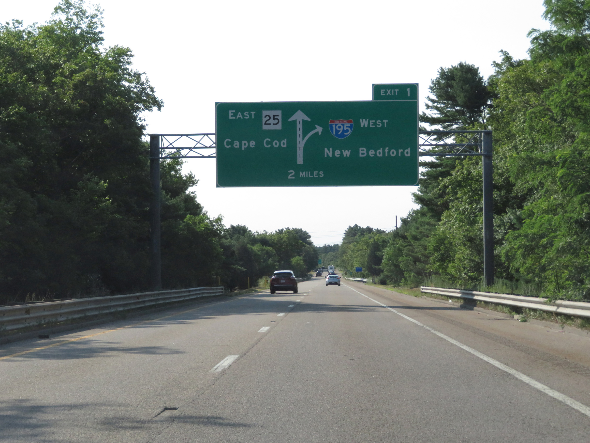
Interstate 495 South at Exit 1: Interstate 195 West - Wareham / New Bedford (Photo taken 8/6/17). |
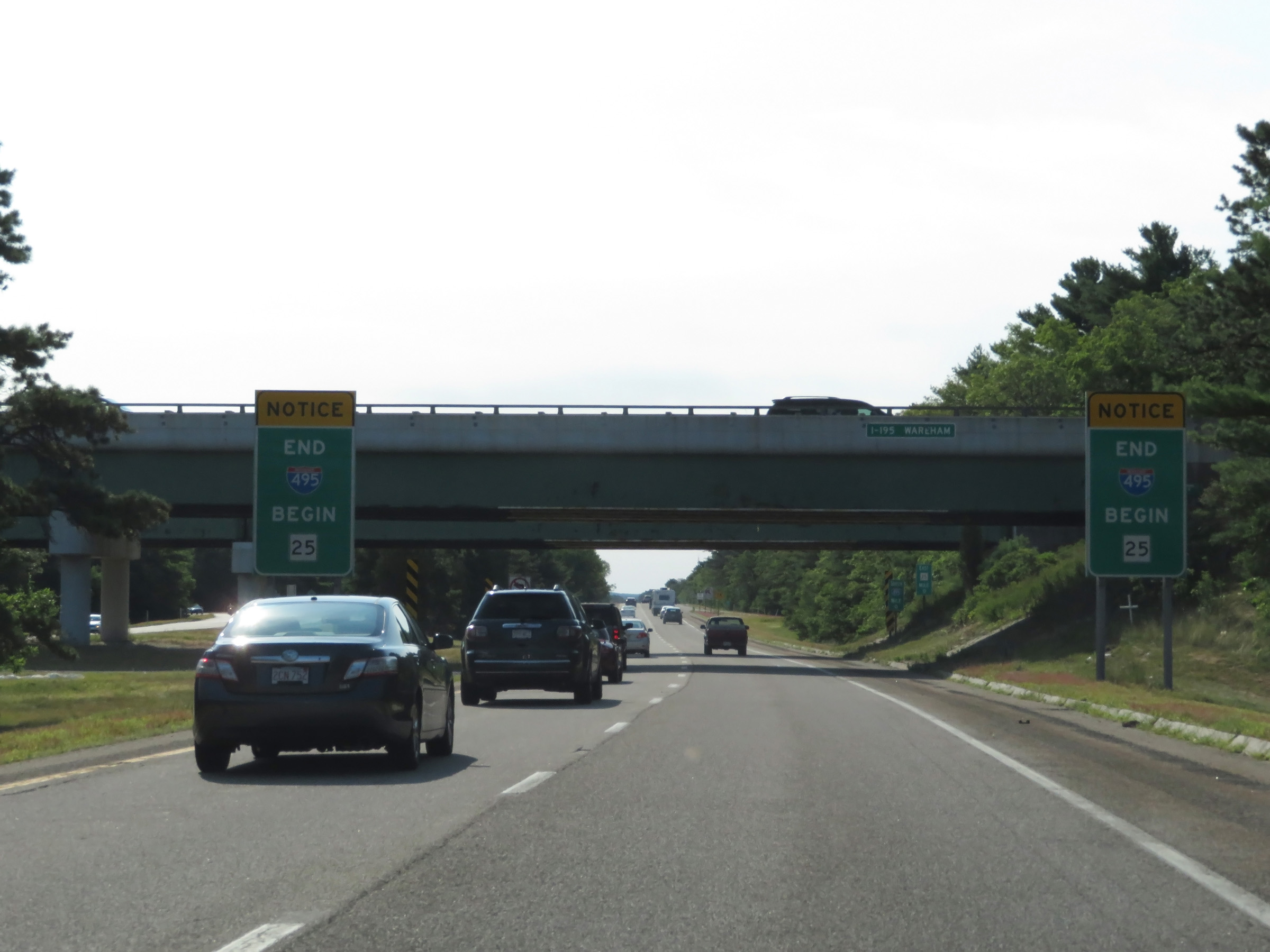 |
Just beyond Exit 1, Interstate 495 reaches its southern terminus and its two southbound lanes become the eastbound lanes of MA 25 at this point, as these signs read. (Photo taken 8/6/17). |
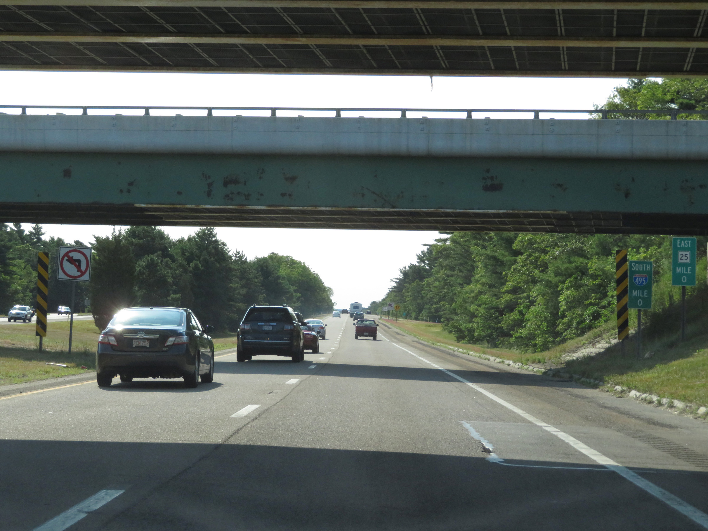 |
The official southern terminus of Interstate 495 is marked here at mile marker 0 as its two southbound lanes become the eastbound lanes of MA 25 toward Cape Cod underneath the ramps to and from Interstate 195. (Photo taken 8/6/17). |