Road Information |
||
 |
||
| Total Mileage in State: | 80 miles | |
| Eastern End: | At I-70, in Hancock | |
| Western End: | At West Virginiastate line | |
| Mileage covered in Photos: | 80 miles | |
| Counties covered in Photos: | Garrett, Allegany, Washington | |
| Major Junctions in Photos: | US 40/US 219, near Grantsville US 220, in Cumberland I-70, in Hancock |
|
| Control Cities in Photos: | Friendsville, Frostburg, Cumberland, Hancock | |
Eastbound
- Section 1: West Virginia Border to Cumberland (Exit 43A)
- Section 2: Cumberland (Exit 43A) to Interstate 70
Section 1: West Virginia Border to Cumberland (Exit 43A)
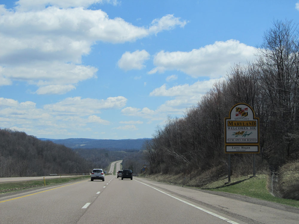 |
Maryland welcome sign as Interstate 68 East enters the Old Line State from West Virginia. (Photo taken 4/11/15). |
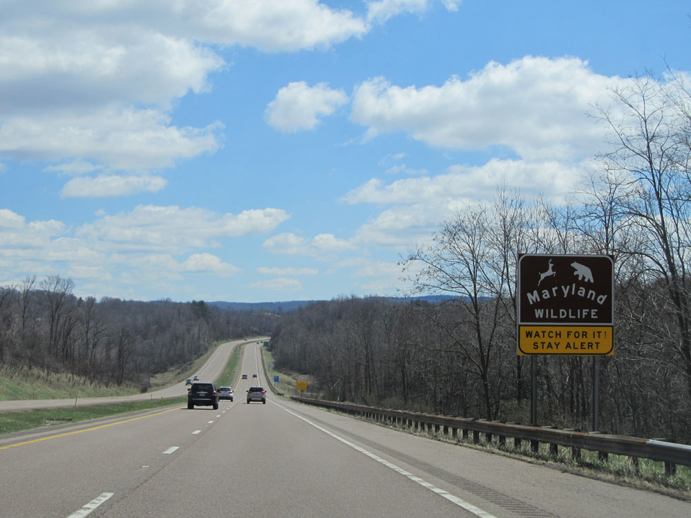 |
Sign alerting motorists to stay alert and watch for wildlife entering the roadway. Since Interstate 68 runs through the rural panhandle of Maryland, wildlife is a common site. (Photo taken 4/11/15). |
 |
Trucks headed to the towns of Westernport or Luke should use Exit 34, which is 32 miles ahead. It's the only safe truck route to these locations, given the mountainous terrain of the region. (Photo taken 4/11/15). |
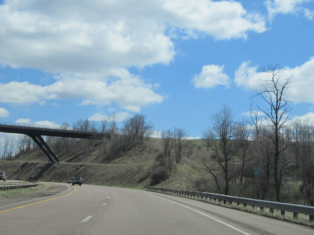 |
Interstate 68 East: Road view from mile marker 2. (Photo taken 4/11/15). |
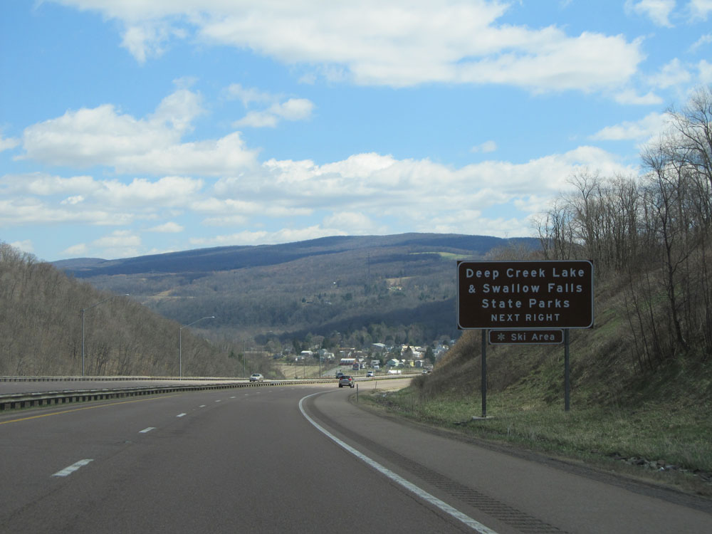 |
Use the next exit (Exit 4) to Deep Creek Lake and Shallow Falls State Parks. (Photo taken 4/11/15). |
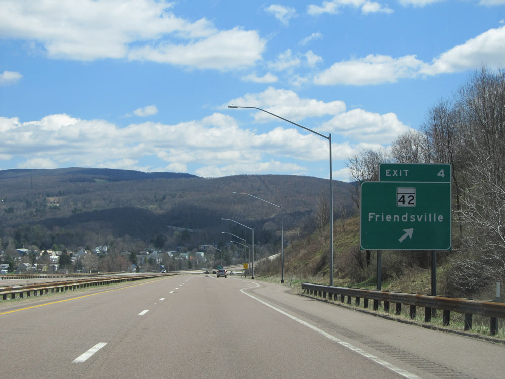 |
Interstate 68 East at Exit 4: MD 42 - Friendsville (Photo taken 4/11/15). |
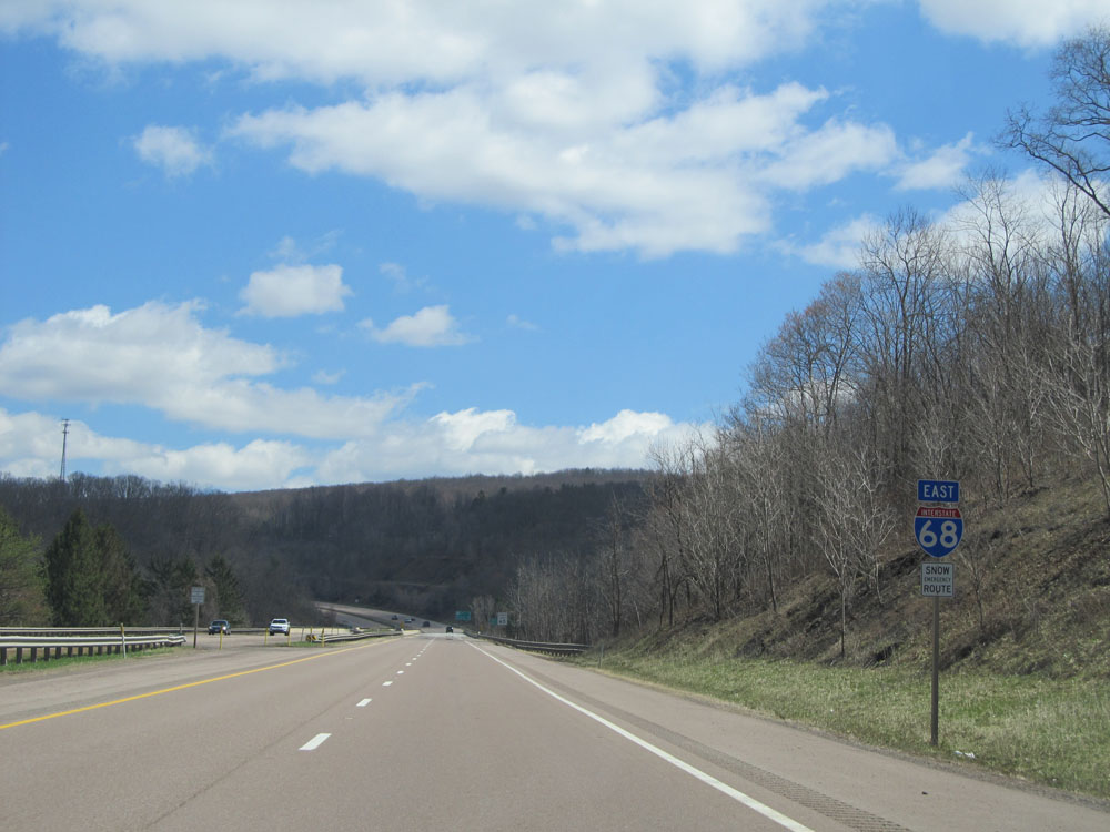 |
Interstate 68 East shield located near mile marker 4. (Photo taken 4/11/15). |
 |
Speed limit sign on Interstate 68 East. The speed limit on most rural Interstate highways in Maryland is 65 mph. (Photo taken 4/11/15). |
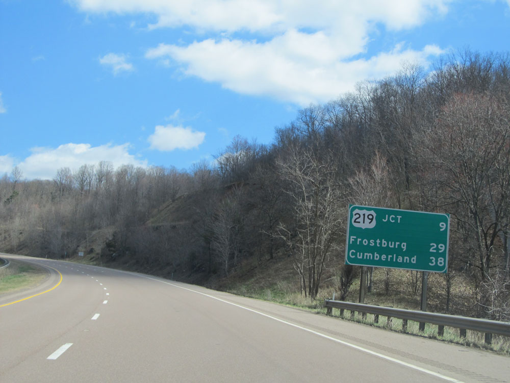 |
Mileage sign located near mile marker 5. It's 9 miles to the junction of US 219, 29 miles to Frostburg, and 38 miles to Cumberland. (Photo taken 4/11/15). |
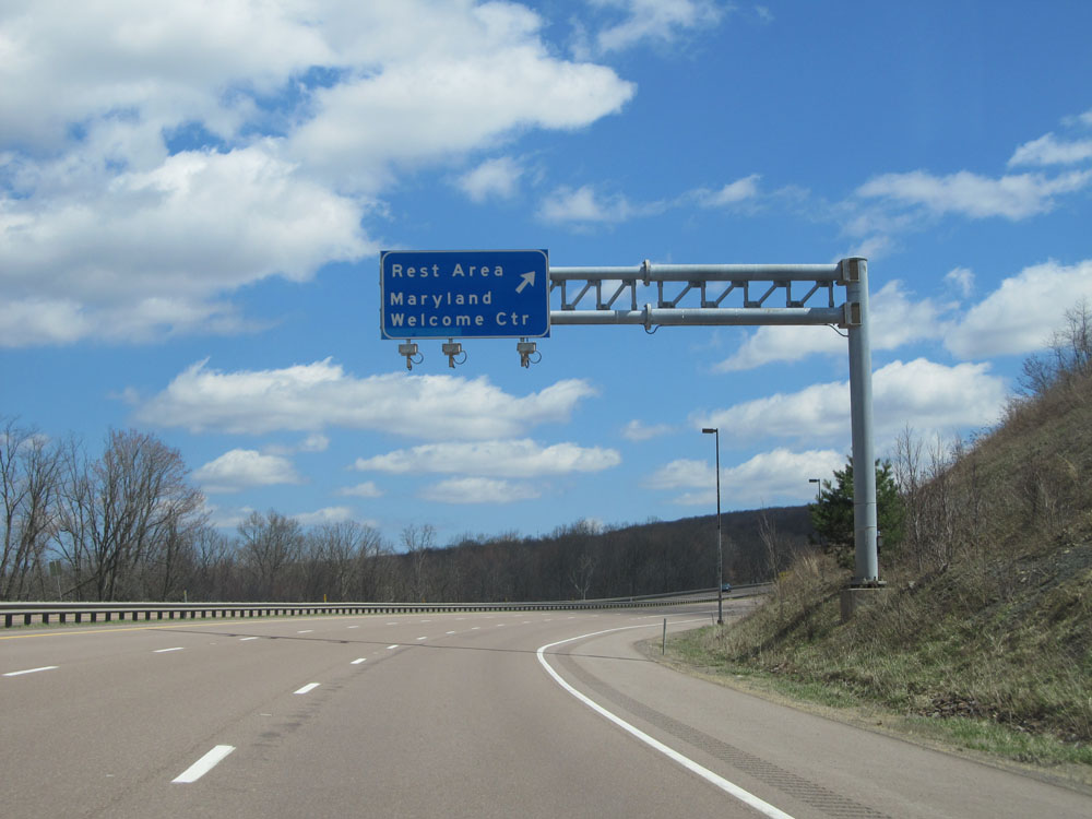 |
Interstate 68 East at the Maryland Welcome Center / Rest Area located near mile marker 6. (Photo taken 4/11/15). |
 |
A closer view of the Rest Area / Welcome Center ramp. (Photo taken 4/11/15). |
 |
Sign near mile marker 7 listing the distances to the upcoming exits which have truck services available. (Photo taken 4/11/15). |
 |
Road view on Interstate 68 East. (Photo taken 4/11/15). |
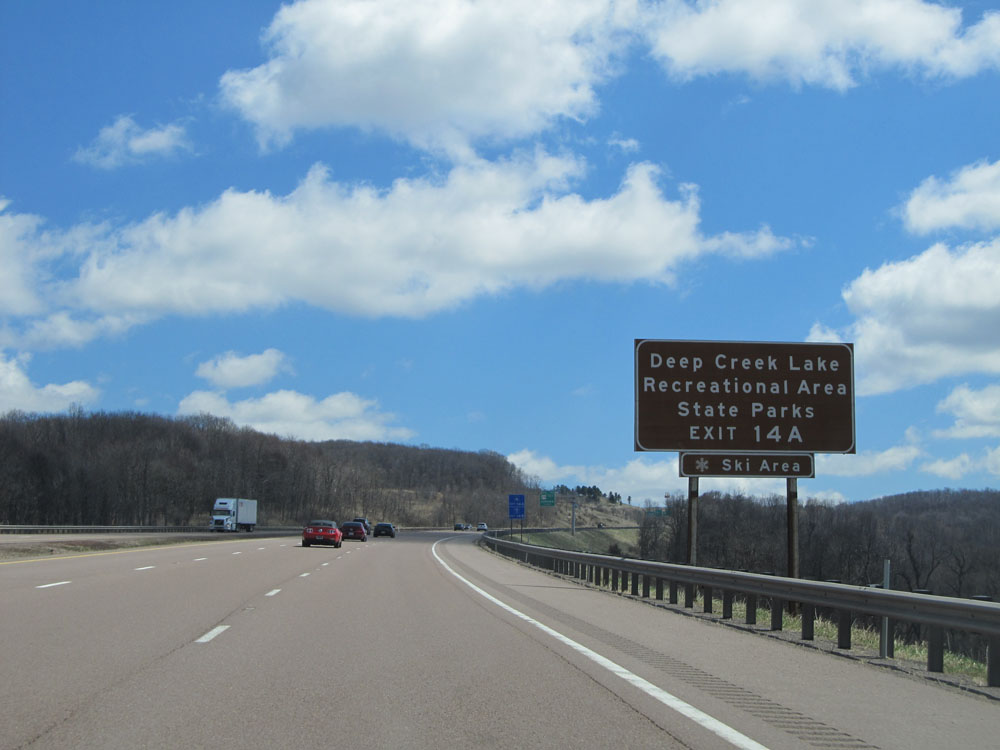 |
Take Exit 14A to Deep Creek Lake, Recreational Area, and State Park. (Photo taken 4/11/15). |
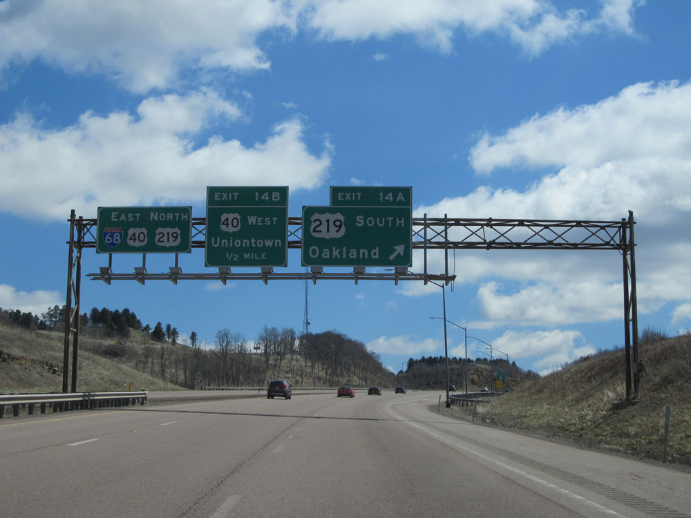 |
Interstate 68 East at Exit 14A: US 219 South - Oakland (Photo taken 4/11/15). |
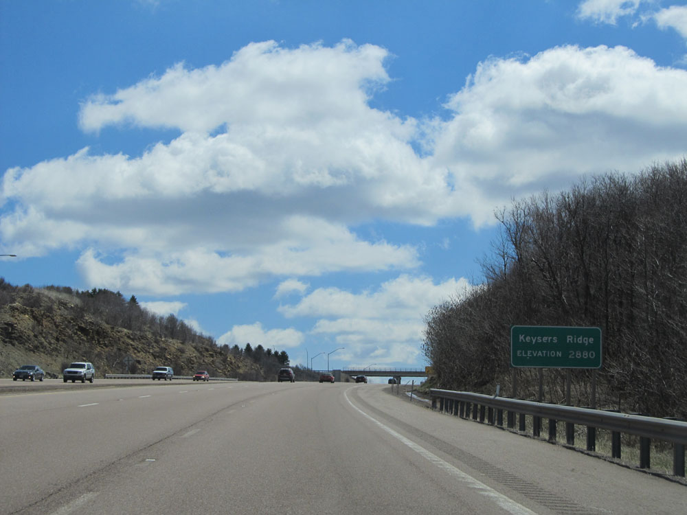 |
Interstate 68 East as you reach the summit of Keysers Ridge at an elevation of 2,880 ft. (Photo taken 4/11/15). |
 |
Interstate 68 East at Exit 14B: US 40 West - Uniontown (Photo taken 4/11/15). |
 |
Interstate 68 East: Road view from mile marker 15. (Photo taken 4/11/15). |
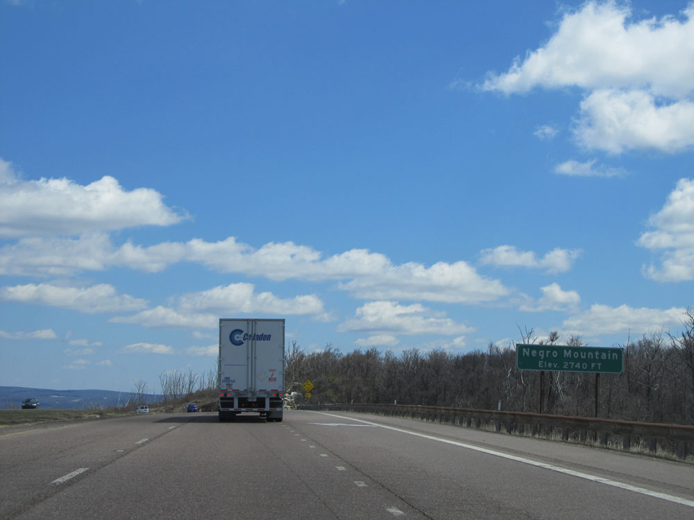 |
Interstate 68 East as you reach the summit of Negro Mountain at an elevation of 2,740 ft. (Photo taken 4/11/15). |
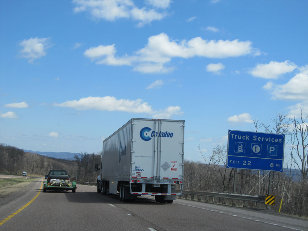 |
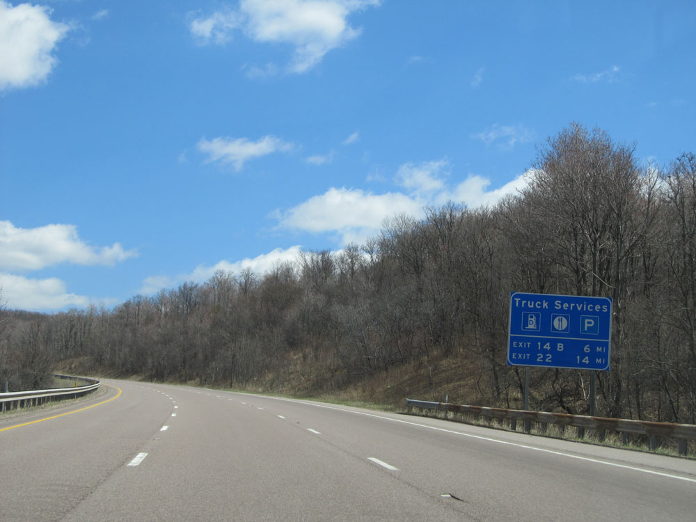
There are truck services located off Exit 22, which is 6 miles ahead. (Photo taken 4/11/15). |
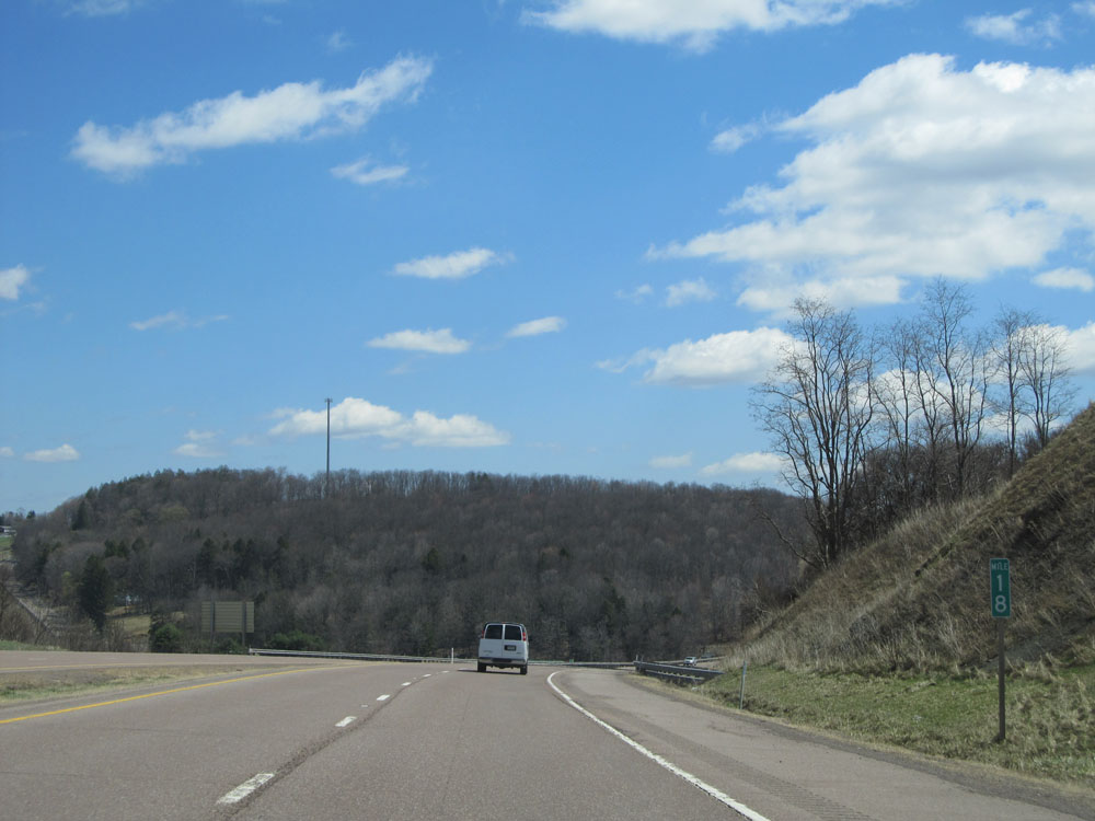 |
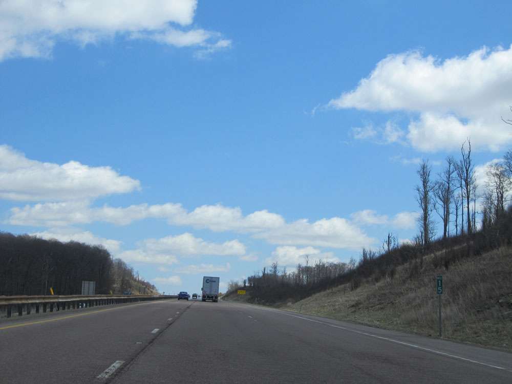
Interstate 68 East: Road view from mile marker 18. (Photo taken 4/11/15). |
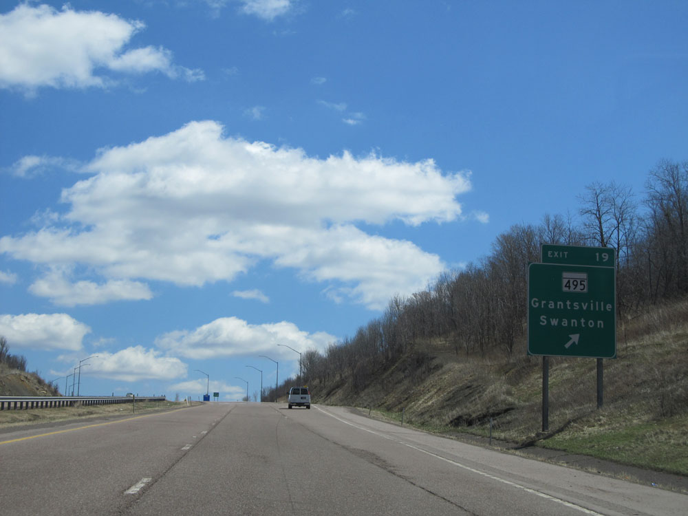 |
Interstate 68 East at Exit 19: MD 495 - Grantsville / Swanton (Photo taken 4/11/15). |
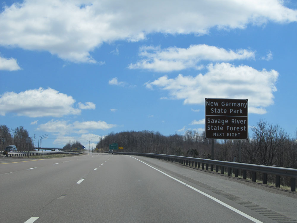 |
Take the next exit (Exit 22) to New Germany State Park and Savage River State Forest. (Photo taken 4/11/15). |
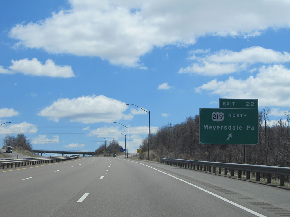 |
Interstate 68 East at Exit 22: US 219 North - Meyersdale, PA (Photo taken 4/11/15). |
 |
Interstate 68 East as it reaches the summit of Meadow Mountain at an elevation of 2,780 ft. (Photo taken 4/11/15). |
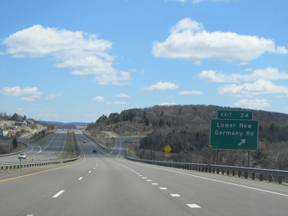 |
Interstate 68 East at Exit 24: Lower New Germany Rd (Photo taken 4/11/15). |
 |
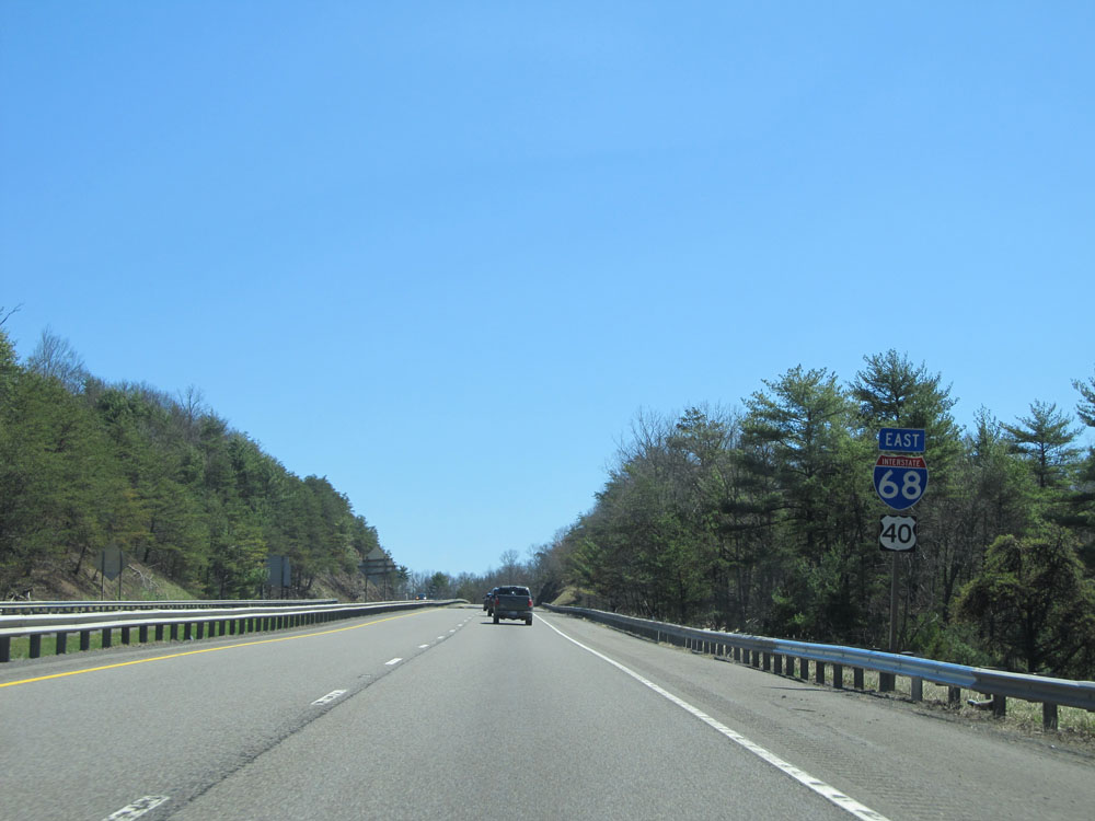
Mileage sign on Interstate 68 East. It's 4 miles to the junction of MD 546, 9 miles to Frostburg, and 18 miles to Cumberland. (Photo taken 4/11/15). |
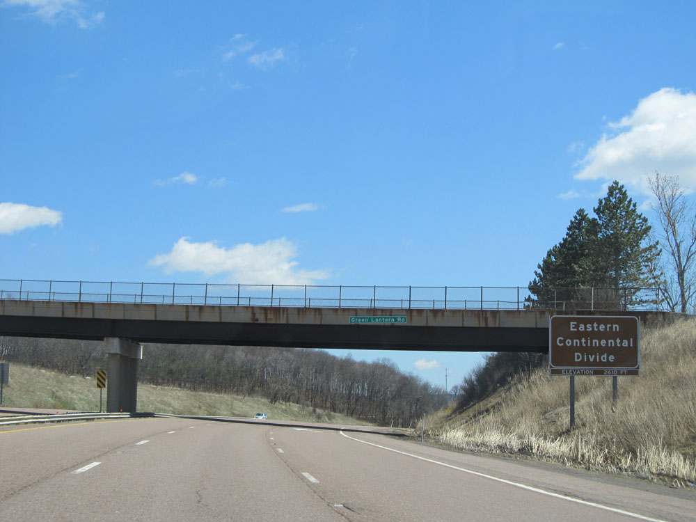 |
Interstate 68 East as it reaches the Eastern Continental Divide at an elevation of 2,610 ft. (Photo taken 4/11/15). |
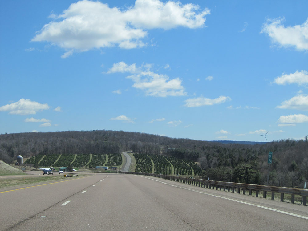 |
Interstate 68 East: Road view from mile marker 26. (Photo taken 4/11/15). |
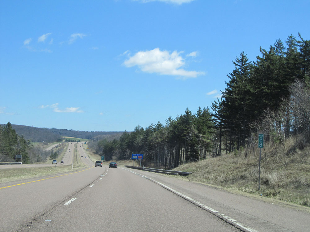 |
Interstate 68 East: Road view from mile marker 28. (Photo taken 4/11/15). |
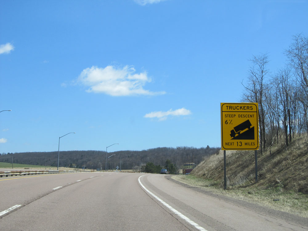 |
Warning sign alerting trucks that they're about to traverse a 13-mile long 6% grade down into Cumberland. Trust me when I say that this grade is no joke and is not to be taken lightly. (Photo taken 4/11/15). |
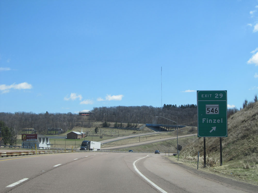 |
Interstate 68 East at Exit 29: MD 546 - Finzel (Photo taken 4/11/15). |
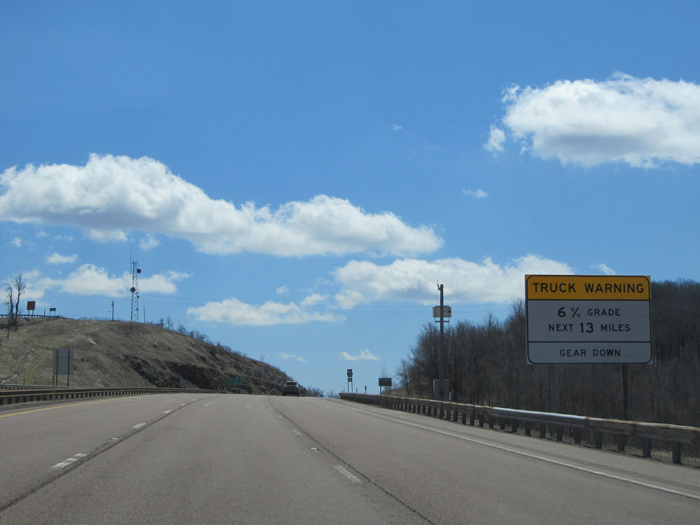 |
Another warning sign for the 13-mile long 6% grade alerting truck drivers to gear down now while they have the chance. (Photo taken 4/11/15). |
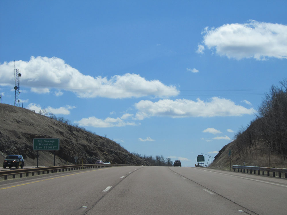 |
Interstate 68 East as you reach the top of Big Savage Mountain at an elevation of 2,800 ft. (Photo taken 4/11/15). |
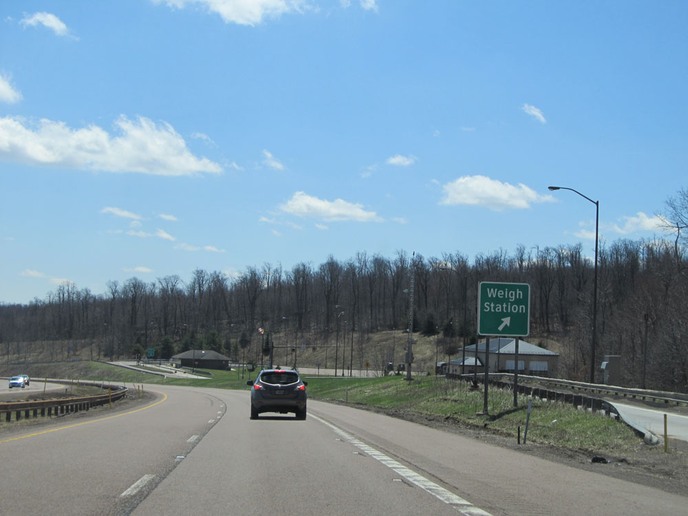 |
Interstate 68 East at the Weigh Station located near mile marker 31. (Photo taken 4/11/15). |
 |
As you begin to go down the long, steep grade, the speed limit for trucks drops to 45 mph. The speed limit for autos remains at 65 mph for the time being. Also, this is the point that you enter Allegany County. (Photo taken 4/11/15). |
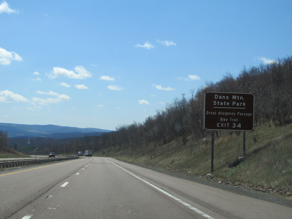 |
Take Exit 34 to Dan's Mountain State Park and Great Allegheny Passage Bike Trail. (Photo taken 4/11/15). |
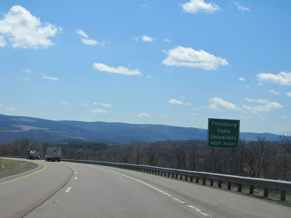 |
Take the next exit (Exit 33) to Frostburg State University. (Photo taken 4/11/15). |
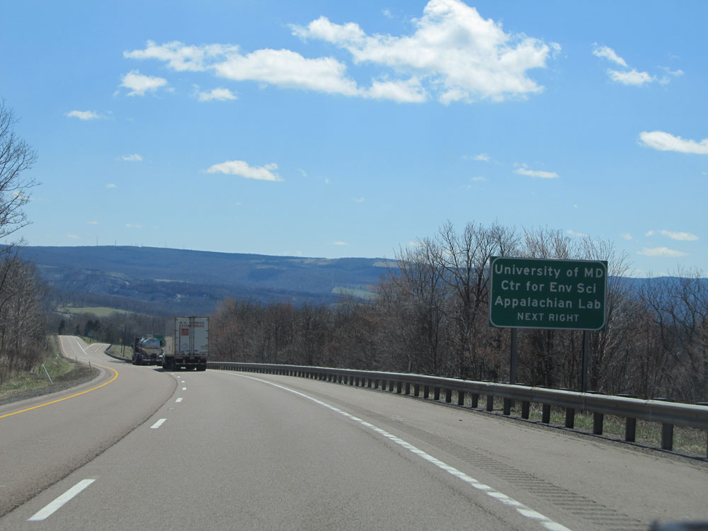 |
Also use the next exit (Exit 33) to University of MD Center for Environmental Science Appalachian Lab. (Photo taken 4/11/15). |
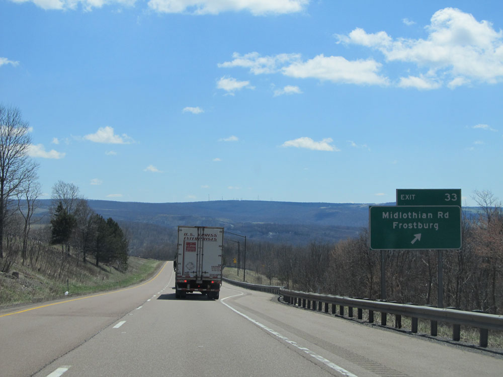 |
Interstate 68 East at Exit 33: Midlothian Rd / Frostburg (Photo taken 4/11/15). |
 |
This sign warns truck drivers that the 6% grade still continues for the next 10 miles, regardless of the brief break in the downhill action you see here. Remain in lower gear. (Photo taken 4/11/15). |
 |
Interstate 68 East at Exit 34: MD 36 - Westernport / Frostburg (Photo taken 4/11/15). |
 |
Interstate 68 East: Road view from mile marker 35, as the downgrade continues. (Photo taken 4/11/15). |
 |
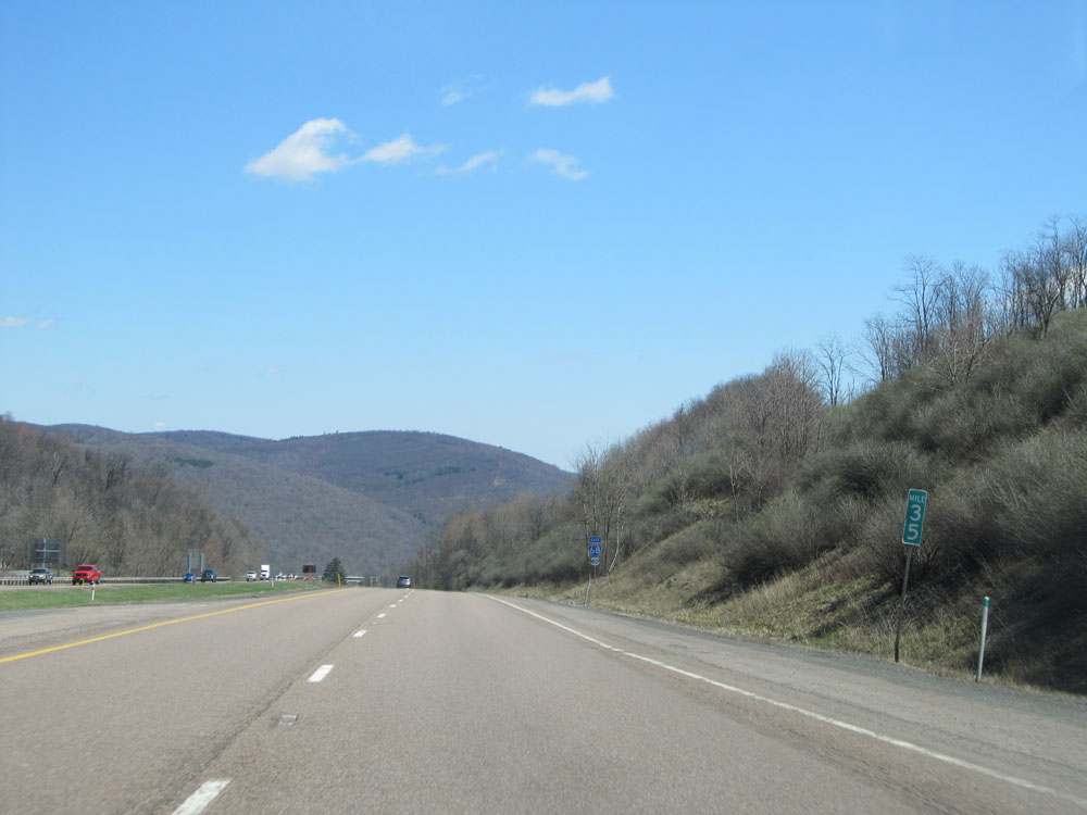
Mileage sign located near mile marker 36. It's 8 miles to Cumberland, 45 miles to Hancock (the eastern terminus of I-68), and 76 miles to Hagerstown (via I-68 East to I-70 East). (Photo taken 4/11/15). |
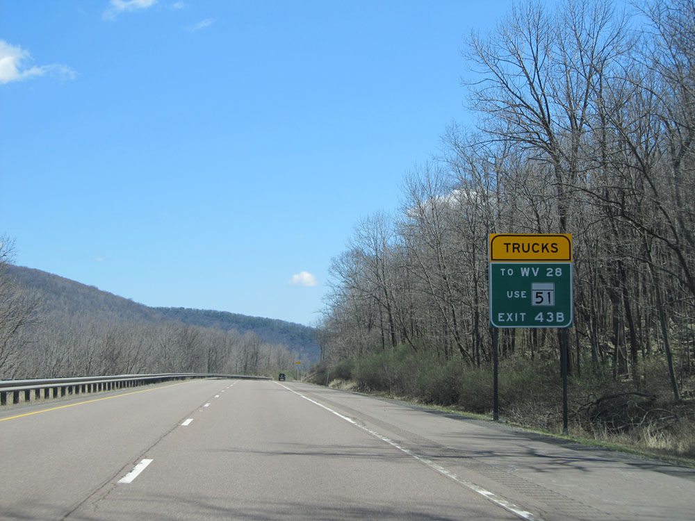 |
Trucks headed to WV 28 should use MD 51 via Exit 43B. (Photo taken 4/11/15). |
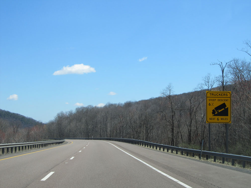 |
Another warning sign for the steep downgrade. The 6% grade continues for 6 more miles from this point. (Photo taken 4/11/15). |
 |
Interstate 68 East: Road view from mile marker 37. (Photo taken 4/11/15). |
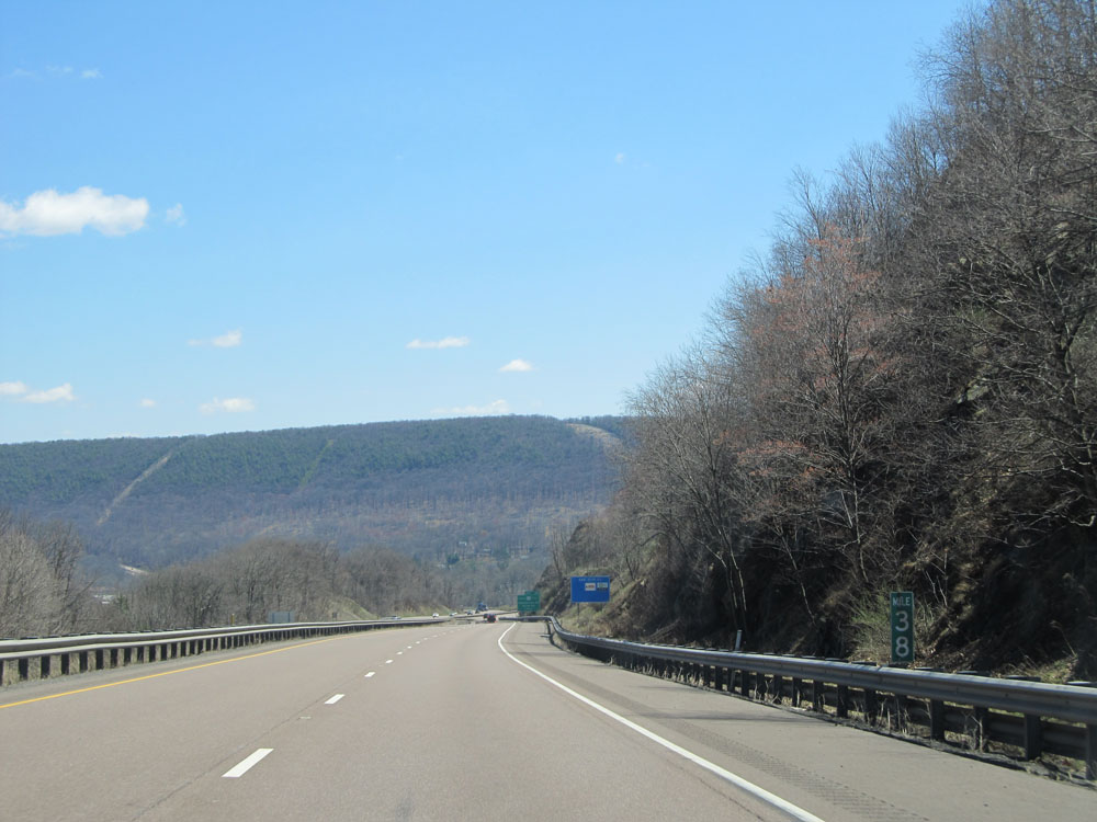 |
Interstate 68 East: Road view from mile marker 38. (Photo taken 4/11/15). |
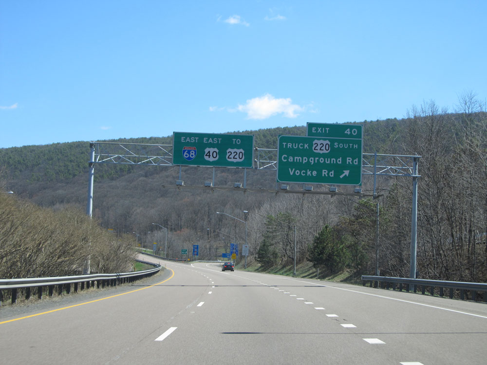 |
Interstate 68 East at Exit 40: US 220 South Truck Route - Campground Rd / Vocke Rd (Photo taken 4/11/15). |
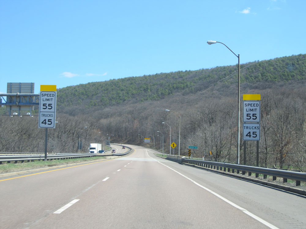 |
Near mile marker 41, the speed limit for autos is reduced to 55 mph. The 45 mph speed limit for trucks remains intact. (Photo taken 4/11/15). |
 |
As you begin the final descent into Cumberland, trucks are restricted to the right lane only. (Photo taken 4/11/15). |
 |
Interstate 68 East approaching the Truck Brake & Equipment Check Area - 1/2 mile. This will be your final chance to check your brakes before heading down Haystack Mountain into downtown Cumberland. (Photo taken 4/11/15). |
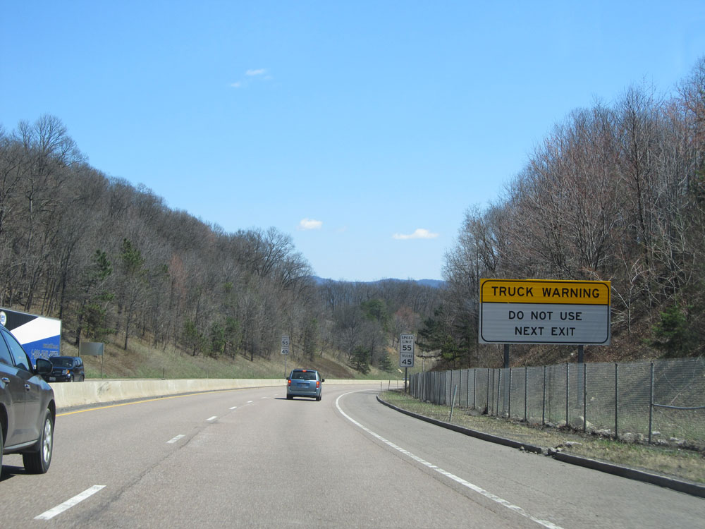 |
Sign warning truck drivers to NOT use the next exit (Exit 42). The off-ramp is too steep and short. (Photo taken 4/11/15). |
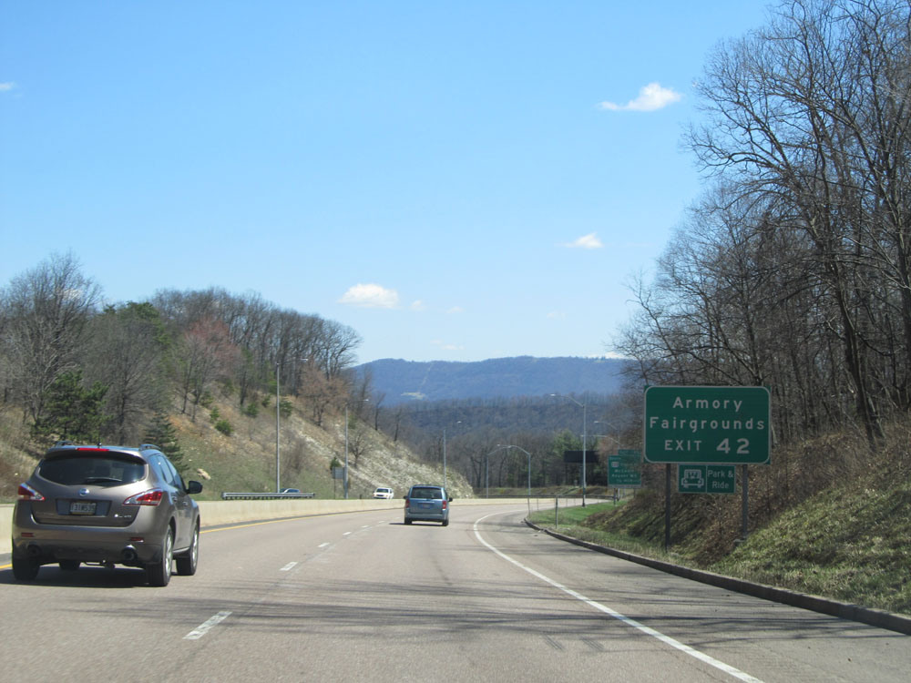 |
Take Exit 42 to the Armory and Fairgrounds. (Photo taken 4/11/15). |
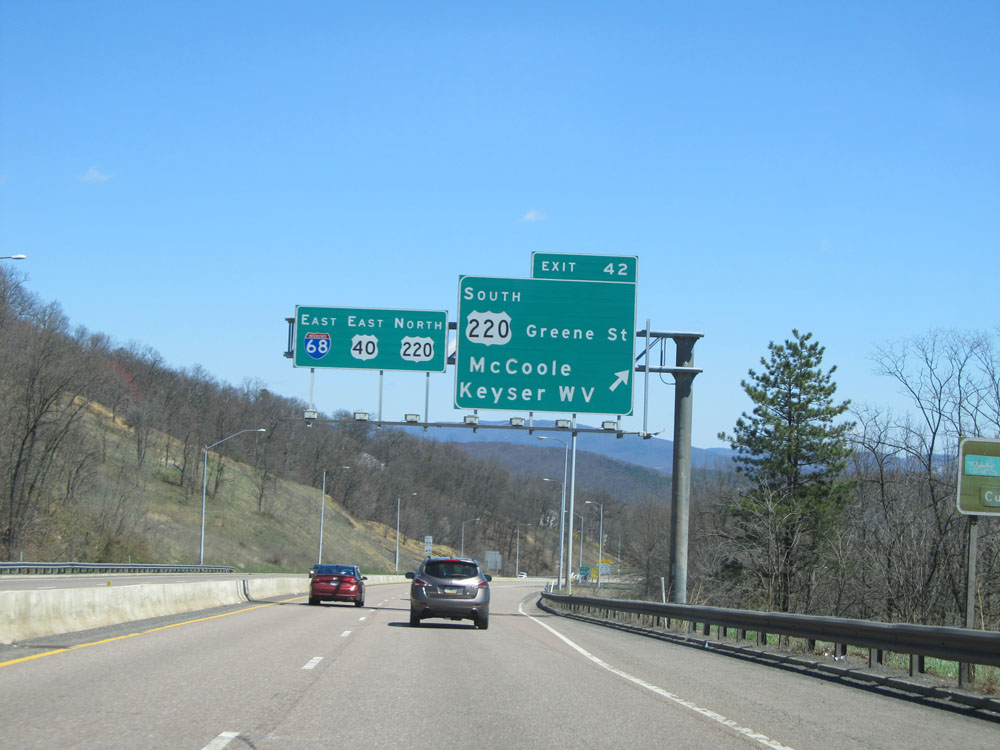 |
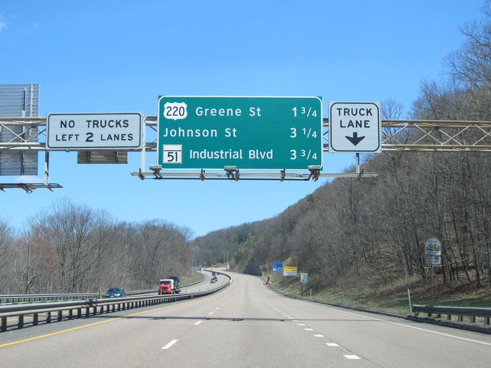
Interstate 68 East at Exit 42: US 220 South - Greene St / McCoole / Keyser, WV (Photo taken 4/11/15). |
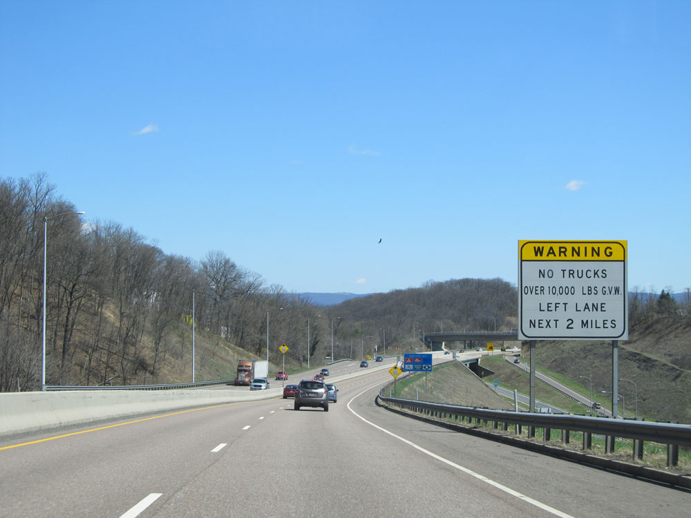 |
The truck lane restriction mentioned earlier remains in effect for the next 2 miles. (Photo taken 4/11/15). |
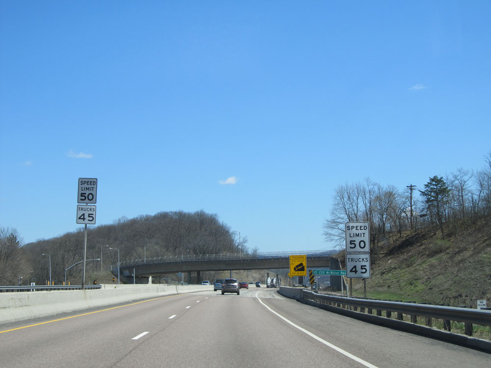 |
Near mile marker 43, the speed limit for autos is reduced to 50 mph while the 45 mph truck speed limit remains in effect. (Photo taken 4/11/15). |
 |
Grade warning sign at the top of the final piece of the downgrade, known as Haystack Mountain. The 6% grade continues for 2 more miles and doesn't end until you're right in downtown Cumberland. (Photo taken 4/11/15). |
 |
Sign listing the distances to the upcoming Cumberland exits. (Photo taken 4/11/15). |
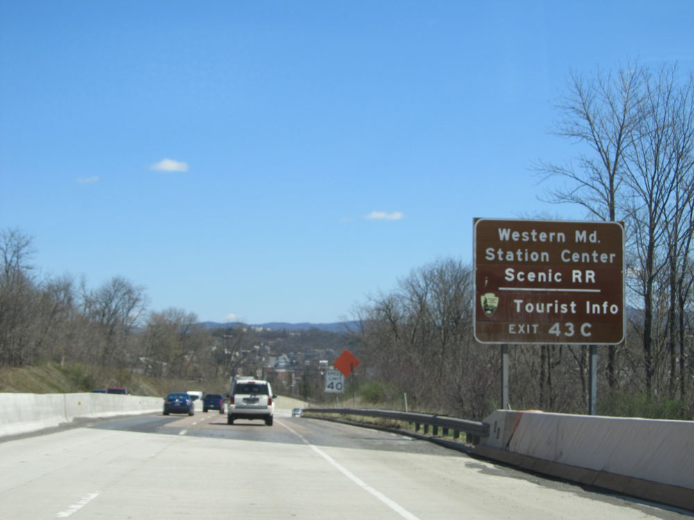 |
Take Exit 43C to Western Maryland Station Center Scenic Railroad and Tourist Info. (Photo taken 4/11/15). |
 |
Interstate 68 East as it descends Haystack Mountain into downtown Cumberland. As the warning sign above suggests, the speed limit for all vehicles down this grade and through downtown is 40 mph. (Photo taken 4/11/15). |
 |
Interstate 68 East as it reaches the bottom of Haystack Mountain and the 13-mile long 6% grade in downtown Cumberland. Now you can breathe a little easier! (Photo taken 4/11/15). |
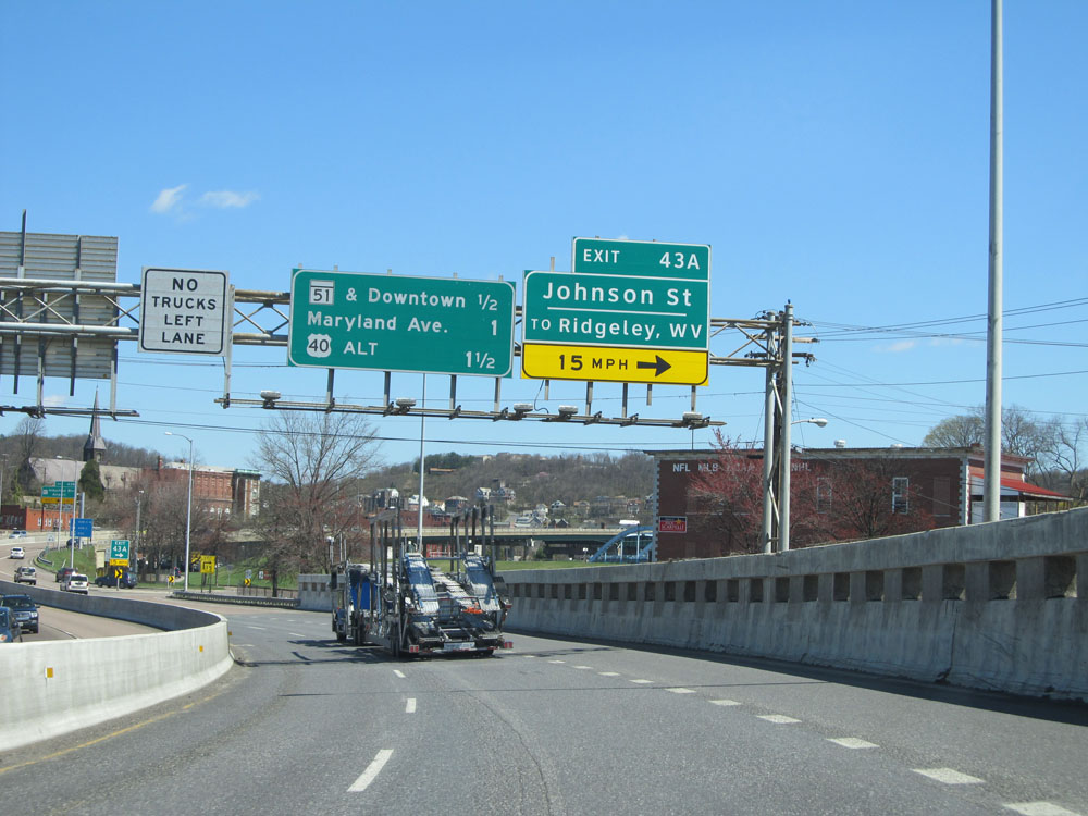 |
Interstate 68 East at Exit 43A: Johnson St / To Ridgeley, WV (Photo taken 4/11/15). |
Section 2: Cumberland (Exit 43A) to Interstate 70
 |
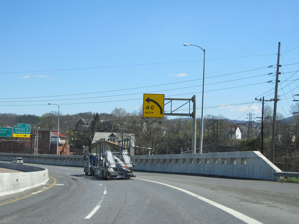
As mentioned earlier, the speed limit through downtown Cumberland on Interstate 68 is 40 mph as this sign says. (Photo taken 4/11/15). |
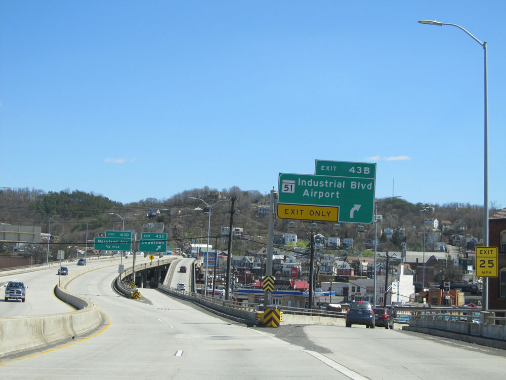 |
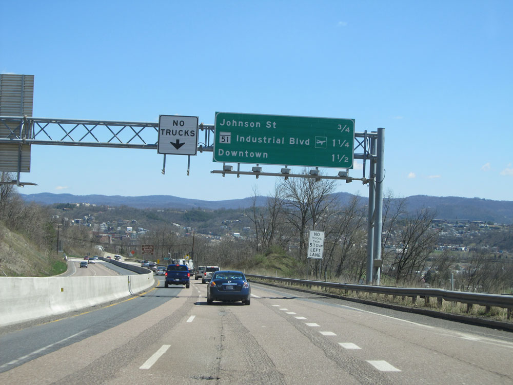
Interstate 68 East at Exit 43B: MD 51 - Industrial Blvd / Airport (Photo taken 4/11/15). |
 |
Interstate 68 East at Exit 43C: Downtown (Photo taken 4/11/15). |
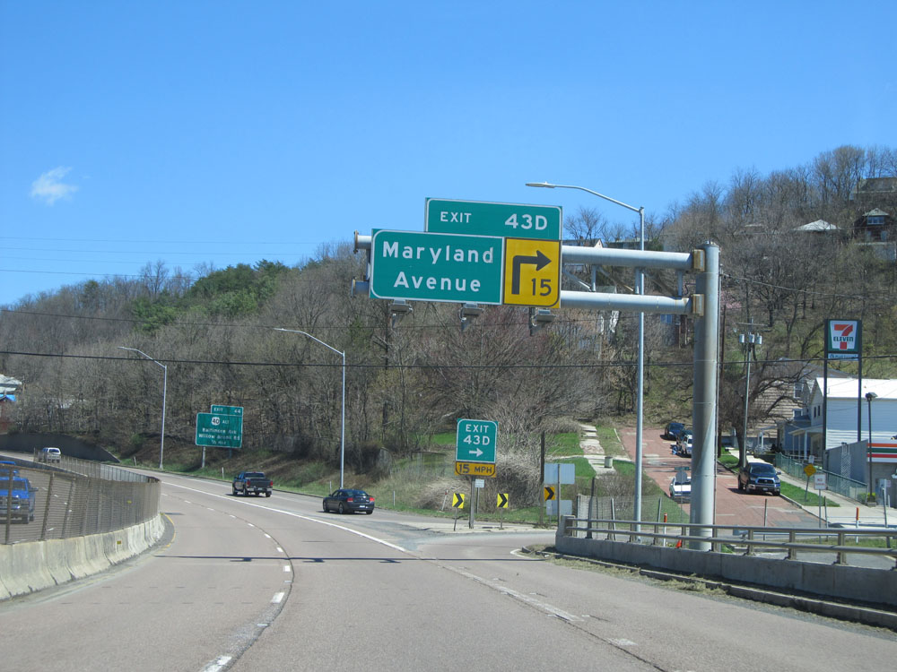 |
Interstate 68 East at Exit 43D: Maryland Avenue (Photo taken 4/11/15). |
 |
Take the next exit (Exit 44) to Allegany College of Maryland. (Photo taken 4/11/15). |
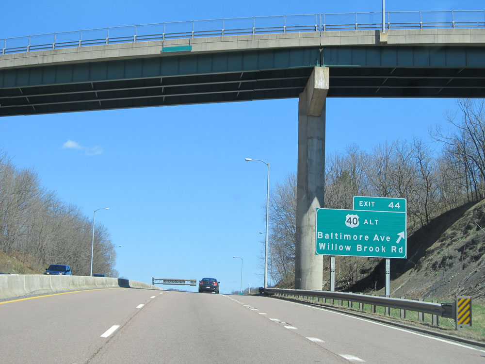 |
Interstate 68 East at Exit 44: US 40 ALT - Baltimore Ave / Willow Brook Rd (Photo taken 4/11/15). |
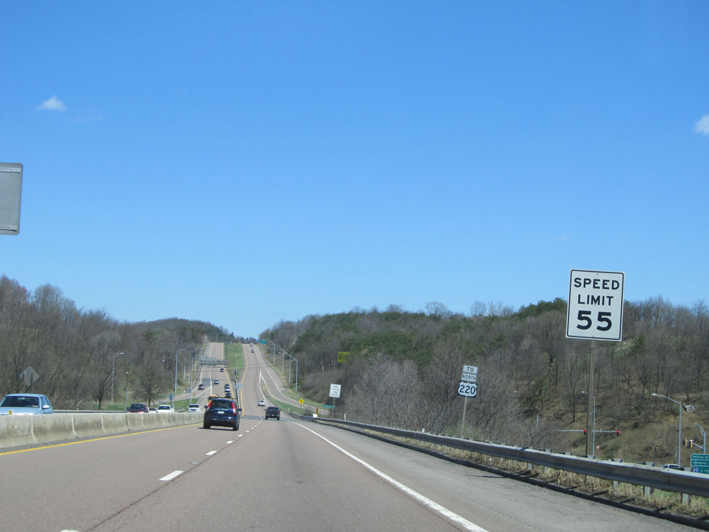 |
Near mile marker 44, the speed limit for all vehicles increases to 55 mph as you leave downtown Cumberland. (Photo taken 4/11/15). |
 |
Interstate 68 East shield. (Photo taken 4/11/15). |
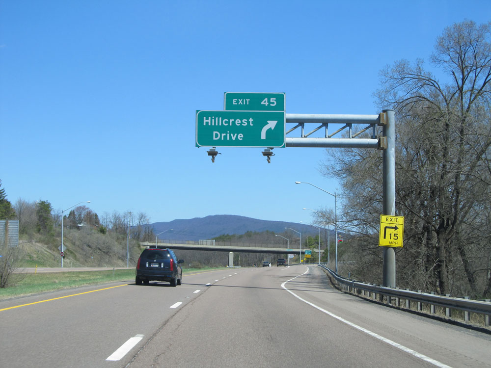 |
Interstate 68 East at Exit 45: Hillcrest Drive (Photo taken 4/11/15). |
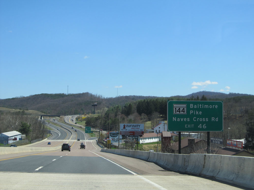 |
Take Exit 46 to MD 144 (Baltimore Pike) and Naves Cross Rd. (Photo taken 4/11/15). |
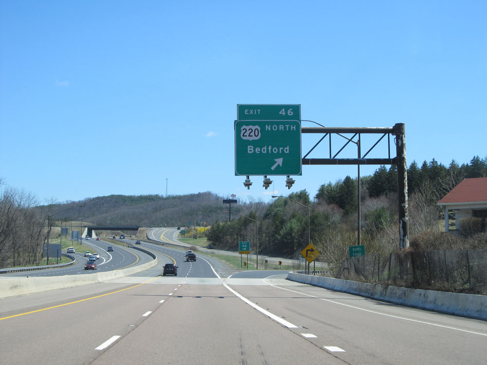 |
Interstate 68 East at Exit 46: US 220 North - Bedford (Photo taken 4/11/15). |
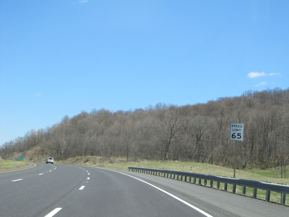 |
Shortly after Exit 46, the speed limit increases to 65 mph once again. (Photo taken 4/11/15). |
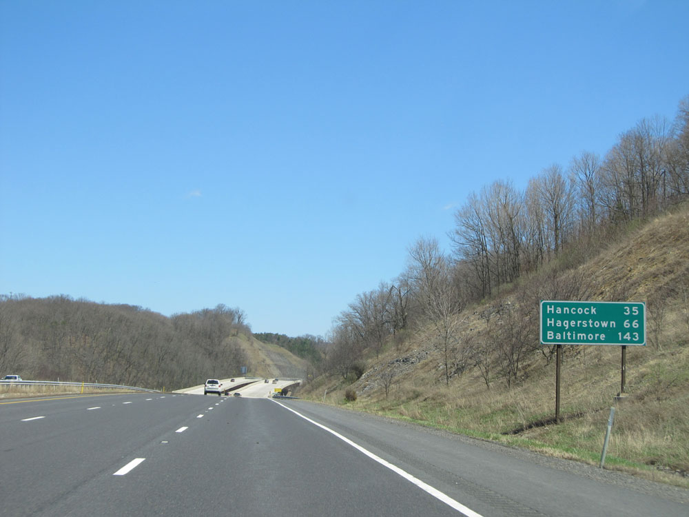 |
Mileage sign on Interstate 68 East. It's 35 miles to Hancock, 66 miles to Hagerstown, and 143 miles to Baltimore. (Photo taken 4/11/15). |
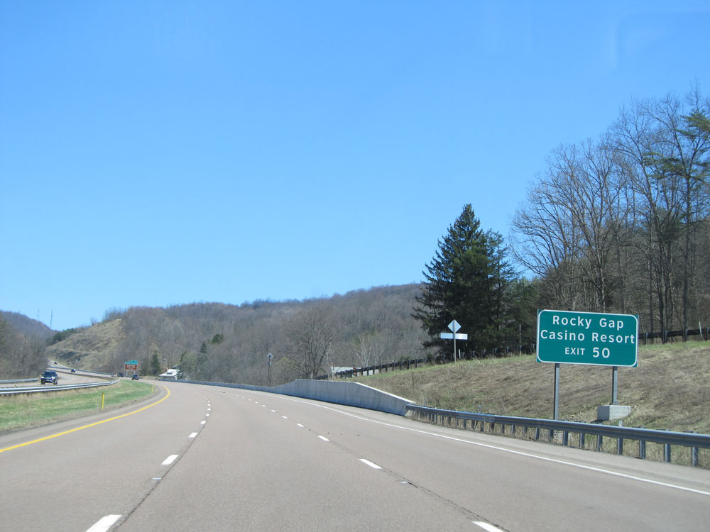 |
Take Exit 50 to Rocky Gap Casino Resort. (Photo taken 4/11/15). |
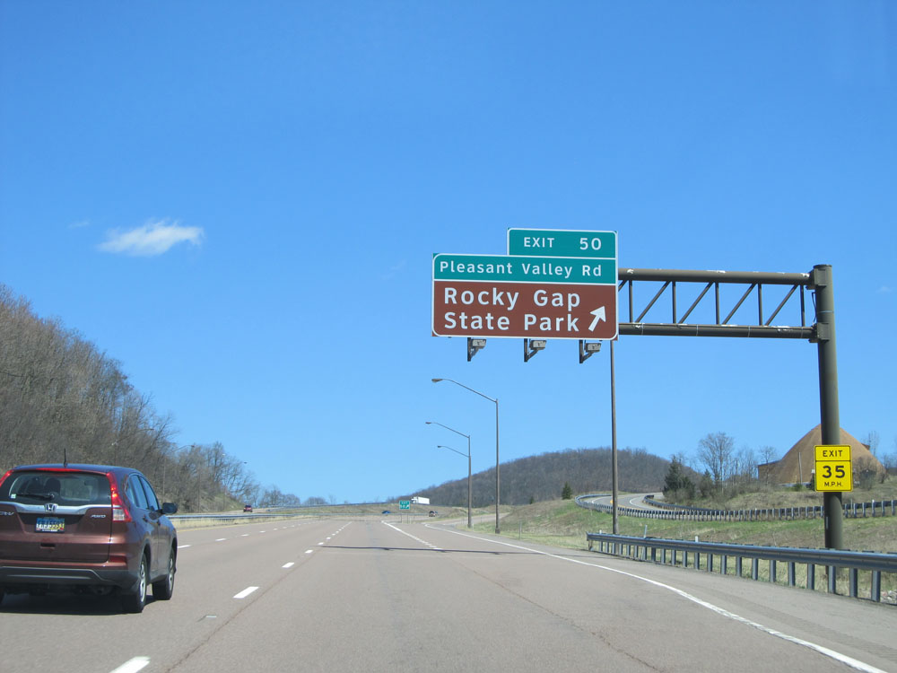 |
Interstate 68 East at Exit 50: Pleasant Valley Rd / Rocky Gap State Park (Photo taken 4/11/15). |
 |
Interstate 68 East: Road view from mile marker 51. (Photo taken 4/11/15). |
 |
Sign warning of another 2 1/2 mile 6% grade 1/4 mile ahead. There are a few more ups and downs as you head east of Cumberland on Interstate 68, but they're all shorter than the one you go down approaching Cumberland from the west. (Photo taken 4/11/15). |
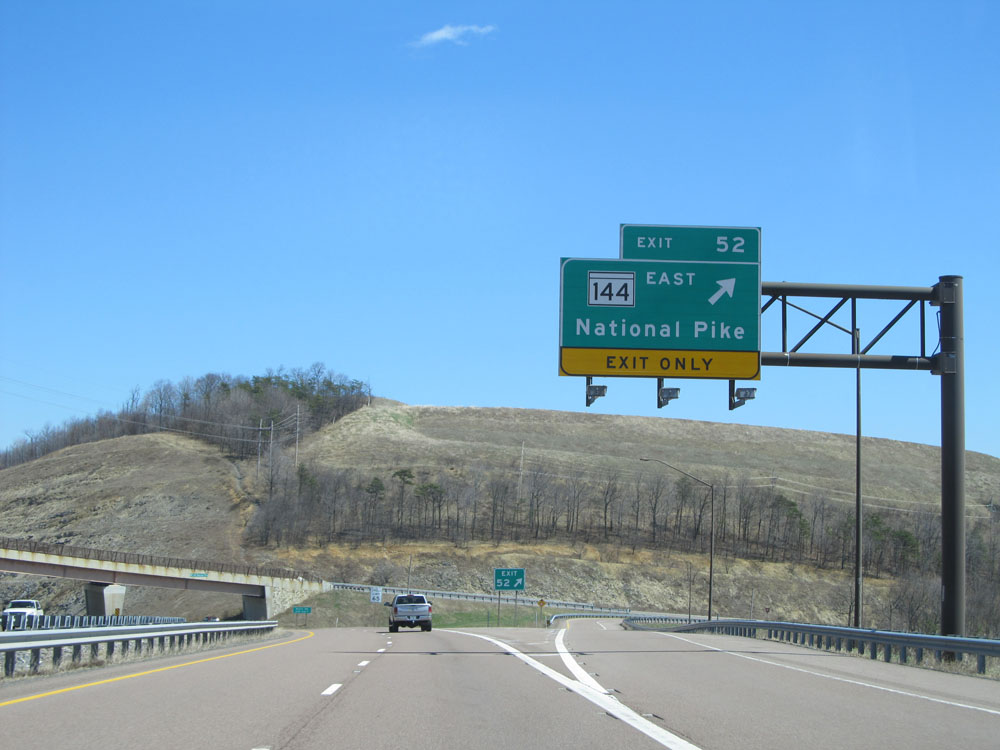 |
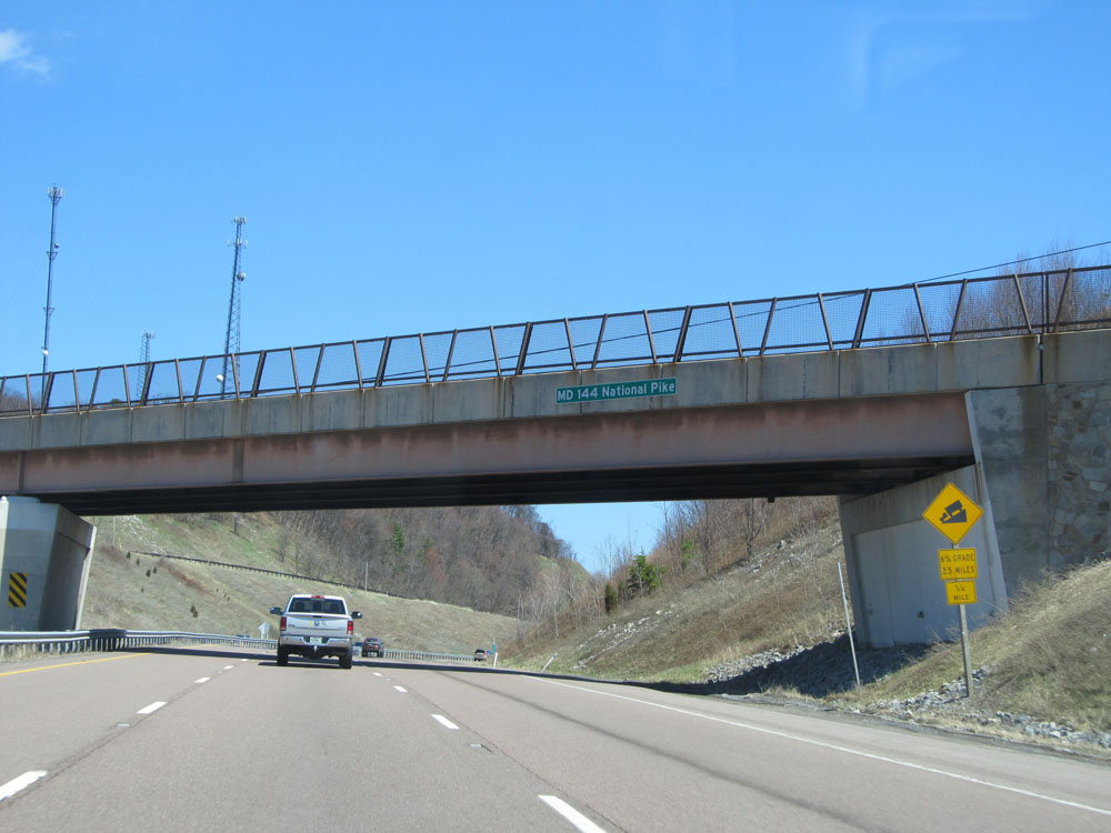
Interstate 68 East at Exit 52: MD 144 East - National Pike (Photo taken 4/11/15). |
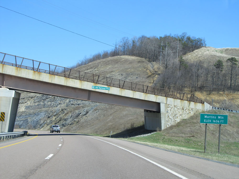 |
Interstate 68 East as it reaches the summit of Martins Mountain at an elevation of 1,636 ft. (Photo taken 4/11/15). |
 |
Interstate 68 East: Road view from mile marker 55. (Photo taken 4/11/15). |
 |
Interstate 68 East at Exit 56: MD 144 (National Pike) - Flintstone (Photo taken 4/11/15). |
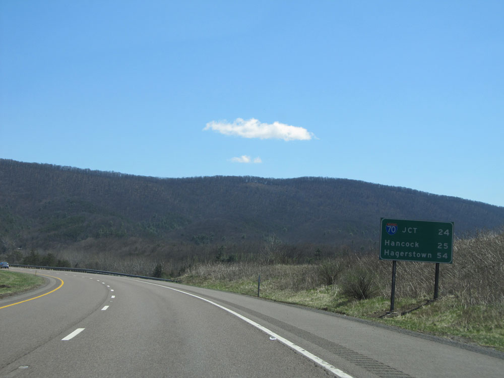 |
Mileage sign located near mile marker 56. It's 24 miles to the junction of Interstate 70, 25 miles to Hancock, and 54 miles to Hagerstown. (Photo taken 4/11/15). |
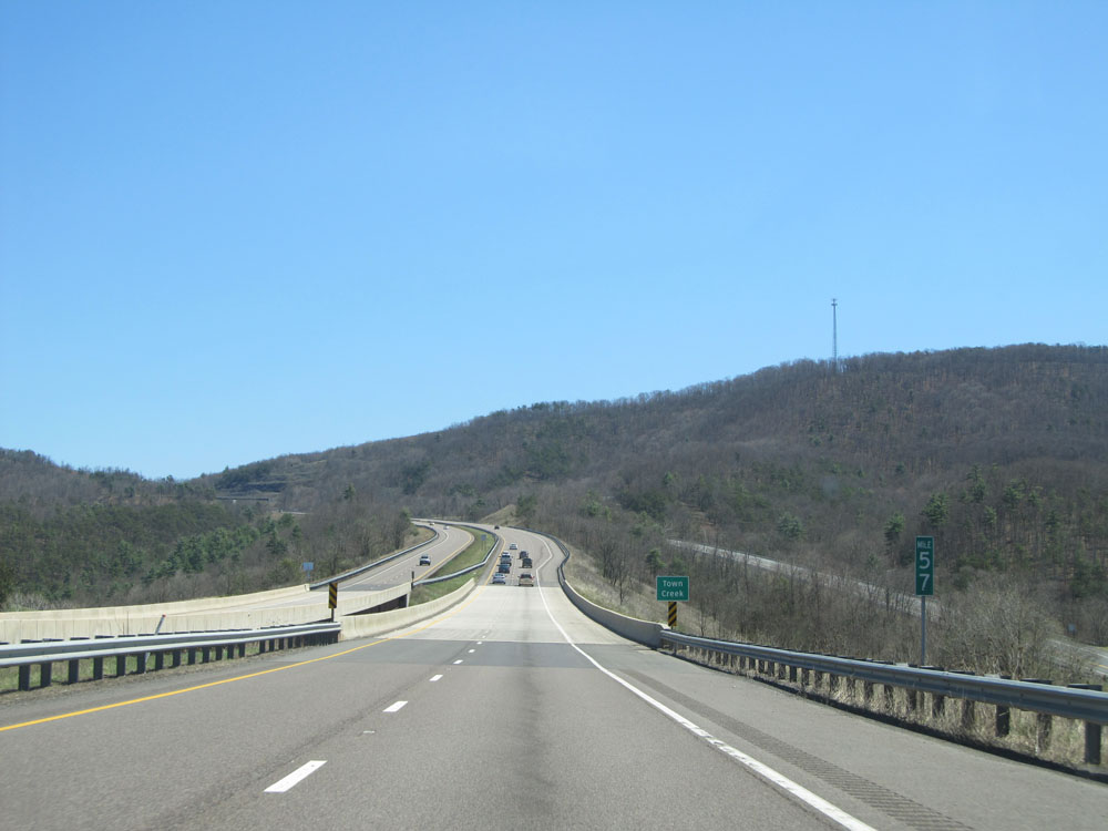 |
Interstate 68 East: Road view from mile marker 57, as you prepare to climb Polish Mountain ahead. (Photo taken 4/11/15). |
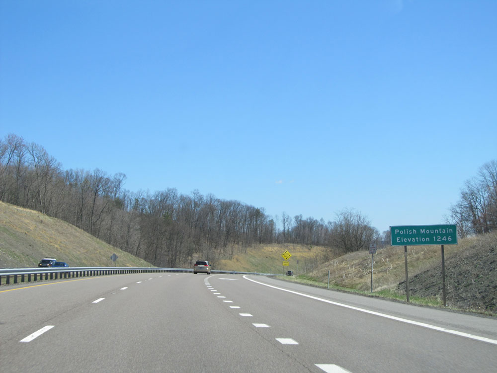 |
Interstate 68 East at the summit of Polish Mountain. Elevation: 1,246 ft. (Photo taken 4/11/15). |
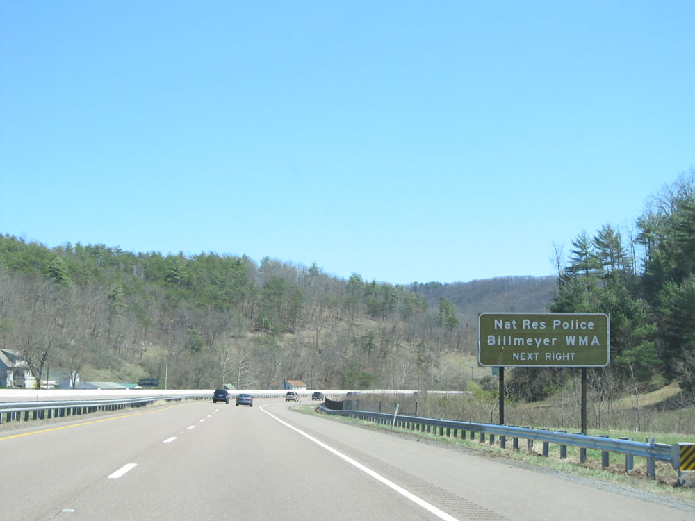 |
Take the next exit (Exit 62) to Nat Res Police and Billmeyer WMA. (Photo taken 4/11/15). |
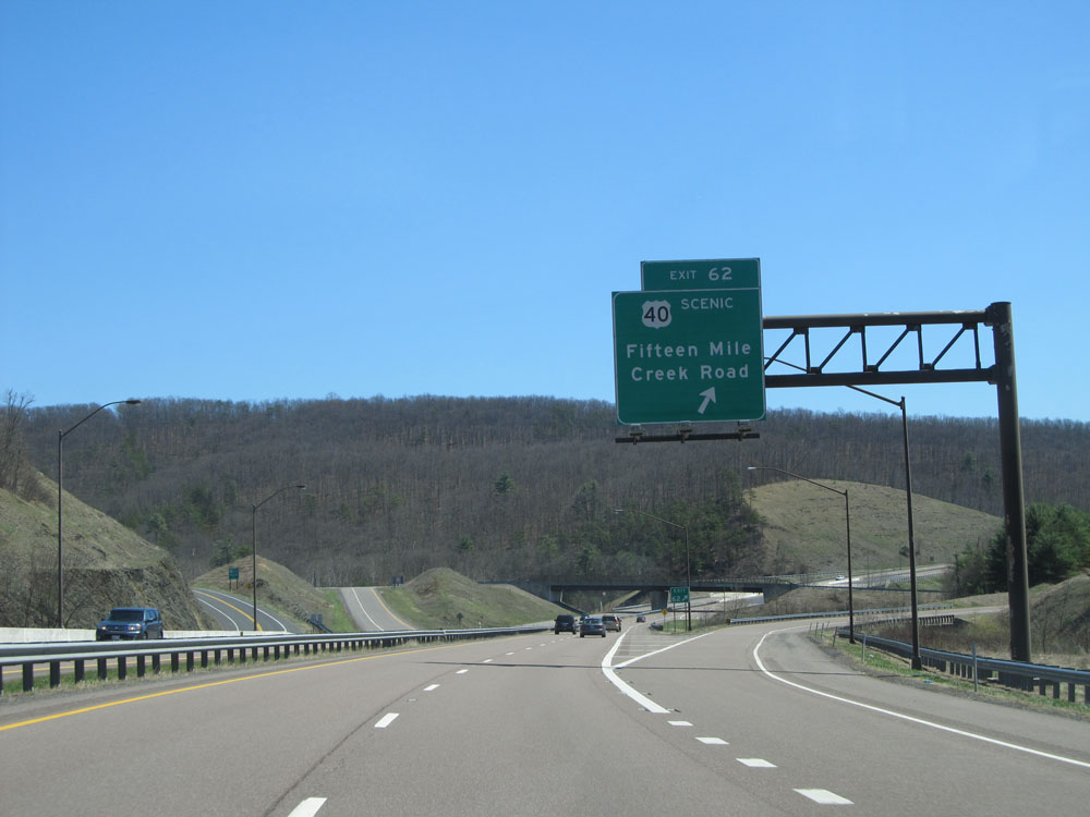 |
Interstate 68 East at Exit 62: US 40 Scenic Route - Fifteen Mile Creek Road (Photo taken 4/11/15). |
 |
Take the next exit (Exit 64) to Green Ridge State Forest Headquarters and a Scenic Overlook. (Photo taken 4/11/15). |
 |
Interstate 68 East at Exit 64: M.V. Smith Road (Photo taken 4/11/15). |
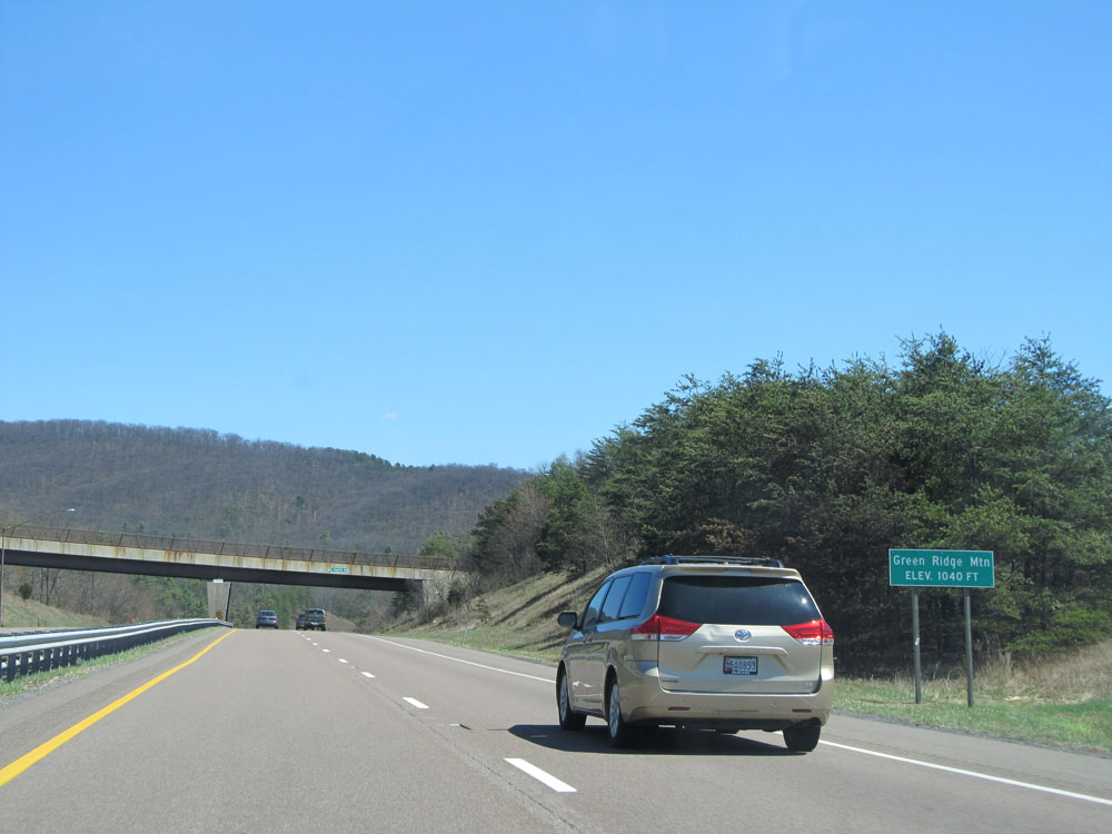 |
Interstate 68 East as it reaches the summit of Green Ridge Mountain at an elevation of 1,040 ft. (Photo taken 4/11/15). |
 |
Another Interstate 68 East shield. (Photo taken 4/11/15). |
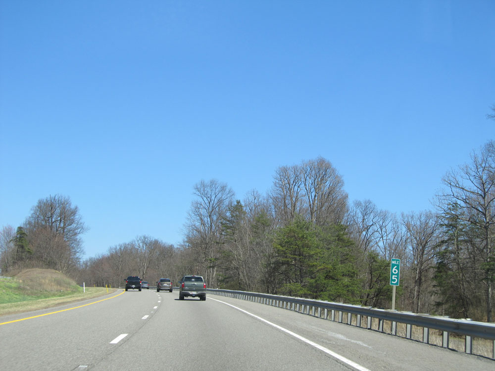 |
Interstate 68 East: Road view from mile marker 65. (Photo taken 4/11/15). |
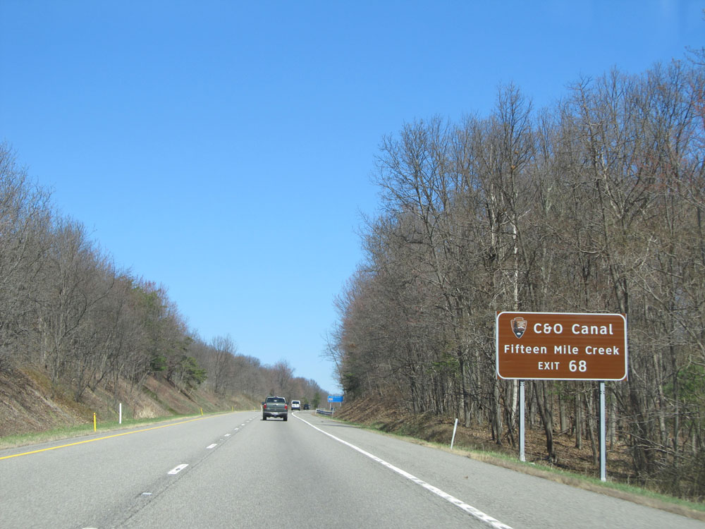 |
Take Exit 68 to C&O Canal / Fifteen Mile Creek. (Photo taken 4/11/15). |
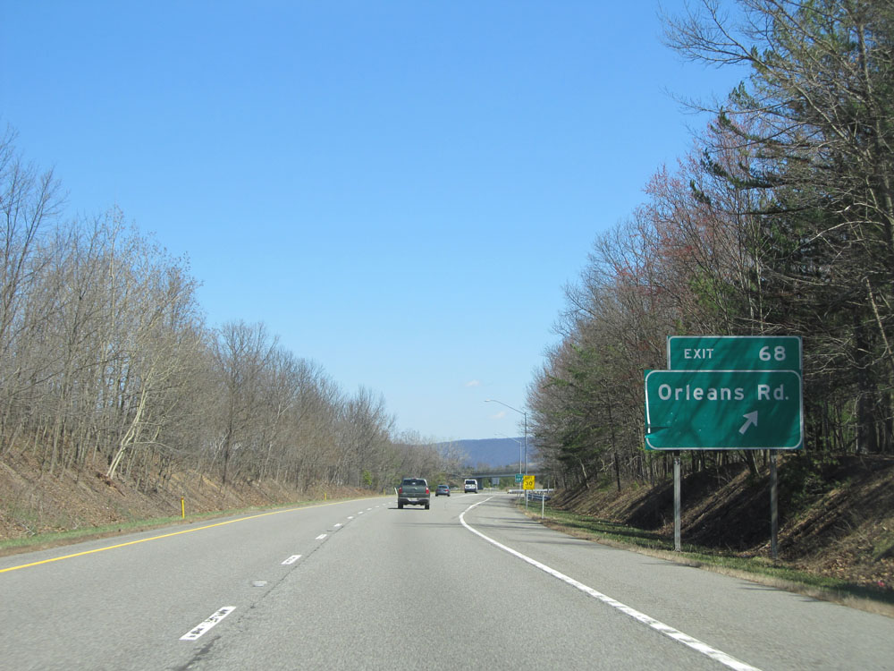 |
Interstate 68 East at Exit 68: Orleans Rd (Photo taken 4/11/15). |
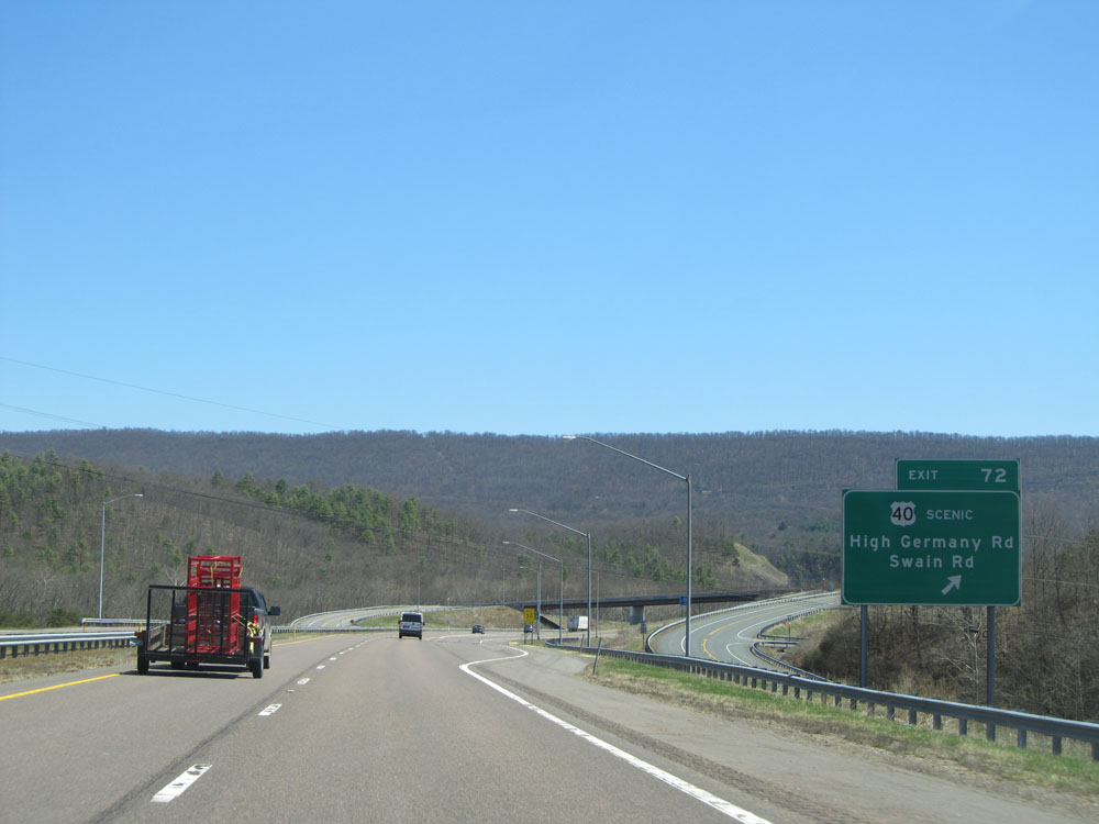 |
Interstate 68 East at Exit 72: US 40 Scenic Route - High Germany Rd / Swain Rd (Photo taken 4/11/15). |
 |
Interstate 68 East as it enters Washington County and crosses Sideling Hill Creek. (Photo taken 4/11/15). |
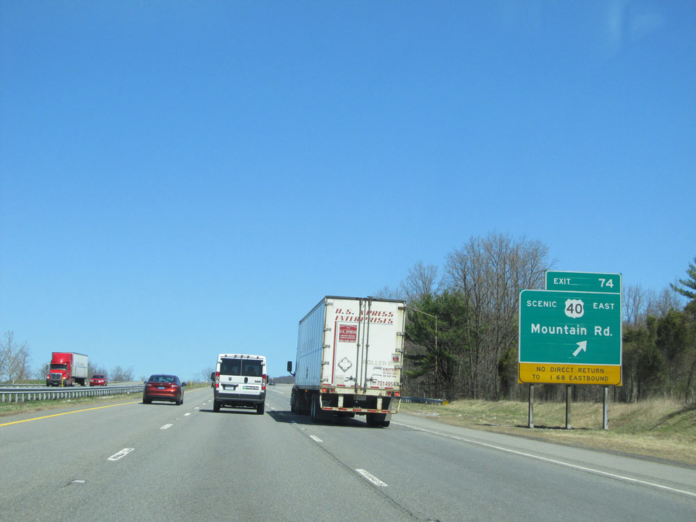 |
Interstate 68 East at Exit 74: US 40 Scenic Route East - Mountain Rd. There is no direct return to I-68 East off this exit. (Photo taken 4/11/15). |
 |
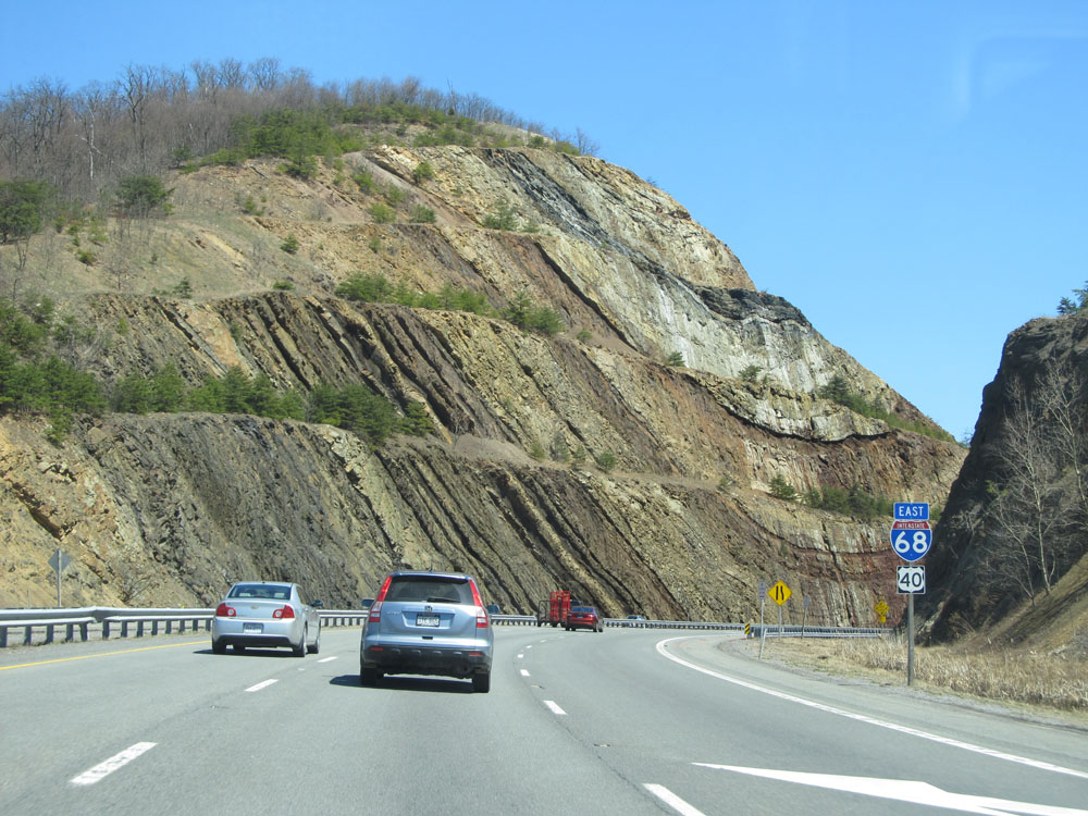
Interstate 68 East: Road view from mile marker 73, as you begin to climb Sideling Hill. At the summit is the well-known Sideling Hill road cut. (Photo taken 4/11/15). |
 |
Interstate 68 East climbing Sideling Hill. There is a Rest Area at the summit, and as this sign says, trucks are not allowed in the Rest Area. (Photo taken 4/11/15). |
 |
Interstate 68 East shield as you prepare to head through the Sideling Hill road cut. (Photo taken 4/11/15). |
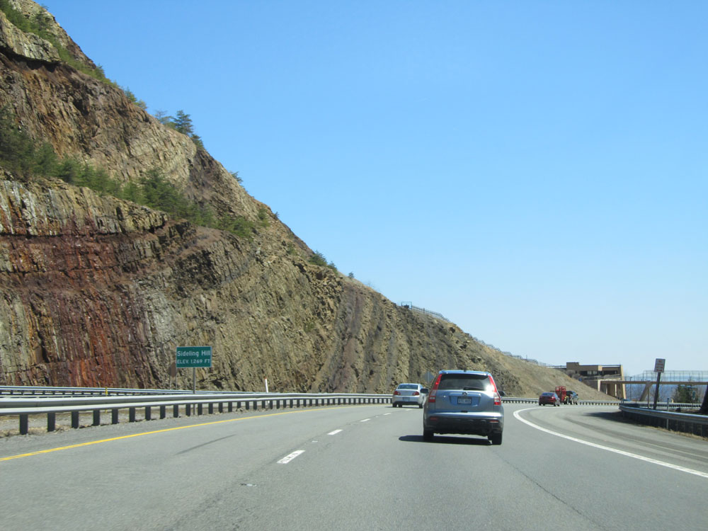 |
Interstate 68 East at the summit of Sideling Hill passing through the road cut. Elevation: 1,269 ft. (Photo taken 4/11/15). |
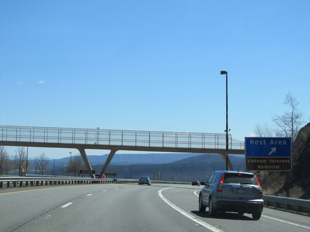 |
Interstate 68 East at the Rest Area / Vietnam Veterans Memorial at the top of Sideling Hill. Again, trucks are not allowed in this Rest Area. (Photo taken 4/11/15). |
 |
Interstate 68 East: Road view from mile marker 75, heading down the east side of Sideling Hill. (Photo taken 4/11/15). |
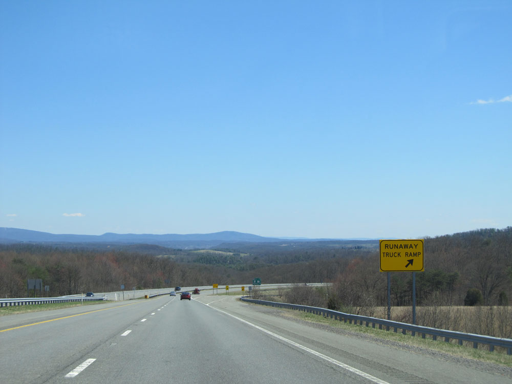 |
Interstate 68 East at the Runaway Truck Ramp located about halfway down Sideling Hill. (Photo taken 4/11/15). |
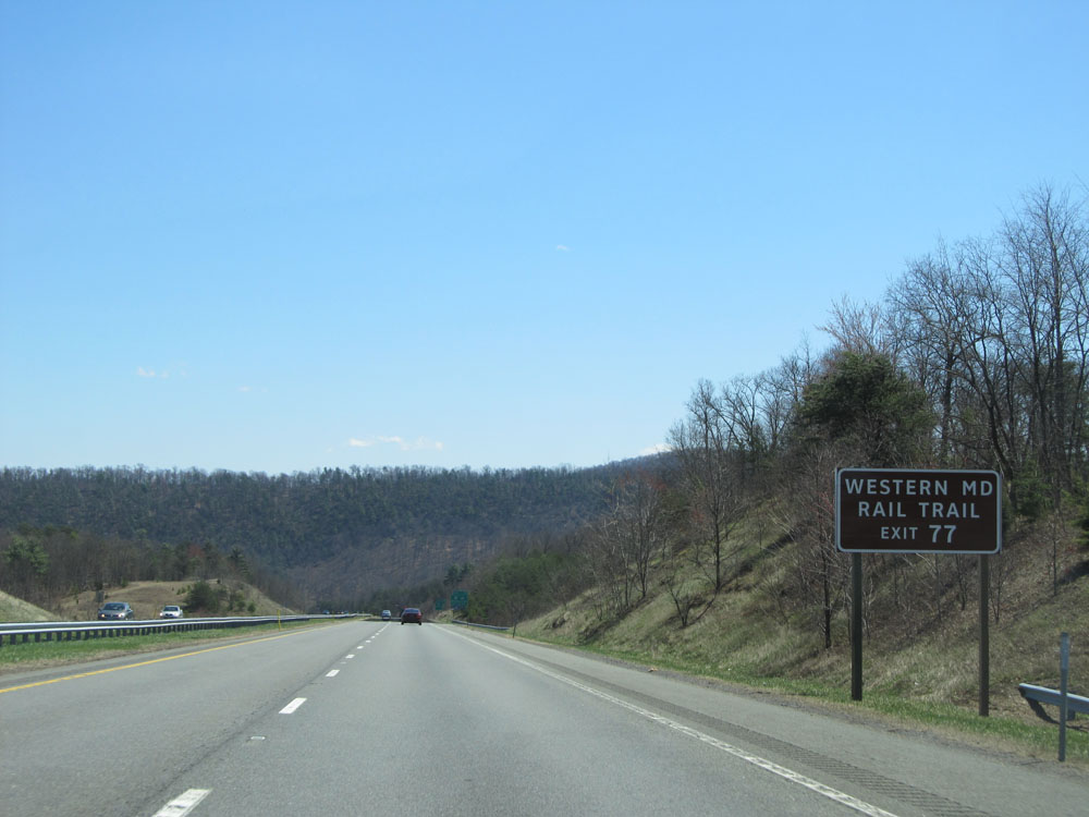 |
Take Exit 77 to Western Maryland Rail Trail. (Photo taken 4/11/15). |
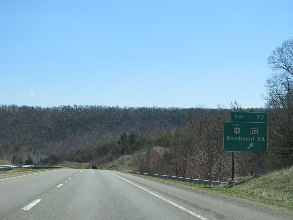 |
Interstate 68 East at Exit 77: US 40 Scenic Route / MD 144 - Woodmont Rd (Photo taken 4/11/15). |
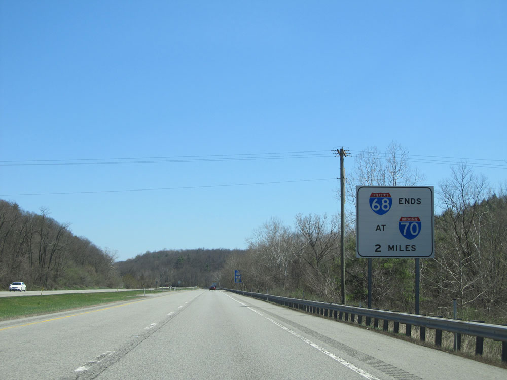 |
Interstate 68 East approaching its eastern terminus at the junction of Interstate 70 - 2 miles. (Photo taken 4/11/15). |
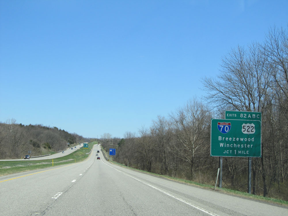 |
Interstate 68 East approaching Exits 82A-B-C - 1 mile. (Photo taken 4/11/15). |
 |
Interstate 68 East approaching Exit 82C - 3/4 mile on the left. (Photo taken 4/11/15). |
 |
Use Exit 82A for US 522 South ahead to the Hancock Museum and Sideling Hill Exhibit. (Photo taken 4/11/15). |
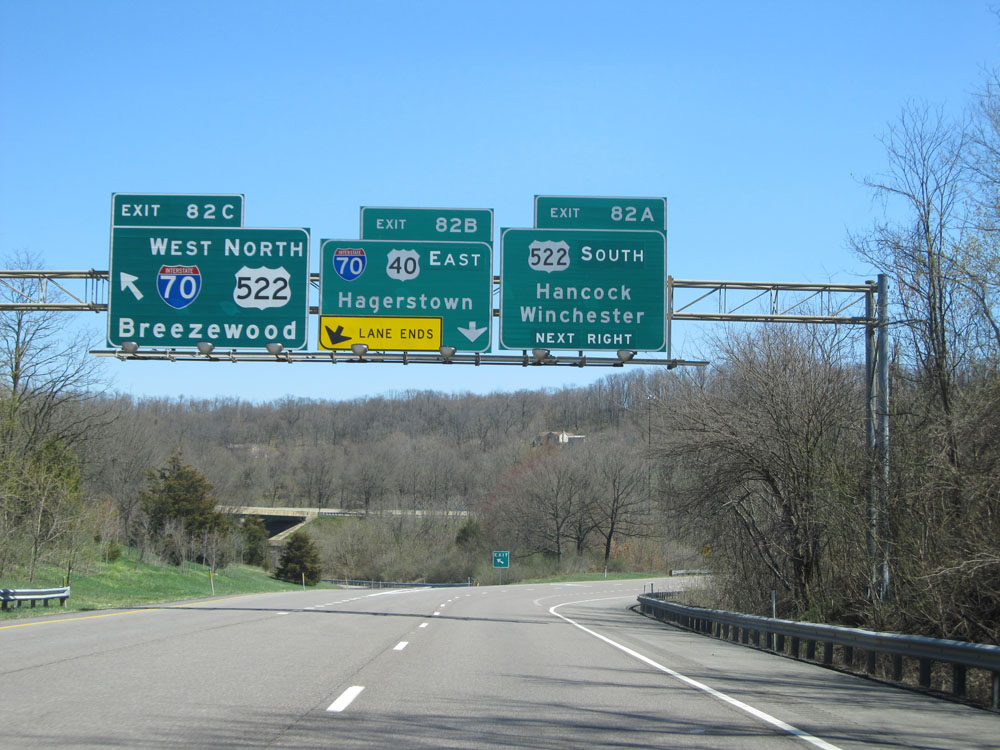 |
Interstate 68 East at Exit 82C: Interstate 70 West / US 522 North - Breezewood (Photo taken 4/11/15). |
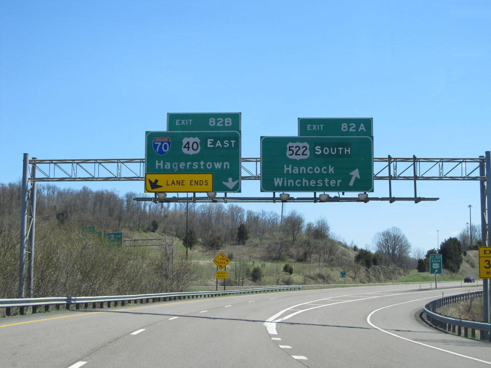 |
Interstate 68 East at Exit 82B: Interstate 70 East / US 40 East - Hagerstown; Exit 82C: US 522 South - Hancock / Winchester. This junction marks the eastern terminus of Interstate 68. (Photo taken 4/11/15). |