Road Information |
||
 |
||
| Total Mileage in State: | 24 miles | |
| Eastern End: | At Ohio state line | |
| Western End: | At Indiana state line | |
| Mileage covered in Photos: | 24 miles | |
| Counties covered in Photos: | Boone, Kenton, Campbell | |
| Major Junctions in Photos: | I-71/I-75, in Erlanger I-471, near Highland Heights |
|
| Control Cities in Photos: | Hebron, Erlanger, Highland Heights | |
Outer Loop
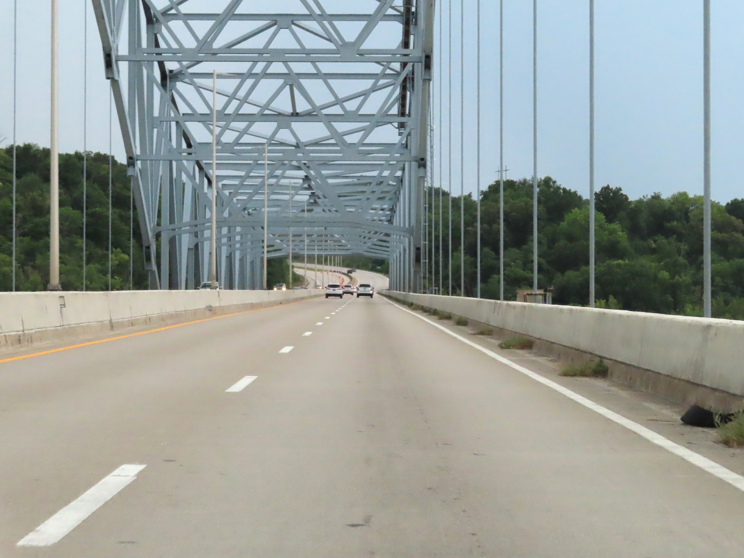 |
Interstate 275 Outer Loop (East) as it enters Kentucky from Indiana by crossing the Carroll Lee Cropper Historical Bridge over the Ohio River. (Photo taken 8/20/22). |
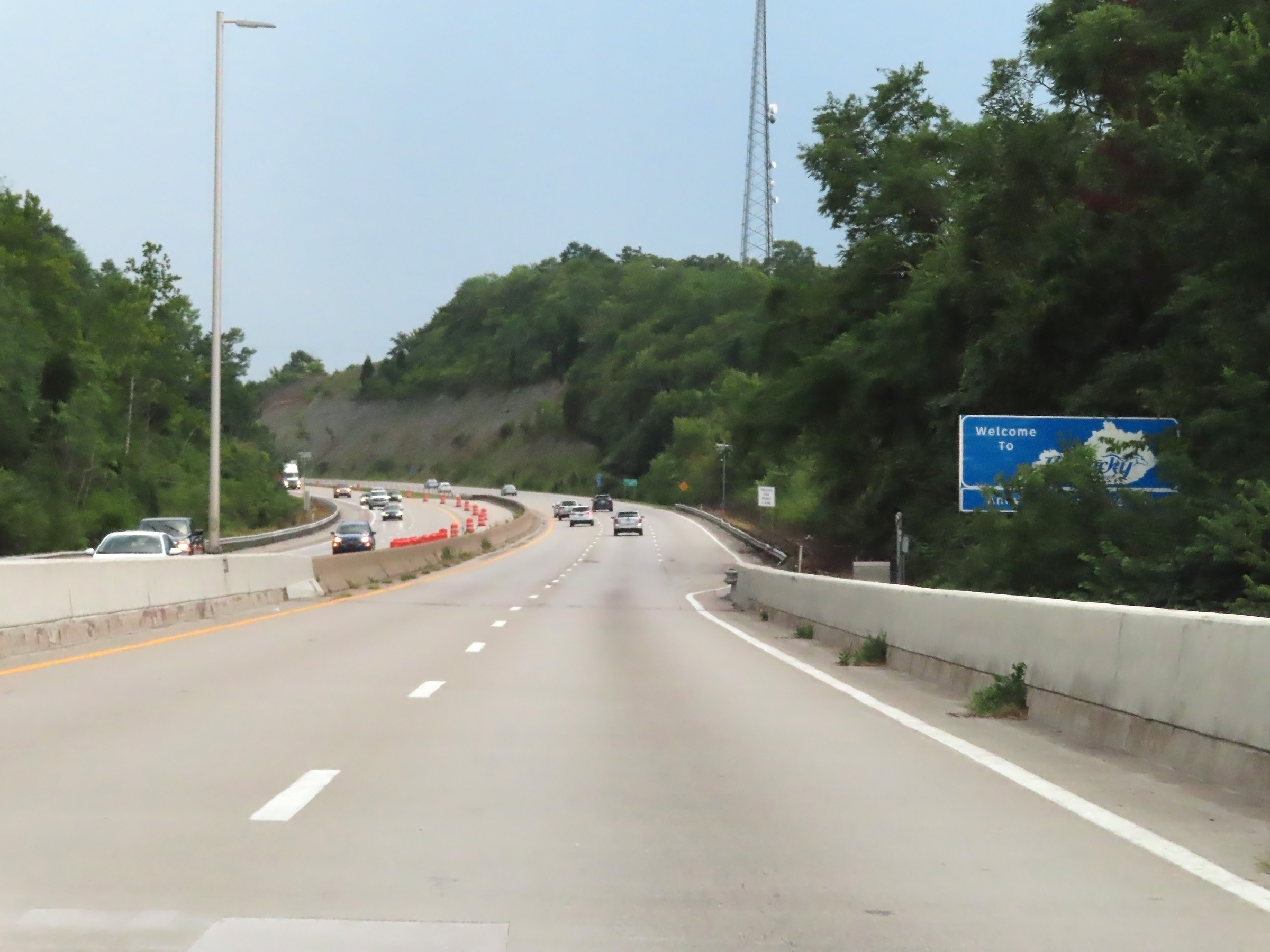 |
An obstructed Kentucky welcome sign on Interstate 275 Outer Loop (East) after crossing the Ohio River. (Photo taken 8/20/22). |
 |
Interstate 275 Outer Loop (East) in Kentucky starts out in Boone County. (Photo taken 8/20/22). |
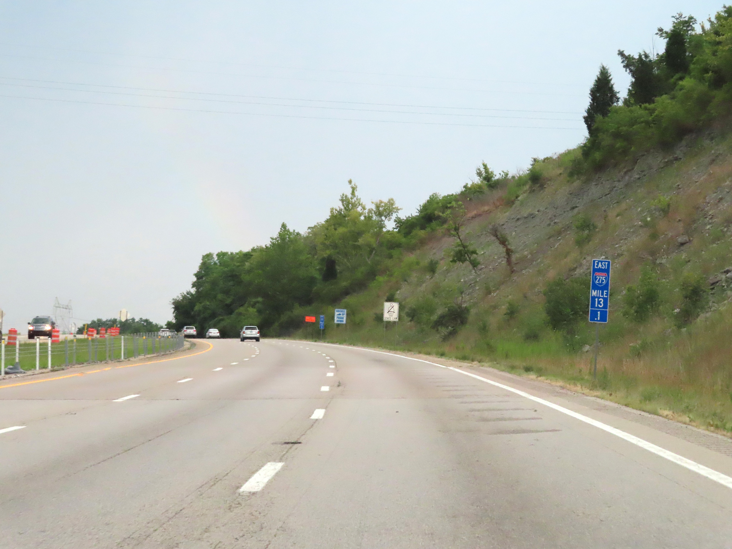 |
View on Interstate 275 Outer Loop (East) at mile marker 13.1, as it climbs up out of the valley from the Ohio River. A truck climbing lane is available. (Photo taken 8/20/22). |
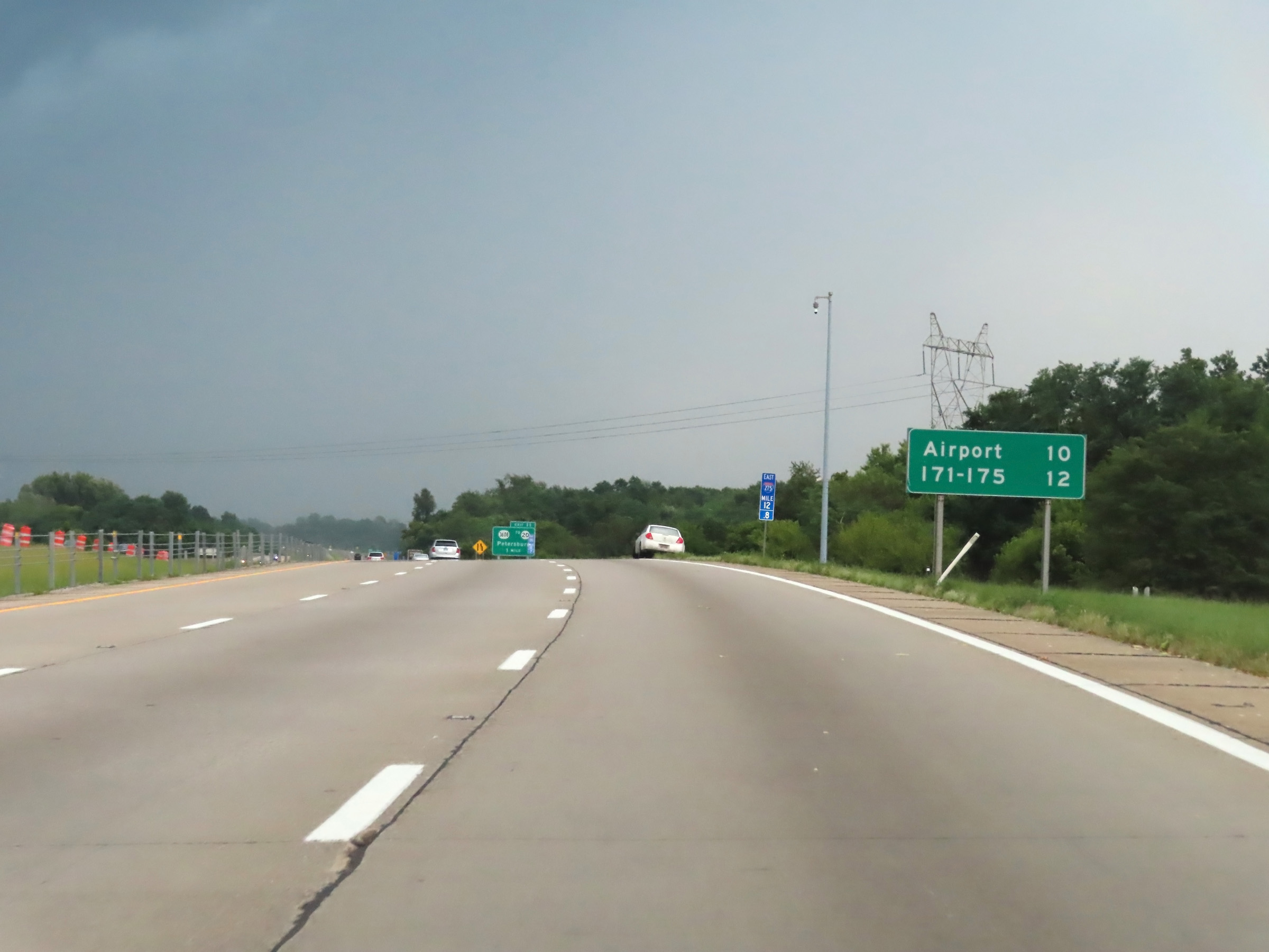 |
Mileage sign at mile marker 12.8. It's 10 miles to the Cincinnati/Northern Kentucky International Airport and 12 miles to the junction of Interstate 71 / Interstate 75. (Photo taken 8/20/22). |
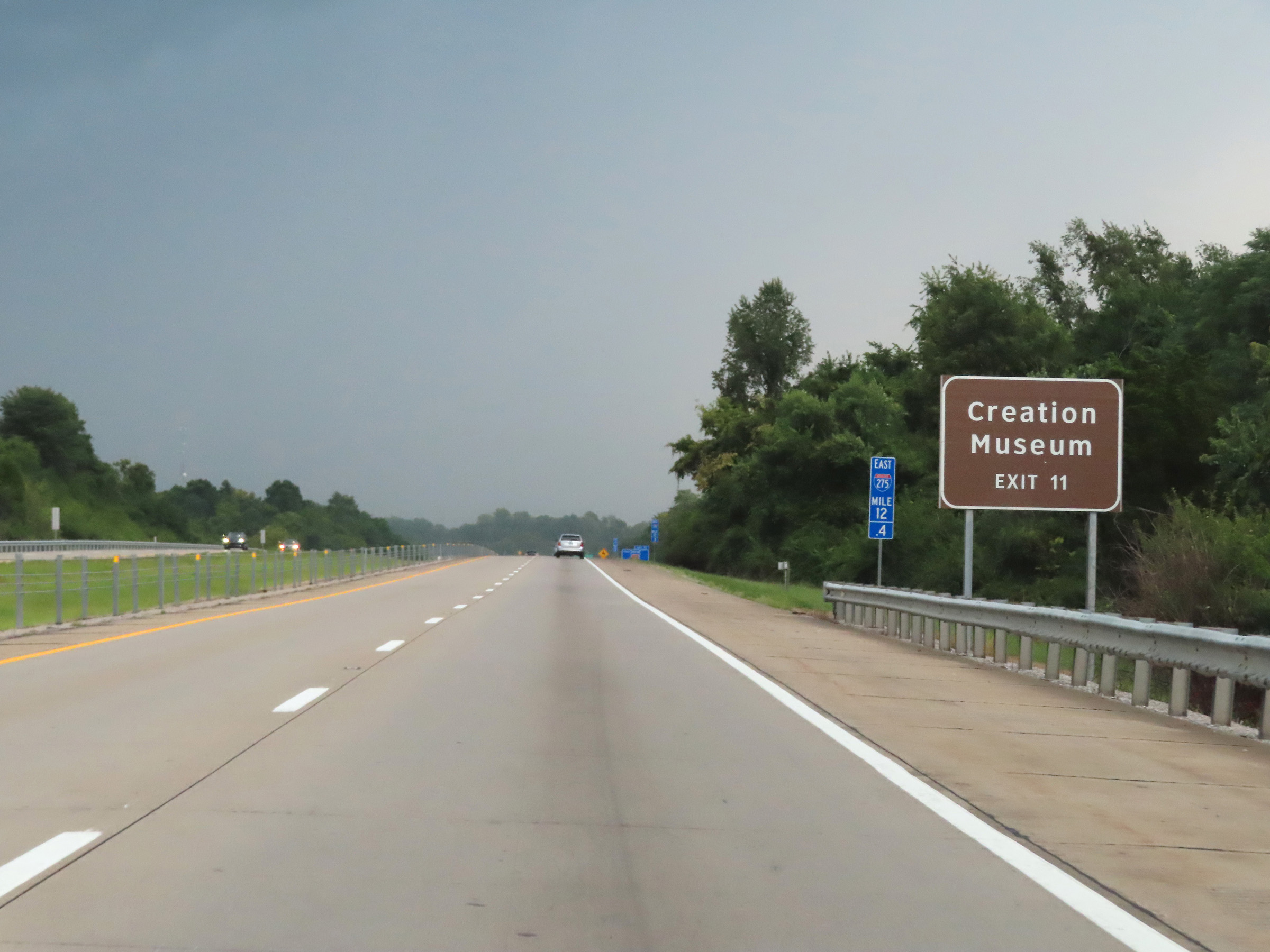 |
Take Exit 11 to the Creation Museum. (Photo taken 8/20/22). |
 |
View on Interstate 275 Outer Loop (East) at mile marker 12. (Photo taken 8/20/22). |
 |
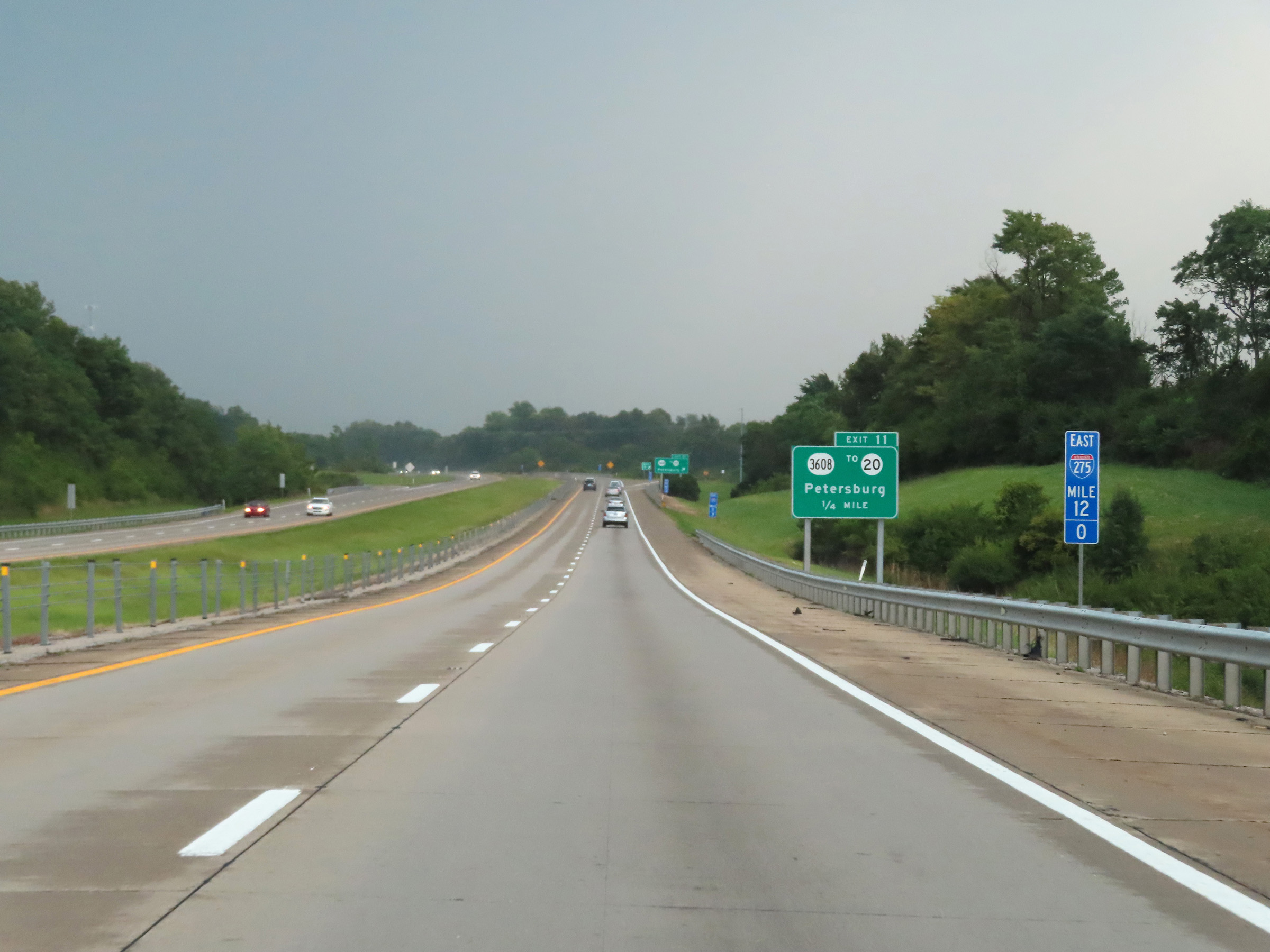
Interstate 275 Outer Loop (East) at Exit 11: KY 3608 / To KY 20 - Petersburg (Photo taken 8/20/22). |
 |
The speed limit on Interstate 275 Outer Loop (East) in Kentucky is 65 mph, consistent with the speed limit in both Ohio and Indiana on the same alignment. (Photo taken 8/20/22). |
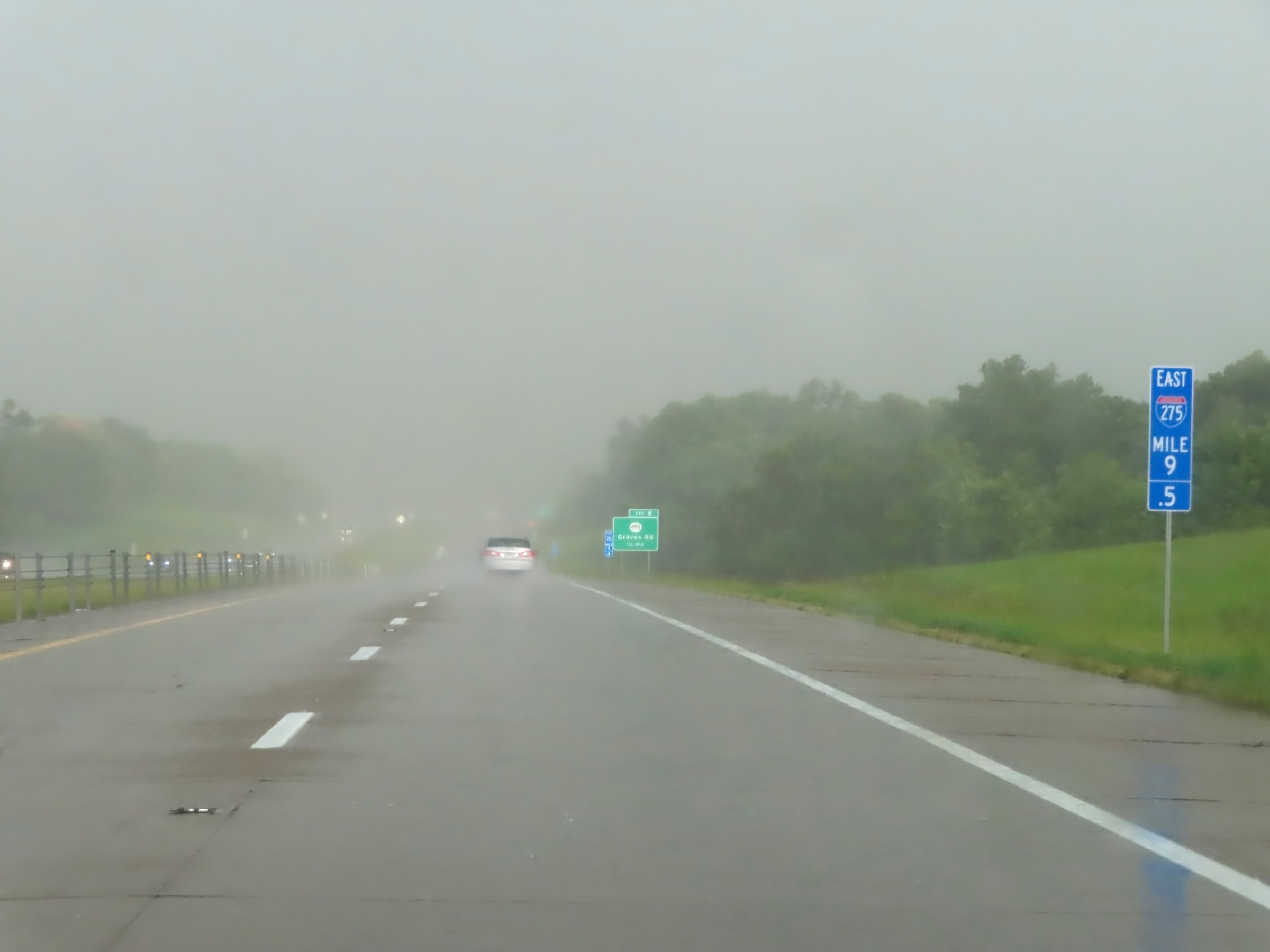 |
Mile marker 9.5 on Interstate 275 Outer Loop (East) in Boone County. (Photo taken 8/20/22). |
 |
Interstate 275 Outer Loop (East) at Exit 8: KY 495 - Graves Rd (Photo taken 8/20/22). |
 |
Take Exit 6 to the Kentucky National Guard Readiness Center and Boone County Arboretum. (Photo taken 8/20/22). |
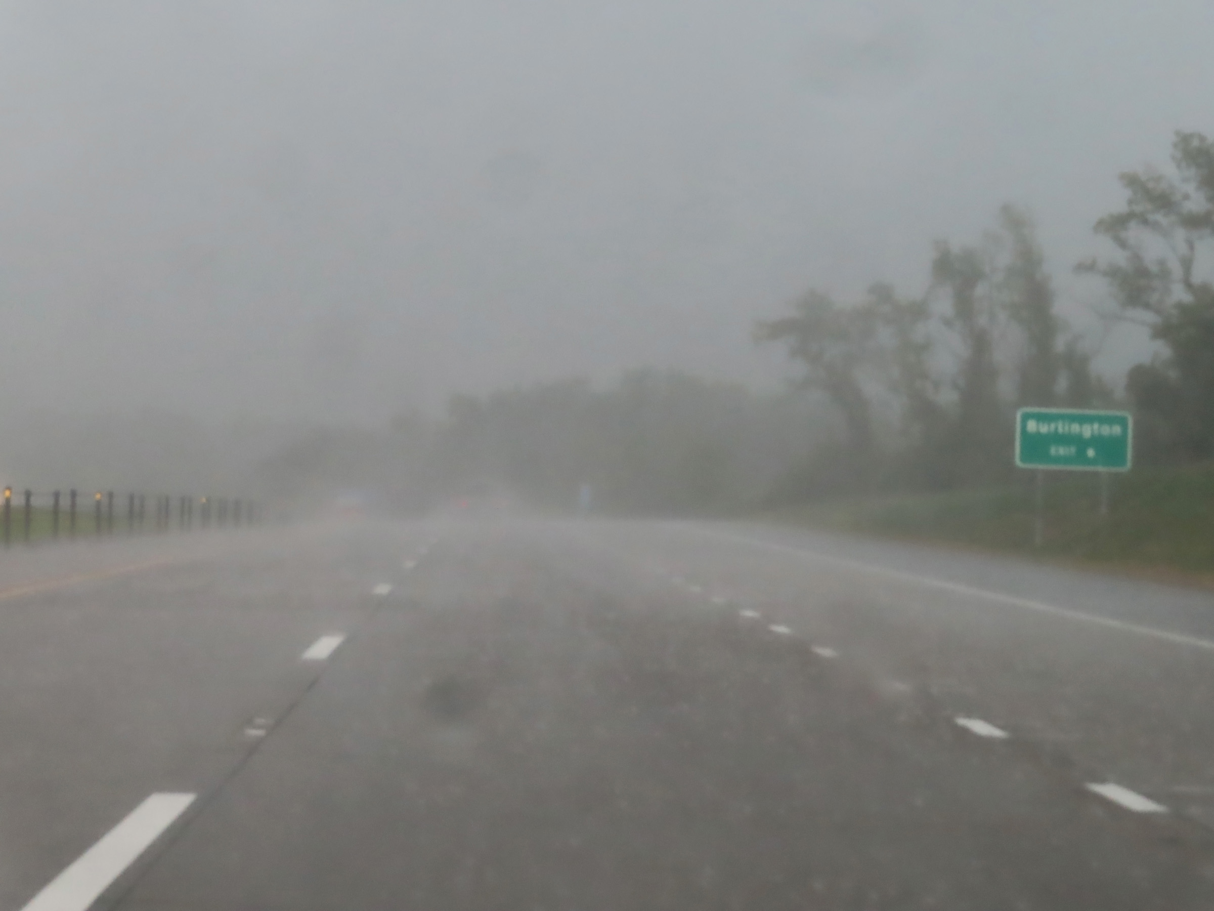 |
Also take Exit 6 to Burlington. (Photo taken 8/20/22). |
 |
Interstate 275 Outer Loop (East) at Exit 6: KY 237 - Hebron (Photo taken 8/20/22). |
 |
View on Interstate 275 Outer Loop (East) at mile marker 6. (Photo taken 8/20/22). |
 |
Interstate 275 Outer Loop (East) at Exit 4: KY 212 / To KY 20 - Airport (Photo taken 8/20/22). |
 |
Mile marker 3 on Interstate 275 Outer Loop (East) in Boone County. (Photo taken 8/20/22). |
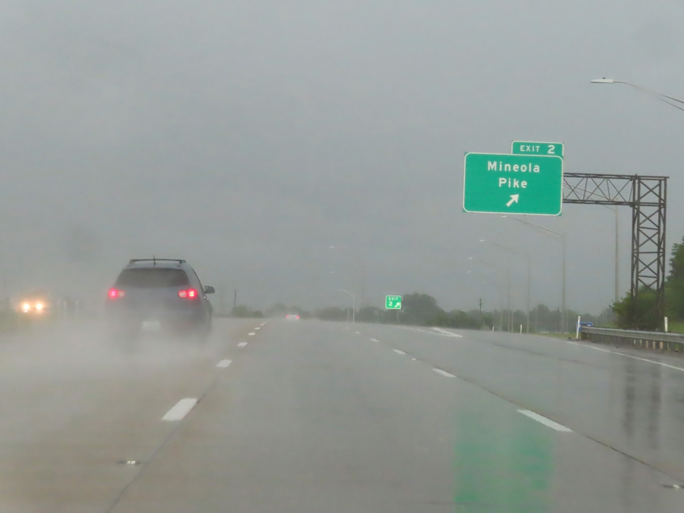 |
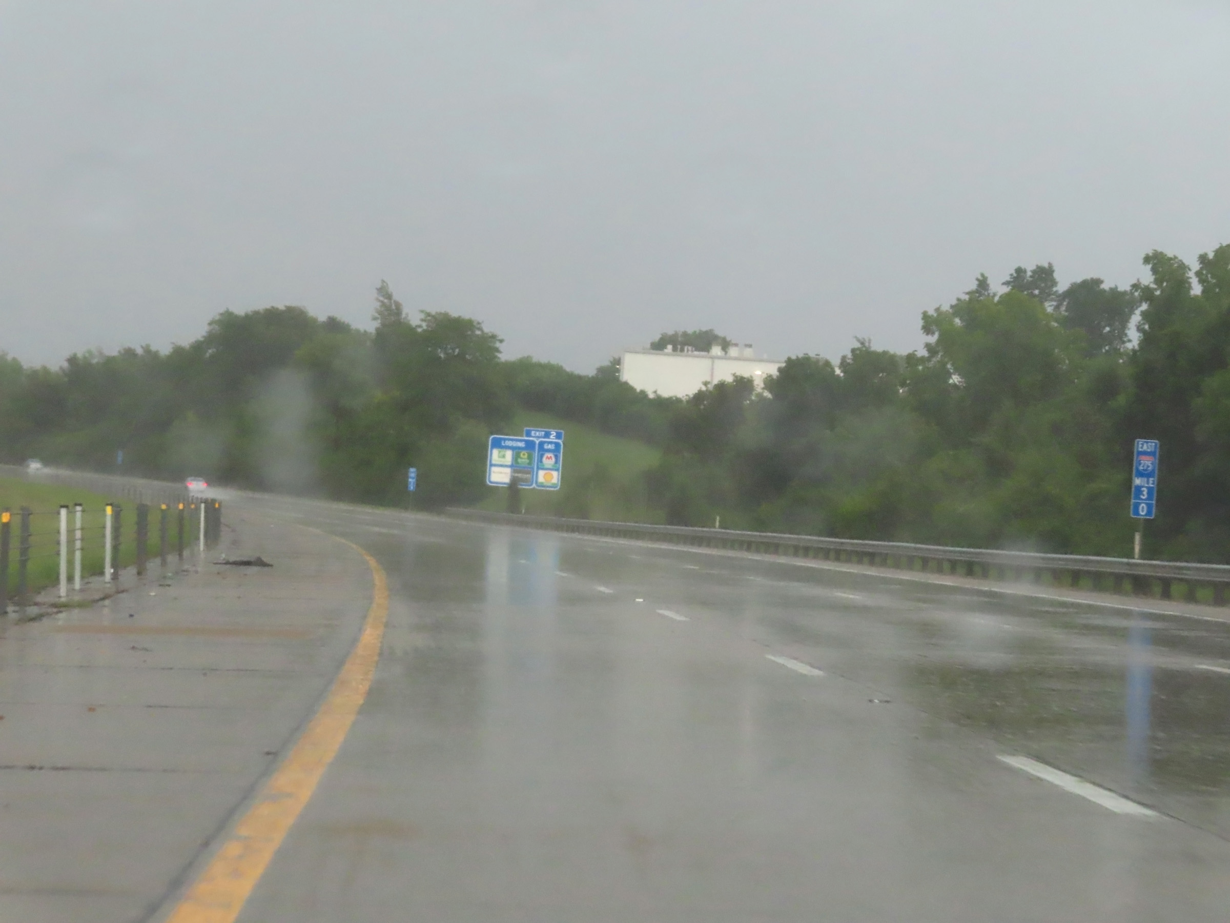
Interstate 275 Outer Loop (East) at Exit 2: Mineola Pike (Photo taken 8/20/22). |
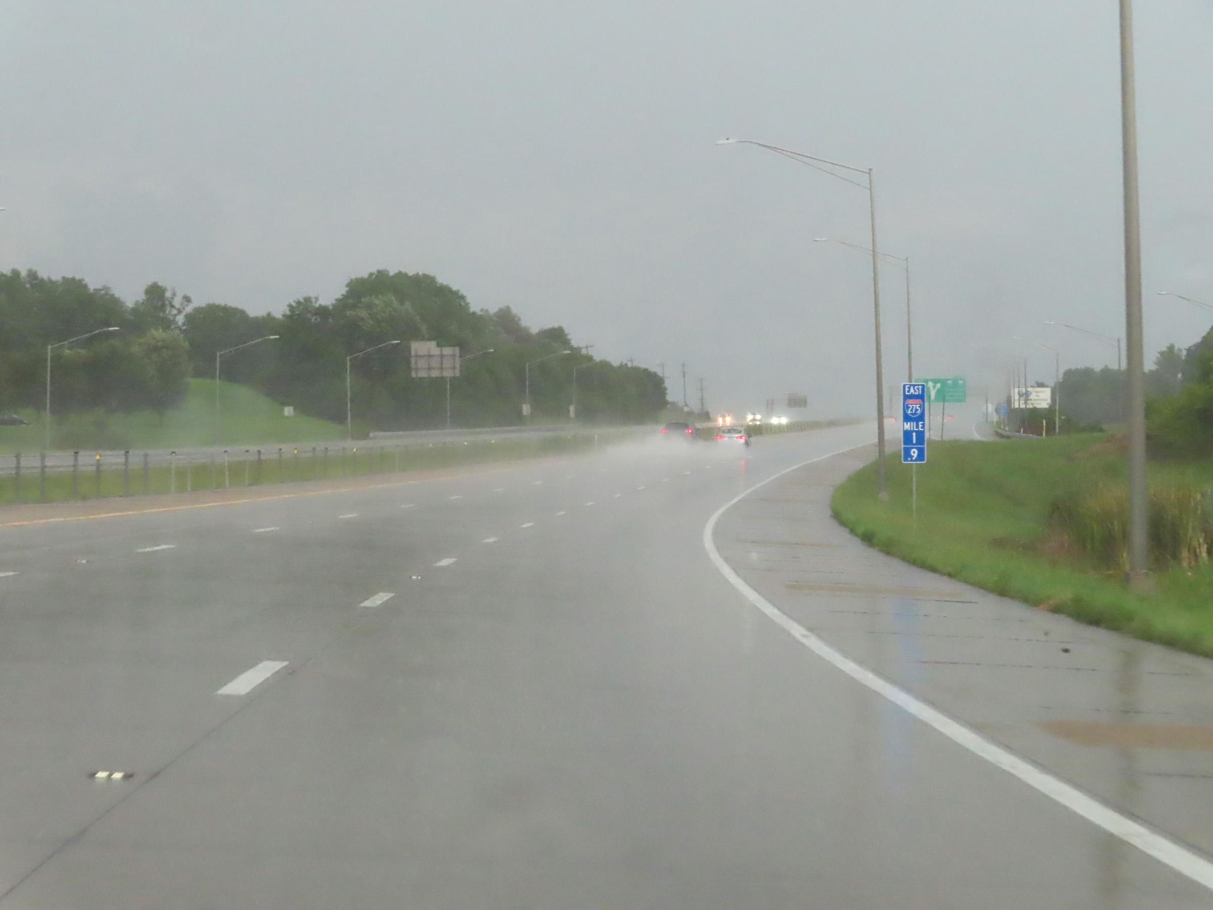 |
Interstate 275 Outer Loop (East) at mile marker 1.9. (Photo taken 8/20/22). |
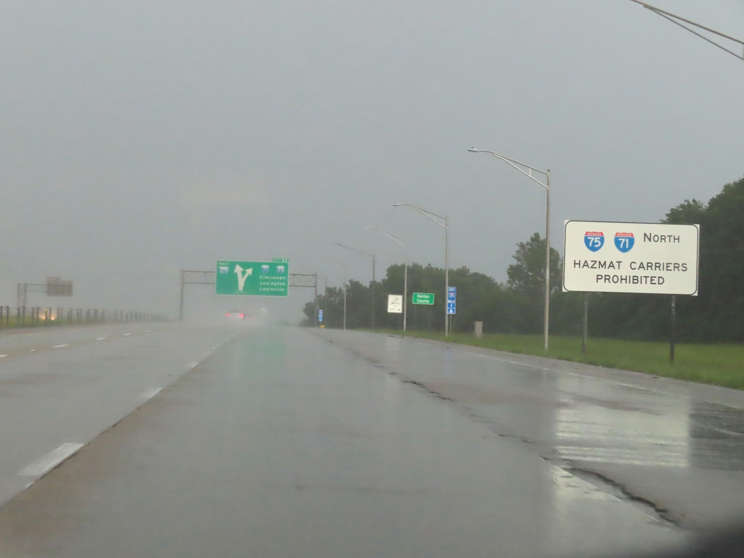 |
Trucks with hazardous materials in a class or weight requiring placards are prohibited on the Brent Spence Bridge on Interstate 71 / Interstate 75 North into downtown Cincinnati. They must remain on Interstate 275 Outer Loop. (Photo taken 8/20/22). |
 |
Approaching the junction of Interstate 71 / Interstate 75, Interstate 275 Outer Loop (East) enters Kenton County. (Photo taken 8/20/22). |
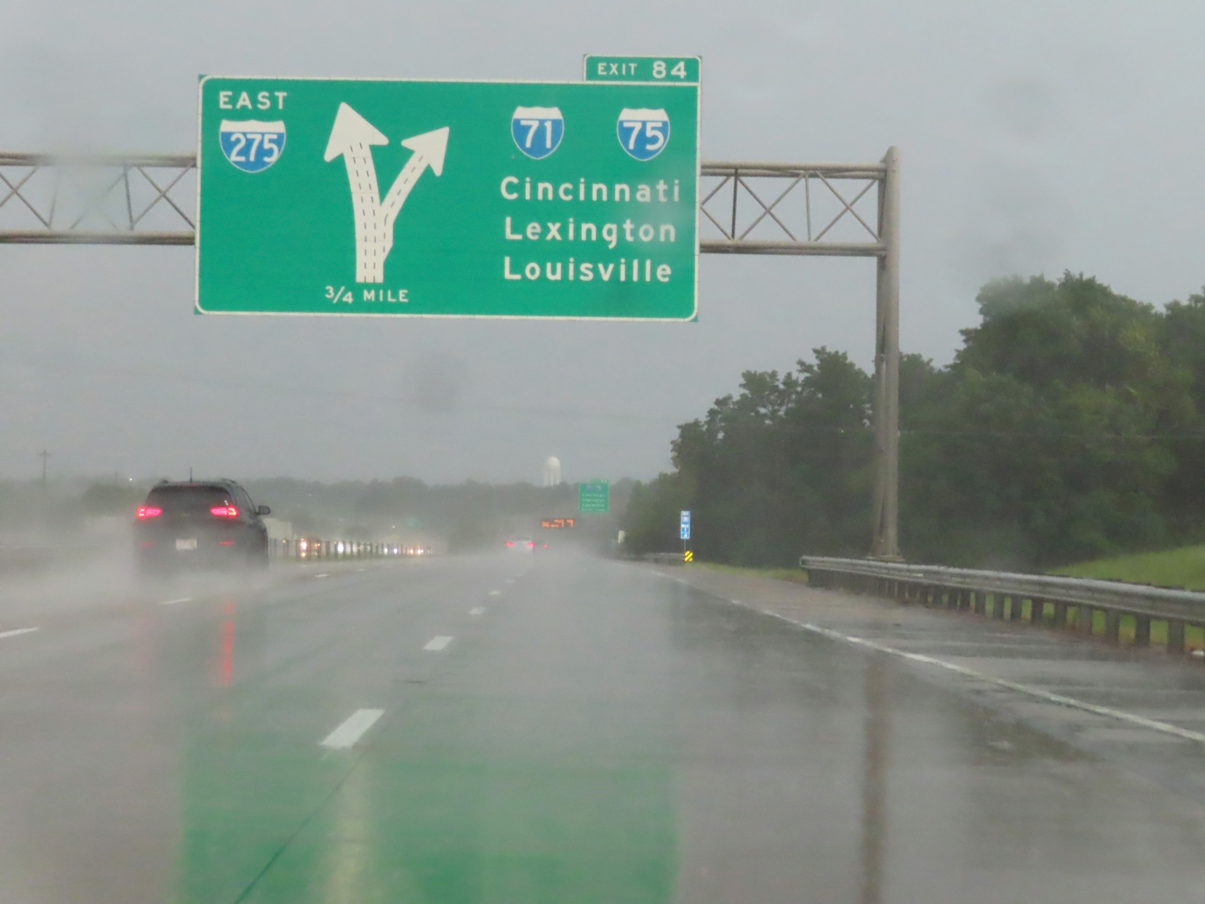 |
Interstate 275 Outer Loop (East) approaching Exit 84 - 3/4 mile. At the junction of Interstate 71 / Interstate 75, the mileage and exit numbers of I-275 reset. (Photo taken 8/20/22). |
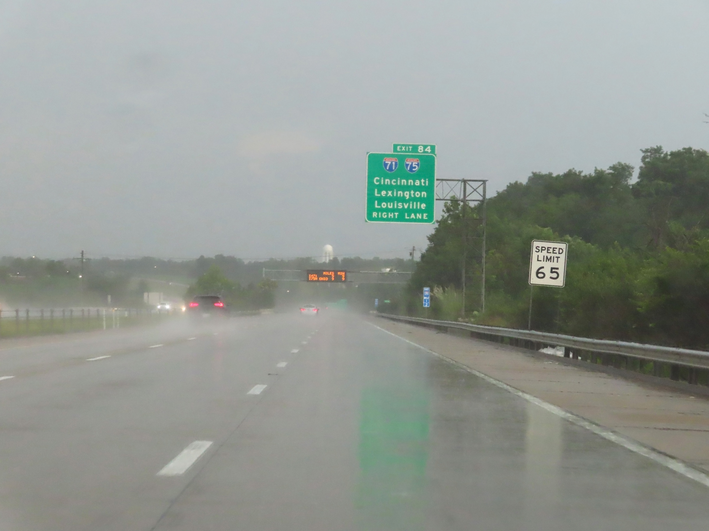 |
The speed limit on Interstate 275 Outer Loop (East) remains 65 mph. Traffic to Interstate 71 / Interstate 75 via Exit 84 should use the right lane ahead. (Photo taken 8/20/22). |
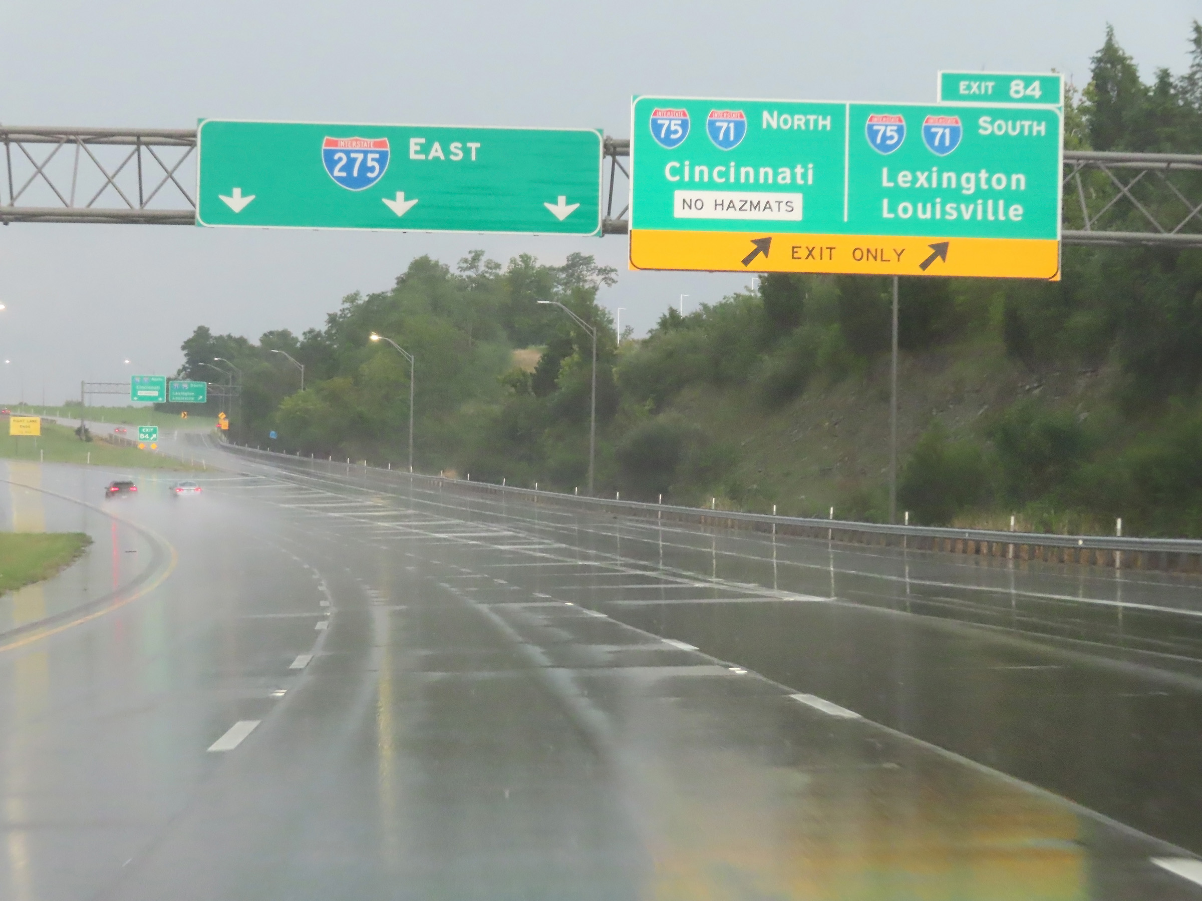 |
Interstate 275 Outer Loop (East) at Exit 84: Interstate 71 / Interstate 75 - Cincinnati / Lexington / Louisville (Photo taken 8/20/22). |
 |
View on Interstate 275 Outer Loop (East) at mile marker 0.3, as its mileage prepares to reset ahead. (Photo taken 8/20/22). |
 |
Interstate 275 Outer Loop (East) at mile marker 0.1, as its mileage resets. (Photo taken 8/20/22). |
 |
Mile marker 83.6 on Interstate 275 Outer Loop (East) in Kenton County, just east of the junction of Interstate 71 / Interstate 75. (Photo taken 8/20/22). |
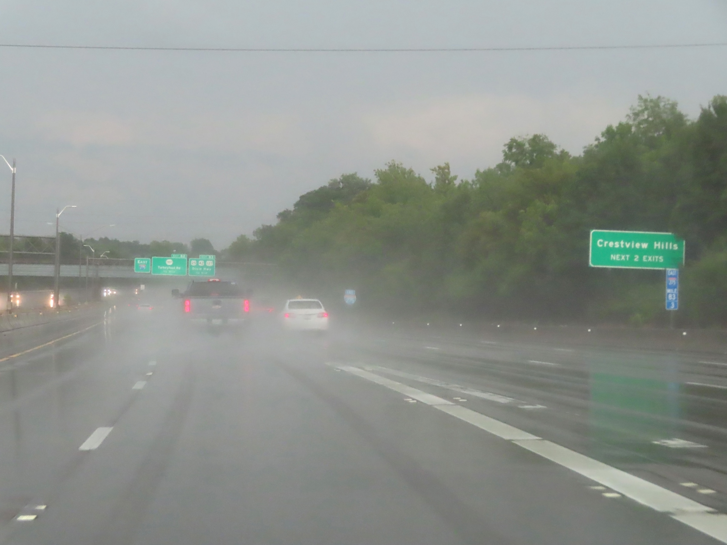 |
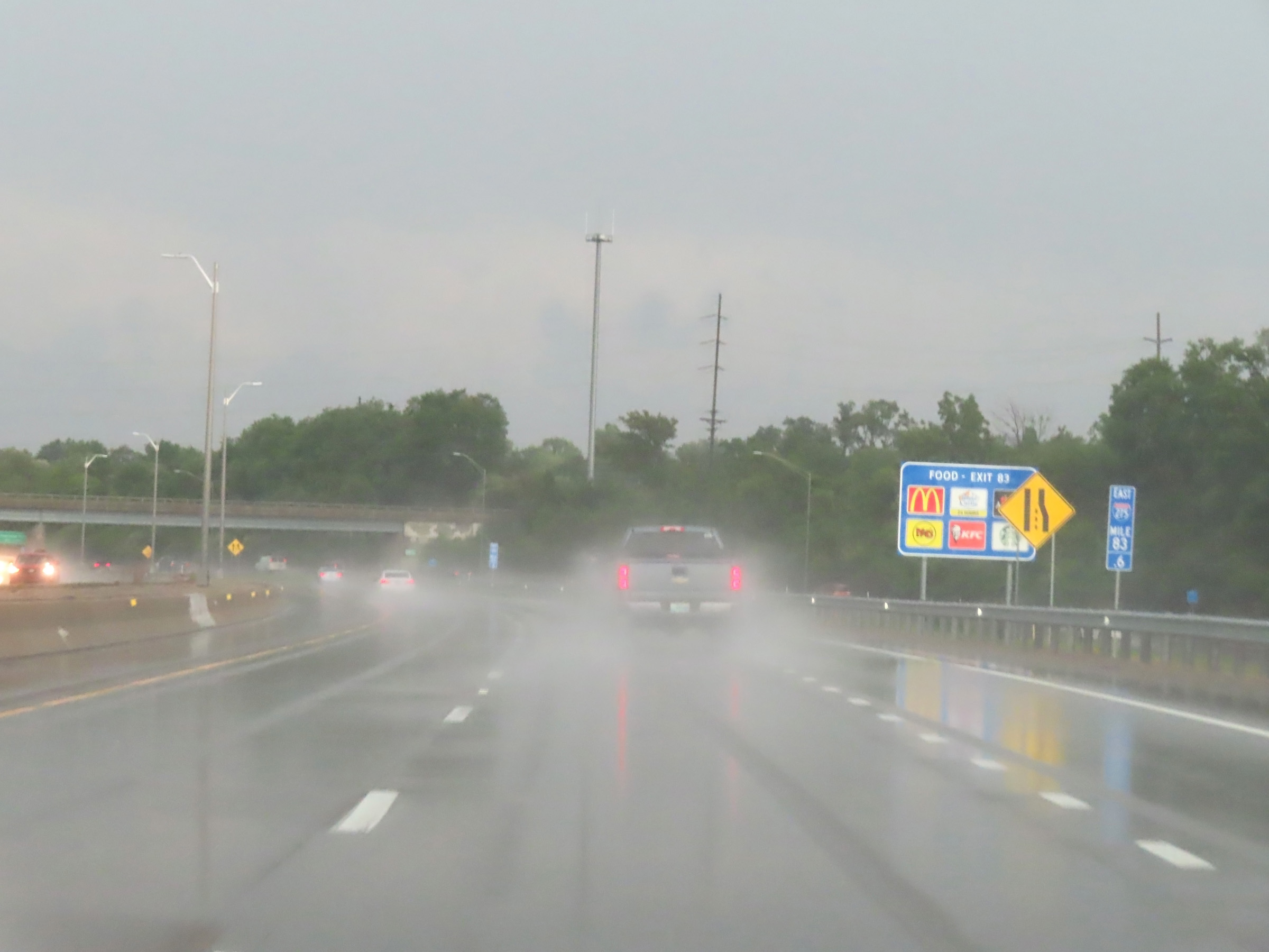
Take either of the next 2 exits to Crestview Hills. (Photo taken 8/20/22). |
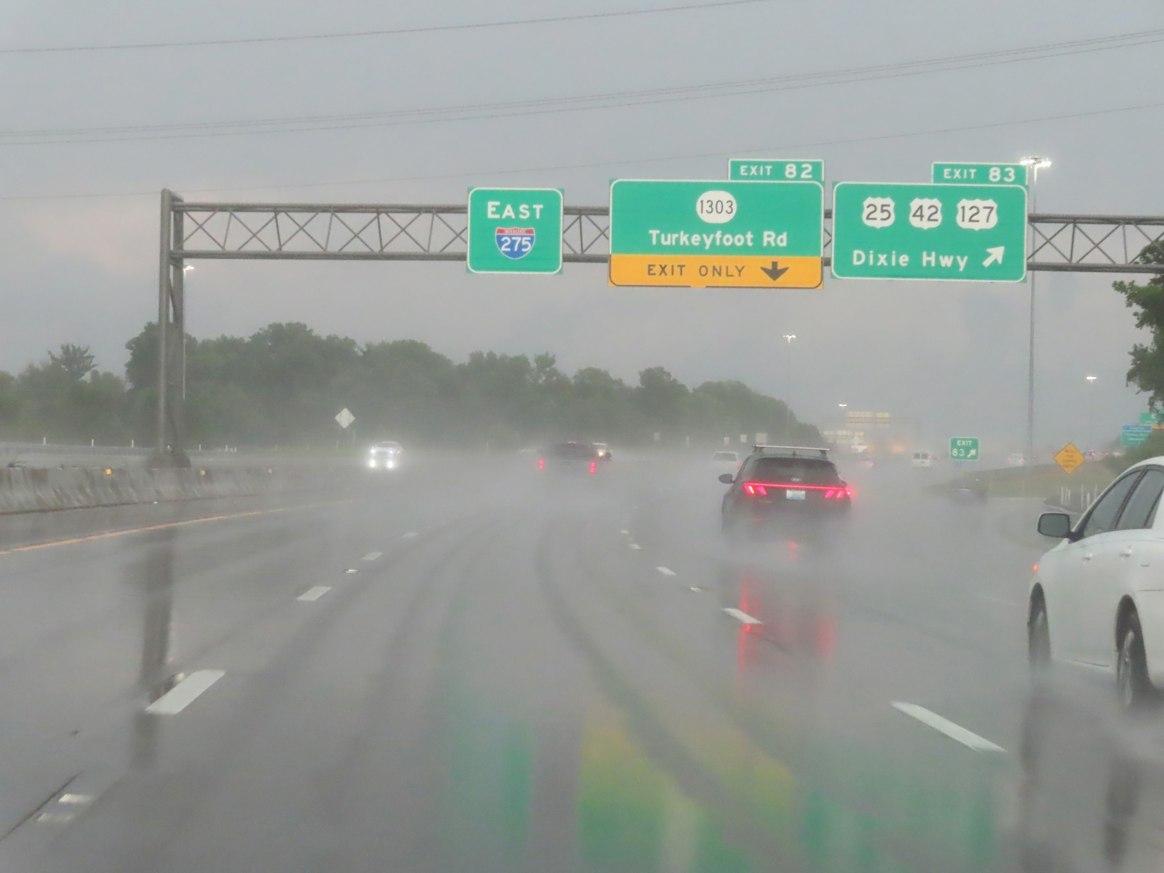 |
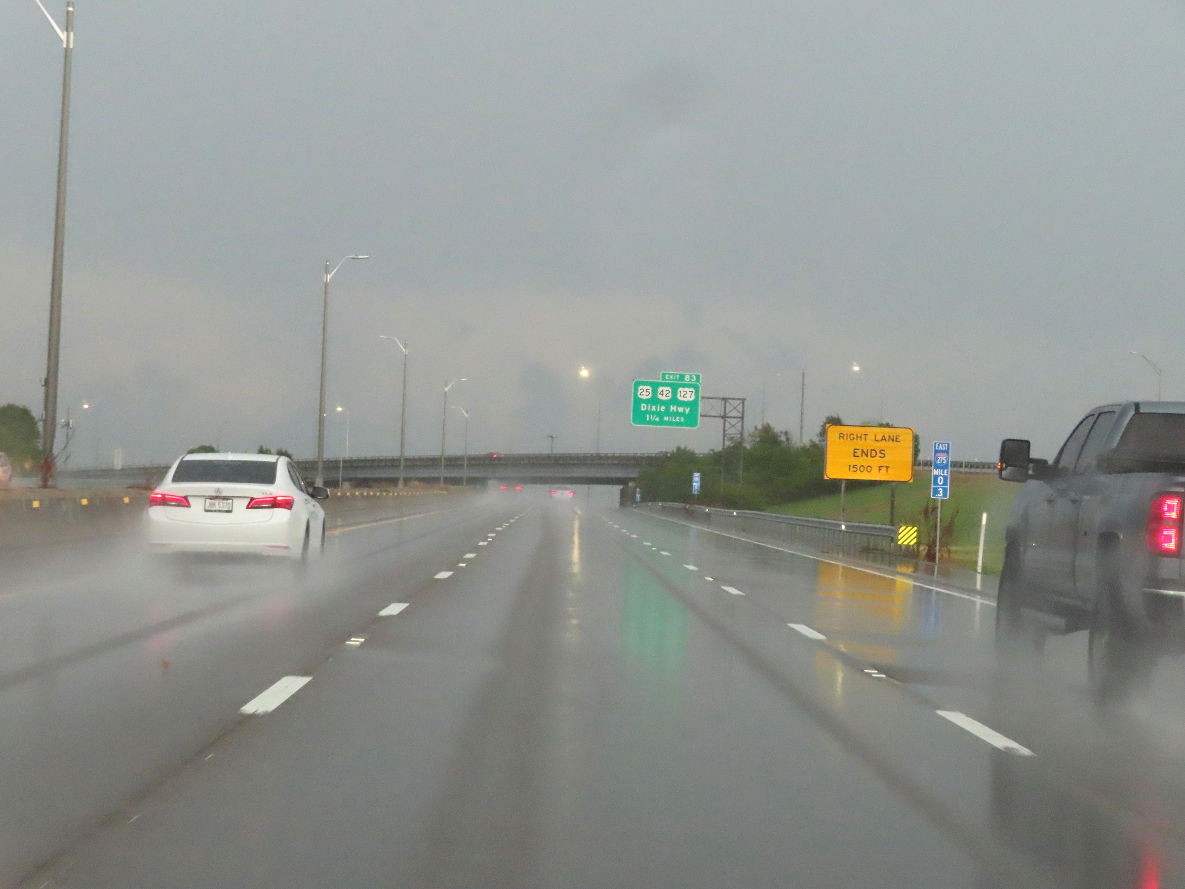
Interstate 275 Outer Loop (East) at Exit 83: US 25 / US 42 / 127 - Dixie Hwy (Photo taken 8/20/22). |
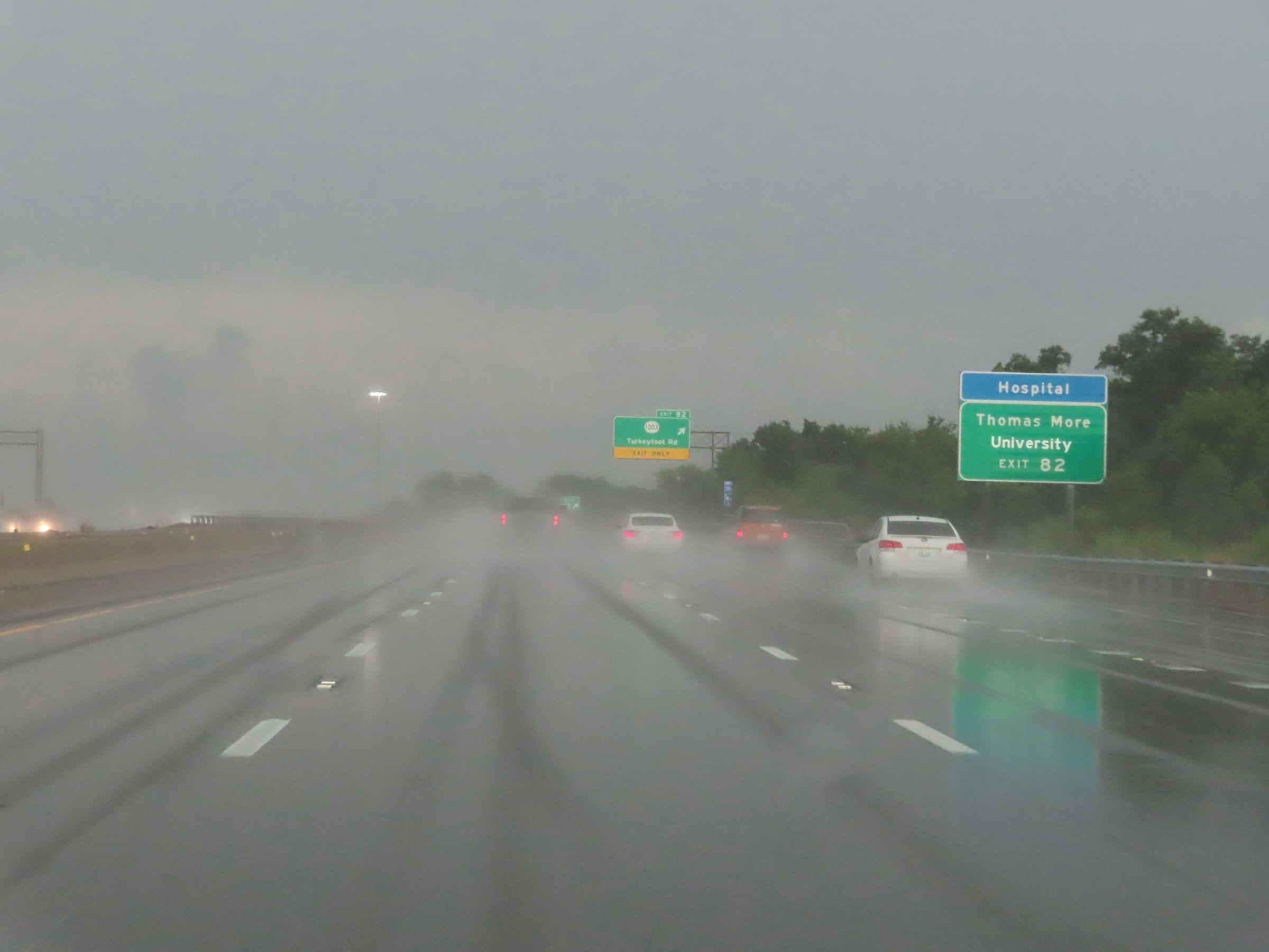 |
Take Exit 82 to Thomas Moore University. (Photo taken 8/20/22). |
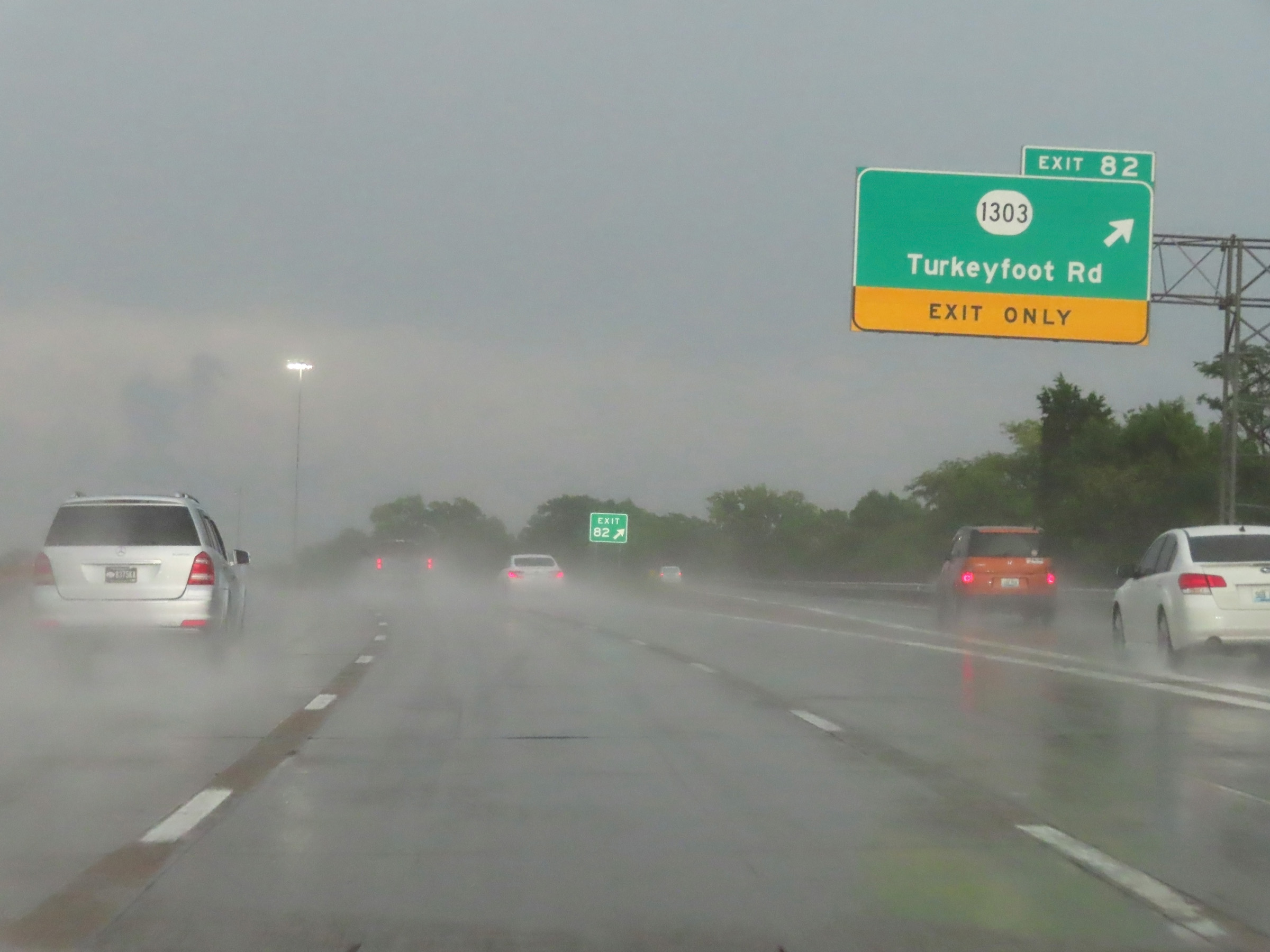 |
Interstate 275 Outer Loop (East) at Exit 82: KY 1303 - Turkeyfoot Rd (Photo taken 8/20/22). |
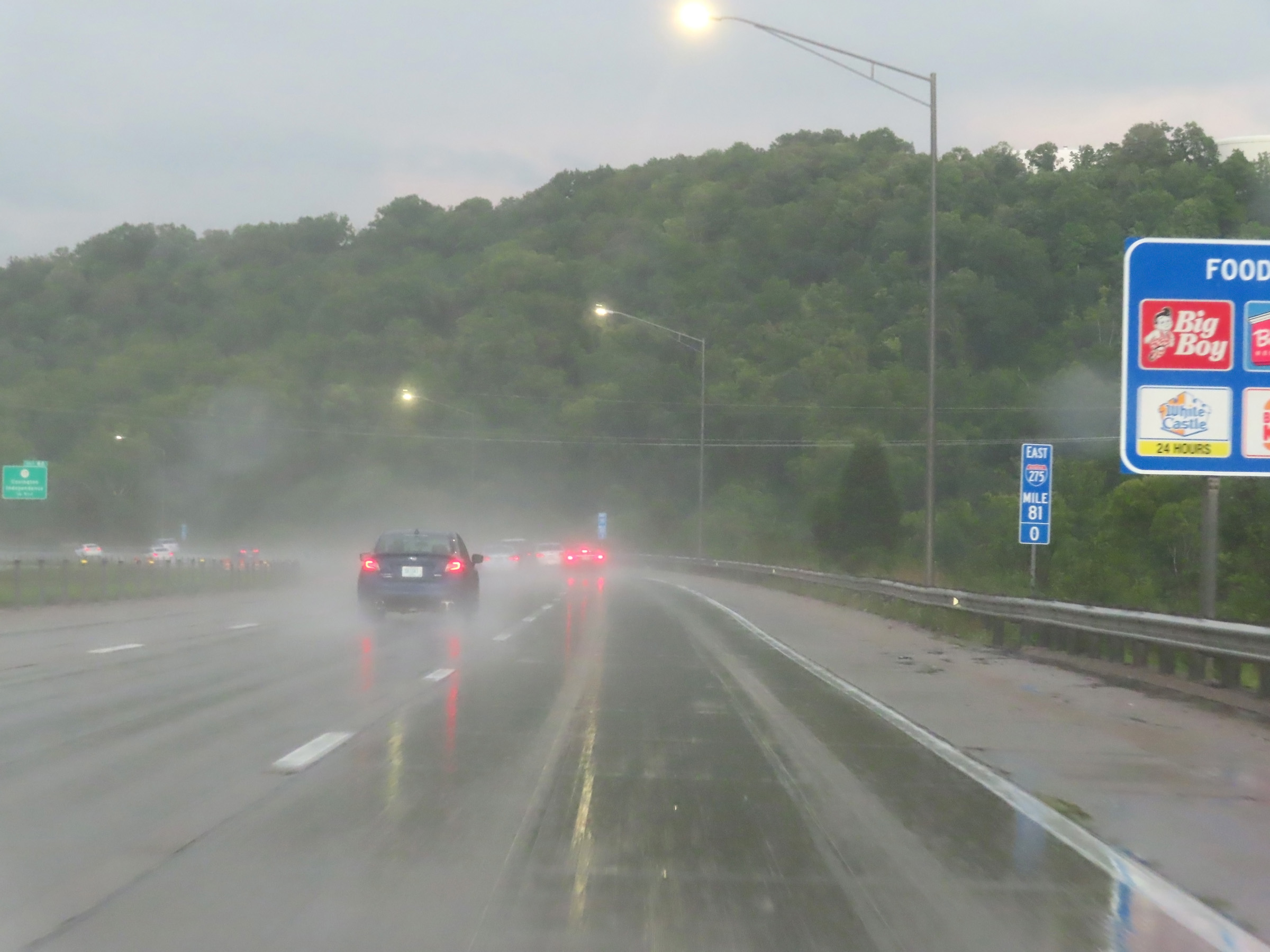 |
View on Interstate 275 Outer Loop (East) at mile marker 81. (Photo taken 8/20/22). |
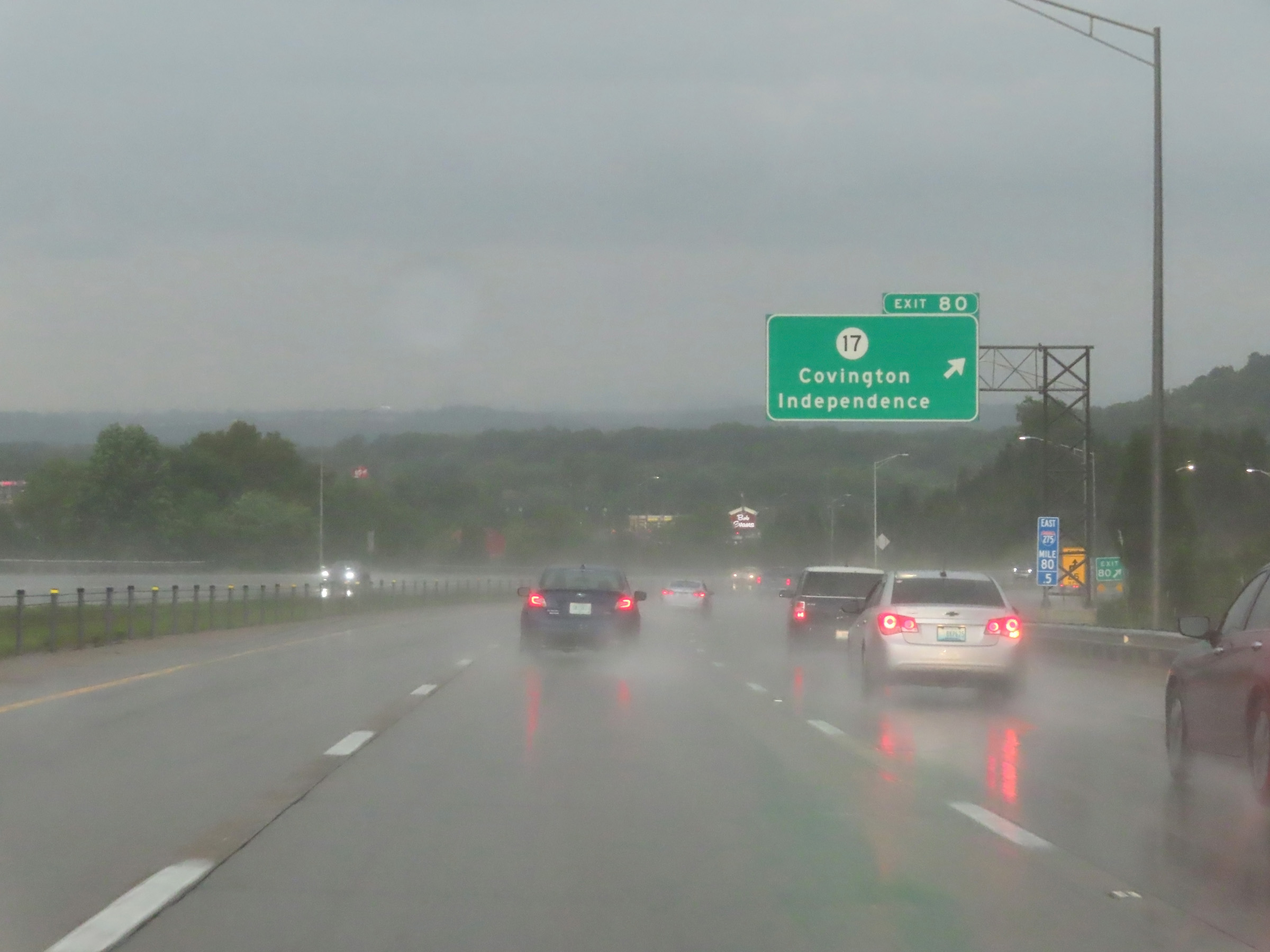 |
Interstate 275 Outer Loop (East) at Exit 80: KY 17 - Covington / Independence (Photo taken 8/20/22). |
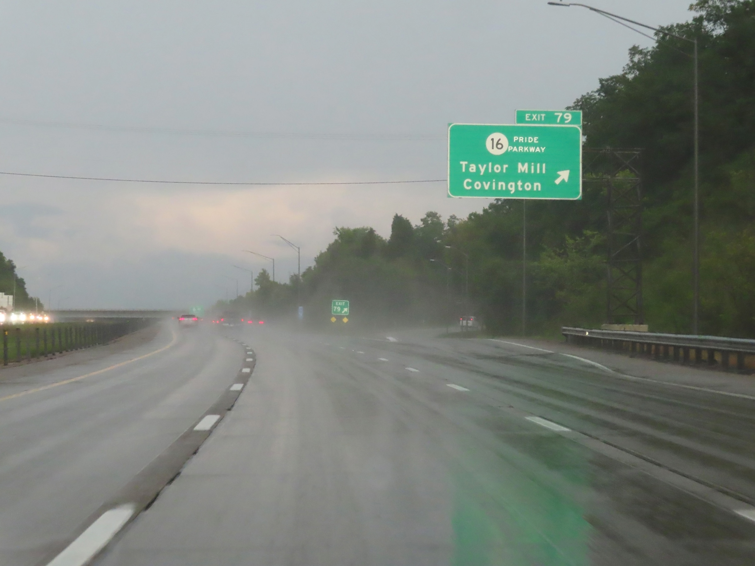 |
Interstate 275 Outer Loop (East) at Exit 79: KY 16 - Taylor Mill / Covington (Photo taken 8/20/22). |
 |
Interstate 275 East reassurance shield. (Photo taken 8/20/22). |
 |
Take Exit 77 to Newport and Alexandria. (Photo taken 8/20/22). |
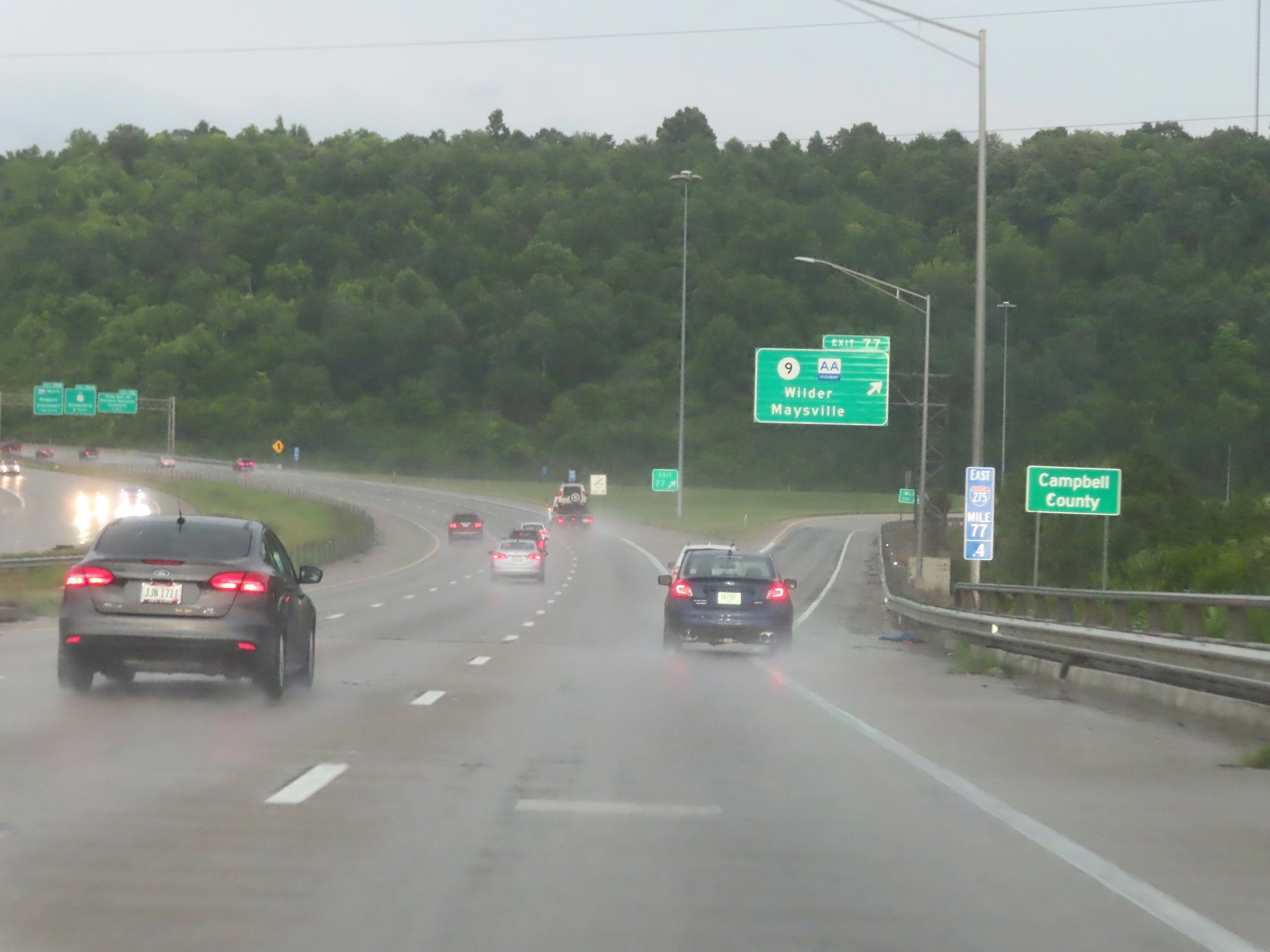 |
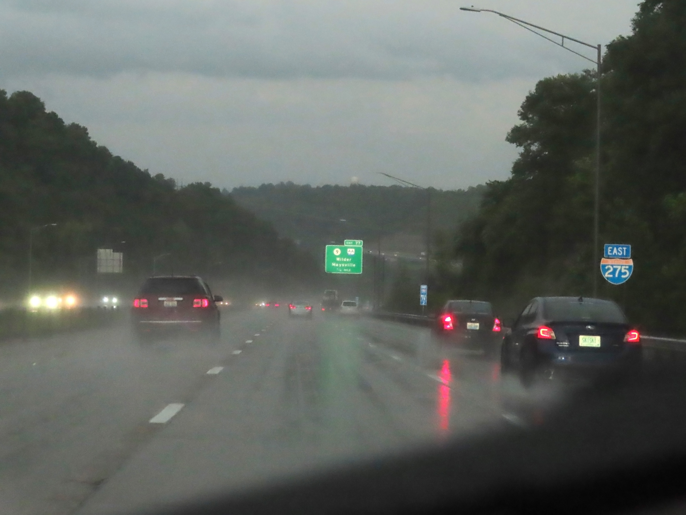
At mile marker 77.4, Interstate 275 Outer Loop (East) enters Campbell County. (Photo taken 8/20/22). |
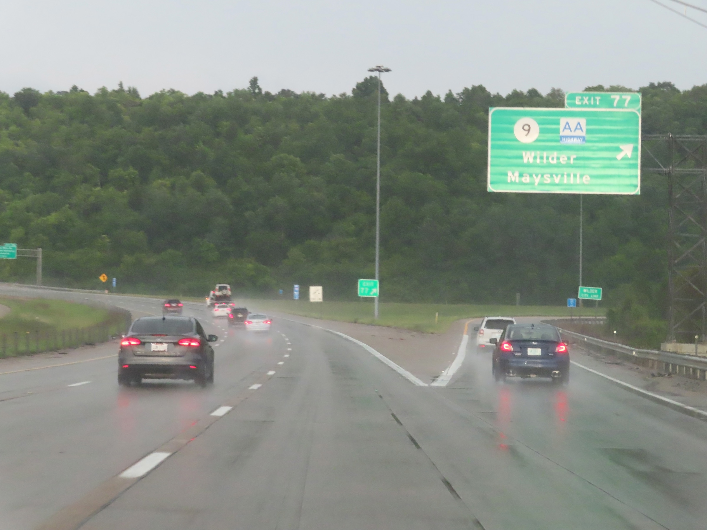 |
Interstate 275 Outer Loop (East) at Exit 77: KY 9 (AA Highway) - Wilder / Maysville (Photo taken 8/20/22). |
 |
Interstate 275 Outer Loop (East) approaching Exit 76 - 1 mile. (Photo taken 8/20/22). |
 |
Interstate 275 Outer Loop (East) at Exit 76: Three Mile Rd / Northern Kentucky University (Photo taken 8/20/22). |
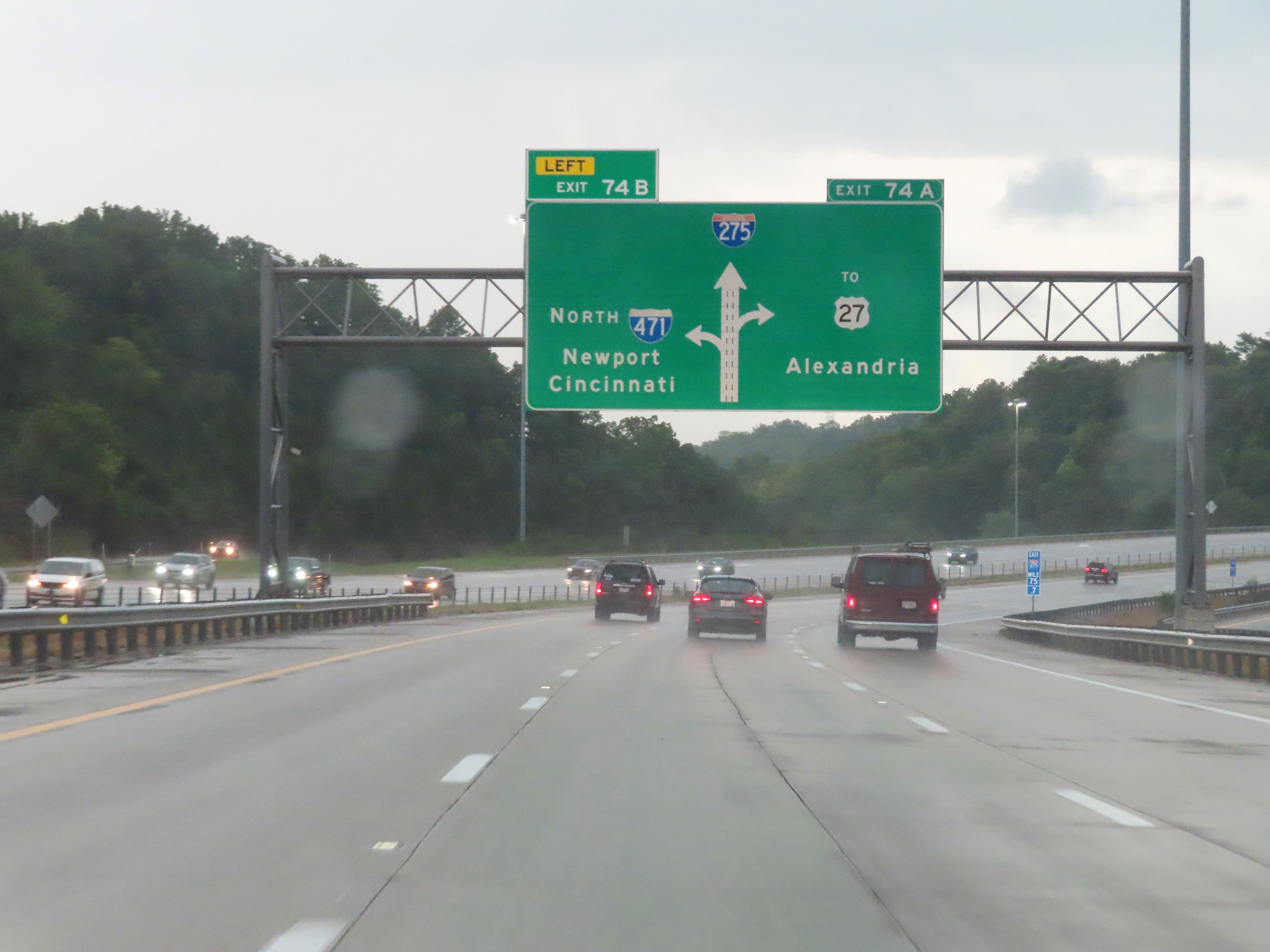 |
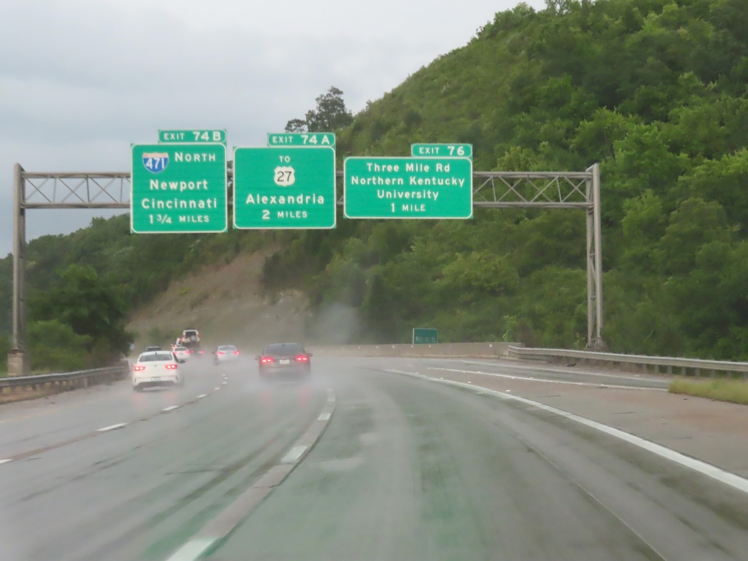
Interstate 275 Outer Loop (East) approaching Exits 74B-A. This overhead signage shows the layout of the interchange. Exit 74B will come first and be on the left, followed by Exit 74A on the right. (Photo taken 8/20/22). |
 |
Take Exit 74A to Highland Heights, Cold Spring, and Kincaid Lake State Park. (Photo taken 8/20/22). |
 |
Interstate 275 Outer Loop (East) at Exit 74B: Interstate 471 North - Newport / Cincinnati (Photo taken 8/20/22). |
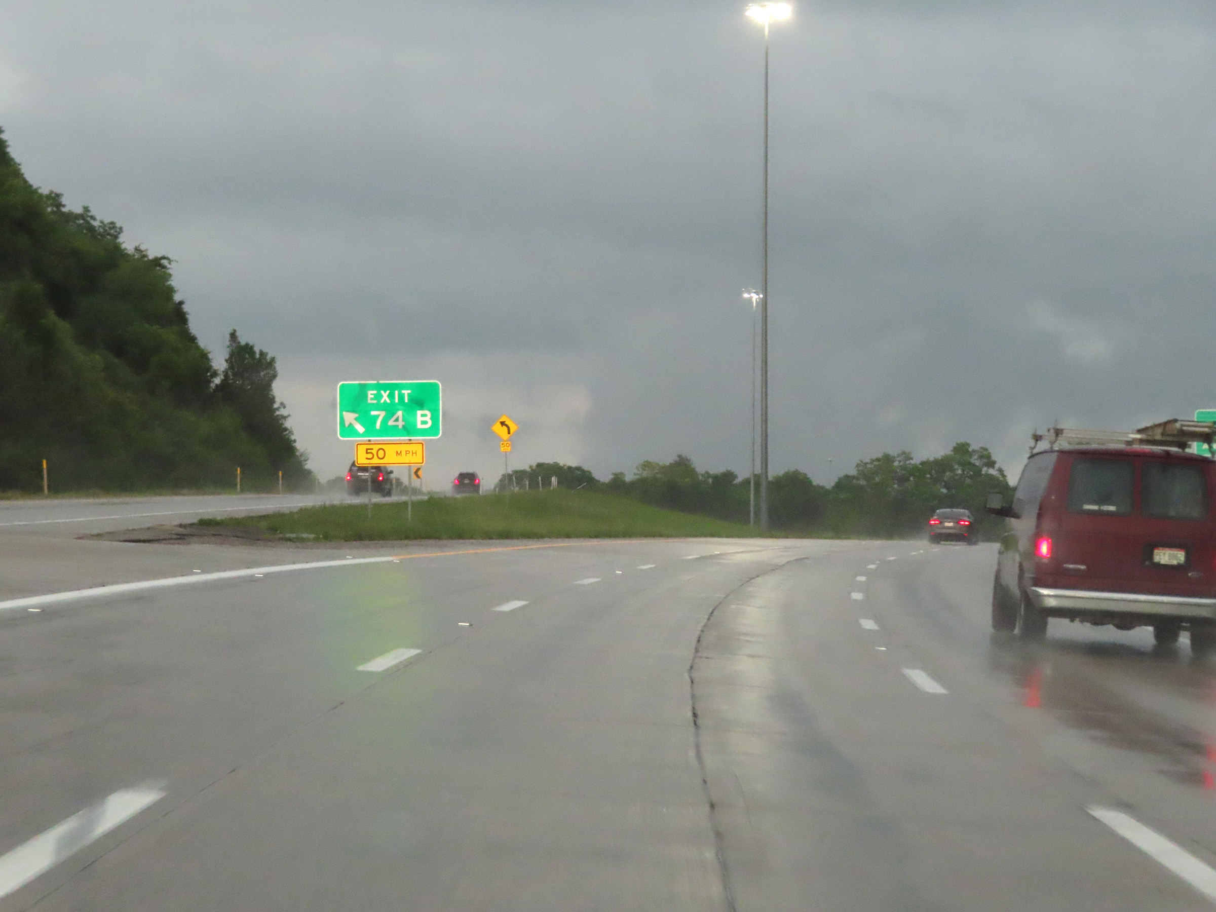 |
A view of the ramp to Interstate 471 North via Exit 74B on the left. (Photo taken 8/20/22). |
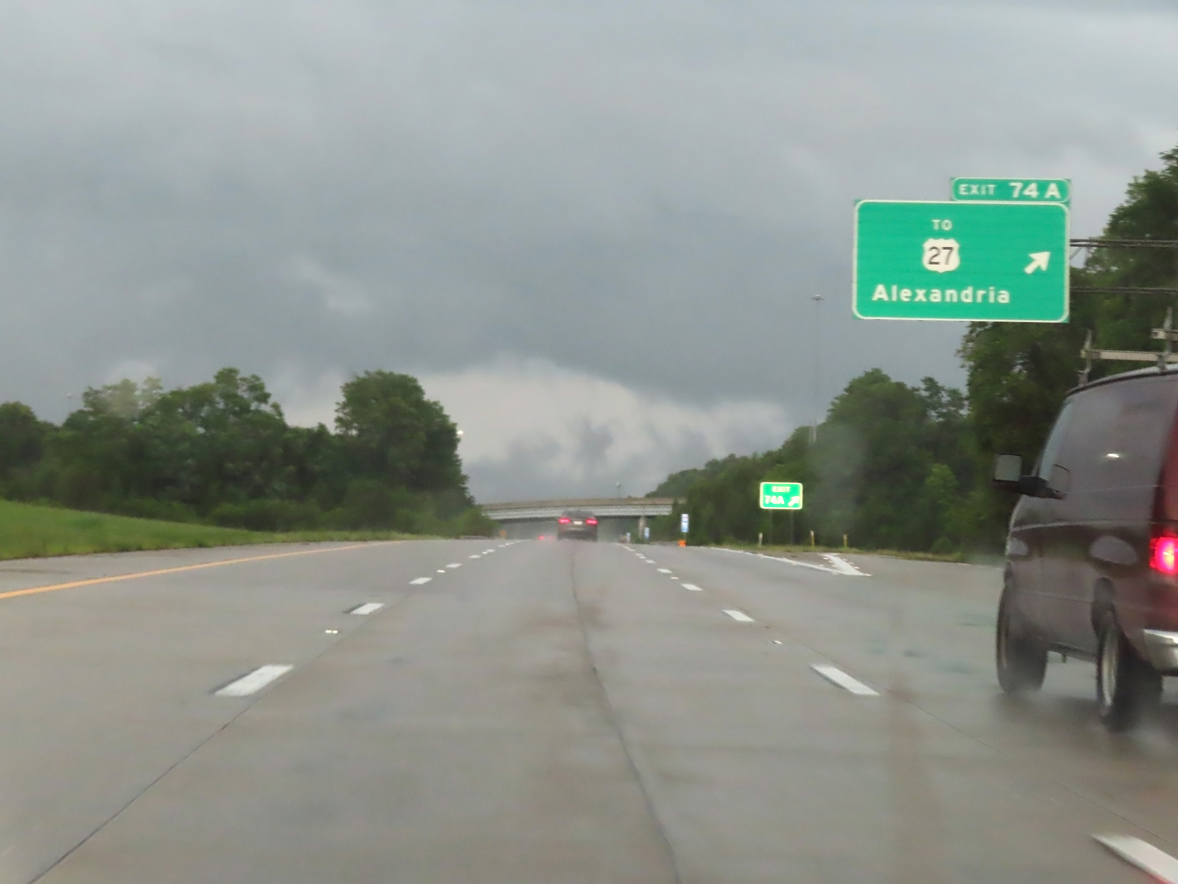 |
Interstate 275 Outer Loop (East) at Exit 74A: To US 27 - Alexandria (Photo taken 8/20/22). |
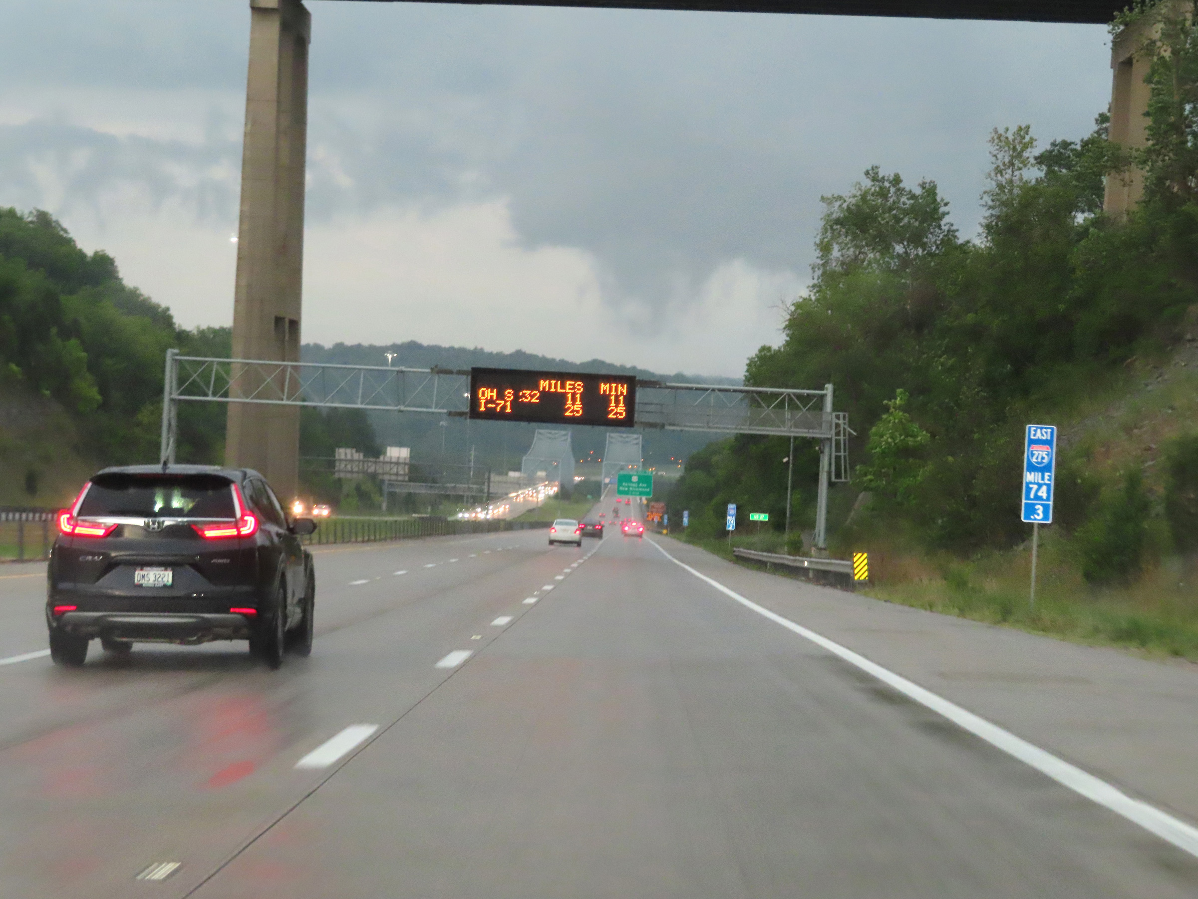 |
View on Interstate 275 Outer Loop (East) at mile marker 74.3. (Photo taken 8/20/22). |
 |
Advance signage for Exit 72, which will be the first exit on Interstate 275 Outer Loop (East) after it crosses the Ohio River into Ohio ahead. (Photo taken 8/20/22). |
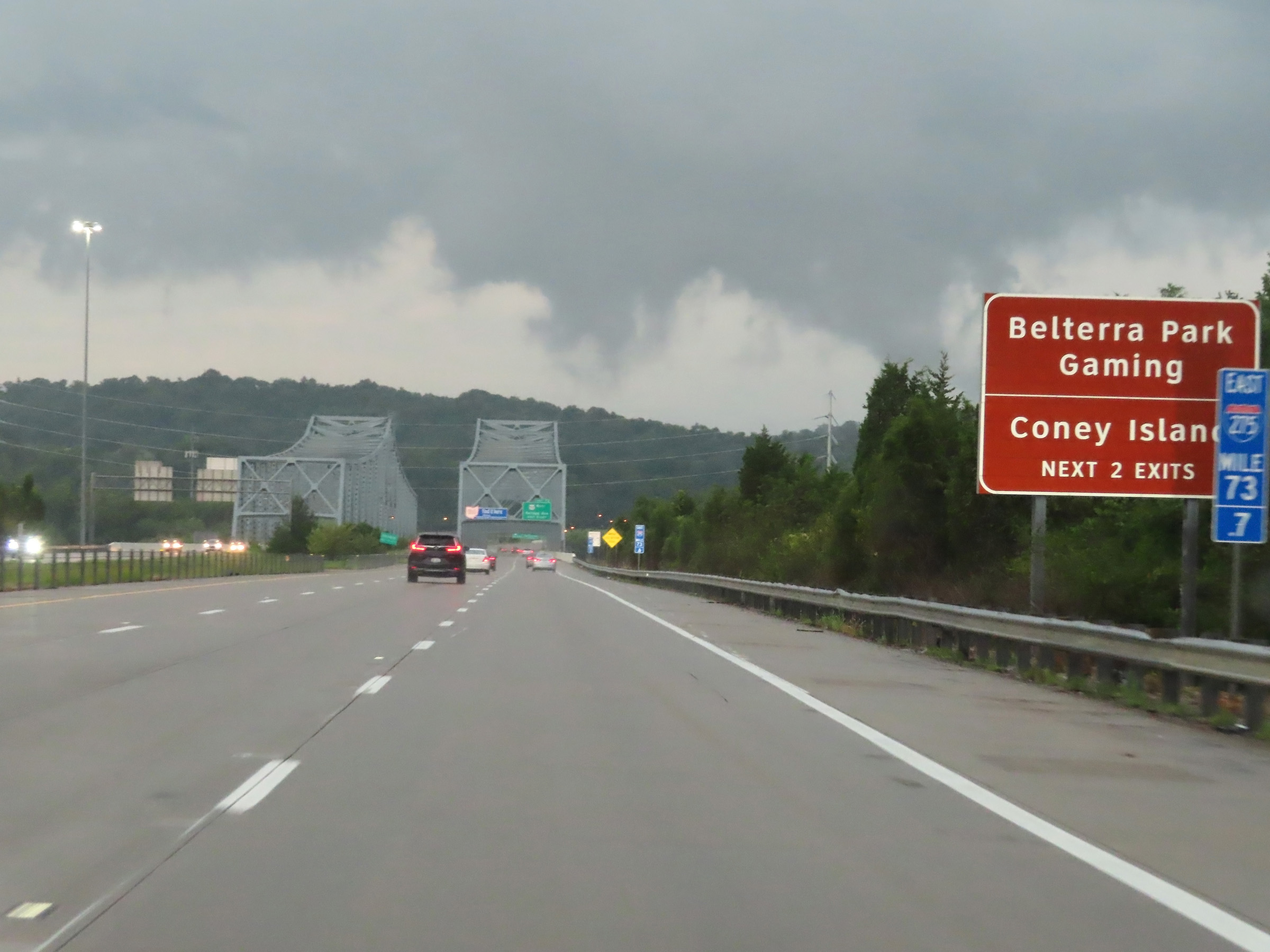 |
Take Exit 72 to Belterra Park Gaming and Coney Island. (Photo taken 8/20/22). |
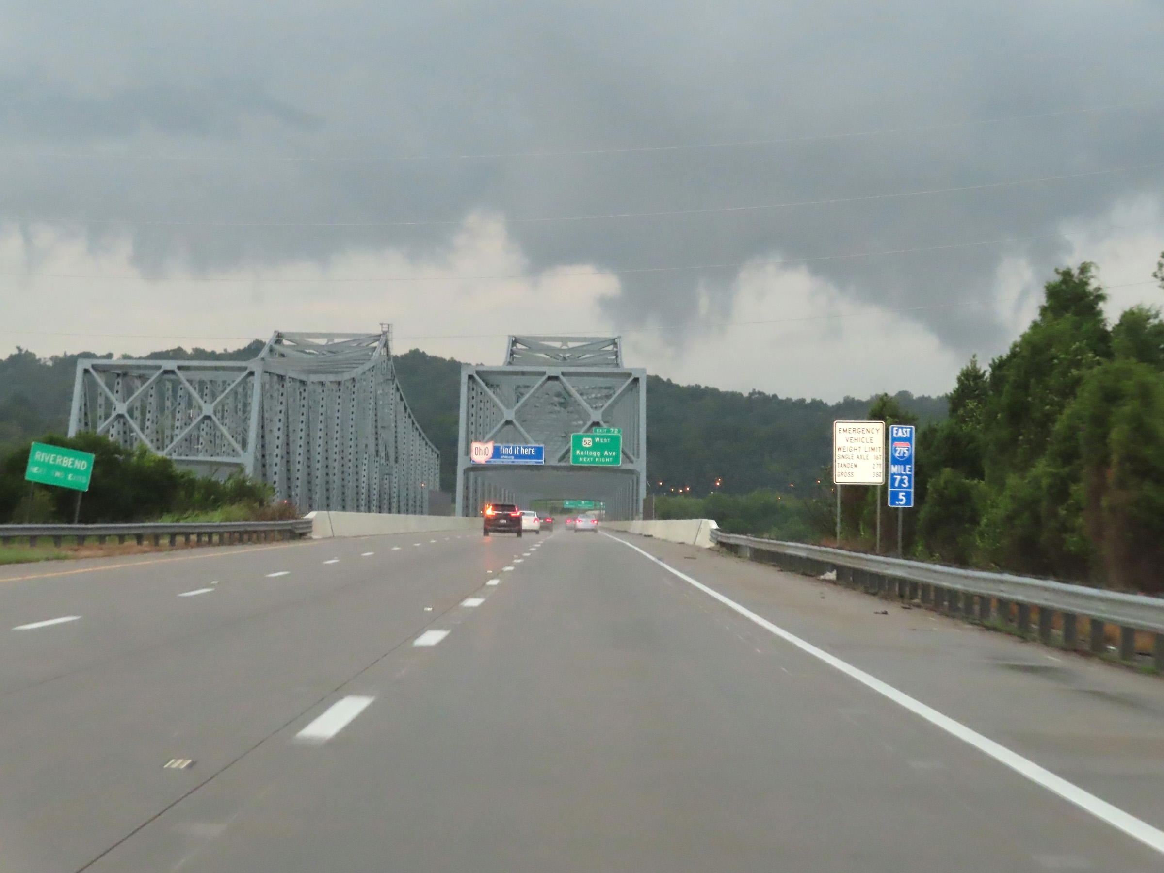 |
At mile marker 73.5, Interstate 275 Outer Loop (East) prepares to cross the Combs-Hehl Bridge over the Ohio River, which will carry traffic from Kentucky into Ohio. (Photo taken 8/20/22). |