Road Information |
||
 |
||
| Total Mileage in State: | 23 miles | |
| Eastern End: | At I-71, in Louisville | |
| Western End: | At I-64, in Louisville | |
| Mileage covered in Photos: | 23 miles | |
| Counties covered in Photos: | Jefferson | |
| Major Junctions in Photos: | I-64, in Louisville I-65, in Louisville I-64, in Louisville |
|
| Control Cities in Photos: | Louisville, Shively | |
Westbound
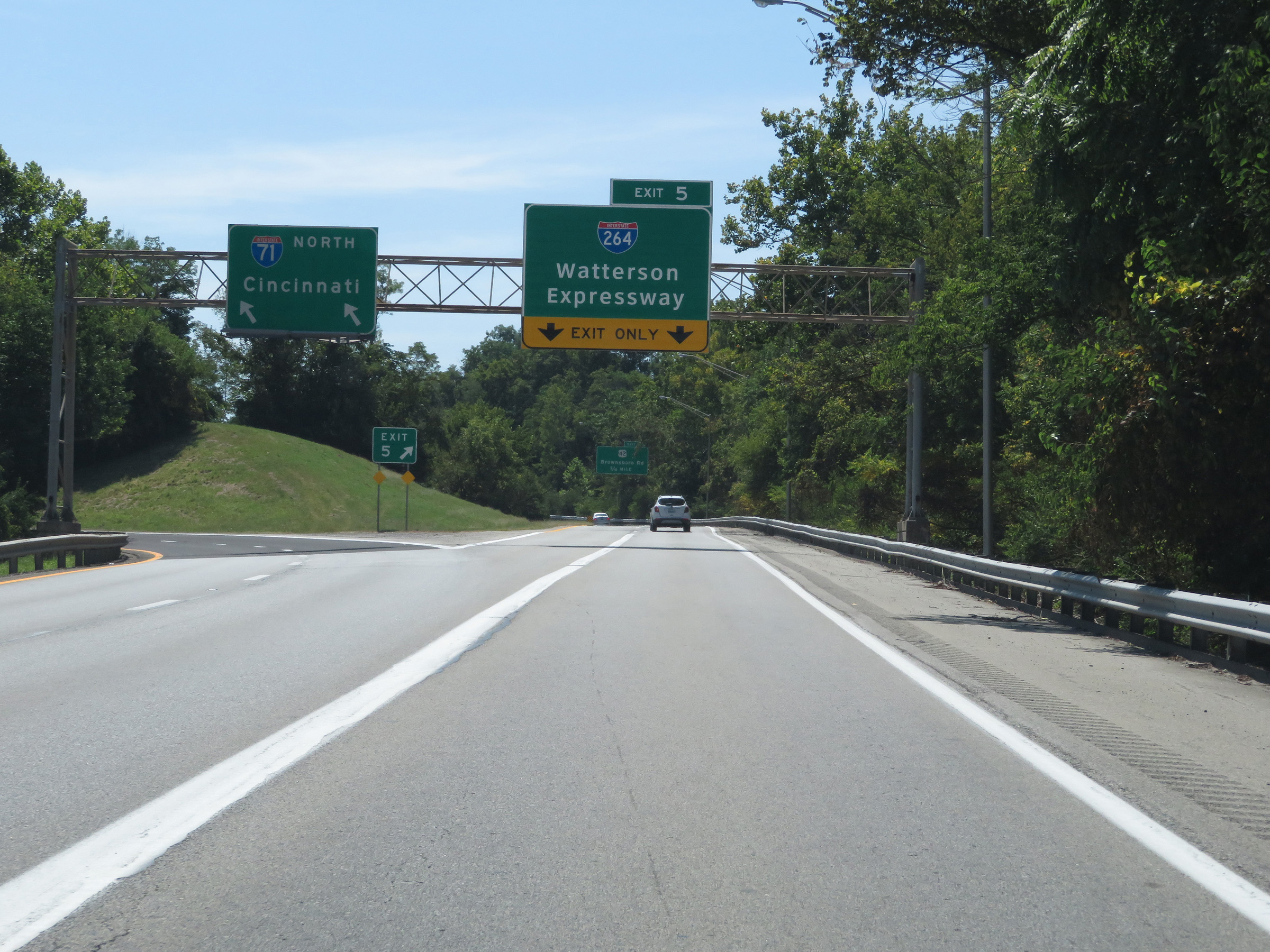 |
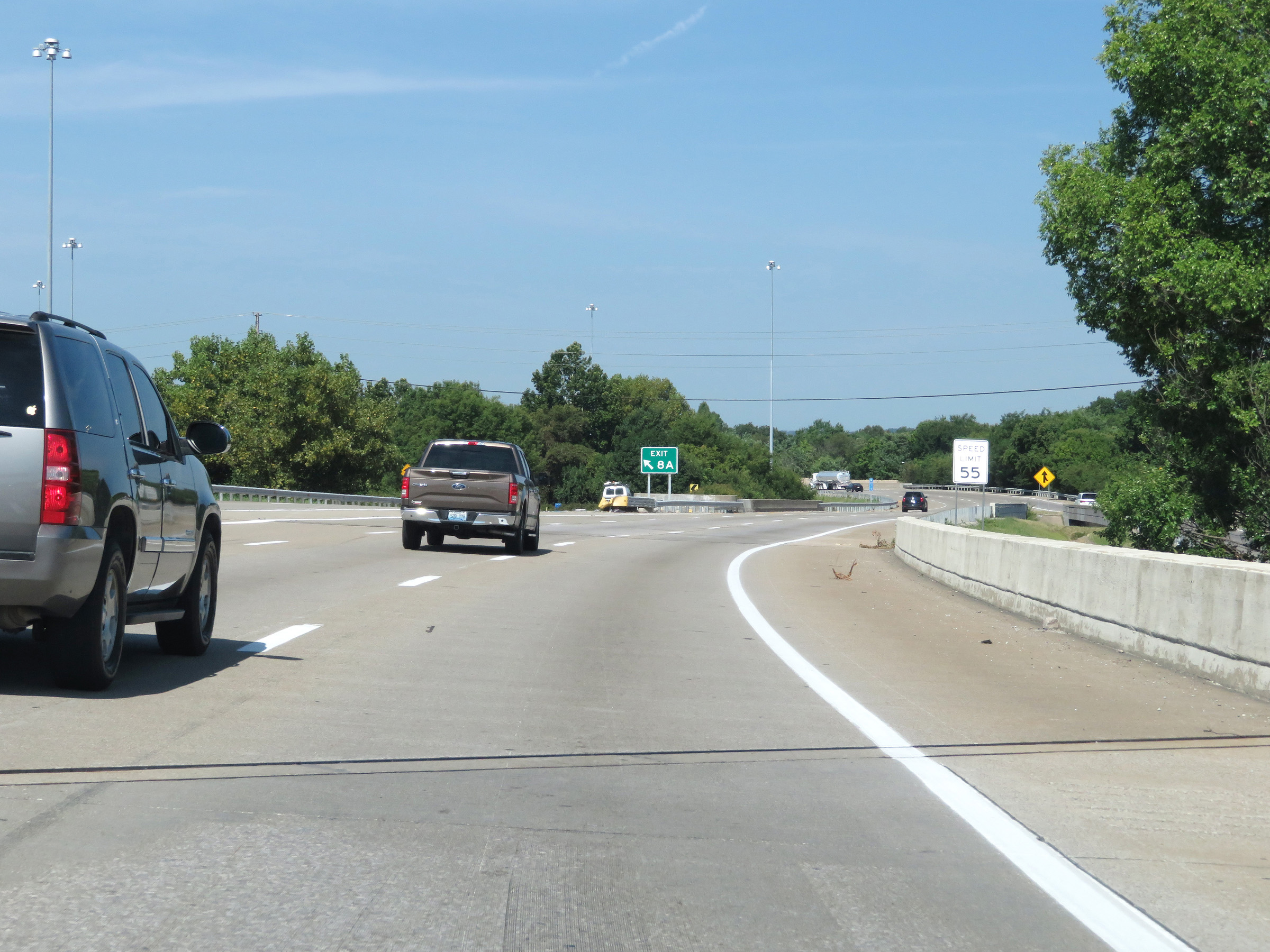
Merging onto Interstate 264 West from Interstate 71 North via Exit 5. (Photo taken 8/10/19). |
 |
Mile marker 23 on Interstate 264 West as it begins. (Photo taken 8/10/19). |
 |
Traffic from Interstate 71 South merges into Interstate 264 West on the left at this point. (Photo taken 8/10/19). |
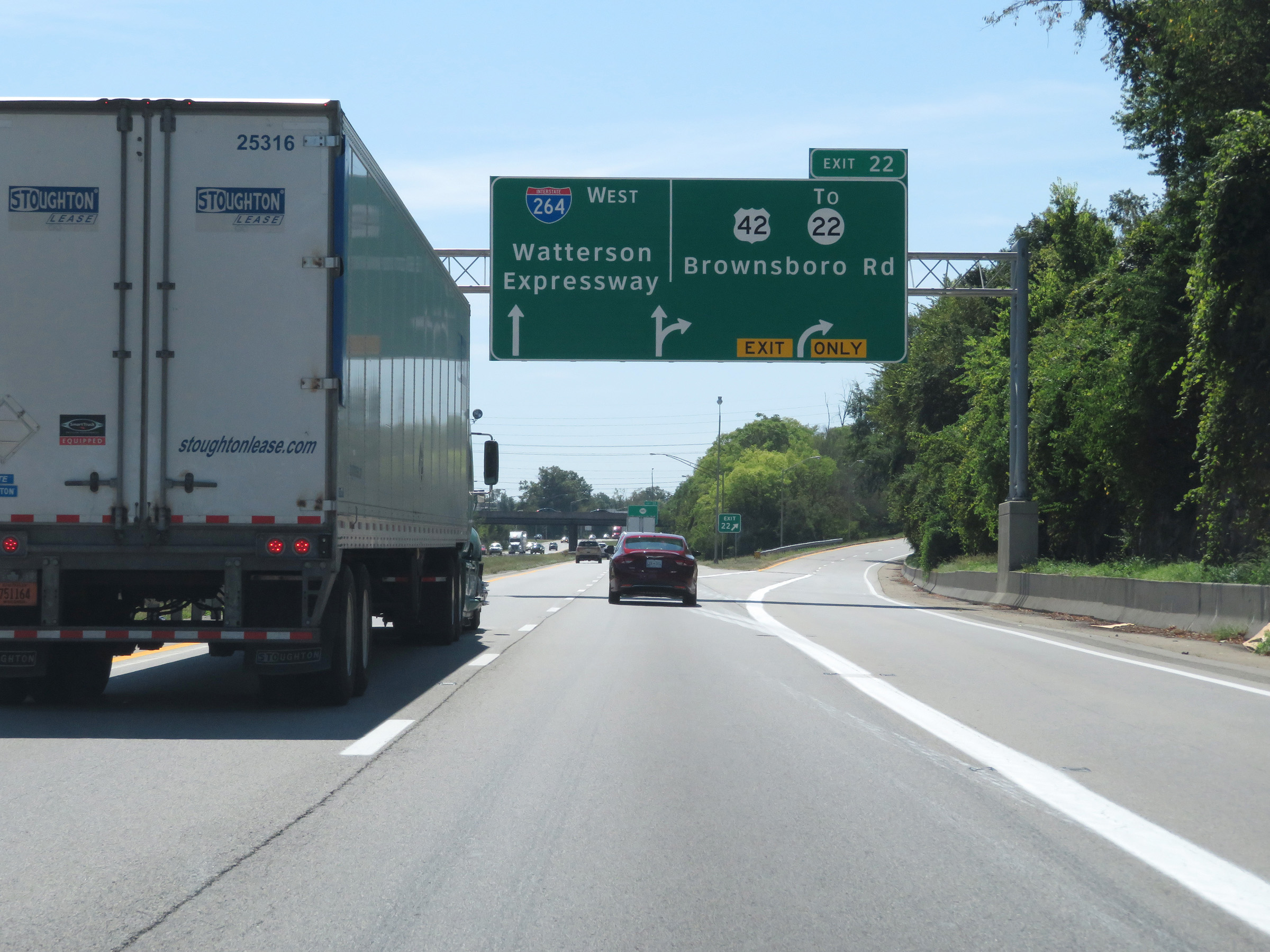 |
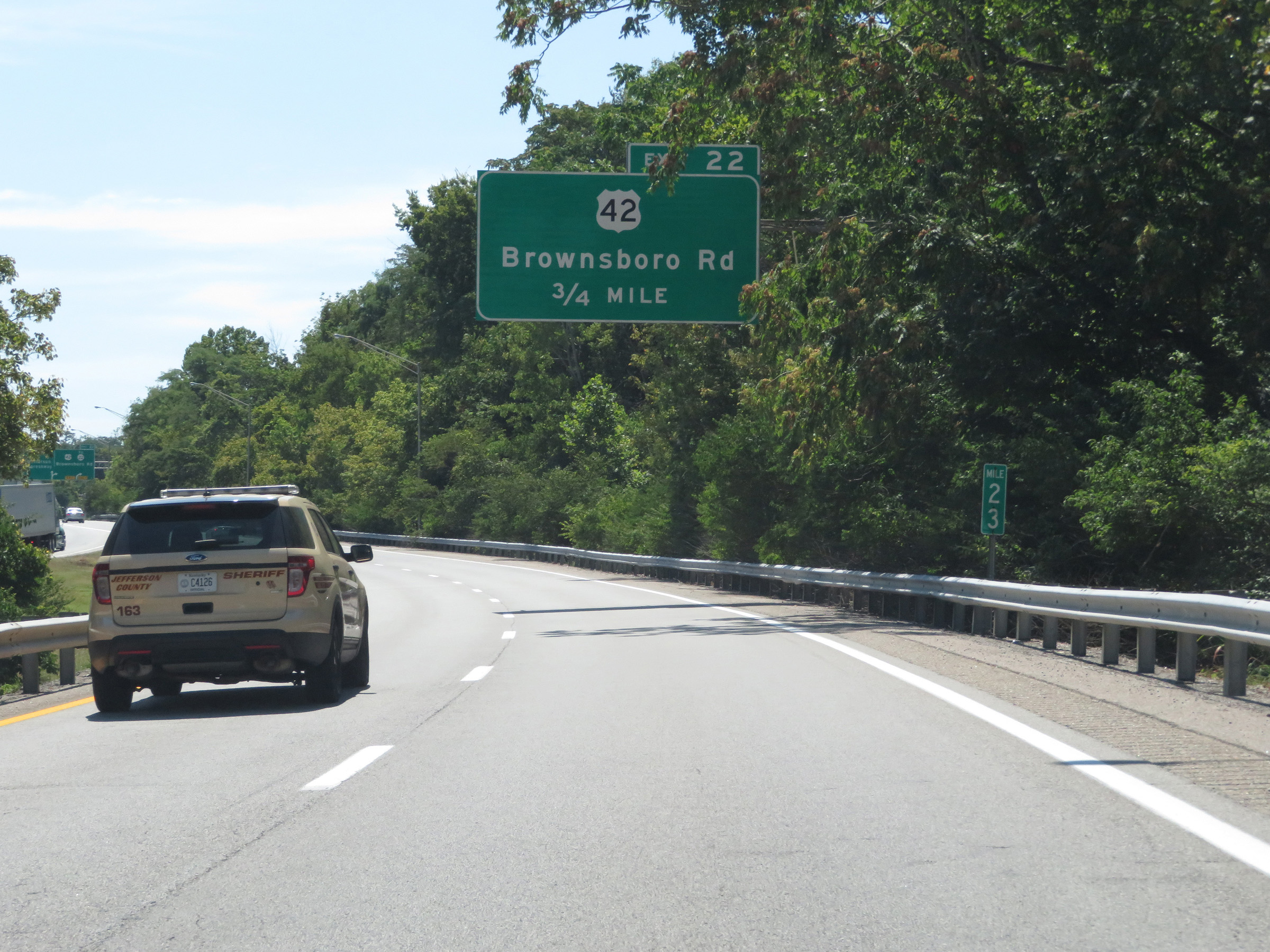
Interstate 264 West at Exit 22: US 42 / To KY 22 - Brownsboro Rd (Photo taken 8/10/19). |
 |
Interstate 264 West at Exit 21: KY 1447 - Westport Rd (Photo taken 8/10/19). |
 |
An Interstate 264 West reassurance shield. (Photo taken 8/10/19). |
 |
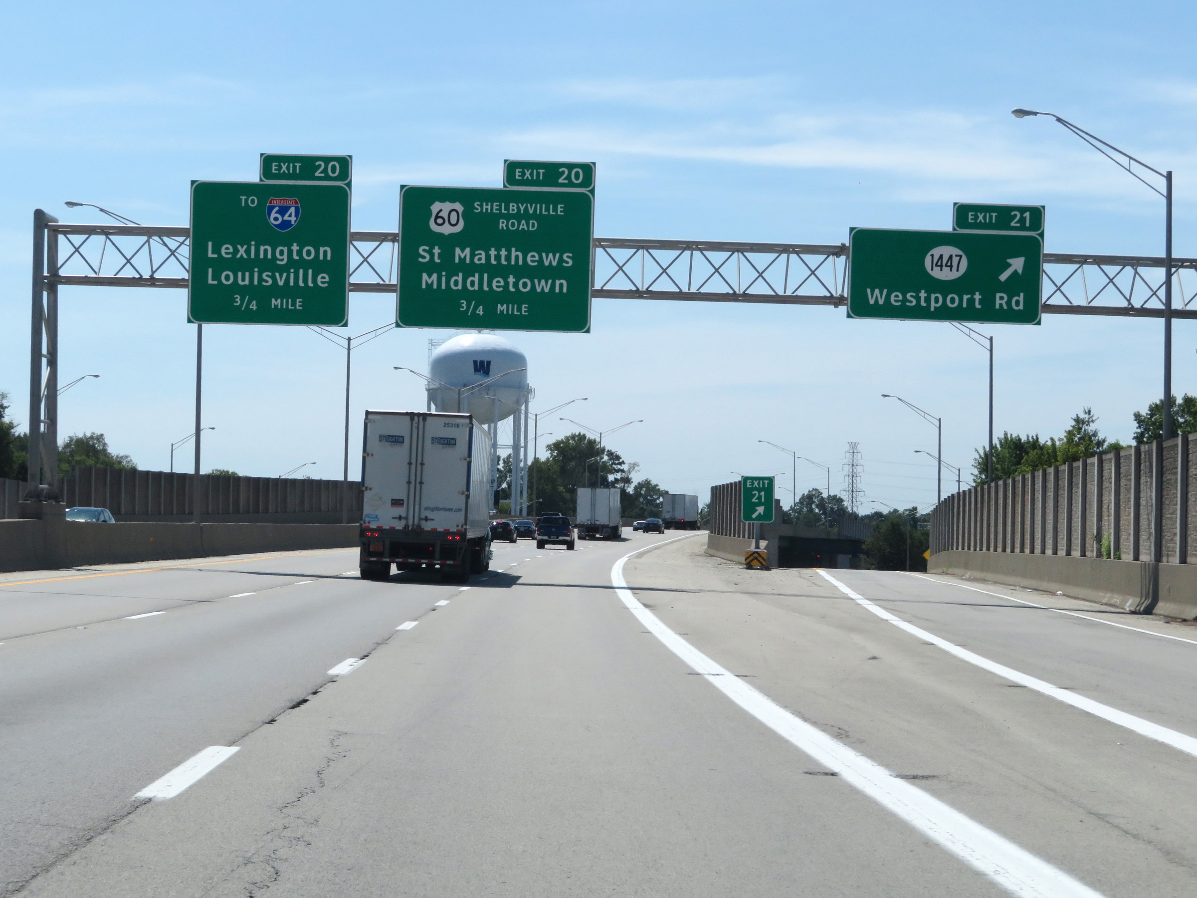
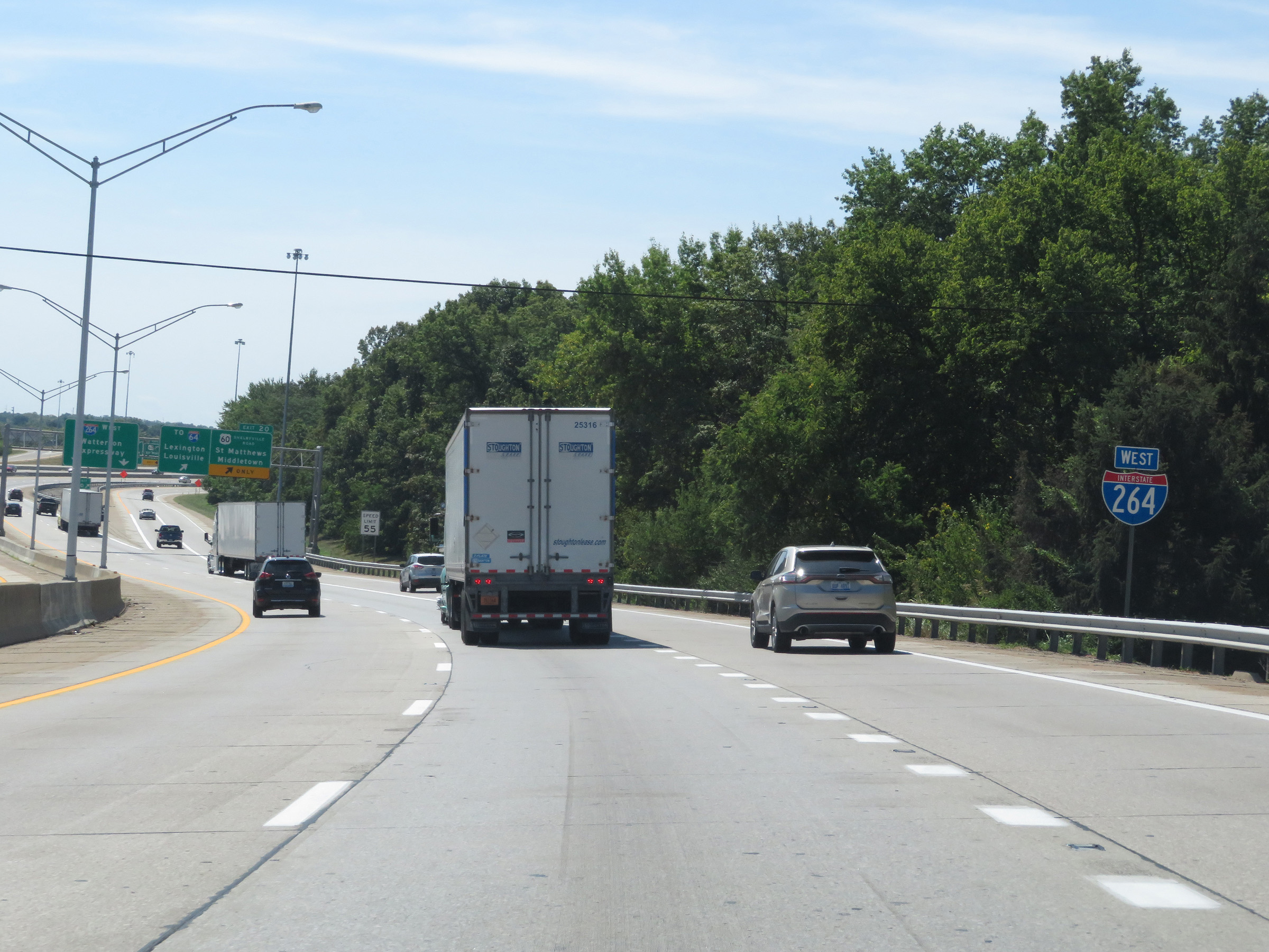
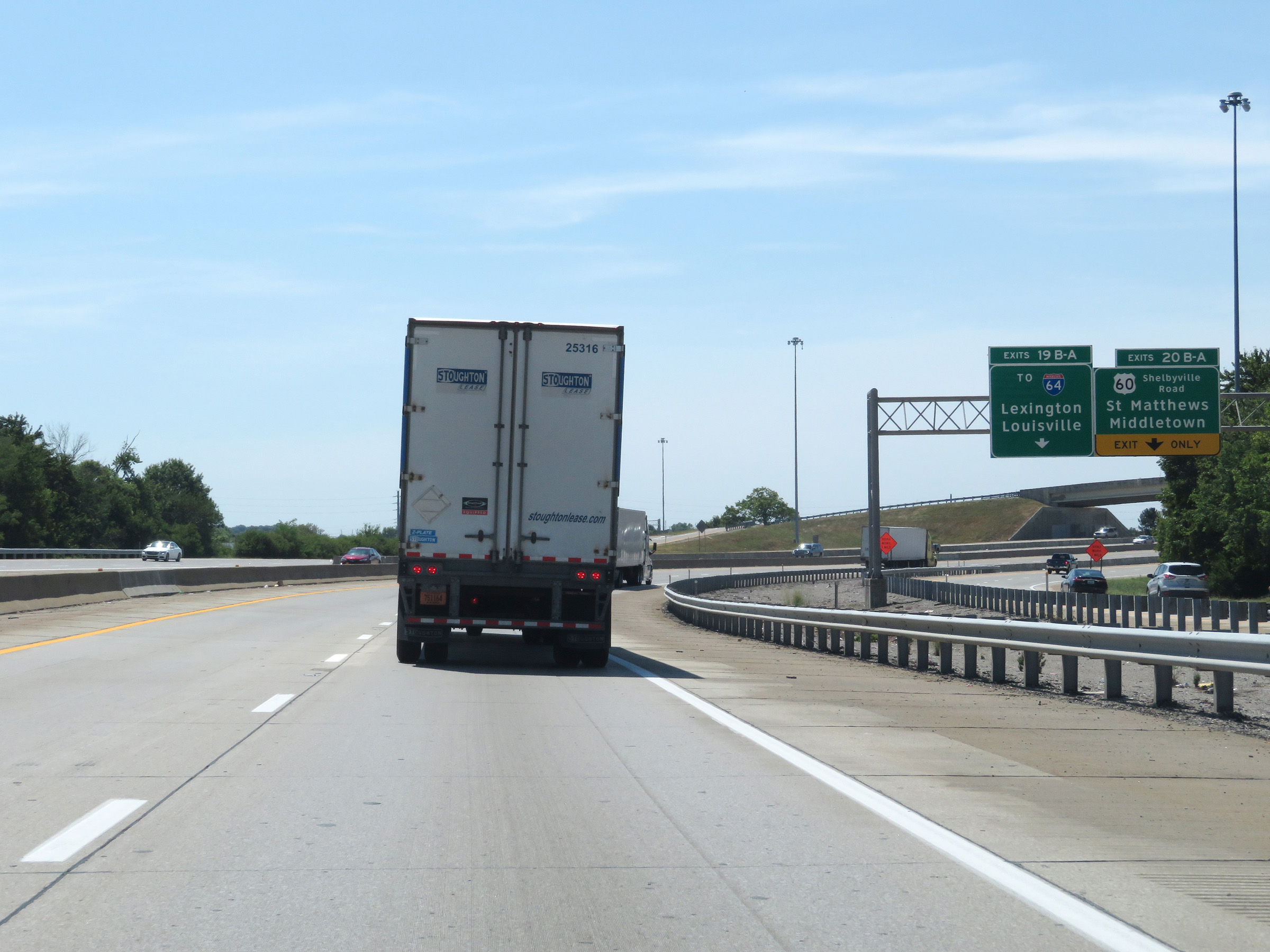
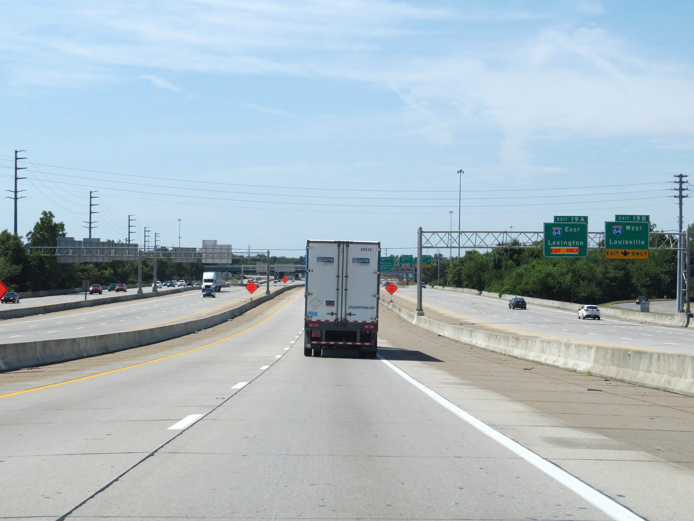
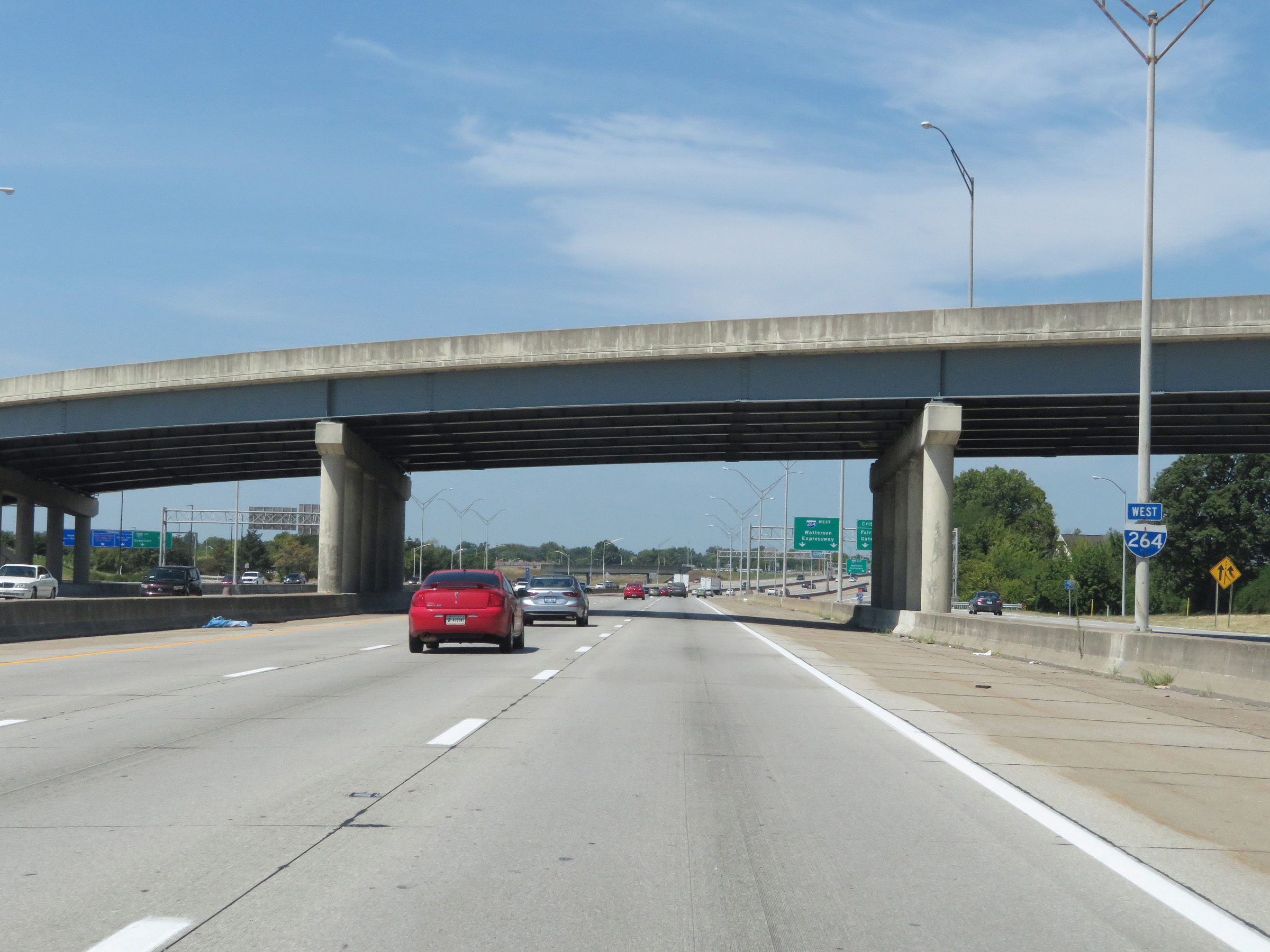
Interstate 264 West at Exits 20B-A: US 60 - St. Matthews / Middletown; Exits 19B-A: Interstate 64 - Lexington / Louisville (Photo taken 8/10/19). |
 |
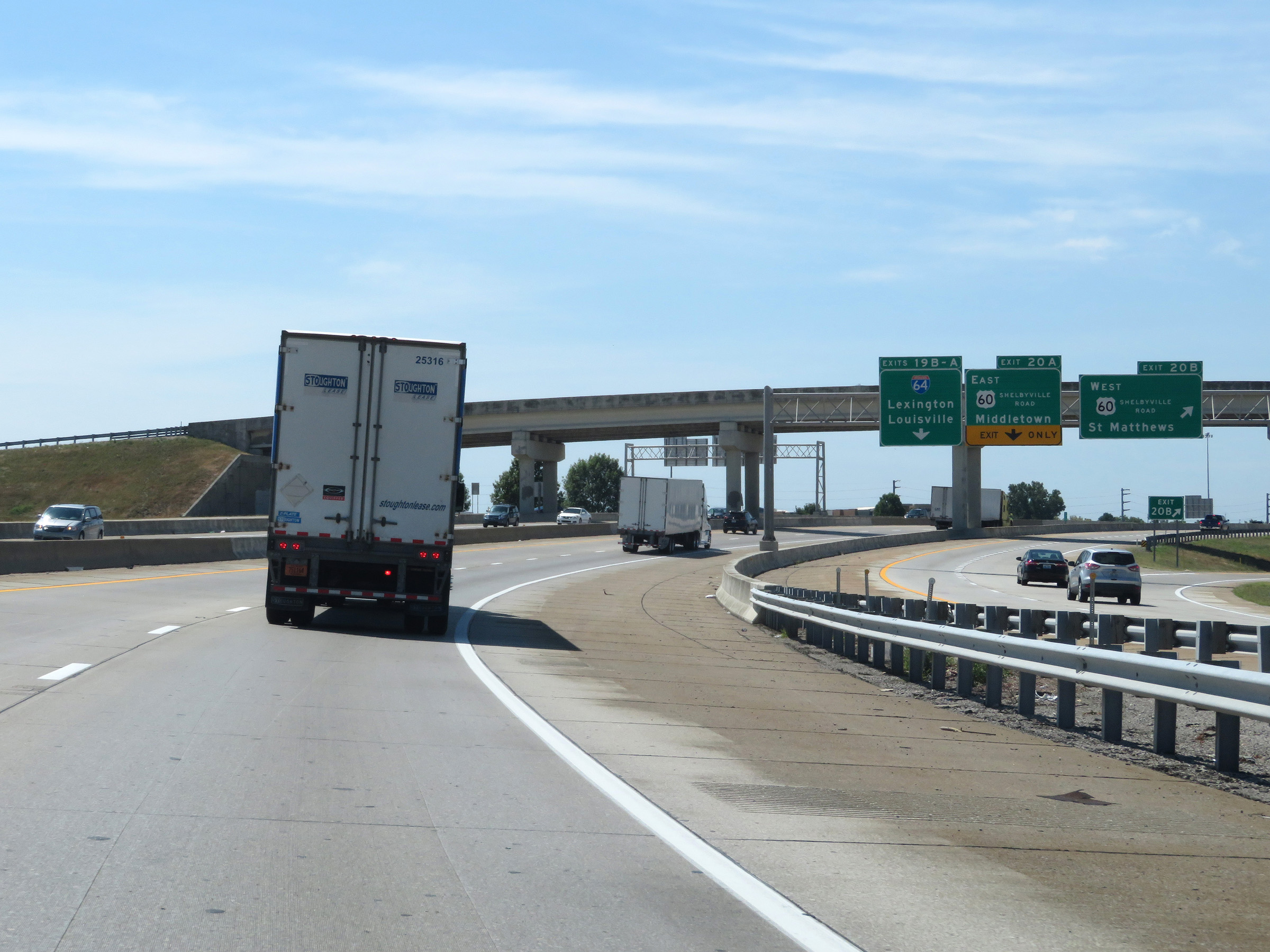
The previous ramp leads to a long collector/distributor road which serves Exits 20B-A and Exits 19B-A. (Photo taken 8/10/19). |
 |
Interstate 264 West at Exit 20B: US 60 West - St. Matthews (Photo taken 8/10/19). |
 |
Interstate 264 West at Exit 20A: US 60 East - Middletown (Photo taken 8/10/19). |
 |
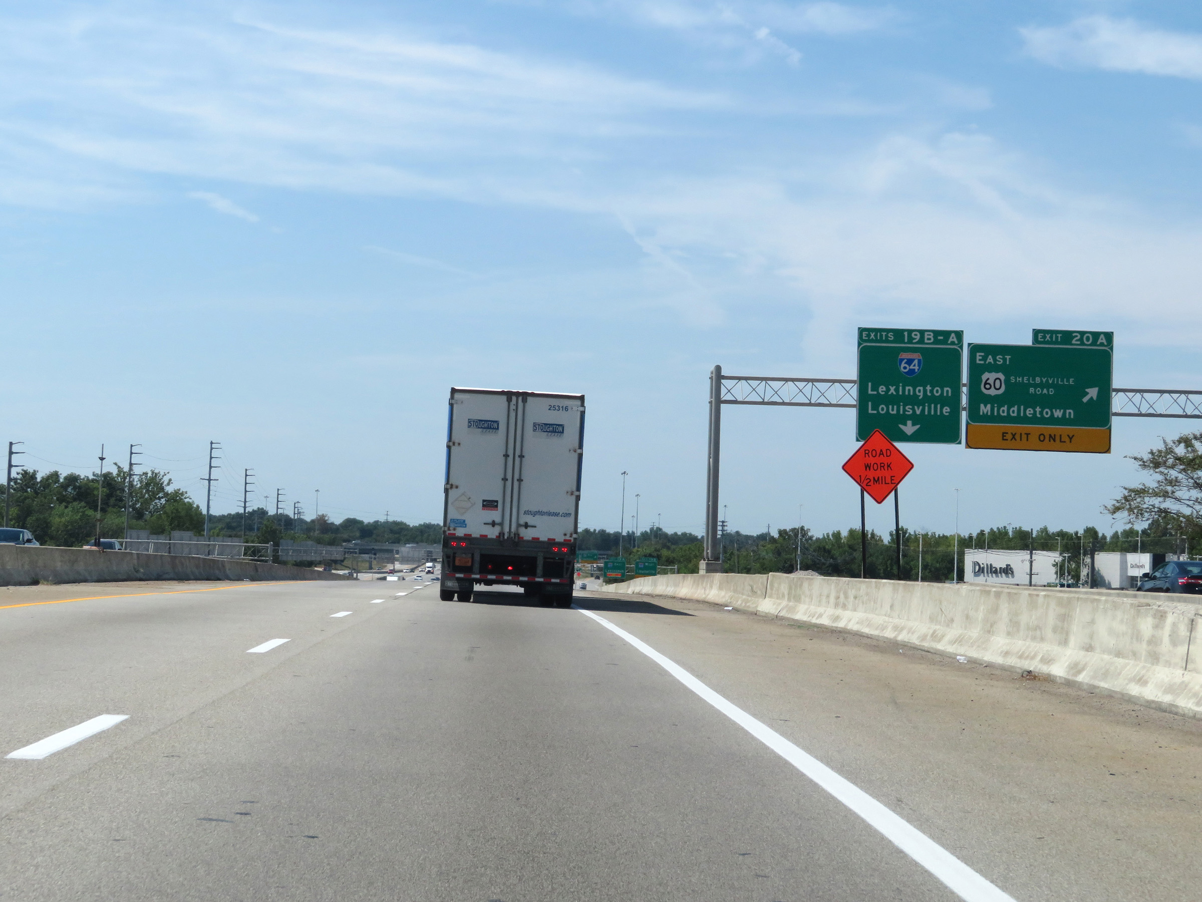
The collector/distributor road continues on the right and will provide access to Exits 19B-A ahead. (Photo taken 8/10/19). |
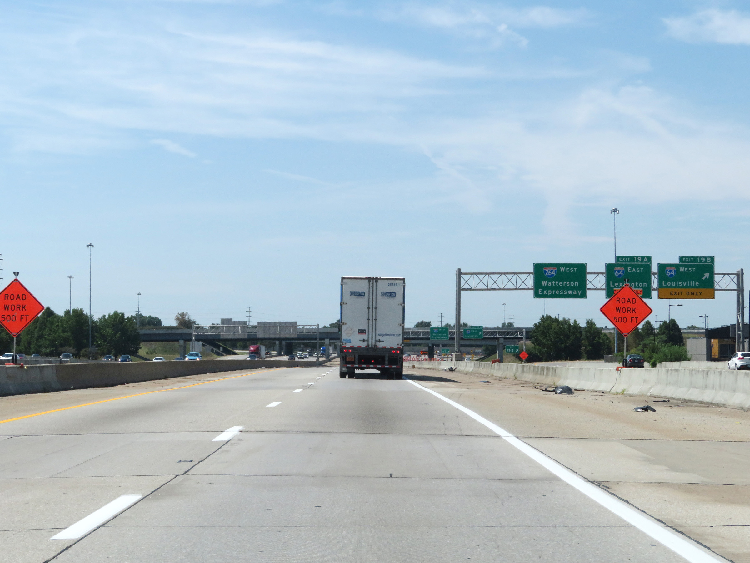 |
Interstate 264 West at Exit 19B: Interstate 64 West - Louisville (Photo taken 8/10/19). |
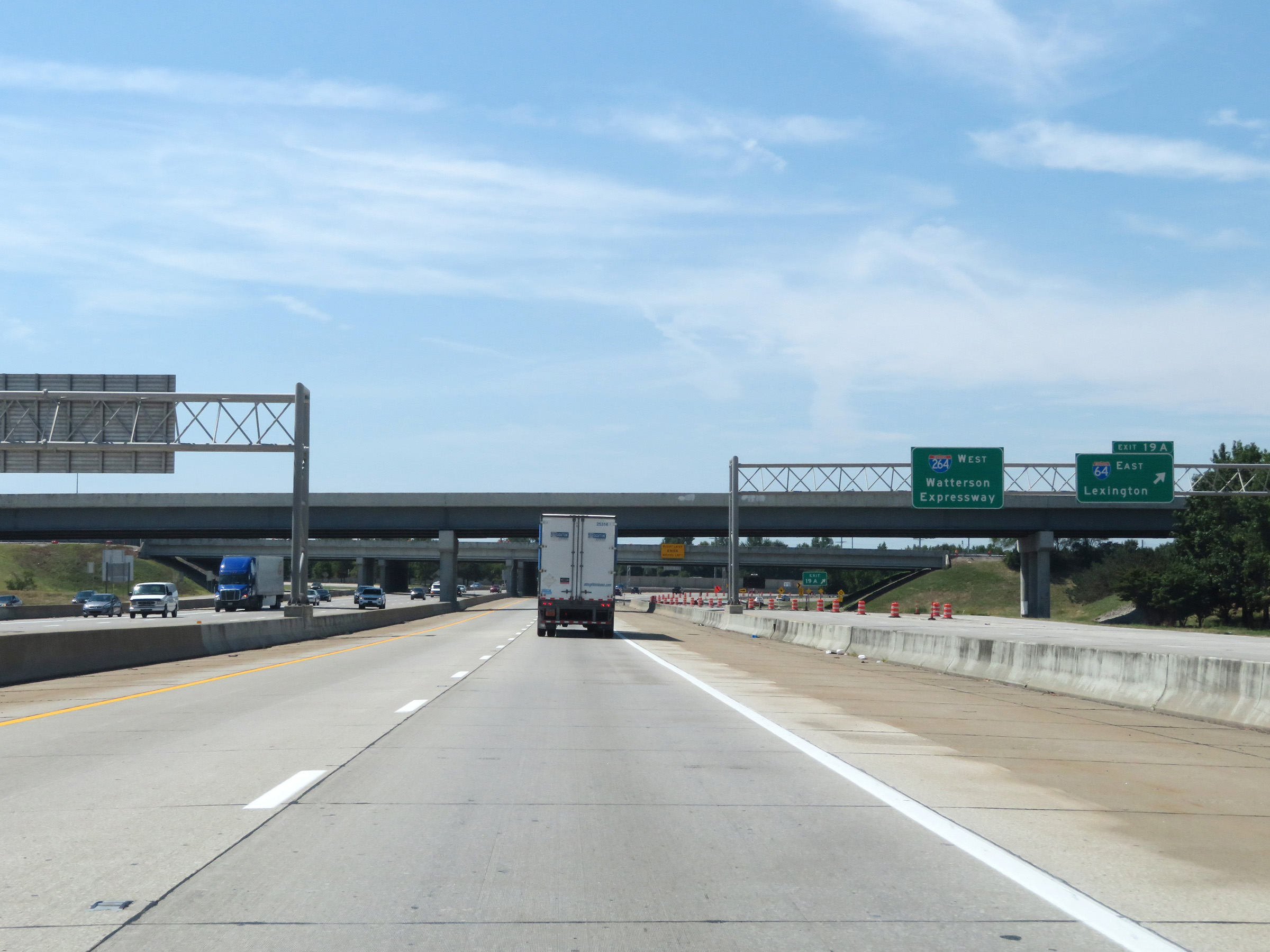 |
Interstate 264 West at Exit 19A: Interstate 64 East - Lexington (Photo taken 8/10/19). |
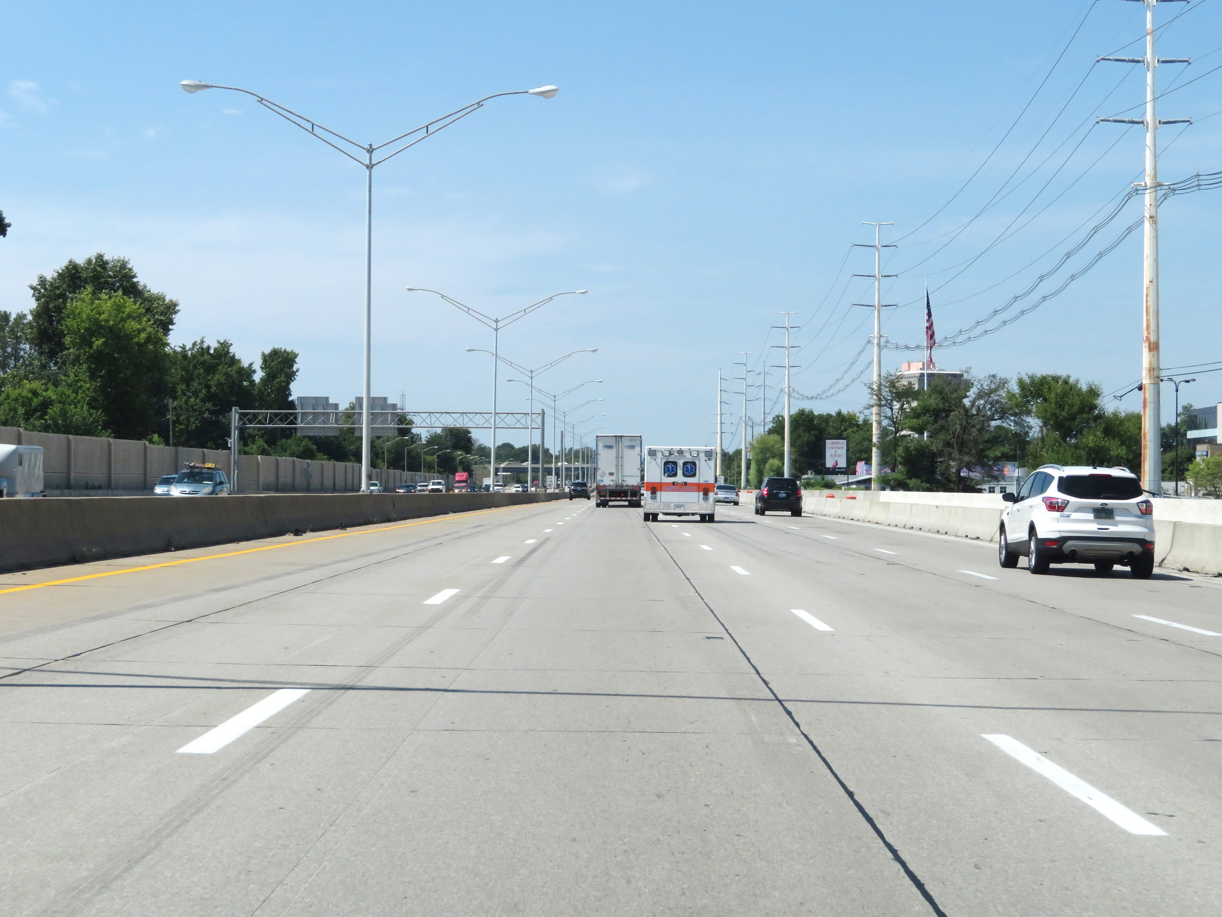 |
View on Interstate 264 West. (Photo taken 8/10/19). |
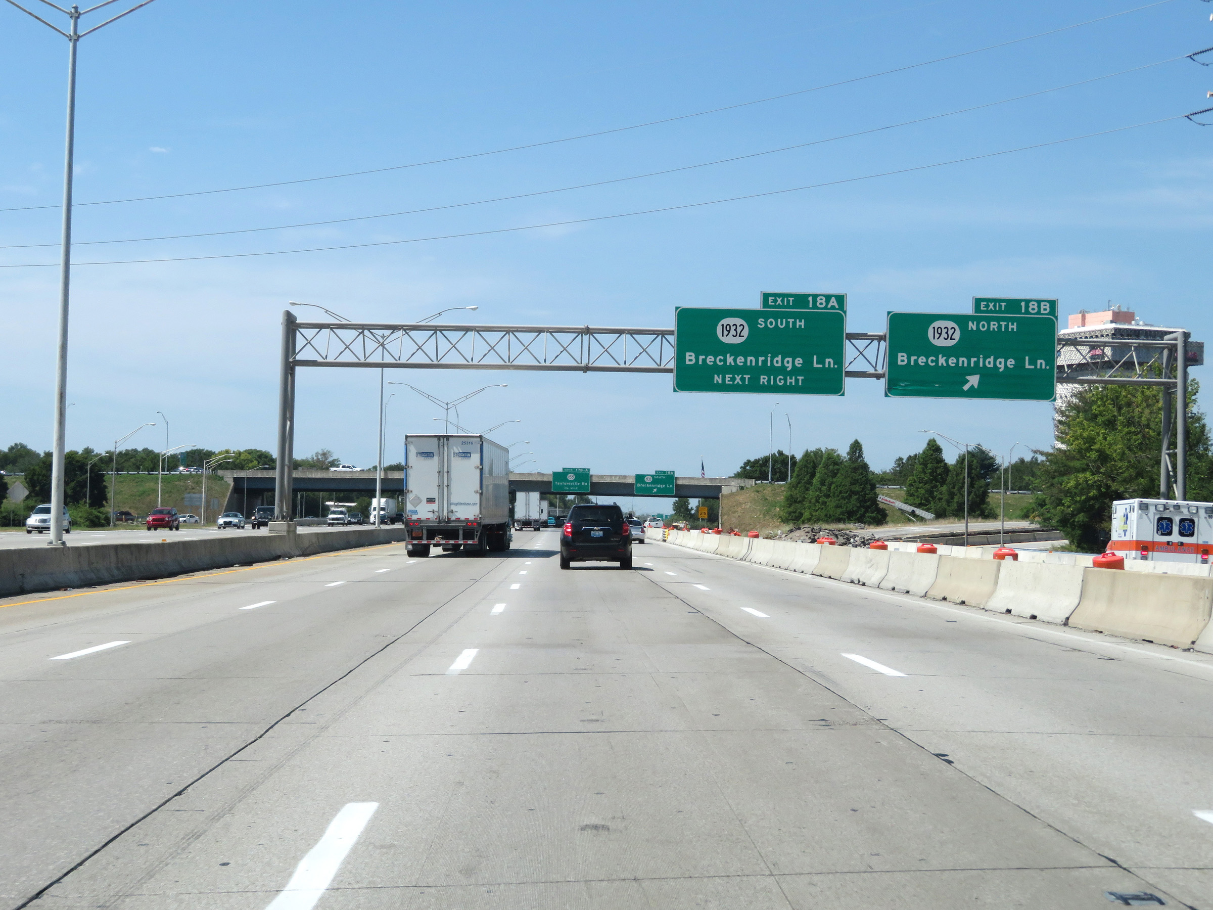 |
Interstate 264 West at Exit 18B: KY 1932 North - Breckenridge Ln (Photo taken 8/10/19). |
 |
Interstate 264 West at Exit 18A: KY 1932 South - Breckenridge Ln (Photo taken 8/10/19). |
 |
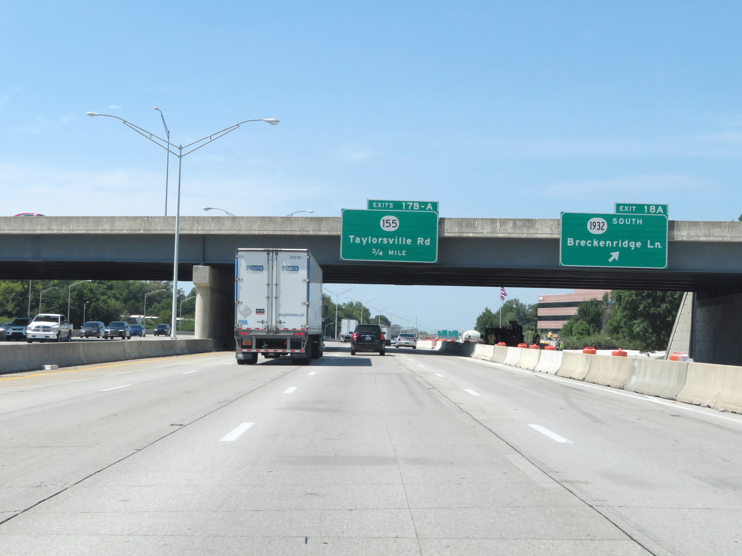
Interstate 264 West at Exit 17B: KY 155 North - Taylorsville Rd (Photo taken 8/10/19). |
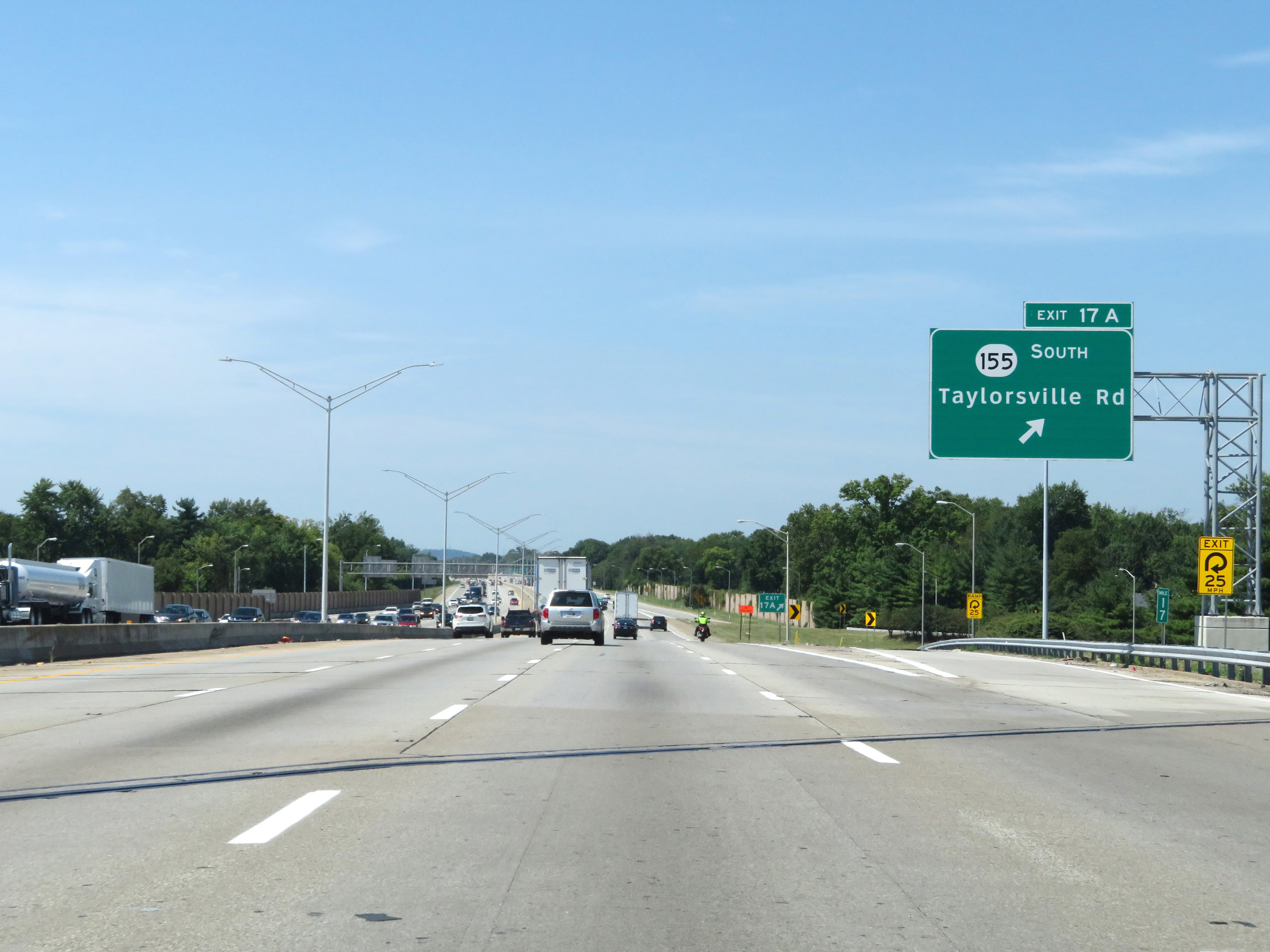 |
Interstate 264 West at Exit 17A: KY 155 South - Taylorsville Rd (Photo taken 8/10/19). |
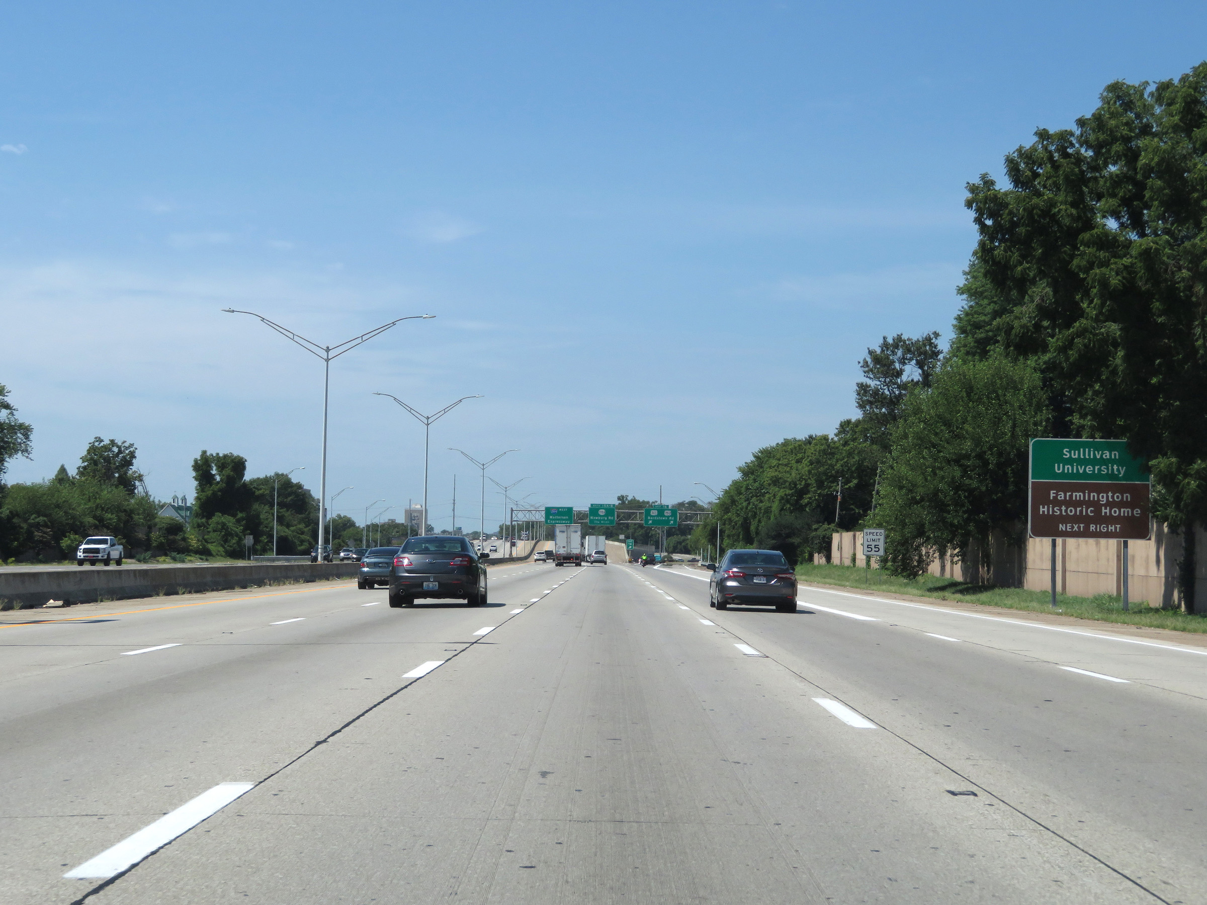 |
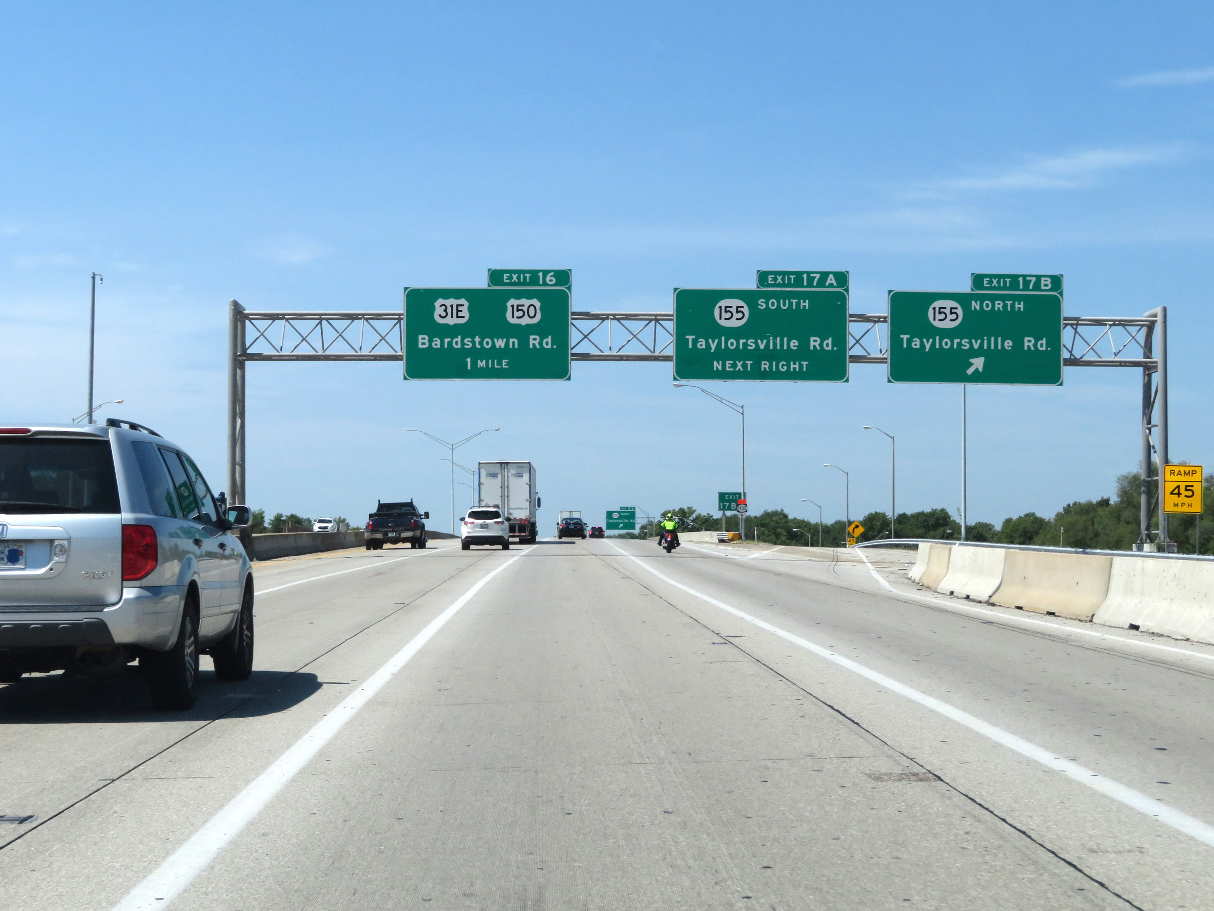
Take Exit 16 to Sullivan University and Farmington Historic Home. The speed limit remains 55 mph on Interstate 264 West. (Photo taken 8/10/19). |
 |
Interstate 264 West at Exit 16: US 31E / US 150 - Bardstown Rd (Photo taken 8/10/19). |
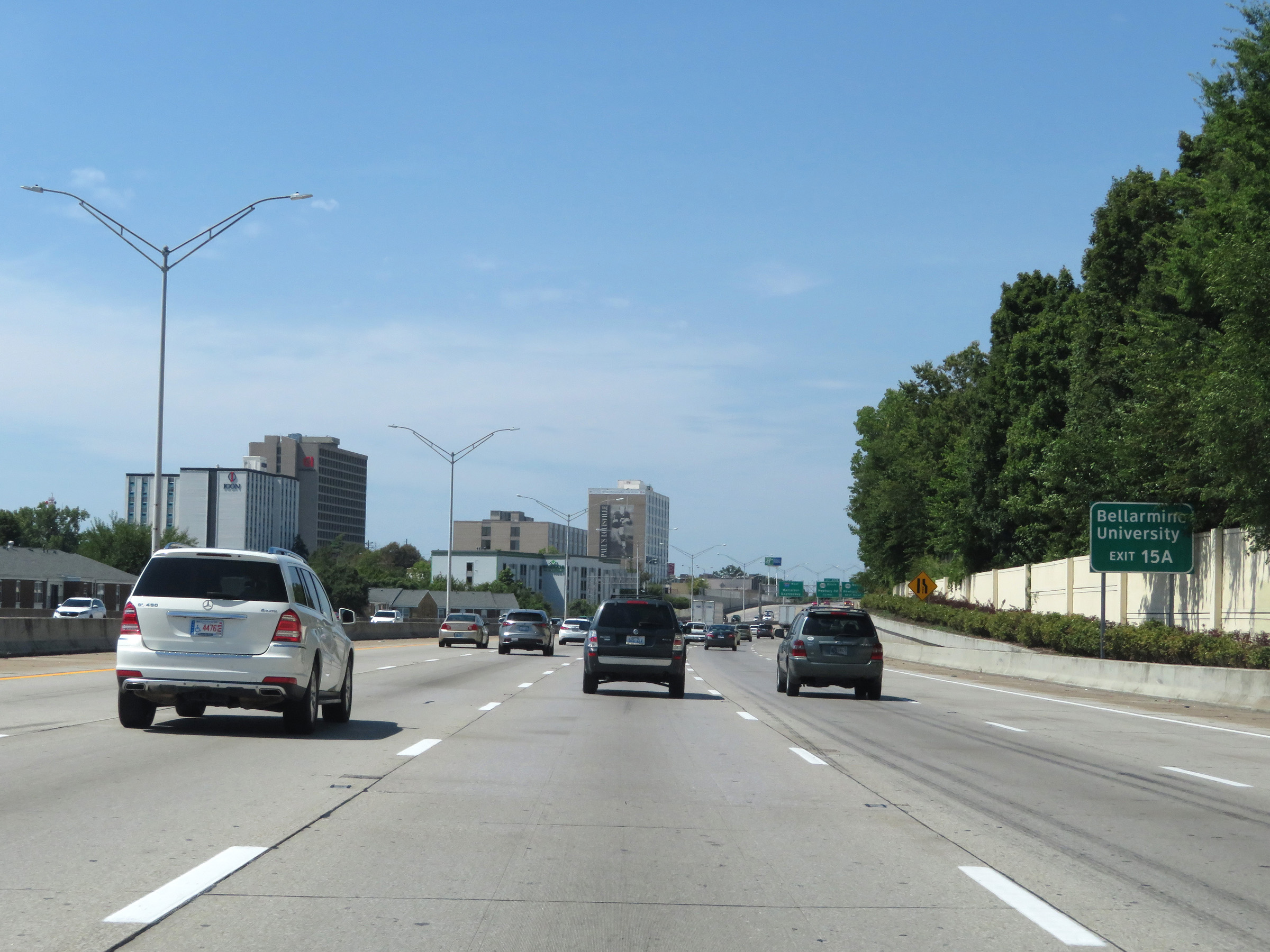 |
Take Exit 15A to Bellarmine University. (Photo taken 8/10/19). |
 |
Interstate 264 West at Exit 15A: KY 1703 North - Newburg Rd (Photo taken 8/10/19). |
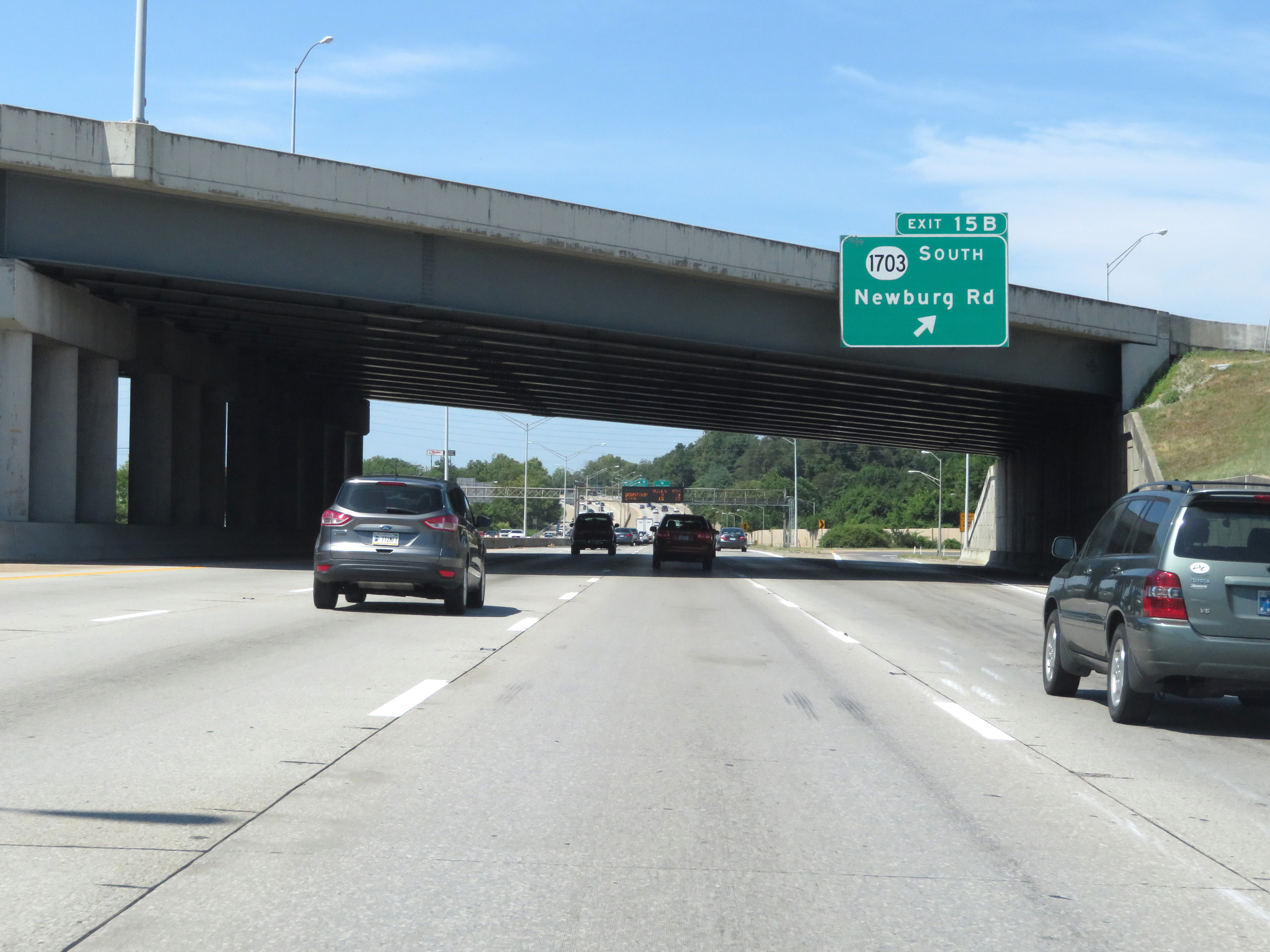 |
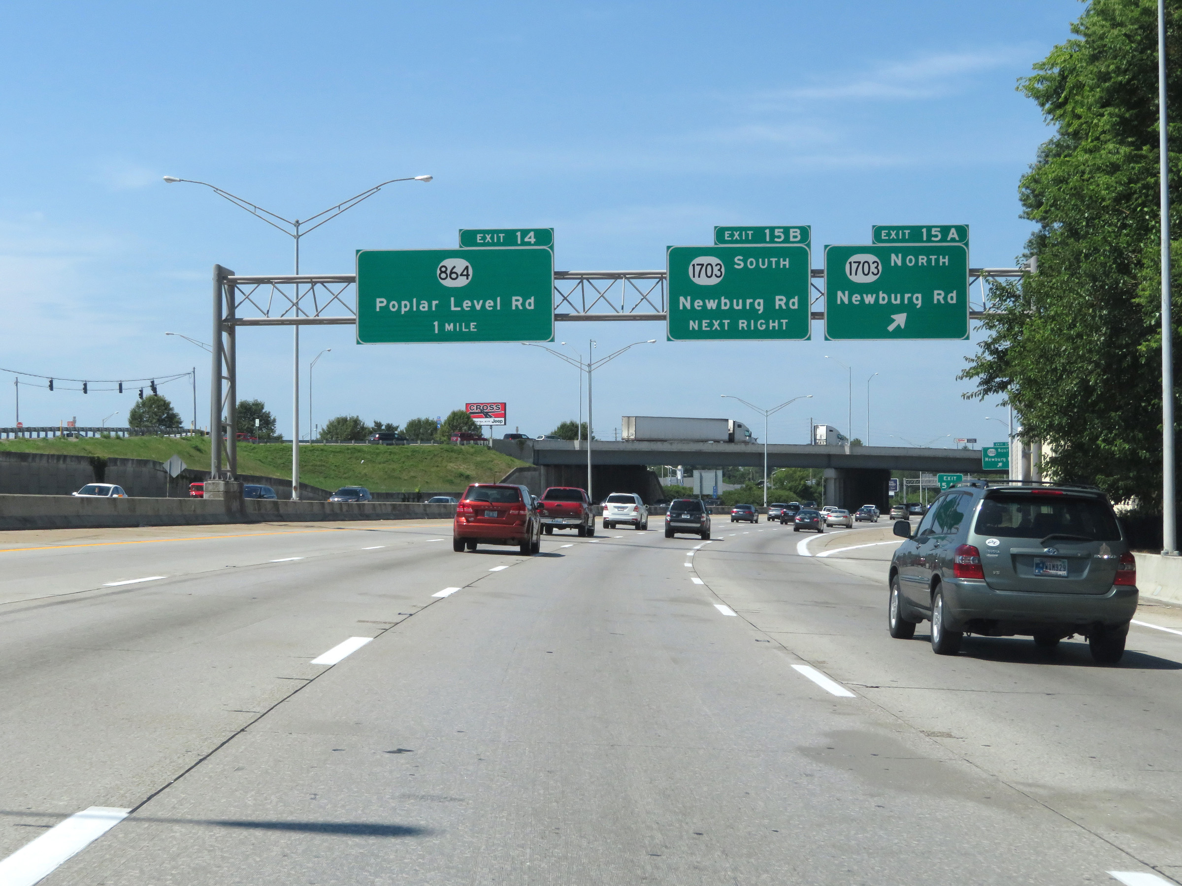
Interstate 264 West at Exit 15B: KY 1703 South - Newburg Rd (Photo taken 8/10/19). |
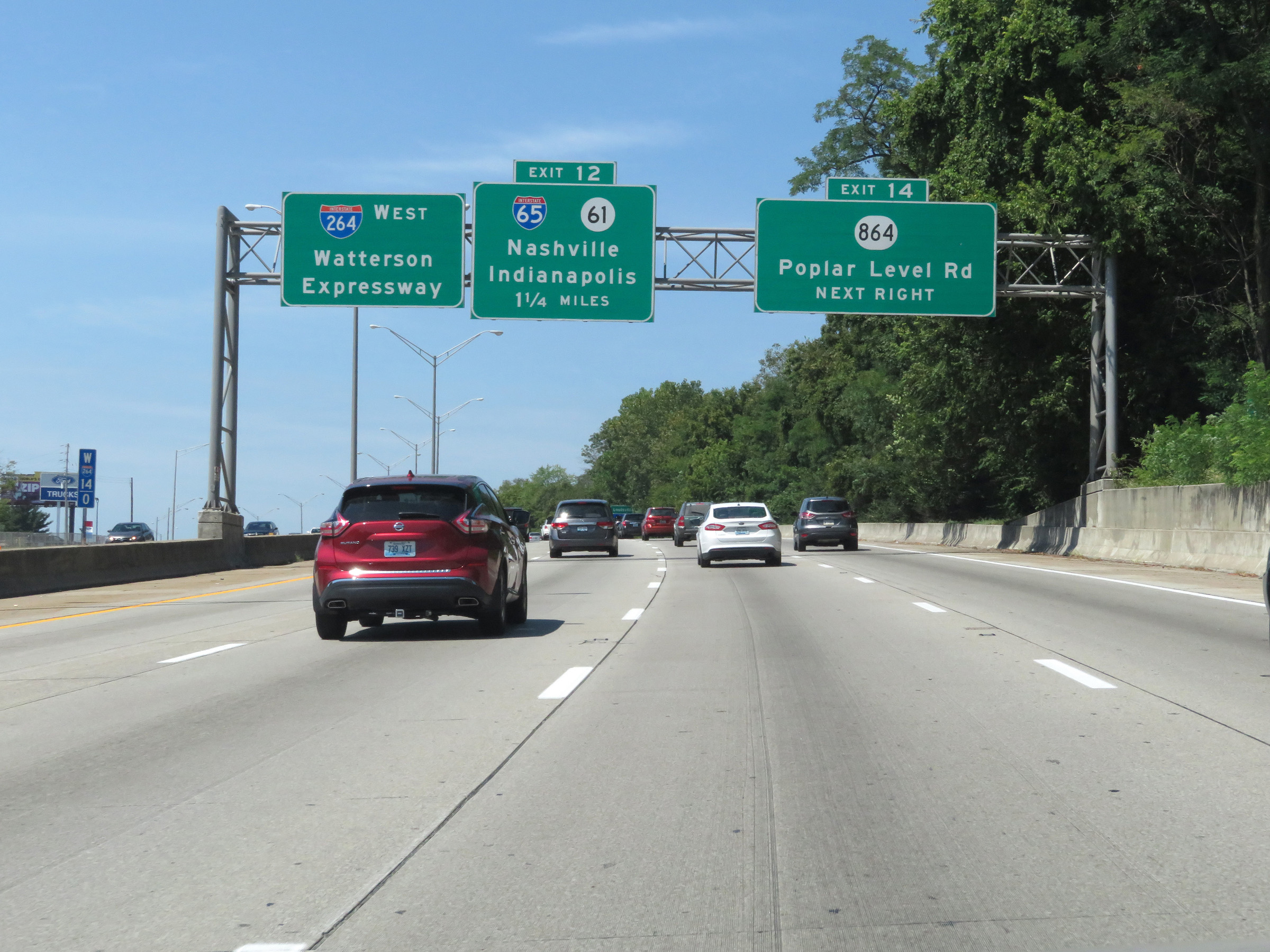 |
Interstate 264 West approaching Exit 12 - 1 1/4 miles. (Photo taken 8/10/19). |
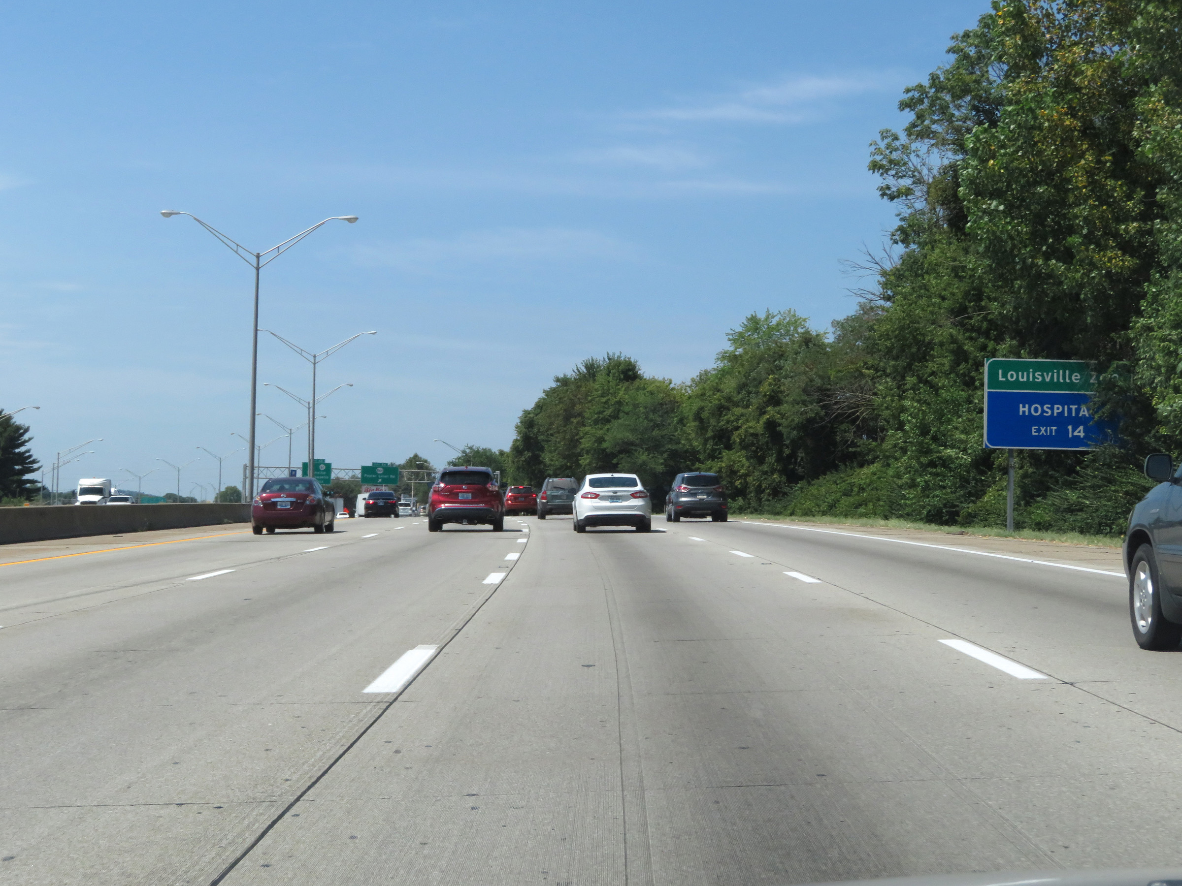 |
Take Exit 14 to the Louisville Zoo. (Photo taken 8/10/19). |
 |
Interstate 264 West at Exit 14: KY 864 - Poplar Level Rd (Photo taken 8/10/19). |
 |
Take Exit 12 to KY 61 (Preston Hwy). It is accessible from the collector/distributor road which also serves the ramps to Interstate 65. (Photo taken 8/10/19). |
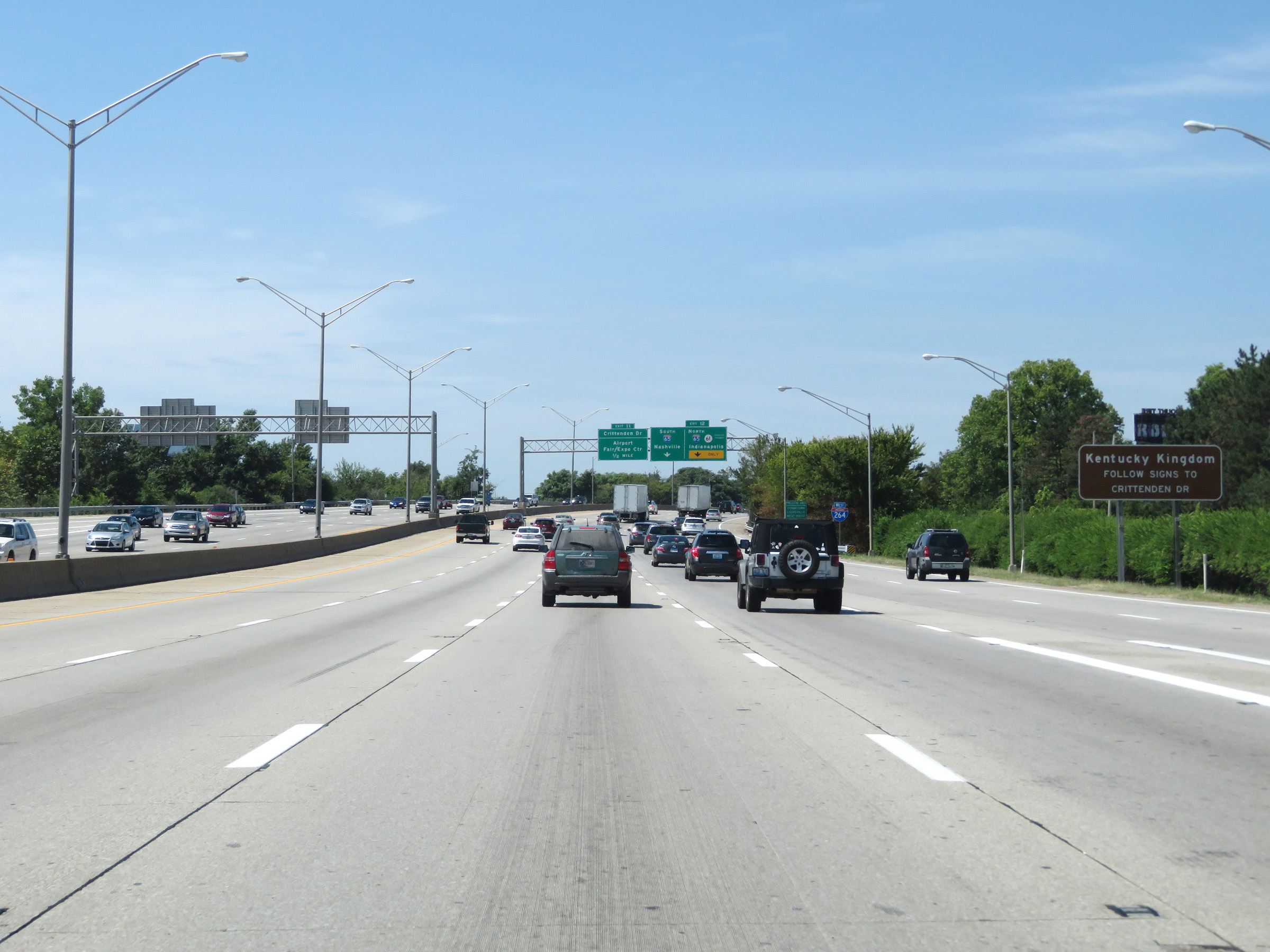 |
Take Exit 11 to Kentucky Kingdom. (Photo taken 8/10/19). |
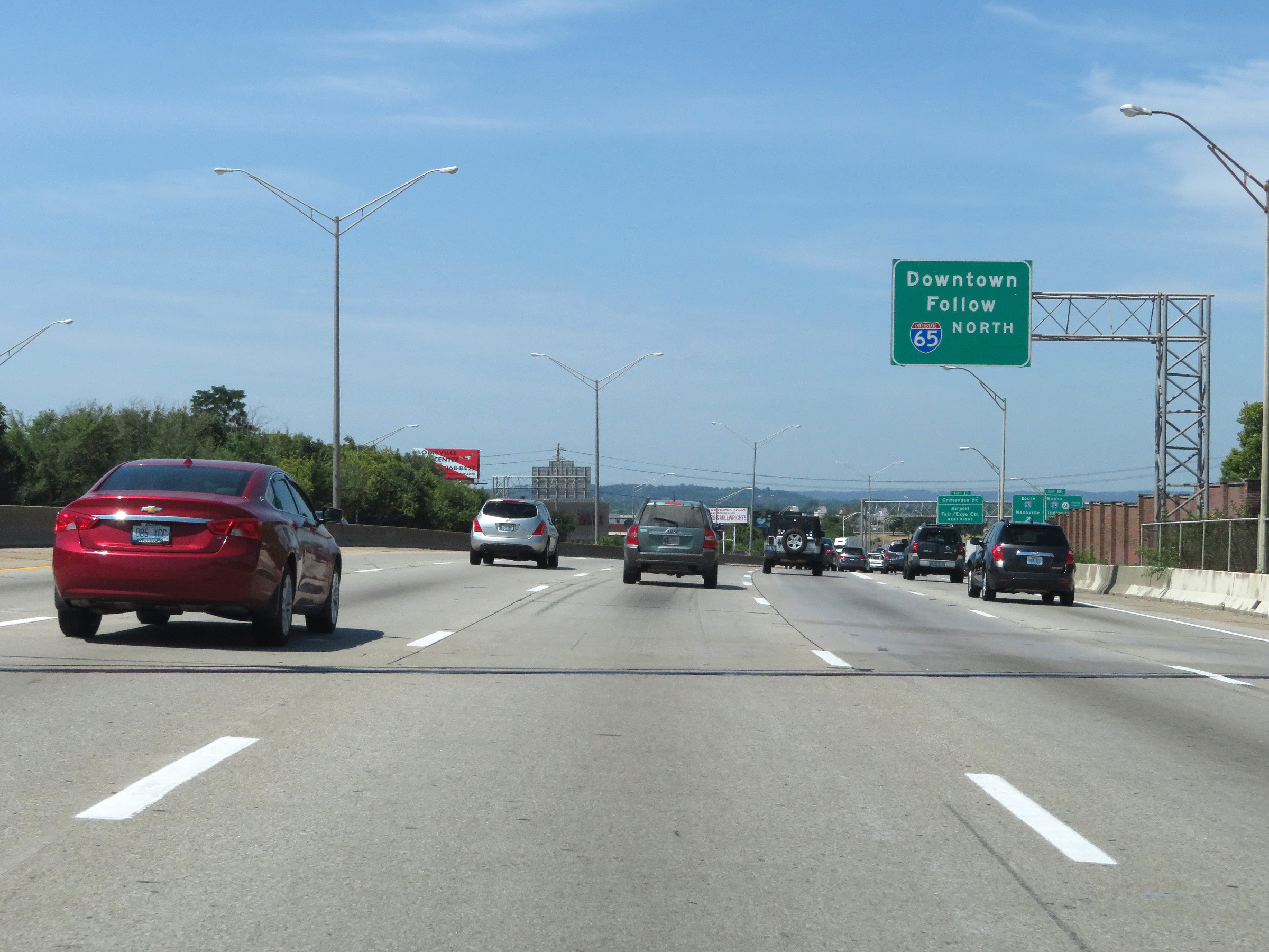 |
Follow Interstate 65 North via Exit 12 to access downtown Louisville. (Photo taken 8/10/19). |
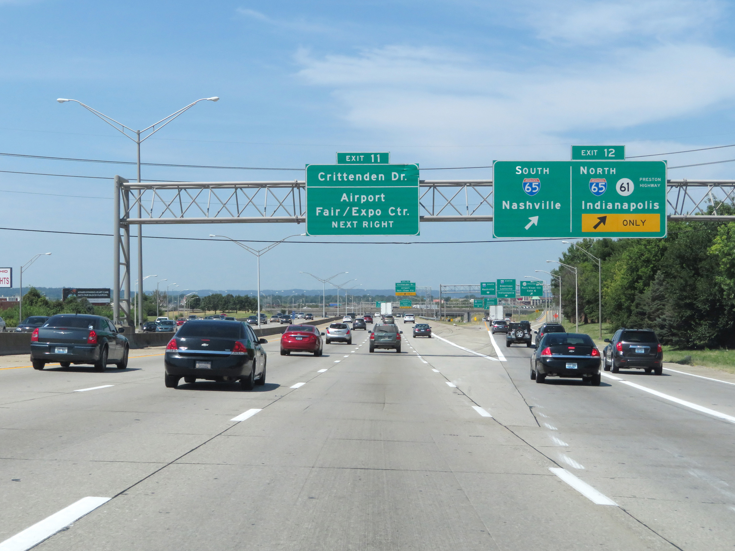 |
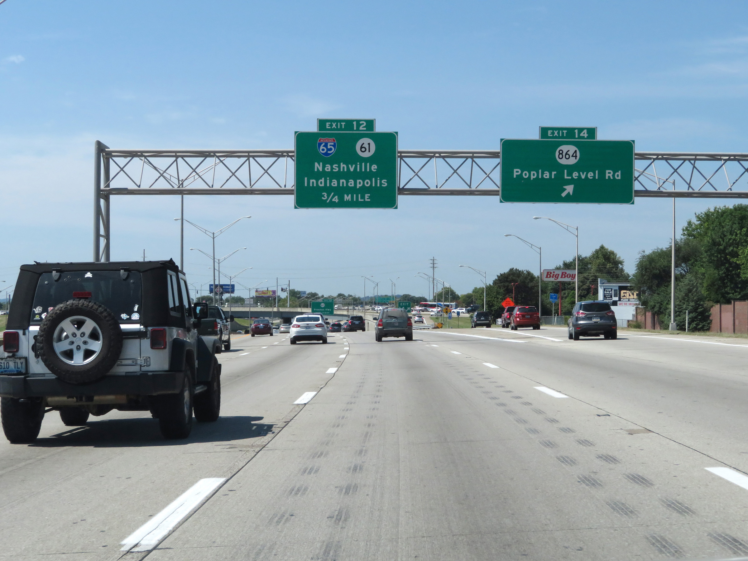
Interstate 264 West at Exit 12: Interstate 65 / KY 61 - Nashville / Indianapolis / Preston Hwy (Photo taken 8/10/19). |
 |
As this collector/distributor road begins, we see the ramp to KY 61 (Preston Hwy). (Photo taken 8/10/19). |
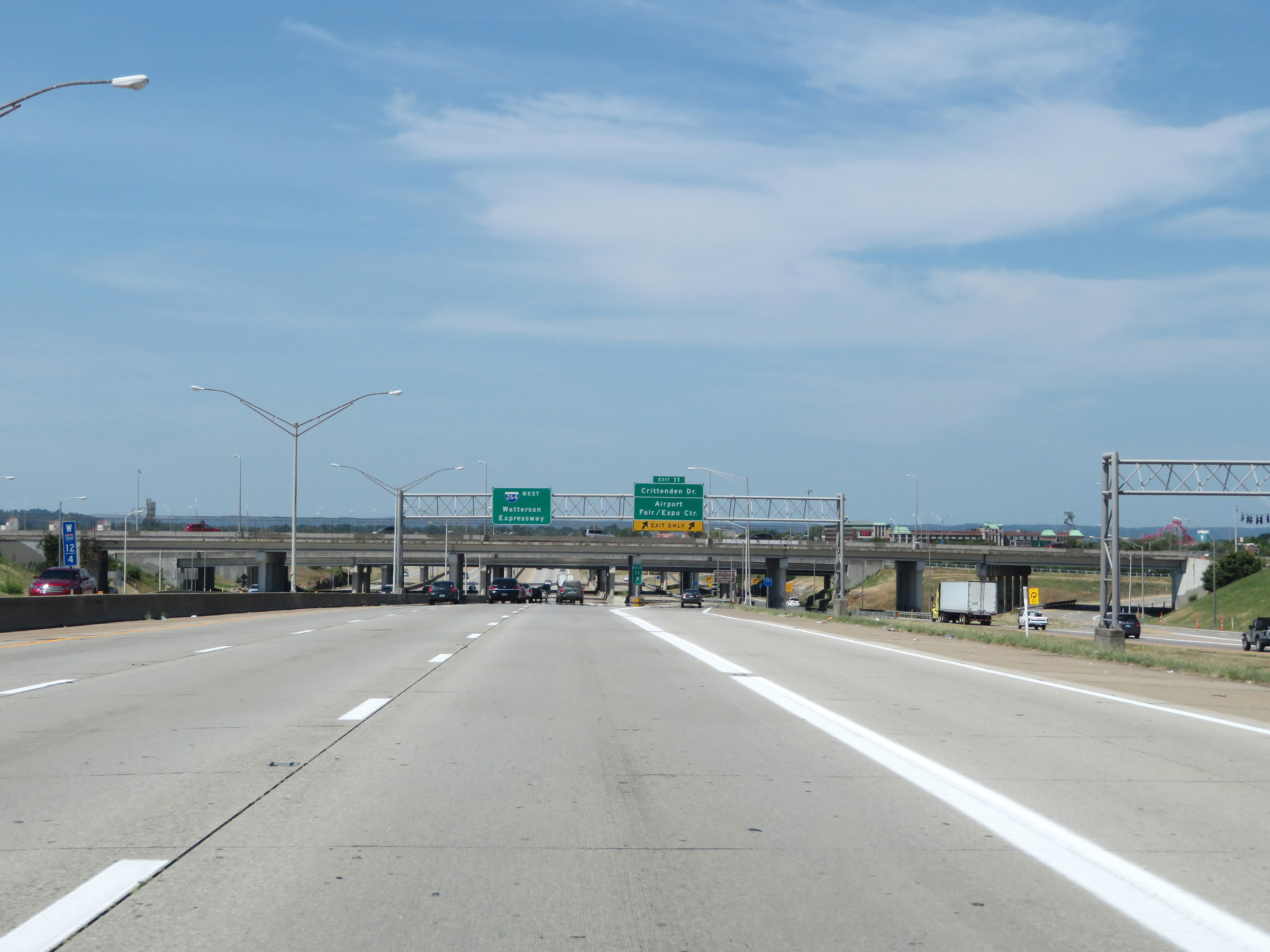 |
View on Interstate 264 West at mile marker 12.4. (Photo taken 8/10/19). |
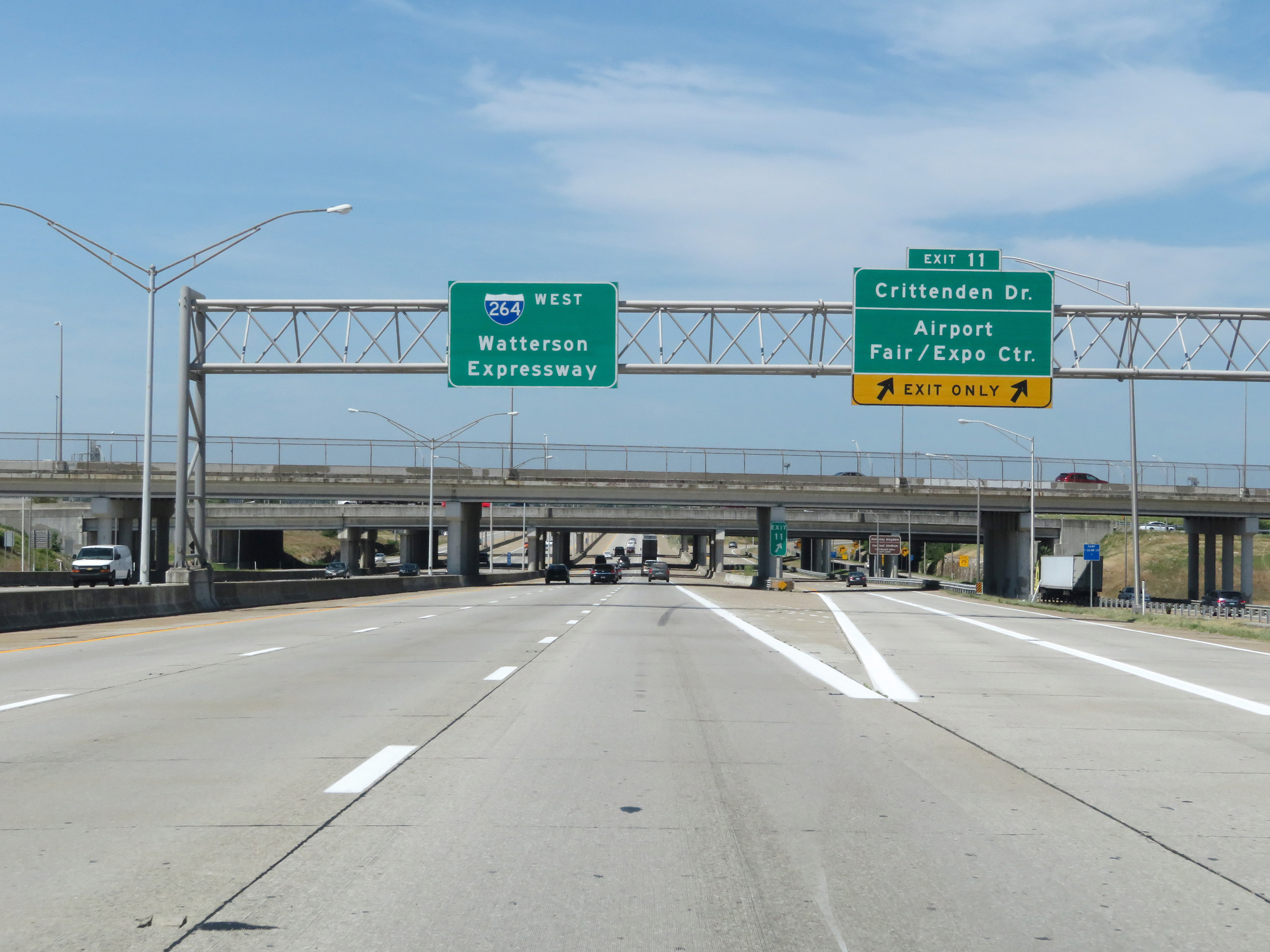 |
Interstate 264 West at Exit 11: Crittenden Dr / Airport / Fair/Expo Center (Photo taken 8/10/19). |
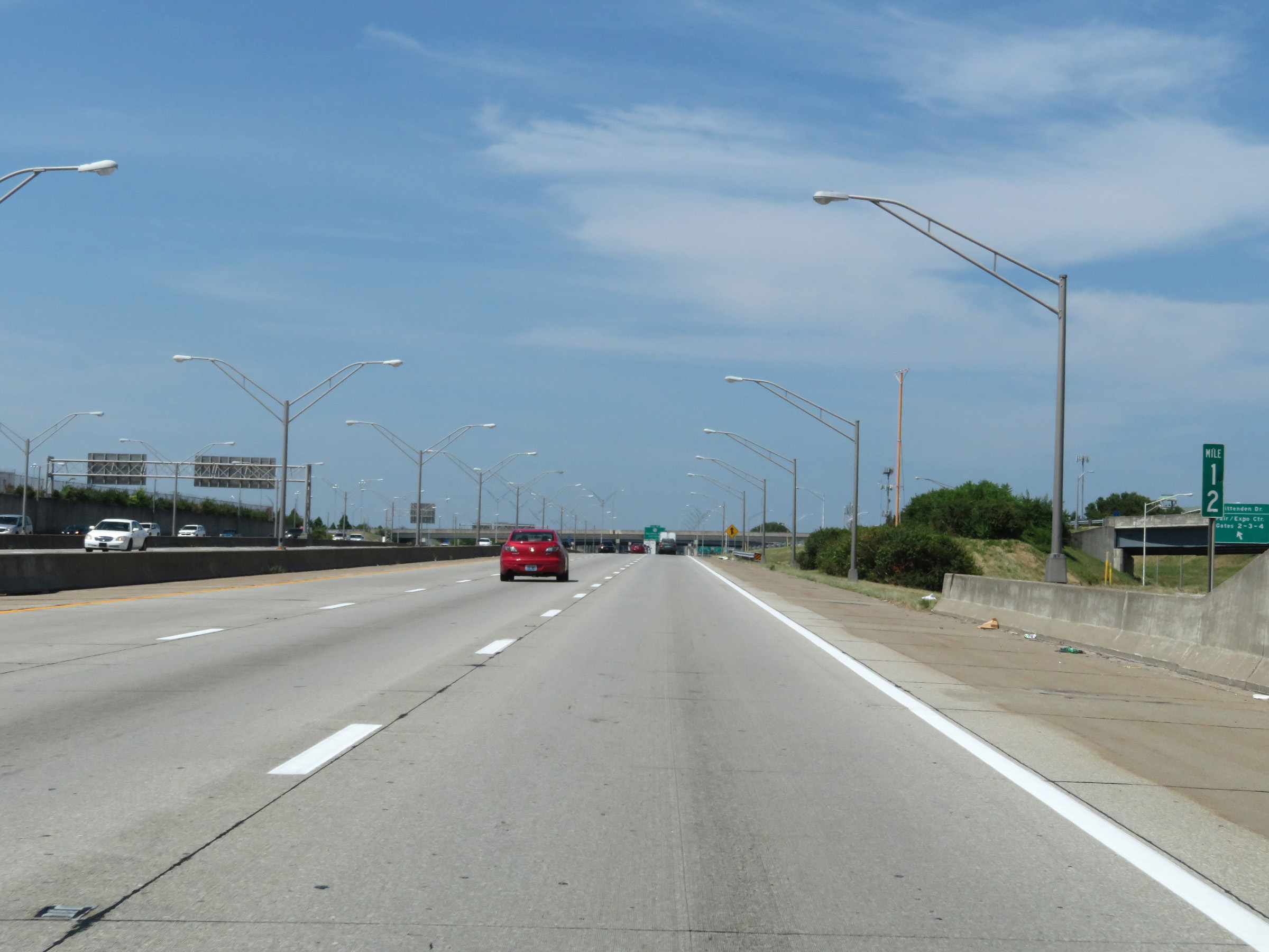 |
Mile marker 12 on Interstate 264 West. (Photo taken 8/10/19). |
 |
Another Interstate 264 West reassurance shield. (Photo taken 8/10/19). |
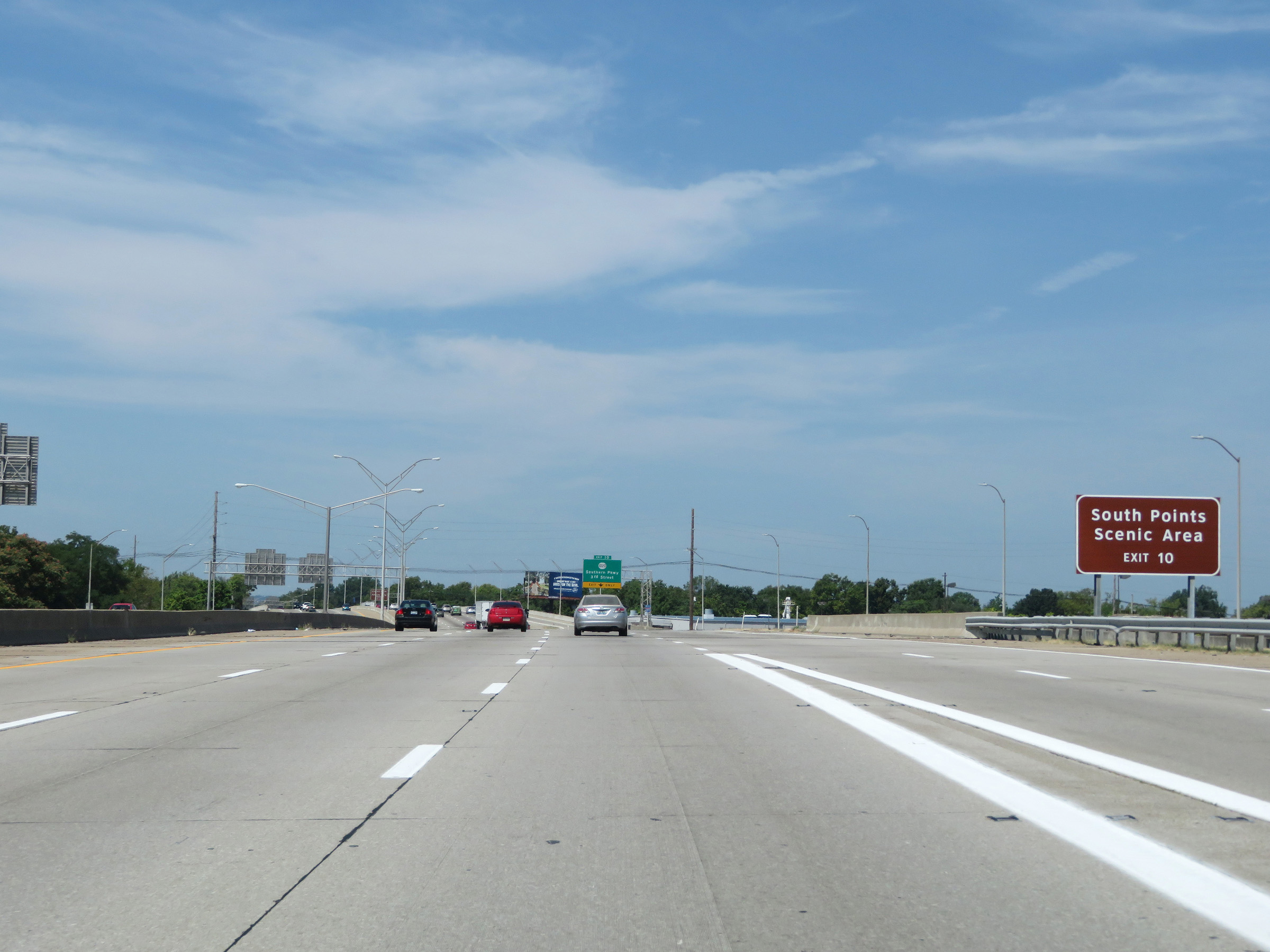 |
Take Exit 10 to South Points Scenic Area. (Photo taken 8/10/19). |
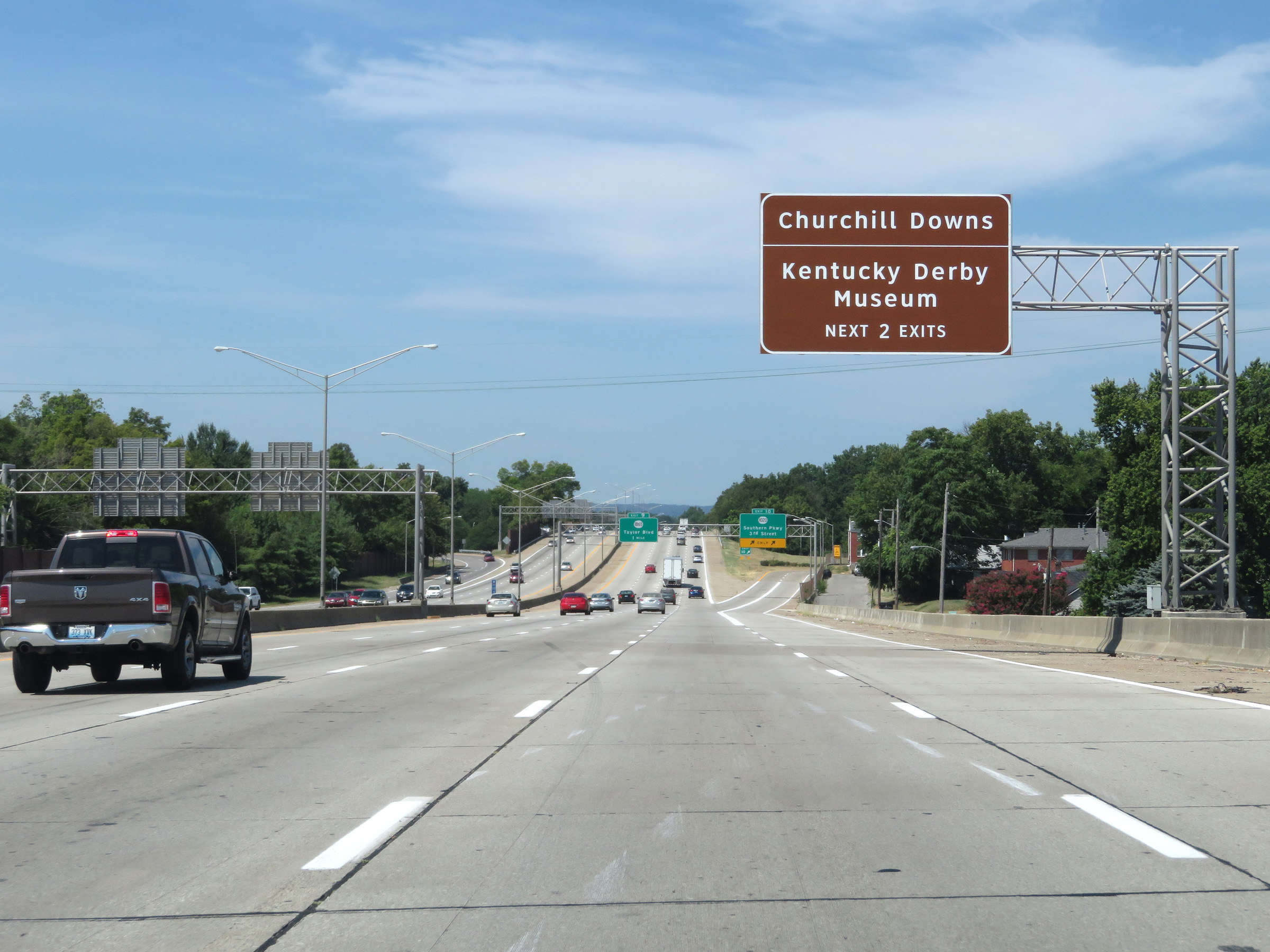 |
Take either of the next 2 exits to Churchill Downs and the Kentucky Derby Museum. (Photo taken 8/10/19). |
 |
Interstate 264 West at Exit 10: KY 1020 - Southern Pkwy / 3rd Street (Photo taken 8/10/19). |
 |
The speed limit on Interstate 264 West remains 55 mph. (Photo taken 8/10/19). |
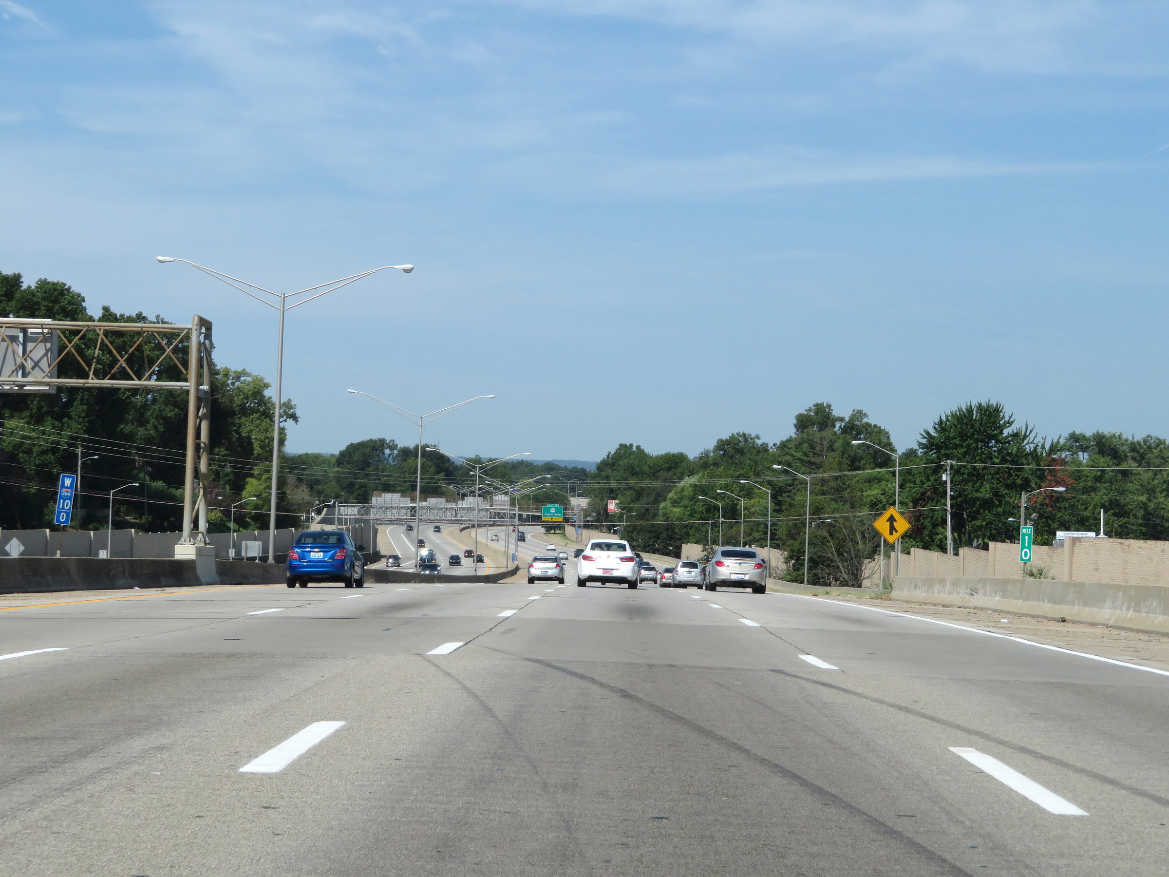 |
View on Interstate 264 West at mile marker 10. (Photo taken 8/10/19). |
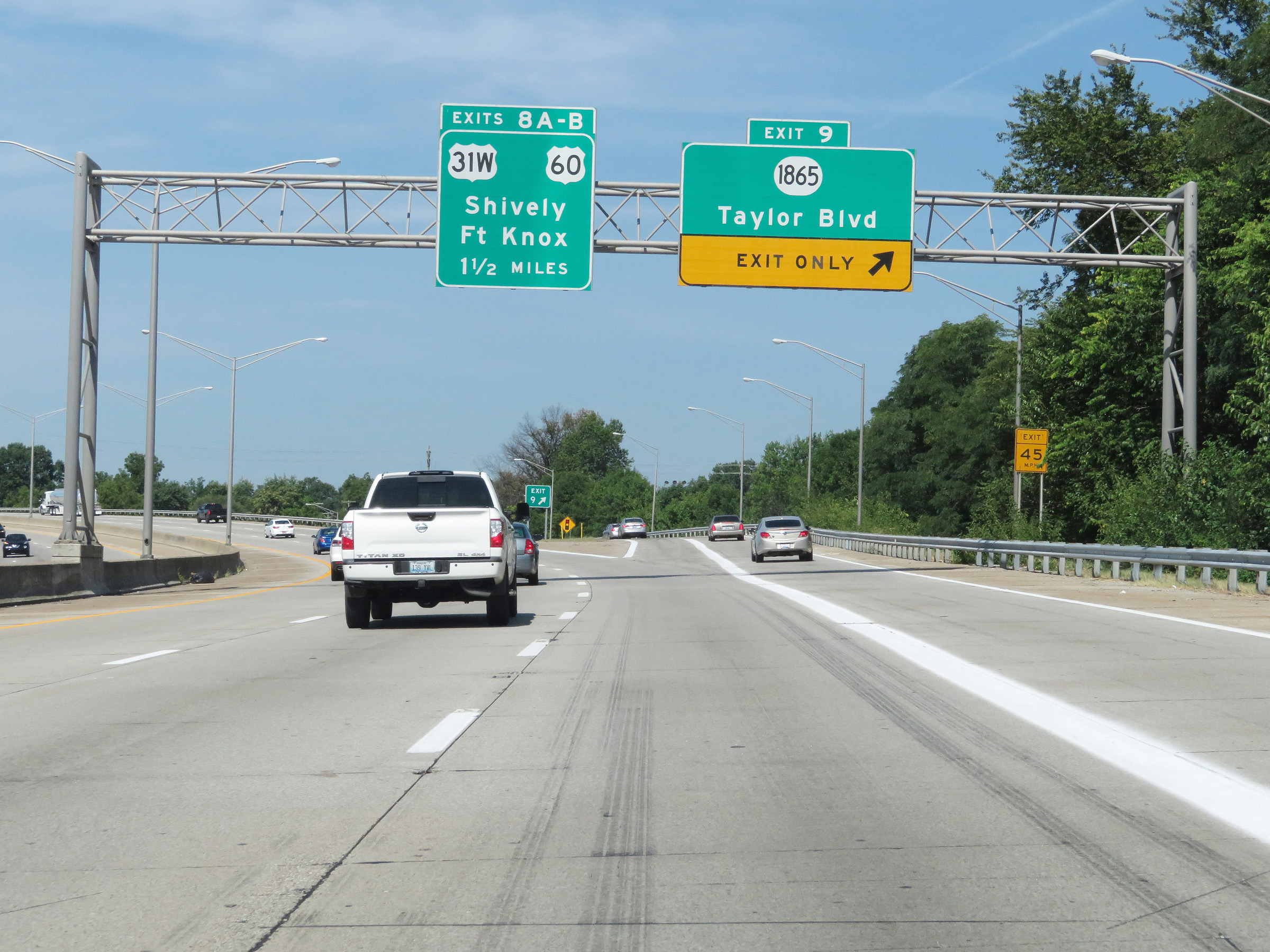 |
Interstate 264 West at Exit 9: KY 1865 - Taylor Blvd (Photo taken 8/10/19). |
 |
View on Interstate 264 West at mile marker 9. (Photo taken 8/10/19). |
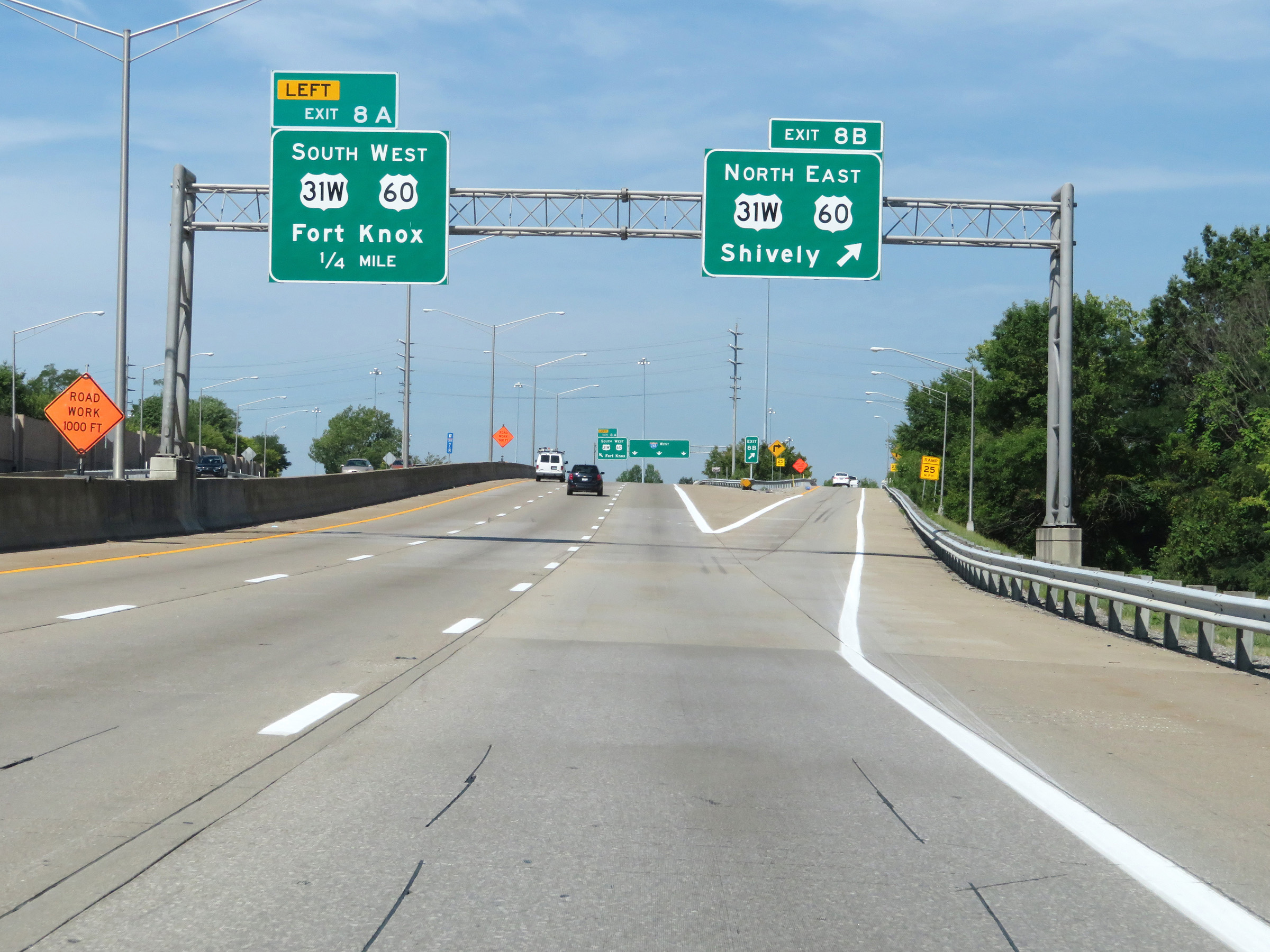 |
Interstate 264 West at Exit 8B: US 31W North / US 60 East - Shively (Photo taken 8/10/19). |
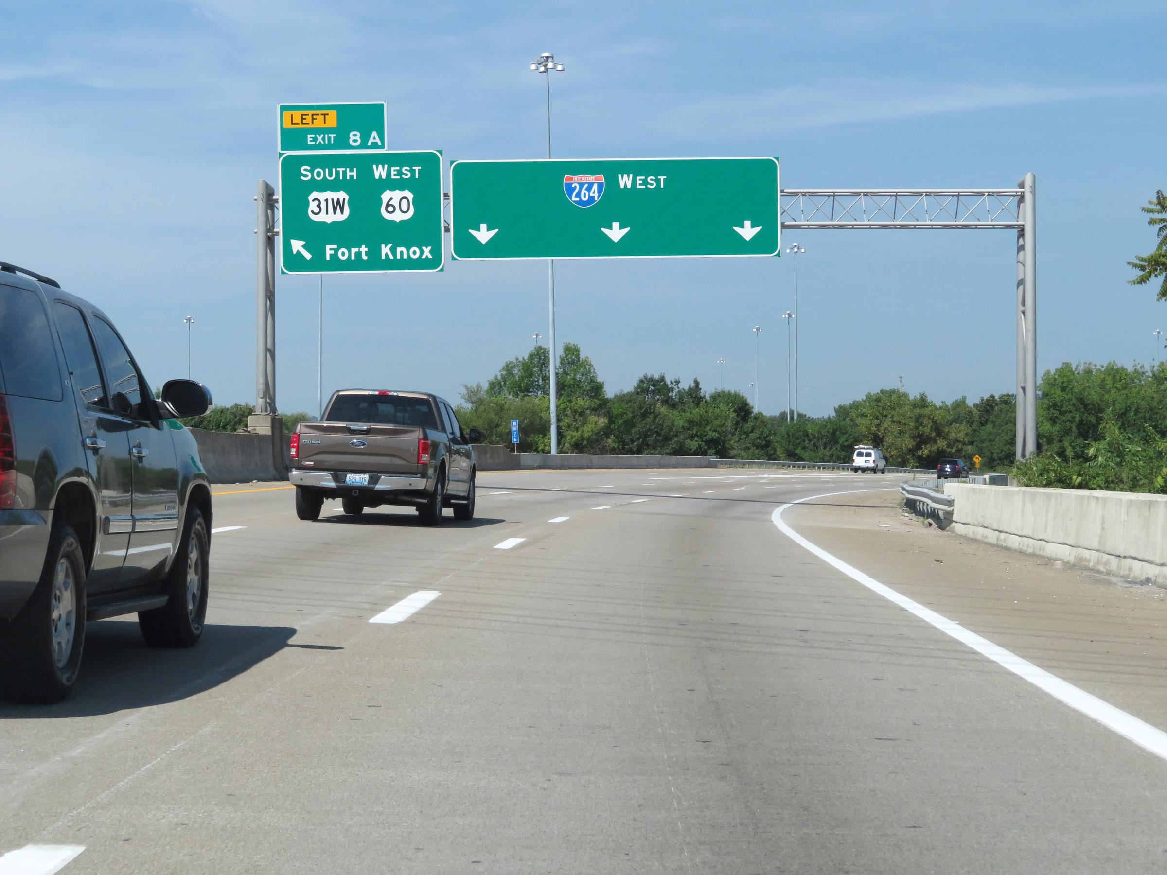 |
Interstate 264 West at Exit 8A: US 31W South / US 60 West - Fort Knox (Photo taken 8/10/19). |
 |
A closer view of the ramp for Exit 8A, on the left. (Photo taken 8/10/19). |
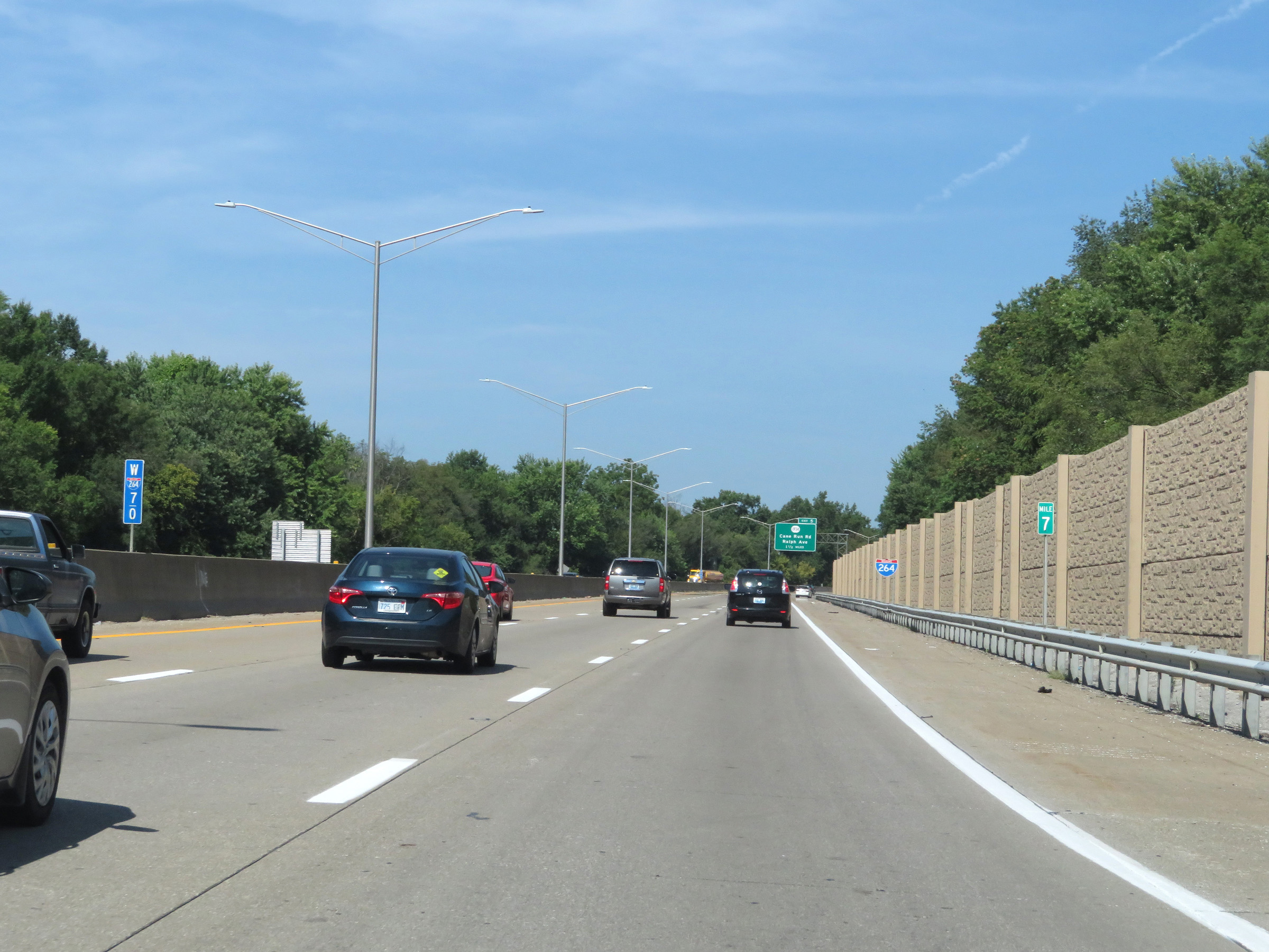 |
View on Interstate 264 West at mile marker 7. (Photo taken 8/10/19). |
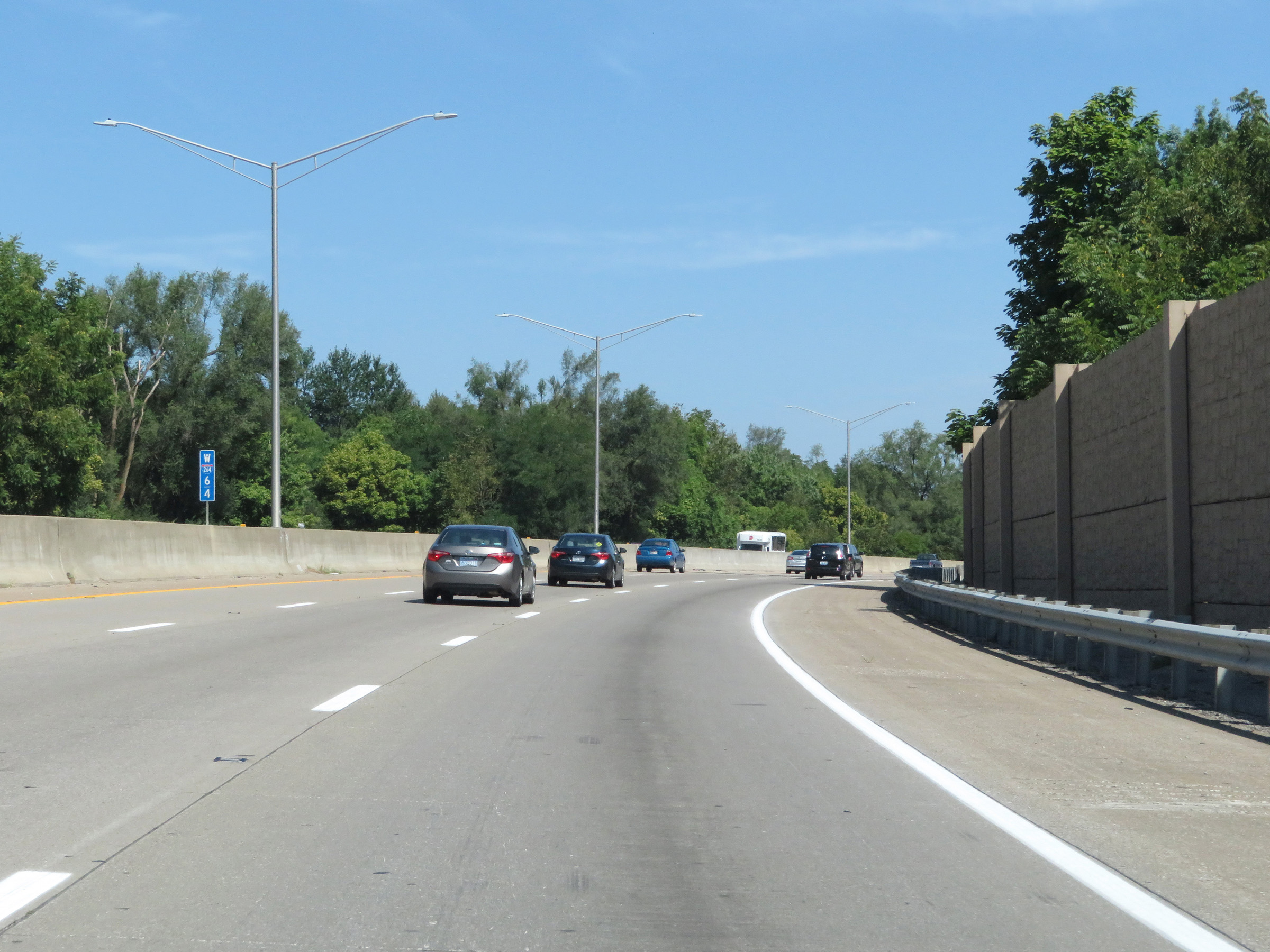 |
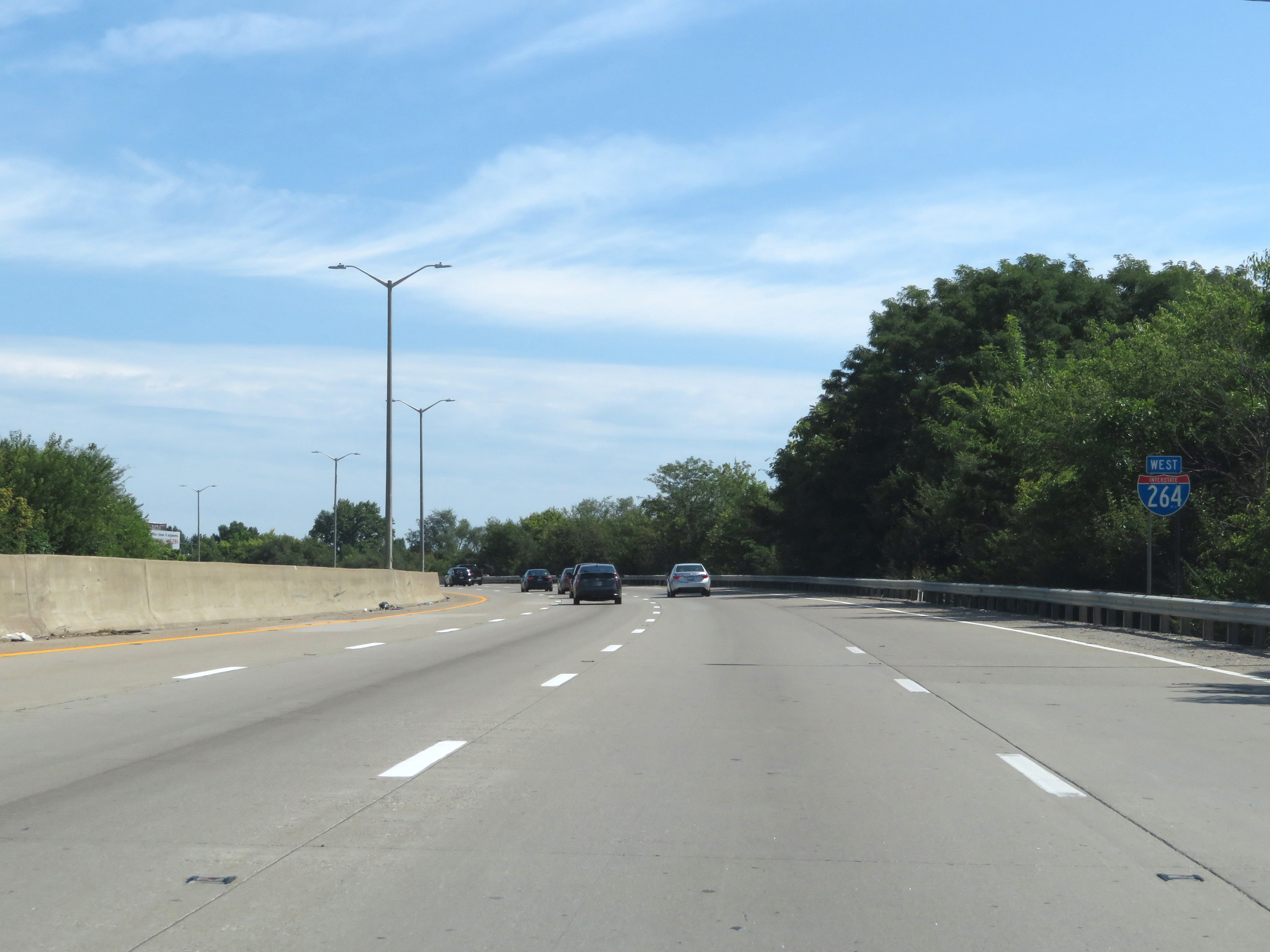
At mile marker 6.4, Interstate 264 West begins to curve to the north at the southwestern corner of the Louisville metro area. (Photo taken 8/10/19). |
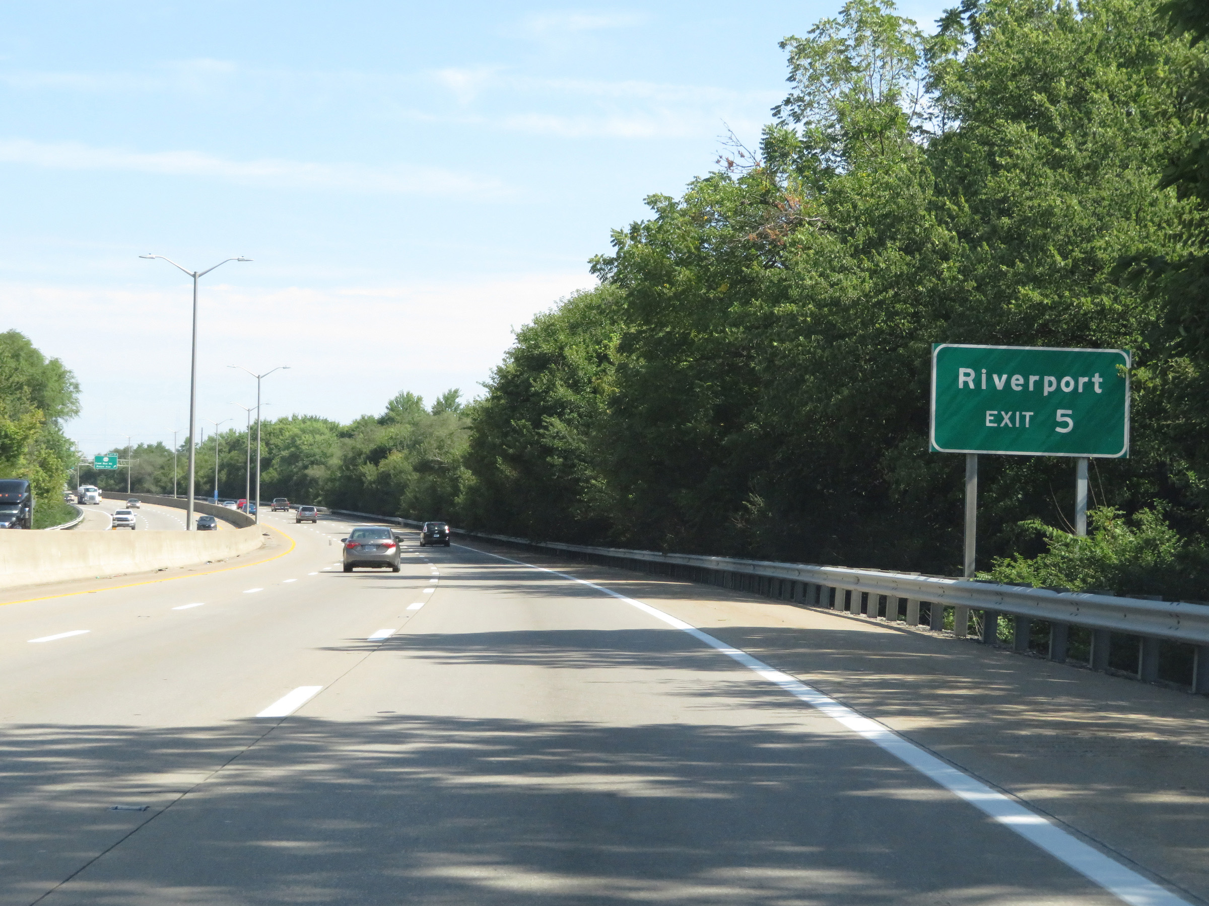 |
Take Exit 5 to Riverport. (Photo taken 8/10/19). |
 |
Interstate 264 West at Exit 5: KY 1934 - Cane Run Rd / Ralph Ave (Photo taken 8/10/19). |
 |
Interstate 264 West reassurance shield. (Photo taken 8/10/19). |
 |
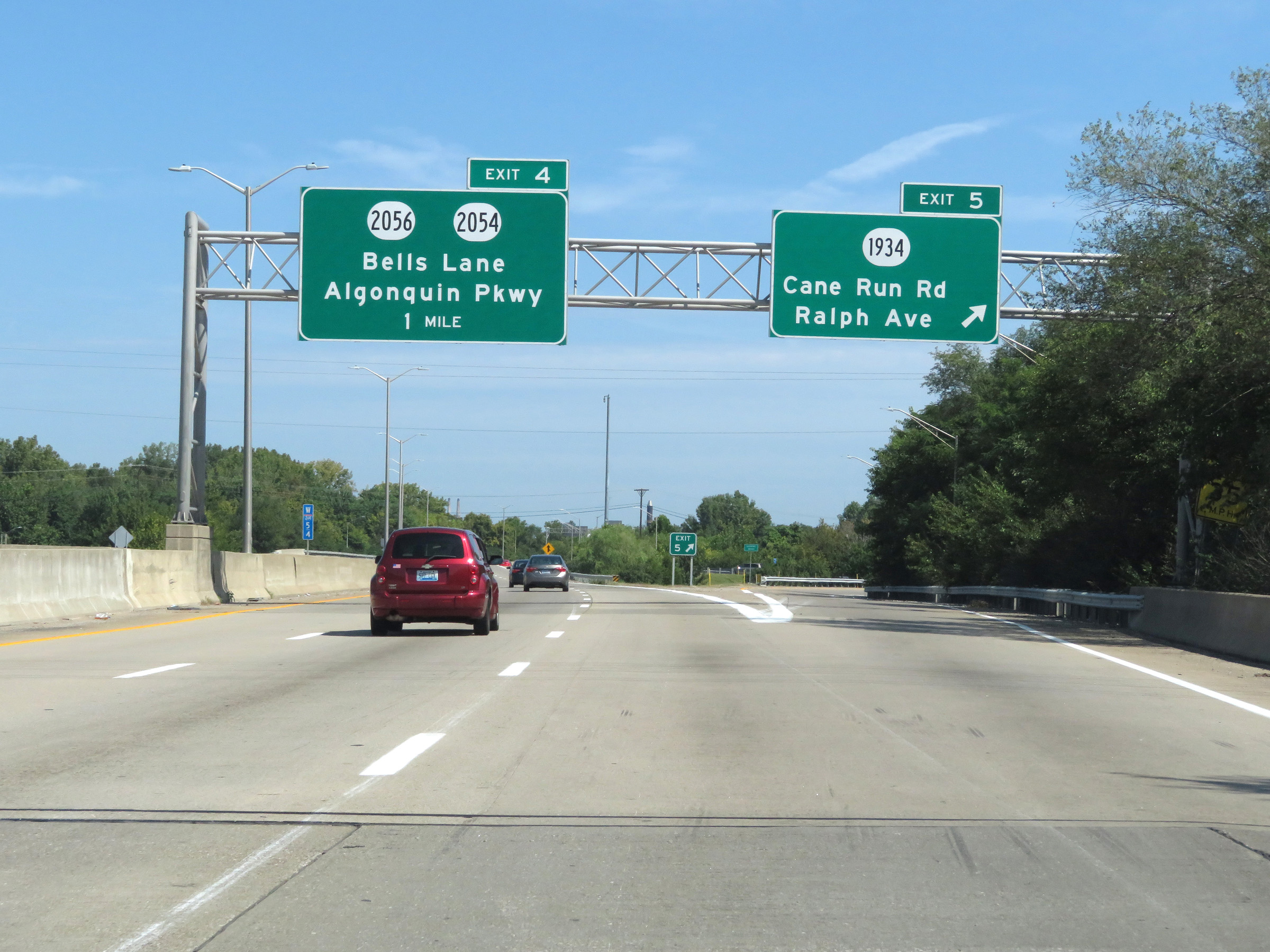
Interstate 264 West at Exit 4: KY 2056 / KY 2054 - Bells Lane / Algonquin Pkwy (Photo taken 8/10/19). |
 |
Interstate 264 West at Exit 3: Dumesnil St / Virginia Ave (Photo taken 8/10/19). |
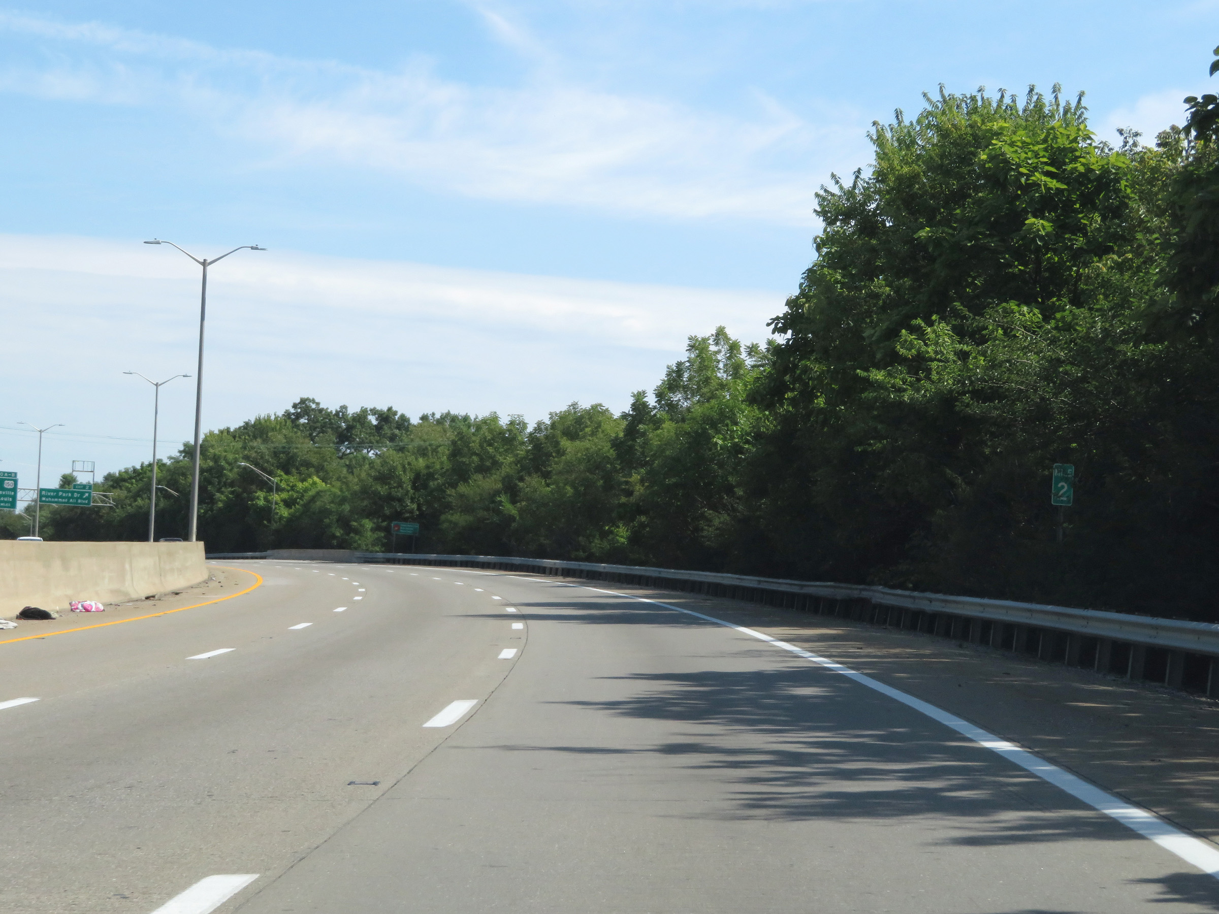 |
View on Interstate 264 West at mile marker 2. (Photo taken 8/10/19). |
 |
Interstate 264 West at Exit 2: River Park Dr / Muhammad Ali Blvd (Photo taken 8/10/19). |
 |
Interstate 264 West approaching Exits 0A-B - 3/4 mile. (Photo taken 8/10/19). |
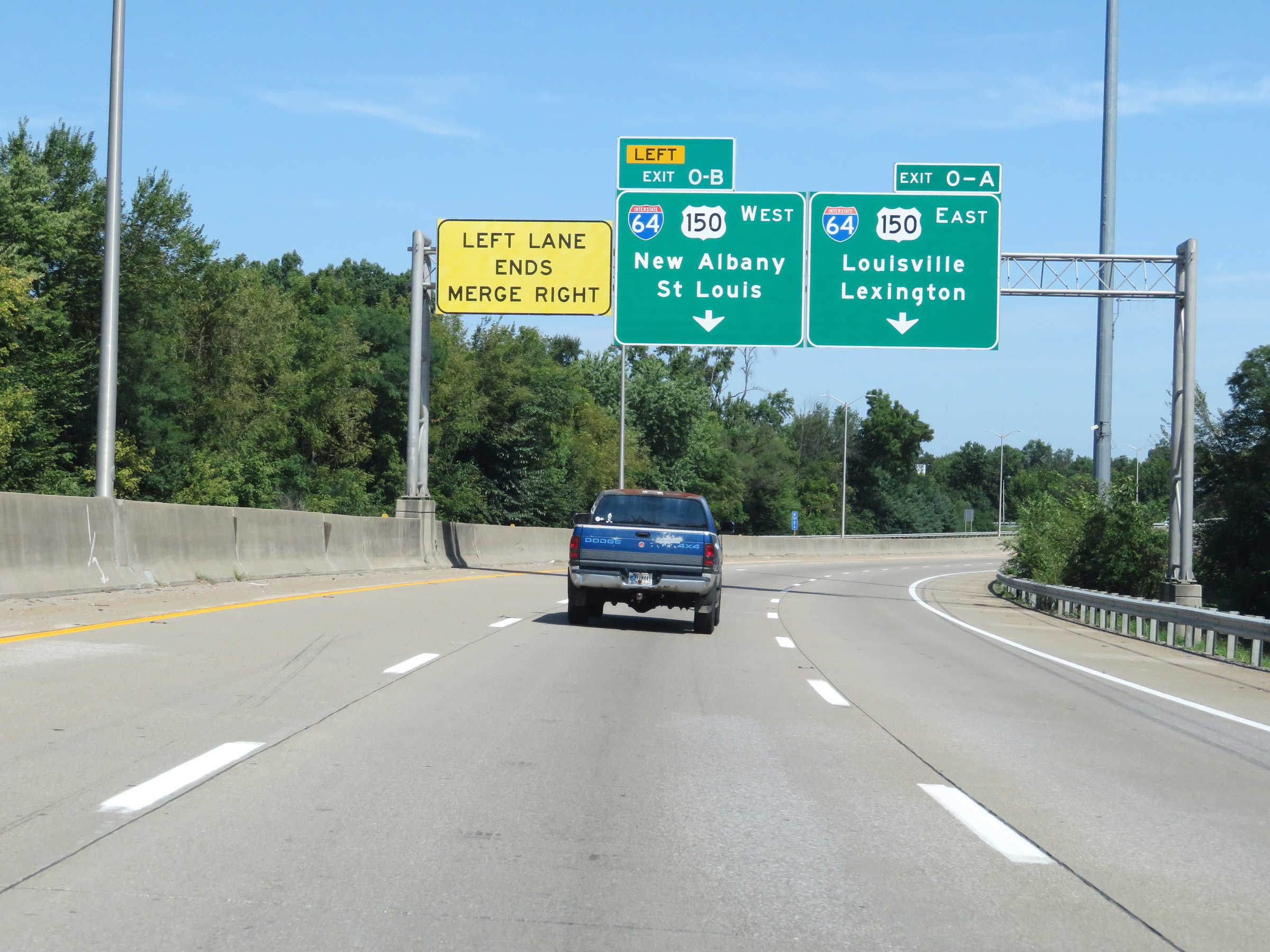 |
Approaching the junction of Interstate 64 via Exits 0A-B, and the western terminus of Interstate 264, the left lane comes to an end. Traffic to I-64 West should use the current center lane (left lane ahead) and traffic to I-64 East should use the right lane. (Photo taken 8/10/19). |
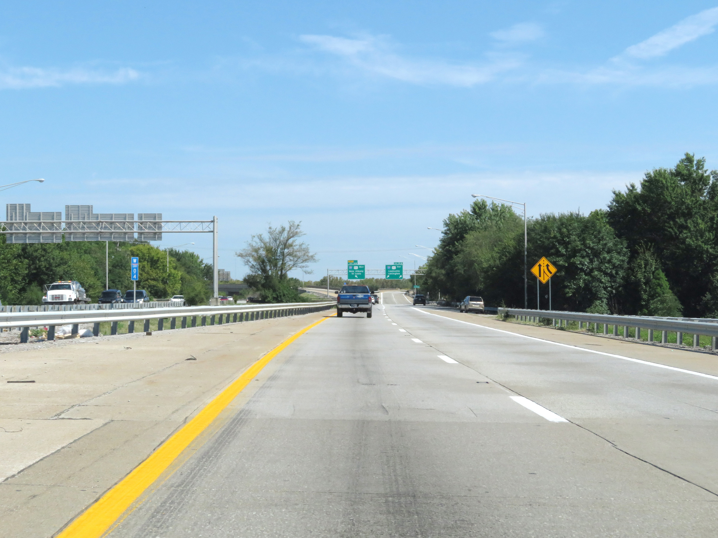 |
View on Interstate 264 West at mile marker 0.4, approaching the junction of Interstate 64 and the western terminus of I-264. (Photo taken 8/10/19). |
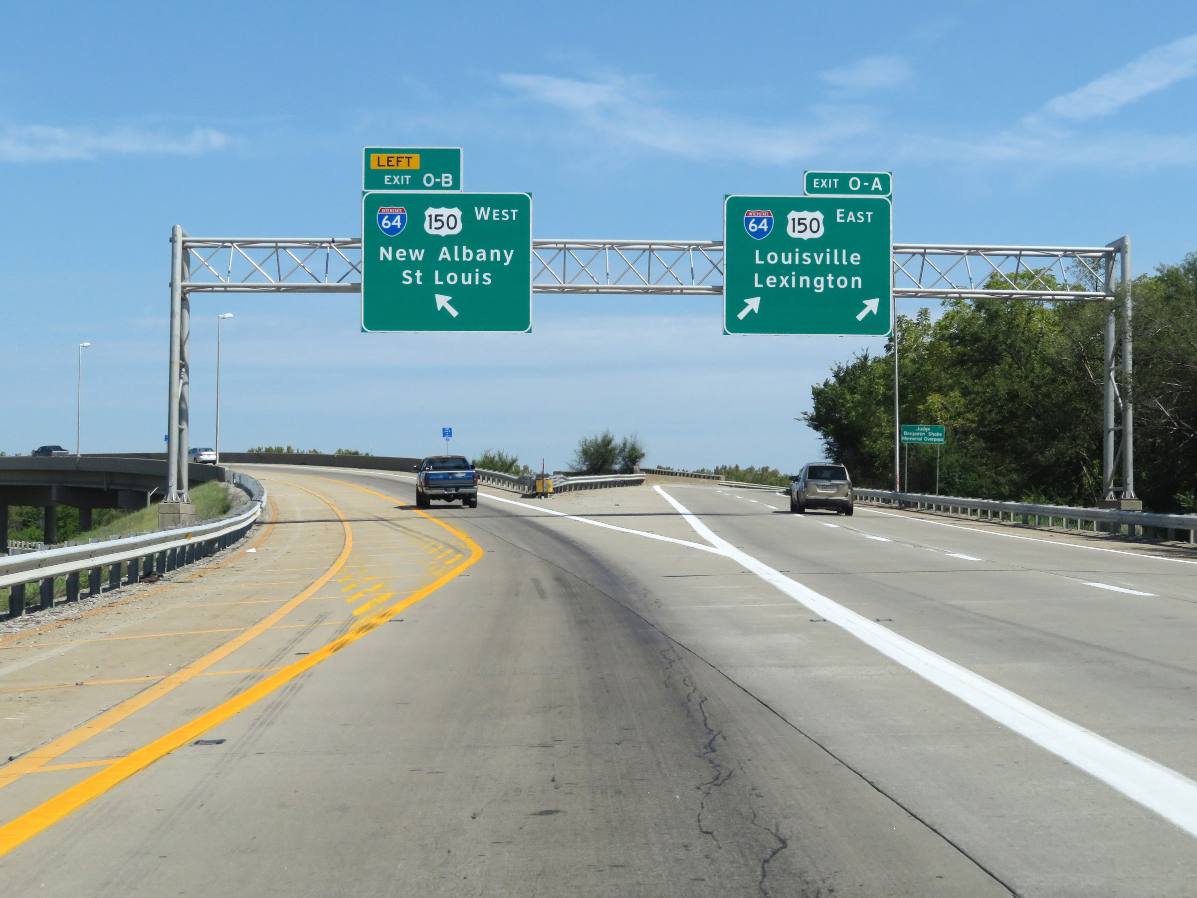 |
Interstate 264 West at Exit 0A: Interstate 64 East / US 150 East - Louisville / Lexington; Exit 0B: Interstate 64 West / US 150 West - New Albany / St. Louis (Photo taken 8/10/19). |
 |
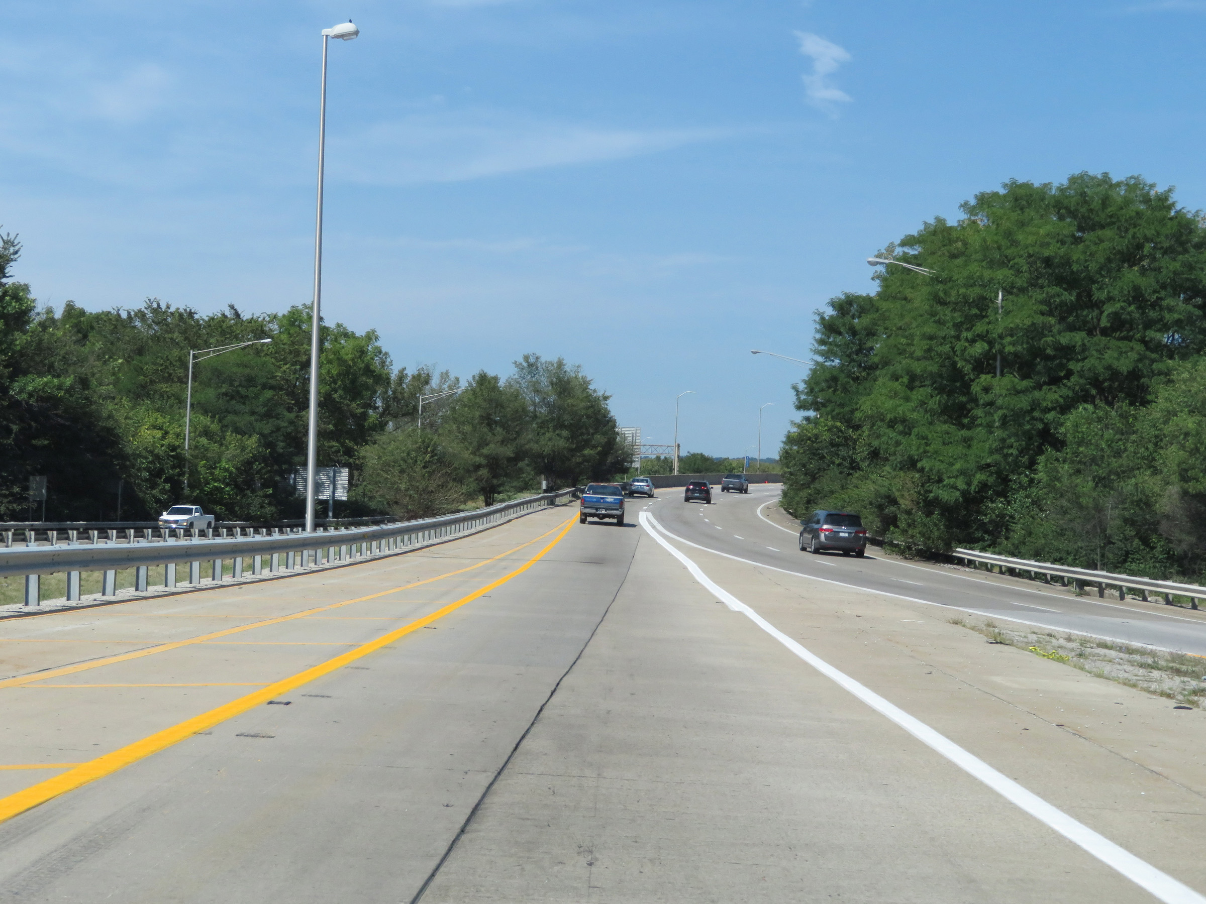
The left lane of Interstate 264 West becomes the ramp to Interstate 64 West (Exit 0B), seen here. (Photo taken 8/10/19). |
 |
A view on the ramp from Interstate 264 West to Interstate 64 West as its single lane prepares to merge into the westbound lanes of Interstate 64 from the left, just east of the Ohio River and Indiana state line. (Photo taken 8/10/19). |