Road Information |
||
 |
||
| Total Mileage in State: | 96 miles | |
| Northern End: | At I-70, in Salina | |
| Southern End: | At I-35 (Kansas Turnpike), in Wichita | |
| Mileage covered in Photos: | 96 miles | |
| Counties covered in Photos: | Saline, McPherson, Harvey, Sedgwick | |
| Major Junctions in Photos: | I-70, in Salina US 56, in McPherson US 50, in Newton I-235/K-96/K-254, in Wichita I-235, in Wichita I-35 (Kansas Turnpike), in Wichita |
|
| Control Cities in Photos: | Salina, McPherson, Newton, Wichita | |
Southbound
- Section 1: Interstate 70 to McPherson (Exit 60)
- Section 2: McPherson (Exit 60) to Wichita (Exit 13)
- Section 3: Wichita (Exit 13) to Interstate 35 (Kansas Turnpike)
Section 1: Interstate 70 to McPherson (Exit 60)
 |
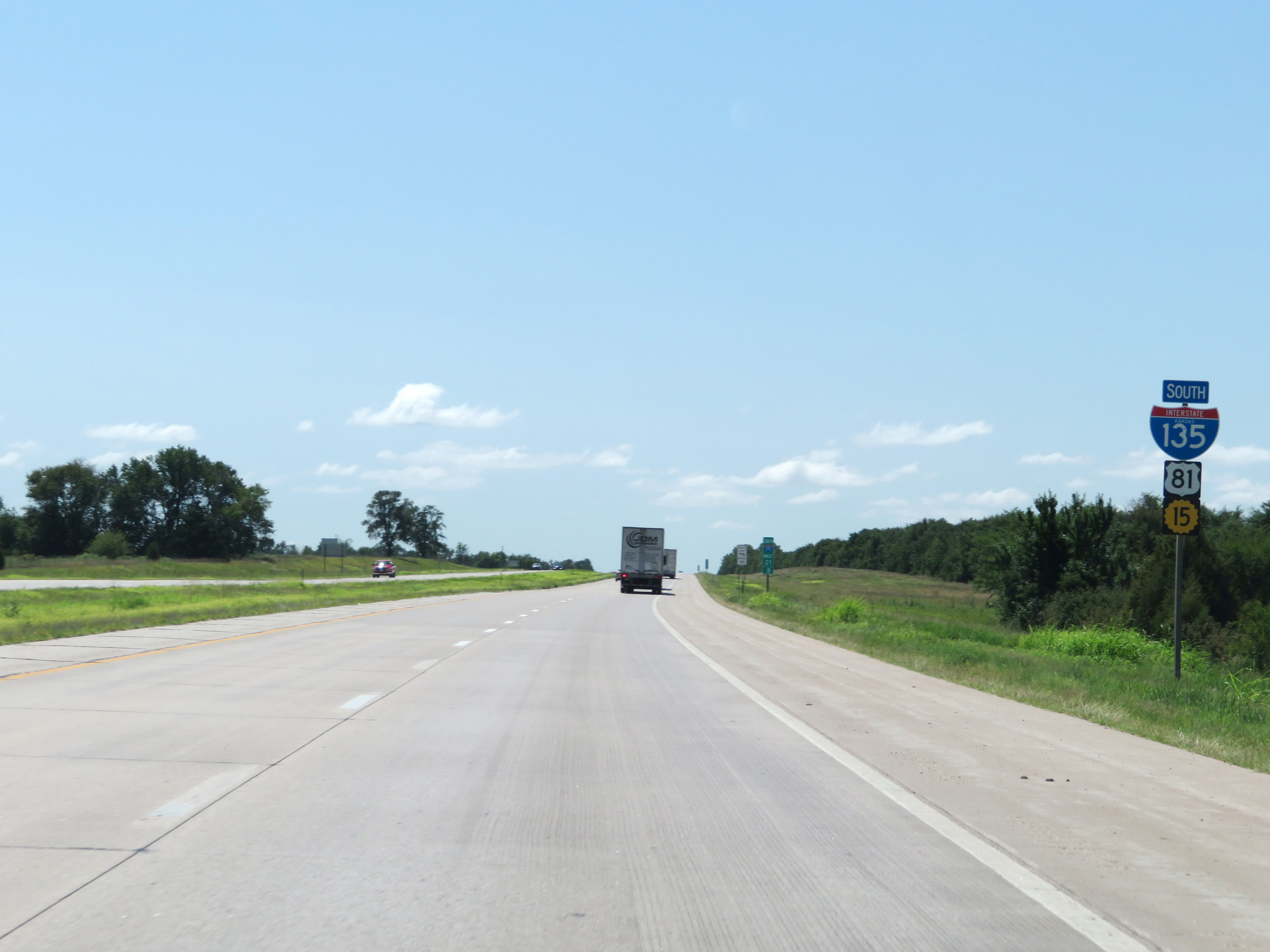
US 81 South as it approaches the beginning of Interstate 135 South, which will occur 1/2 mile ahead at the junction of Interstate 70. (Photo taken 8/11/20). |
 |
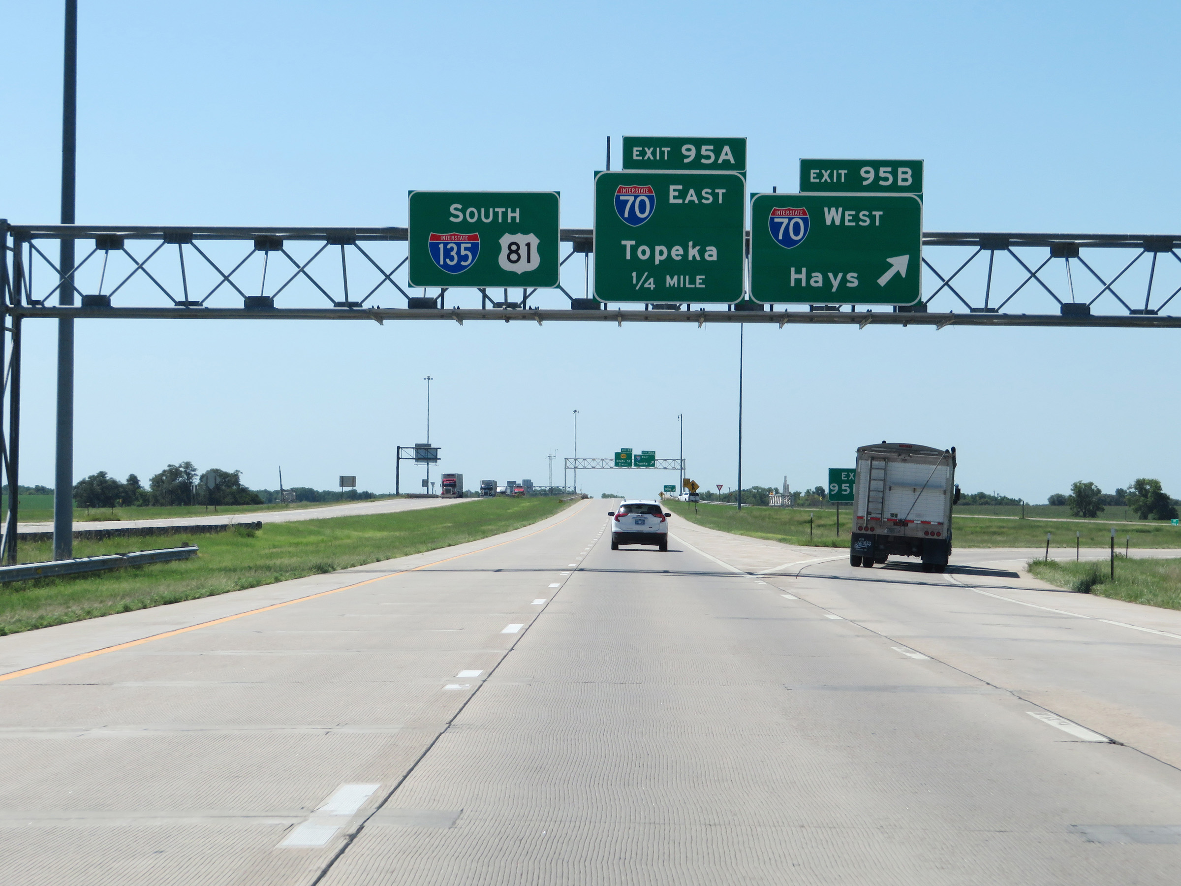
Interstate 135 South begins here, at the junction of Interstate 70. The mileage and exit numbers on the signage for Exits 95B-A ahead reflect the mileage of I-135. (Photo taken 8/11/20). |
 |
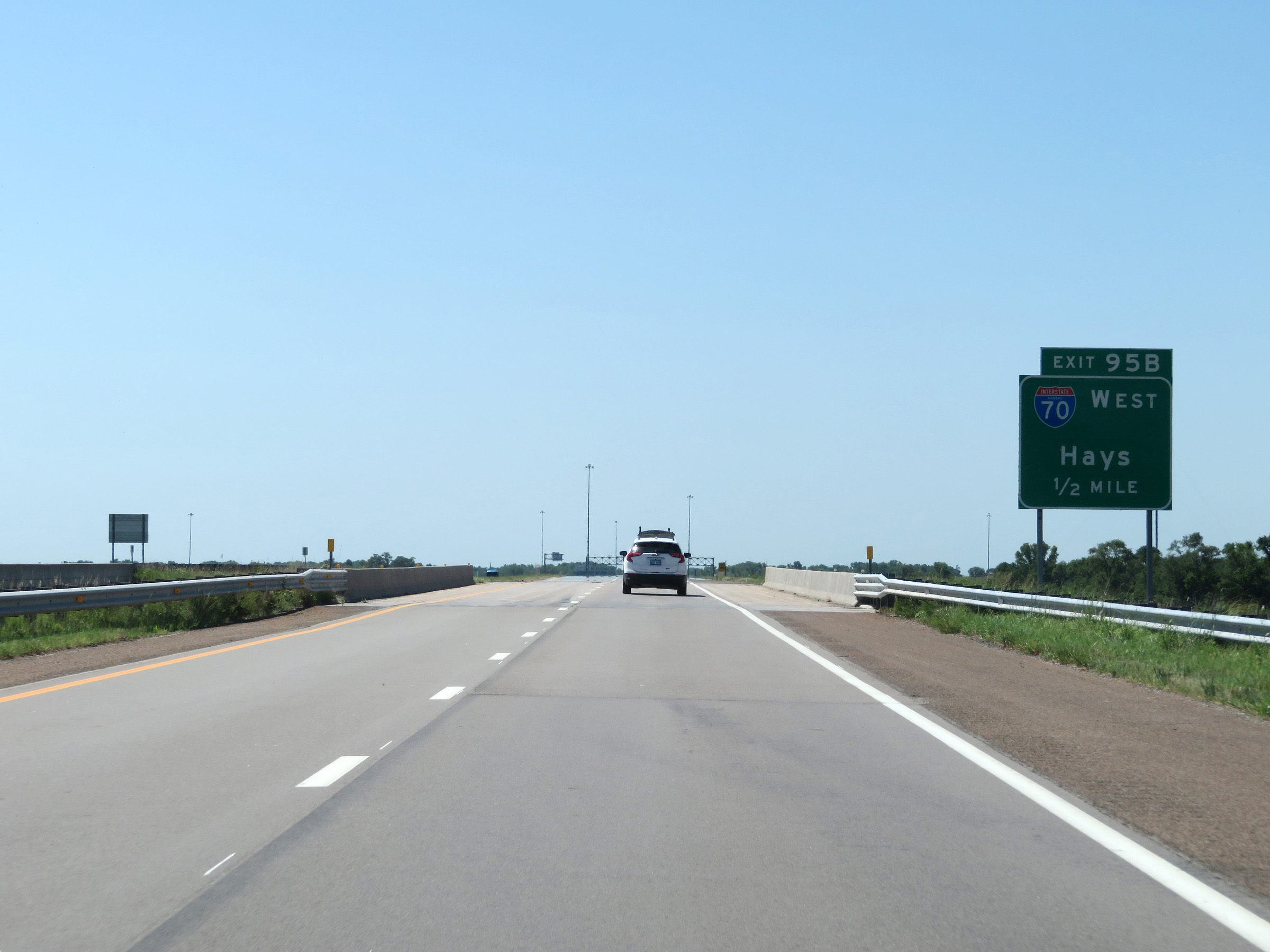
Interstate 135 South at Exit 95B: Interstate 70 West - Hays (Photo taken 8/11/20). |
 |
Interstate 135 South at Exit 95A: Interstate 70 East - Topeka (Photo taken 8/11/20). |
 |
View on Interstate 135 South as traffic from Interstate 70 East merges into it on the right. (Photo taken 8/11/20). |
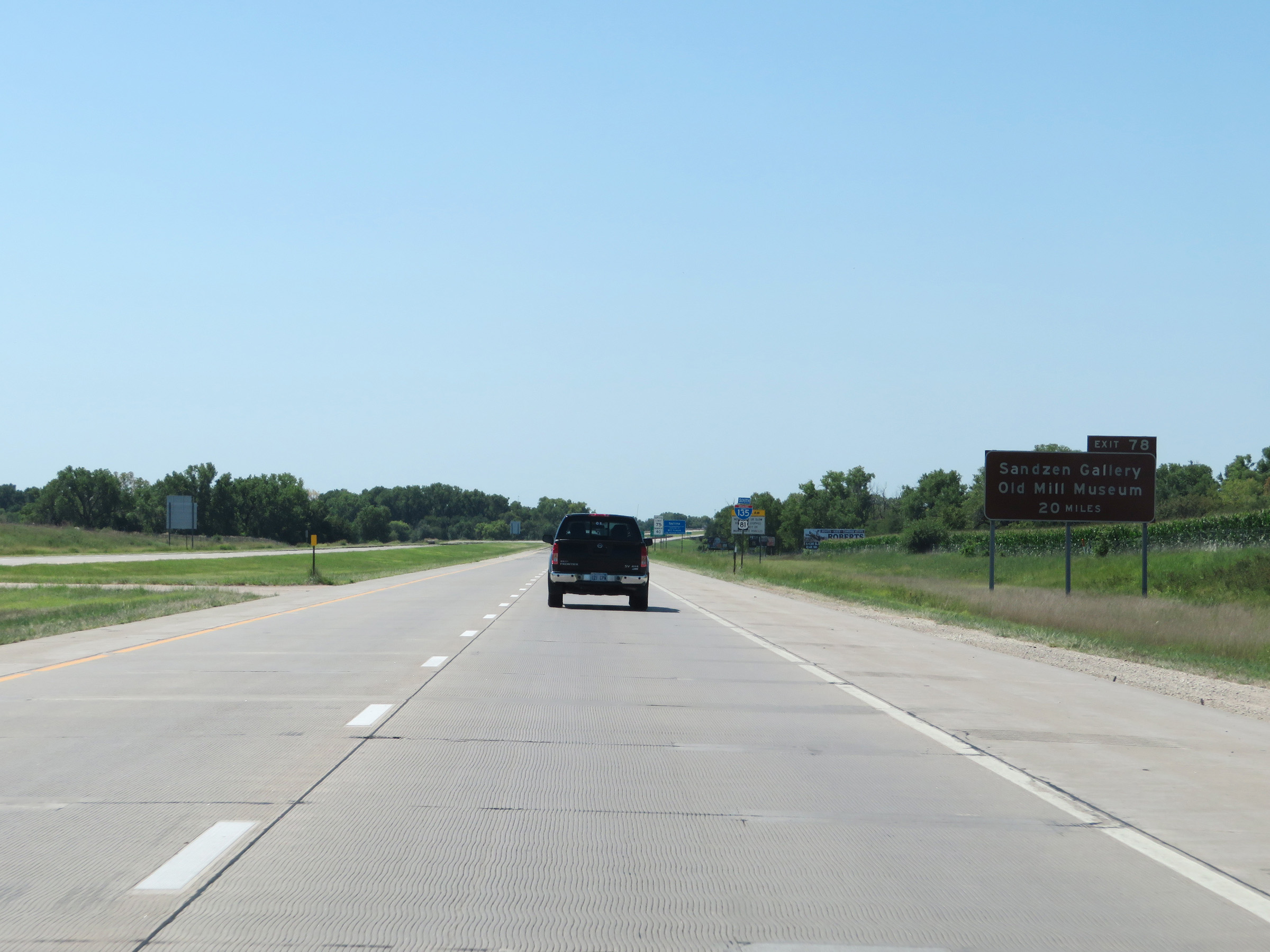 |
Take Exit 78 (20 miles ahead) to Sandzen Gallery and Old Mill Museum. (Photo taken 8/11/20). |
 |
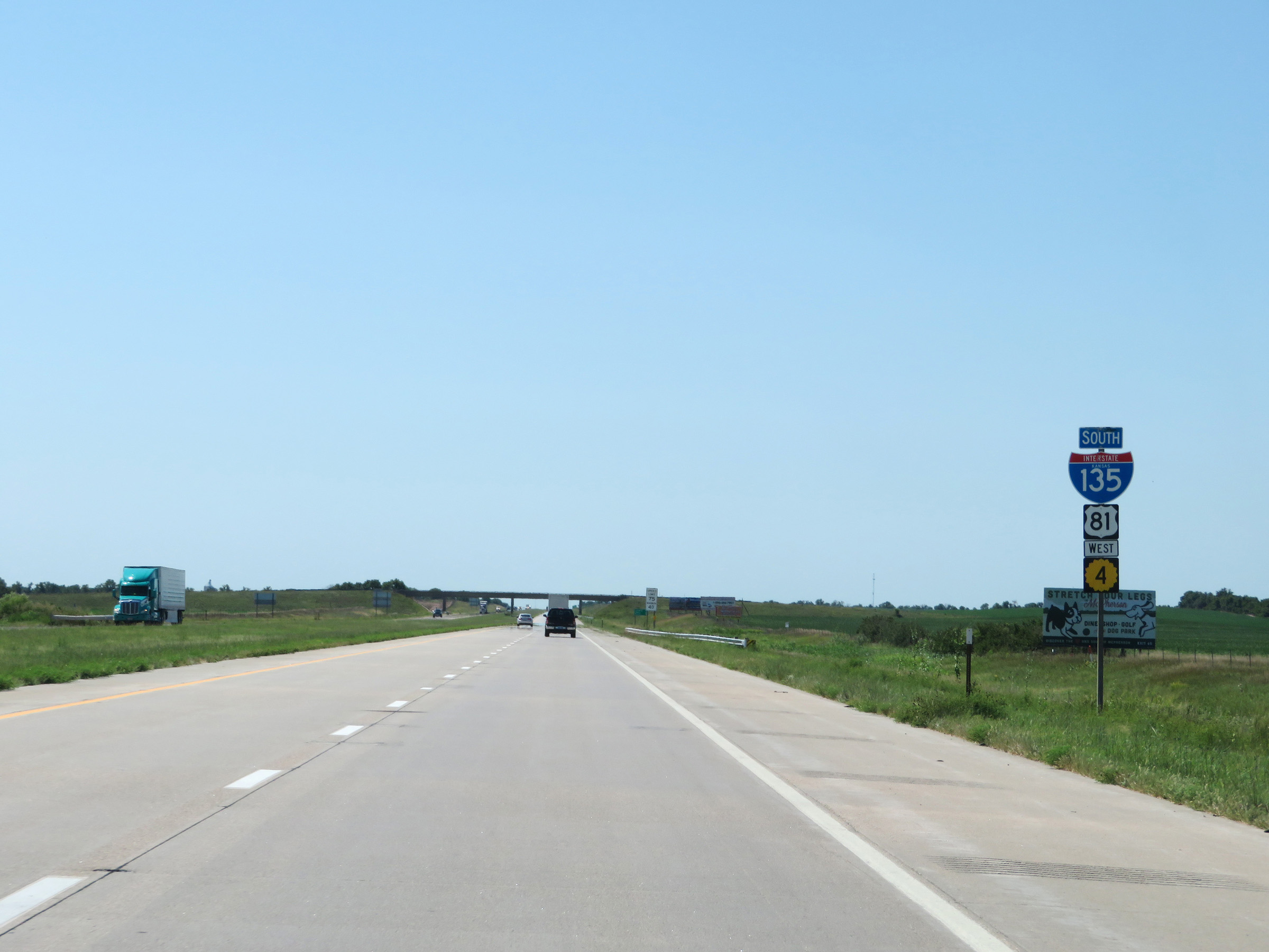
State-named Interstate 135 South reassurance shield. (Photo taken 8/11/20). |
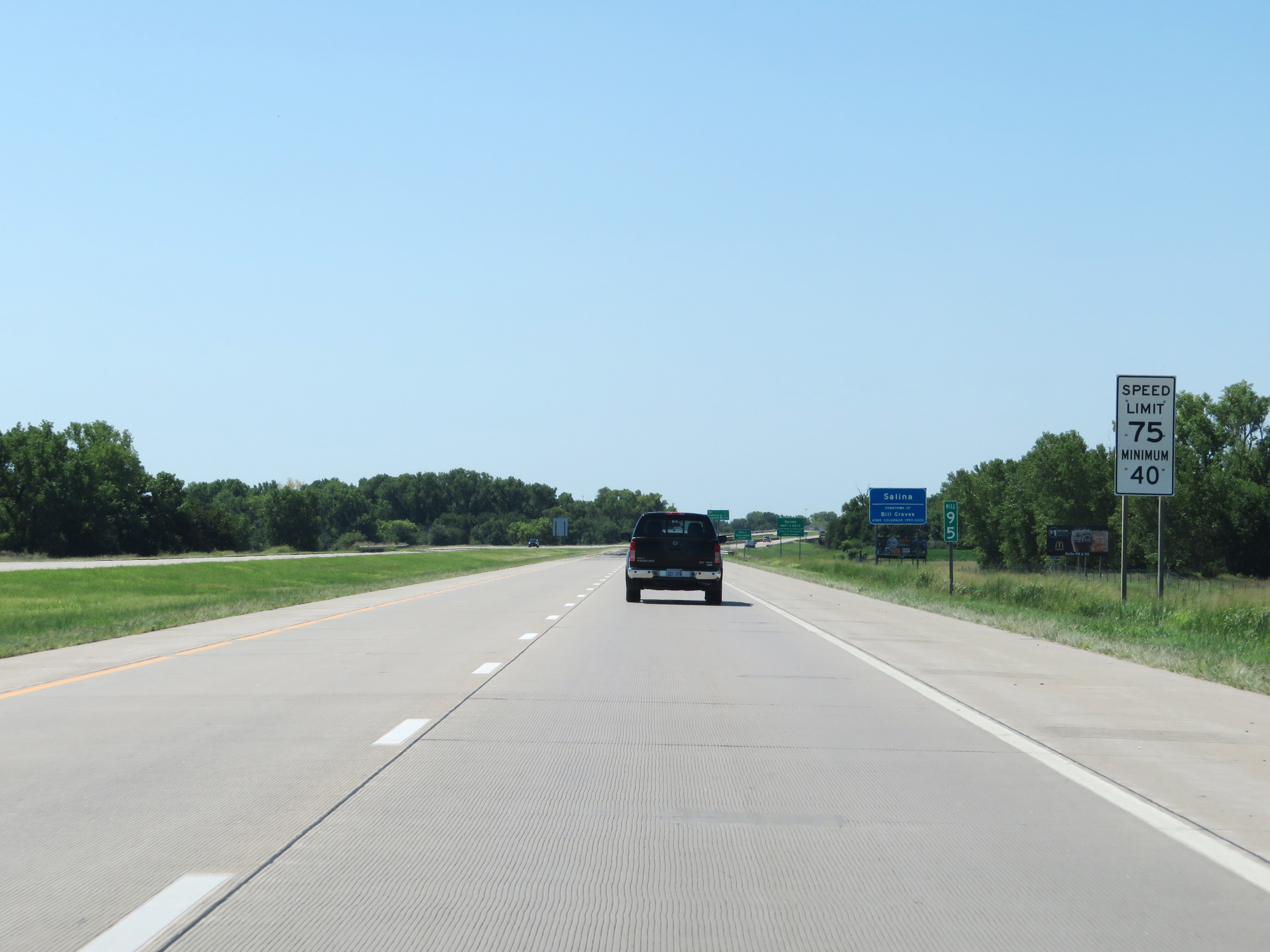 |
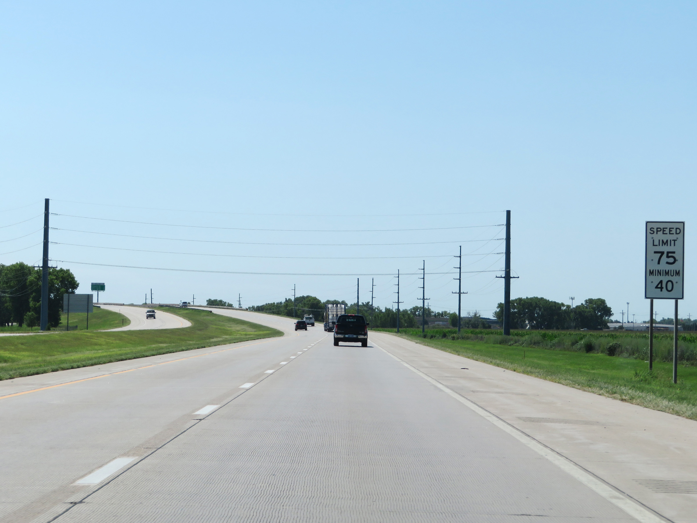
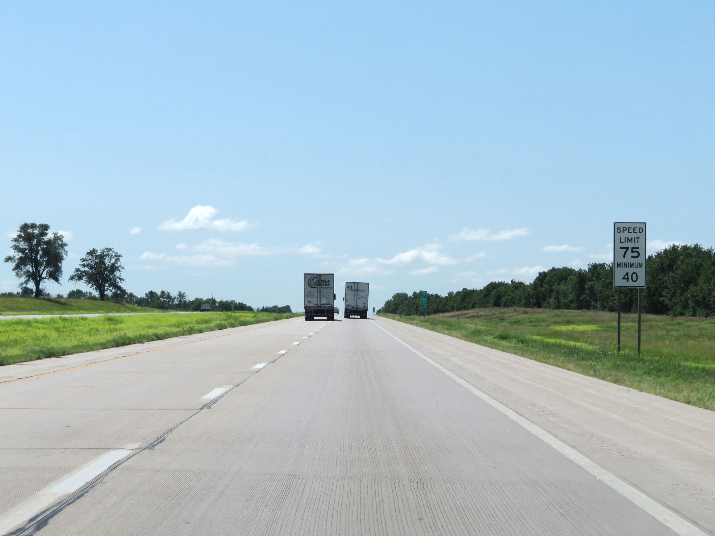
Speed limit signs at mile marker 95. The speed limits on Interstate 135 South start out at 75 mph maximum and 40 mph minimum. These are the standard speed limits on most rural Interstate highways in Kansas. (Photo taken 8/11/20). |
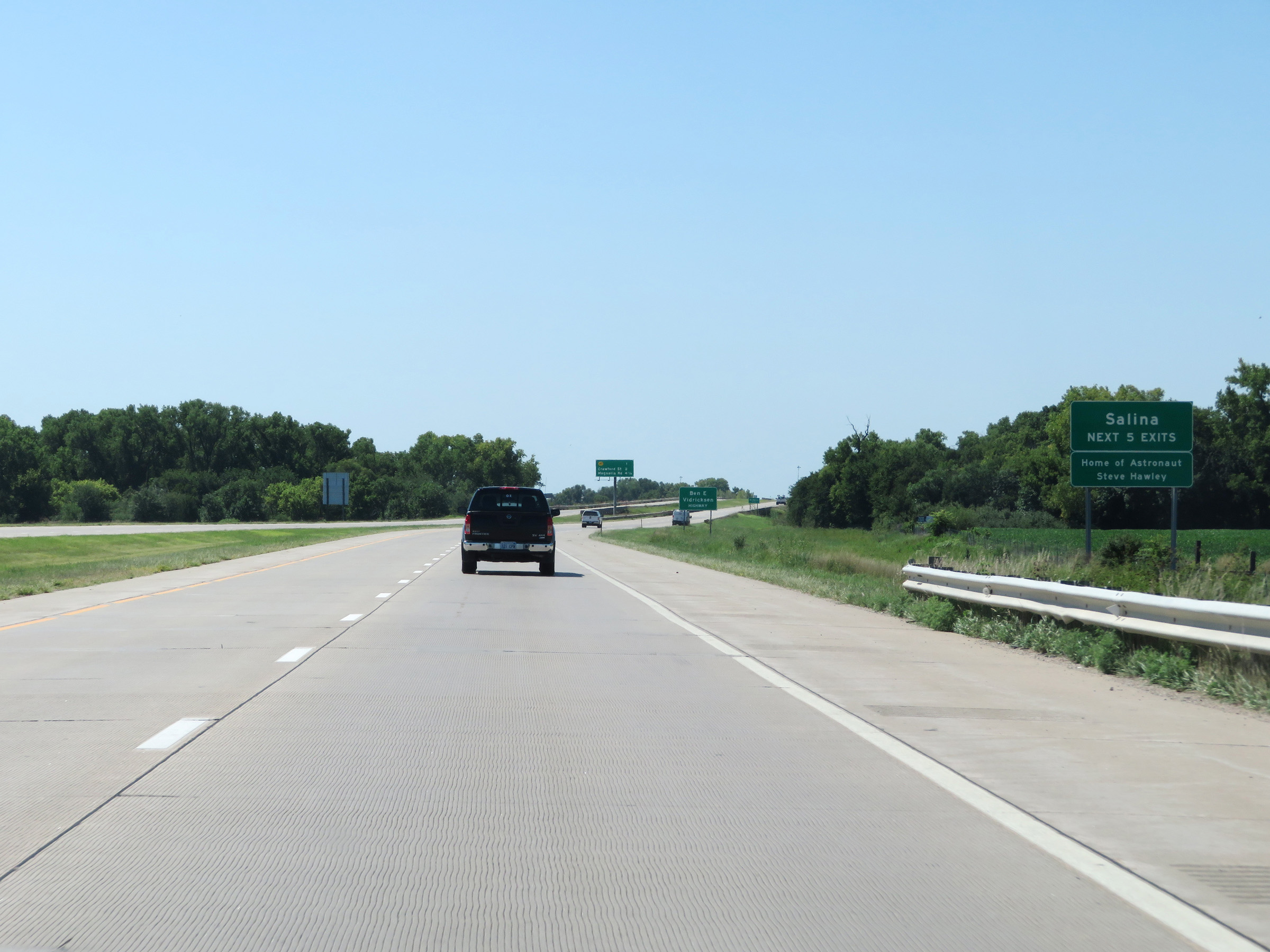 |
Take any of the next 5 exits to Salina. (Photo taken 8/11/20). |
 |
Overhead mileage sign in the median which lists the distances to the three upcoming exits to Salina. (Photo taken 8/11/20). |
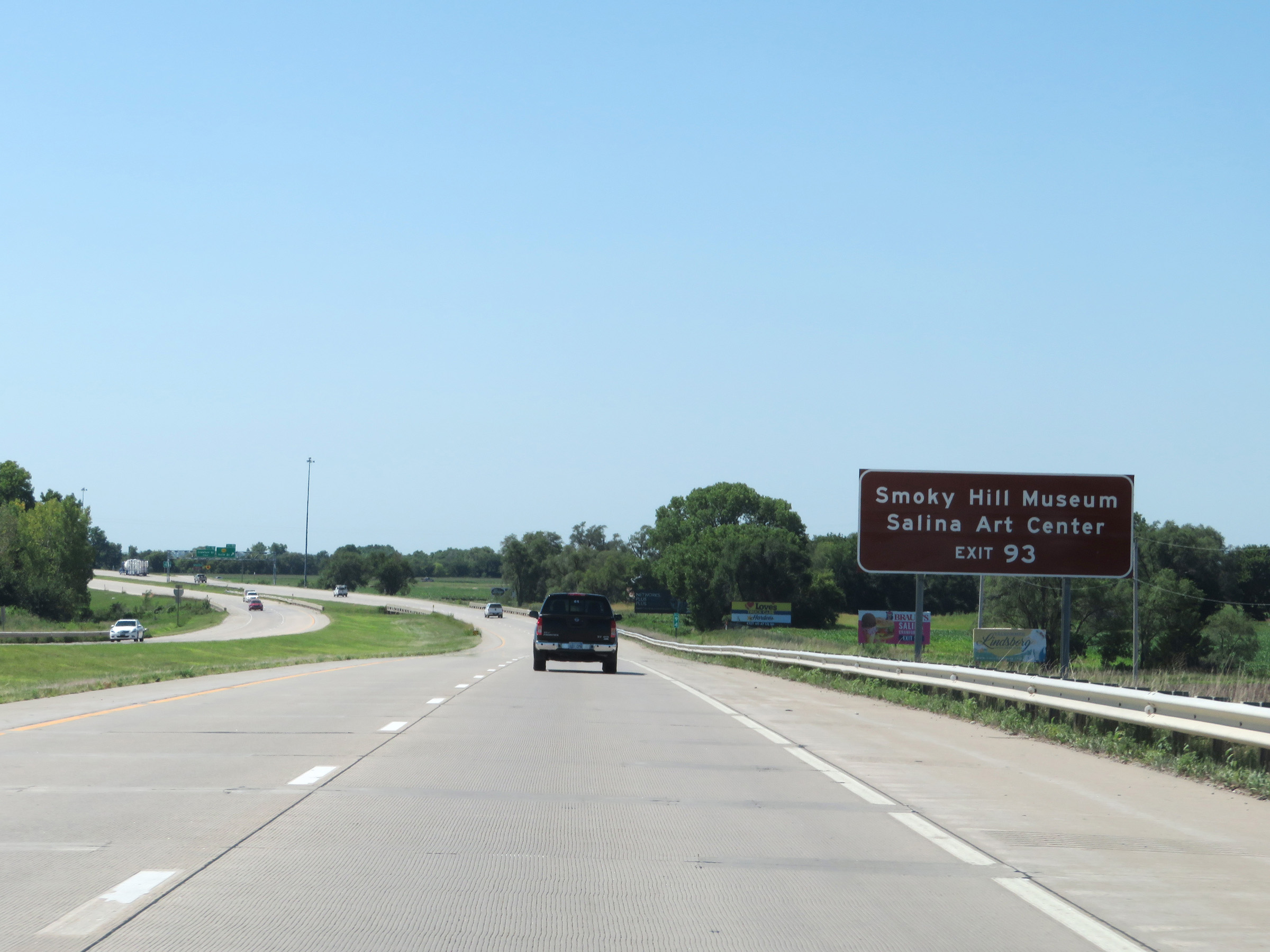 |
Take Exit 93 to Smoky Hill Museum and Salina Art Center. (Photo taken 8/11/20). |
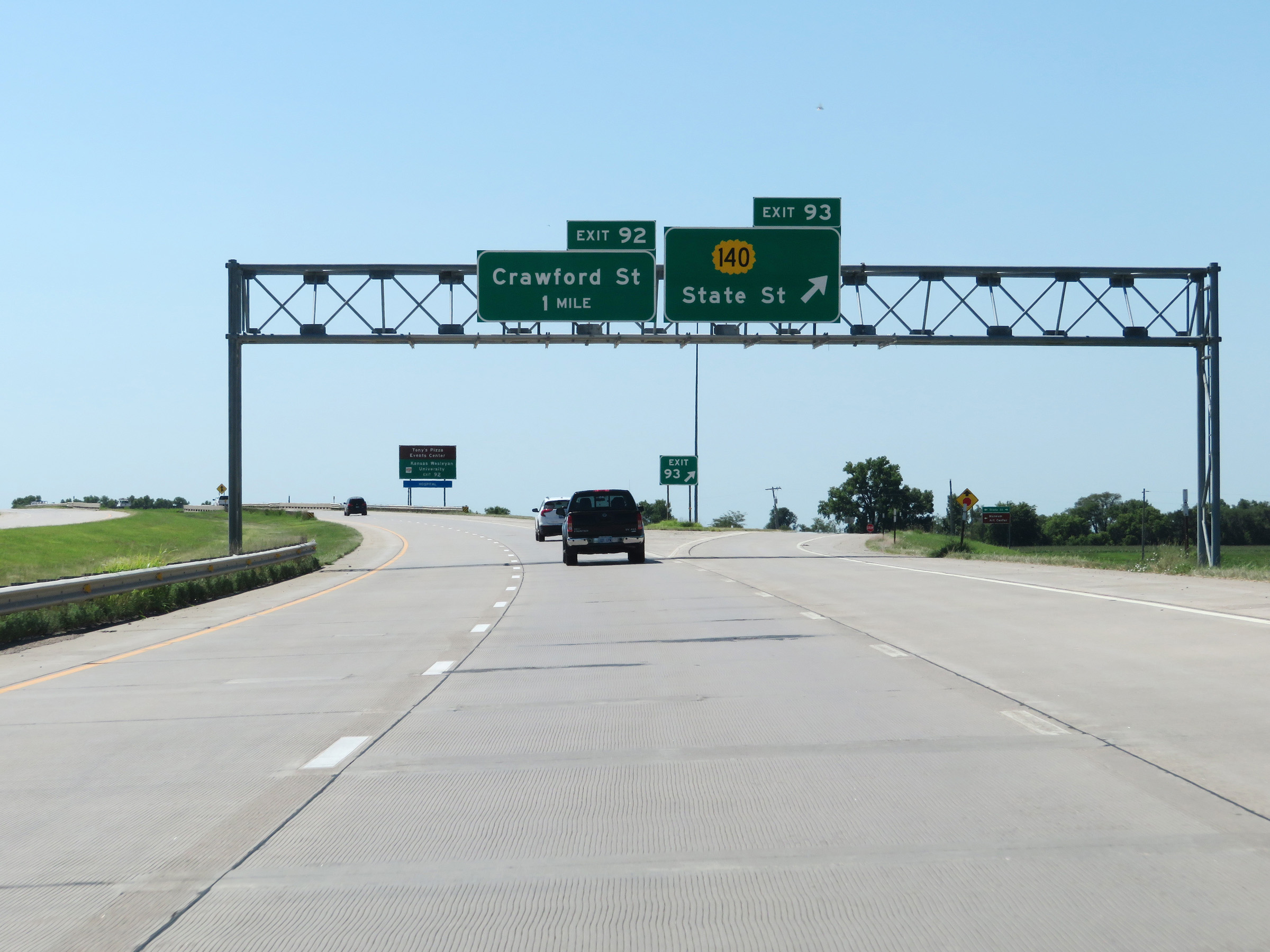 |
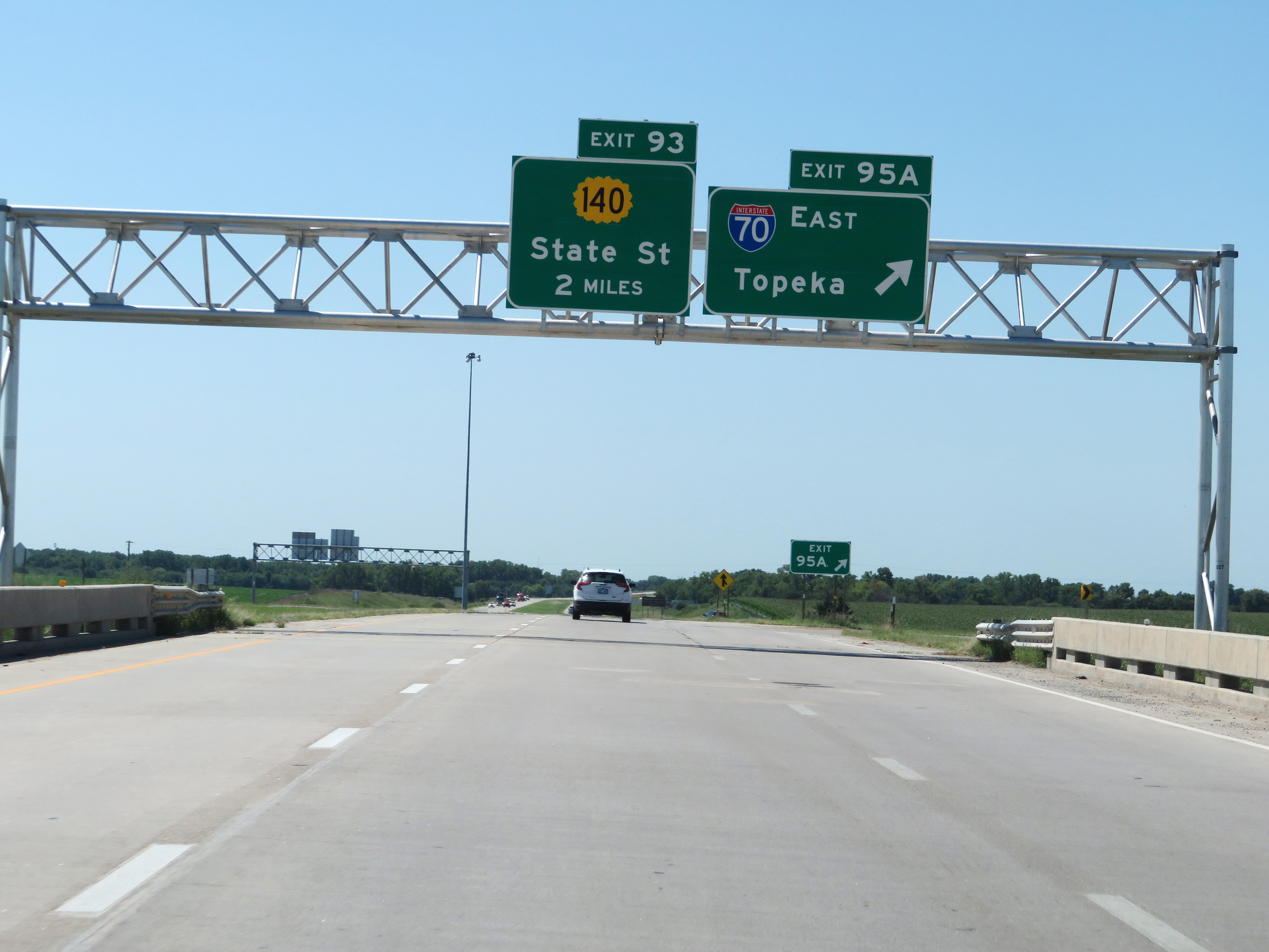
Interstate 135 South at Exit 93: K-140 - State St (Photo taken 8/11/20). |
 |
Take Exit 92 to the Tony's Pizza Events Center and Kansas Wesleyan University. (Photo taken 8/11/20). |
 |
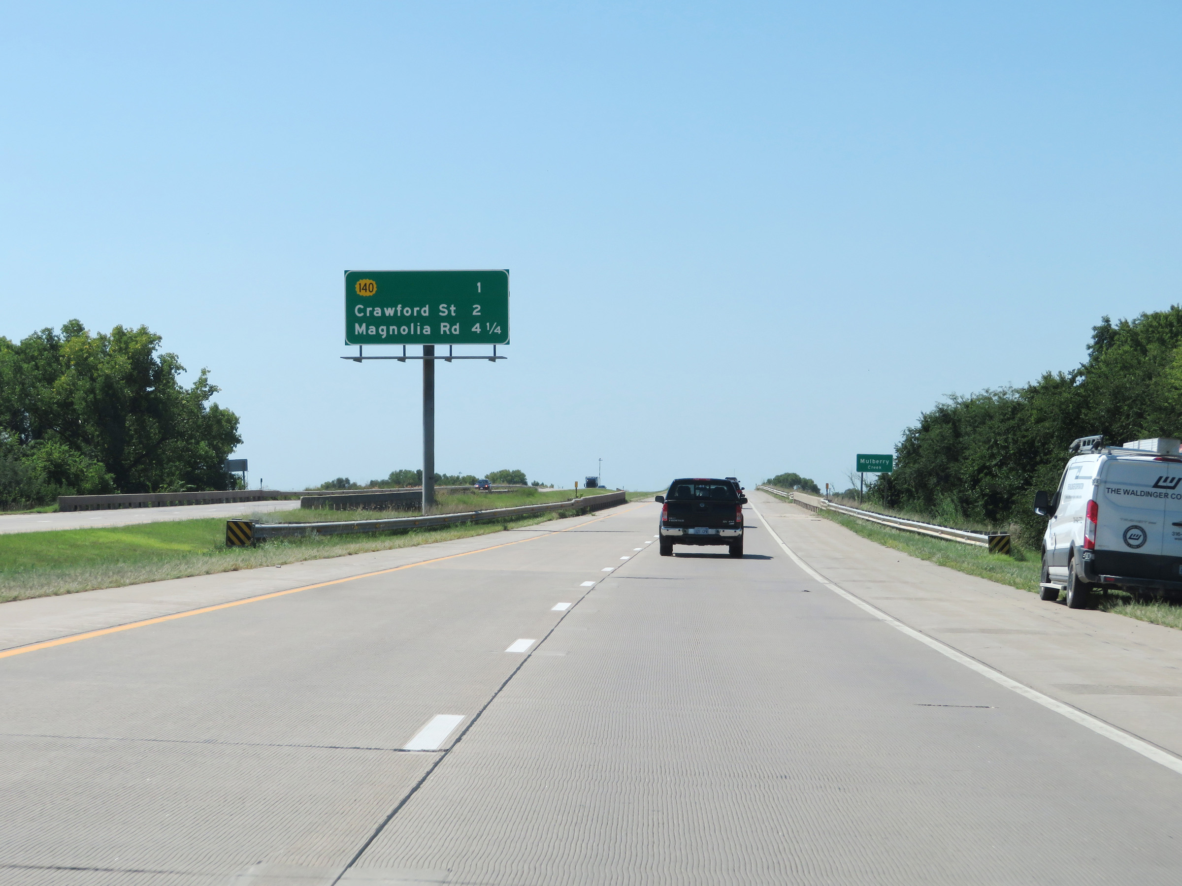
Interstate 135 South at Exit 92: Crawford St (Photo taken 8/11/20). |
 |
The speed limits remain 75 mph maximum and 40 mph minimum on Interstate 135 South through the Salina area. (Photo taken 8/11/20). |
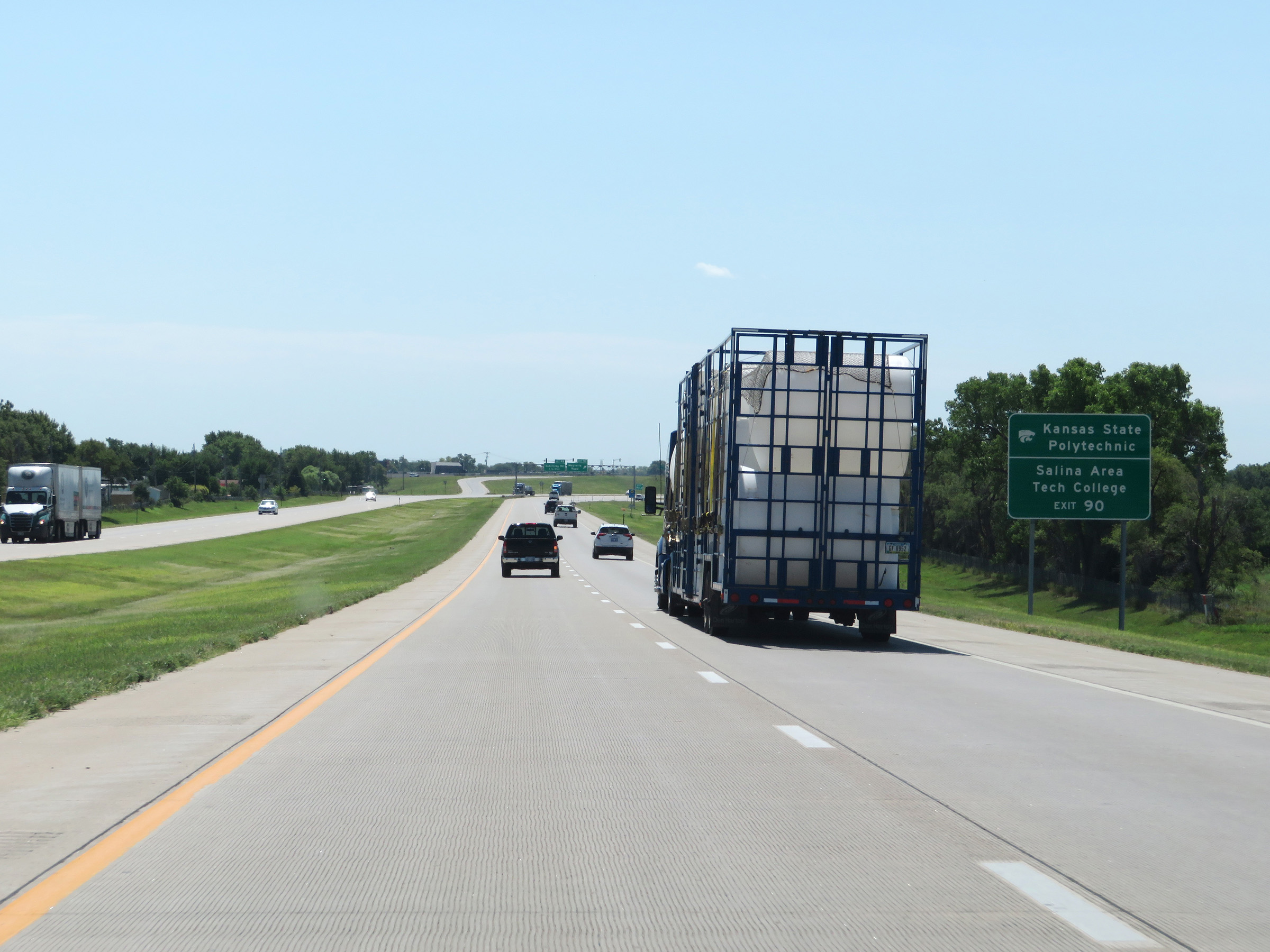 |
Take Exit 90 to Kansas State Polytechnic and Salina Area Tech College. (Photo taken 8/11/20). |
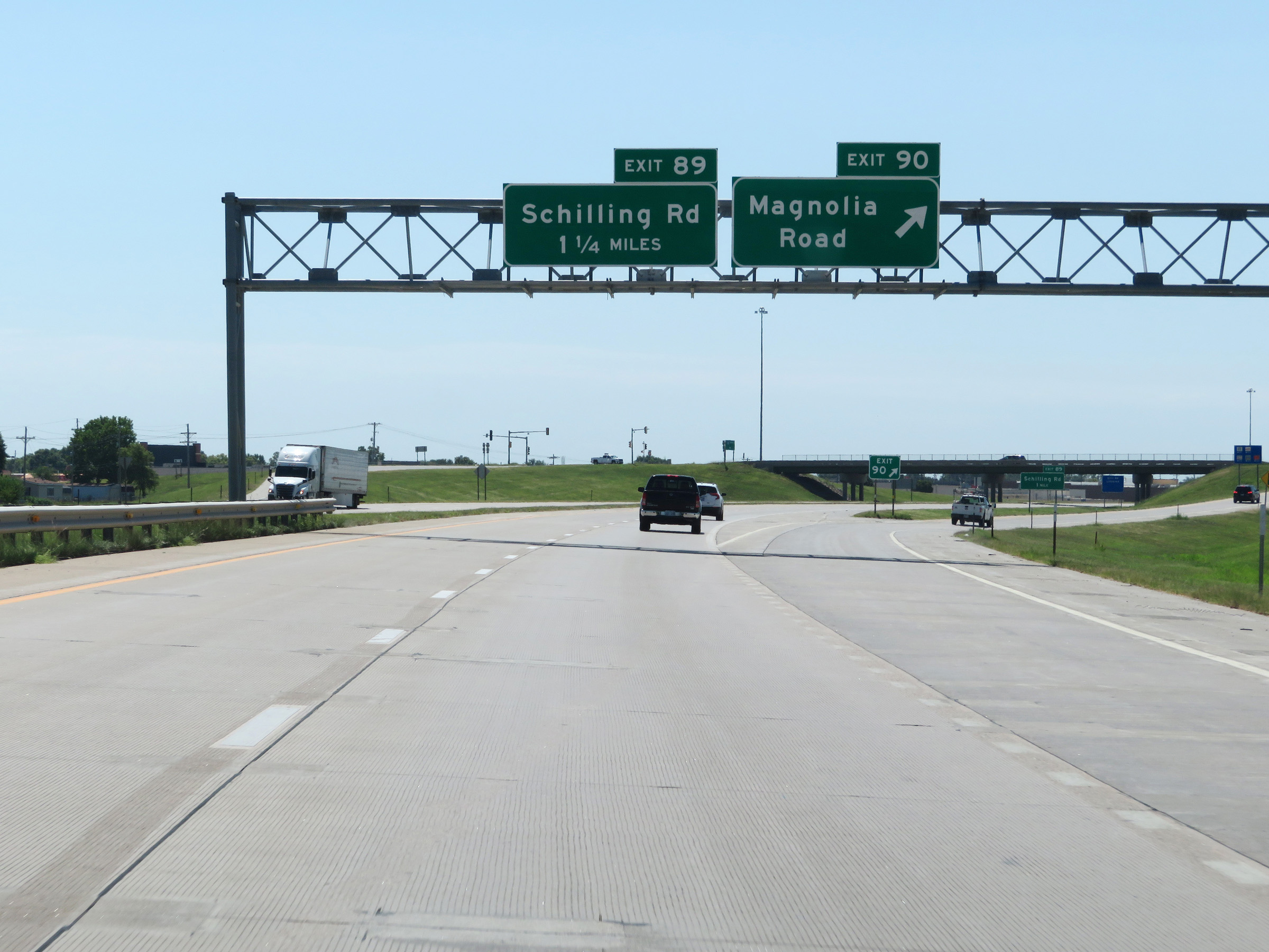 |
Interstate 135 South at Exit 90: Magnolia Road (Photo taken 8/11/20). |
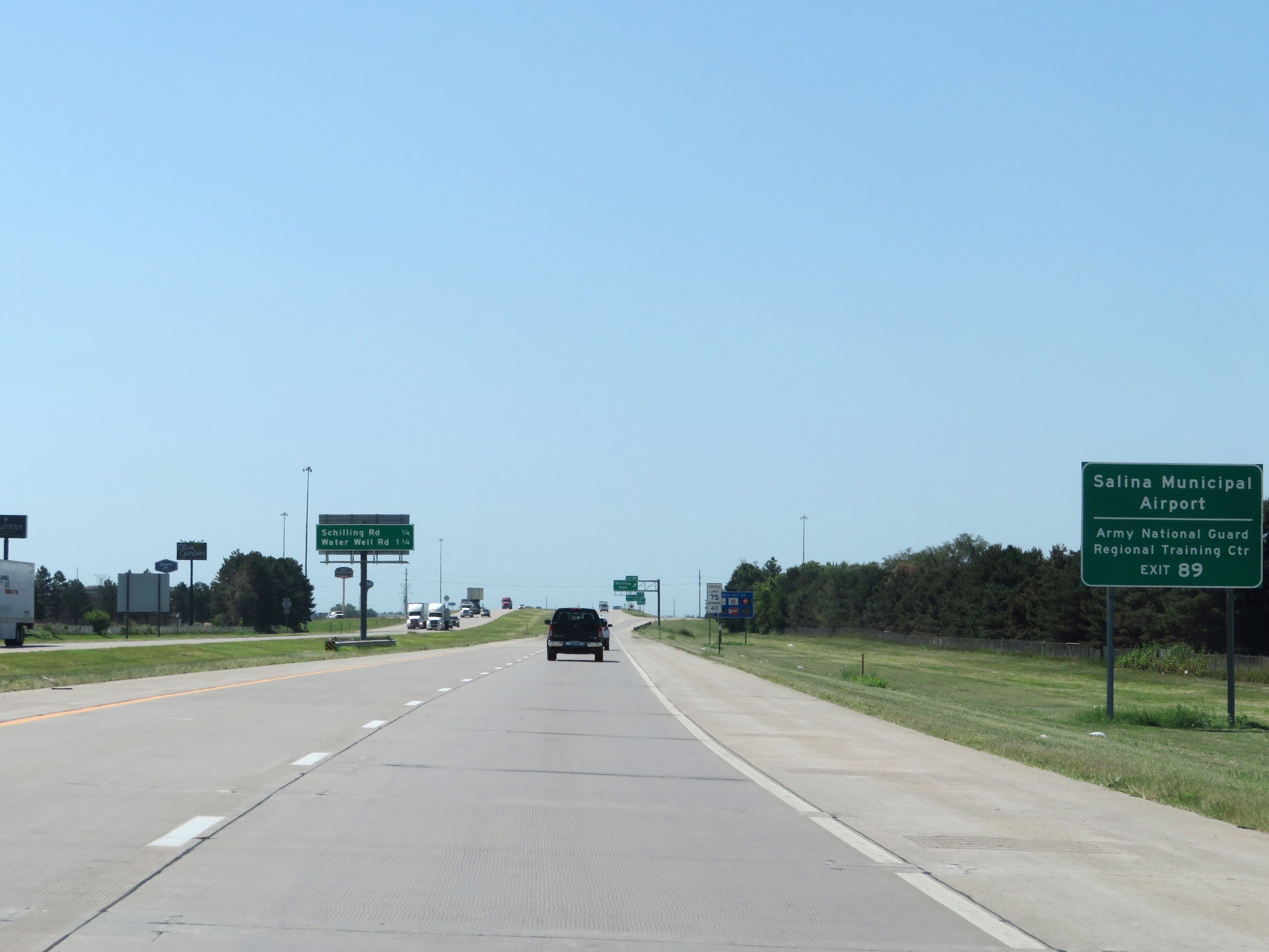 |
Take Exit 89 to Salina Municipal Airport and the Army National Guard Regional Training Center. (Photo taken 8/11/20). |
 |
Interstate 135 South at Exit 89: Schilling Road (Photo taken 8/11/20). |
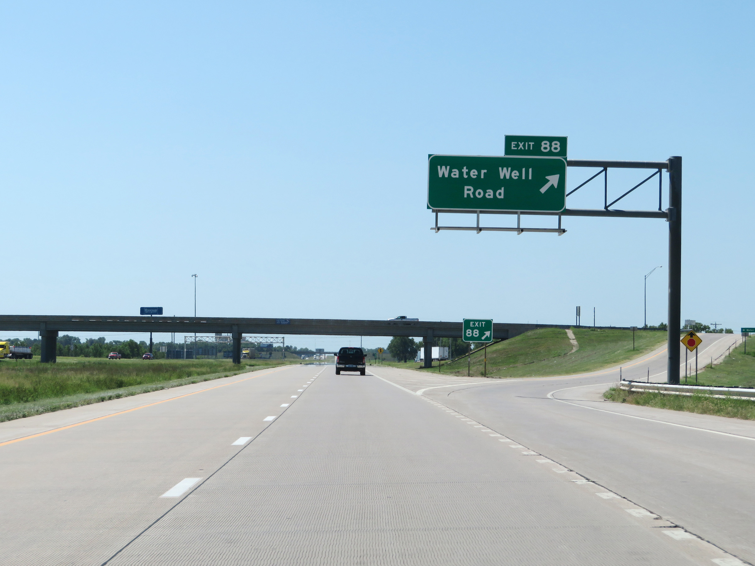 |
Interstate 135 South at Exit 88: Water Well Road (Photo taken 8/11/20). |
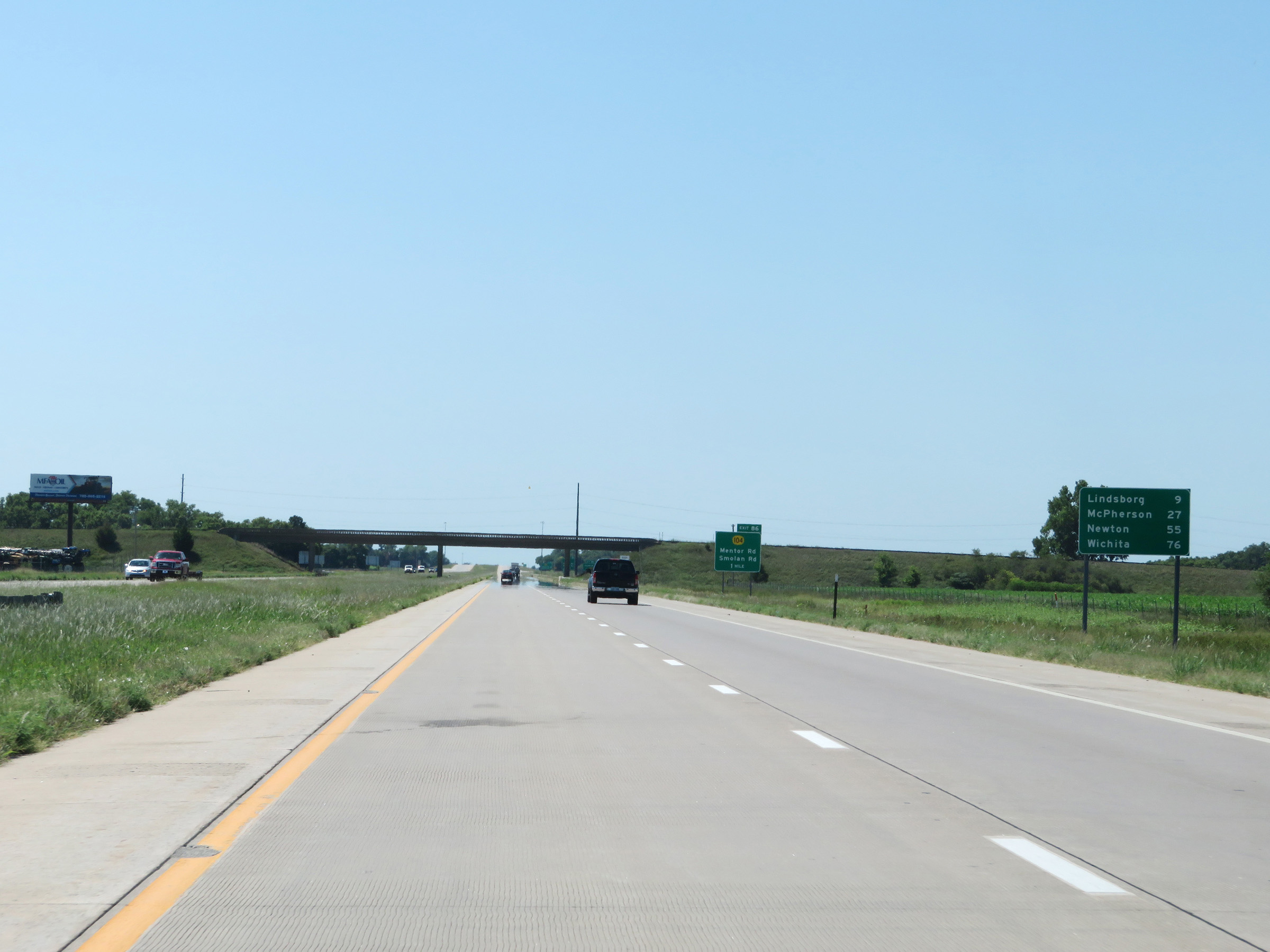 |
Mileage sign on Interstate 135 South. It's 9 miles to Lindsborg, 27 miles to McPherson, 55 miles to Newton, and 76 miles to Wichita. (Photo taken 8/11/20). |
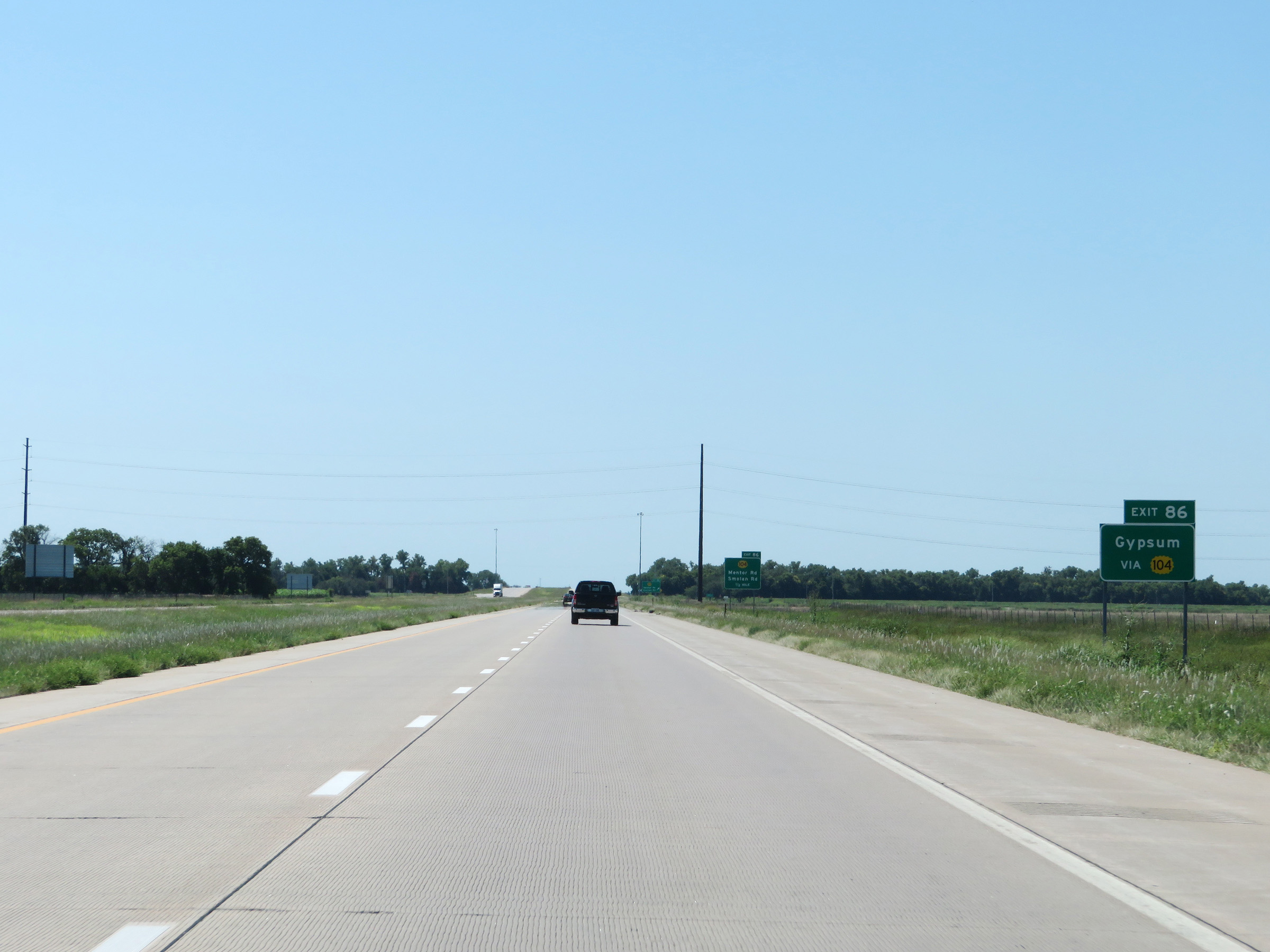 |
Take Exit 86 to Gypsum. (Photo taken 8/11/20). |
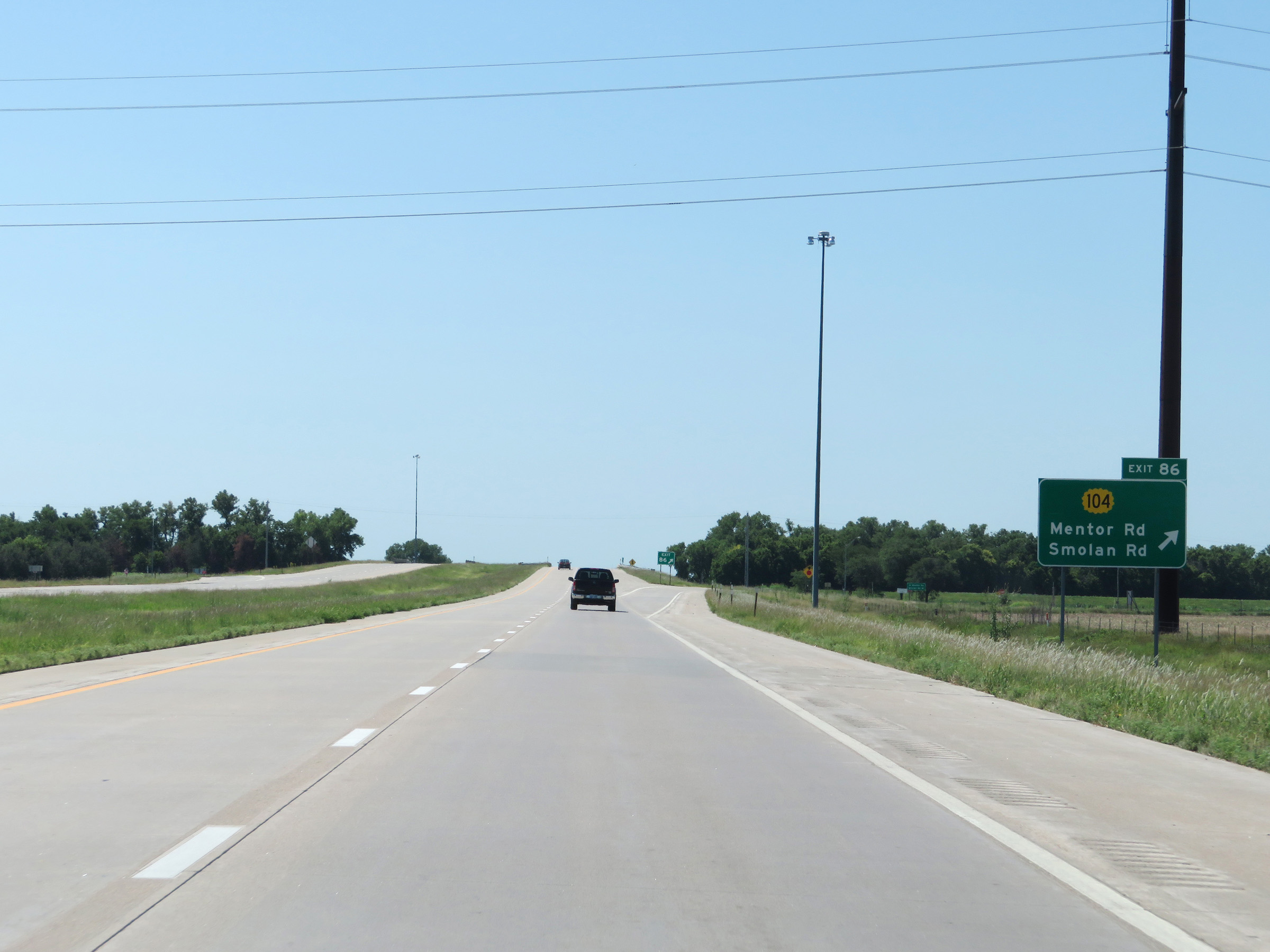 |
Interstate 135 South at Exit 86: K-104 - Mentor Rd / Smolan Rd (Photo taken 8/11/20). |
 |
Mile marker 85 on Interstate 135 South in Saline County. (Photo taken 8/11/20). |
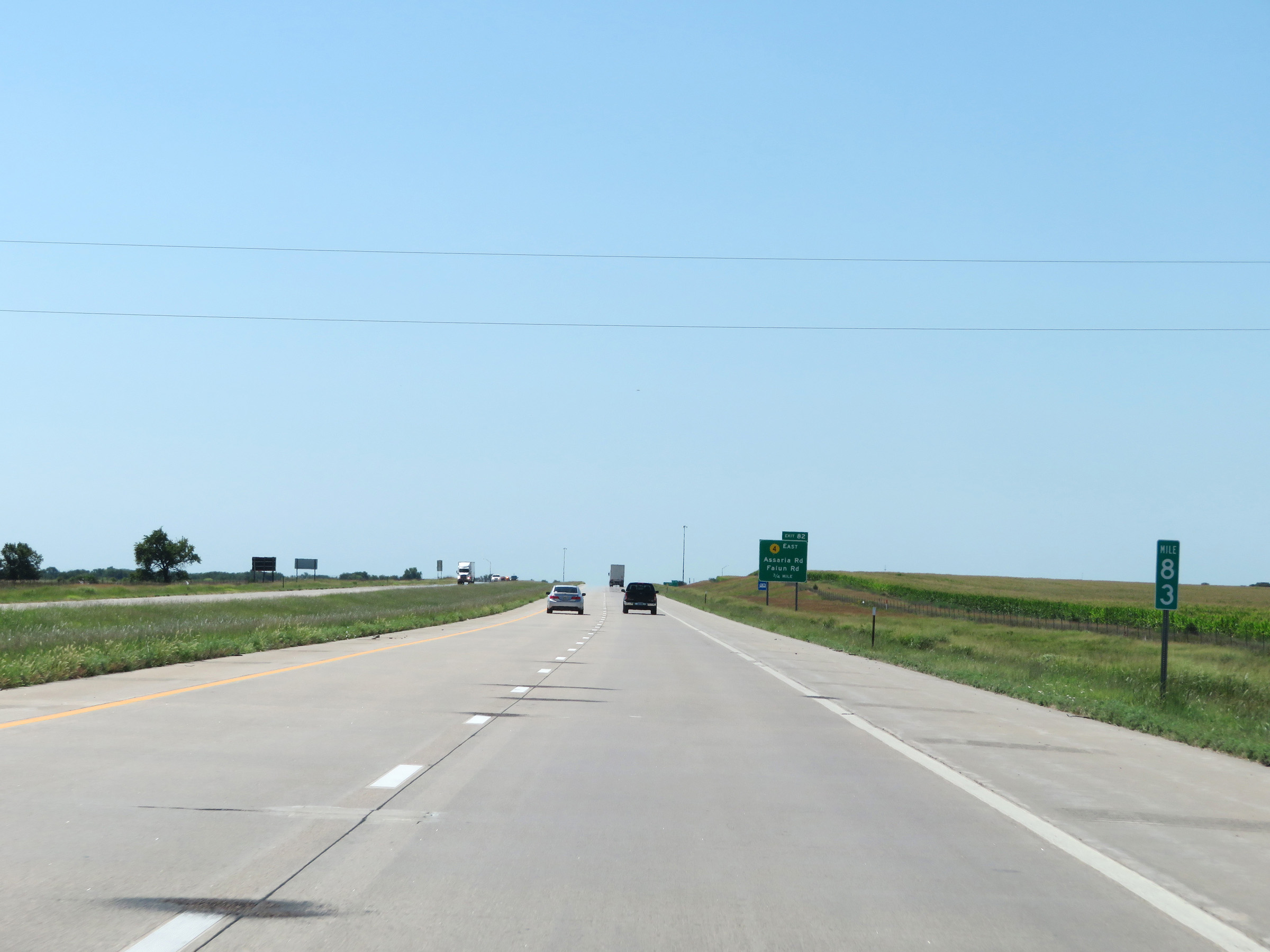 |
View on Interstate 135 South at mile marker 83. (Photo taken 8/11/20). |
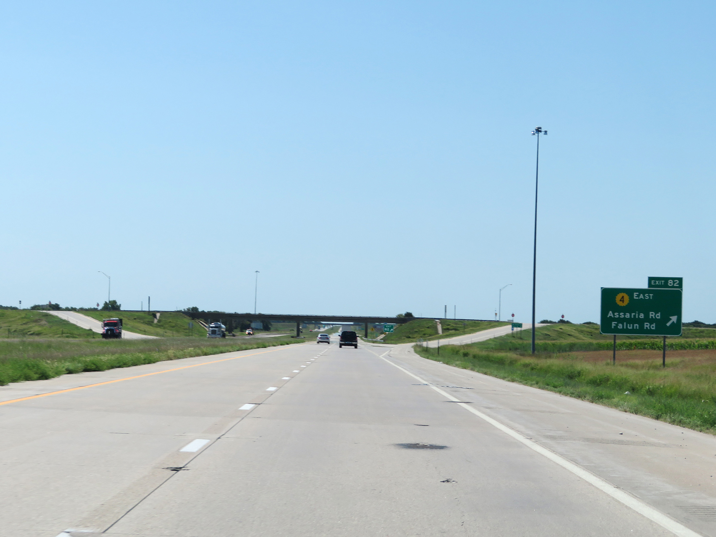 |
Interstate 135 South at Exit 82: K-4 East - Assaria Rd / Falun Rd (Photo taken 8/11/20). |
 |
Another state-named Interstate 135 South reassurance shield. (Photo taken 8/11/20). |
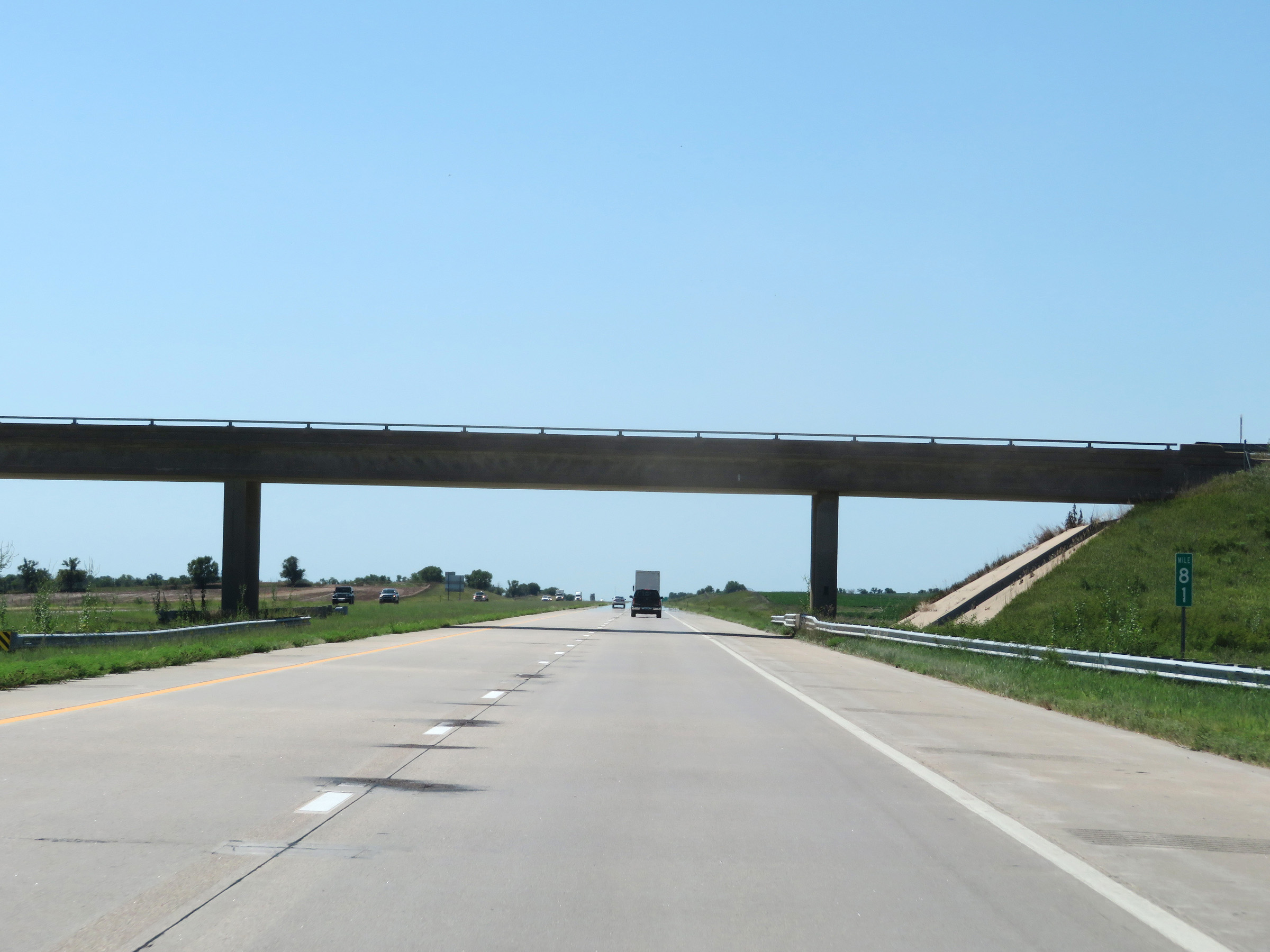 |
Interstate 135 South at mile marker 81. (Photo taken 8/11/20). |
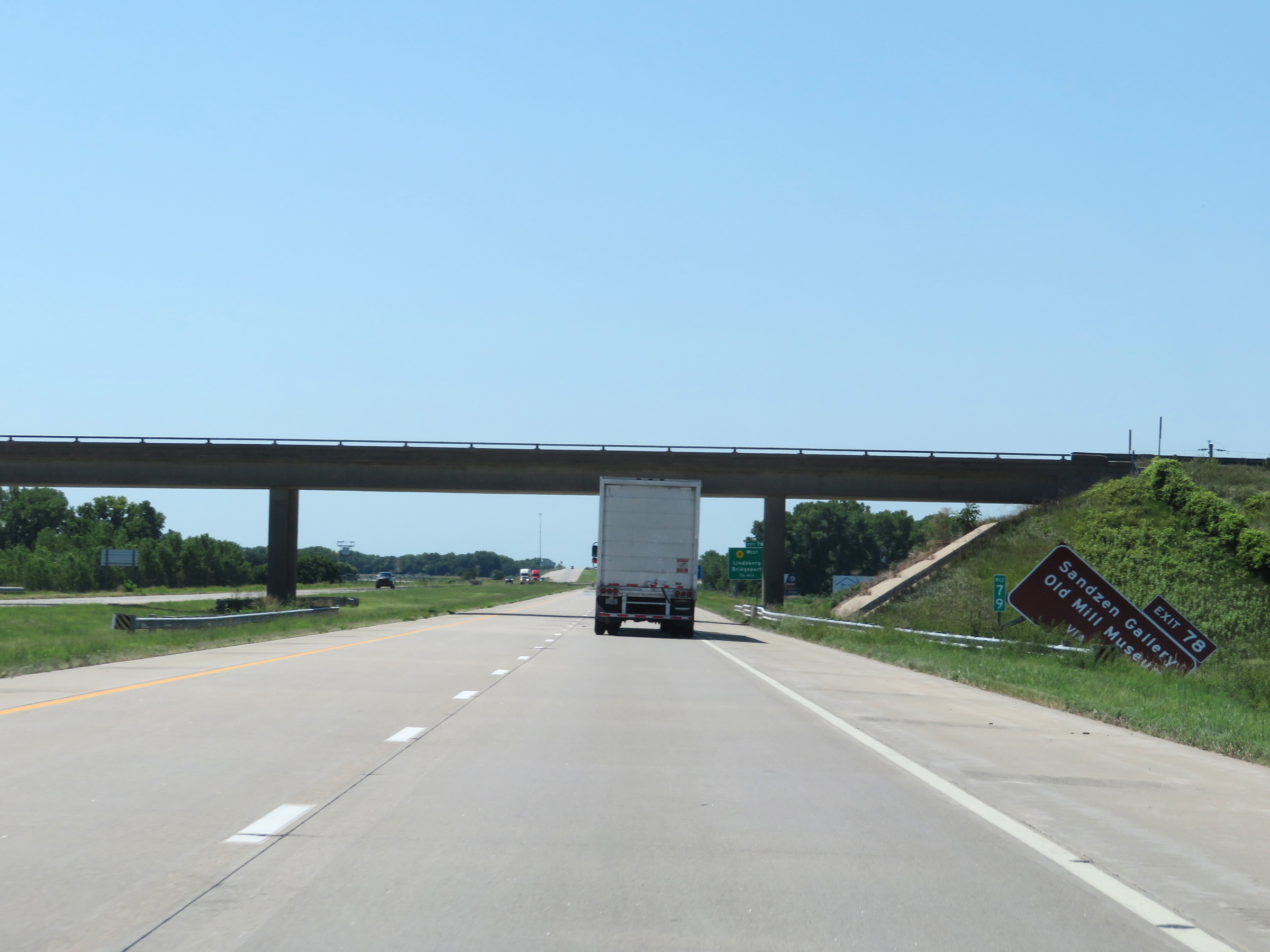 |
Again, take Exit 78 to Sandzen Gallery and Old Mill Museum. (Photo taken 8/11/20). |
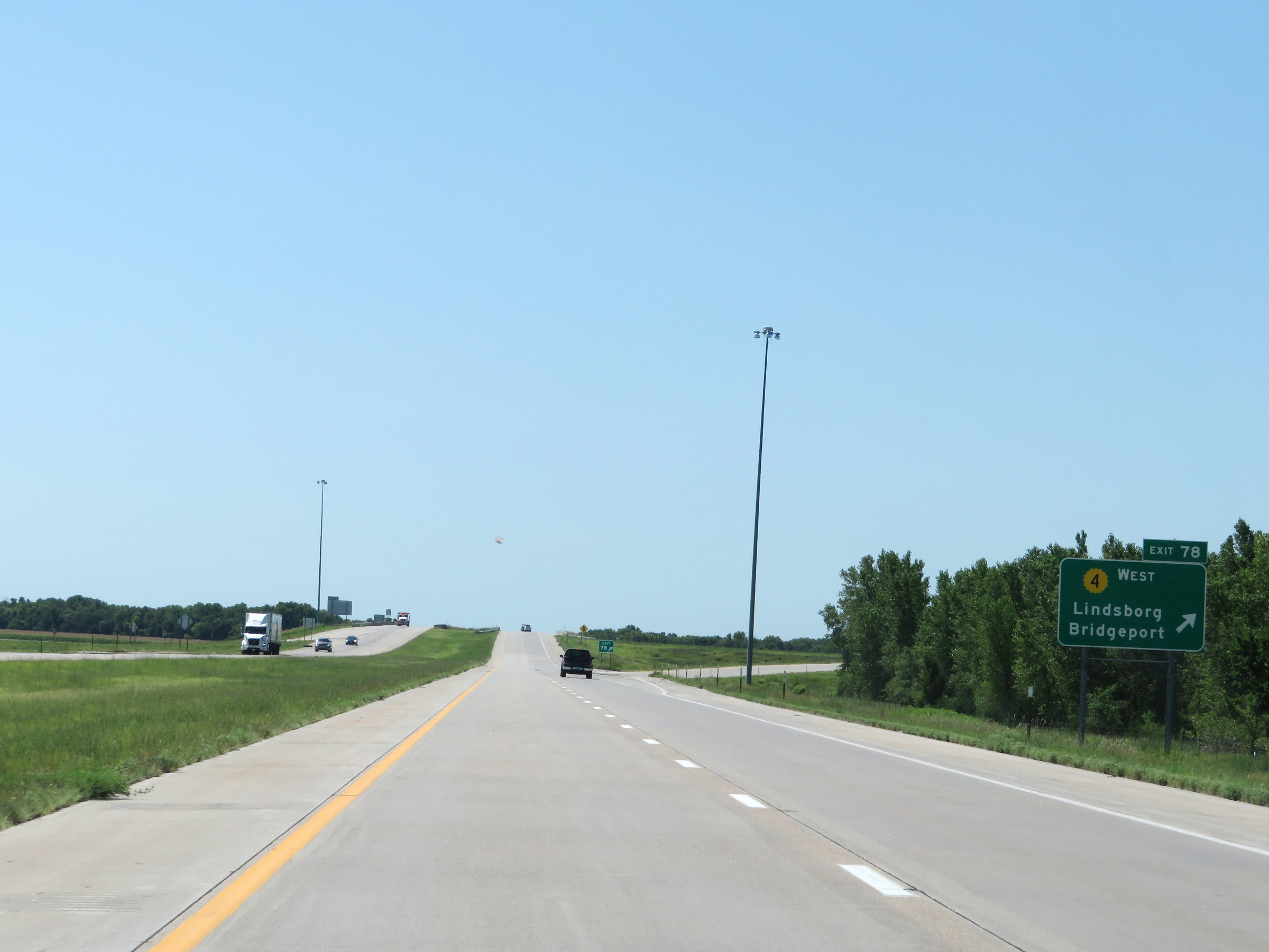 |
Interstate 135 South at Exit 78: K-4 West - Lindsborg / Bridgeport (Photo taken 8/11/20). |
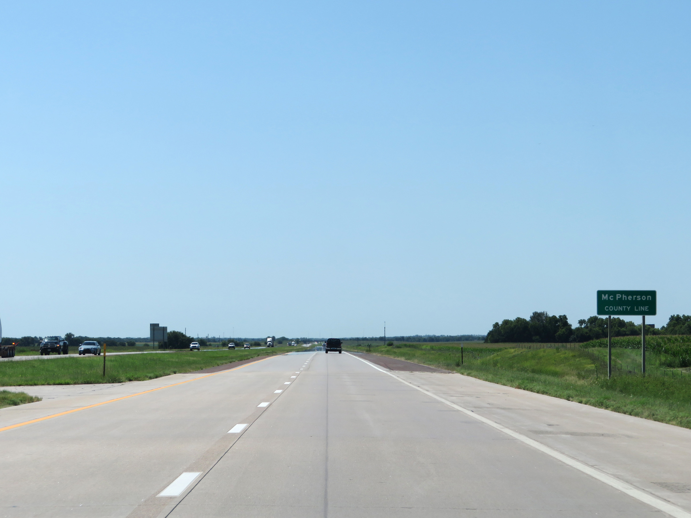 |
Interstate 135 South as it enters McPherson County. (Photo taken 8/11/20). |
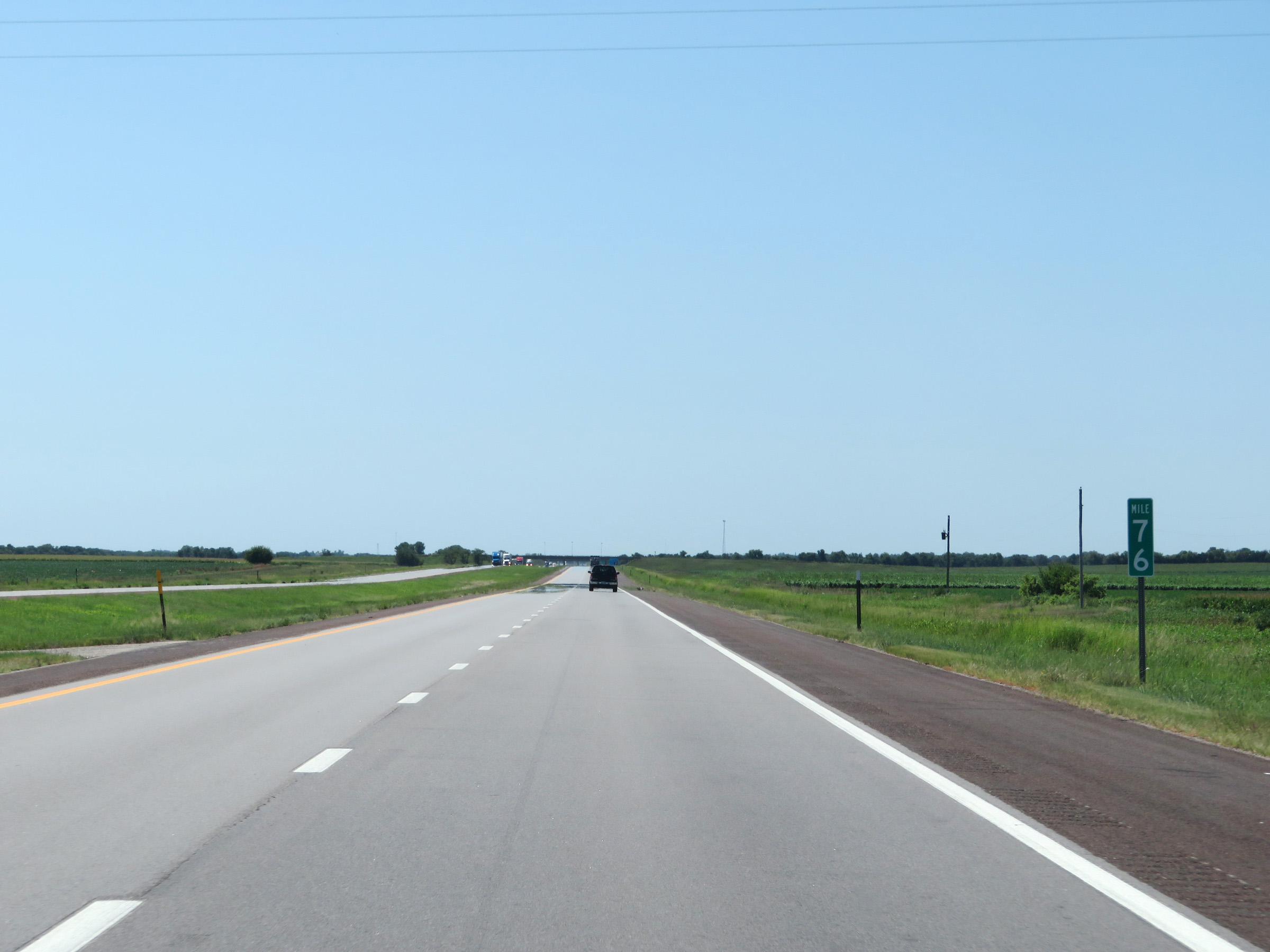 |
View on Interstate 135 South at mile marker 76. (Photo taken 8/11/20). |
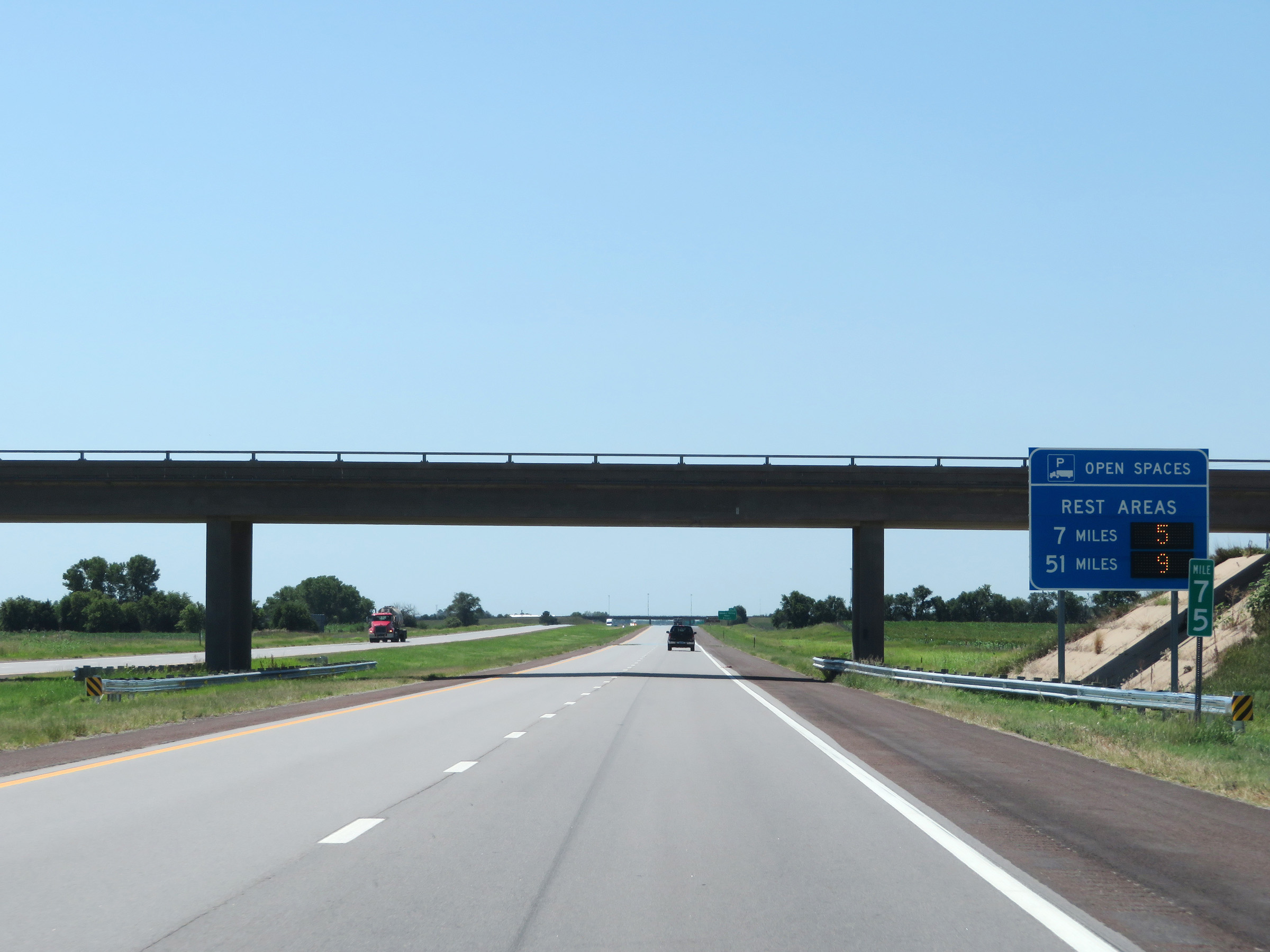 |
This sign at mile marker 75 dynamically shows the current number of available truck parking spaces at the two Rest Areas on Interstate 135 South, 7 miles ahead and 51 miles ahead. (Photo taken 8/11/20). |
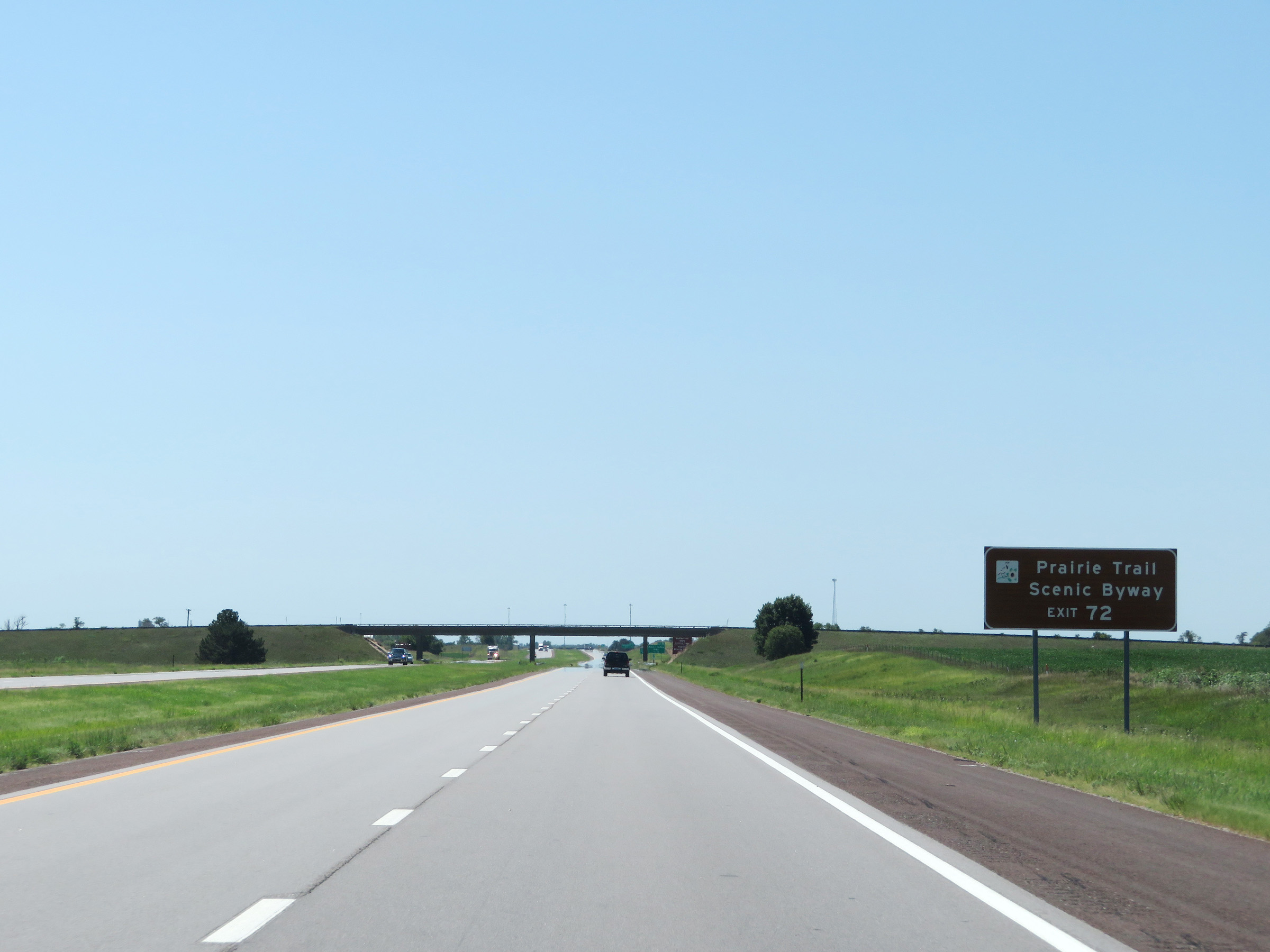 |
Take Exit 72 to Prairie Trail Scenic Byway. (Photo taken 8/11/20). |
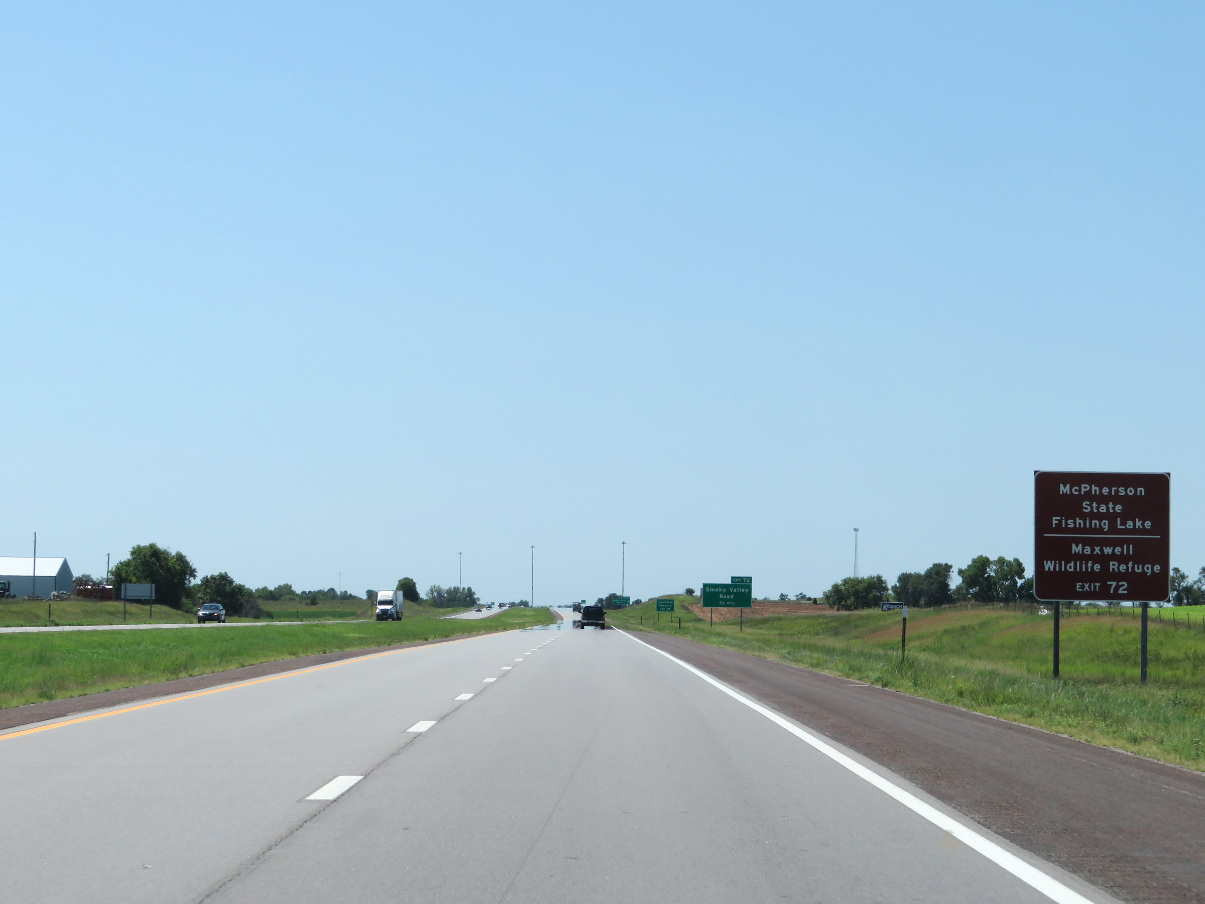 |
Also take Exit 72 to McPherson State Fishing Lake and Maxwell Wildlife Refuge. (Photo taken 8/11/20). |
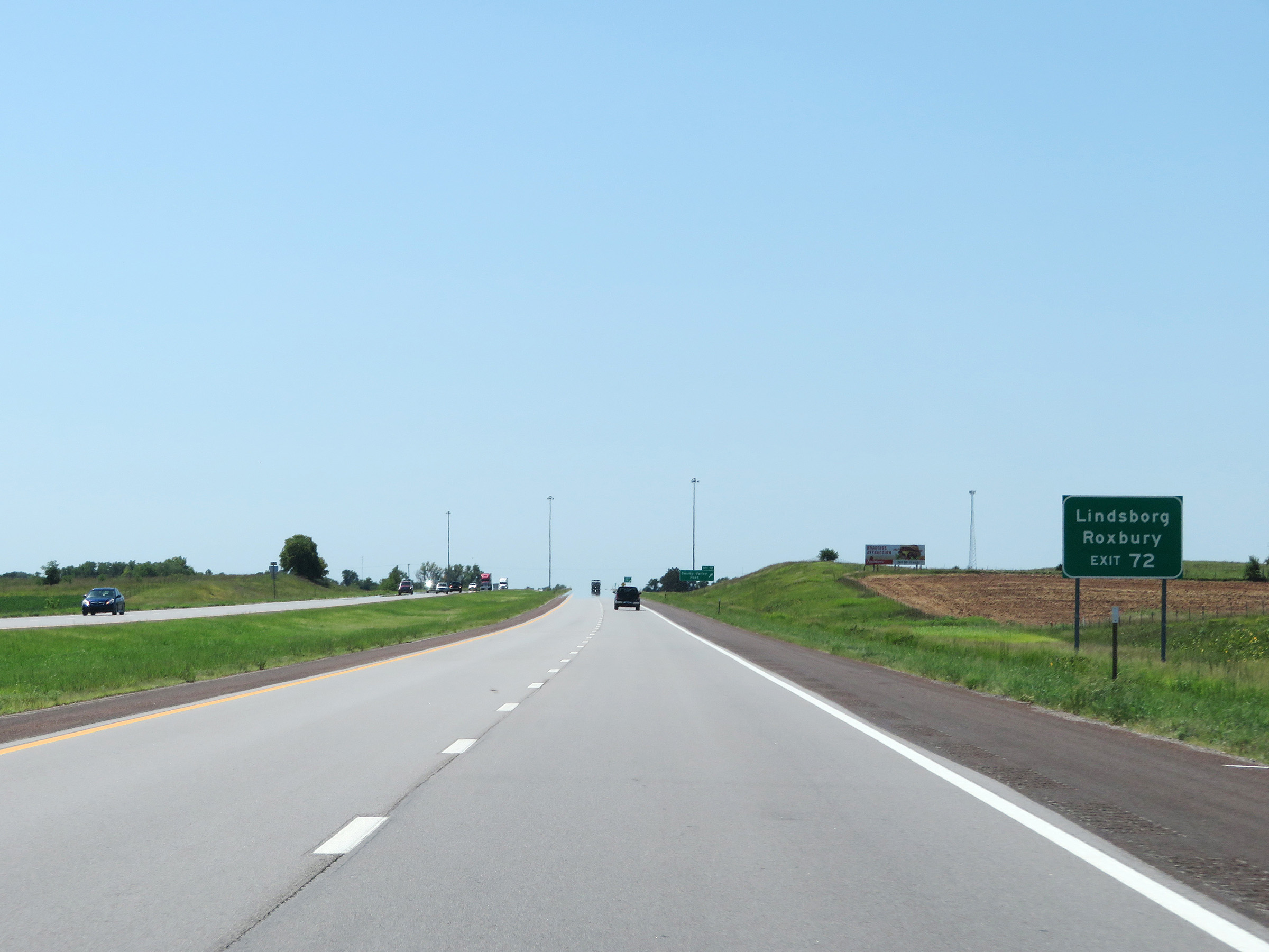 |
Take Exit 72 to Lindsborg and Roxbury as well. (Photo taken 8/11/20). |
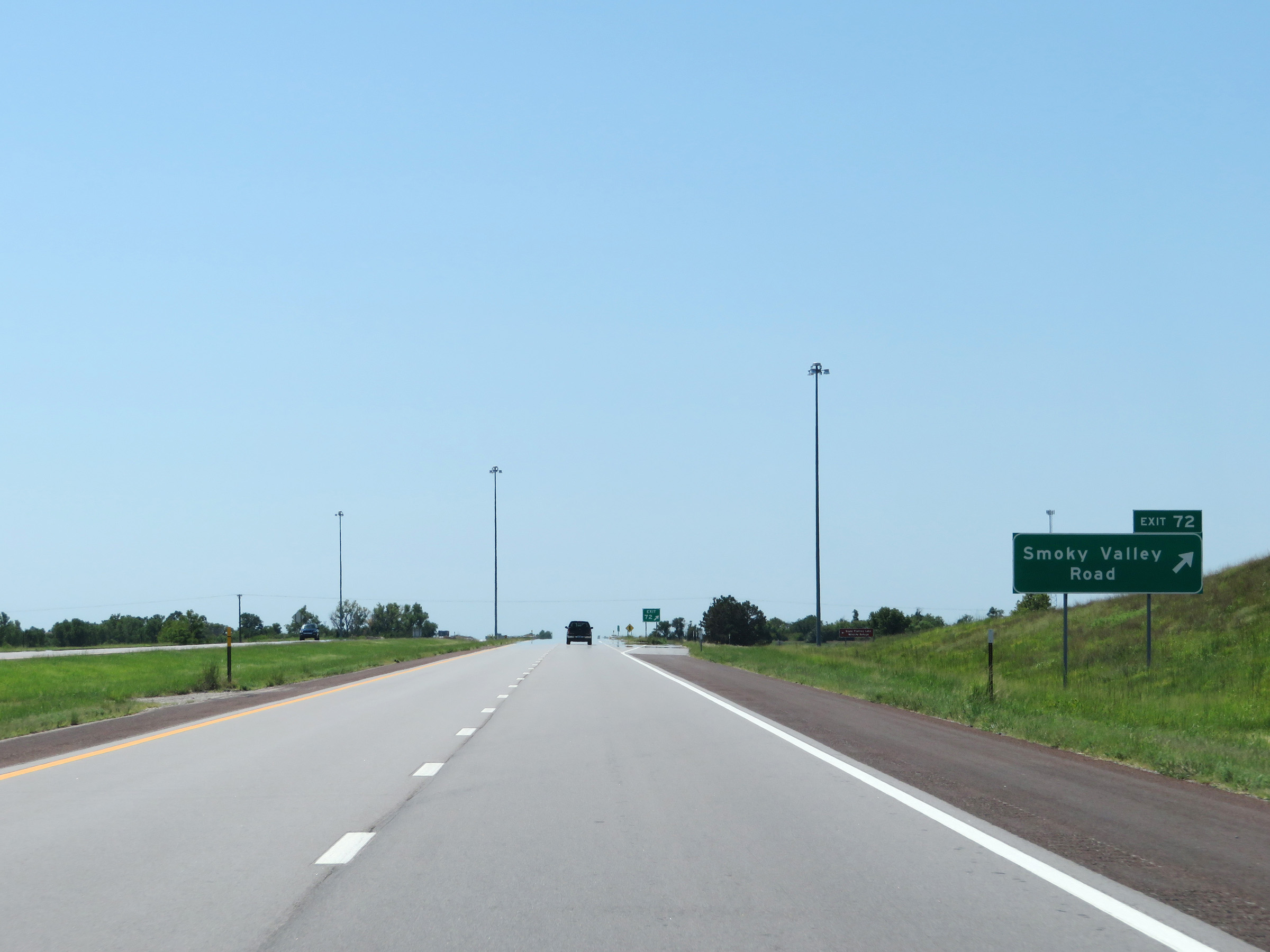 |
Interstate 135 South at Exit 72: Smoky Valley Road (Photo taken 8/11/20). |
 |
Mileage sign on Interstate 135 South. It's 12 miles to McPherson, 24 miles to Moundridge, and 62 miles to Wichita. (Photo taken 8/11/20). |
 |
Mile marker 71 on Interstate 135 South in McPherson County. (Photo taken 8/11/20). |
 |
View on Interstate 135 South at mile marker 70. (Photo taken 8/11/20). |
 |
Rest Area (on the left, in the median) on Interstate 135 South in McPherson County. (Photo taken 8/11/20). |
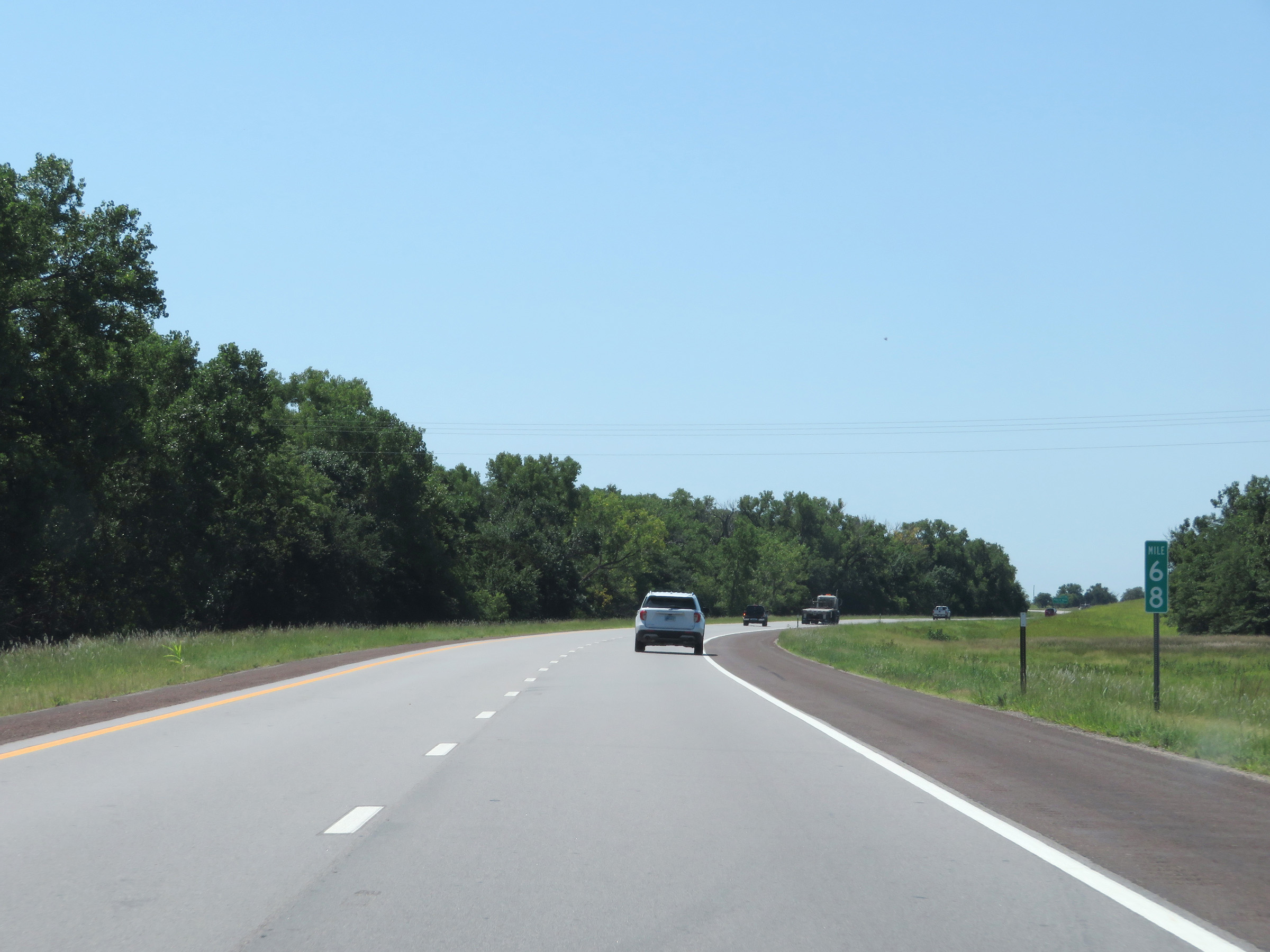 |
Interstate 135 South at mile marker 68. (Photo taken 8/11/20). |
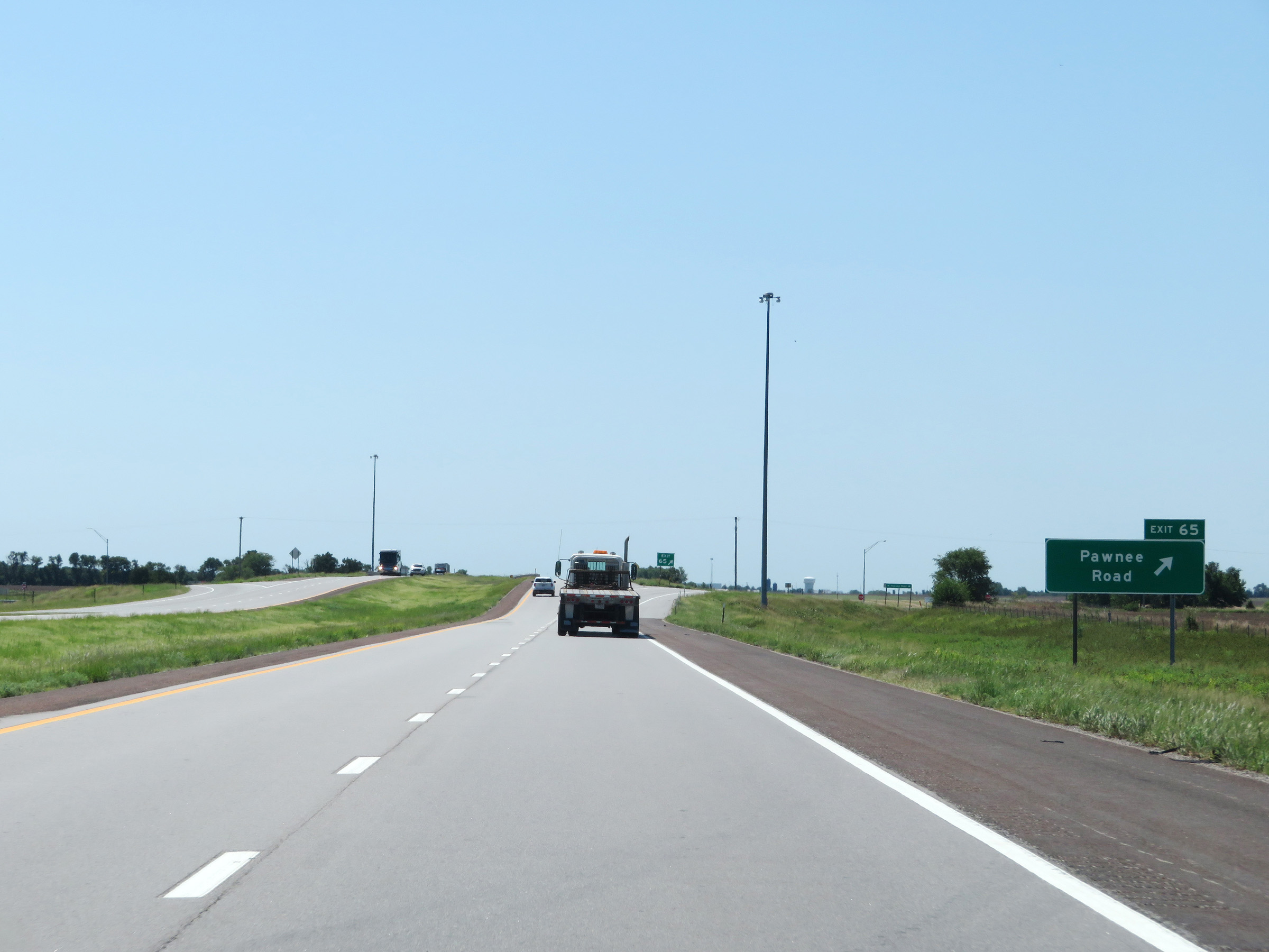 |
Interstate 135 South at Exit 65: Pawnee Road (Photo taken 8/11/20). |
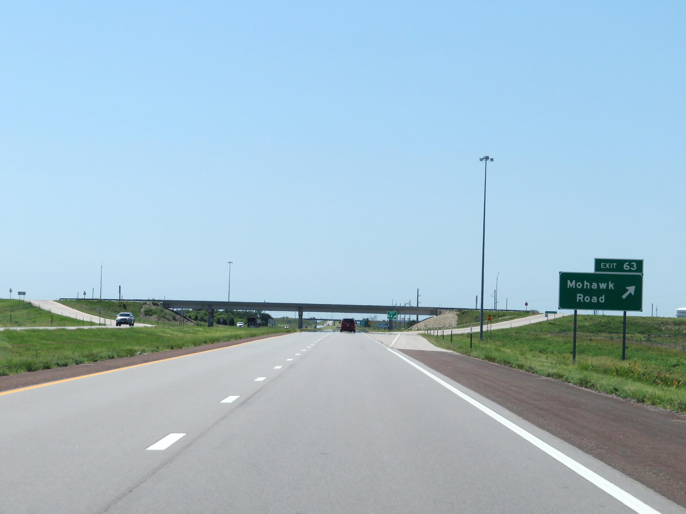 |
Interstate 135 South at Exit 63: Mohawk Road (Photo taken 8/11/20). |
 |
State-named Interstate 135 South reassurance shield. (Photo taken 8/11/20). |
 |
The speed limits remain 75 mph maximum and 40 mph minimum on Interstate 135 South. (Photo taken 8/11/20). |
 |
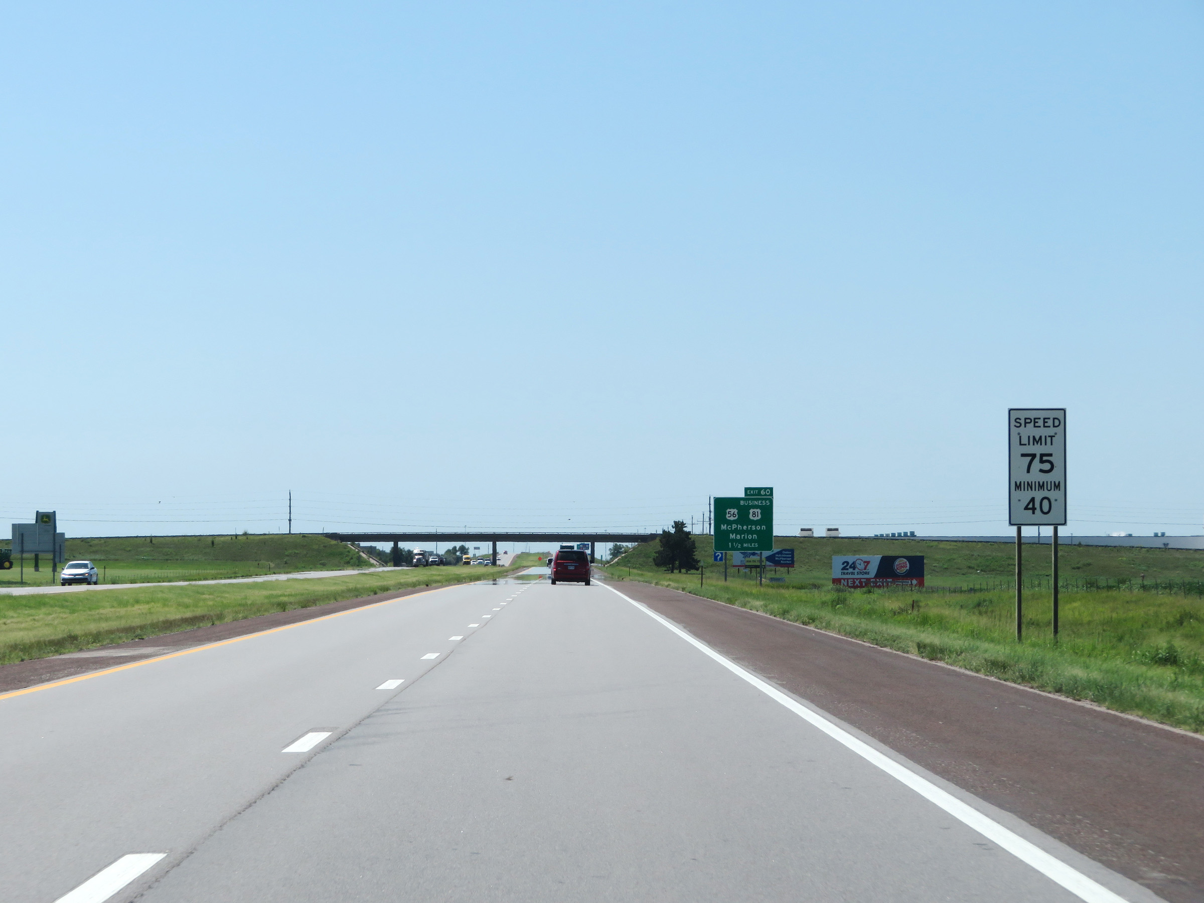
Tak Exit 60 to Hillsboro and Tabor College. (Photo taken 8/11/20). |
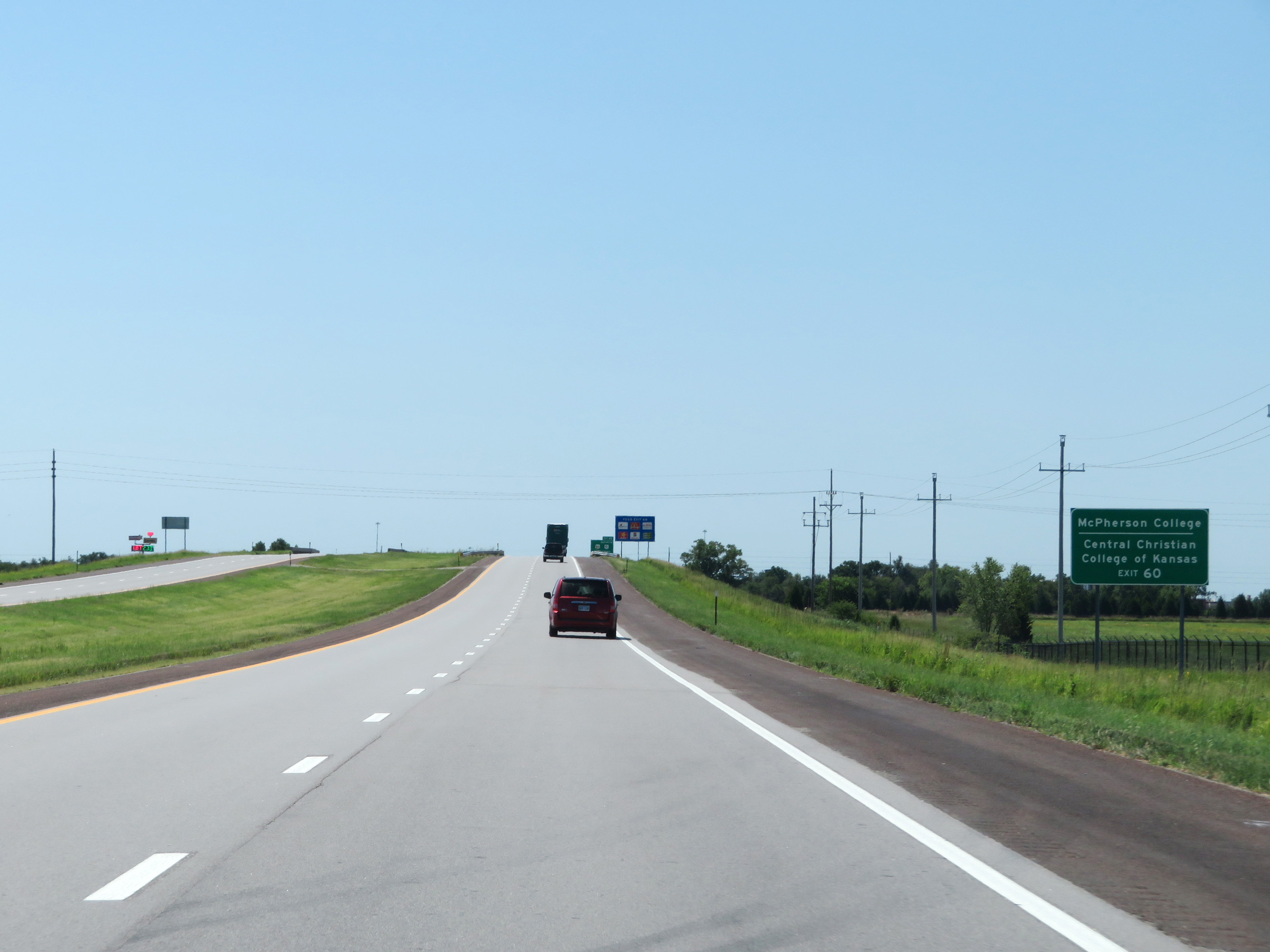 |
Also take Exit 60 to McPherson College and Central Christian College of Kansas. (Photo taken 8/11/20). |
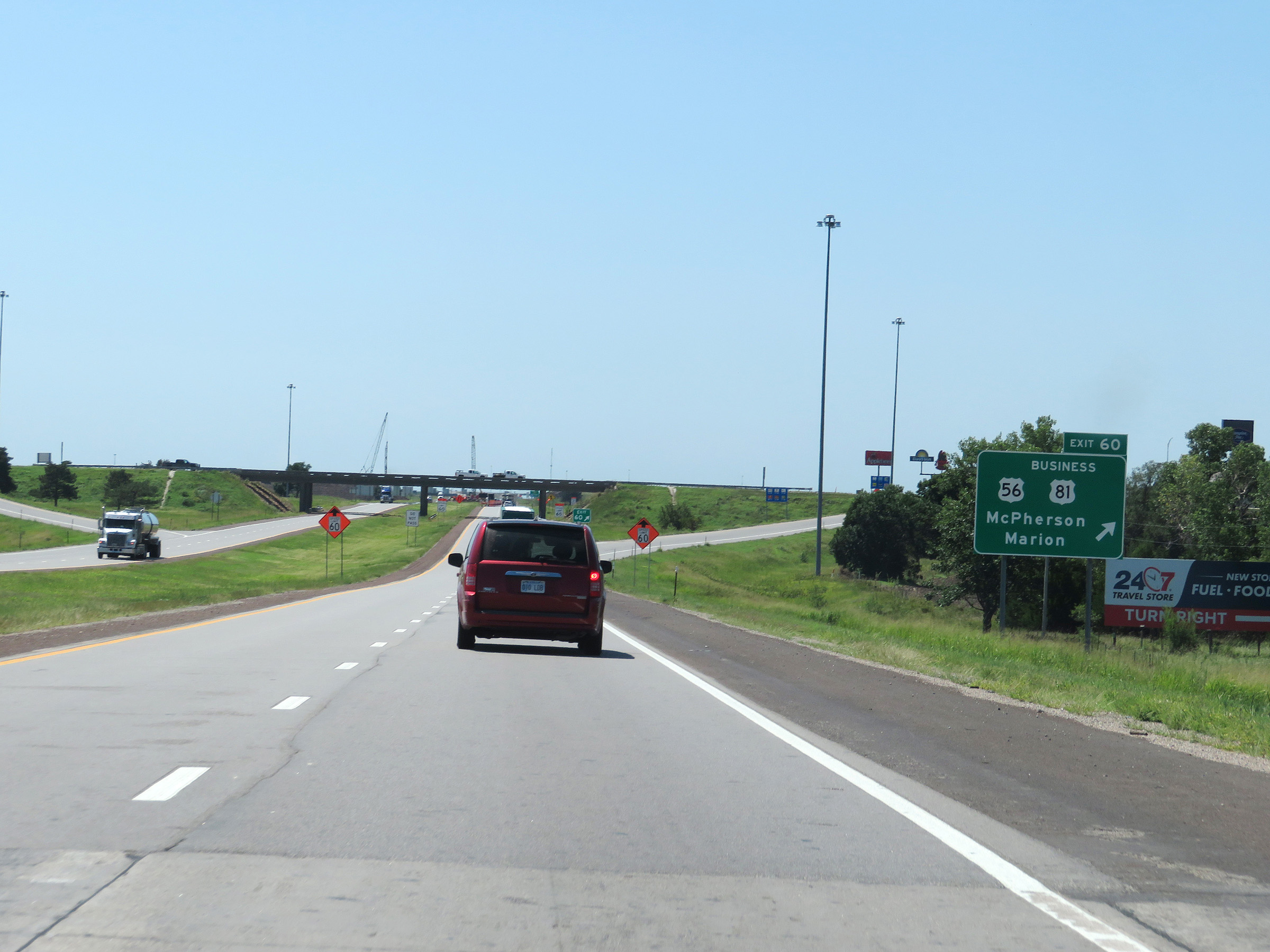 |
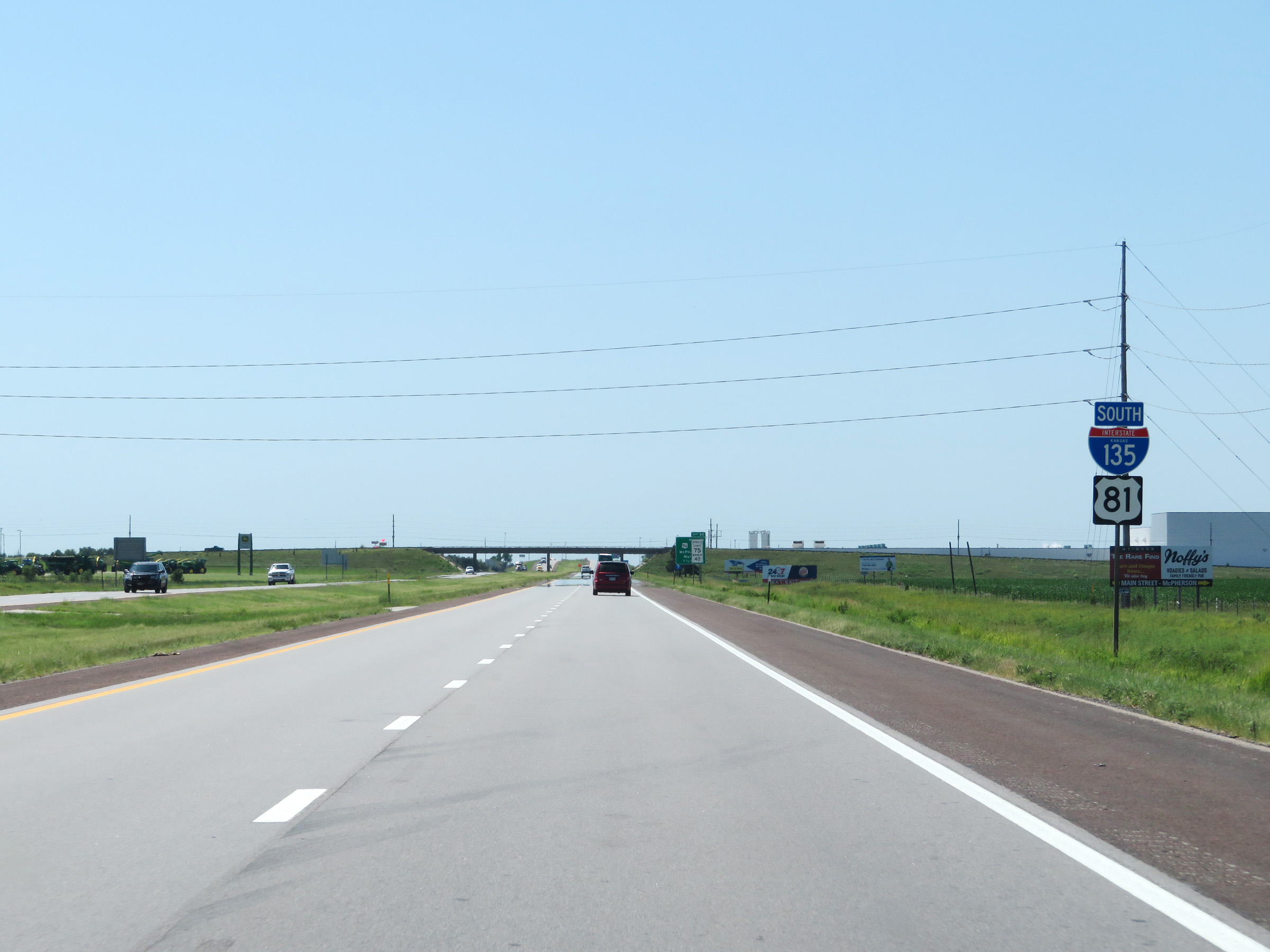
Interstate 135 South at Exit 60: US 56 / US 81 Business - McPherson / Marion (Photo taken 8/11/20). |
Section 2: McPherson (Exit 60) to Wichita (Exit 13)
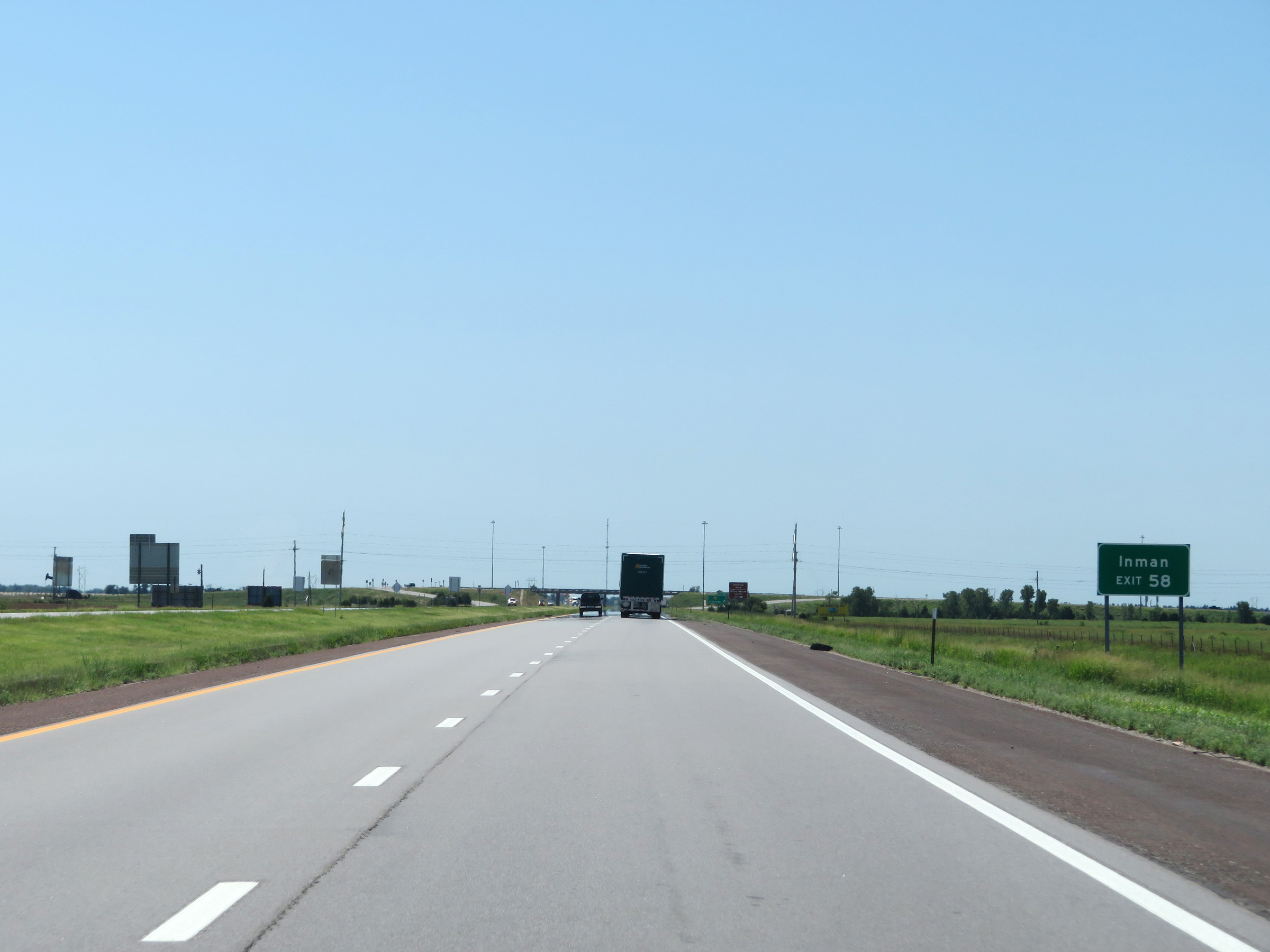 |
Take Exit 58 to Inman. (Photo taken 8/11/20). |
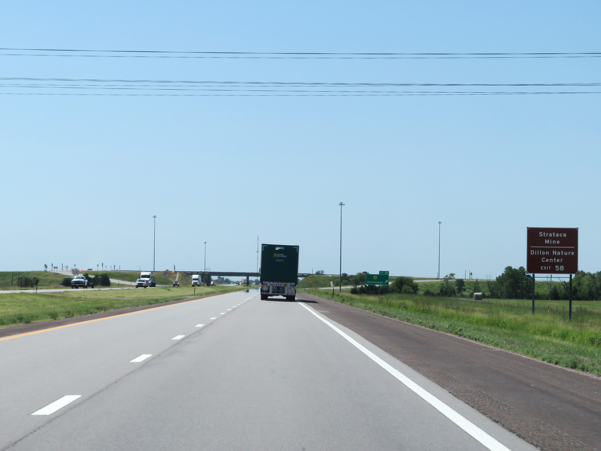 |
Also take Exit 58 to Strataca Mine and Dillon Nature Center. (Photo taken 8/11/20). |
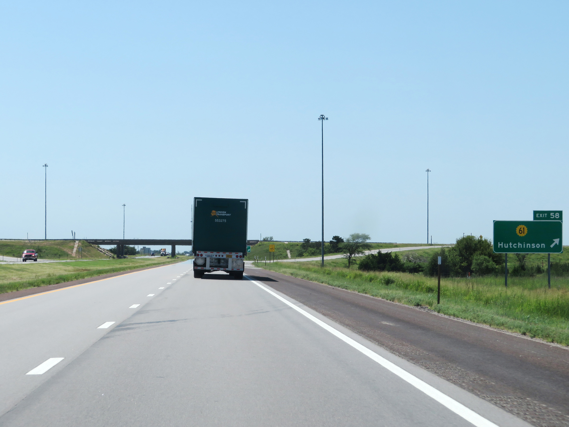 |
Interstate 135 South at Exit 58: K-61 - Hutchinson (Photo taken 8/11/20). |
 |
Another mileage sign on Interstate 135 South. It's 10 miles to Moundridge, 16 miles to Hesston, and 46 miles to Wichita. (Photo taken 8/11/20). |
 |
Take Exit 54 to Elyria. (Photo taken 8/11/20). |
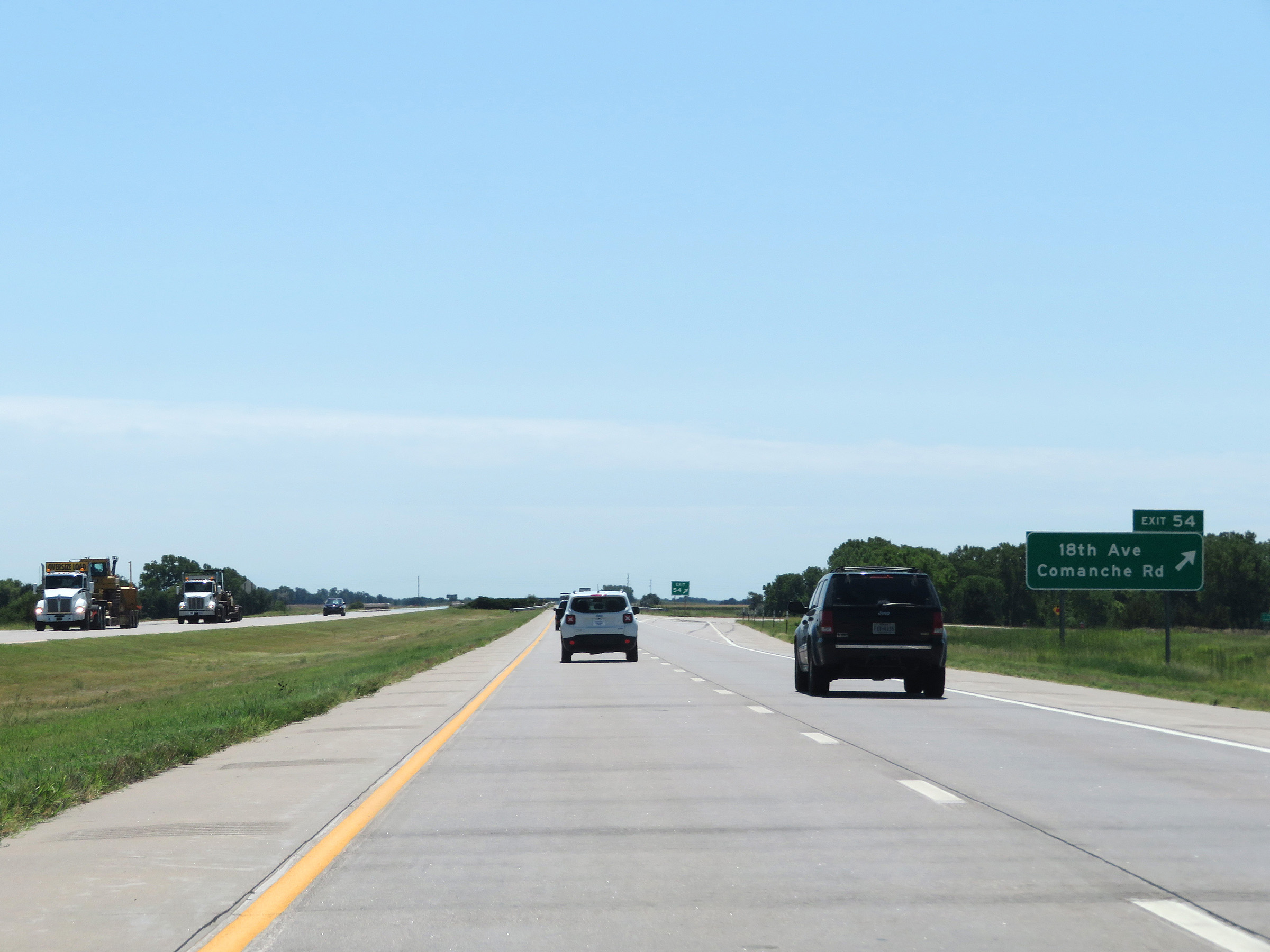 |
Interstate 135 South at Exit 54: 18th Ave / Comanche Rd (Photo taken 8/11/20). |
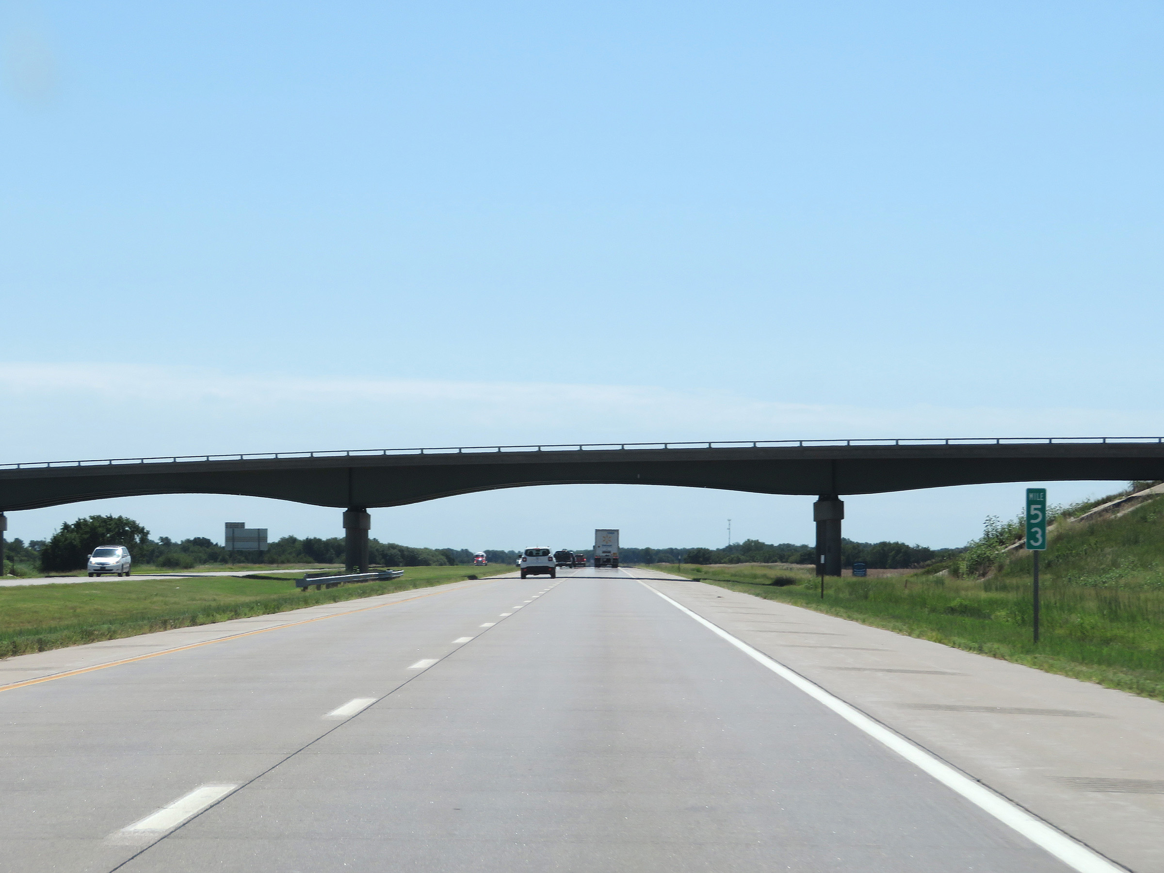 |
Mile marker 53 on Interstate 135 South in McPherson County. (Photo taken 8/11/20). |
 |
View on Interstate 135 South at mile marker 50. (Photo taken 8/11/20). |
 |
Take Exit 48 to 22nd Ave. (Photo taken 8/11/20). |
 |
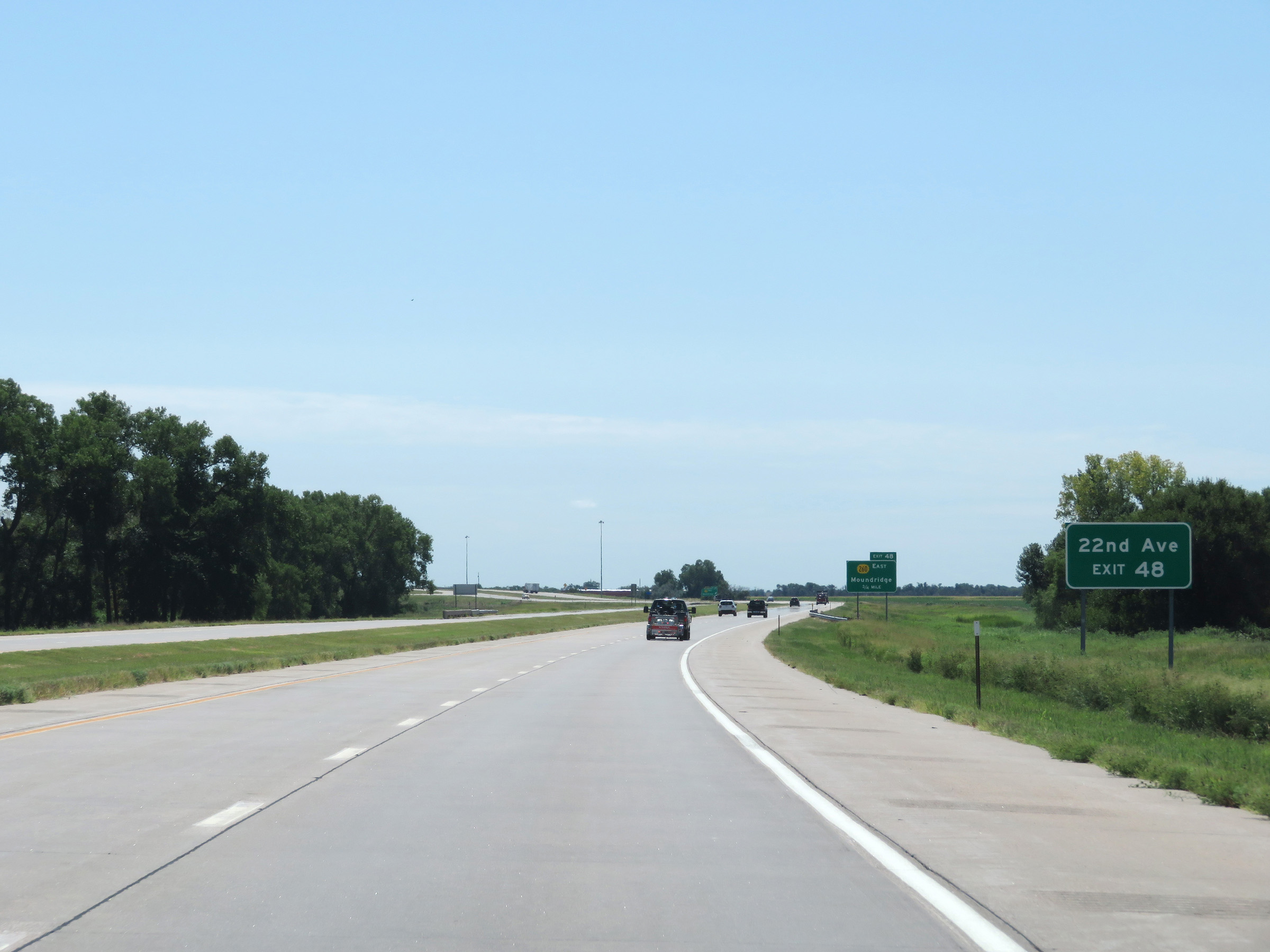
Interstate 135 South at Exit 48: K-260 East - Moundridge (Photo taken 8/11/20). |
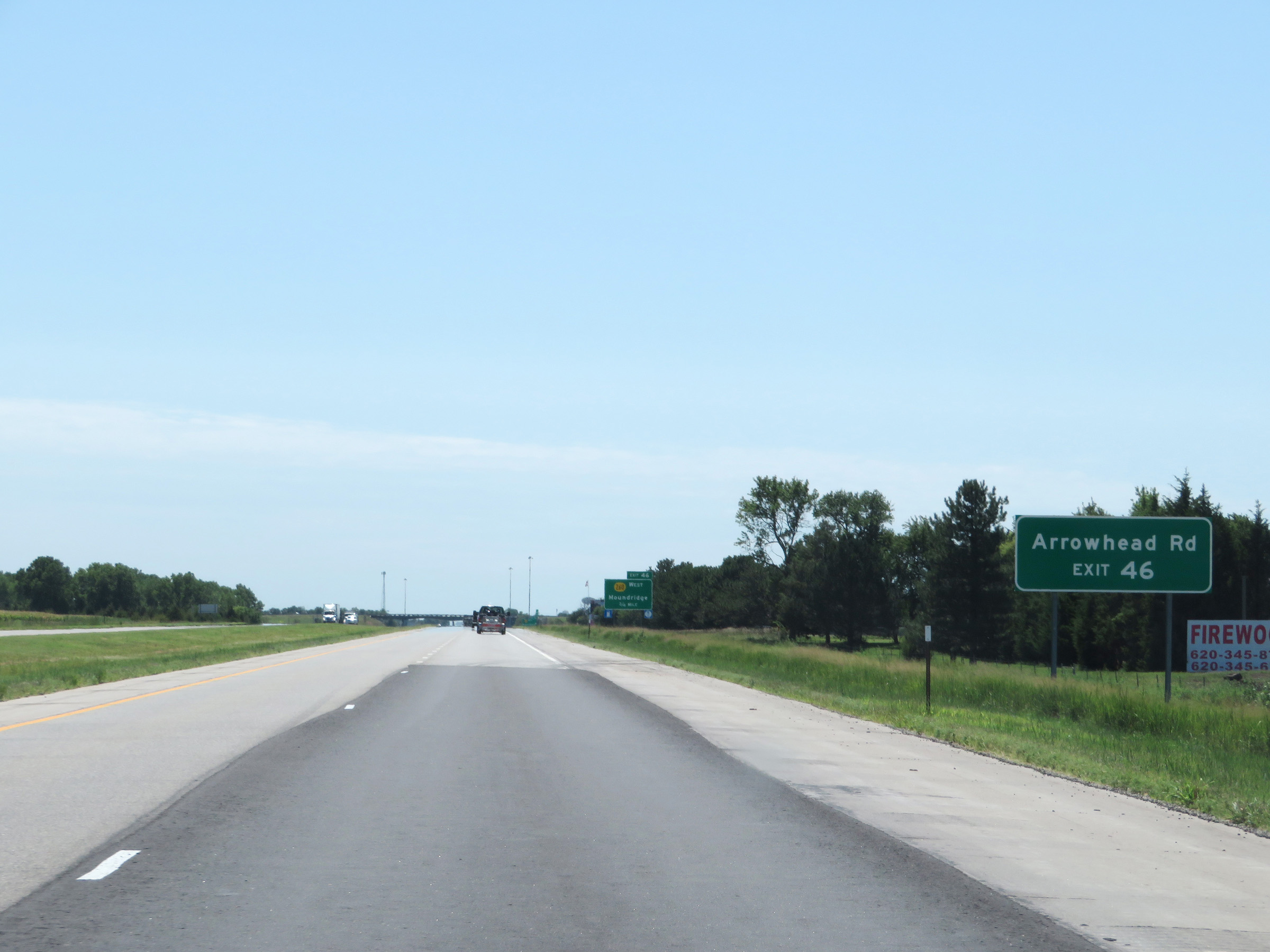 |
Take Exit 46 to Arrowhead Rd. (Photo taken 8/11/20). |
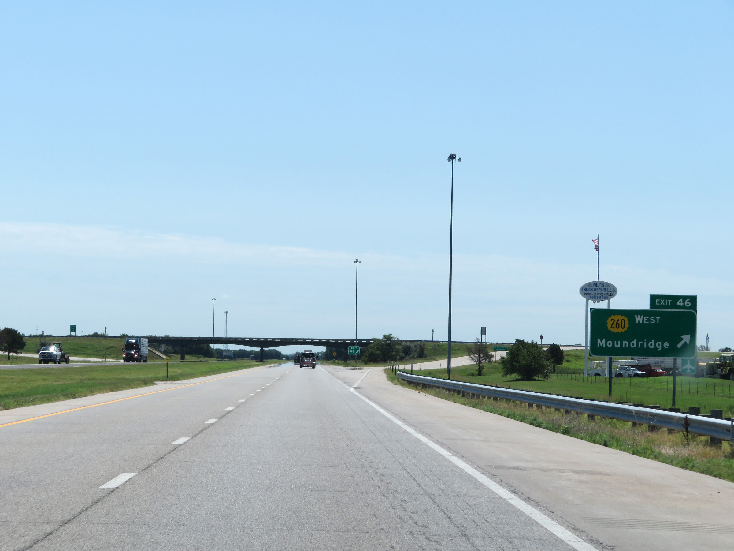 |
Interstate 135 South at Exit 46: K-260 West - Moundridge (Photo taken 8/11/20). |
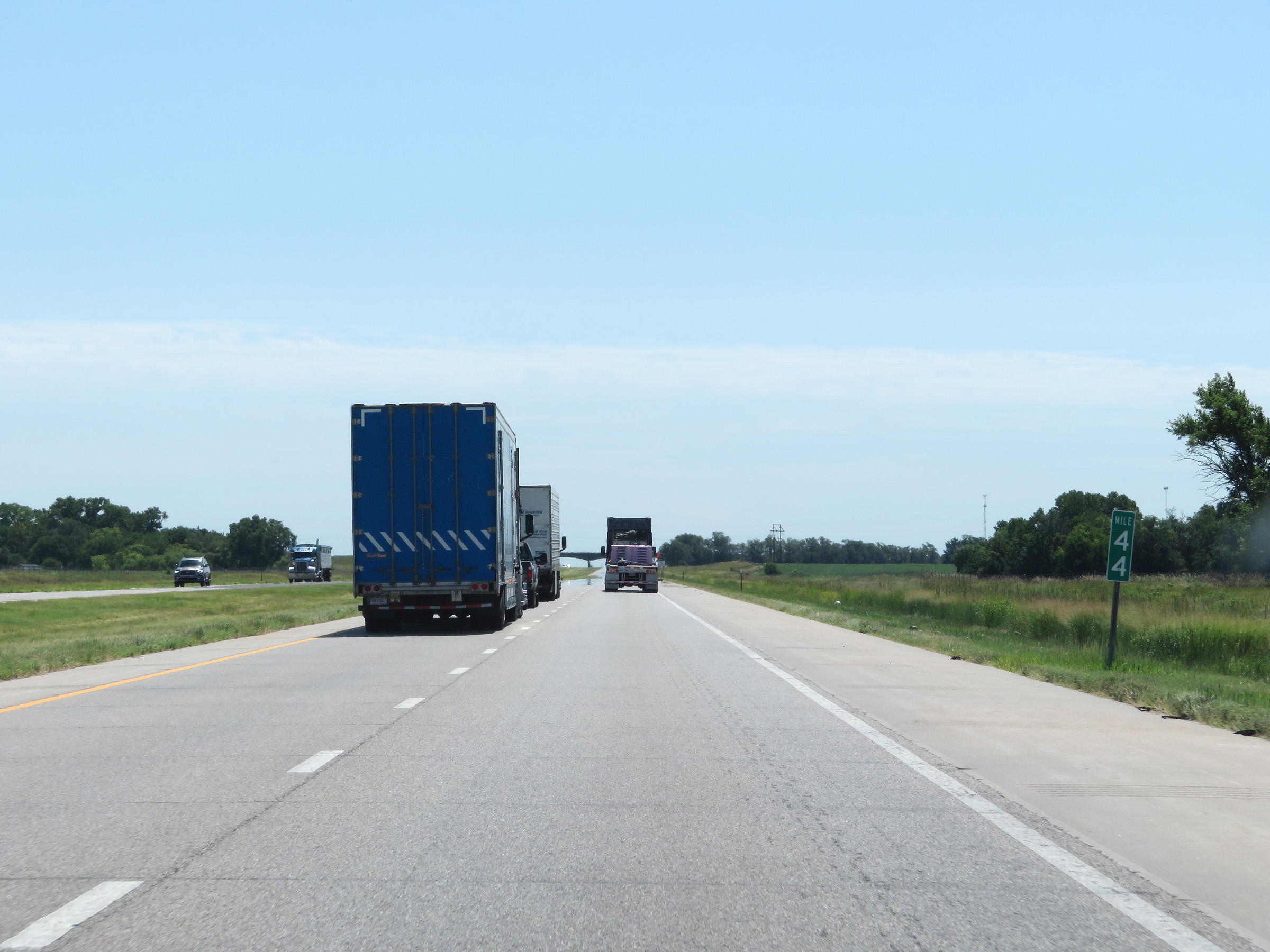 |
Mile marker 44 on Interstate 135 South in McPherson County. (Photo taken 8/11/20). |
 |
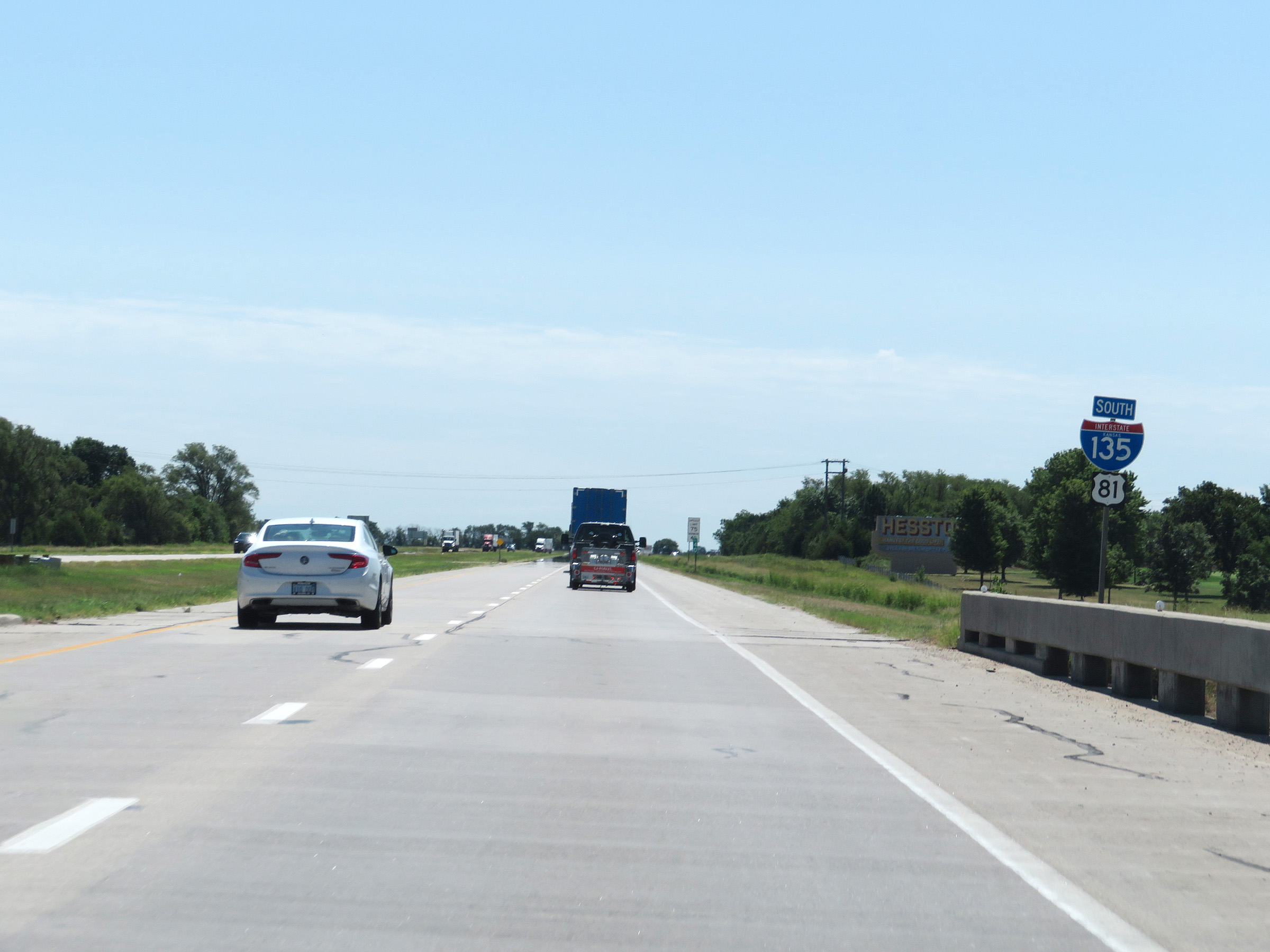
Interstate 135 South as it enters Harvey County. (Photo taken 8/11/20). |
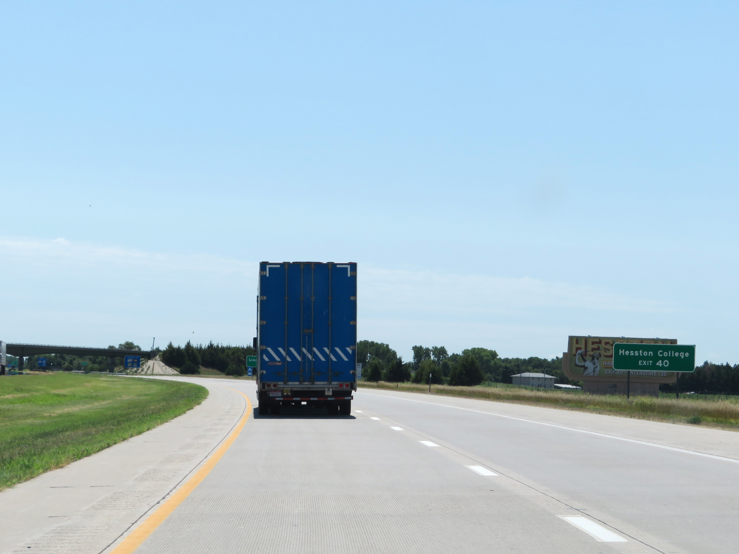 |
Take Exit 40 to Hesston College. (Photo taken 8/11/20). |
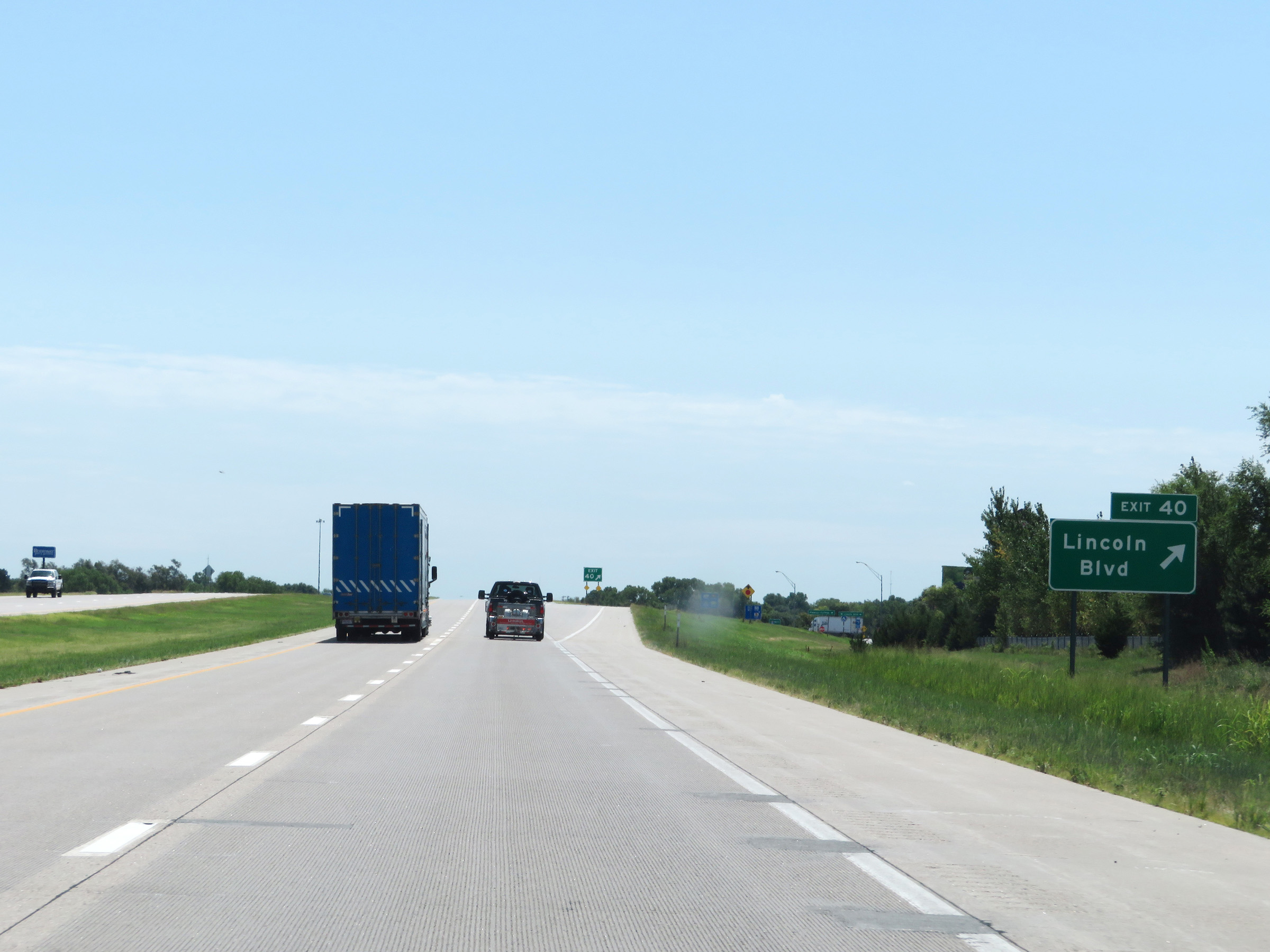 |
Interstate 135 South at Exit 40: Lincoln Blvd (Photo taken 8/11/20). |
 |
Another state-named Interstate 135 South reassurance shield approaching mile marker 40. (Photo taken 8/11/20). |
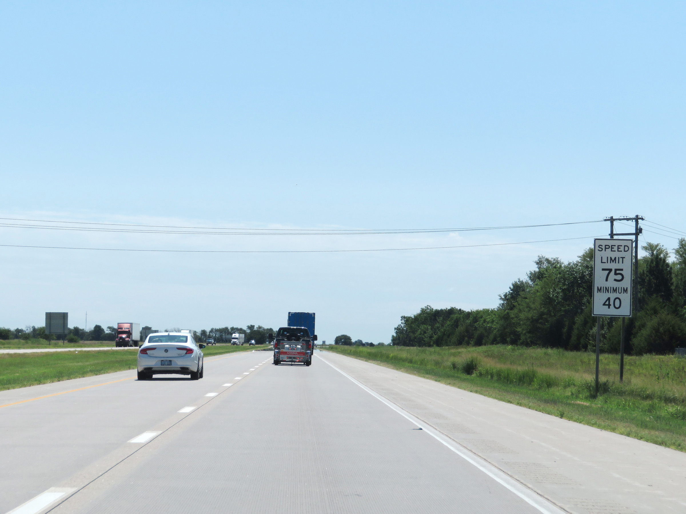 |
The speed limits remain 75 mph maximum and 40 mph minimum on Interstate 135 South. (Photo taken 8/11/20). |
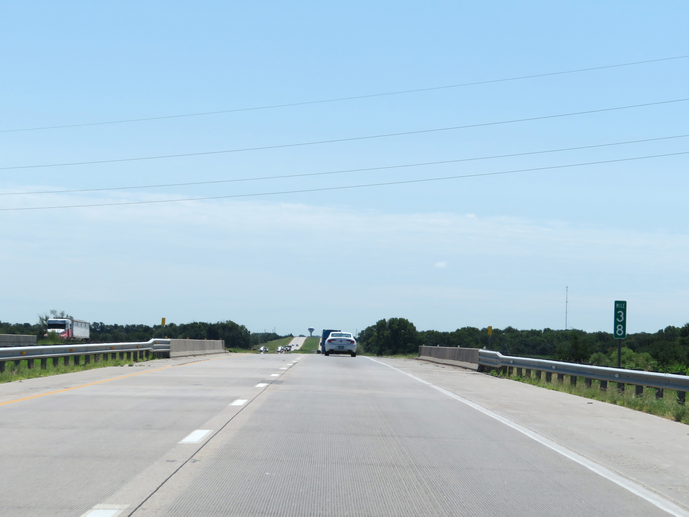 |
Interstate 135 South at mile marker 38. (Photo taken 8/11/20). |
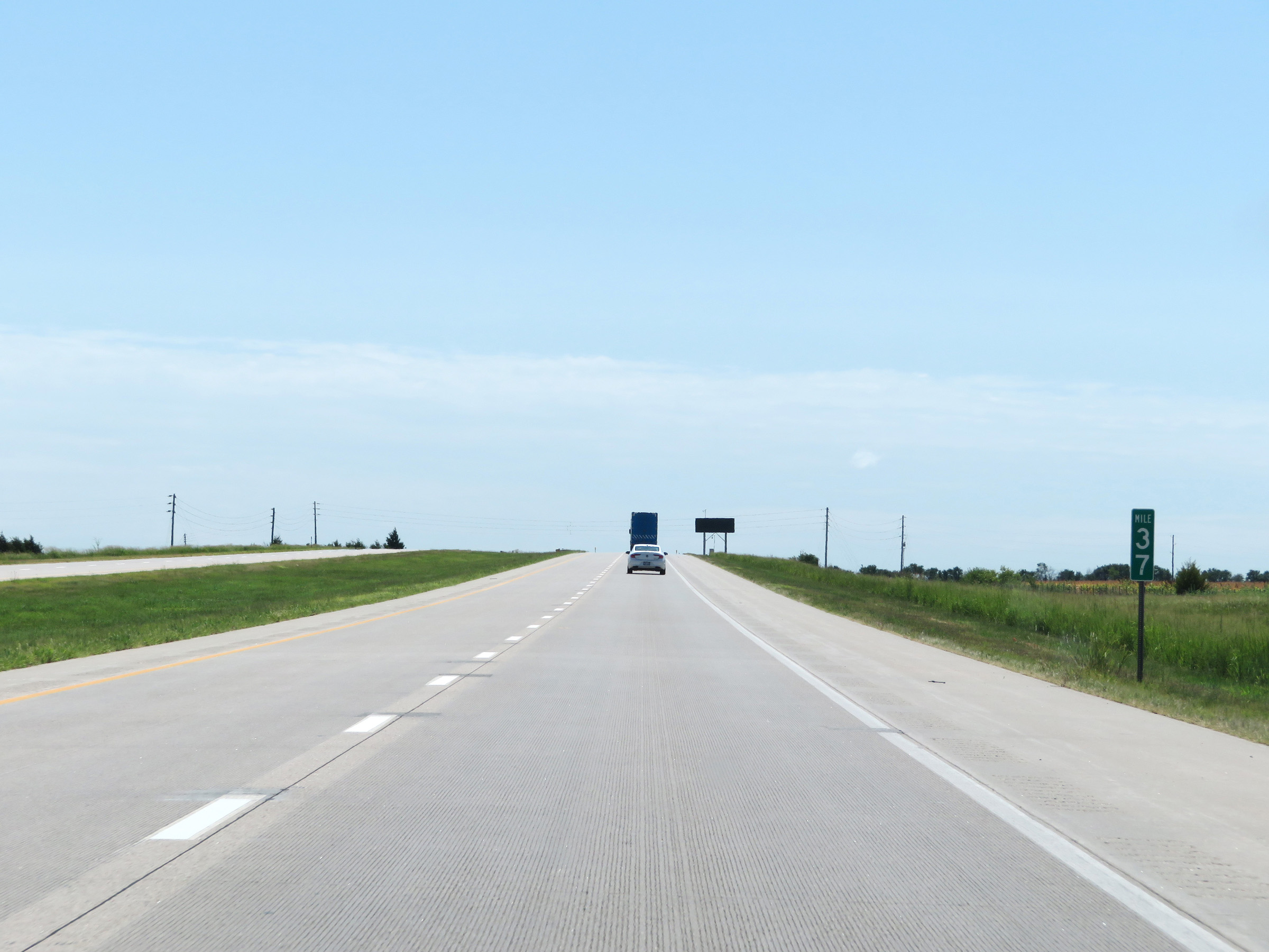 |
View on Interstate 135 South at mile marker 37. (Photo taken 8/11/20). |
 |
Take any of the next 4 exits to Newton. (Photo taken 8/11/20). |
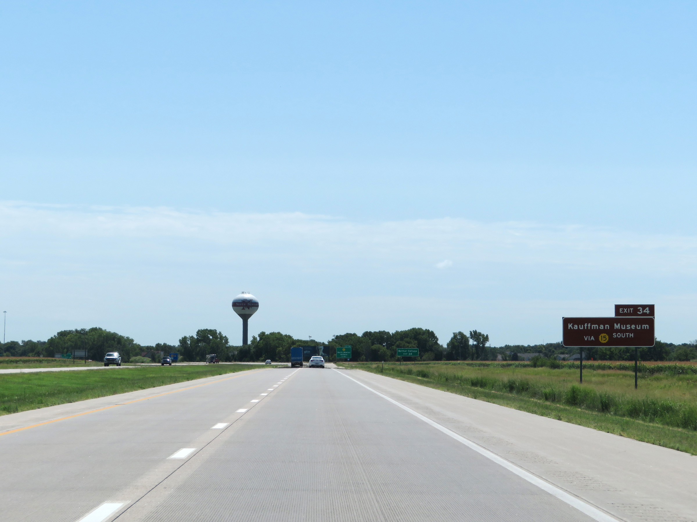 |
Take Exit 34 to the Kauffman Museum via K-15 South. (Photo taken 8/11/20). |
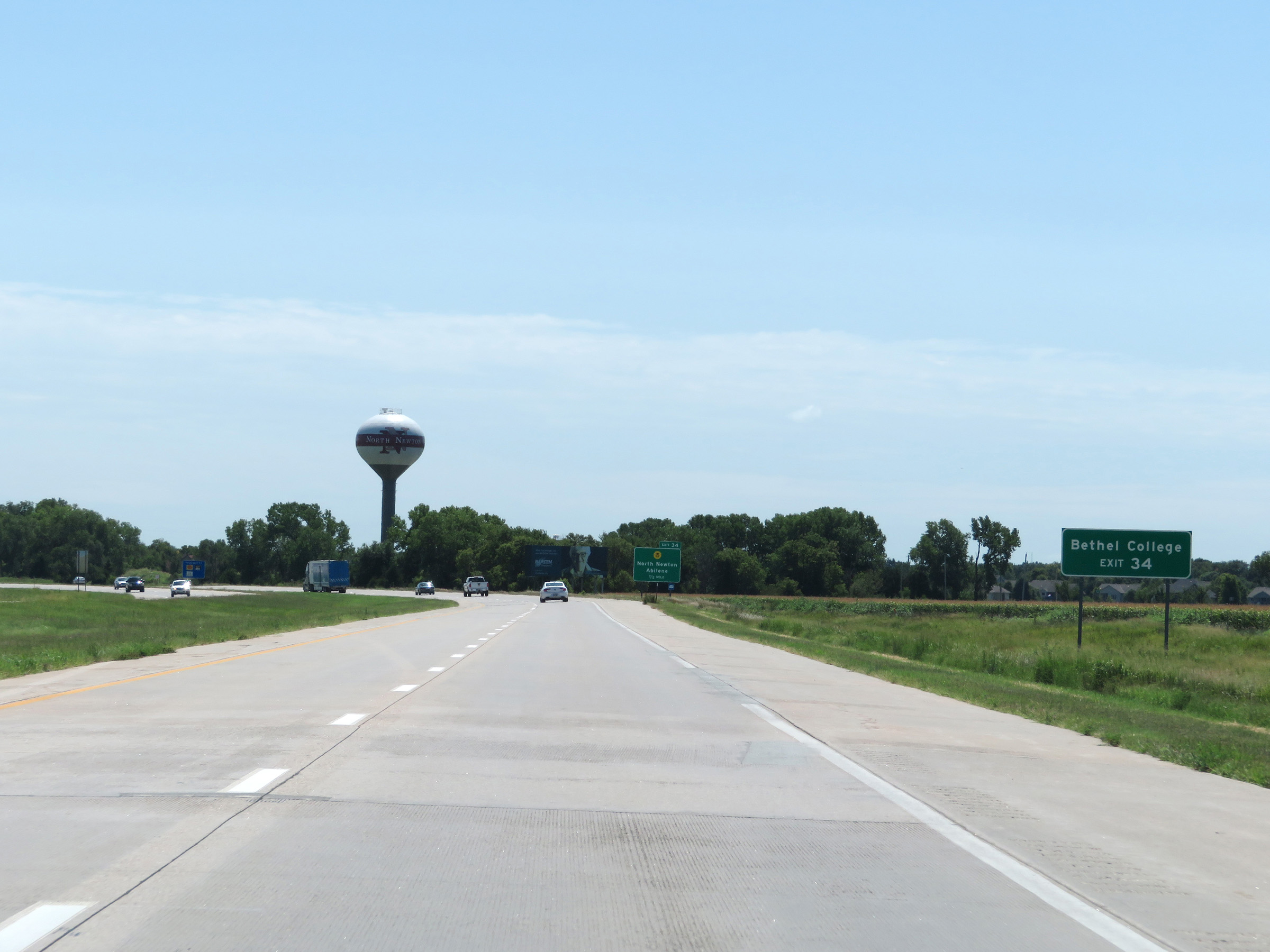 |
Also take Exit 34 to Bethel College. (Photo taken 8/11/20). |
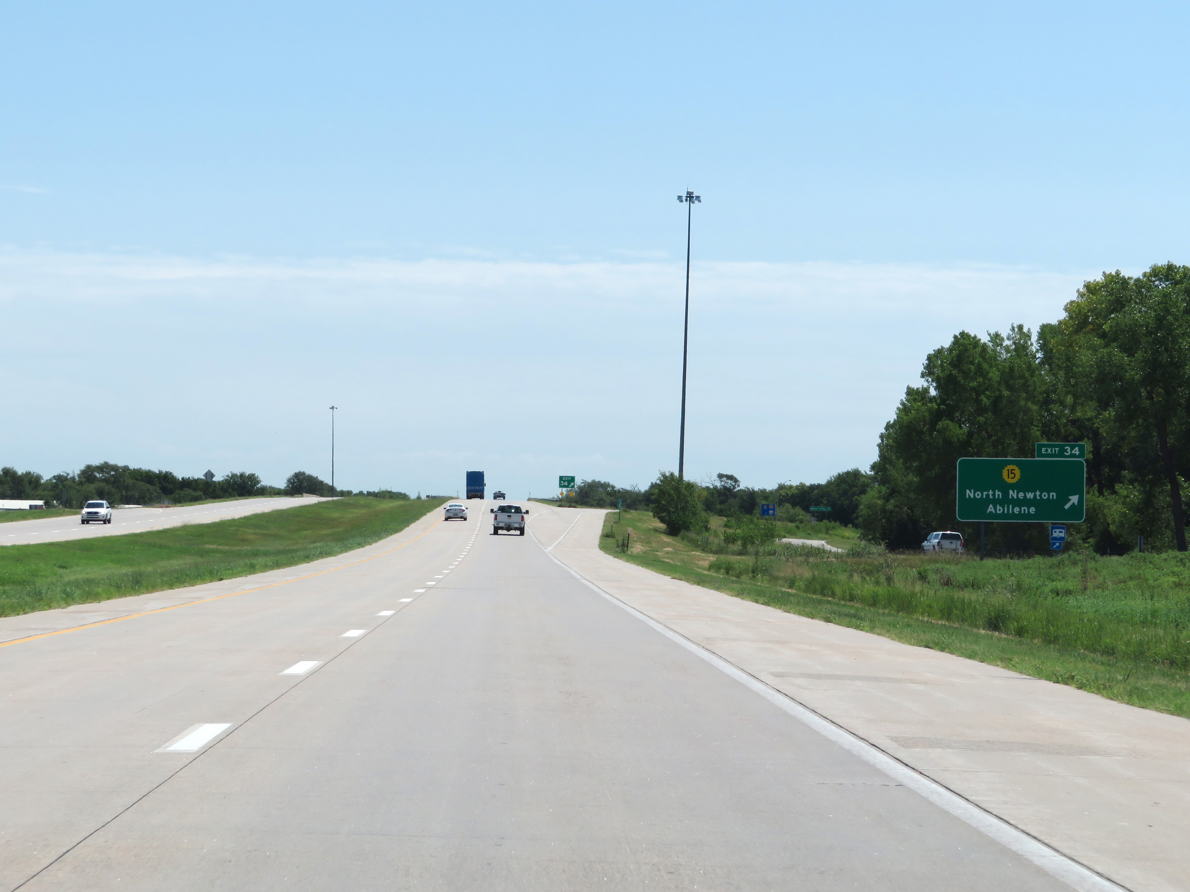 |
Interstate 135 South at Exit 34: K-15 - North Newton / Abilene (Photo taken 8/11/20). |
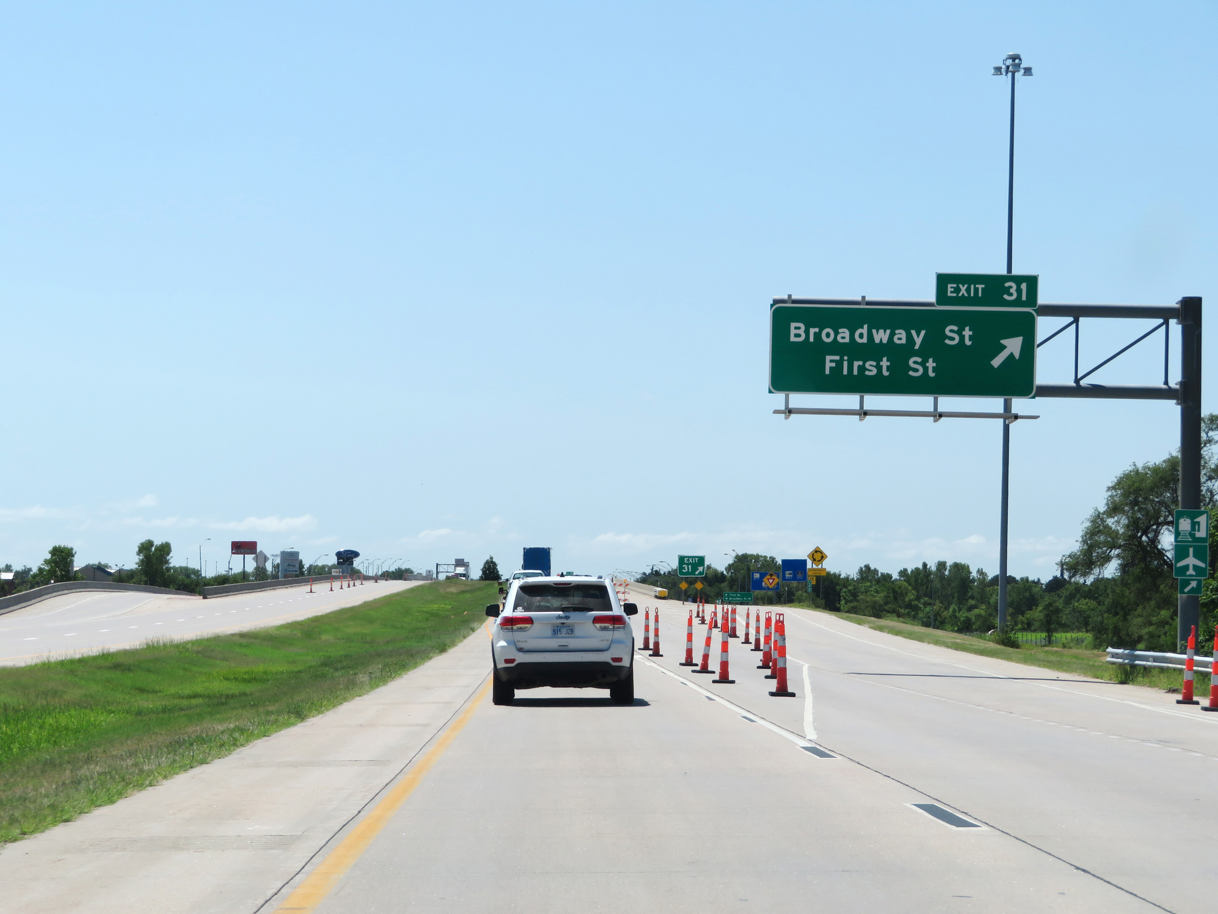 |
Interstate 135 South at Exit 31: Broadway St / First St (Photo taken 8/11/20). |
 |
Take Exit 30 to Kansas Learning Center for Health via US 50 West. (Photo taken 8/11/20). |
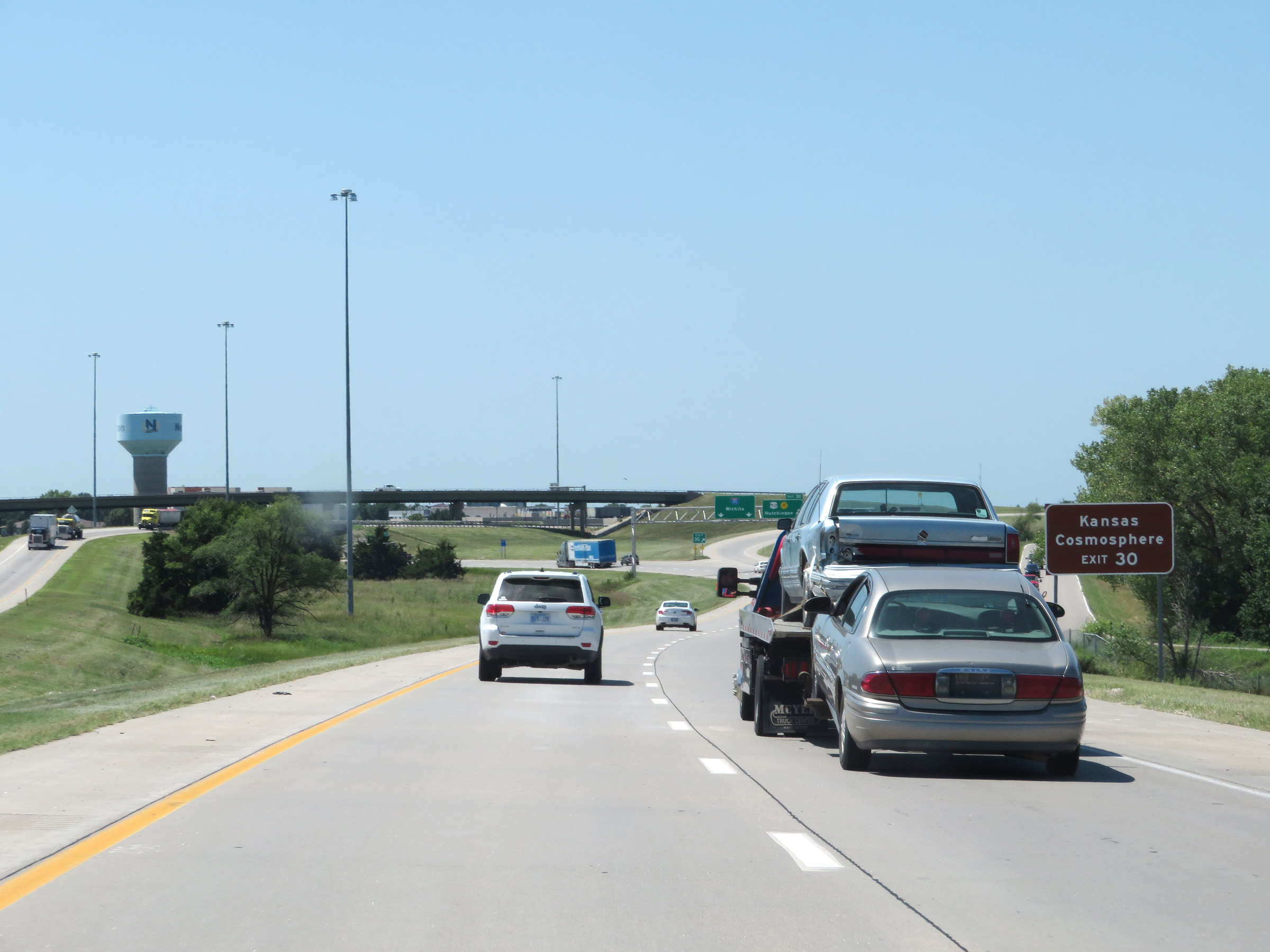 |
Also take Exit 30 to Kansas Cosmosphere. (Photo taken 8/11/20). |
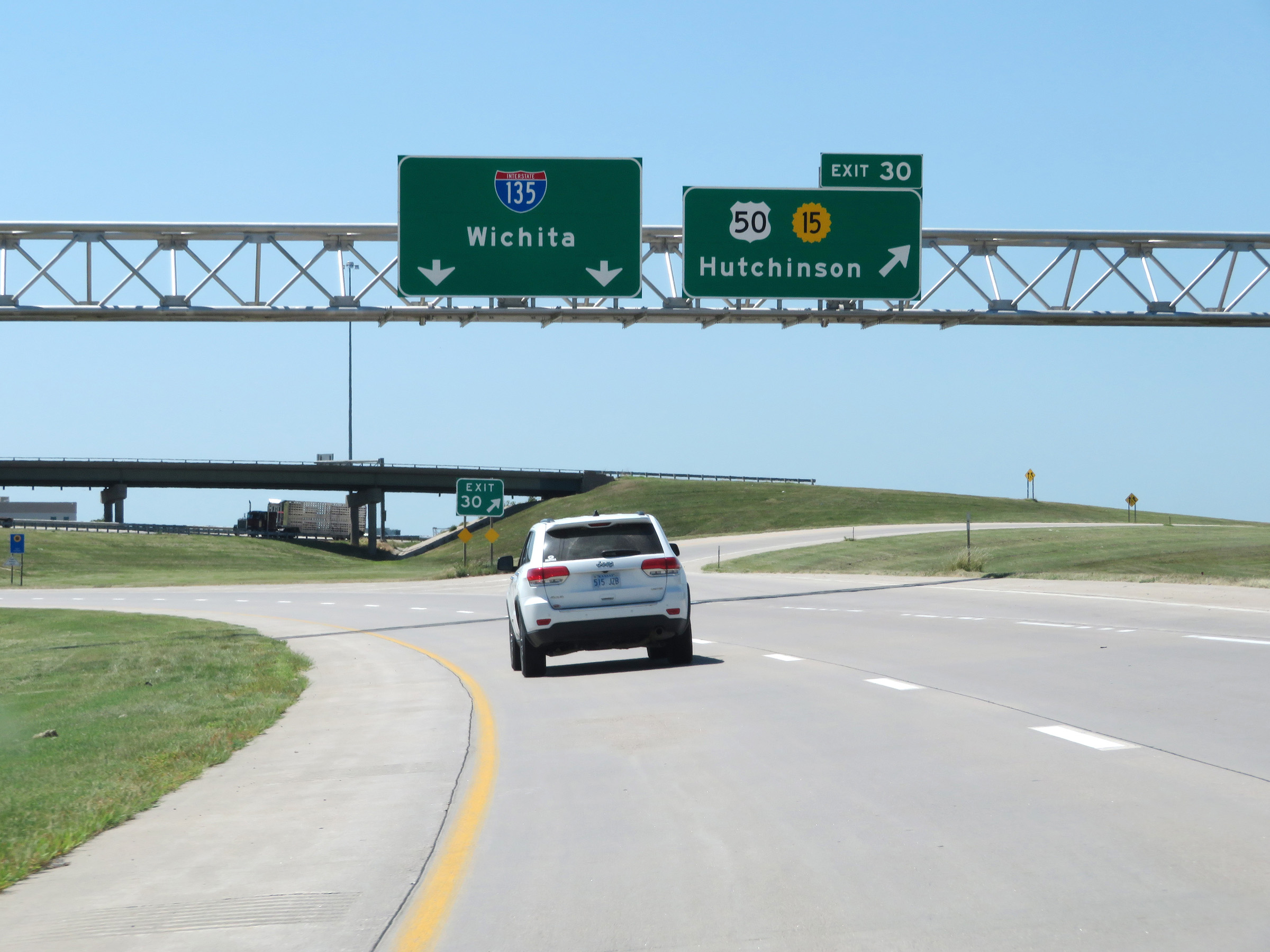 |
Interstate 135 South at Exit 30: US 50 / K-15 - Hutchinson (Photo taken 8/11/20). |
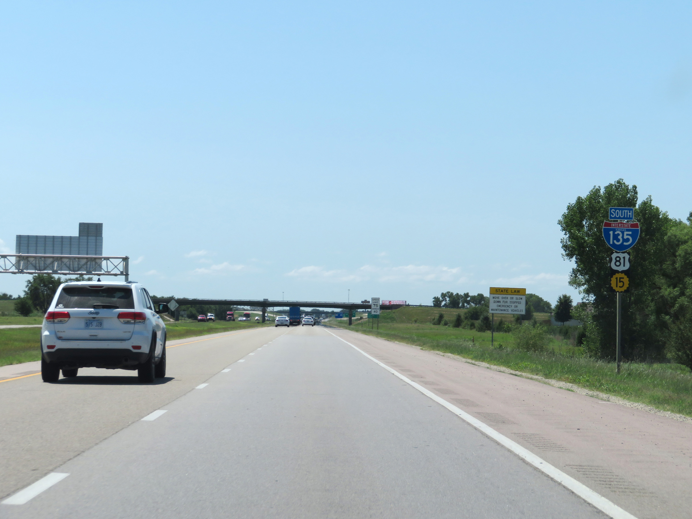 |
State-named Interstate 135 South reassurance shield. (Photo taken 8/11/20). |
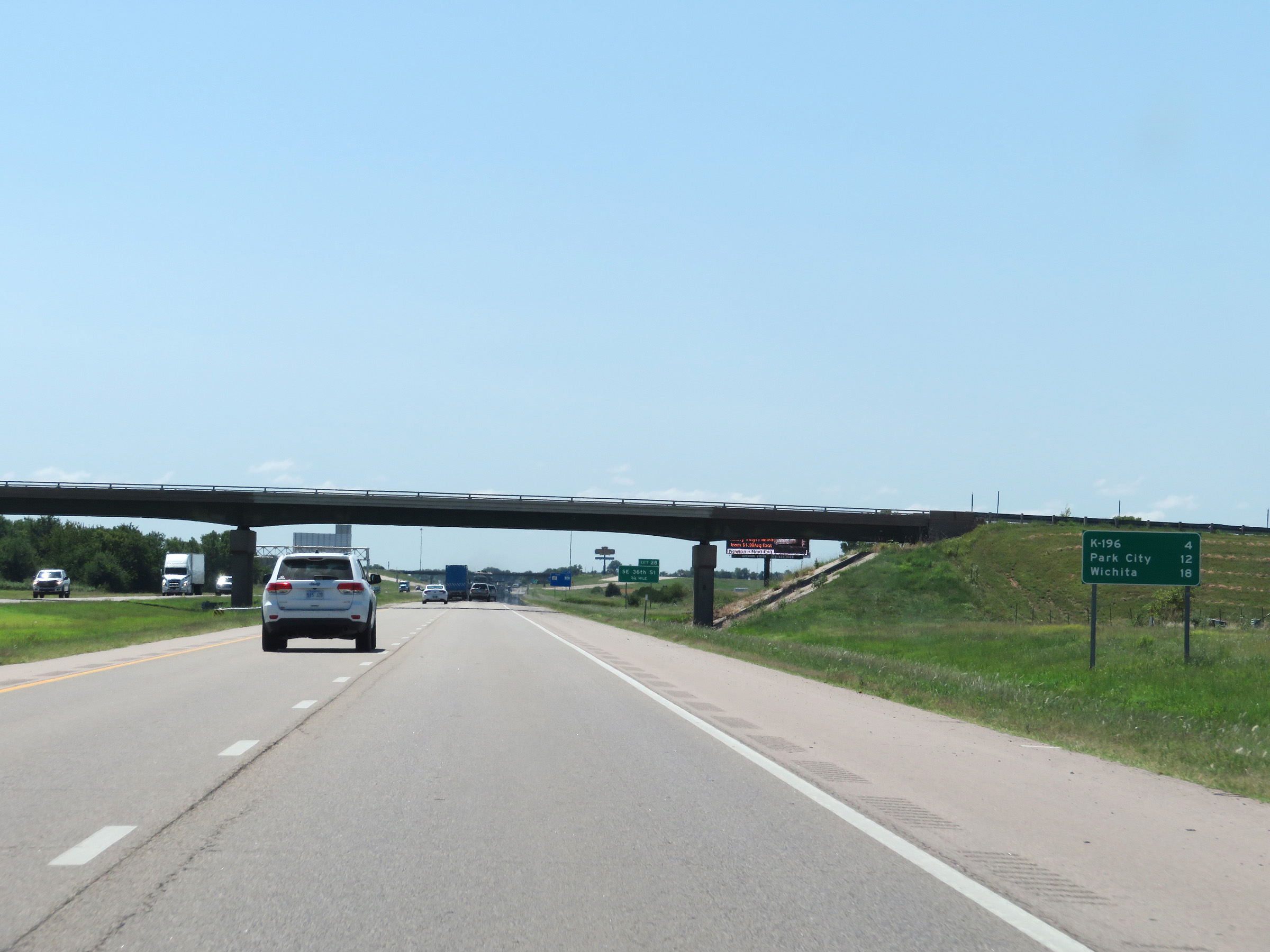 |
Mileage sign on Interstate 135 South. It's 4 miles to the junction of K-196, 12 miles to Park City, and 18 miles to Wichita. (Photo taken 8/11/20). |
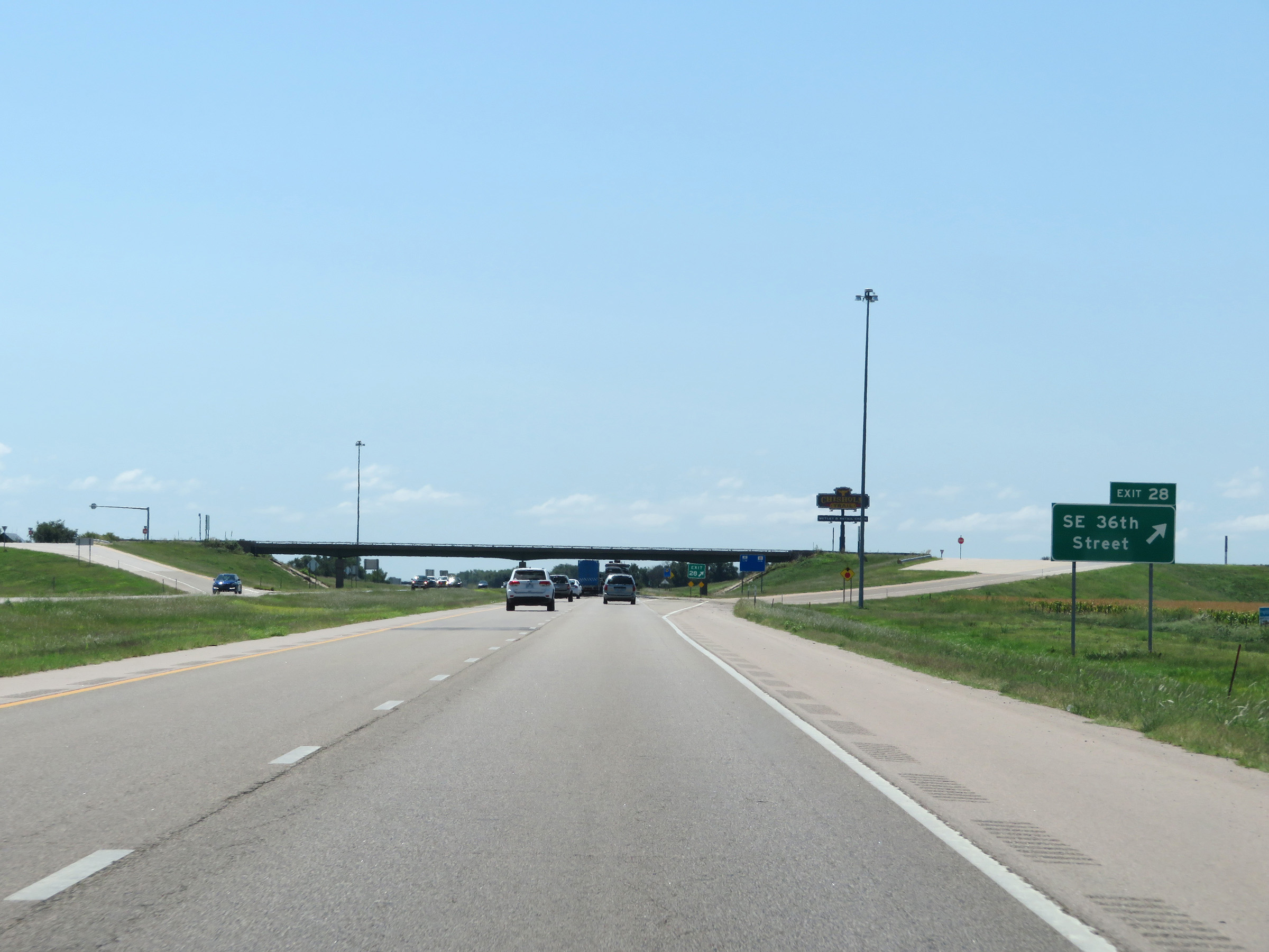 |
Interstate 135 South at Exit 28: SE 36th Street (Photo taken 8/11/20). |
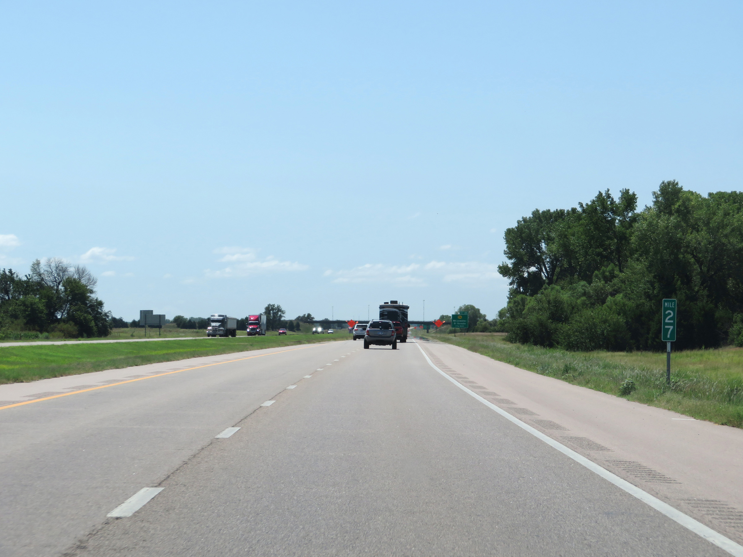 |
Mile marker 27 on Interstate 135 South in Harvey County. (Photo taken 8/11/20). |
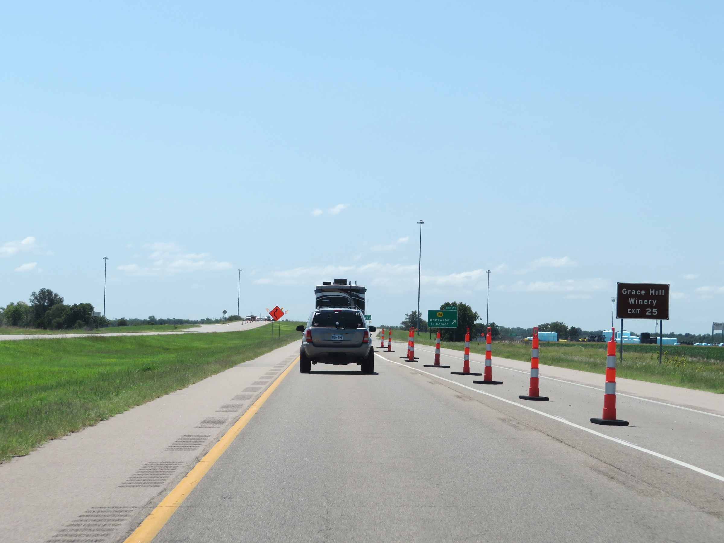 |
Take Exit 25 to Grace Hill Winery. (Photo taken 8/11/20). |
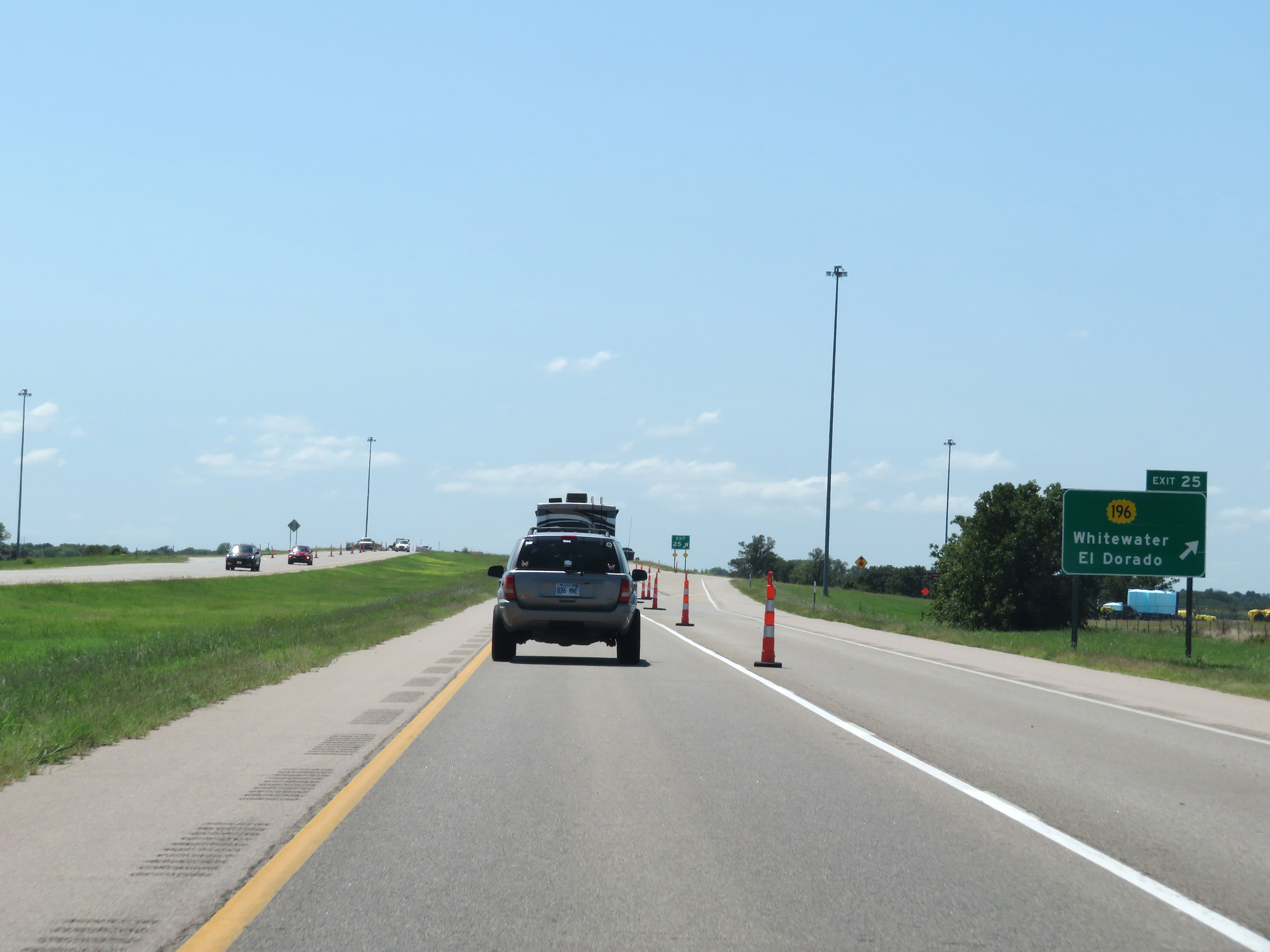 |
Interstate 135 South at Exit 25: K-196 - Whitewater / El Dorado (Photo taken 8/11/20). |
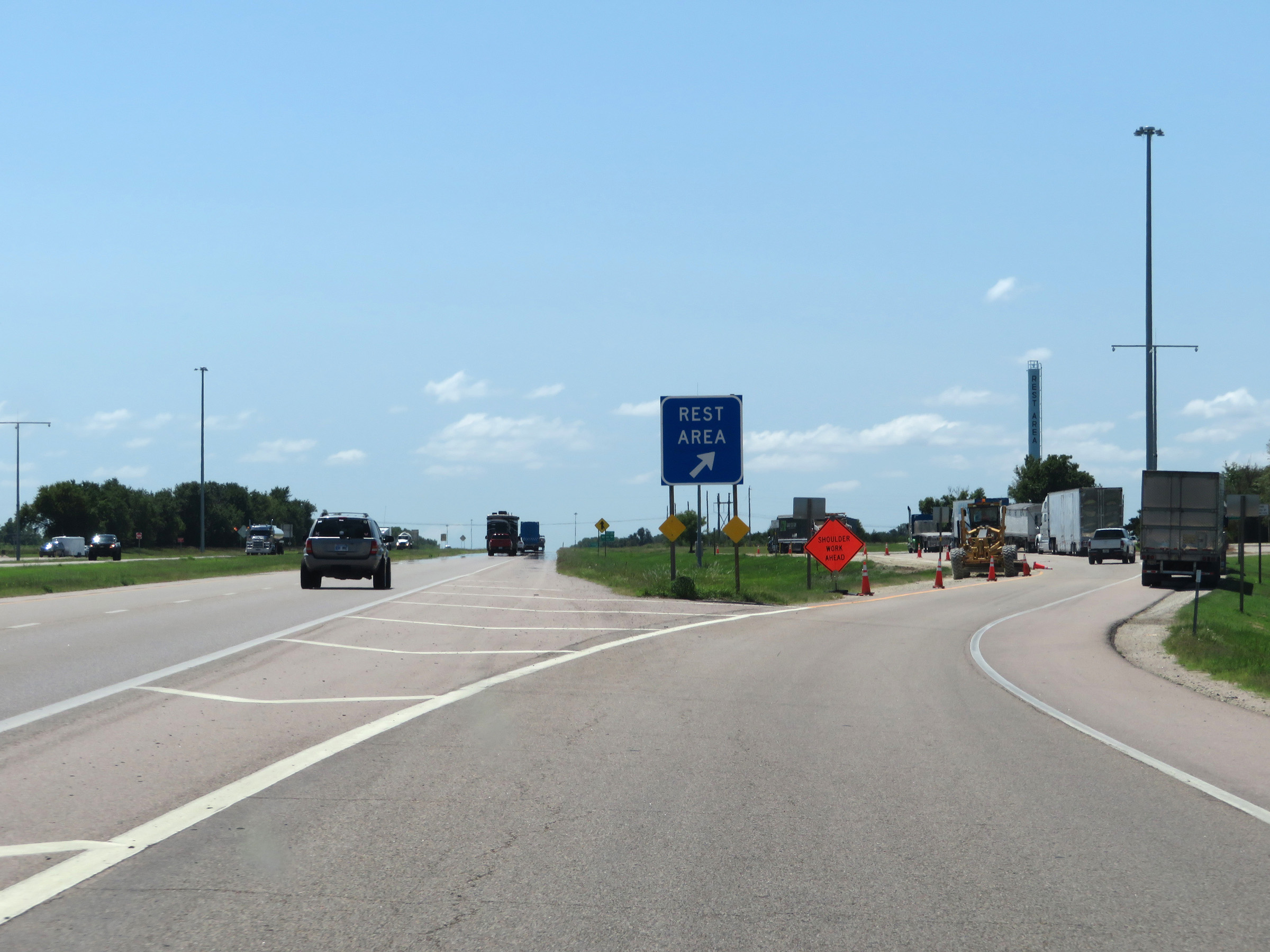 |
Rest Area on Interstate 135 South in Harvey County. (Photo taken 8/11/20). |
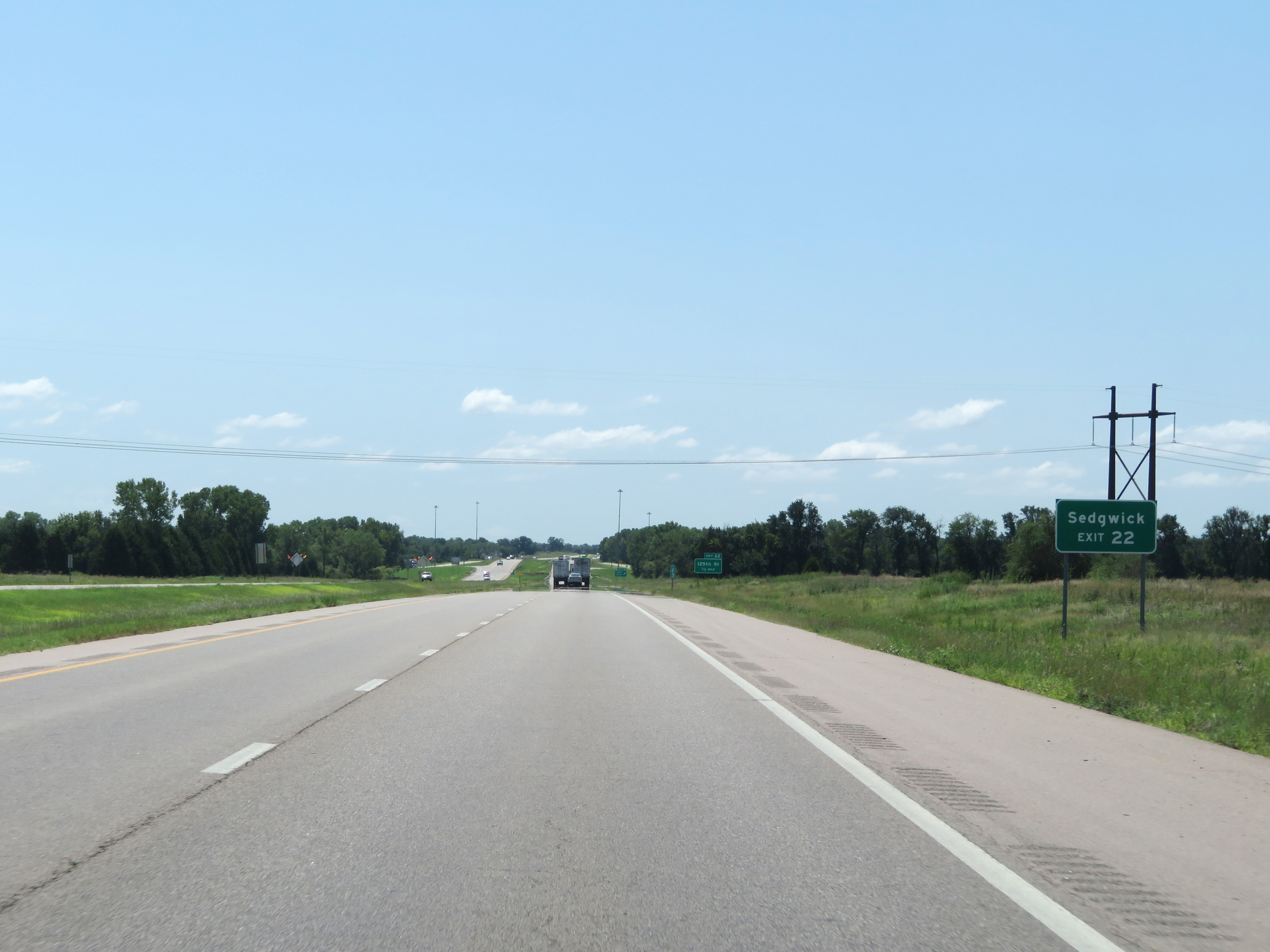 |
Take Exit 22 to Sedgwick. (Photo taken 8/11/20). |
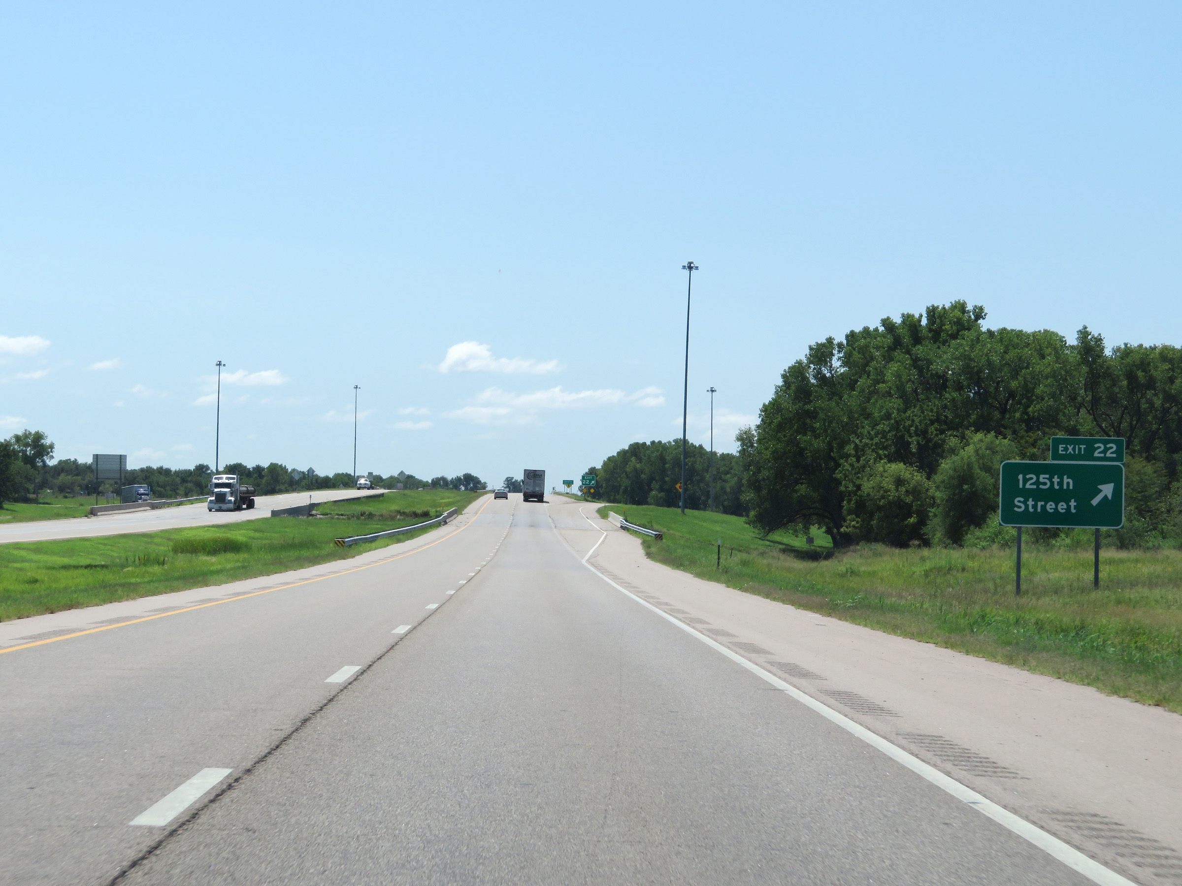 |
Interstate 135 South at Exit 22: 125th Street (Photo taken 8/11/20). |
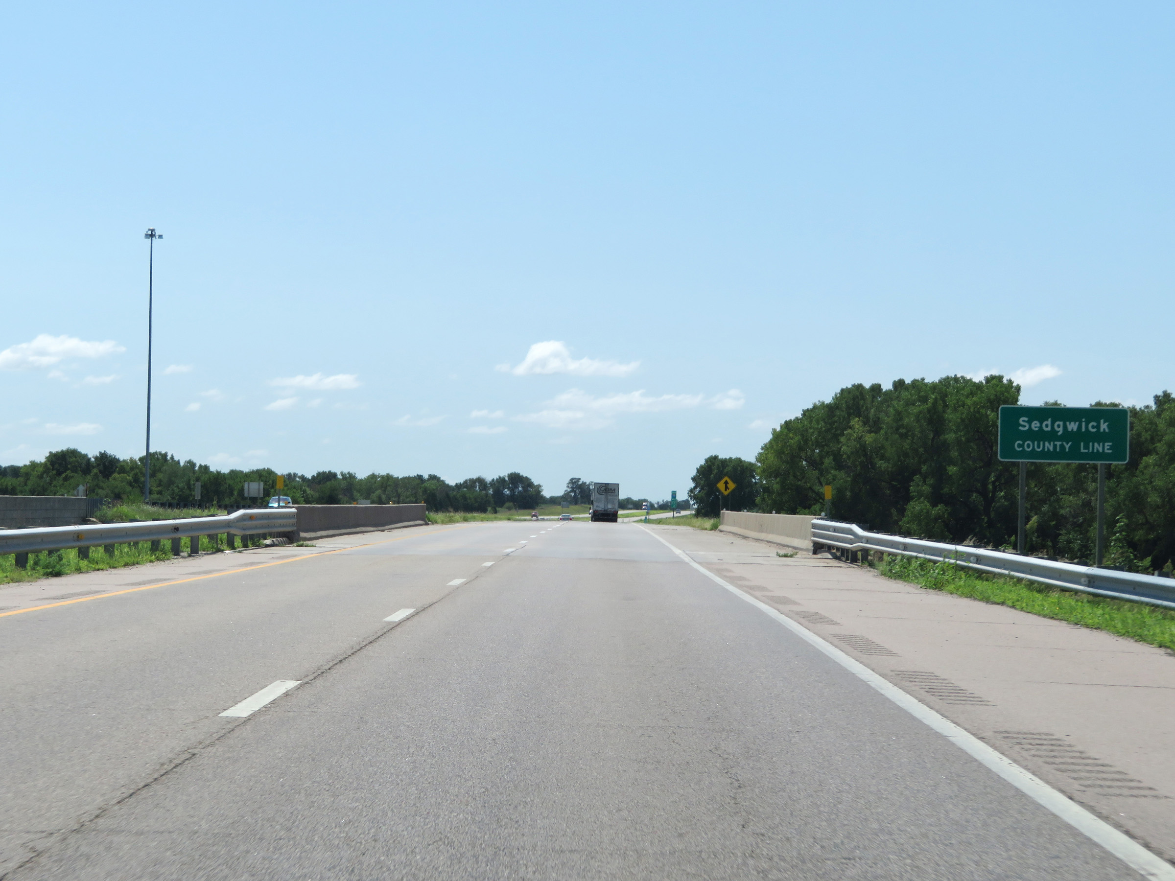 |
Interstate 135 South as it enters Sedgwick County. (Photo taken 8/11/20). |
 |
Another state-named Interstate 135 South reassurance shield at mile marker 21.8. (Photo taken 8/11/20). |
 |
Speed limit signs on Interstate 135 South. The speed limits remain 75 mph maximum and 40 mph minimum. (Photo taken 8/11/20). |
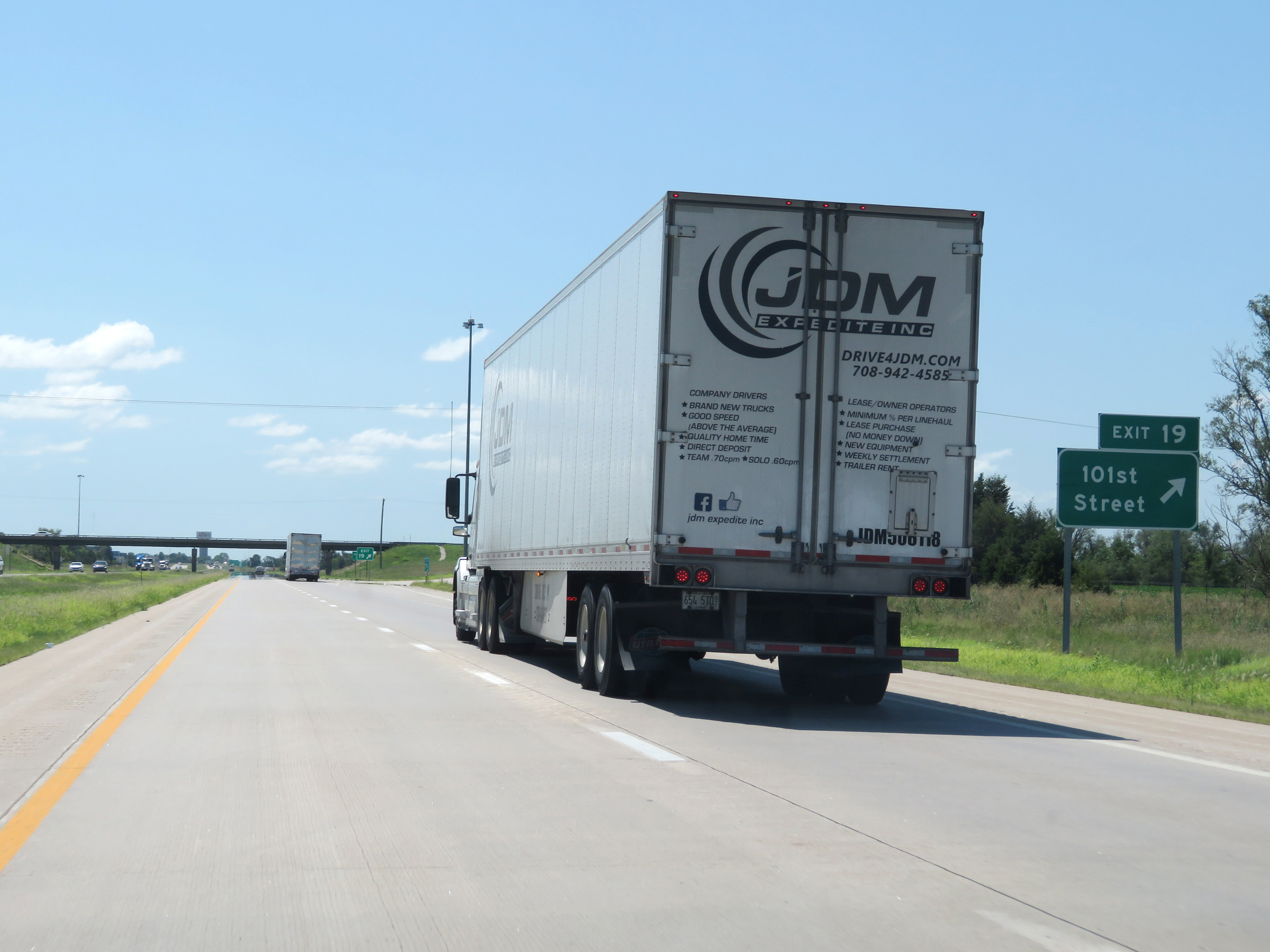 |
Interstate 135 South at Exit 19: 101st Street (Photo taken 8/11/20). |
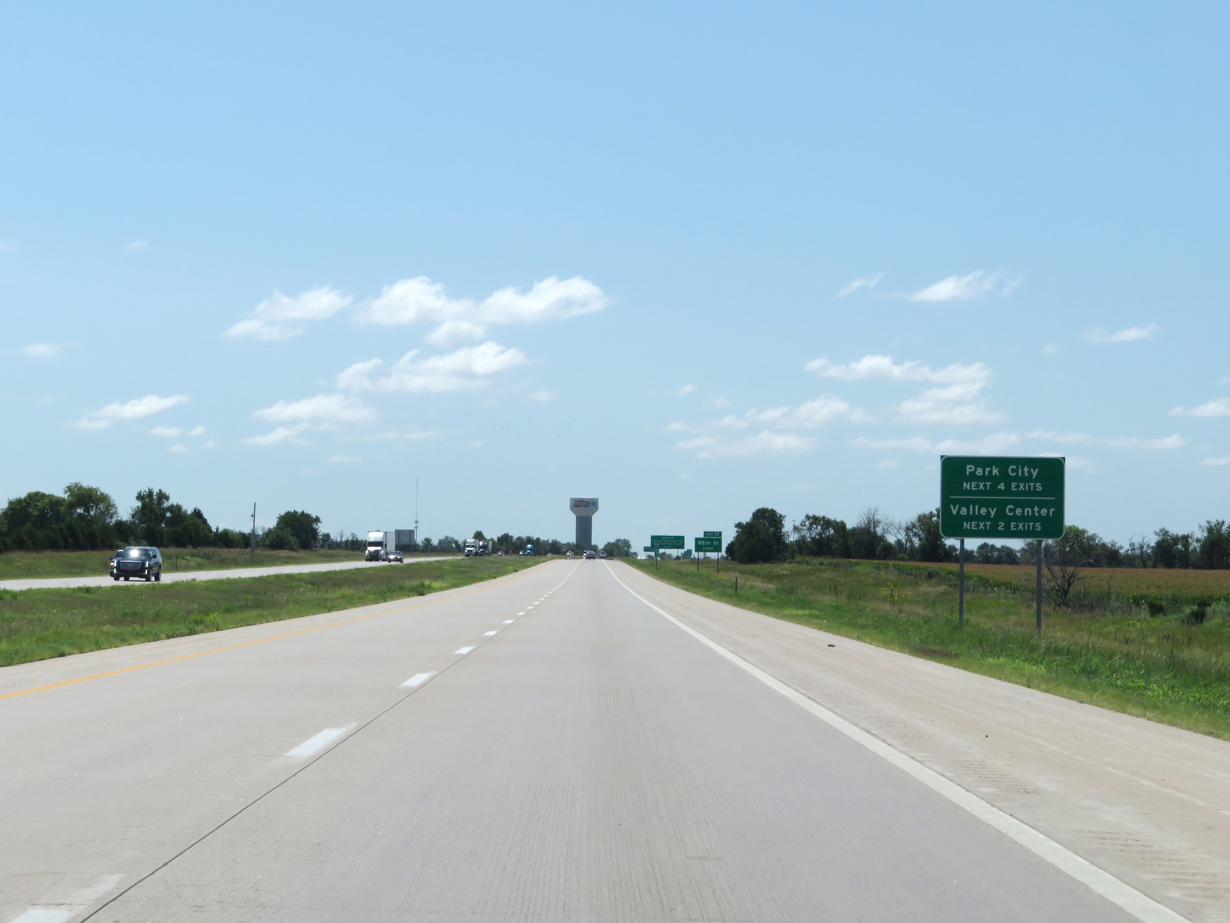 |
Take any of the next 4 exits to Park City. Use either of the next 2 exits to Valley Center. (Photo taken 8/11/20). |
 |
Take Exit 17 to WSU-NIAR Aircraft Structural Test and Evaluation Center. (Photo taken 8/11/20). |
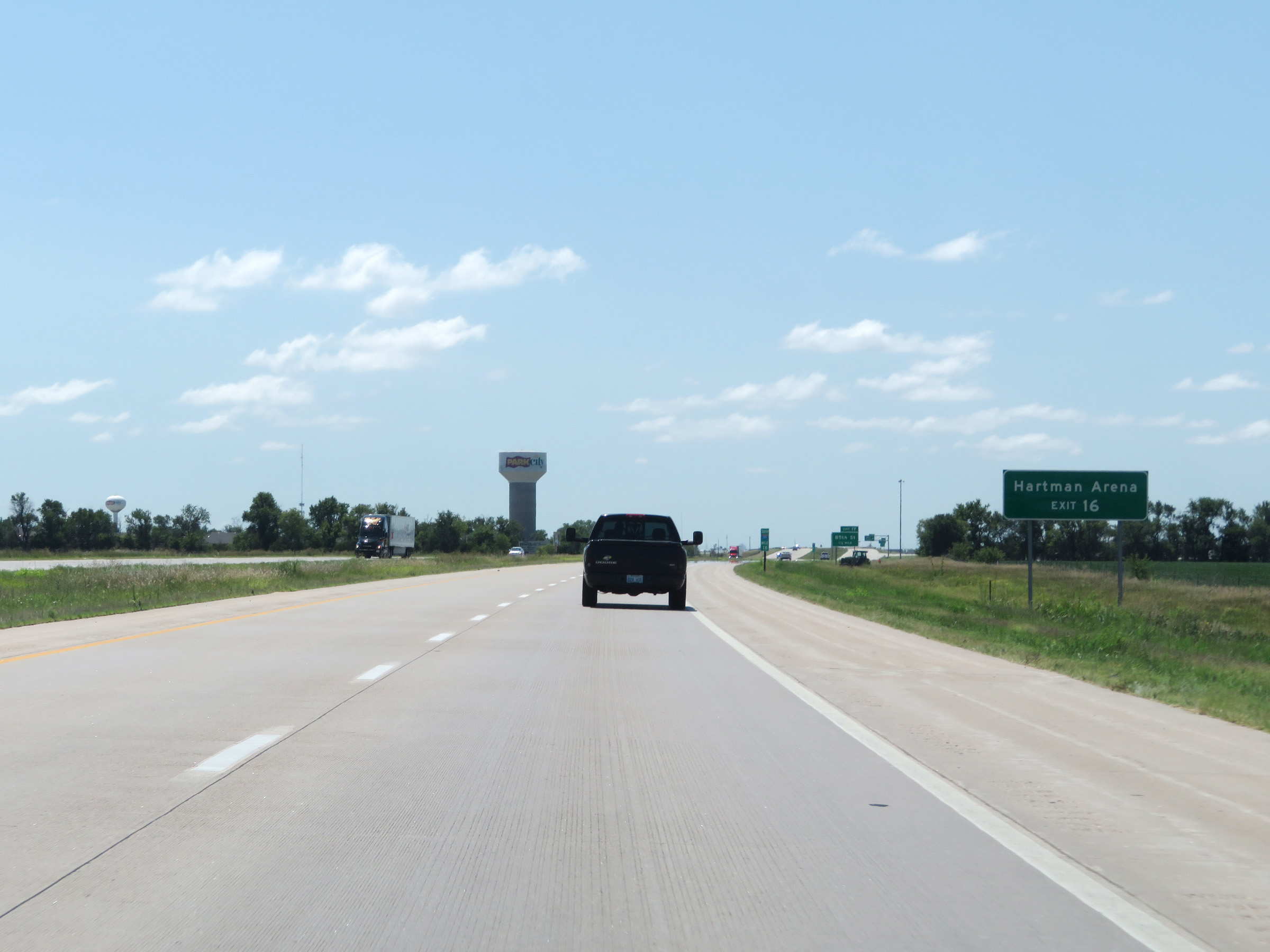 |
Also take Exit 16 to Hartman Arena. (Photo taken 8/11/20). |
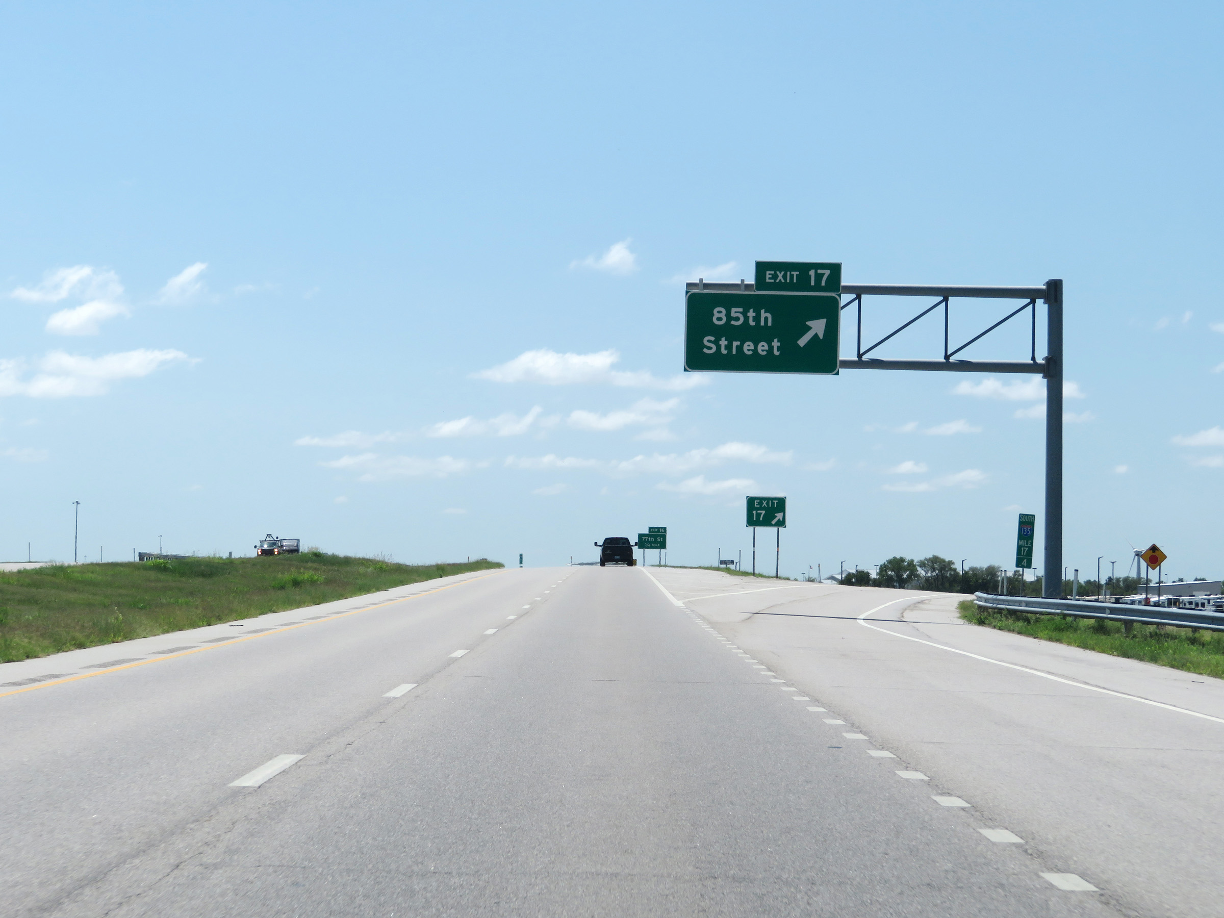 |
Interstate 135 South at Exit 17: 85th Street (Photo taken 8/11/20). |
 |
Again, take Exit 16 to Hartman Arena. (Photo taken 8/11/20). |
 |
Interstate 135 South at Exit 16: 77th Street (Photo taken 8/11/20). |
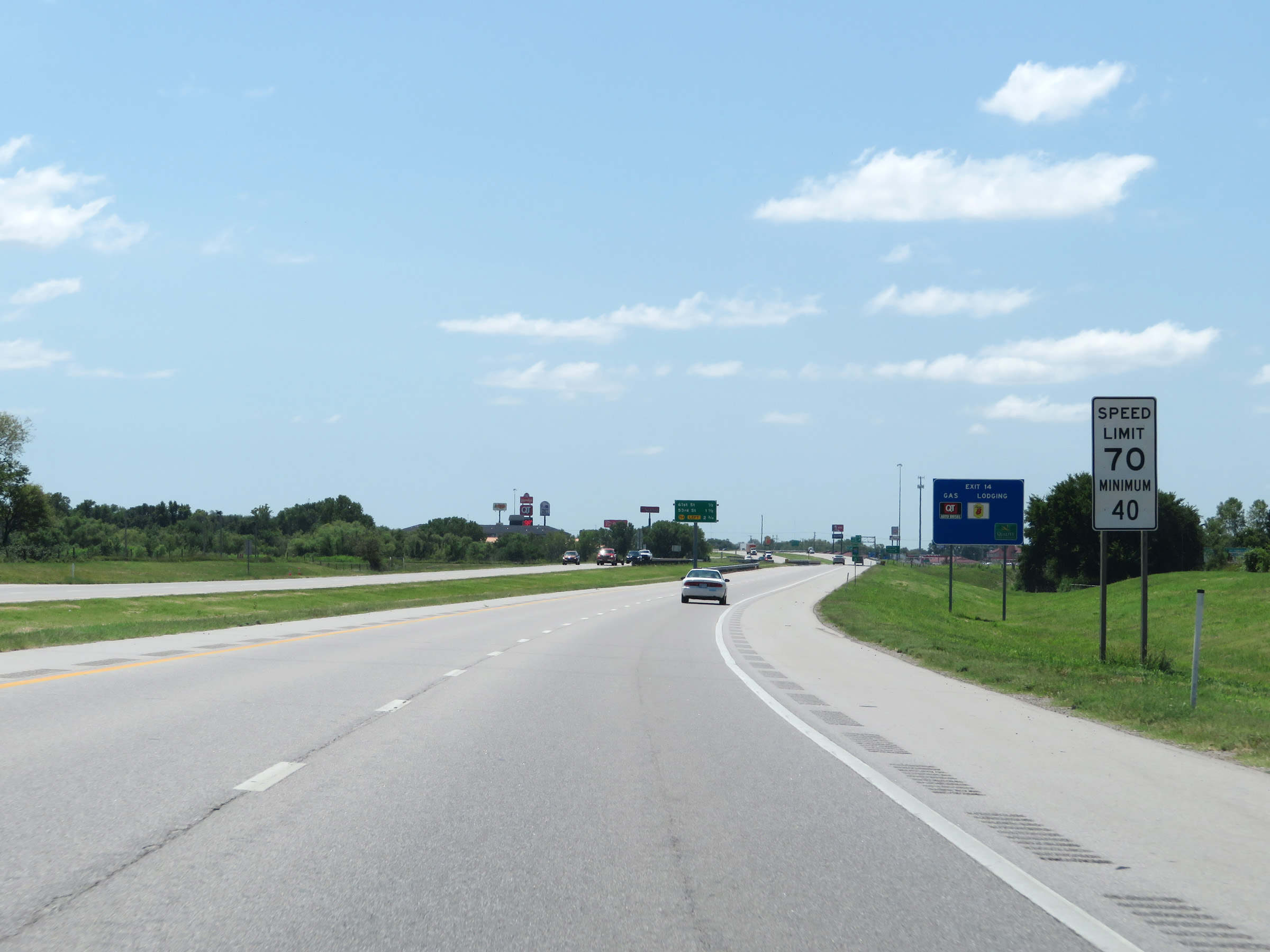 |
At mile marker 15, the maximum speed limit on Interstate 135 South decreases to 70 mph. The minimum speed limit remains 40 mph. (Photo taken 8/11/20). |
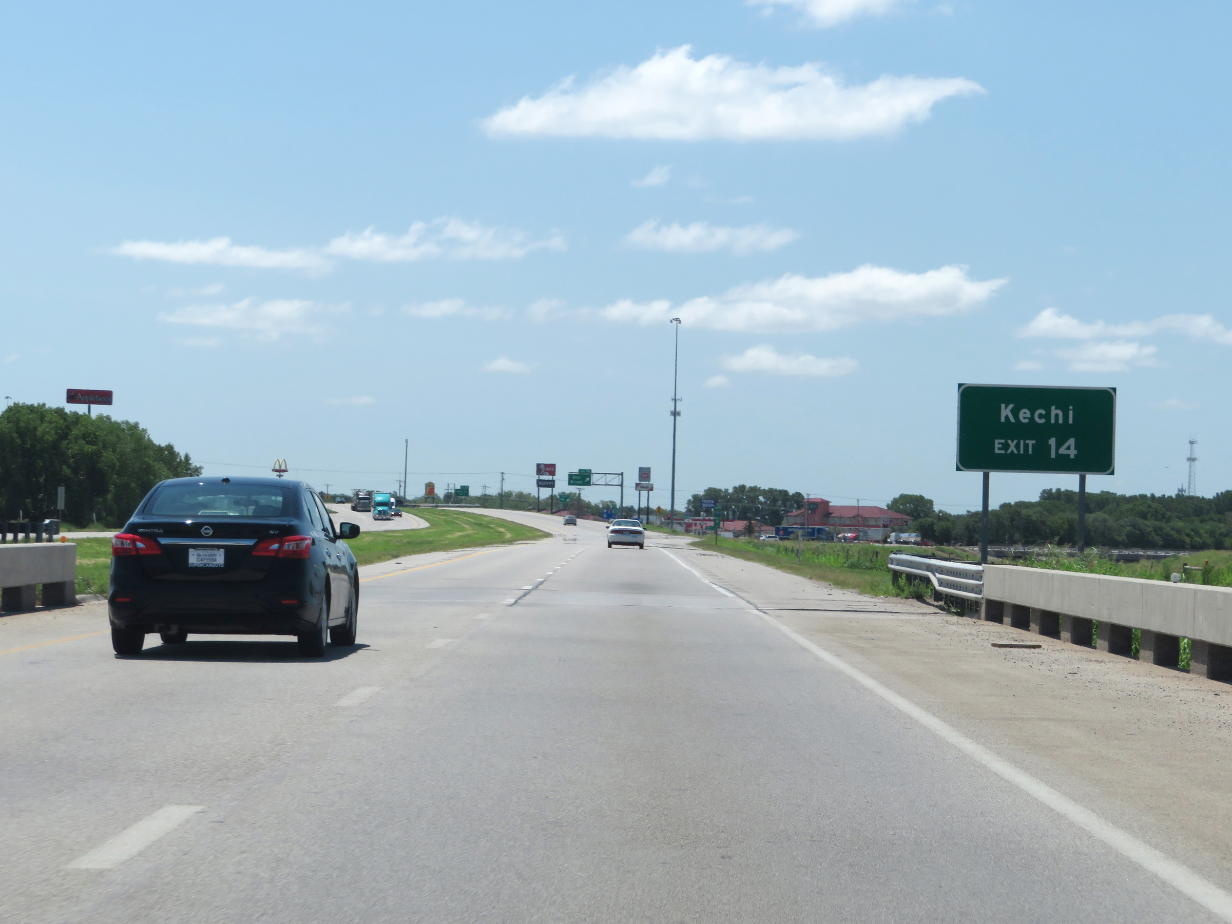 |
Take Exit 14 to Kechi. (Photo taken 8/11/20). |
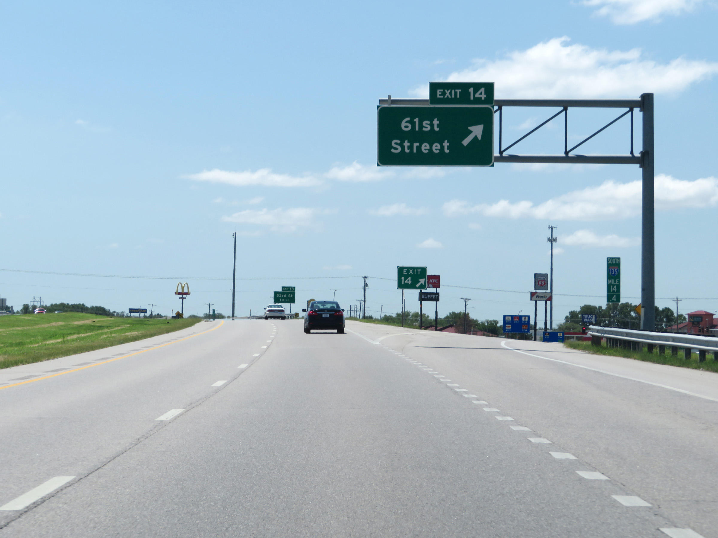 |
Interstate 135 South at Exit 14: 61st Street (Photo taken 8/11/20). |
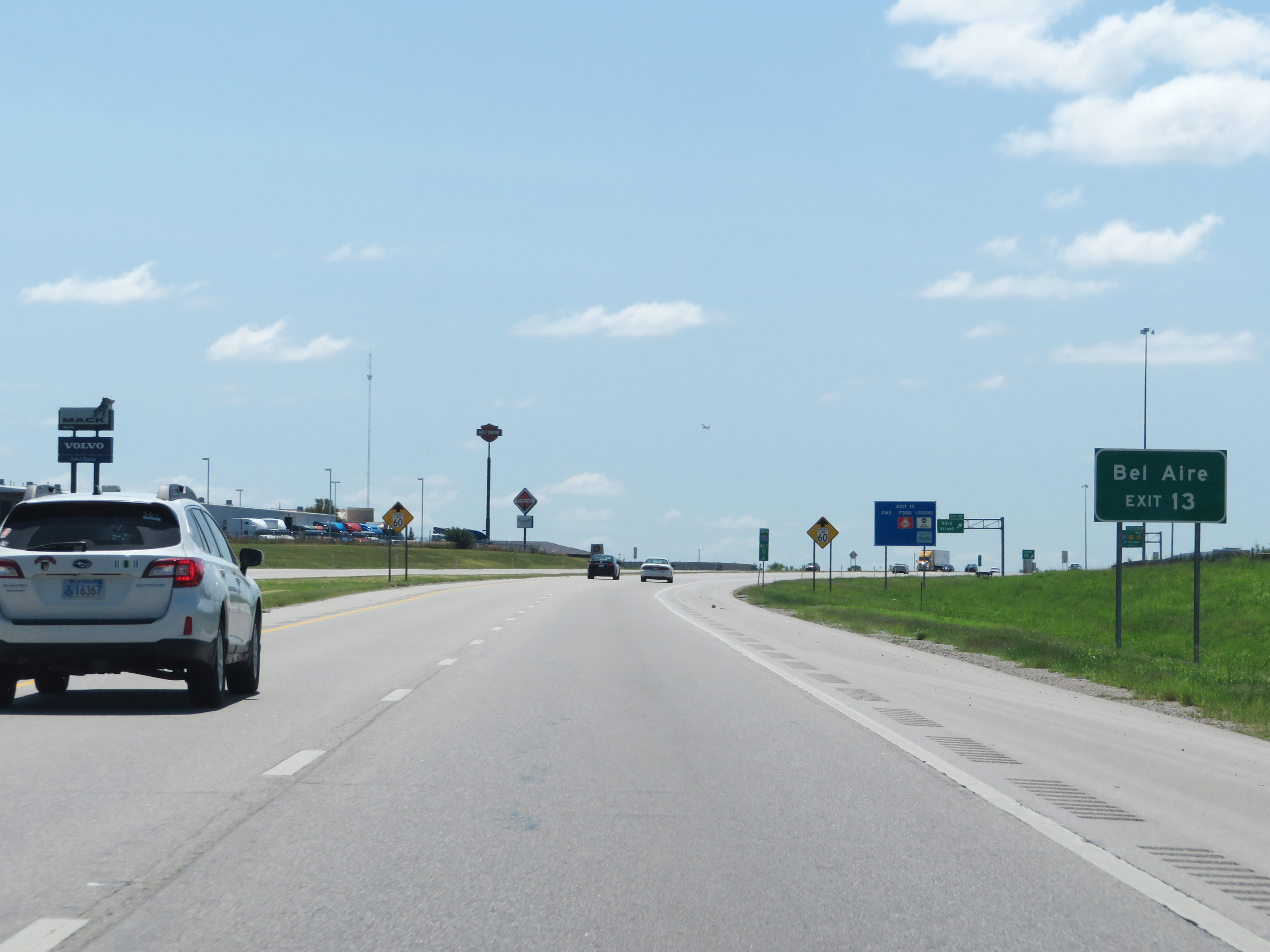 |
Take Exit 13 to Bel Aire. (Photo taken 8/11/20). |
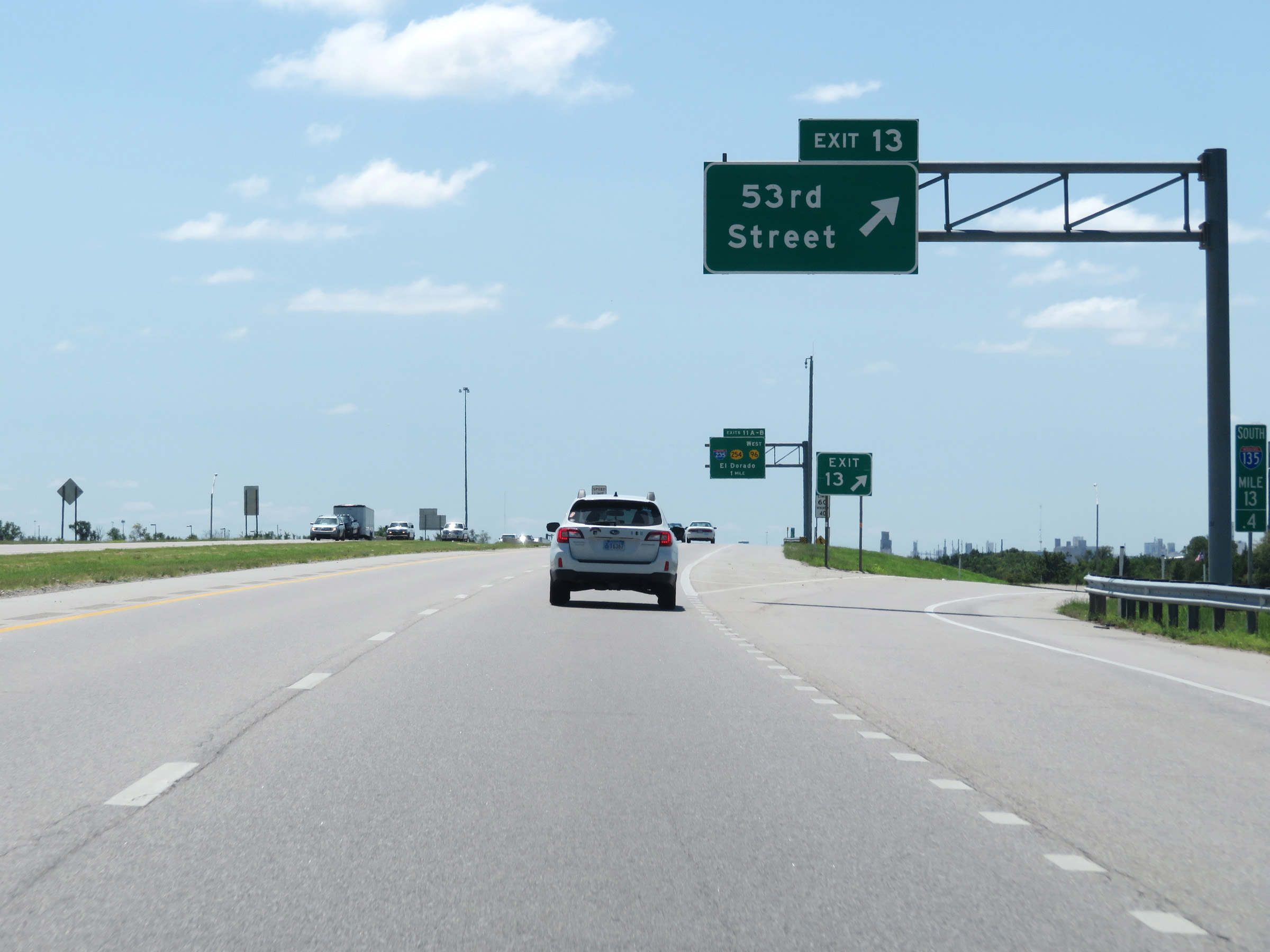 |
Interstate 135 South at Exit 13: 53rd Street (Photo taken 8/11/20). |
Section 3: Wichita (Exit 13) to Interstate 35 (Kansas Turnpike)
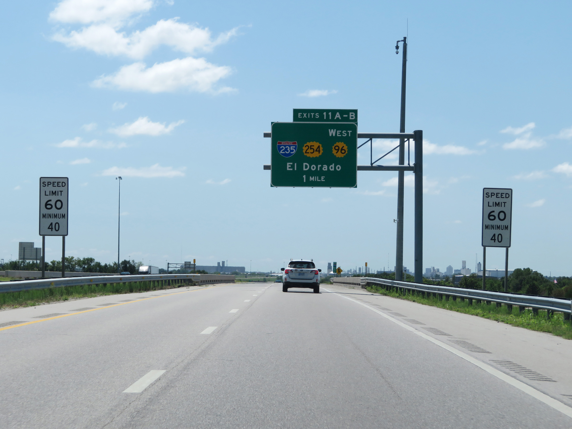 |
Approaching exits 11A-B and downtown Wichita, the maximum speed limit on Interstate 135 South decreases to 60 mph. The minimum speed limit is 40 mph. (Photo taken 8/11/20). |
 |
Advance signage for Exit 11A - 1/2 mile on the left. (Photo taken 8/11/20). |
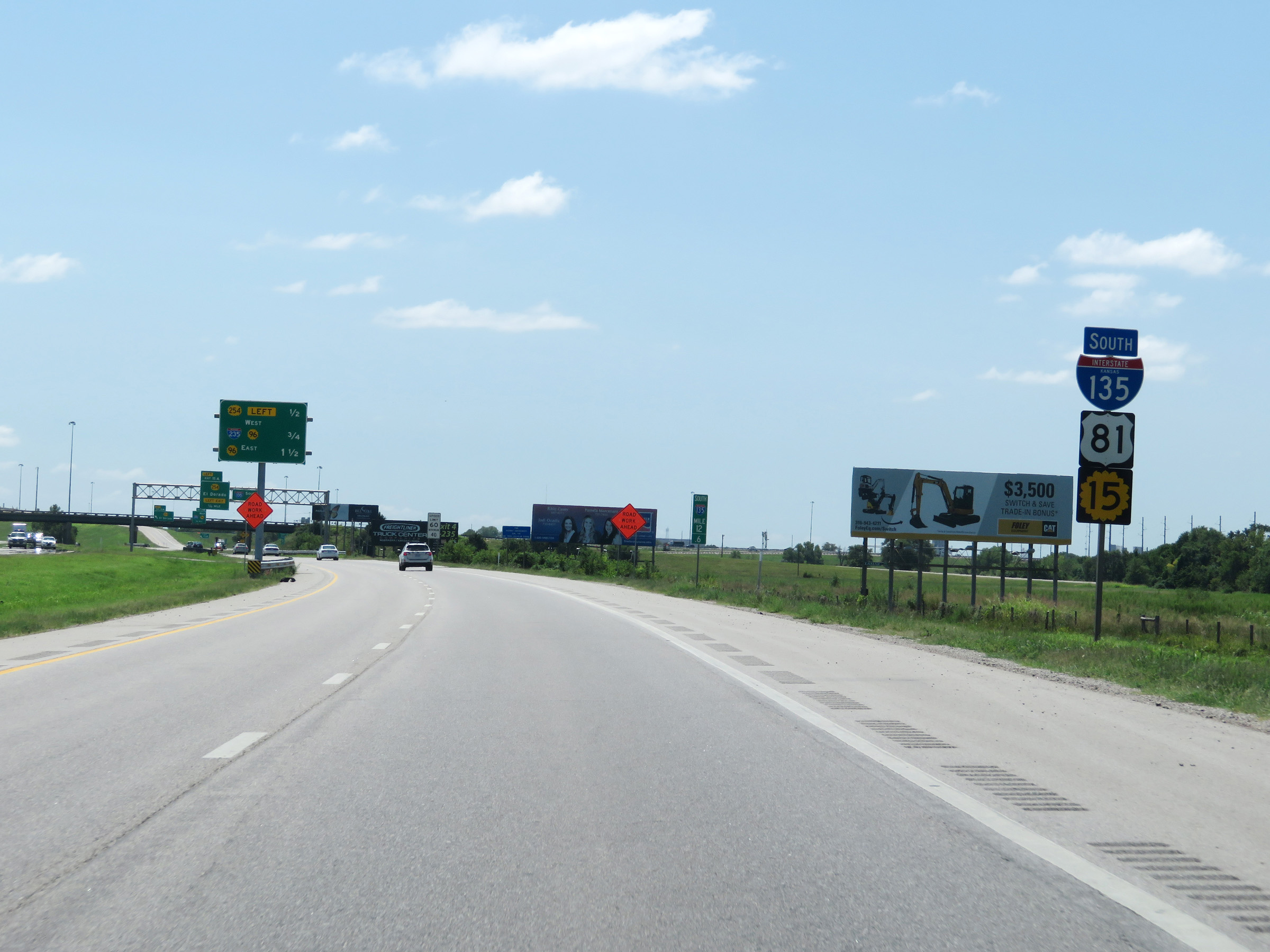 |
State-named Interstate 135 South reassurance shield at mile marker 12.6. (Photo taken 8/11/20). |
 |
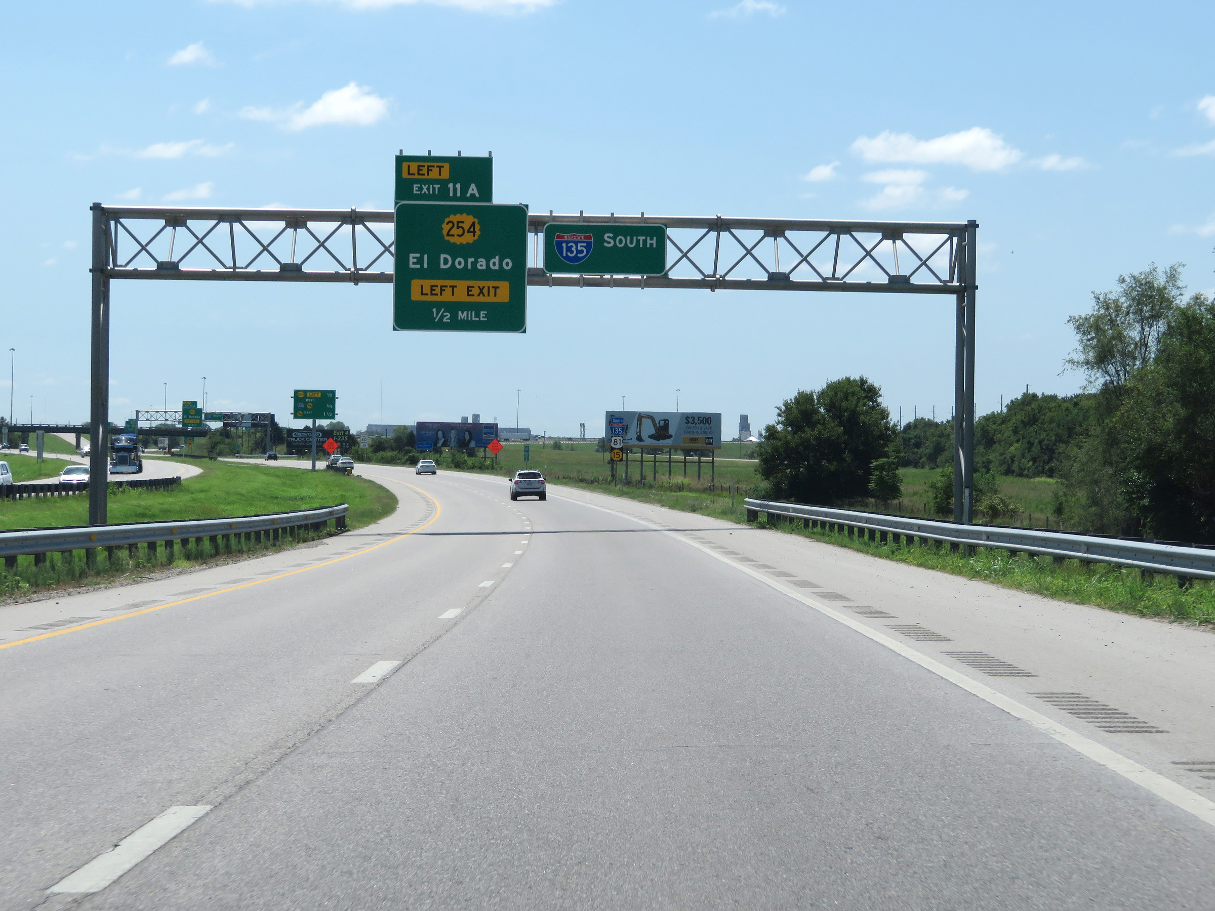
Interstate 135 South approaching Exit 11A - 1/4 mile on the left. (Photo taken 8/11/20). |
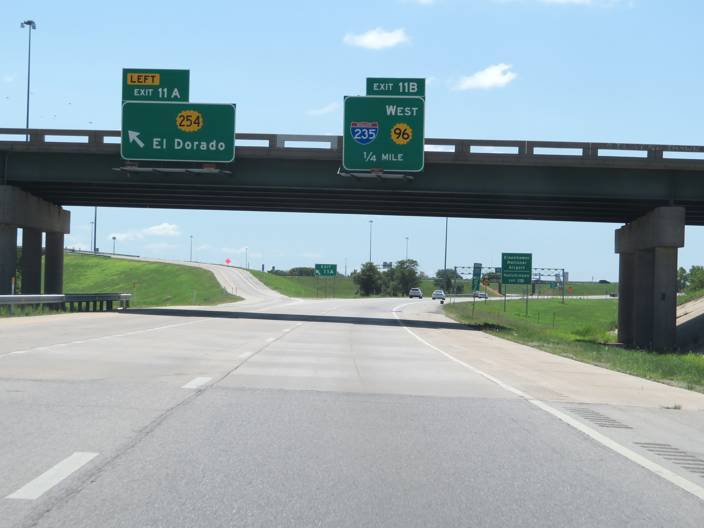 |
Interstate 135 South at Exit 11A: K-254 - El Dorado (Photo taken 8/11/20). |
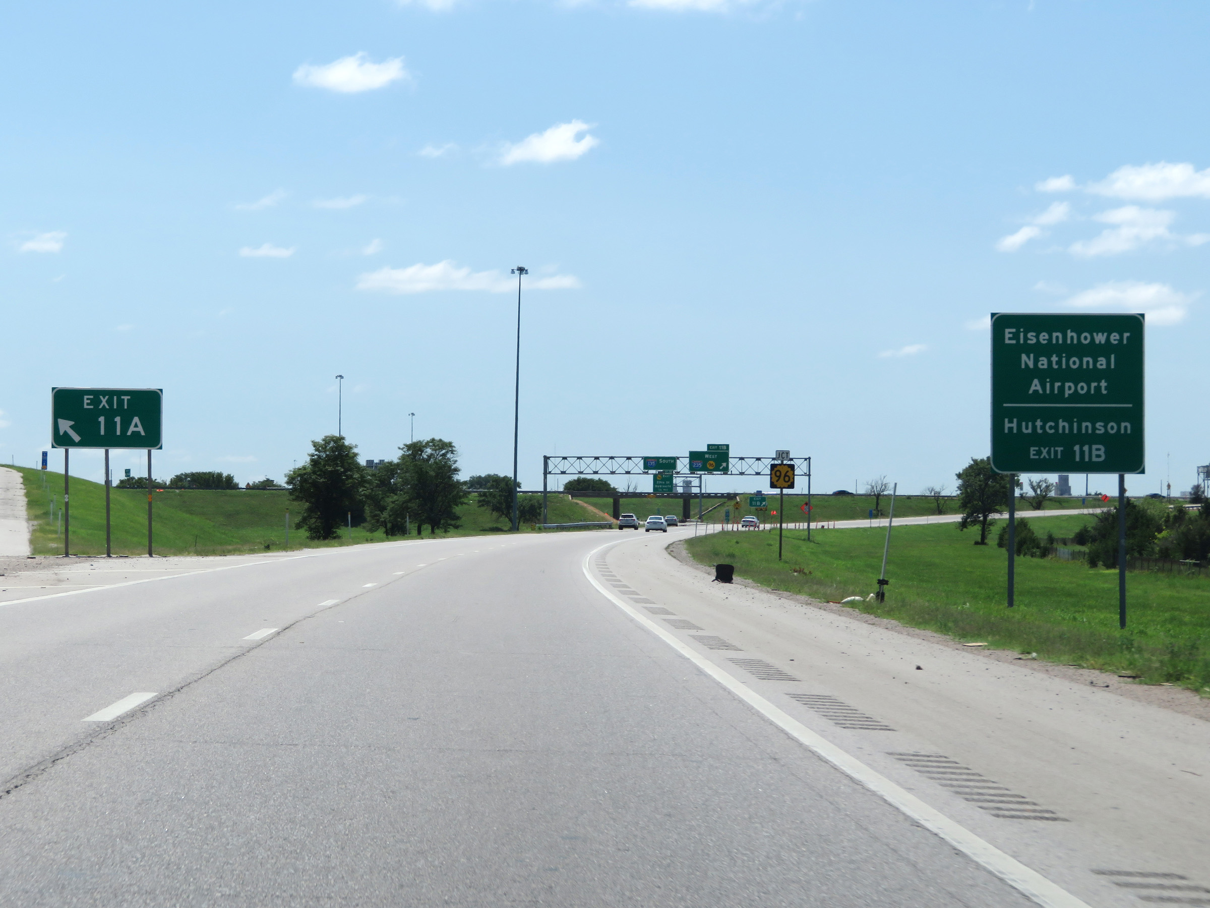 |
Take Exit 11B (Interstate 235 South) to Eisenhower National Airport and Hutchinson. (Photo taken 8/11/20). |
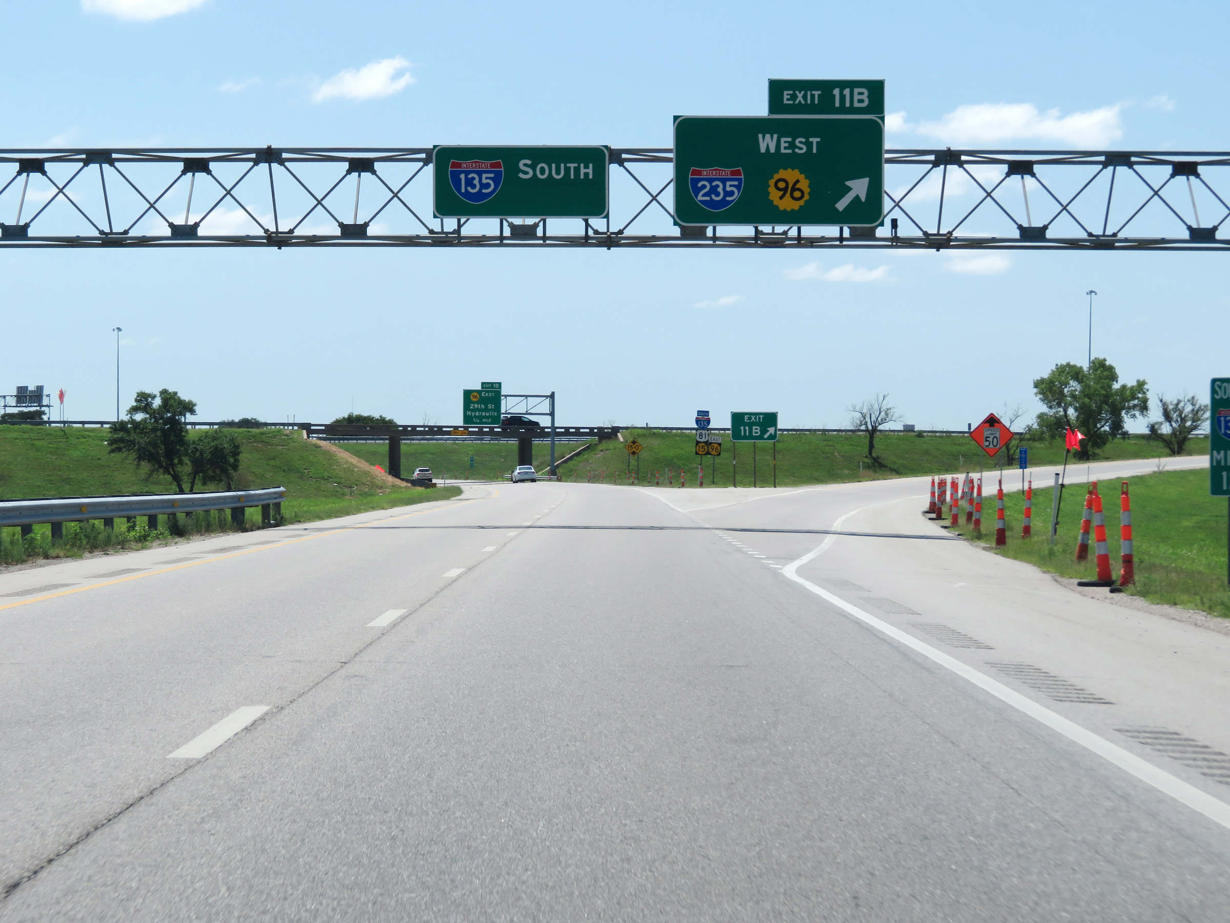 |
Interstate 135 South at Exit 11B: Interstate 235 South / K-96 West (Photo taken 8/11/20). |
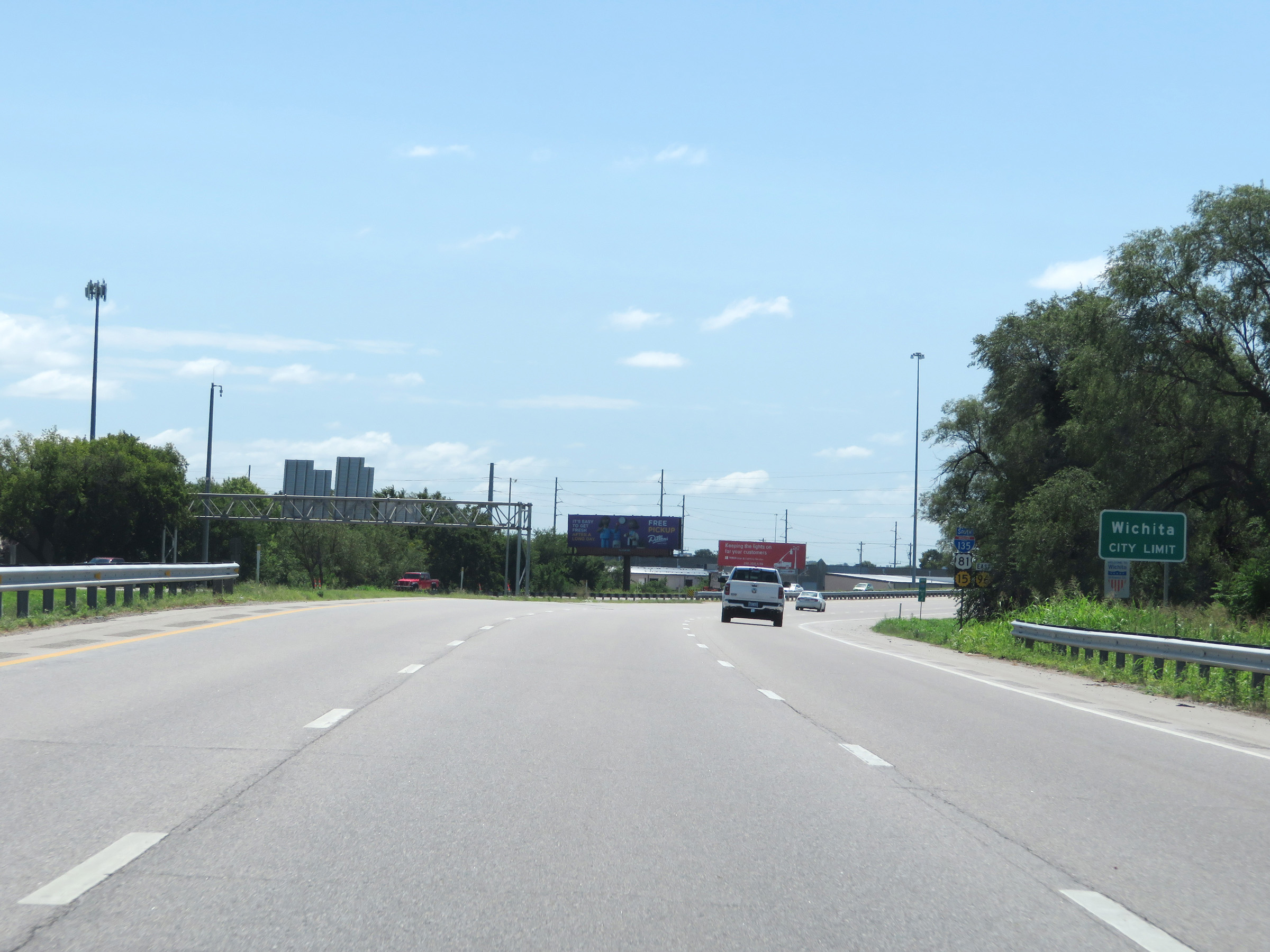 |
Approaching mile marker 11.6, Interstate 135 South enters the Wichita city limits. (Photo taken 8/11/20). |
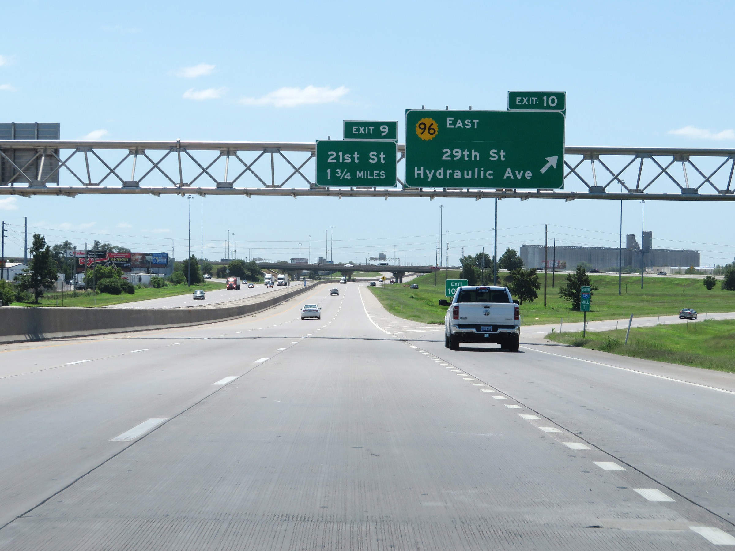 |
Interstate 135 South at Exit 10: K-96 East - 29th St / Hydraulic Ave (Photo taken 8/11/20). |
 |
View on Interstate 135 South at mile marker 10. (Photo taken 8/11/20). |
 |
Mileage sign on the median, listing the distances to the next three Wichita exits on Interstate 135 South. (Photo taken 8/11/20). |
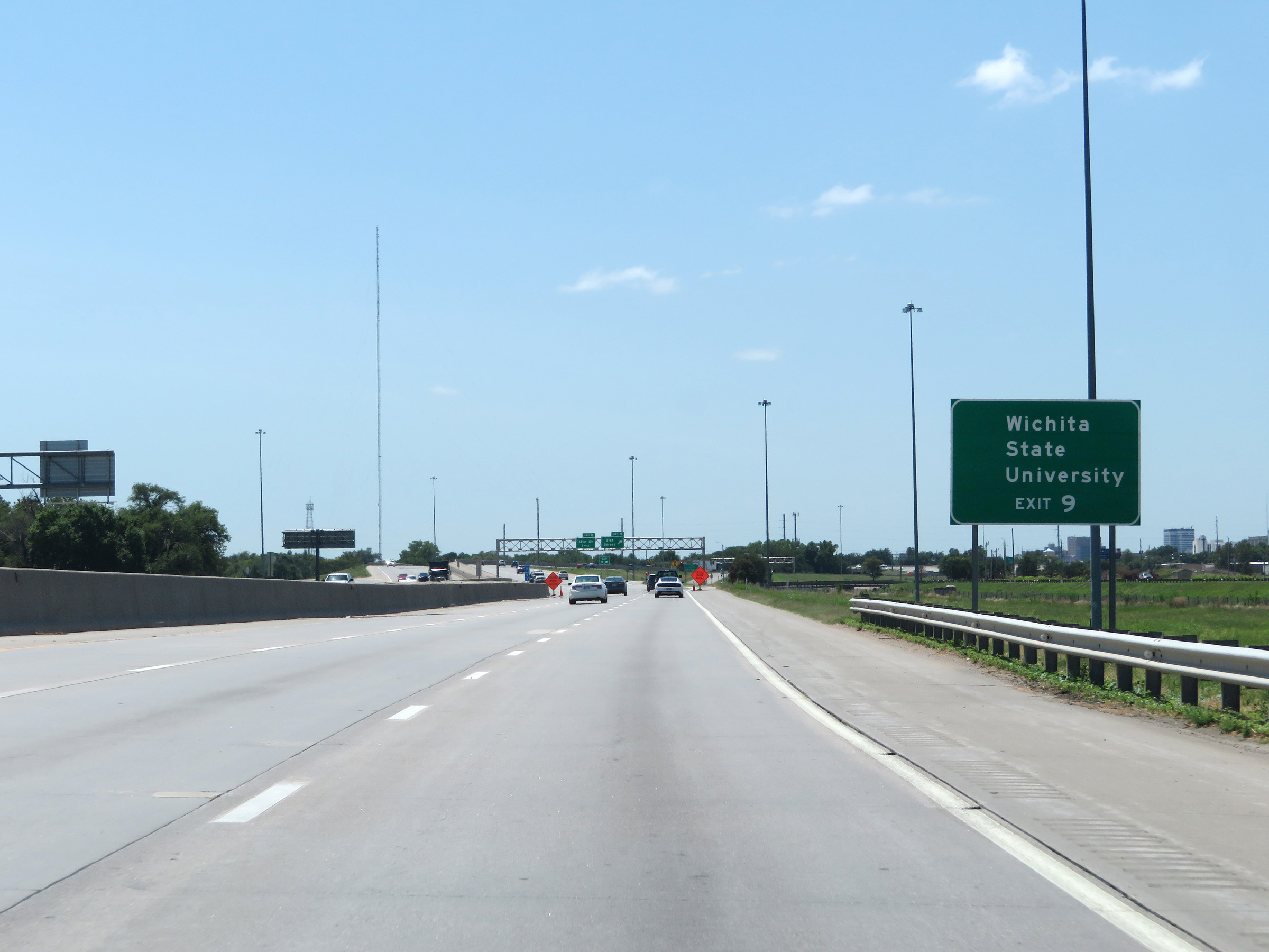 |
Take Exit 9 to Wichita State University. (Photo taken 8/11/20). |
 |
Interstate 135 South at Exit 9: 21st Street (Photo taken 8/11/20). |
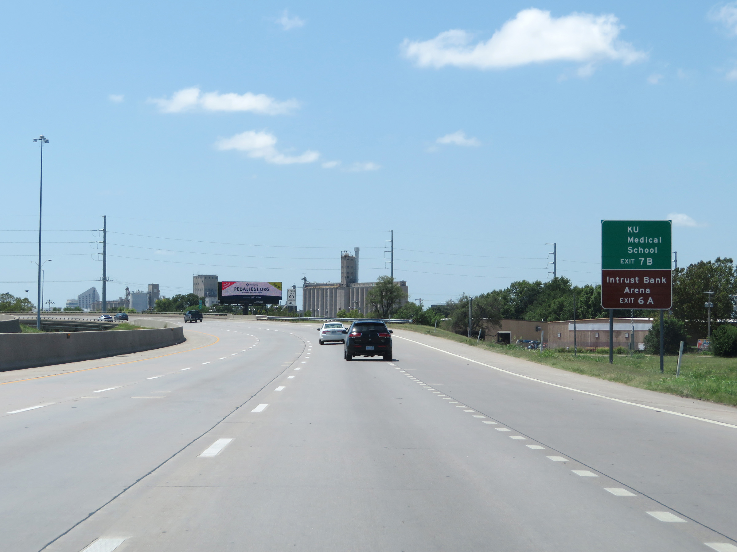 |
Take Exit 7B to KU Medical School. Take Exit 6A to Intrust Bank Arena. (Photo taken 8/11/20). |
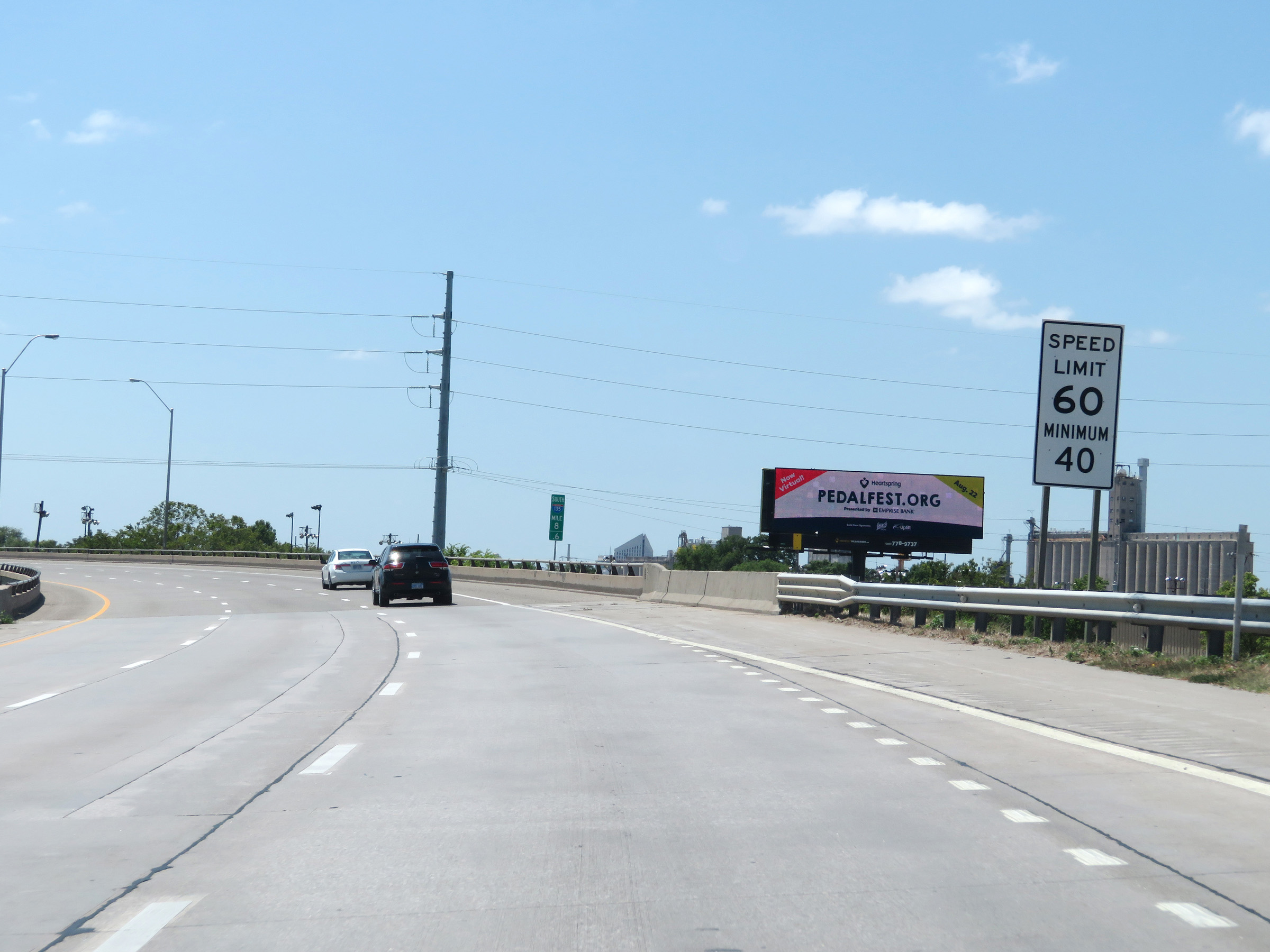 |
The speed limits remain 60 mph maximum and 40 mph minimum through the Wichita area. (Photo taken 8/11/20). |
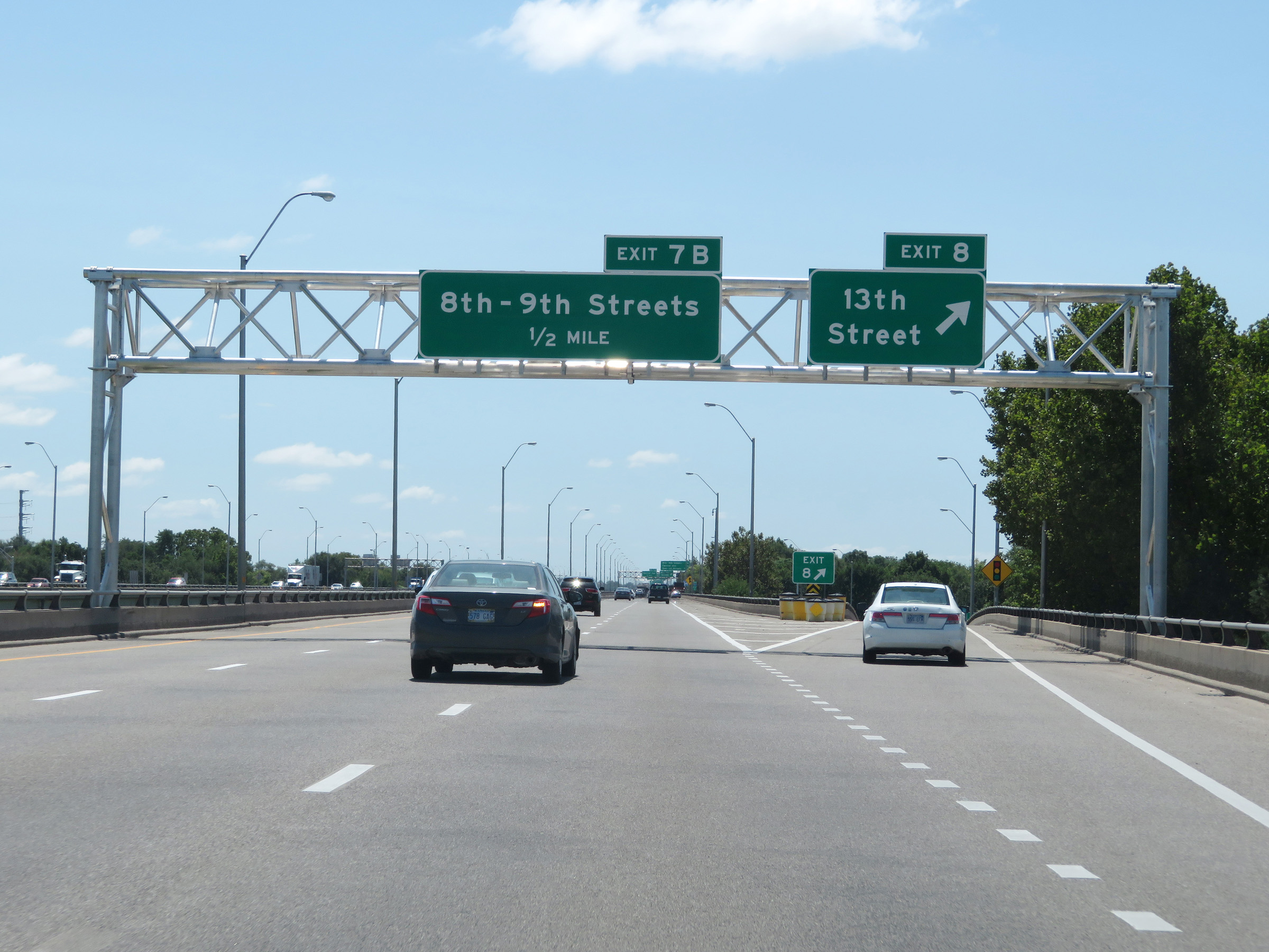 |
Interstate 135 South at Exit 8: 13th Street (Photo taken 8/11/20). |
 |
Interstate 135 South at Exit 7B: 8th Street / 9th Street (Photo taken 8/11/20). |
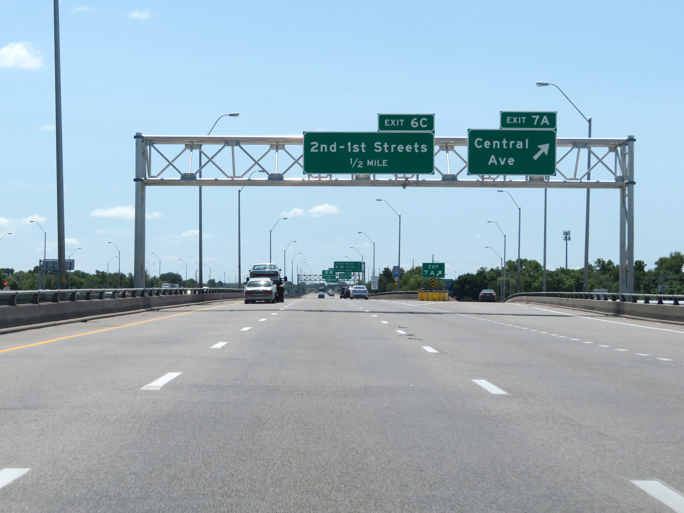 |
Interstate 135 South at Exit 7A: Central Ave (Photo taken 8/11/20). |
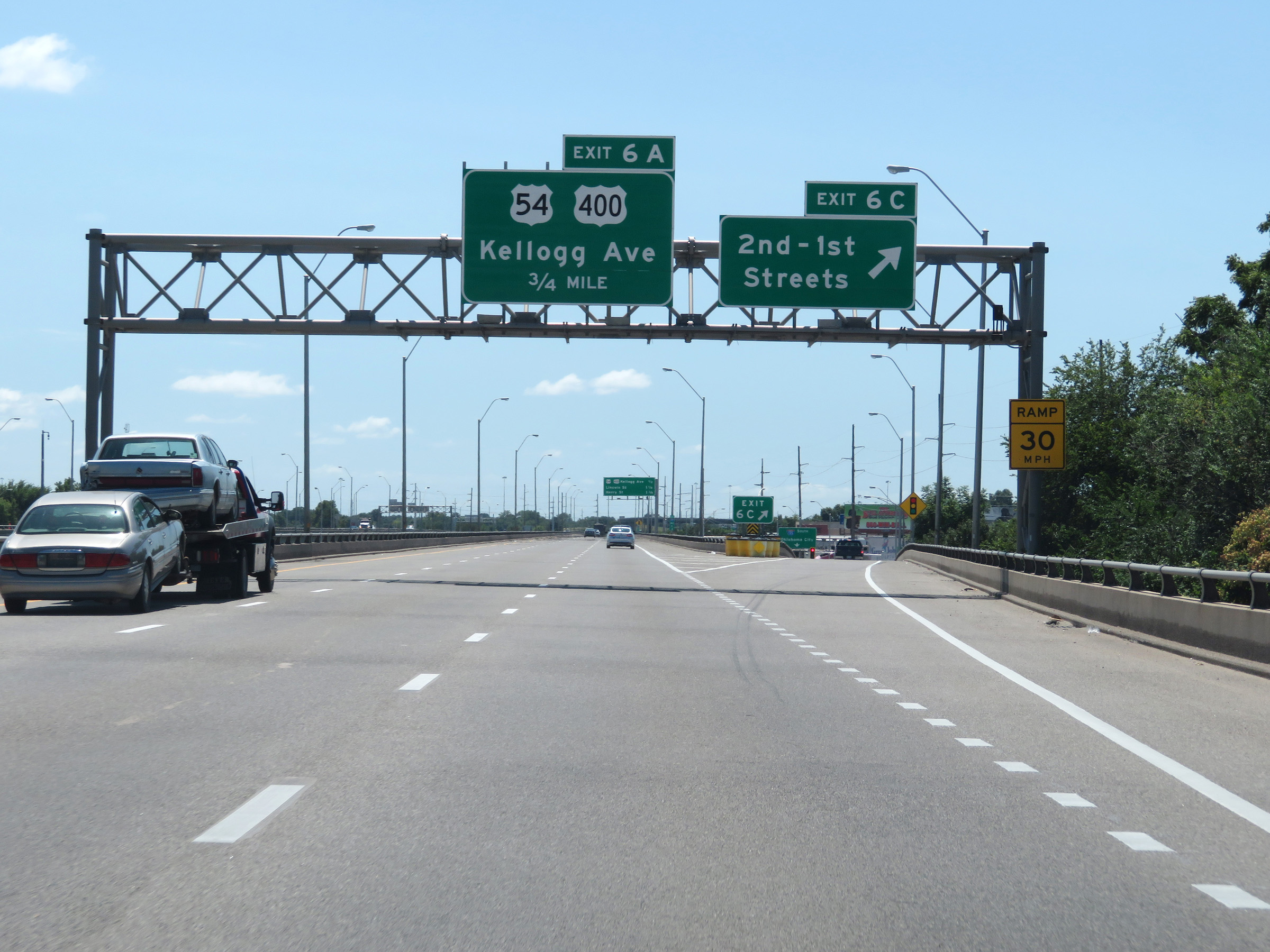 |
Interstate 135 South at Exit 6C: 2nd Street / 1st Street (Photo taken 8/11/20). |
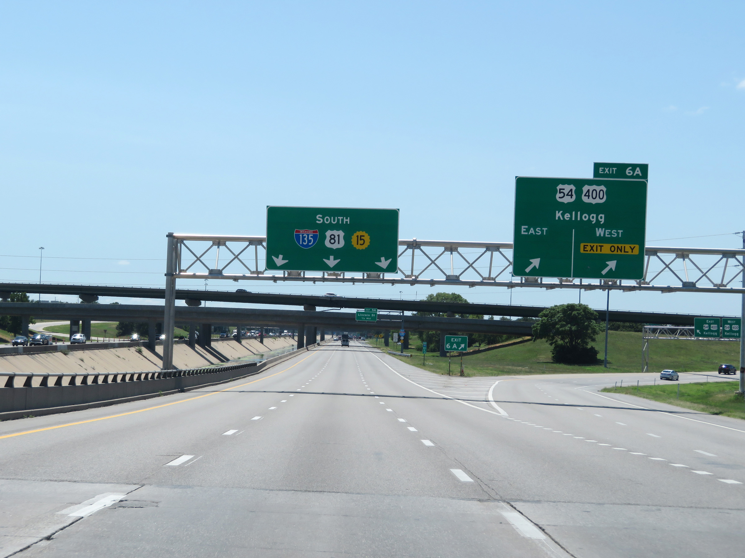 |
Interstate 135 South at Exit 6A: US 54 / US 400 - Kellogg Ave (Photo taken 8/11/20). |
 |
Another state-named Interstate 135 South reassurance shield. (Photo taken 8/11/20). |
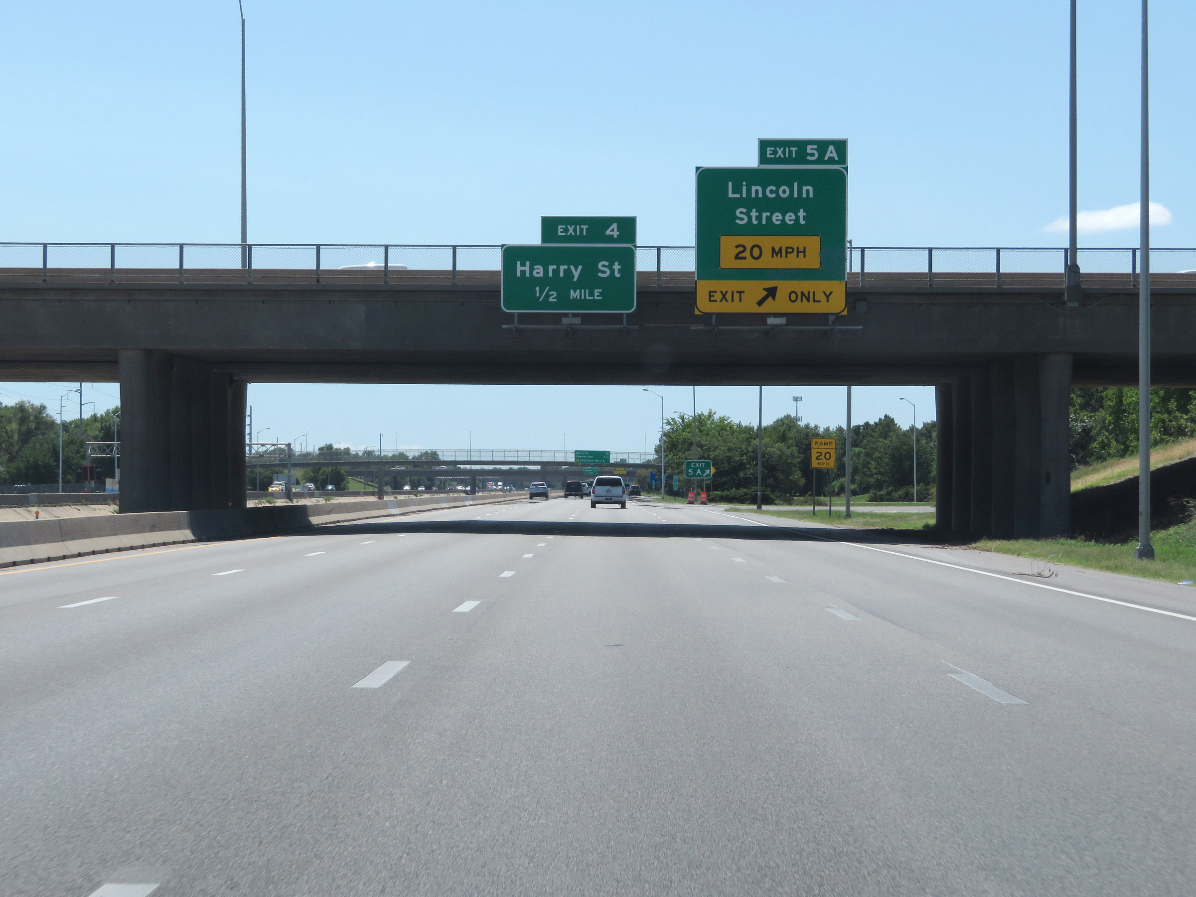 |
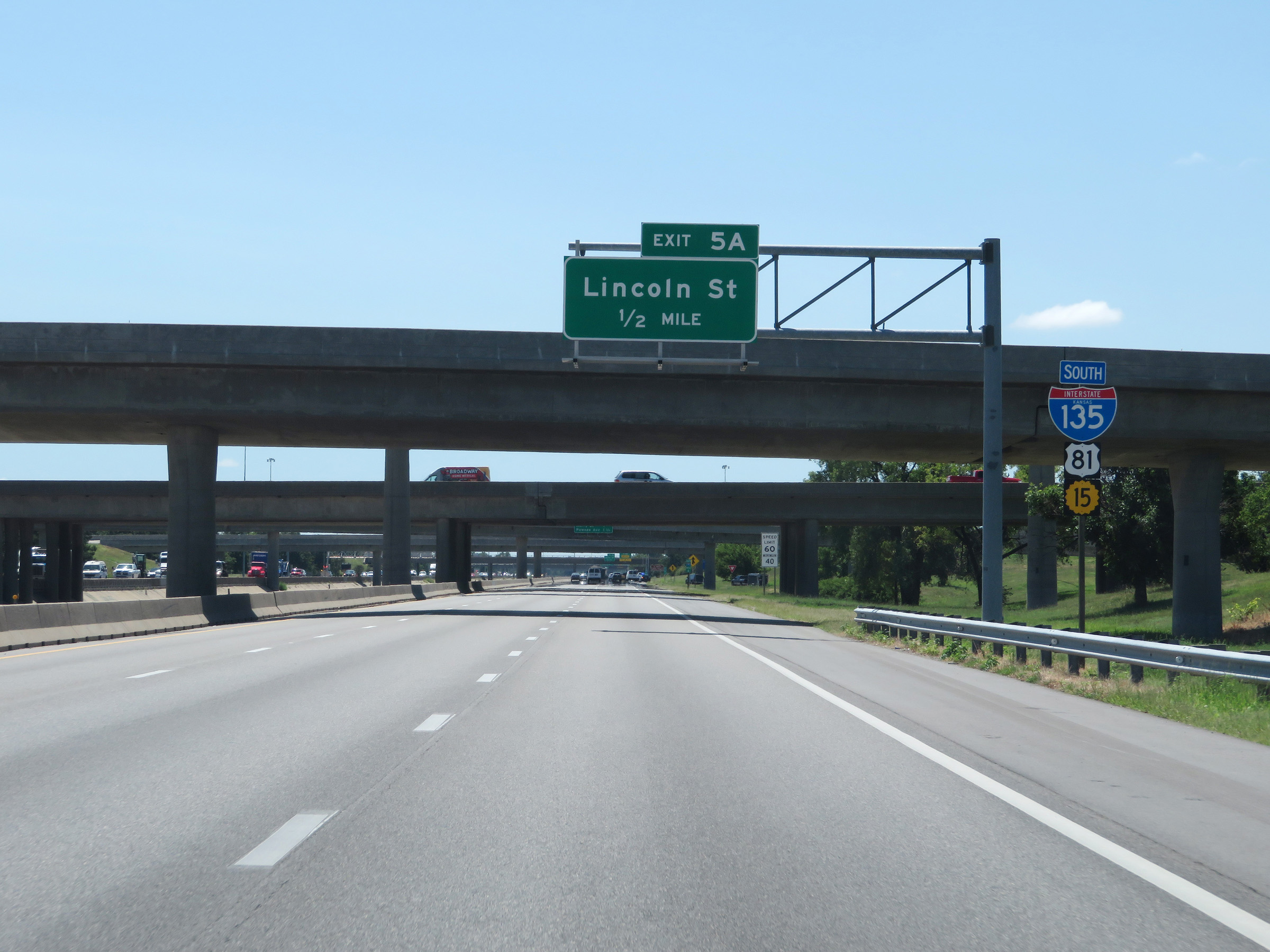
Interstate 135 South at Exit 5A: Lincoln Street (Photo taken 8/11/20). |
 |
Interstate 135 South at Exit 4: Harry Street (Photo taken 8/11/20). |
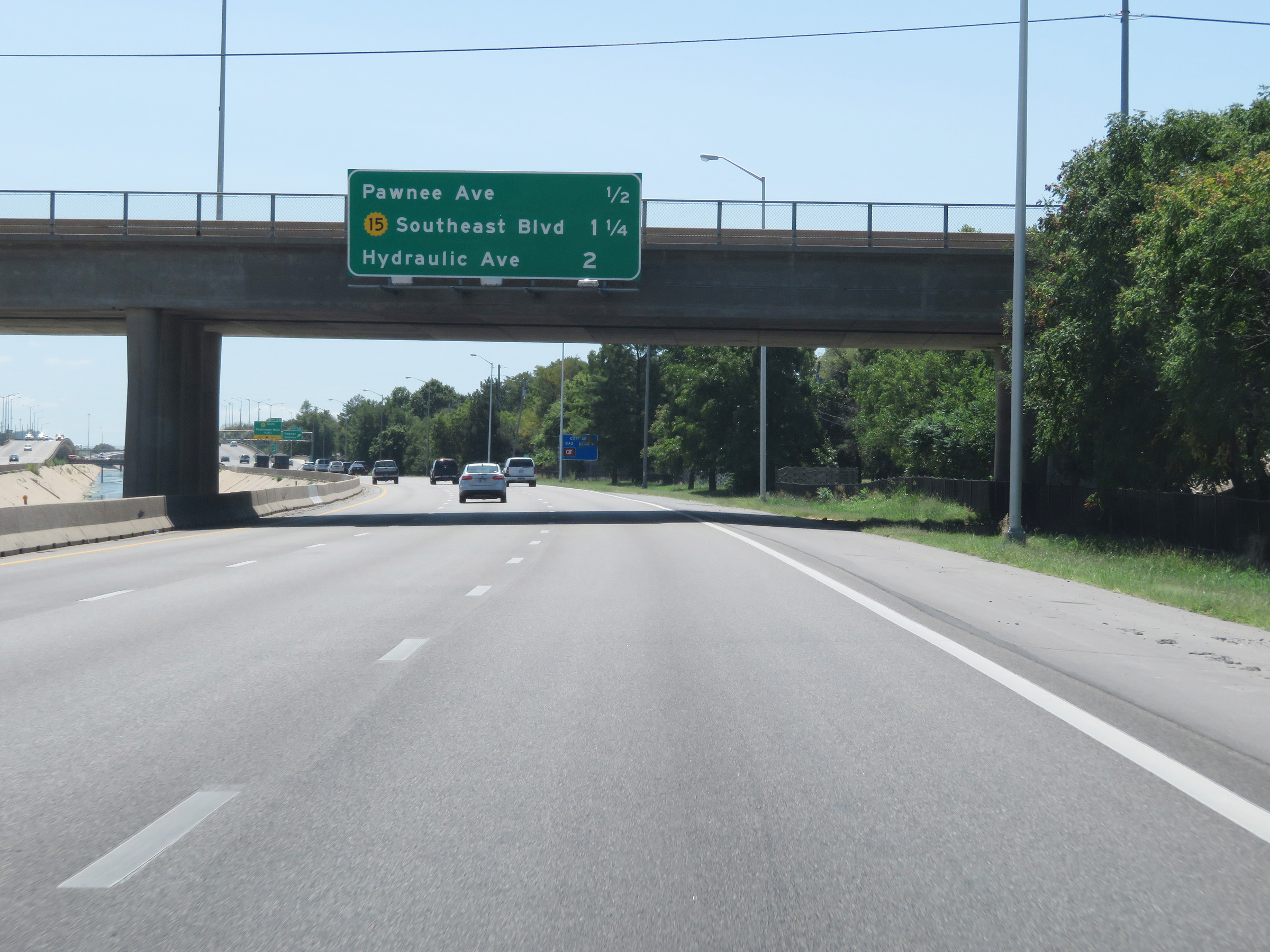 |
Overhead mileage sign listing the distances to three of the remaining exits to Wichita on Interstate 135 South. (Photo taken 8/11/20). |
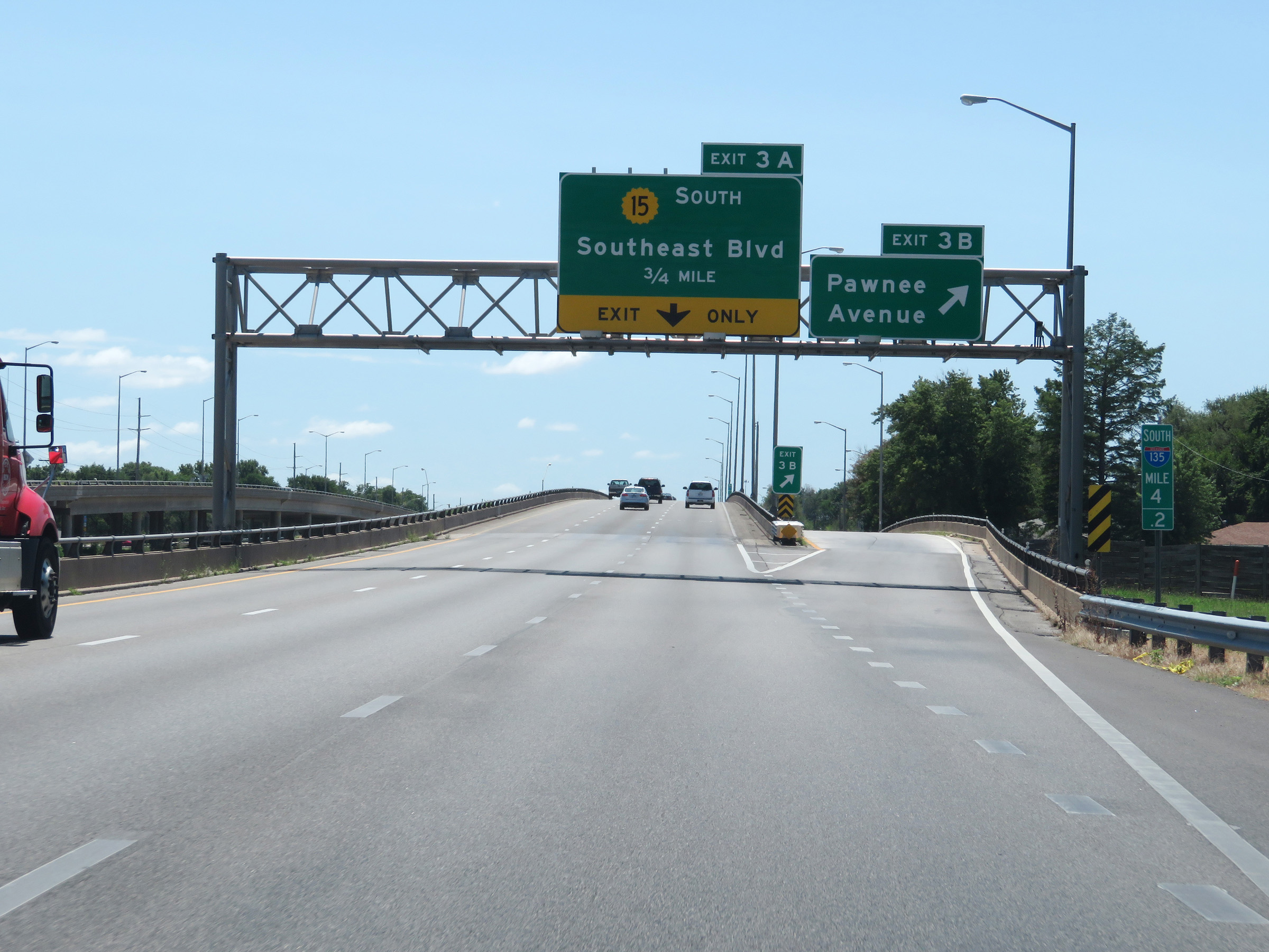 |
Interstate 135 South at Exit 3B: Pawnee Avenue (Photo taken 8/11/20). |
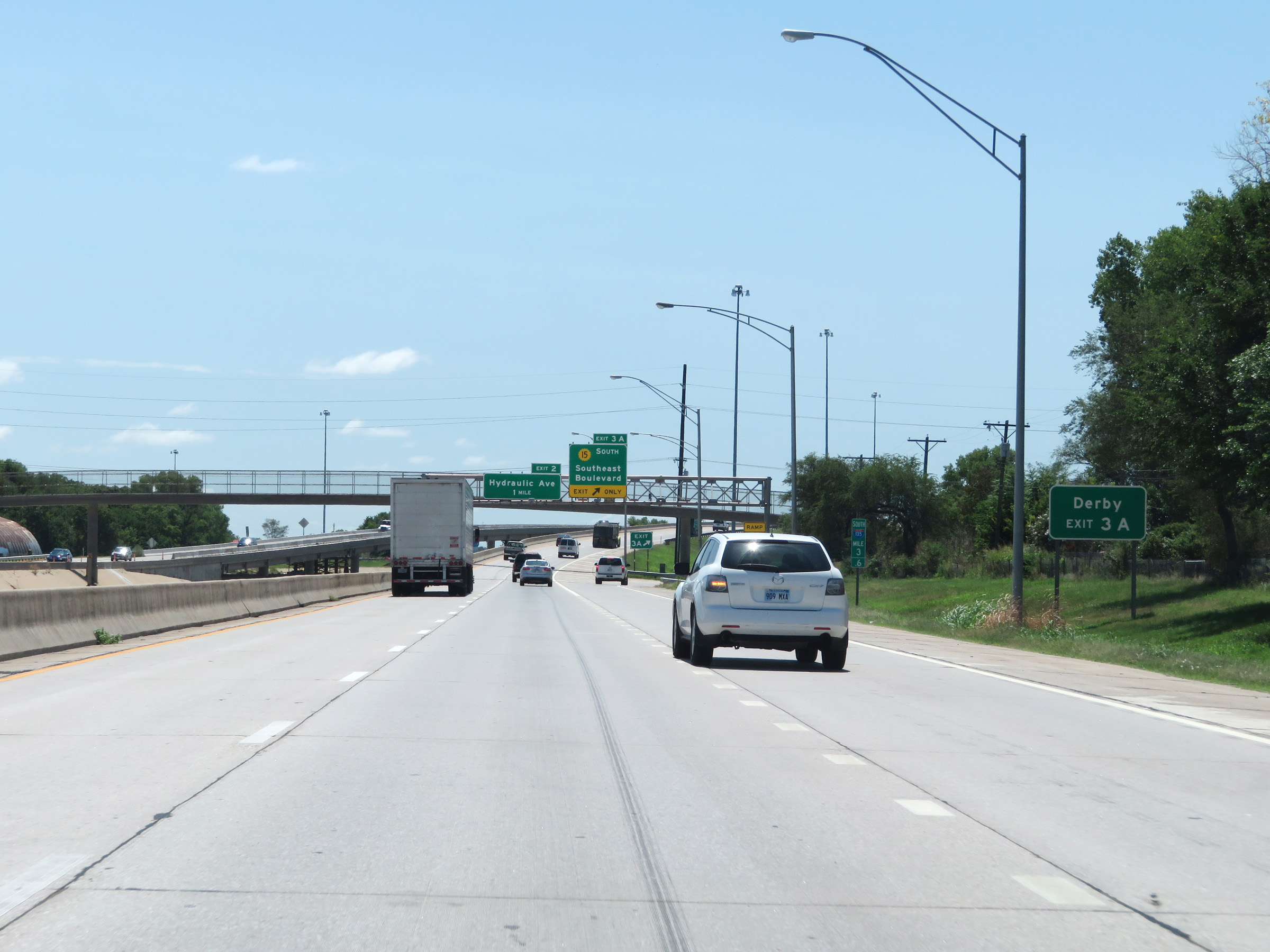 |
Take Exit 3A to Derby. (Photo taken 8/11/20). |
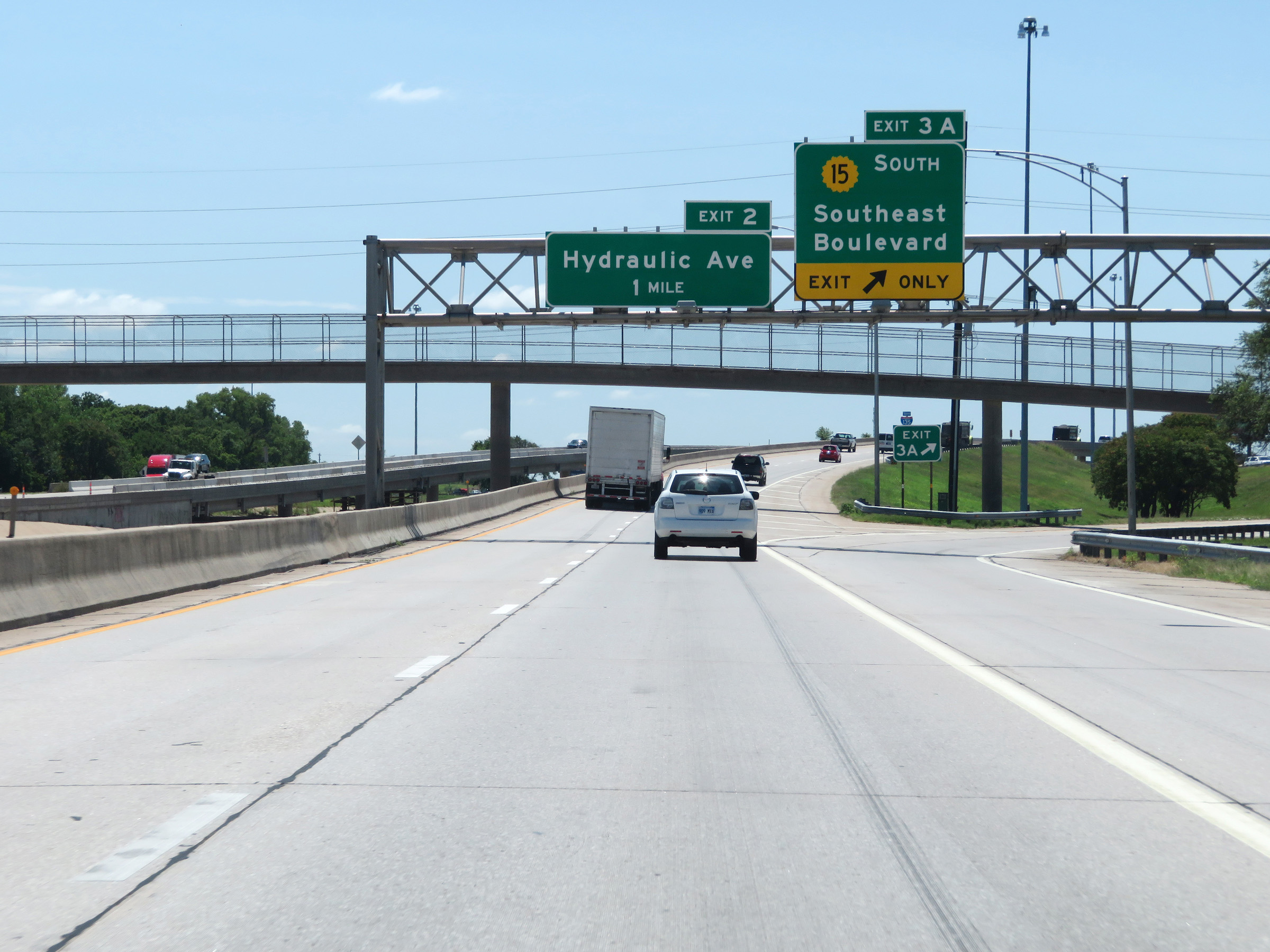 |
Interstate 135 South at Exit 3A: K-15 South - Southeast Boulevard (Photo taken 8/11/20). |
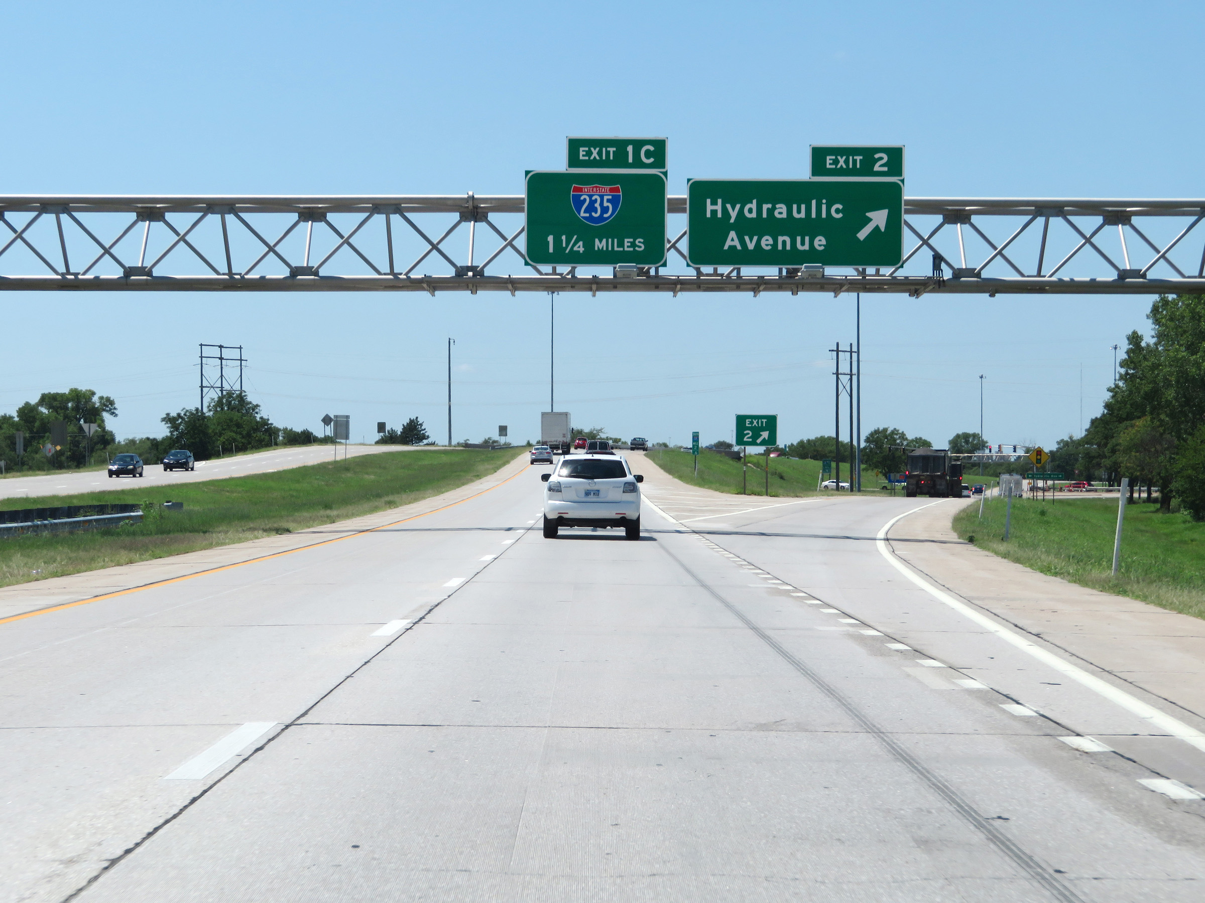 |
Interstate 135 South at Exit 2: Hydraulic Avenue (Photo taken 8/11/20). |
 |
State-named Interstate 135 South reassurance shield at mile marker 2. (Photo taken 8/11/20). |
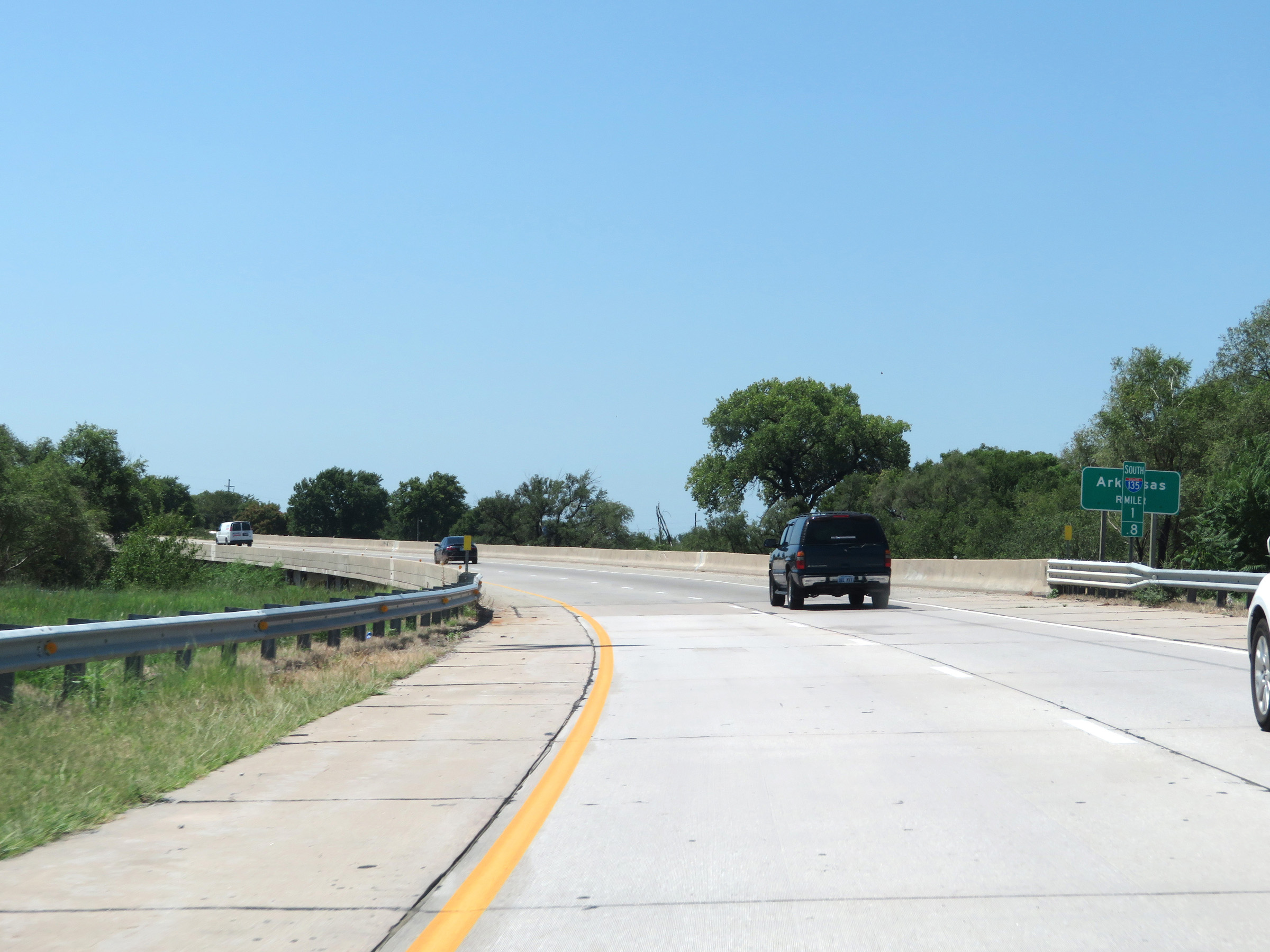 |
Interstate 135 South crosses the Arkansas River at mile marker 1.8. (Photo taken 8/11/20). |
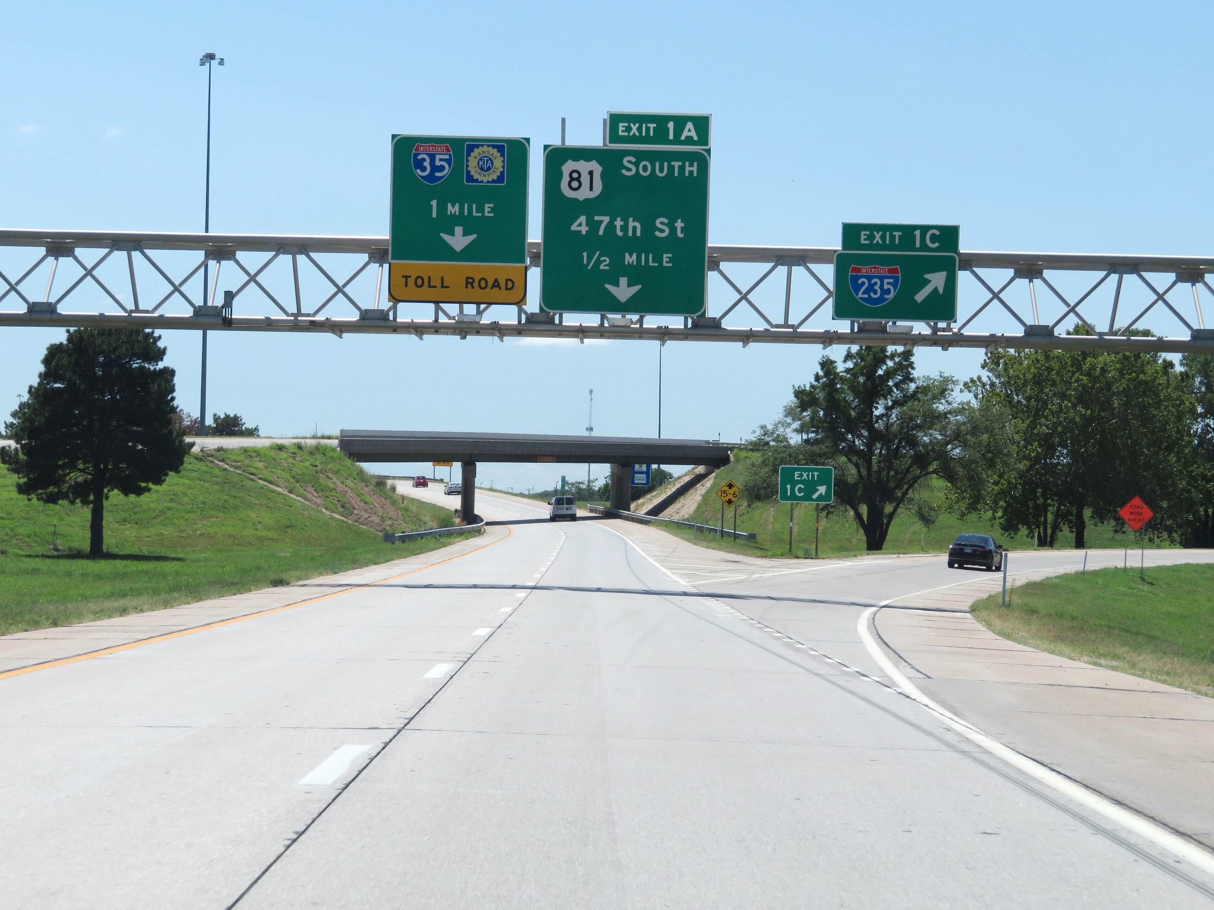 |
Interstate 135 South at Exit 1C: Interstate 235 North (Photo taken 8/11/20). |
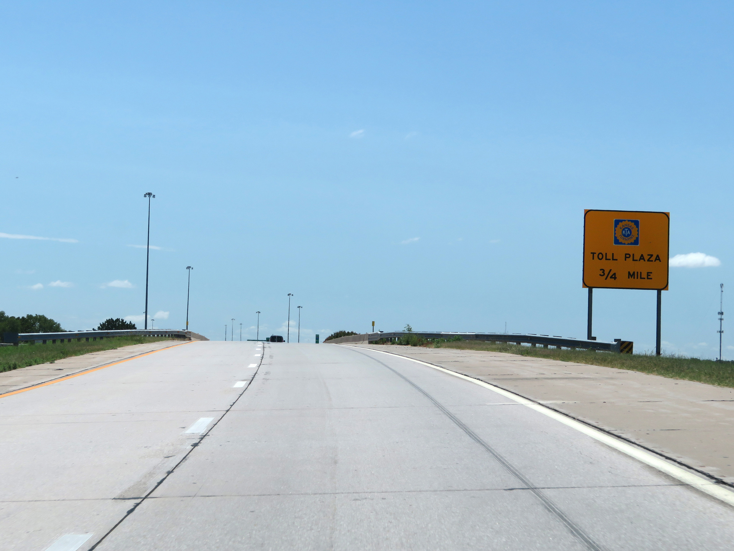 |
Interstate 135 South will end 3/4 mile ahead at the junction of Interstate 35 (Kansas Turnpike). As such, this sign warns of the toll plaza for the Kansas Turnpike being 3/4 mile ahead. (Photo taken 8/11/20). |
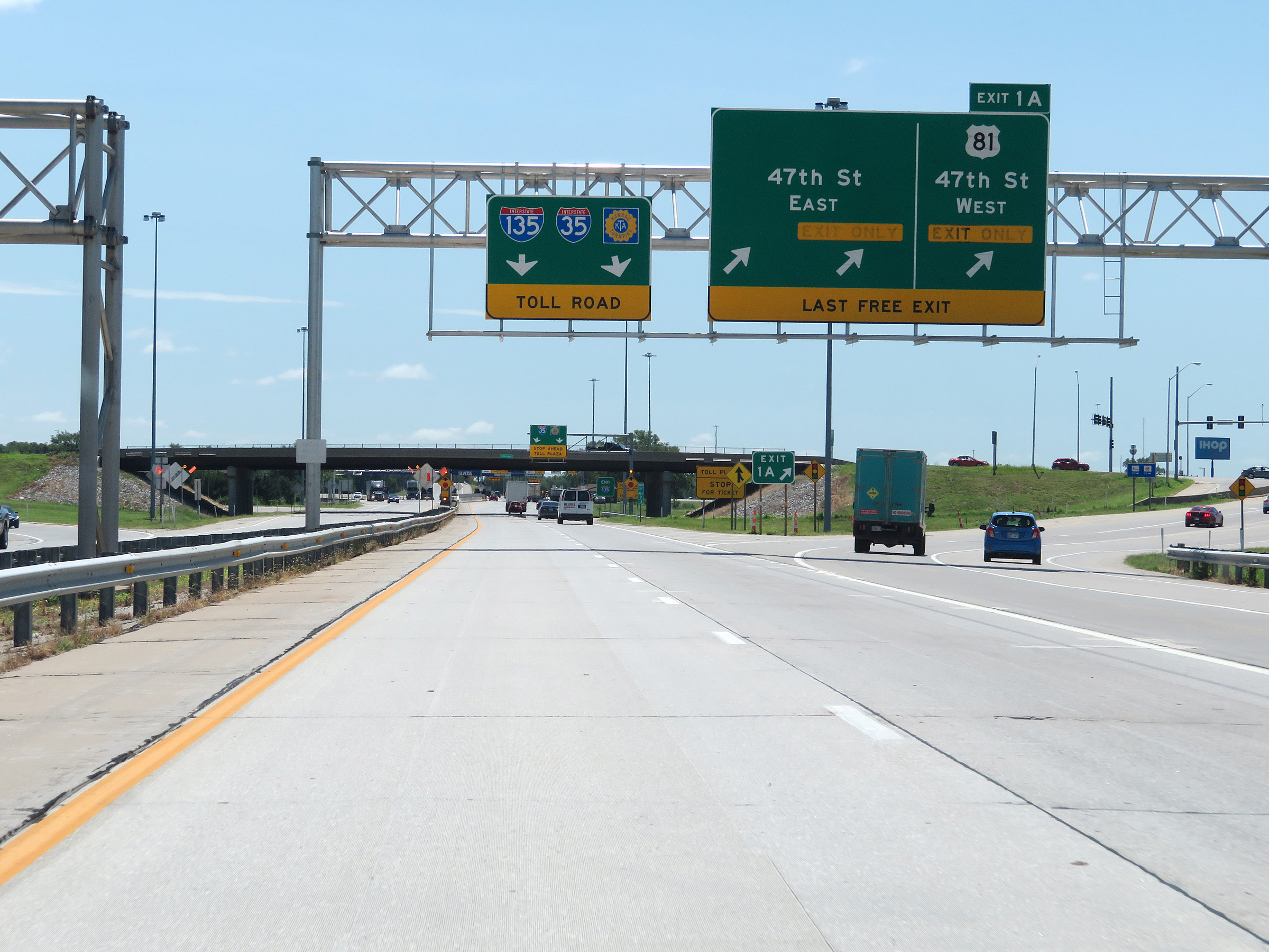 |
Interstate 135 South at Exit 1A: US 81 - 47th St (Photo taken 8/11/20). |
 |
More signage at mile marker 0.6 warning of the toll plaza for the Kansas Turnpike ahead. (Photo taken 8/11/20). |
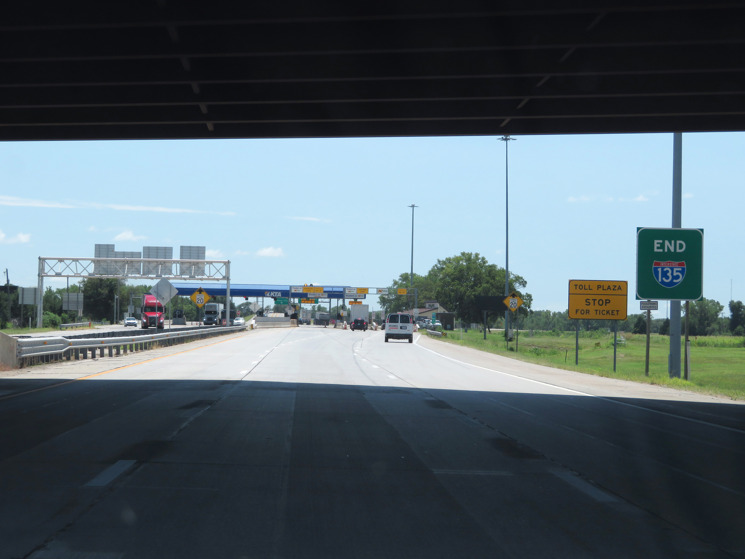 |
Premature Interstate 135 END marker as it approaches the toll plaza to enter the Kansas Turnpike and Interstate 35. (Photo taken 8/11/20). |
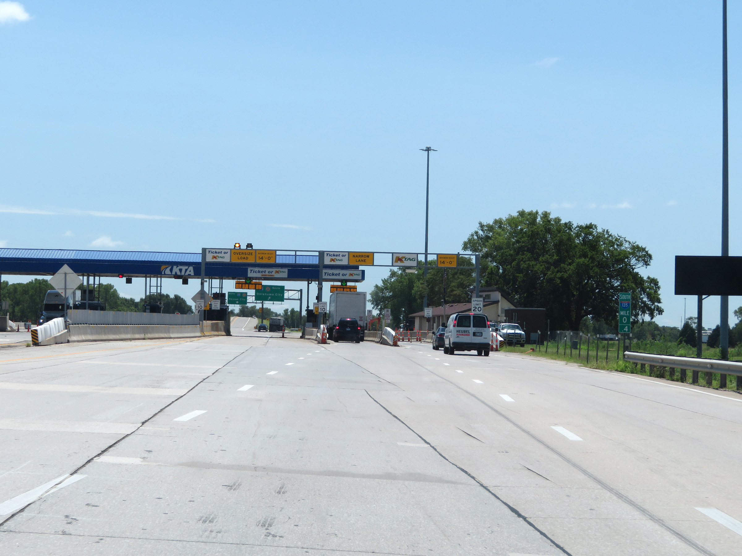 |
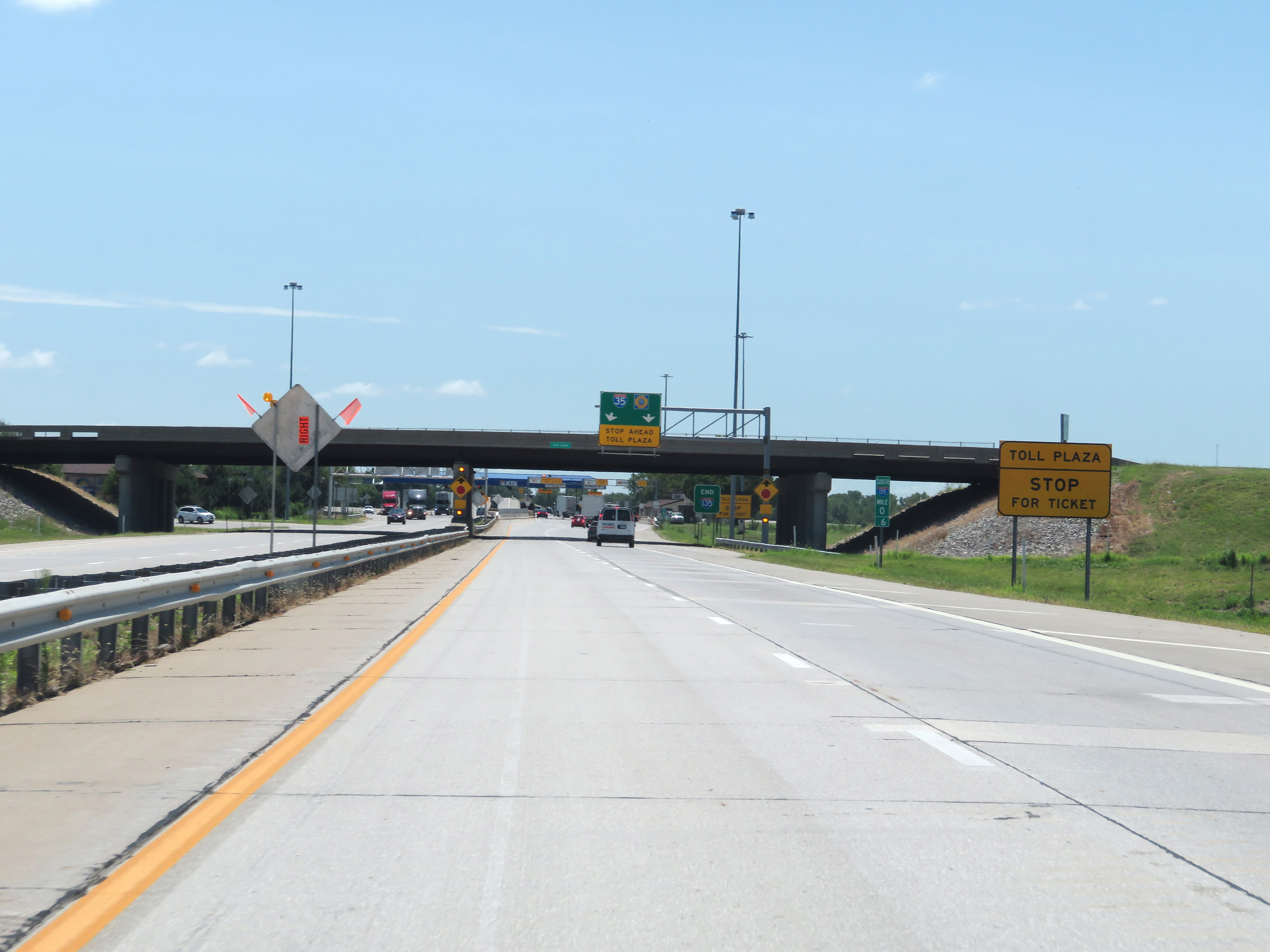
View on Interstate 135 South at mile marker 0.4, approaching the toll plaza for the Kansas Turnpike and Interstate 35. (Photo taken 8/11/20). |
 |
The speed limits decrease to 20 mph in the K Tag lane and 10 mph in the Ticket or K Tag lanes on the left. (Photo taken 8/11/20). |
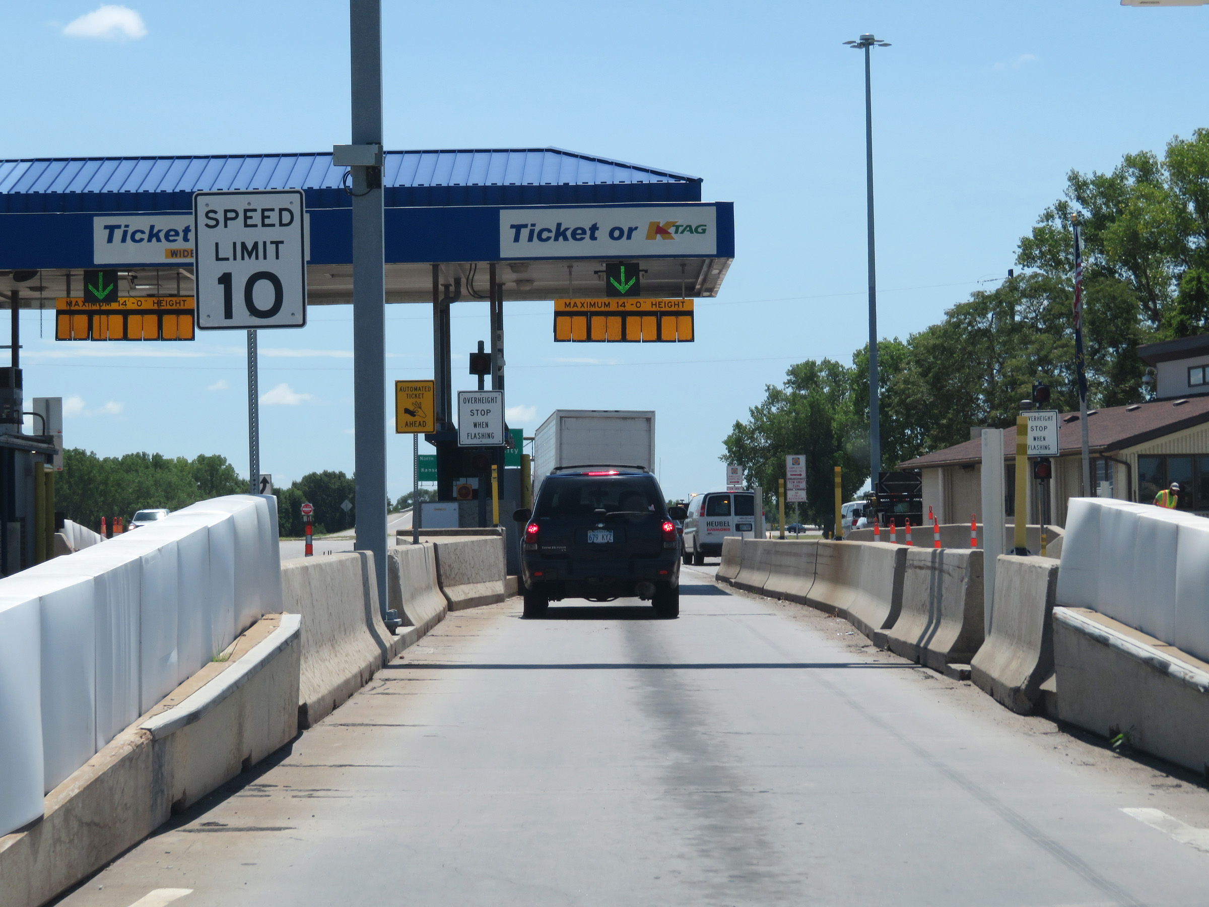 |
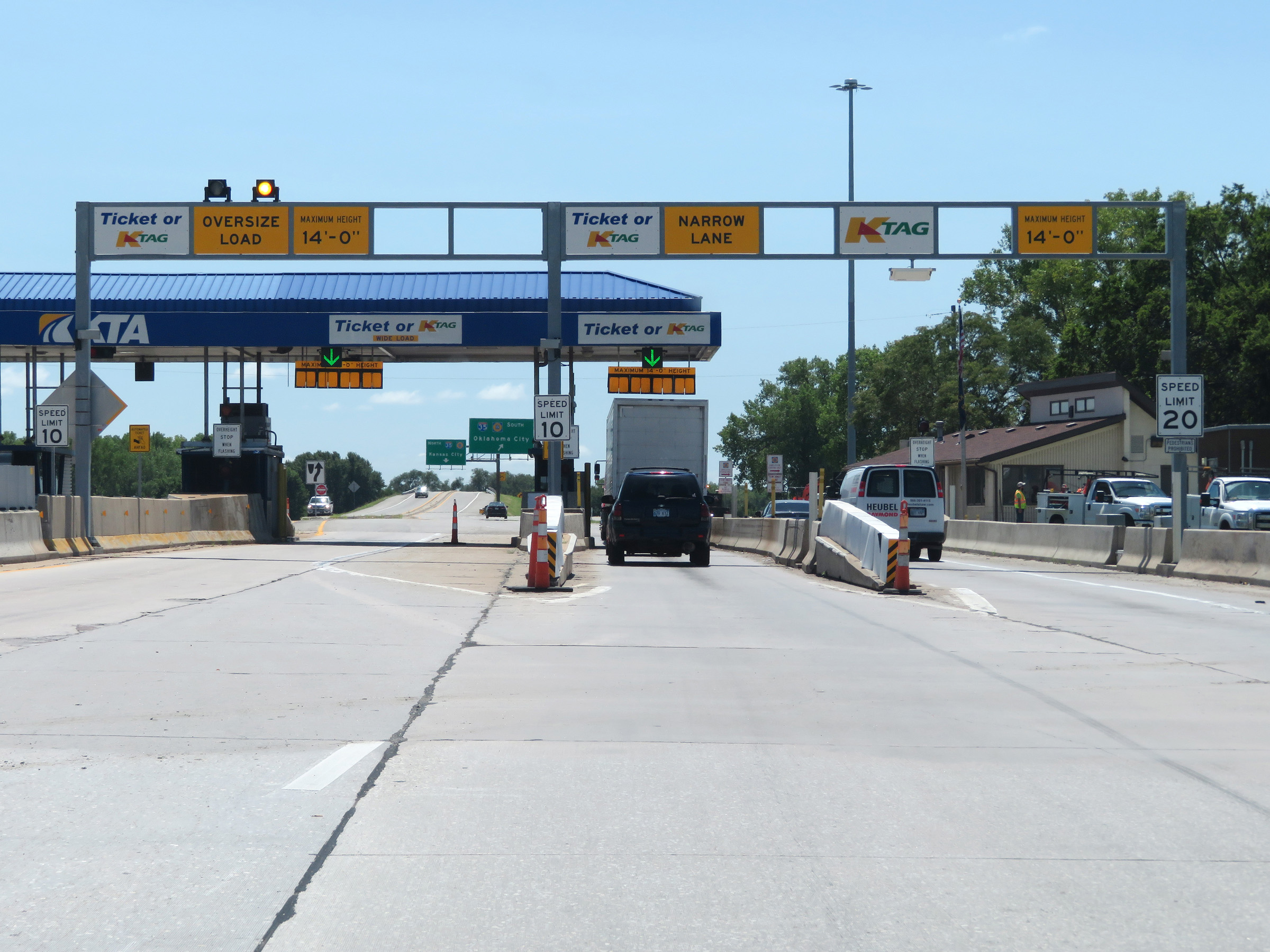
Close up view of the toll plaza on Interstate 135 South entering Interstate 35 (Kansas Turnpike) via a Ticket or K Tag lane. (Photo taken 8/11/20). |
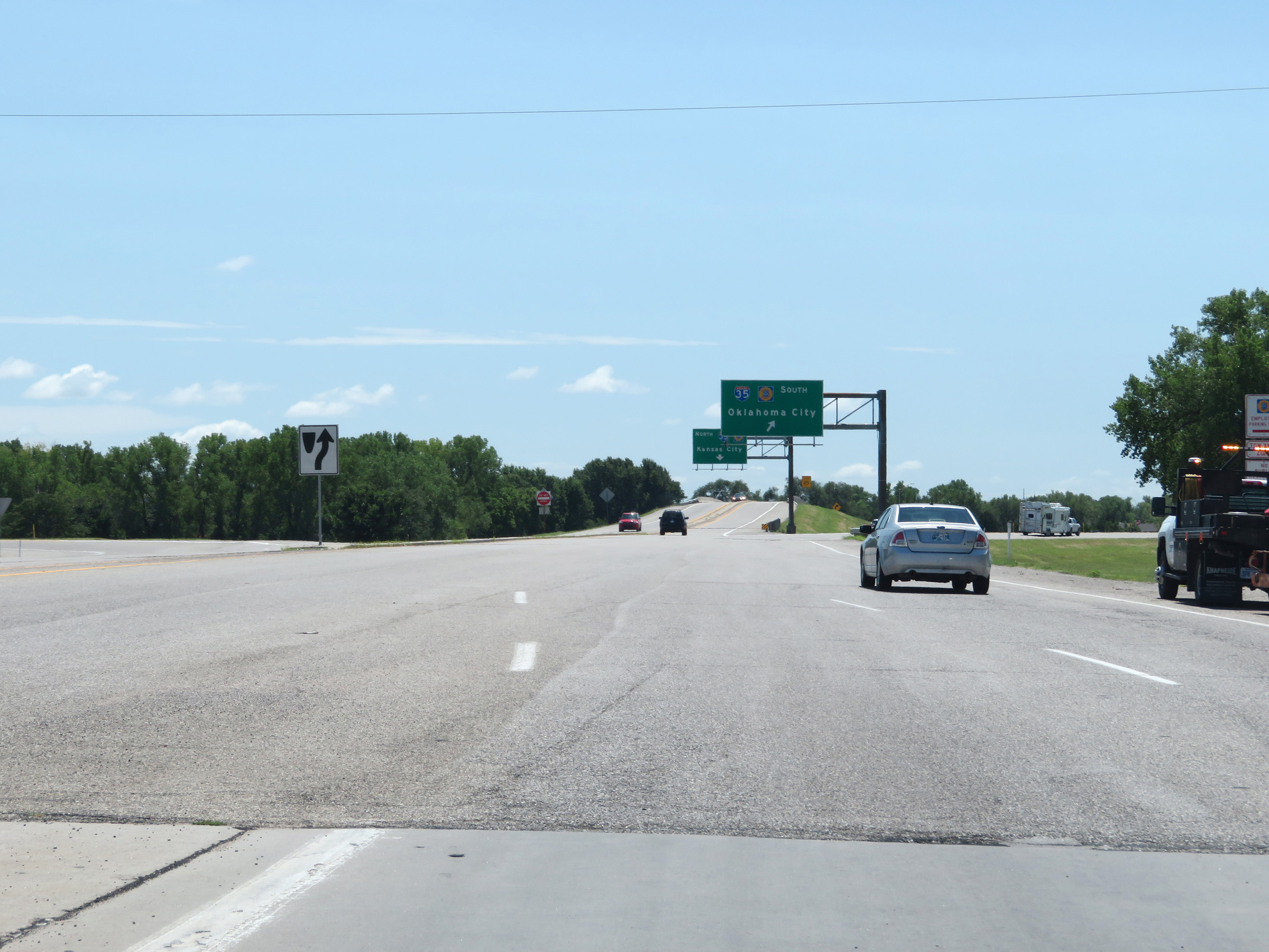 |
View on Interstate 135 South leaving the toll plaza and approaching the ramps to Interstate 35 North and South (Kansas Turnpike). (Photo taken 8/11/20). |
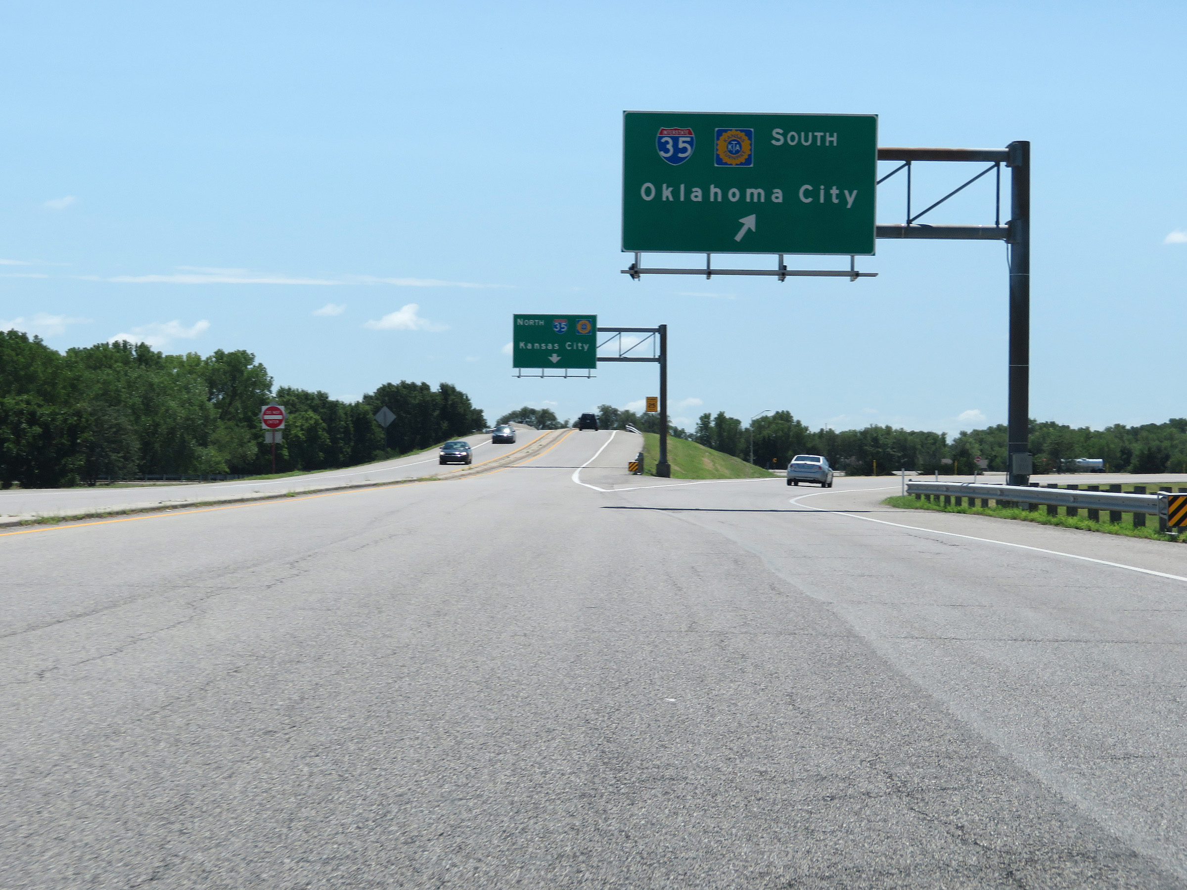 |
Ramp to Interstate 35 South (Kansas Turnpike) to the south of the toll plaza at the southern terminus of Interstate 135. (Photo taken 8/11/20). |
 |
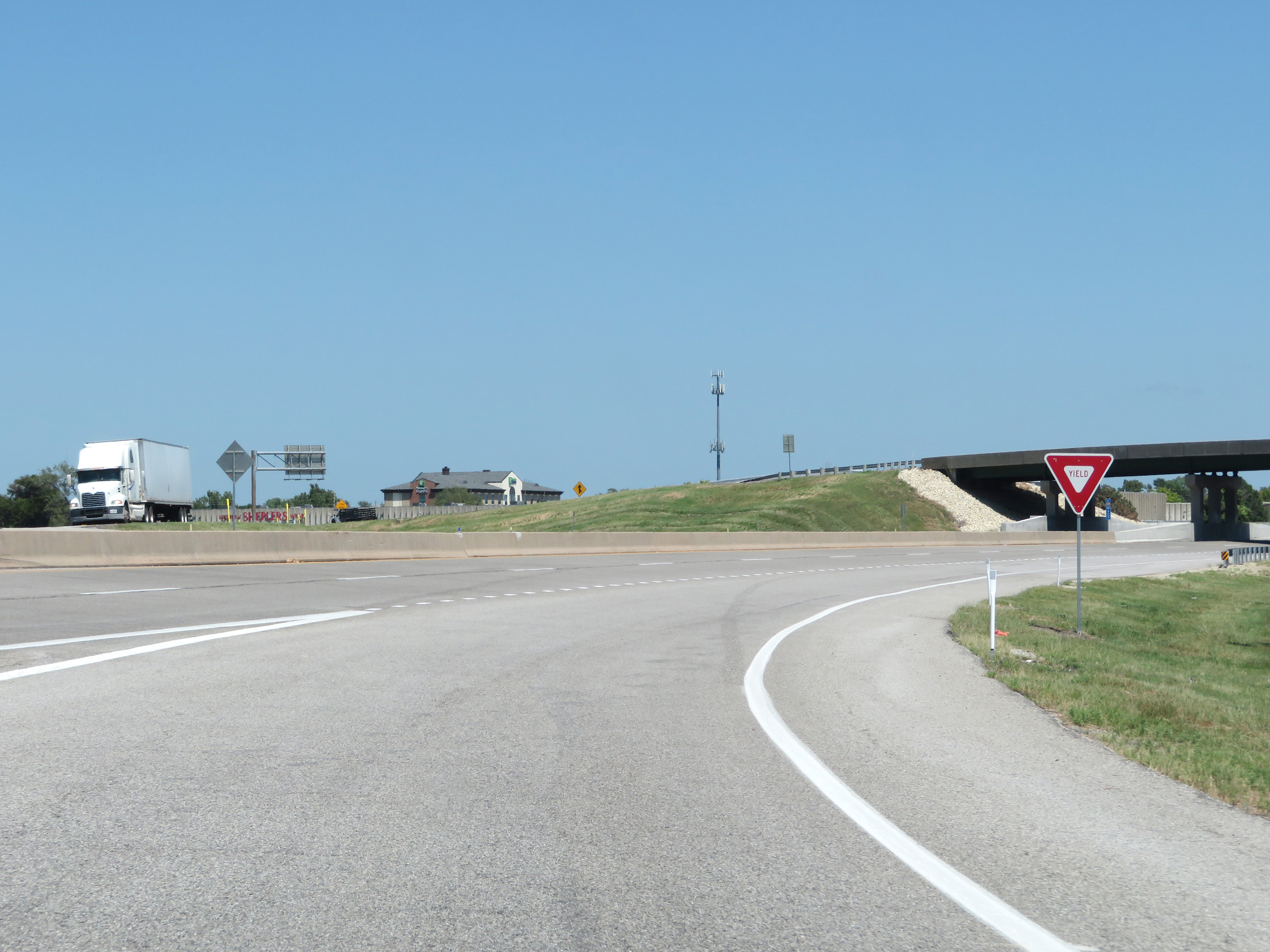
View of the ramp to Interstate 35 North (Kansas Turnpike) at the southern terminus of Interstate 135. (Photo taken 8/11/20). |
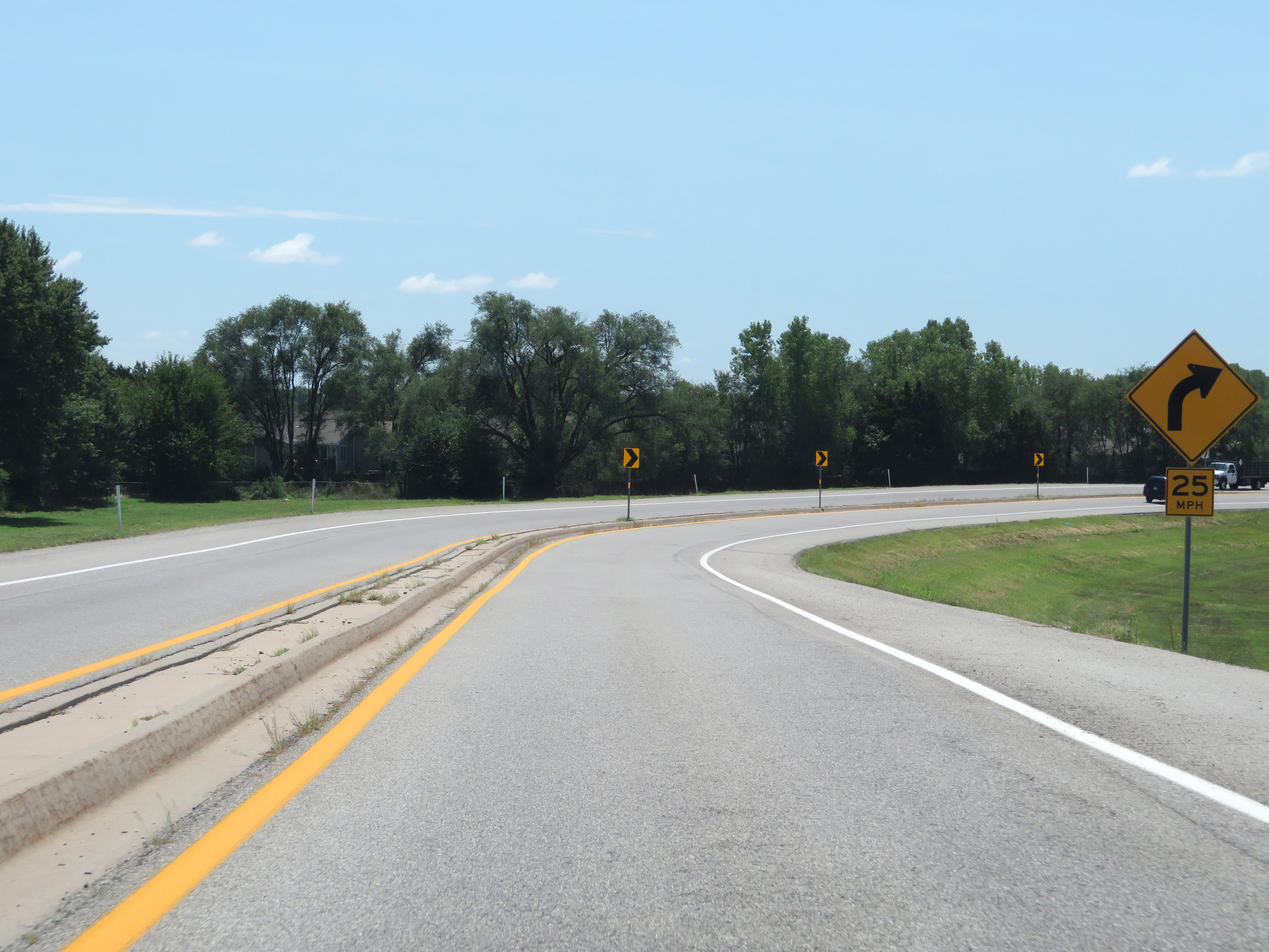 |
The ramp to Interstate 35 North (Kansas Turnpike) is a loop ramp which will curve hard to the right ahead. (Photo taken 8/11/20). |
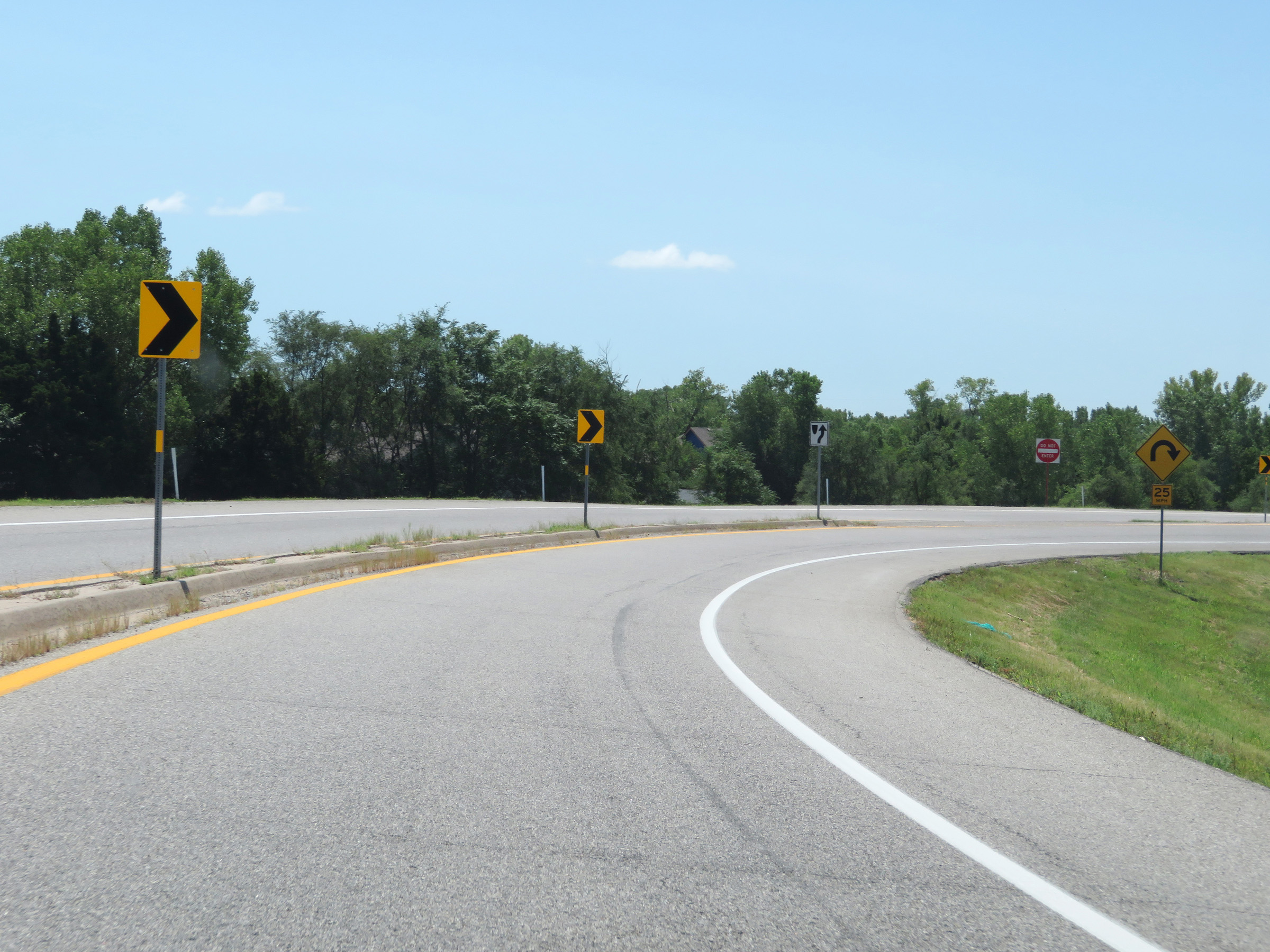 |
View on the ramp from Interstate 135 South to Interstate 35 North (Kansas Turnpike) as it curves hard to the right. (Photo taken 8/11/20). |
 |
The ramp from Interstate 135 South prepares to join the northbound lanes of Interstate 35 (Kansas Turnpike) here. (Photo taken 8/11/20). |
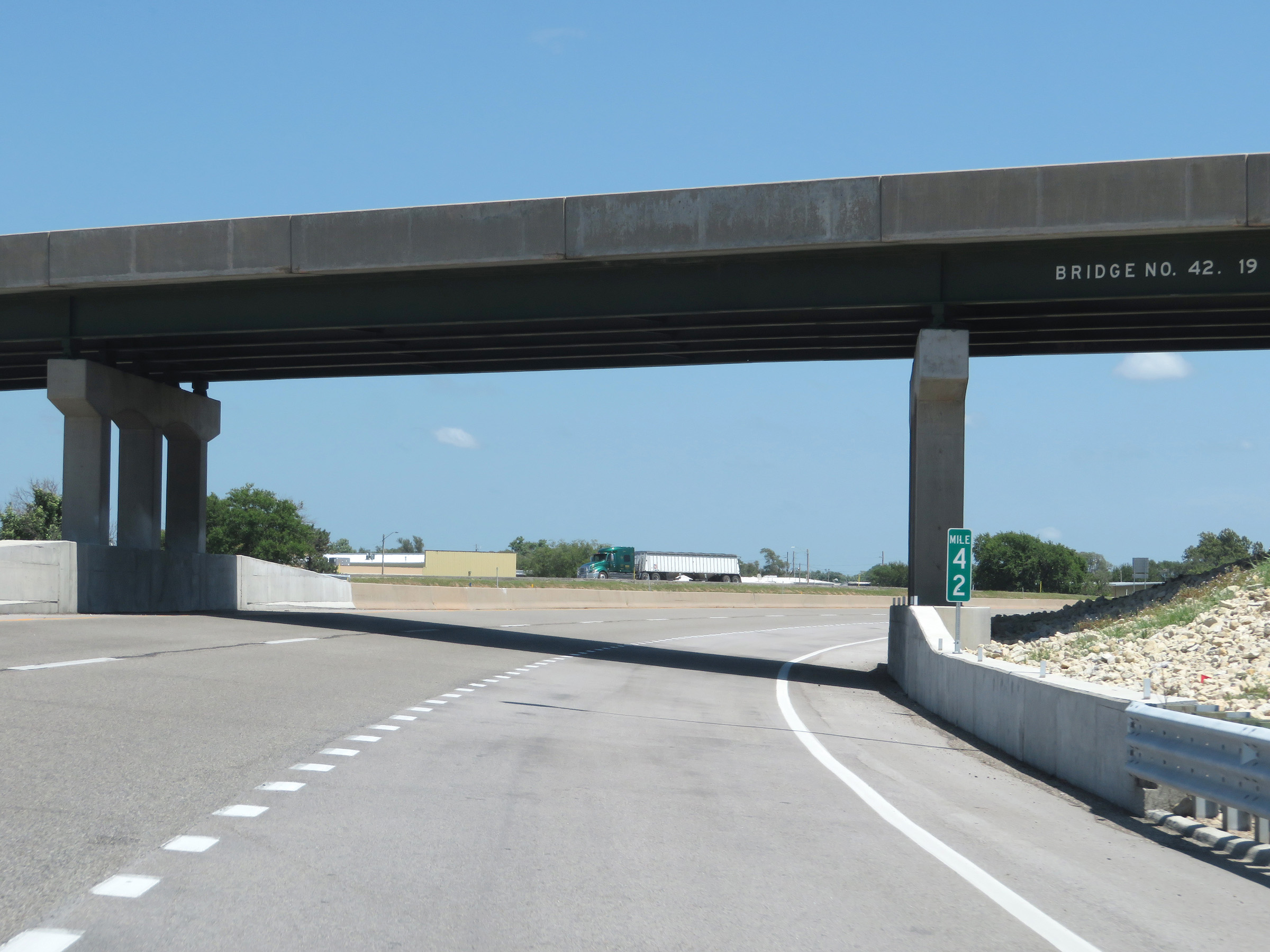 |
The ramp joins the northbound lanes of Interstate 35 (Kansas Turnpike) at mile marker 42. (Photo taken 8/11/20). |