Road Information |
||
 |
||
| Total Mileage in State: | 53 miles | |
| Beginning/End: | At I-65, Indianapolis | |
| Mileage covered in Photos: | 53 miles | |
| Counties covered in Photos: | Marion, Boone, Hamilton | |
| Major Junctions in Photos: | I-65, in Indianapolis I-70, in Indianapolis I-74, in Speedway I-65, in Indianapolis I-865, in Zionsville I-69, in Indianapolis I-70, in Indianapolis I-74, in Indianapolis |
|
| Control Cities in Photos: | Indianapolis, Zionsville, Carmel | |
Inner Loop
- Section 1: Mile Marker 0 to Exit 27
- Section 2: Exit 27 to Mile Marker 0
Section 1: Mile Marker 0 to Exit 27
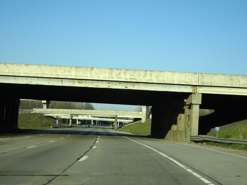 |
Interstate 465 Inner Loop (West) / Interstate 74 West as it passes under Interstate 65 on the south side of Indianapolis. At this point, I-465's mileage resets which marks its official beginning/end. (Photo taken 4/17/16). |
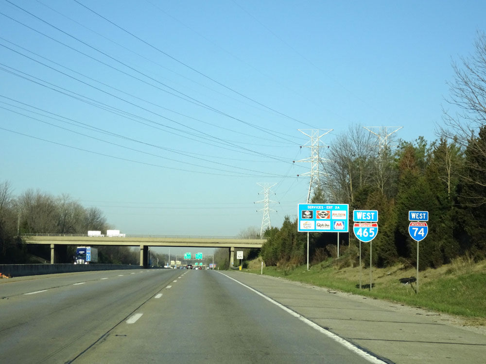 |
Dual Interstate 465 West / Interstate 74 West assurance shields shortly after I-465's mileage resets to 0. (Photo taken 4/17/16). |
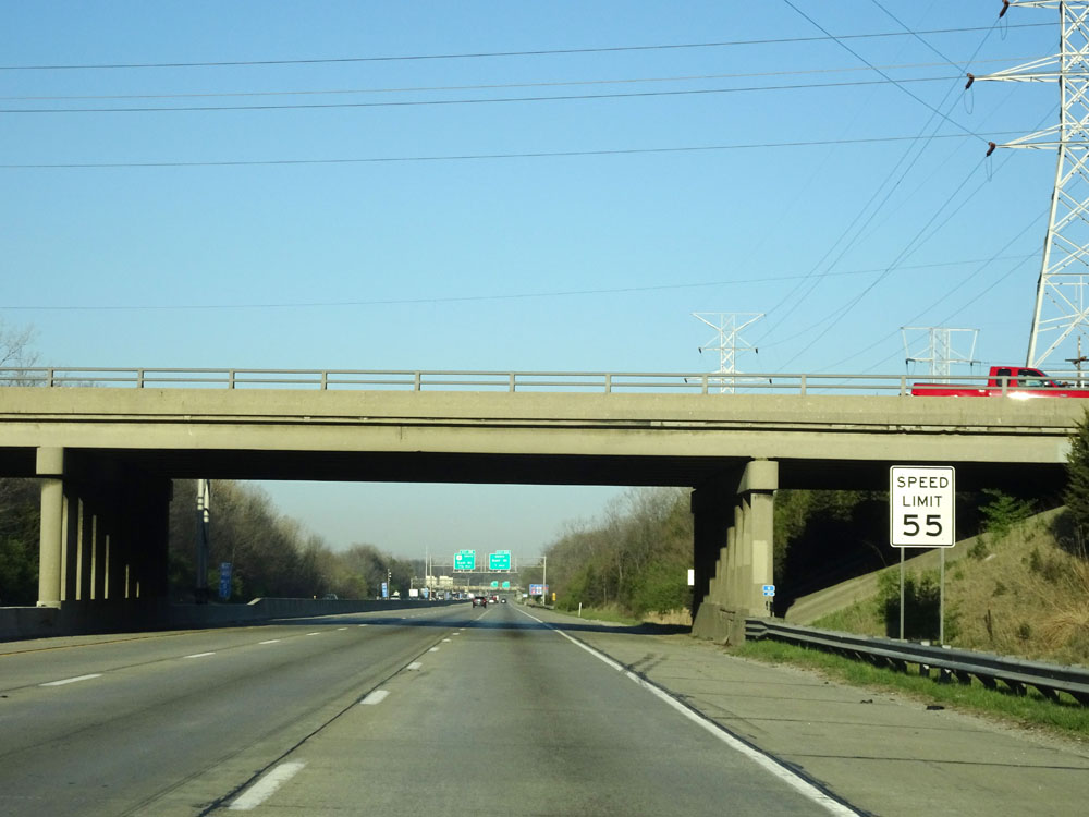 |
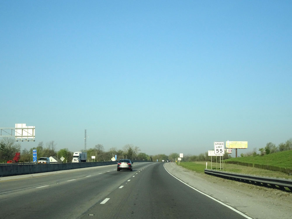
Speed limit sign near mile marker 1. The speed limit on Interstate 465 is 55 mph for its entirety. Don't worry, traffic moves along much faster than that. (Photo taken 4/17/16). |
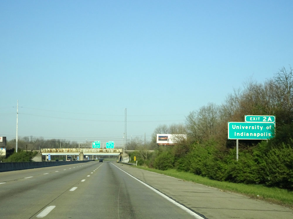 |
Take Exit 2A to University of Indianapolis. (Photo taken 4/17/16). |
 |
Interstate 465 in Indiana is also known as the USS Indianapolis Memorial Highway, as this sign reads. (Photo taken 4/17/16). |
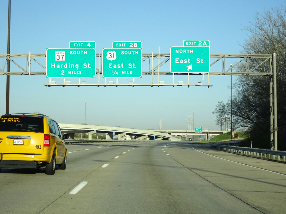 |
Interstate 465 Inner Loop (West) / Interstate 74 West at Exit 2A: East St North (Photo taken 4/17/16). |
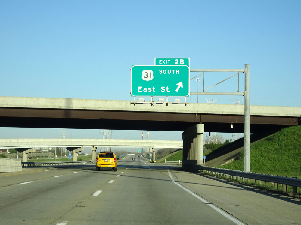 |
Interstate 465 Inner Loop (West) / Interstate 74 West at Exit 2B: US 31 South - East St (Photo taken 4/17/16). |
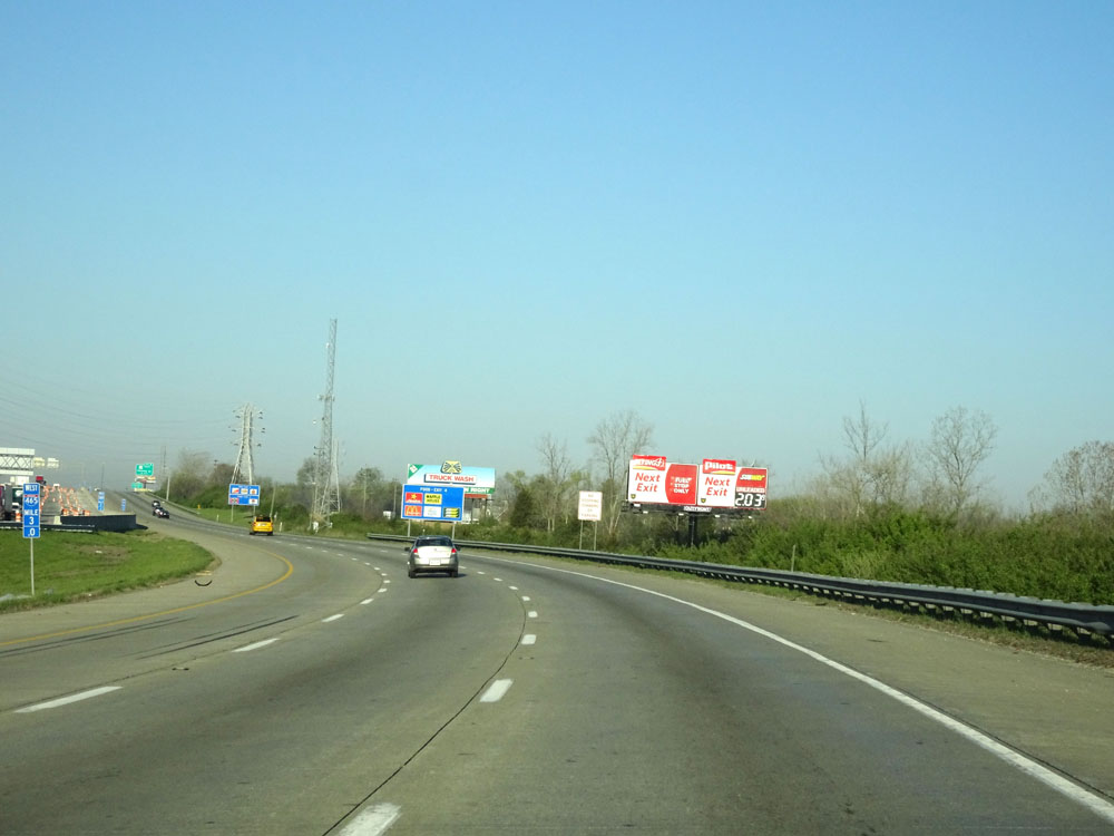 |
Interstate 465 Inner Loop (West) / Interstate 74 West at mile marker 3. (Photo taken 4/17/16). |
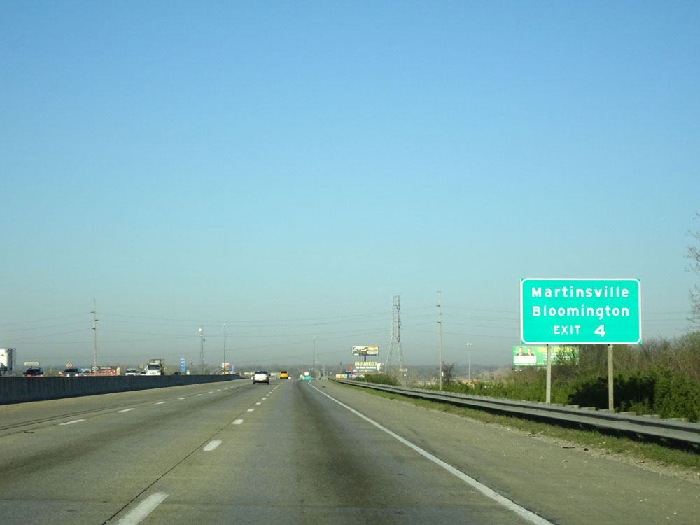 |
Take Exit 4 to Martinsville and Bloomington. (Photo taken 4/17/16). |
 |
Interstate 465 Inner Loop (West) / Interstate 74 West at Exit 4: IN 37 South - Harding St (Photo taken 4/17/16). |
 |
Interstate 465 Inner Loop (West) / Interstate 74 West at mile marker 5. (Photo taken 4/17/16). |
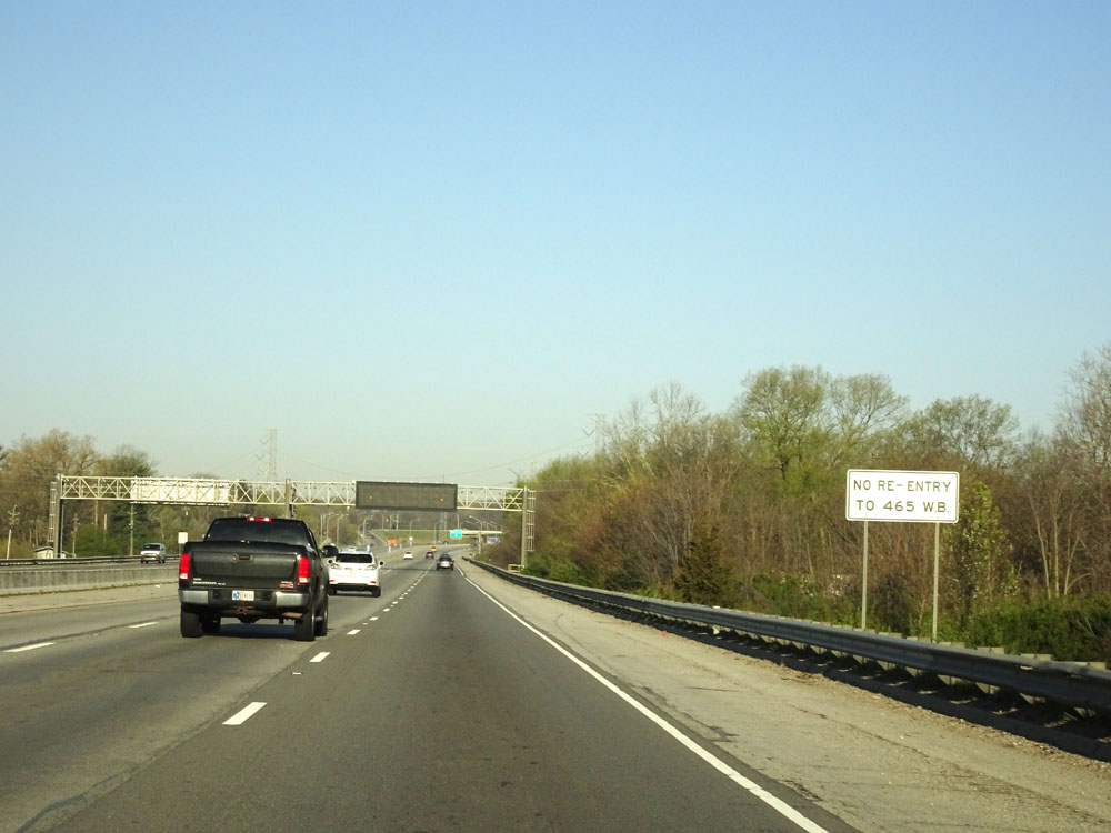 |
The next exit (Exit 7) has no direct re-entry to Interstate 465 Inner Loop (West). (Photo taken 4/17/16). |
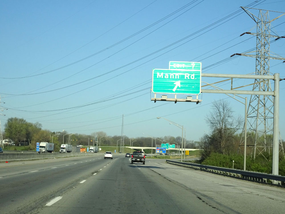 |
Interstate 465 Inner Loop (West) / Interstate 74 West at Exit 7: Mann Rd (Photo taken 4/17/16). |
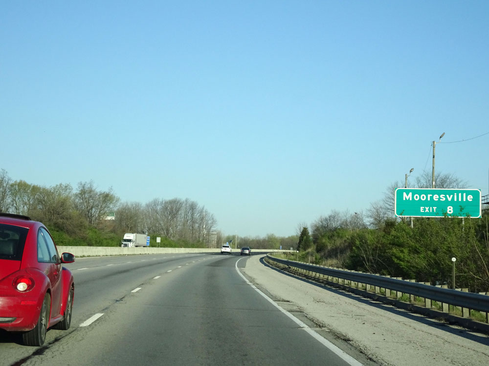 |
Take Exit 8 to Mooresville. (Photo taken 4/17/16). |
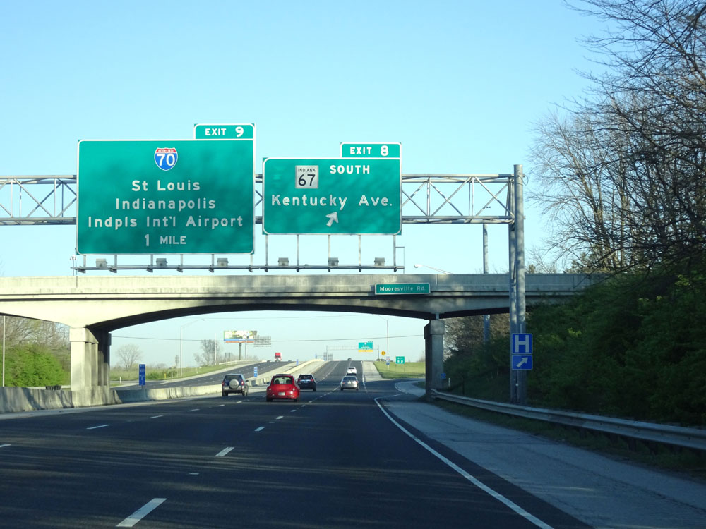 |
Interstate 465 Inner Loop (West) / Interstate 74 West at Exit 8: IN 67 South - Kentucky Ave (Photo taken 4/17/16). |
 |
Interstate 465 Inner Loop (West) / Interstate 74 West approaching Exit 9 - 1/2 mile. (Photo taken 4/17/16). |
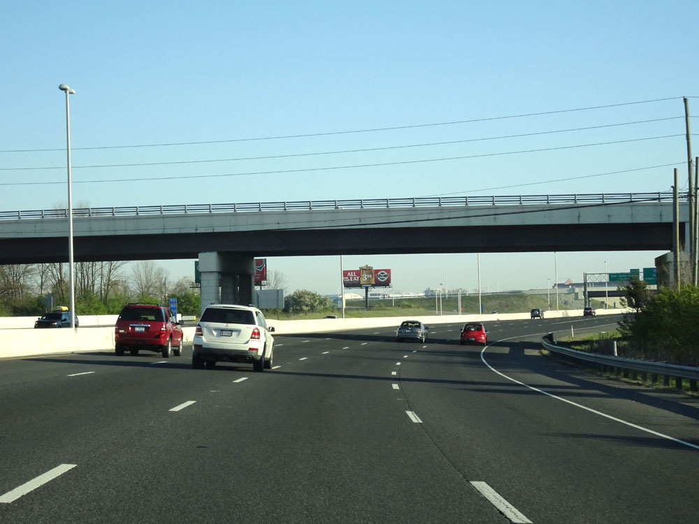 |
View on Interstate 465 Inner Loop (West) / Interstate 74 West as it curves to the north on the southwest side of Indianapolis. (Photo taken 4/17/16). |
 |
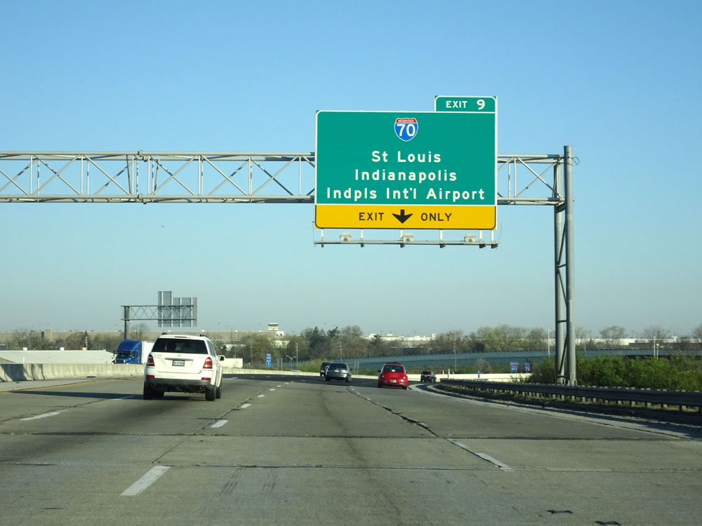
Interstate 465 Inner Loop (North) / Interstate 74 West at Exit 9: Interstate 70 - St Louis / Indianapolis / Indianapolis International Airport (Photo taken 4/17/16). |
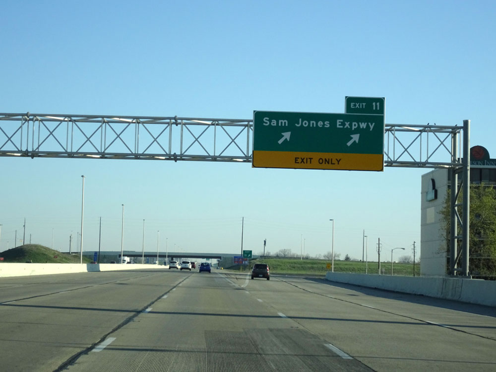 |
Interstate 465 Inner Loop (North) / Interstate 74 West at Exit 11: Sam Jones Expwy (Photo taken 4/17/16). |
 |
Take Exit 12 to Plainfield. (Photo taken 4/17/16). |
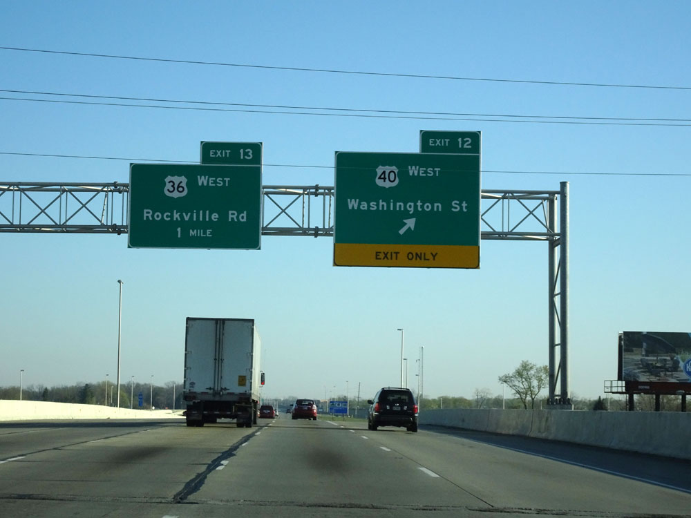 |
Interstate 465 Inner Loop (North) / Interstate 74 West at Exit 12: US 40 West - Washington St (Photo taken 4/17/16). |
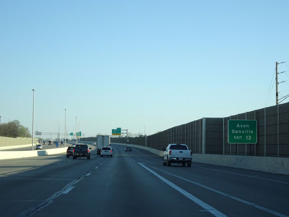 |
Take Exit 13 to Avon and Danville. (Photo taken 4/17/16). |
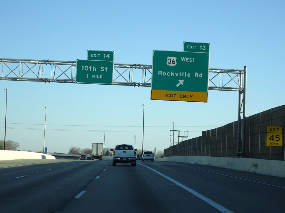 |
Interstate 465 Inner Loop (North) / Interstate 74 West at Exit 13: US 36 West - Rockville Rd (Photo taken 4/17/16). |
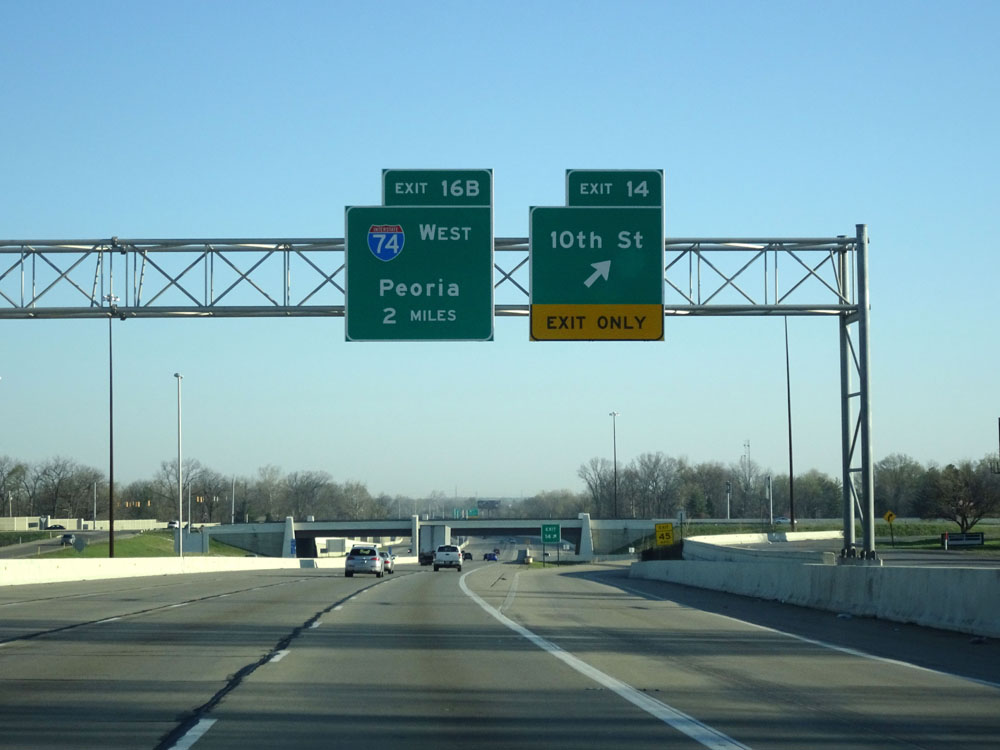 |
Interstate 465 Inner Loop (North) / Interstate 74 West at Exit 14: 10th St (Photo taken 4/17/16). |
 |
Interstate 465 Inner Loop (North) / Interstate 74 West approaching Exit 16B - 1 mile. (Photo taken 4/17/16). |
 |
Interstate 465 Inner Loop (North) / Interstate 74 West at Exit 16A: US 136 West - Crawfordsville Rd (Photo taken 4/17/16). |
 |
Interstate 465 Inner Loop (North) / Interstate 74 West at Exit 16B: Interstate 74 West - Peoria (Photo taken 4/17/16). |
 |
Speed limit assurance sign north of Exit 16B. Again, the speed limit on Interstate 465 remains 55 mph the whole way around. (Photo taken 4/17/16). |
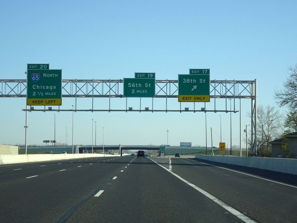 |
Interstate 465 Inner Loop (North) at Exit 17: 38th St (Photo taken 4/17/16). |
 |
Interstate 465 North assurance shield. (Photo taken 4/17/16). |
 |
Interstate 465 Inner Loop (North) approaching Exit 20 - 1 mile on the left. (Photo taken 4/17/16). |
 |
Take Exit 19 to Indiana Farm Bureau Football Center. (Photo taken 4/17/16). |
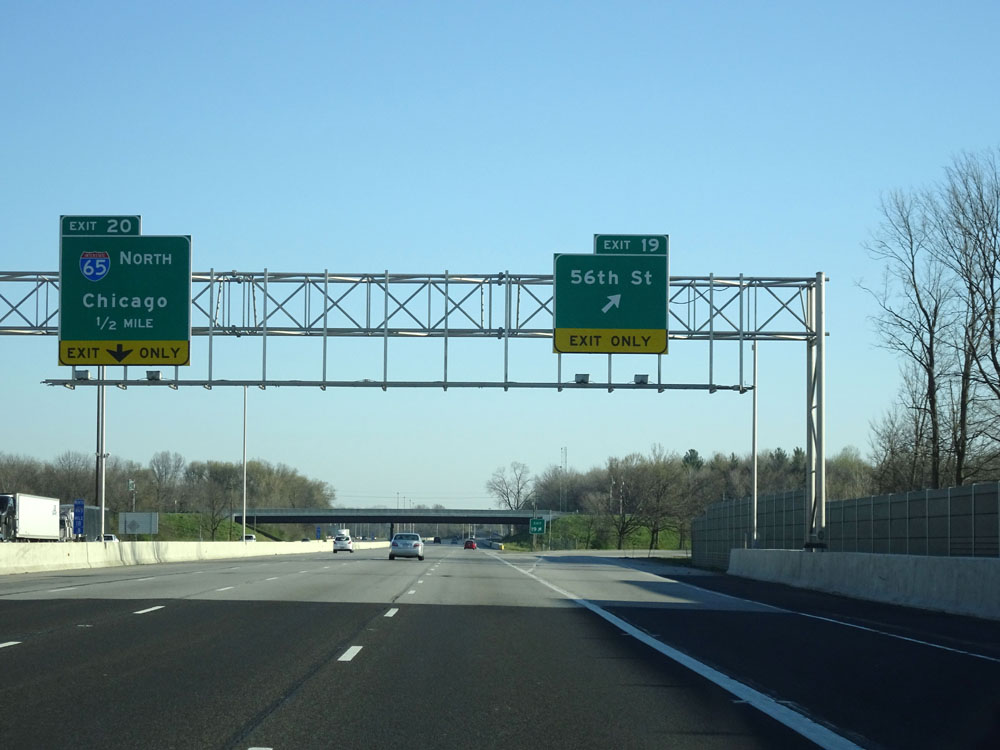 |
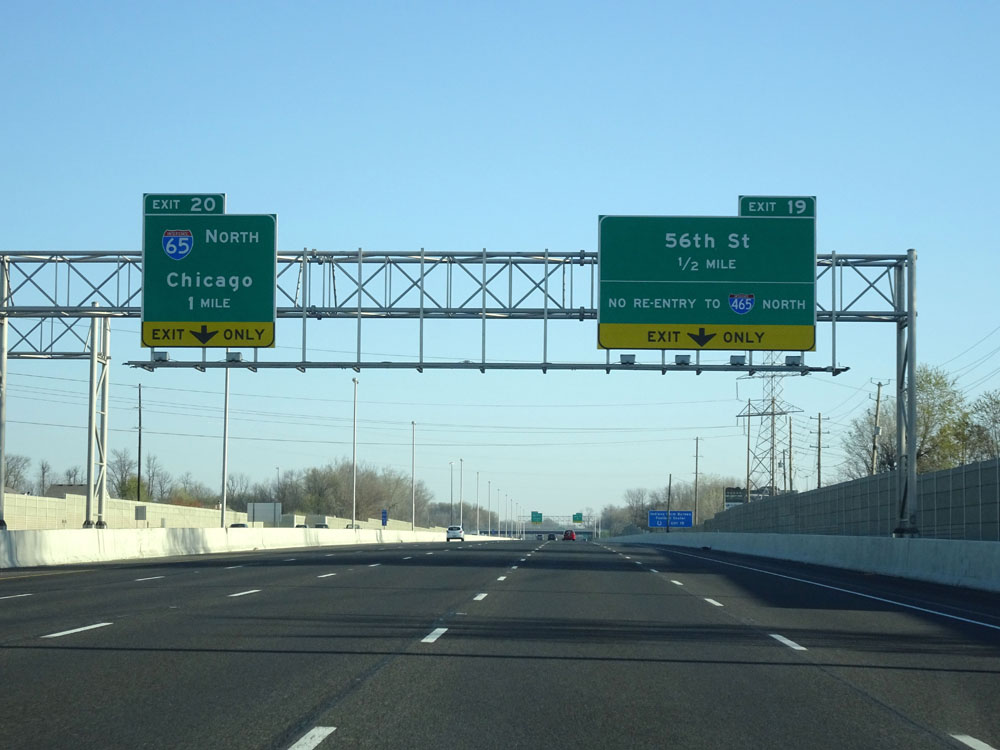
Interstate 465 Inner Loop (North) at Exit 19: 56th St (Photo taken 4/17/16). |
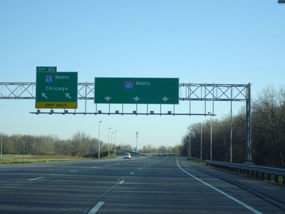 |
Interstate 465 Inner Loop (North) at Exit 20: Interstate 65 North - Chicago (Photo taken 4/17/16). |
 |
Interstate 465 Inner Loop (North) as it begins to curve to the east at the northwestern corner of Indianapolis. (Photo taken 4/17/16). |
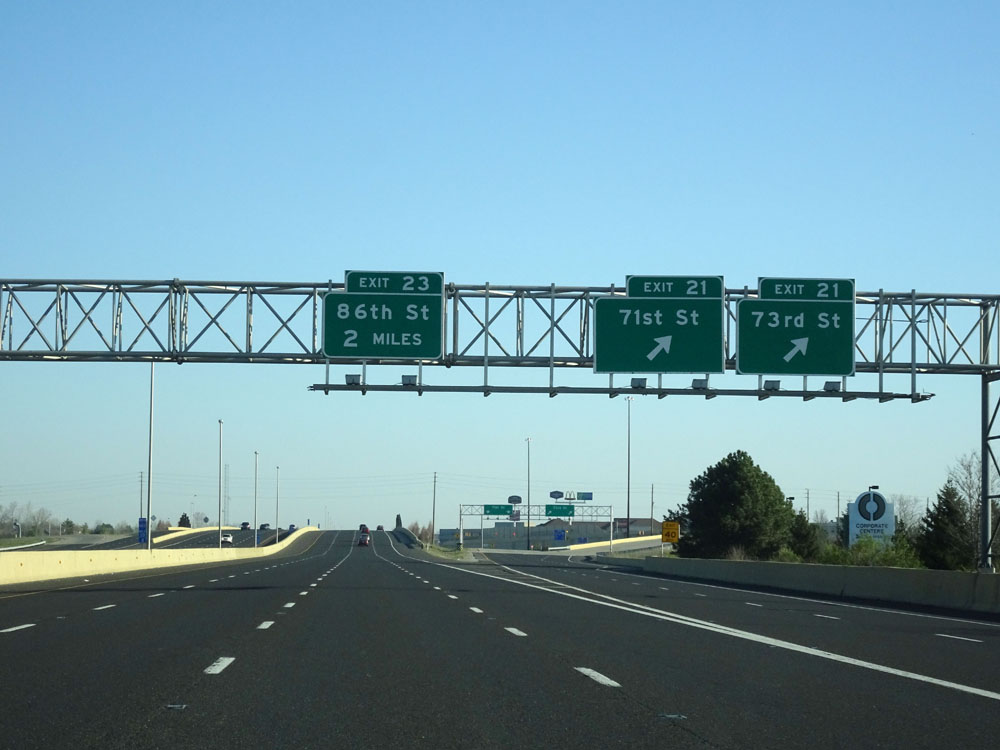 |
Interstate 465 Inner Loop (East) at Exit 21: 71st St / 73rd St (Photo taken 4/17/16). |
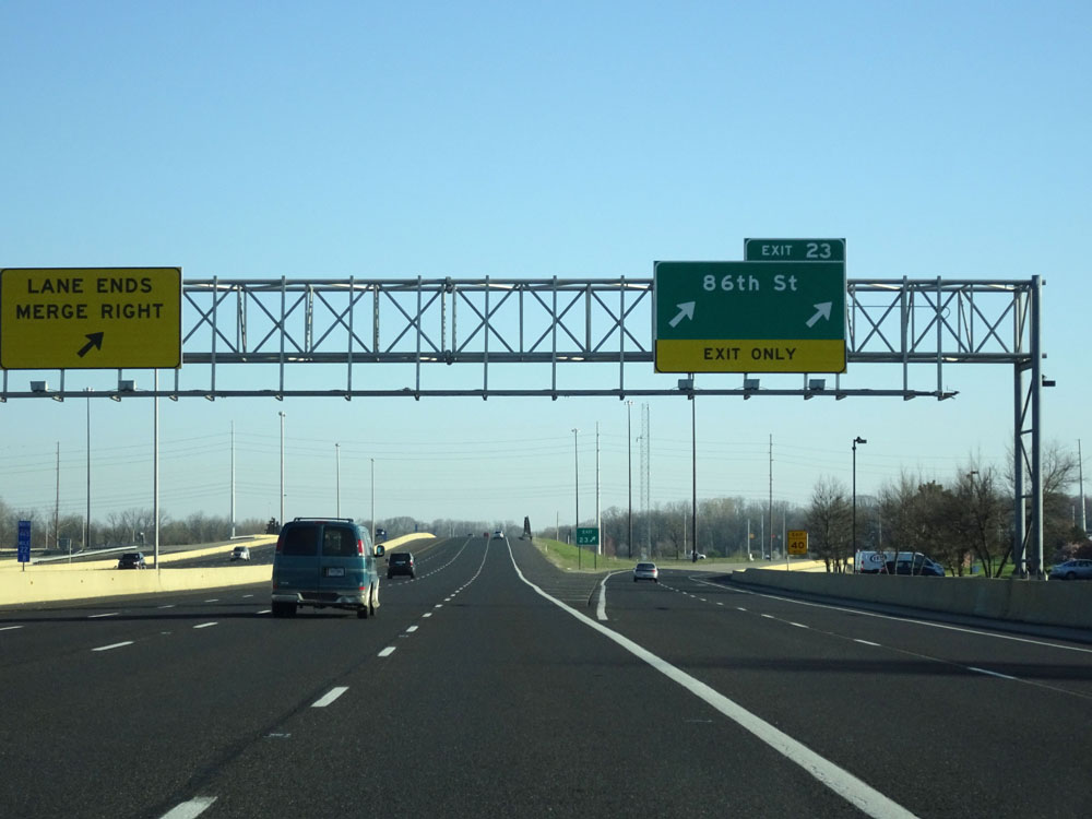 |
Interstate 465 Inner Loop (East) at Exit 23: 86th St (Photo taken 4/17/16). |
 |
Interstate 465 Inner Loop (East) approaching Exit 25 - 1/4 mile on the left. (Photo taken 4/17/16). |
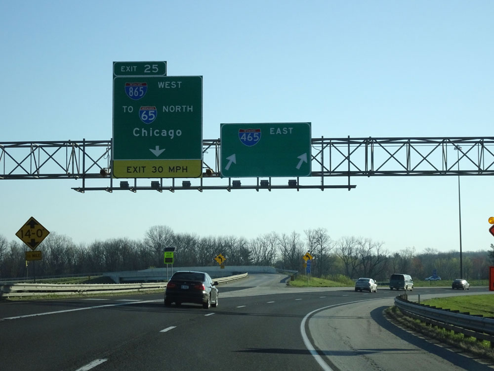 |
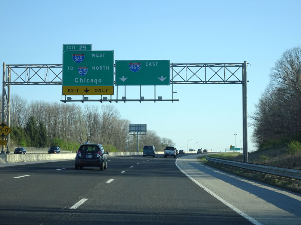
Interstate 465 Inner Loop (East) at Exit 25: Interstate 865 West / To Interstate 65 North - Chicago (Photo taken 4/17/16). |
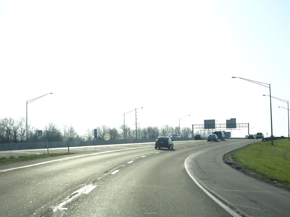 |
Interstate 465 Inner Loop (East) as finishes curving to the east. (Photo taken 4/17/16). |
 |
Interstate 465 Inner Loop (East) approaching Exit 27 - 1 mile. (Photo taken 4/17/16). |
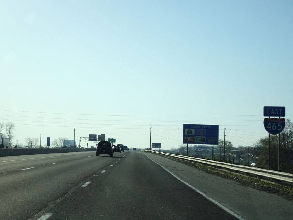 |
Interstate 465 East assurance shield approaching Exit 27. (Photo taken 4/17/16). |
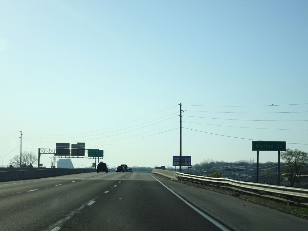 |
Interstate 465 Inner Loop (East) as it re-enters Marion County after a brief jaunt into Boone County. (Photo taken 4/17/16). |
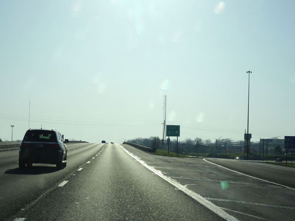 |
Interstate 465 Inner Loop (East) at Exit 27: US 421 North - Michigan Rd (Photo taken 4/17/16). |
Section 2: Exit 27 to Mile Marker 0
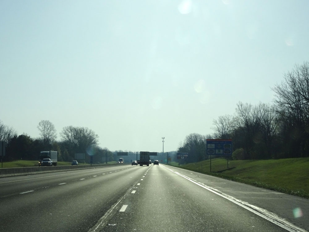 |
Sun-soaked view on Interstate 465 Inner Loop (East) just beyond Exit 27. (Photo taken 4/17/16). |
 |
Interstate 465 Inner Loop (East) as it briefly enters Hamilton County to the north of Indianapolis. (Photo taken 4/17/16). |
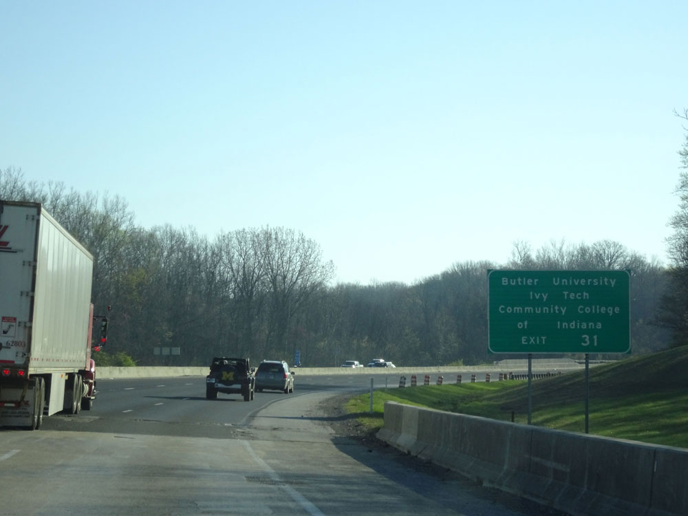 |
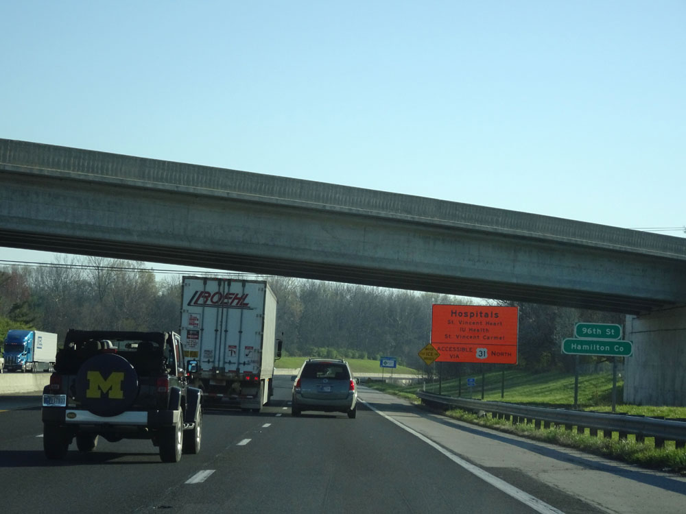
Take Exit 31 to Butler University and Ivy Tech. (Photo taken 4/17/16). |
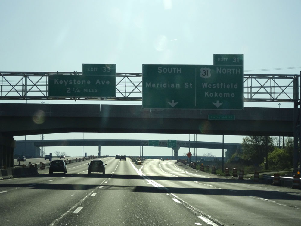 |
Interstate 465 Inner Loop (East) at Exit 31: US 31 North - Meridian St / Westfield / Kokomo (Photo taken 4/17/16). |
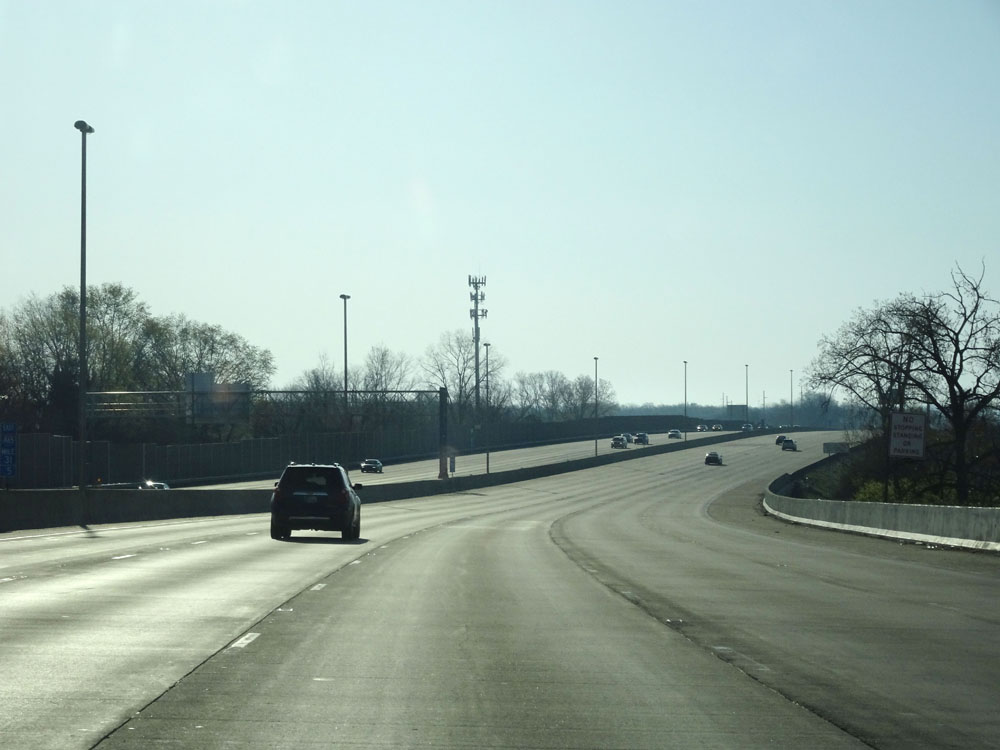 |
View on Interstate 465 Inner Loop (East) just beyond Exit 31. (Photo taken 4/17/16). |
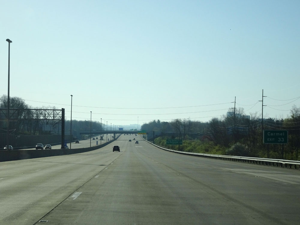 |
Take Exit 33 to Carmel. (Photo taken 4/17/16). |
 |
Also take Exit 33 to The Center For The Performing Arts. (Photo taken 4/17/16). |
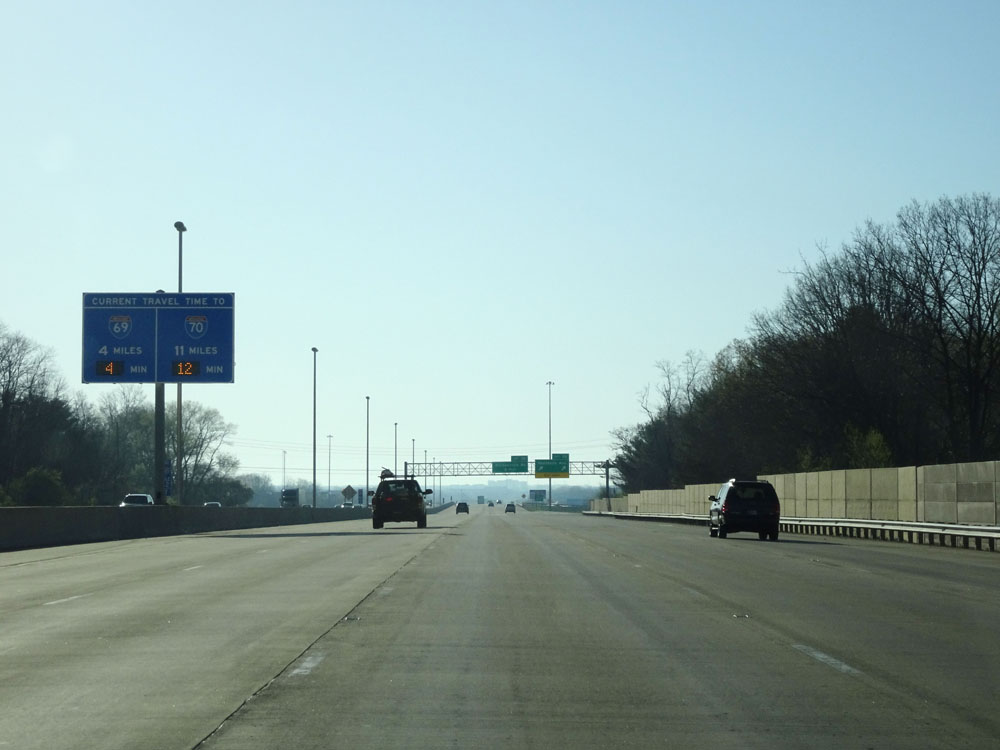 |
Digital travel time sign on the median approaching Exit 33, listing the distances and estimated travel times to the next two major junctions on Interstate 465 Inner Loop - Interstate 69 and Interstate 70. (Photo taken 4/17/16). |
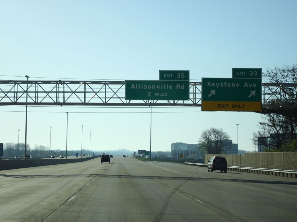 |
Interstate 465 Inner Loop (East) at Exit 33: Keystone Ave (Photo taken 4/17/16). |
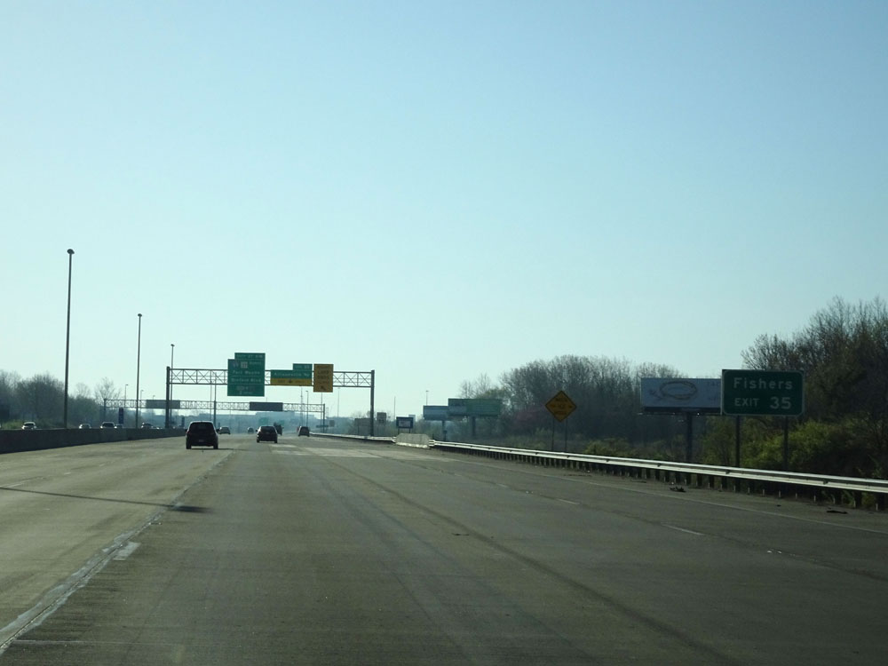 |
Take Exit 35 to Fishers. (Photo taken 4/17/16). |
 |
Interstate 465 Inner Loop (East) at Exit 35: Allisonville Rd (Photo taken 4/17/16). |
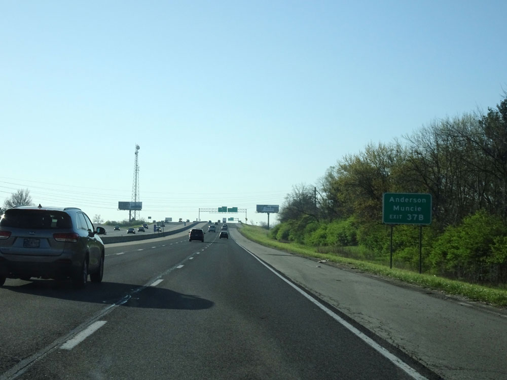 |
Take Exit 37B to Anderson and Muncie. (Photo taken 4/17/16). |
 |
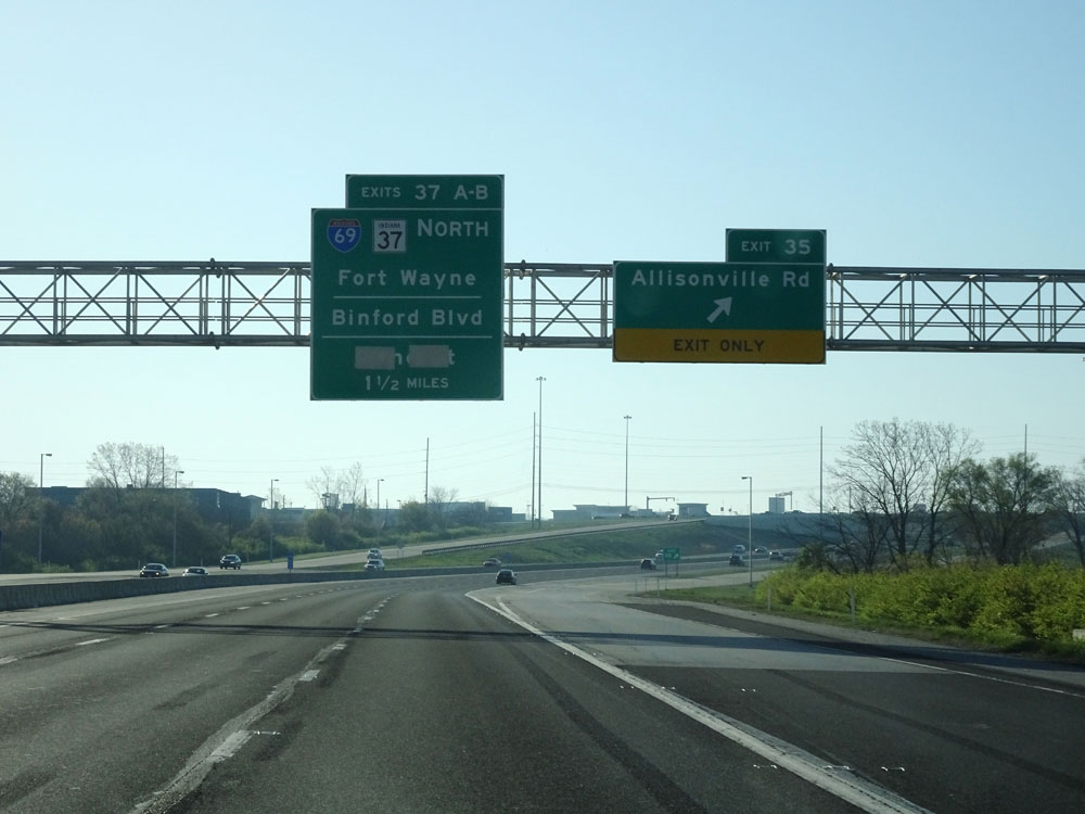
Interstate 465 Inner Loop (East) at Exit 37A: Binford Blvd / Indianapolis (Photo taken 4/17/16). |
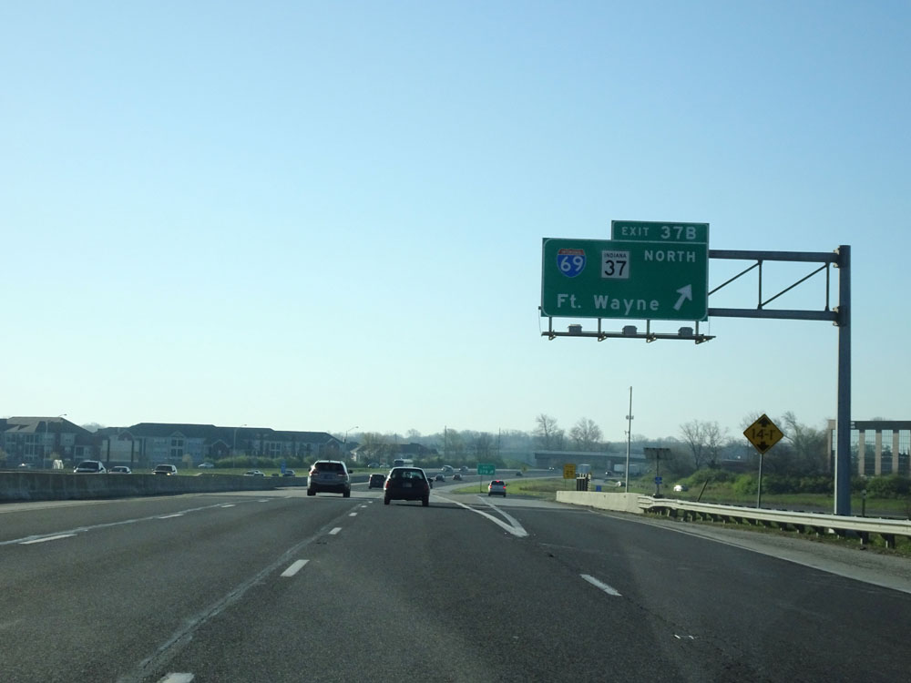 |
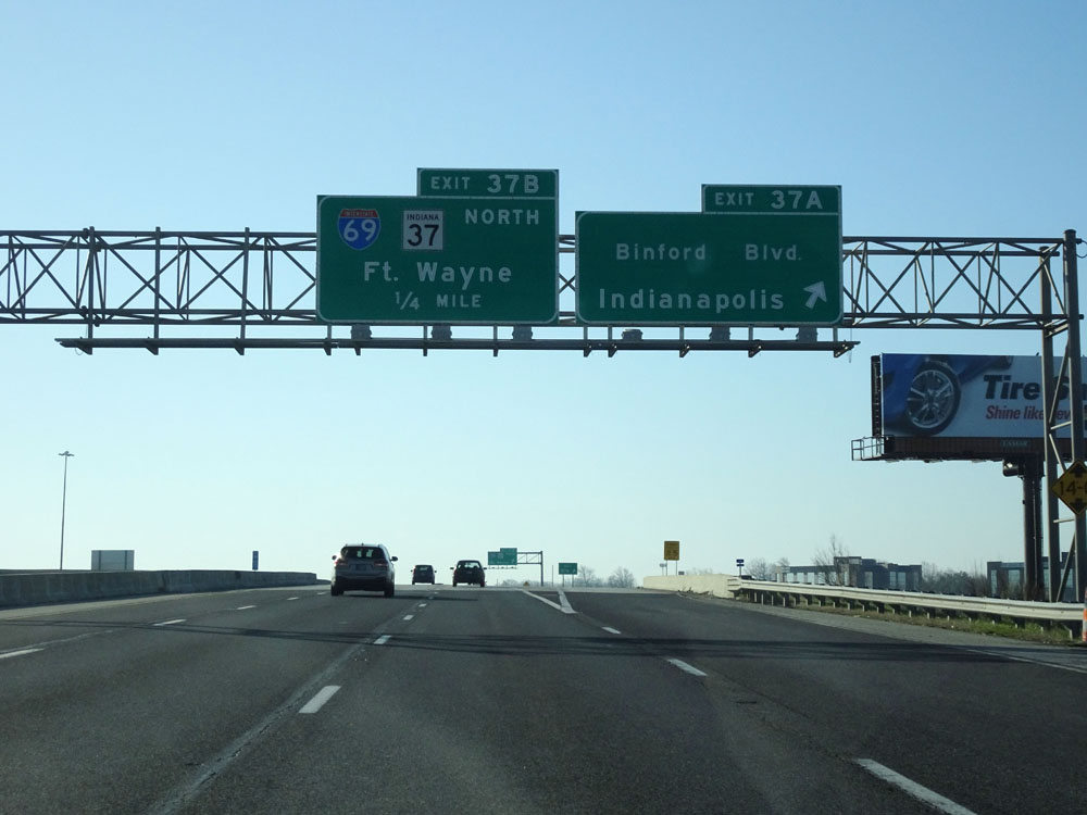
Interstate 465 Inner Loop (East) at Exit 37B: Interstate 69 North / IN 37 North - Fort Wayne (Photo taken 4/17/16). |
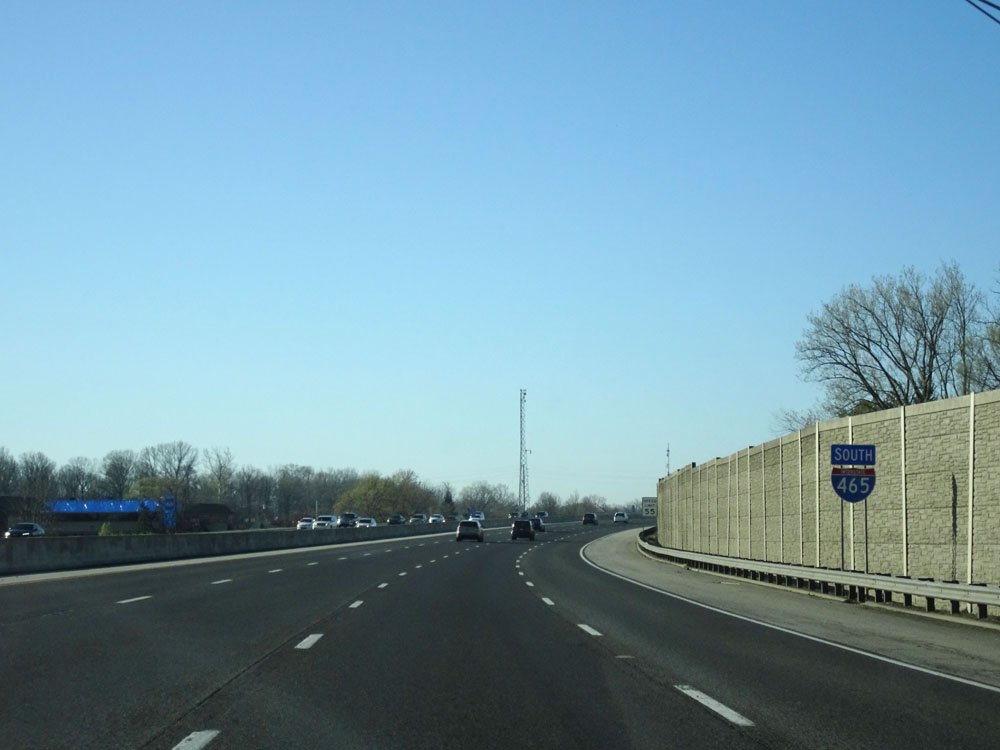 |
Now that Interstate 465 Inner Loop has finished curving to the south on the northeastern side of Indianapolis, we see this Interstate 465 South assurance shield. (Photo taken 4/17/16). |
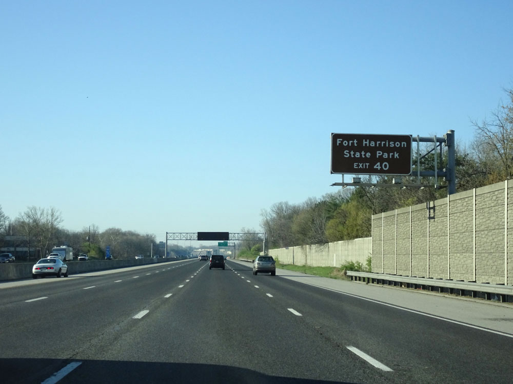 |
Take Exit 40 to Fort Harrison State Park. (Photo taken 4/17/16). |
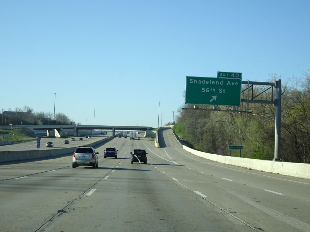 |
Interstate 465 Inner Loop (South) at Exit 40: Shadeland Ave / 56th St (Photo taken 4/17/16). |
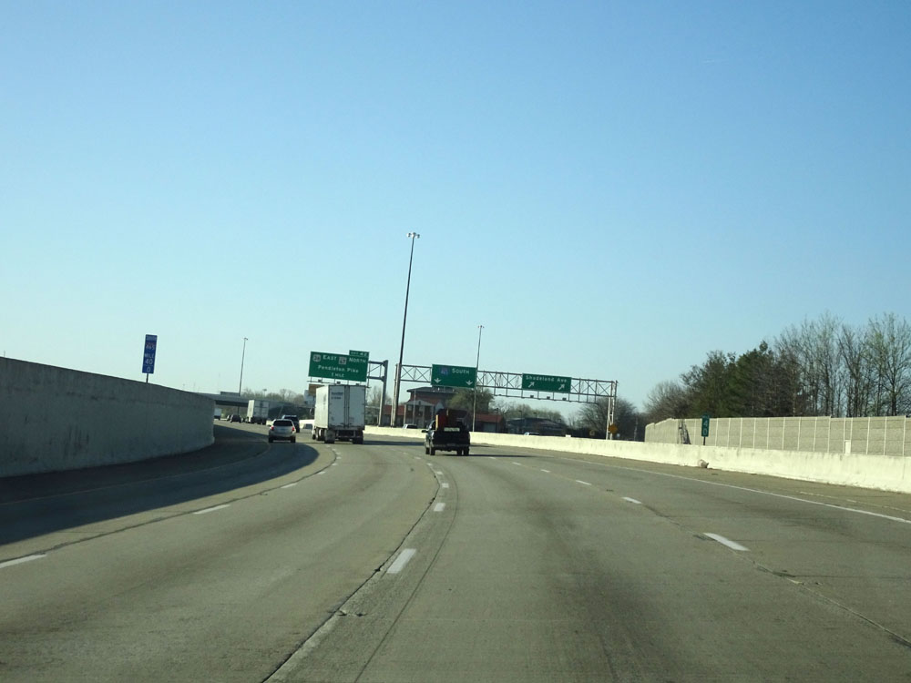 |
Interstate 465 Inner Loop (South) at mile marker 40. (Photo taken 4/17/16). |
 |
Take Exit 42 to Lawrence. (Photo taken 4/17/16). |
 |
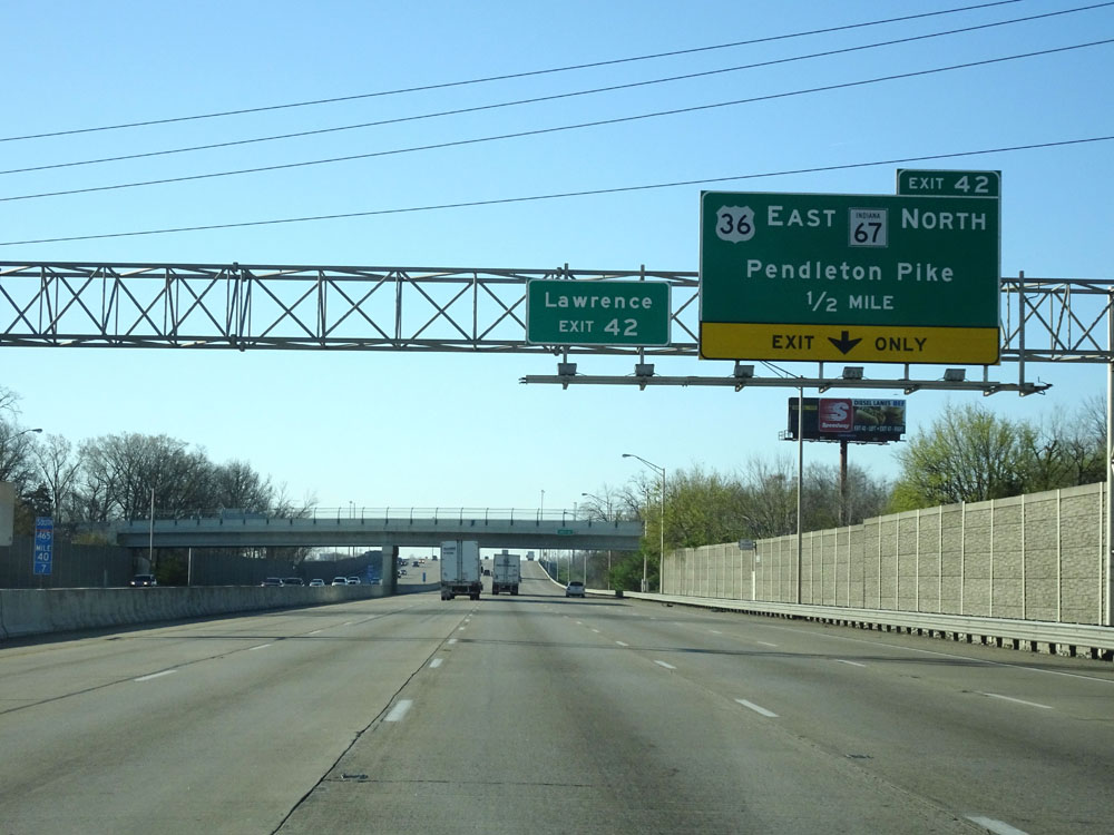
Interstate 465 Inner Loop (South) at Exit 42: US 36 East / IN 67 North - Pendleton Pike (Photo taken 4/17/16). |
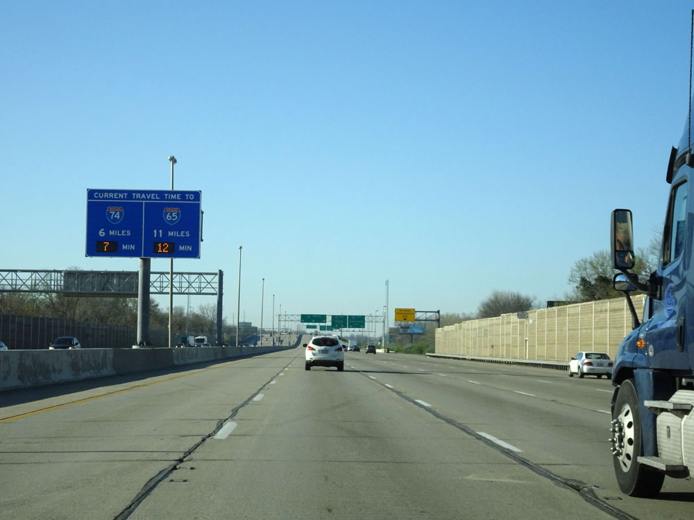 |
Another digital travel time sign on the median, this one listing the distances and estimated travel times to the junctions of Interstate 74 and Interstate 65. (Photo taken 4/17/16). |
 |
Interstate 465 Inner Loop (South) approaching Exit 44 - 1 mile. (Photo taken 4/17/16). |
 |
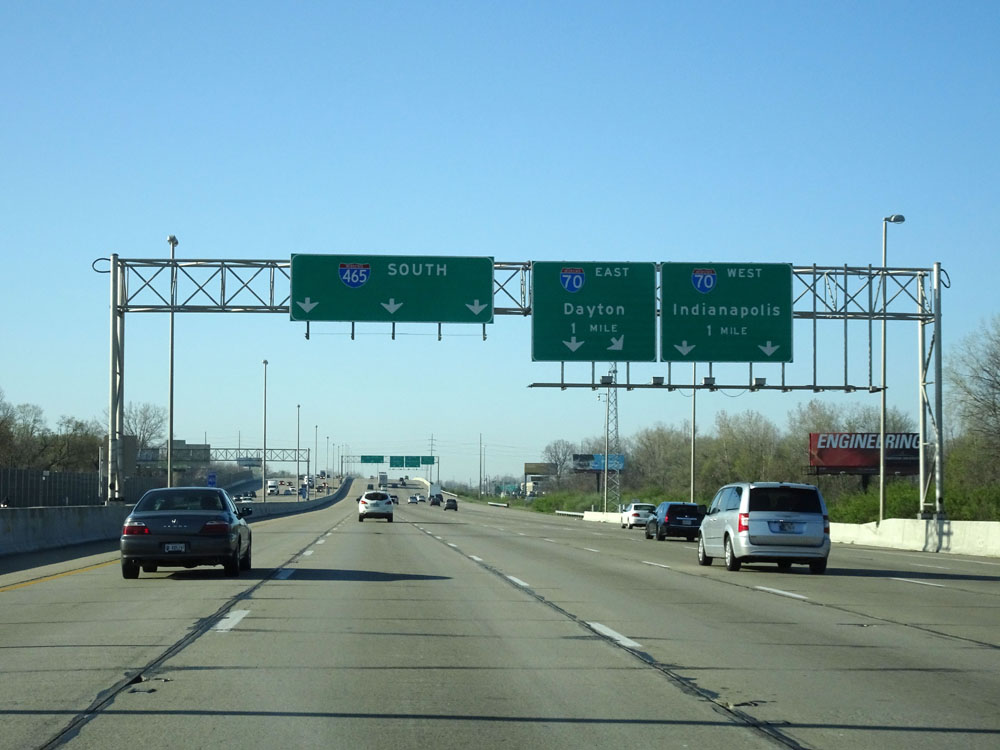
Interstate 465 Inner Loop (South) at Exit 44: Interstate 70 - Dayton / Indianapolis (Photo taken 4/17/16). |
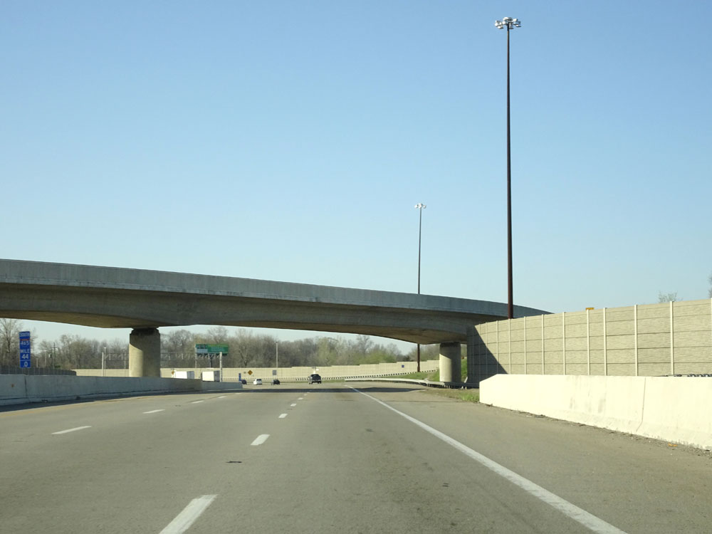 |
Interstate 465 Inner Loop (South) at mile marker 44. (Photo taken 4/17/16). |
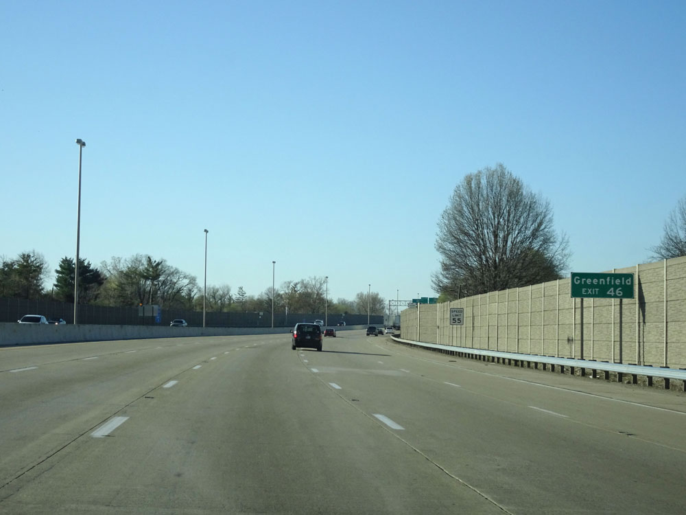 |
Take Exit 46 to Greenfield. (Photo taken 4/17/16). |
 |
Interstate 465 Inner Loop (South) at Exit 46: US 40 East - Washington St (Photo taken 4/17/16). |
 |
Interstate 465 Inner Loop (South) at Exit 47: US 52 East - Brookville Rd (Photo taken 4/17/16). |
 |
Interstate 465 Inner Loop (South) approaching Exit 49 - 1/2 mile. (Photo taken 4/17/16). |
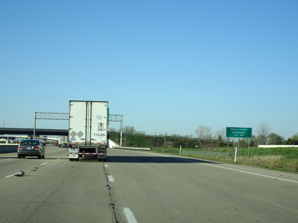 |
Take Exit 49 to the Marion County Fairgrounds. (Photo taken 4/17/16). |
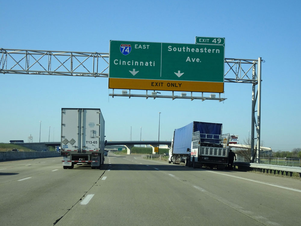 |
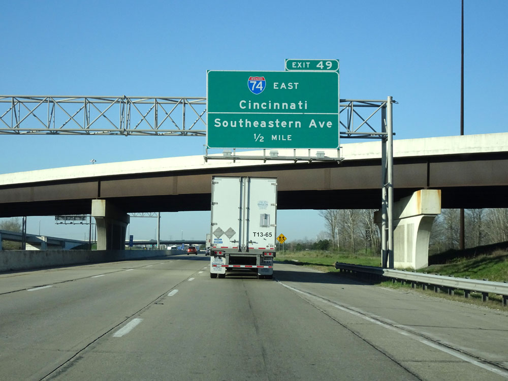
Interstate 465 Inner Loop (South) at Exit 49: Interstate 74 East - Cincinnati / Southeastern Ave (Photo taken 4/17/16). |
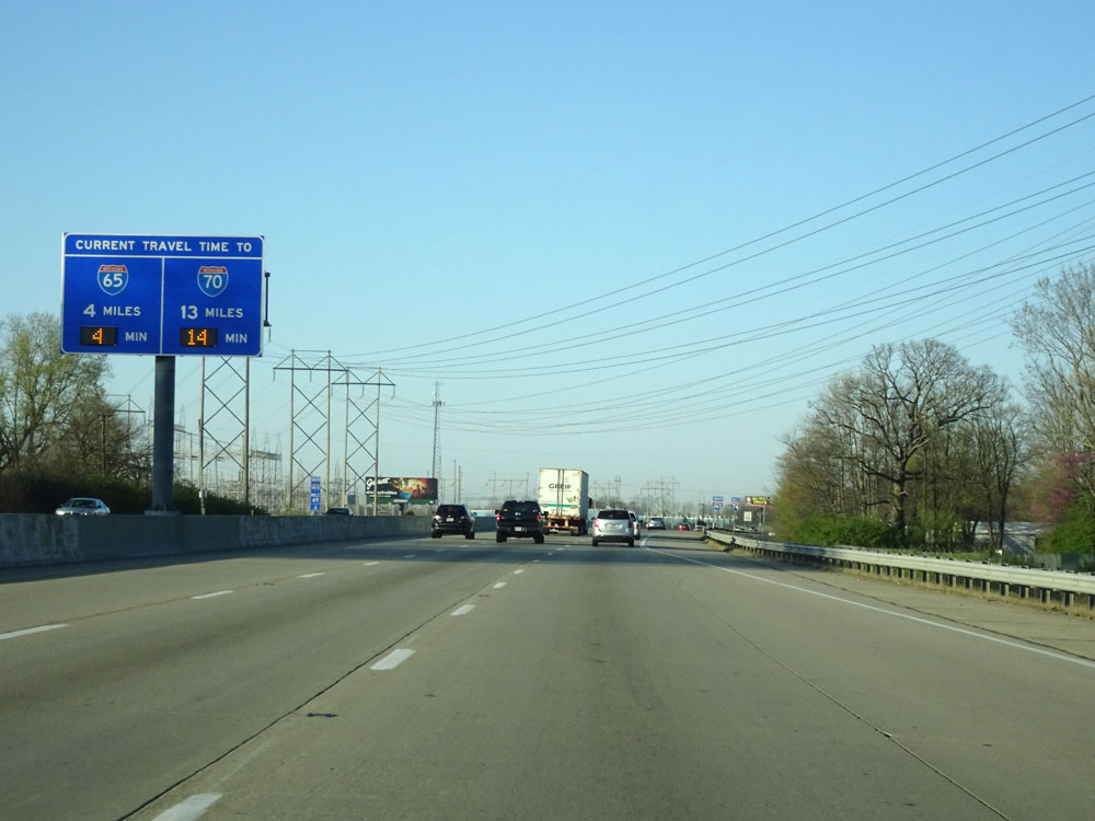 |
Another digital travel time sign on the median at mile marker 49.6. (Photo taken 4/17/16). |
 |
Dual Interstate 465 South / Interstate 74 West assurance shields. (Photo taken 4/17/16). |
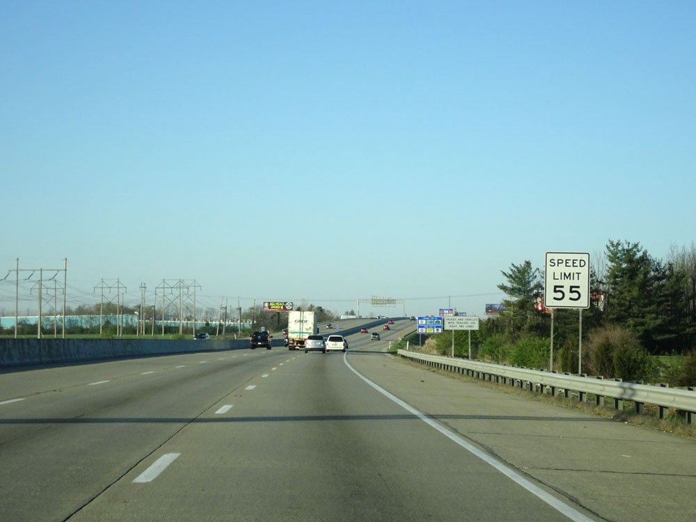 |
Speed limit sign near mile marker 50. Speed Limit - 55 mph. (Photo taken 4/17/16). |
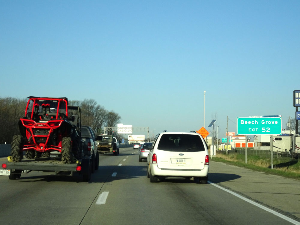 |
Take Exit 52 to Beech Grove. (Photo taken 4/17/16). |
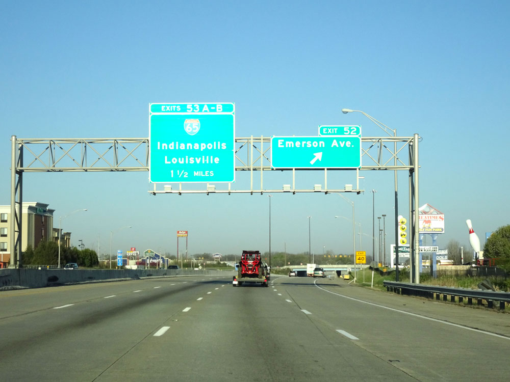 |
Interstate 465 Inner Loop (West) / Interstate 74 West at Exit 52: Emerson Ave (Photo taken 4/17/16). |
 |
Interstate 465 Inner Loop (West) / Interstate 74 West approaching Exits 53B-A - 1/4 mile and 1/2 mile respectively. (Photo taken 4/17/16). |
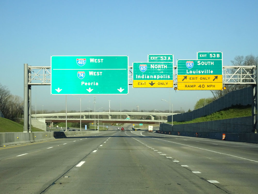 |
Interstate 465 Inner Loop (West) / Interstate 74 West at Exit 53B: Interstate 65 South - Louisville (Photo taken 4/17/16). |
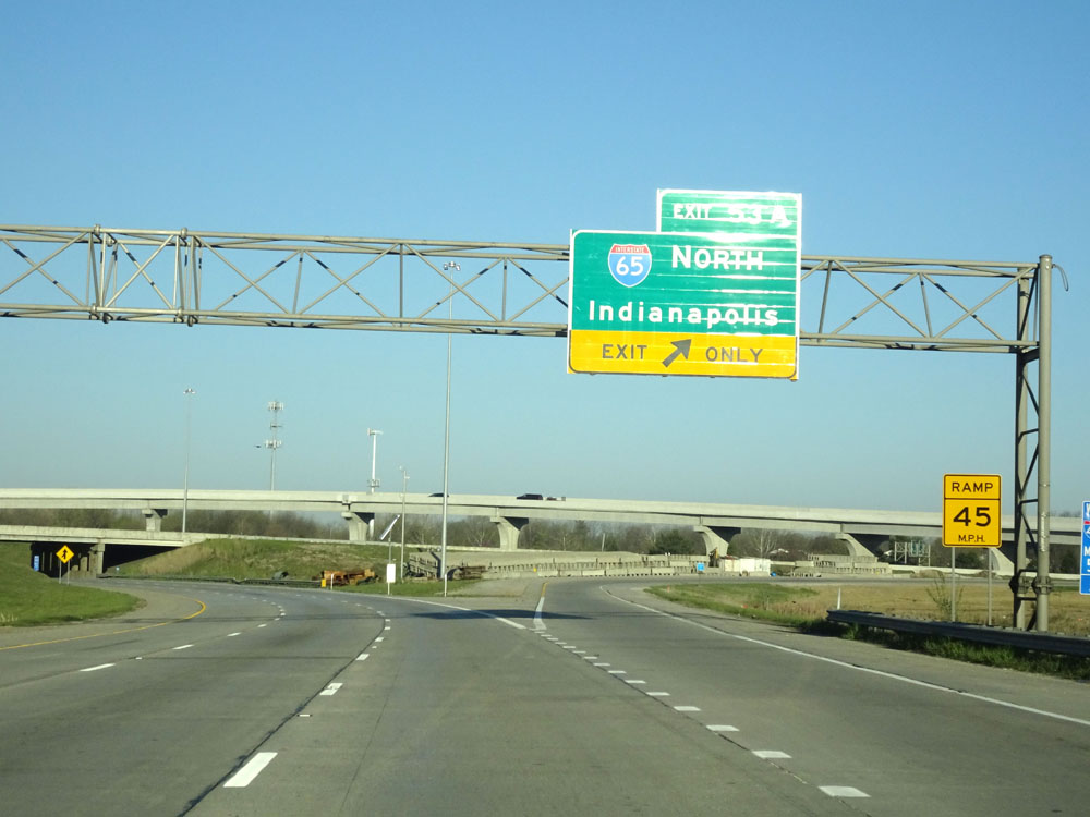 |
Interstate 465 Inner Loop (West) / Interstate 74 West at Exit 53A: Interstate 65 North - Indianapolis. Just beyond this interchange, I-465's mileage resets to 0. That marks the beginning/end of this beltway around the Indianapolis metro area. (Photo taken 4/17/16). |