| |
|
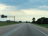 |
View on Interstate 80 West at mile marker 60. (Photo taken 8/19/22). |
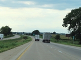 |
Mile marker 58 on Interstate 80 West in Bureau County. (Photo taken 8/19/22). |
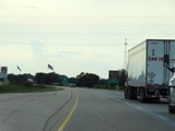 |
Take Exit 56 to Soldiers and Sailors Park, the Flags of Freedom Memorial, and the Amtrak station. (Photo taken 8/19/22). |
 |
Also take Exit 56 to the Hometown of Ronald Reagan. (Photo taken 8/19/22). |
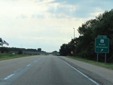 |
Interstate 80 West at Exit 56: IL 26 - Dixon / Princeton (Photo taken 8/19/22). |
 |
Mile marker 54 on Interstate 80 West in Bureau County. (Photo taken 8/19/22). |
 |
View on Interstate 80 West at mile marker 53. (Photo taken 8/19/22). |
 |
Rest Area on Interstate 80 West in Bureau County. (Photo taken 8/19/22). |
 |
Interstate 80 West at mile marker 51. (Photo taken 8/19/22). |
 |
View on Interstate 80 West at mile marker 49. (Photo taken 8/19/22). |
 |
Interstate 80 West at mile marker 48. (Photo taken 8/19/22). |
 |
Mile marker 46 on Interstate 80 West in Bureau County. (Photo taken 8/19/22). |
 |
Interstate 80 West approaching Exit 45 - 1/2 mile. (Photo taken 8/19/22). |
 |
Take Exit 45 to Hennepin Canal Parkway and its Visitor Center. (Photo taken 8/19/22). |
 |
Interstate 80 West at Exit 45: IL 40 - Peoria / Sterling (Photo taken 8/19/22). |
 |
View on Interstate 80 West at mile marker 43. (Photo taken 8/19/22). |
 |
Mile marker 41 on Interstate 80 West in Bureau County. (Photo taken 8/19/22). |
 |
Interstate 80 West at mile marker 40. (Photo taken 8/19/22). |
 |
View on Interstate 80 West at mile marker 38. (Photo taken 8/19/22). |
 |
Interstate 80 West at mile marker 37. (Photo taken 8/19/22). |
 |
Interstate 80 West as it enters Henry County. (Photo taken 8/19/22). |
 |
View on Interstate 80 West at mile marker 35. (Photo taken 8/19/22). |
 |
Take Exit 33 to Annawan. (Photo taken 8/19/22). |
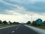 |
Interstate 80 West at Exit 33: IL 78 - Kewanee / Prophetstown (Photo taken 8/19/22). |
 |
Interstate 80 West reassurance shield. (Photo taken 8/19/22). |
 |
The speed limits remain 70 mph maximum and 45 mph minimum on Interstate 80 West. (Photo taken 8/19/22). |
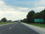 |
Mileage sign on Interstate 80 West. It's 5 miles to the Atkinson Exit, 33 miles to Moline-Rock Island, and 207 miles to Des Moines. (Photo taken 8/19/22). |
 |
Interstate 80 West at mile marker 31. (Photo taken 8/19/22). |
 |
Mile marker 30 on Interstate 80 West in Henry County. (Photo taken 8/19/22). |
 |
Interstate 80 West at Exit 27: Galva / Atkinson (Photo taken 8/19/22). |
 |
View on Interstate 80 West at mile marker 26. (Photo taken 8/19/22). |
 |
Mile marker 24 on Interstate 80 West in Henry County. (Photo taken 8/19/22). |
 |
Interstate 80 West at mile marker 22. (Photo taken 8/19/22). |
 |
View on Interstate 80 West at mile marker 21. (Photo taken 8/19/22). |
 |
Take Exit 19 to Bishop Hill. (Photo taken 8/19/22). |
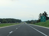 |
Interstate 80 West at Exit 19: IL 82 - Geneseo / Cambridge (Photo taken 8/19/22). |
 |
Another mileage sign on Interstate 80 West. It's 8 miles to the junction of Interstate 74, 20 miles to Moline-Rock Island, and 194 miles to Des Moines. (Photo taken 8/19/22). |
 |
Mile marker 18 on Interstate 80 West in Henry County. (Photo taken 8/19/22). |
 |
View on Interstate 80 West at mile marker 16. (Photo taken 8/19/22). |
 |
Interstate 80 West at mile marker 15. (Photo taken 8/19/22). |
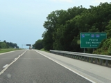 |
The junction of Interstate 74 / Interstate 280 lies 2 miles ahead on Interstate 80 West. (Photo taken 8/19/22). |
 |
View on Interstate 80 West at mile marker 12. (Photo taken 8/19/22). |
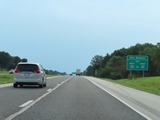 |
Traffic to Des Moines can use either Interstate 80 West or Interstate 280 West. (Photo taken 8/19/22). |
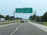 |
Interstate 80 West approaching the junction of Interstate 74 / Interstate 280 - 1 mile. (Photo taken 8/19/22). |
 |
Traffic to Quad City Airport should follow Interstate 74 West / Interstate 280 West by staying straight ahead at the interchange ahead. (Photo taken 8/19/22). |
 |
As this sign implies, Interstate 80 West thru traffic will have to keep right and exit off to the right ahead. (Photo taken 8/19/22). |
 |
View on Interstate 80 West at mile marker 11, approaching the junction of Interstate 74 / Interstate 280. (Photo taken 8/19/22). |
 |
As this sign shows, Interstate 80 West thru traffic will have to keep right and exit off to the right ahead. (Photo taken 8/19/22). |
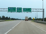 |
Interstate 80 West at its junction with Interstate 74 / Interstate 280 West, at mile marker 10.6. I-74 and I-280 West traffic should remain straight ahead, while I-80 West traffic must exit to the right here at mile marker 10.6. (Photo taken 8/19/22). |
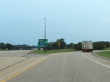 |
A closer view of the split, as Interstate 80 West thru traffic must exit off to the right here at the junction of Interstate 74 / Interstate 280 West. (Photo taken 8/19/22). |
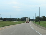 |
View on Interstate 80 West, as its mainline is reduced to a single lane as a ramp to itself in Colona. (Photo taken 8/19/22). |
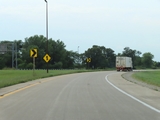 |
Another look at the ramp which makes up the mainline continuation of Interstate 80 West in Colona, as it curves to the north. I-80 West will travel in a northerly direction from here to the Iowa border to cross the Mississippi River. (Photo taken 8/19/22). |
 |
Interstate 80 West at mile marker 9.2, as it joins together with traffic from Interstate 74 / Interstate 280 on the left. (Photo taken 8/19/22). |
 |
Interstate 80 West reassurance shield, as it now heads north toward the Mississippi River in the Quad Cities area. (Photo taken 8/19/22). |
 |
The speed limits on Interstate 80 West at this point remain 70 mph maximum and 45 mph minimum. (Photo taken 8/19/22). |
 |
Take Exit 9 to Niabi Zoo. (Photo taken 8/19/22). |
 |
Interstate 80 West at Exit 9: US 6 (Photo taken 8/19/22). |
 |
Mile marker 8 on Interstate 80 West in Henry County. (Photo taken 8/19/22). |
 |
Interstate 80 West at Exit 7: Colona (Photo taken 8/19/22). |
 |
View on Interstate 80 West at mile marker 6. (Photo taken 8/19/22). |
 |
Interstate 80 West at mile marker 5.2, as it crosses the Rock River. (Photo taken 8/19/22). |
 |
Upon crossing the Rock River, Interstate 80 West enters Rock Island County at mile marker 5. (Photo taken 8/19/22). |
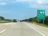 |
Interstate 80 West approaching Exits 4B-A - 1 mile. (Photo taken 8/19/22). |
 |
Take Exit 4A to Silvis. (Photo taken 8/19/22). |
 |
Interstate 80 West at Exit 4B: Interstate 88 East / IL 92 East - Sterling / Rock Falls (Photo taken 8/19/22). |
 |
Interstate 80 West at Exit 4A: IL 5 West / IL 92 West - East Moline (Photo taken 8/19/22). |
 |
View on Interstate 80 West at mile marker 2.8. (Photo taken 8/19/22). |
 |
All trucks over 8 tons GVWR / GCWR must enter the Weigh Station ahead when its open or when directed to. (Photo taken 8/19/22). |
 |
Weigh Station on Interstate 80 West at mile marker 2 in Rock Island County. (Photo taken 8/19/22). |
 |
View on Interstate 80 West at mile marker 1.6. (Photo taken 8/19/22). |
 |
Take Exit 1 to Great River Road National Route. (Photo taken 8/19/22). |
 |
Also take Exit 1 to Port Byron. (Photo taken 8/19/22). |
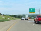 |
Interstate 80 West at Exit 1: IL 84 - East Moline / Savanna (Photo taken 8/19/22). |
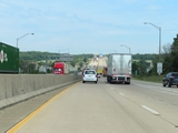 |
At mile marker 0.4, the maximum speed limit on Interstate 80 West decreases to 65 mph. The minimum speed limit remains 45 mph. (Photo taken 8/19/22). |
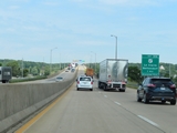 |
Advance signage for Exit 306, which is the first exit on Interstate 80 West in Iowa after it crosses the Mississippi River ahead. (Photo taken 8/19/22). |
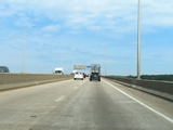 |
View on Interstate 80 West as it starts across the Fred Schwengel Memorial Bridge over the Mississippi River, which will carry I-80 West traffic from Illinois into Iowa. (Photo taken 8/19/22). |
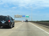 |
As Interstate 80 West reaches the peak of the Fred Schwengel Memorial Bridge over the Mississippi River, it crosses the state line into Iowa. (Photo taken 8/19/22). |
