Road Information |
||
 |
||
| Total Mileage in State: | 42 miles | |
| Eastern End: | At I-80 (Ohio Turnpike), in Streetsboro | |
| Western End: | At I-80 (Ohio Turnpike), in North Ridgeville | |
| Mileage covered in Photos: | 42 miles | |
| Counties covered in Photos: | Portage, Summit, Cuyahoga, Lorain | |
| Major Junctions in Photos: | I-271, in Bedford Heights I-77, in Independence I-71, in Brook Park I-80, in North Ridgeville |
|
| Control Cities in Photos: | Streetsboro, Twinsburg, Bedford Heights, Cleveland, Independence, Brooklyn, North Ridgeville | |
Westbound
- Section 1: Interstate 80 (Ohio Turnpike) to Brooklyn Heights (Exits 17A-B)
- Section 2: Brooklyn Heights (Exits 17A-B) to Interstate 80 (Ohio Turnpike)
Section 1: Interstate 80 (Ohio Turnpike) to Brooklyn Heights (Exits 17A-B)
 |
Merging onto Interstate 480 West from Interstate 80 (Ohio Turnpike), you're greeted with this Interstate 480 West assurance shield. (Photo taken 9/6/15). |
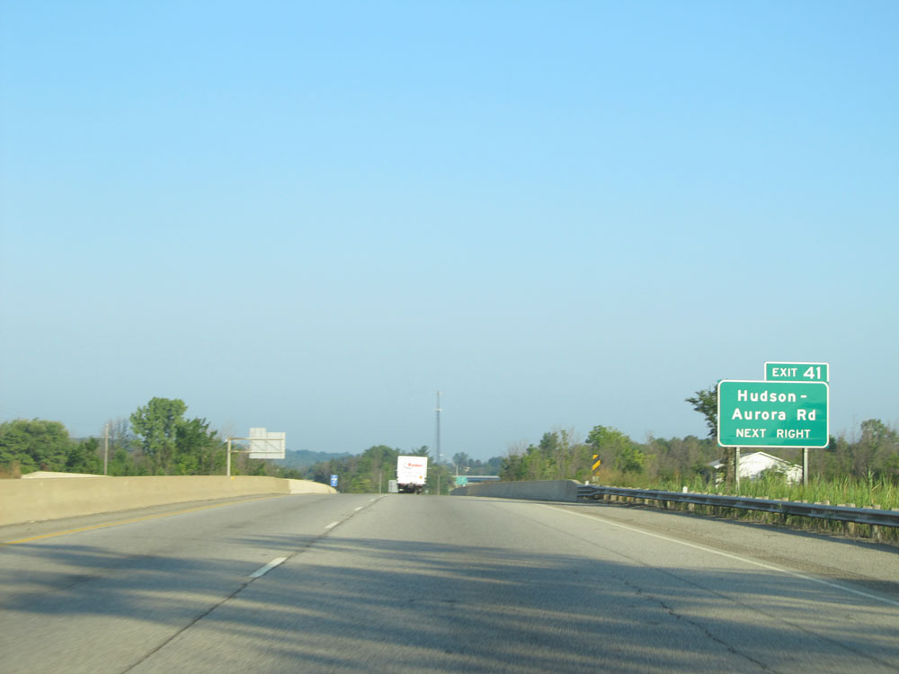 |
Take Exit 41 to Hudson-Aurora Rd. (Photo taken 9/6/15). |
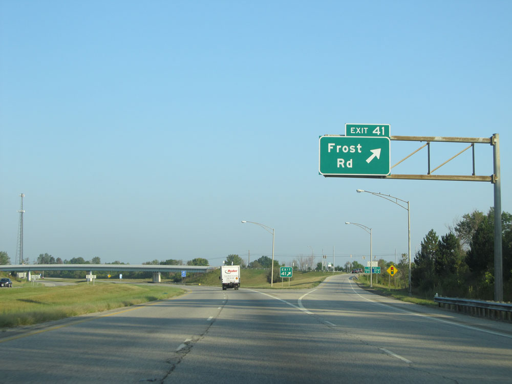 |
Interstate 480 West at Exit 41: Frost Rd (Photo taken 9/6/15). |
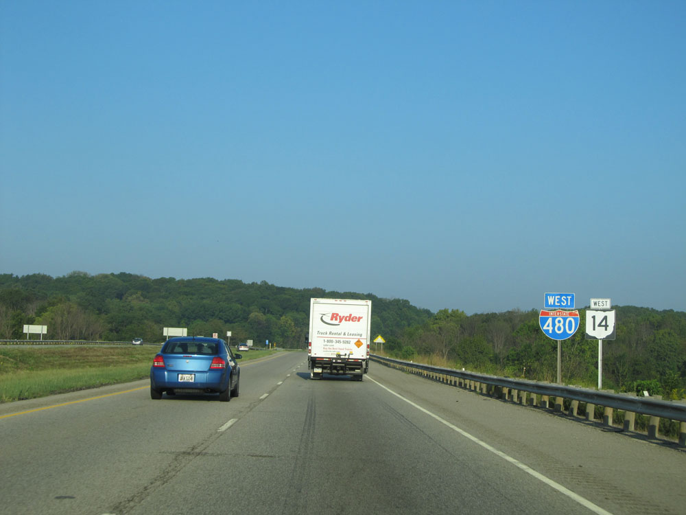 |
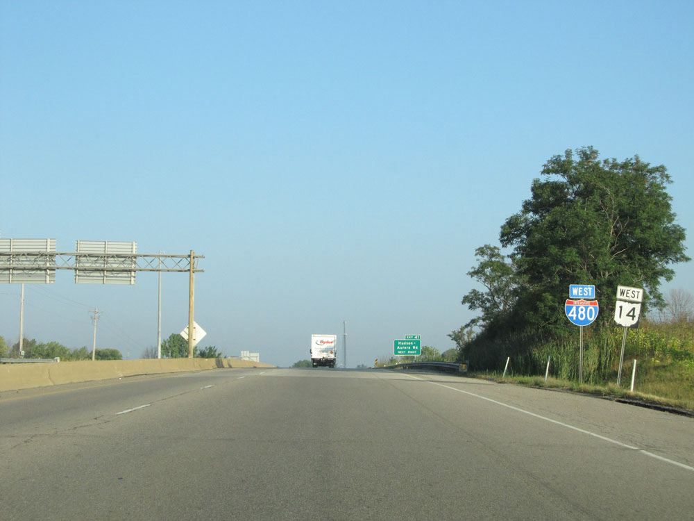
Interstate 480 West / OH 14 West assurance shields just west of Exit 41. (Photo taken 9/6/15). |
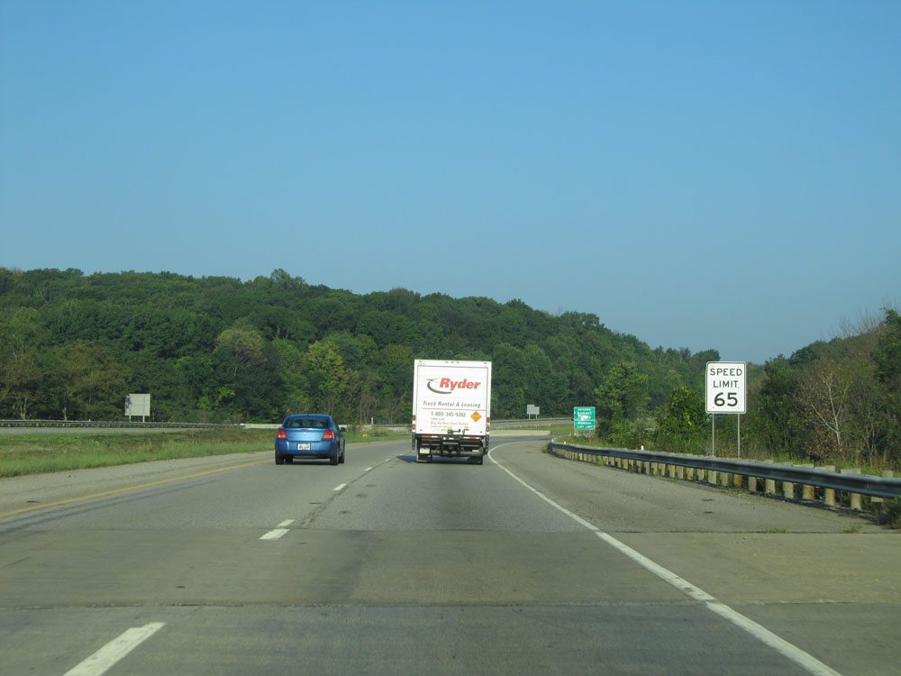 |
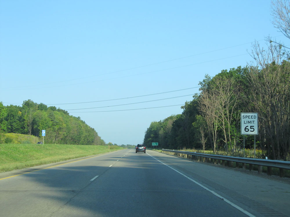
Speed limit sign on Interstate 480 West. The speed limit starts out at 65 mph. (Photo taken 9/6/15). |
 |
Interstate 480 West entering Summit County and the Hudson corporation limits. (Photo taken 9/6/15). |
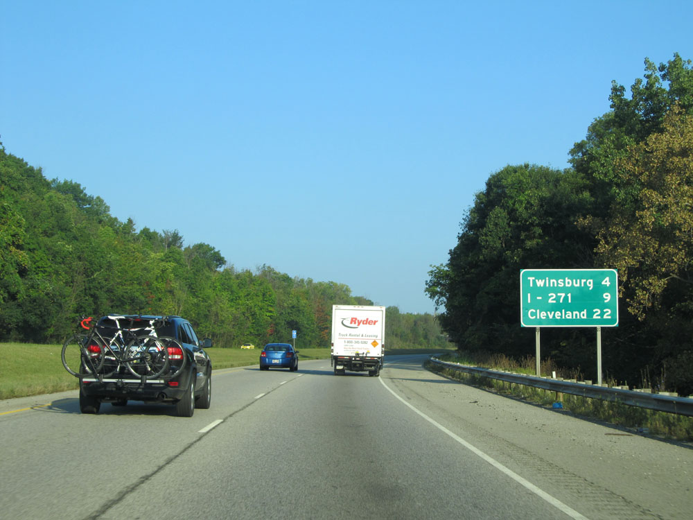 |
Mileage sign on Interstate 480 West. It's 4 miles to Twinsburg, 9 miles to the junction of Interstate 271, and 22 miles to Cleveland. (Photo taken 9/6/15). |
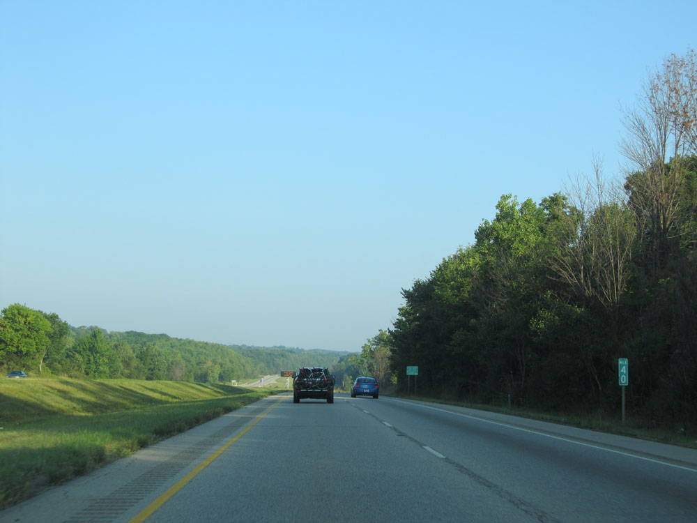 |
Interstate 480 West at mile marker 40. (Photo taken 9/6/15). |
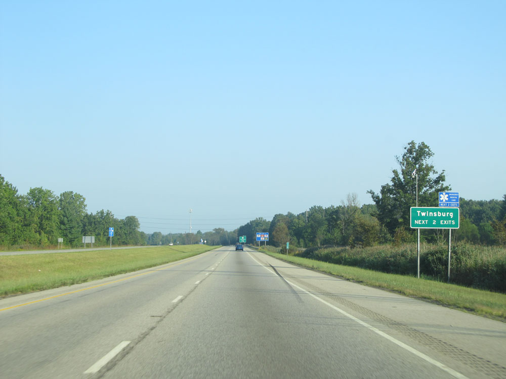 |
Take either of the next 2 exits to Twinsburg. (Photo taken 9/6/15). |
 |
Interstate 480 West at Exit 37: OH 91 - Twinsburg / Solon (Photo taken 9/6/15). |
 |
Interstate 480 West at Exit 36: OH 82 - Macedonia / Twinsburg (Photo taken 9/6/15). |
 |
Speed limit assurance sign west of Exit 36. Speed Limit - 65 mph. (Photo taken 9/6/15). |
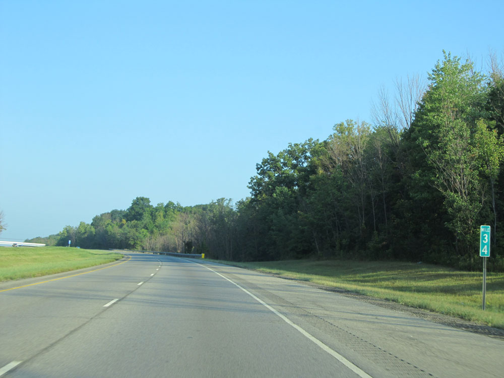 |
Interstate 480 West: Road view from mile marker 34. (Photo taken 9/6/15). |
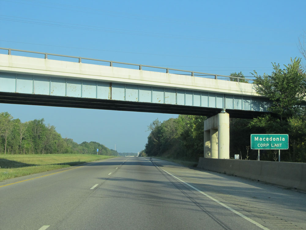 |
Interstate 480 West entering the Macedonia corporate limit. (Photo taken 9/6/15). |
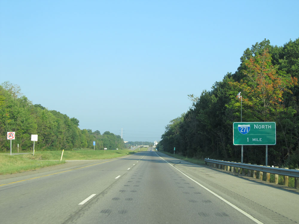 |
Interstate 480 West approaching the junction of Interstate 271 North - 1 mile. I-480 West and I-271 North will run concurrently for about 4 miles ahead. (Photo taken 9/6/15). |
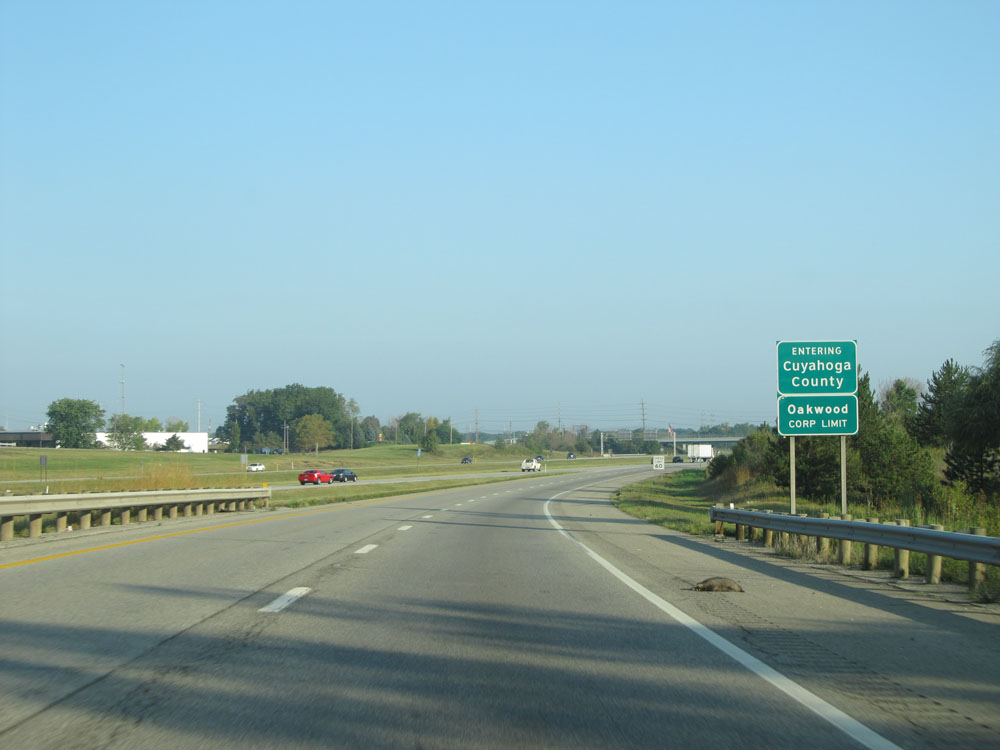 |
Interstate 480 West as it enters Cuyahoga County and the Oakwood corporate limit. Just ahead we see I-480 West merge into I-271 North. (Photo taken 9/6/15). |
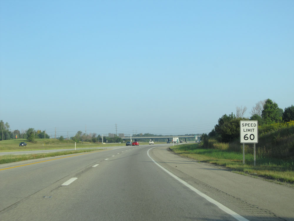 |
Now that we've entered Cuyahoga County, the speed limit decreases to 60 mph. (Photo taken 9/6/15). |
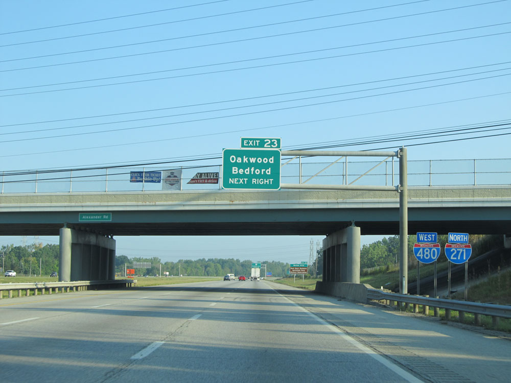 |
Interstate 480 West / Interstate 271 North dual assurance shields as their concurrency begins. Also, take Exit 23 to Oakwood and Bedford. (Photo taken 9/6/15). |
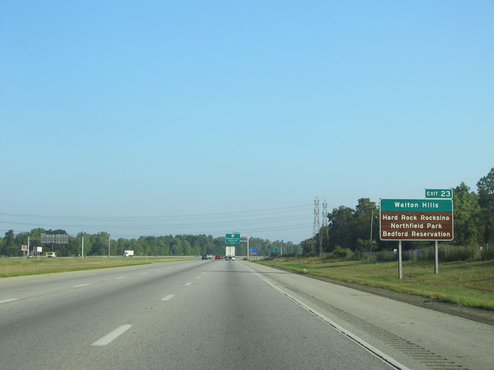 |
Also take Exit 23 to Walton Hills, Hard Rock Rocksino, Northfield Park, and Bedford Reservation. (Photo taken 9/6/15). |
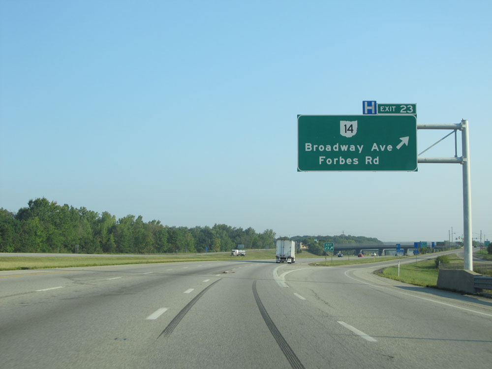 |
Interstate 480 West / Interstate 271 North at Exit 23: OH 14 - Broadway Ave / Forbes Rd (Photo taken 9/6/15). |
 |
Interstate 480 West / Interstate 271 North approaching Exits 26A-B - 1 mile. We also enter the Bedford Heights corporate limit here. (Photo taken 9/6/15). |
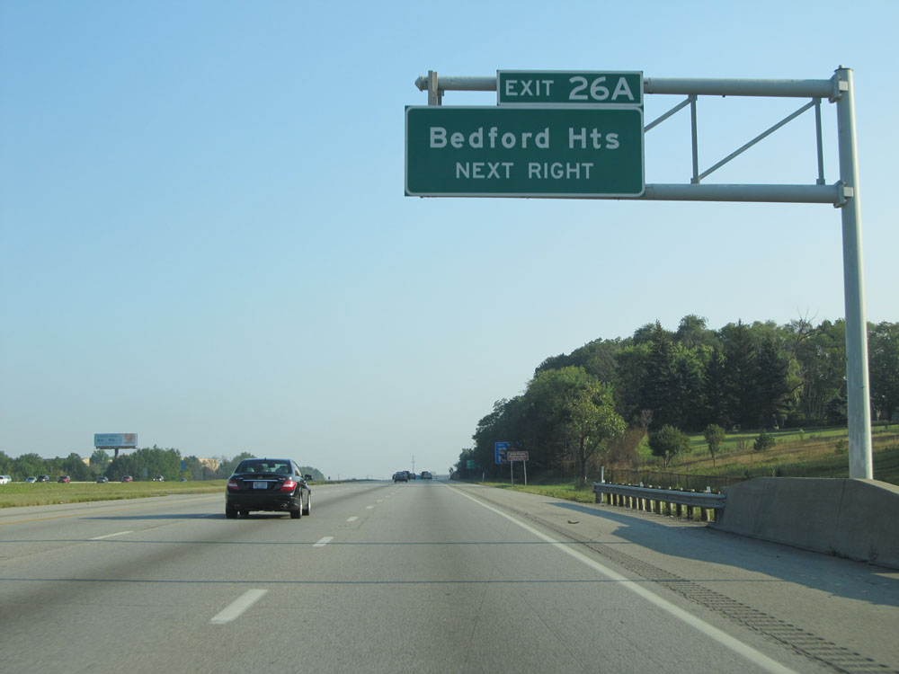 |
Take Exit 26A to Bedford Heights. (Photo taken 9/6/15). |
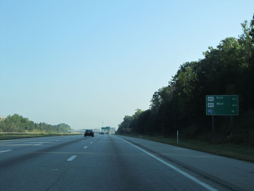 |
Mileage sign on Interstate 480 West / Interstate 271 North approaching Exits 26A-B. On I-271 North, it's 2 1/2 miles to the junction of US 422 East, 4 1/2 miles to the junction of US 422 West, and 15 miles to the junction of Interstate 90 which is the northern terminus of I-271. (Photo taken 9/6/15). |
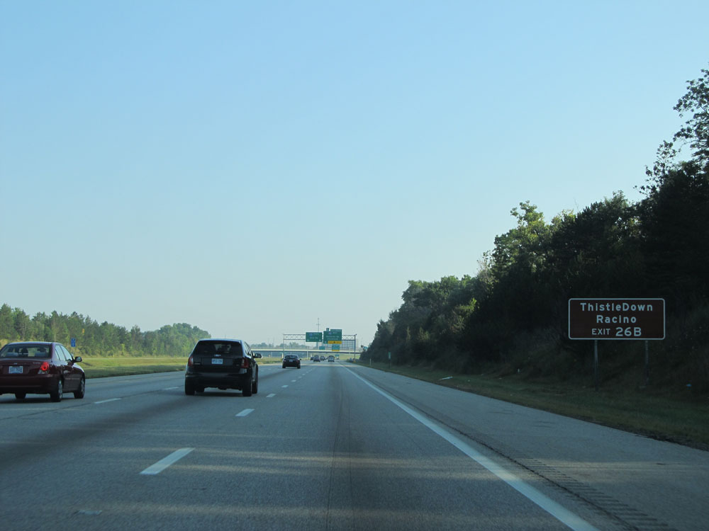 |
Take Exit 26B to ThistleDown Racino. (Photo taken 9/6/15). |
 |
Interstate 480 West / Interstate 271 North at Exits 26A-B: Interstate 480 West - Rockside Rd / Cleveland (Photo taken 9/6/15). |
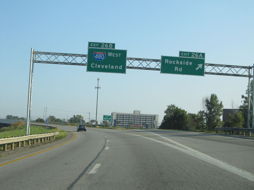 |
Interstate 480 West / Interstate 271 North at Exit 26A: Rockside Rd. Stay straight ahead to continue on Interstate 480 West via Exit 26B. (Photo taken 9/6/15). |
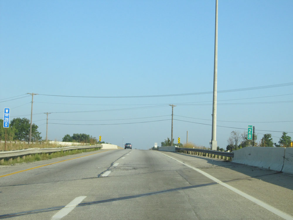 |
Interstate 480 West at mile marker 28. (Photo taken 9/6/15). |
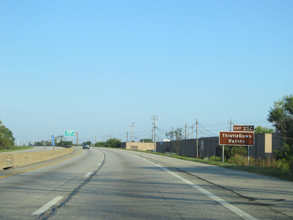 |
Take Exit 25C to ThistleDown Racino. (Photo taken 9/6/15). |
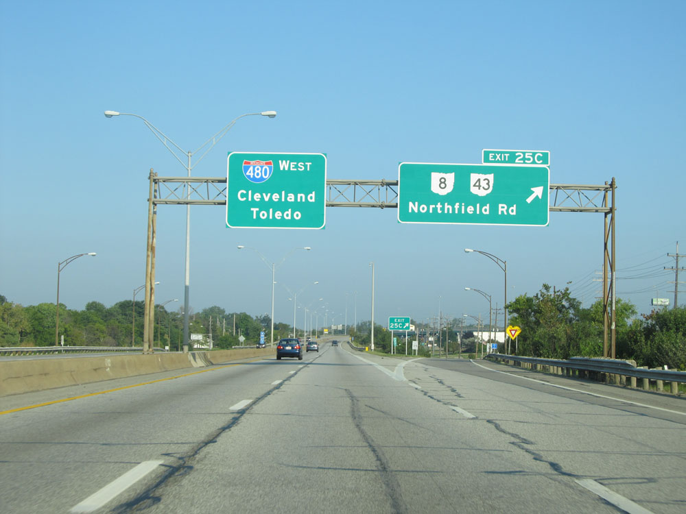 |
Interstate 480 West at Exit 25C: OH 8 / OH 43 - Northfield Rd (Photo taken 9/6/15). |
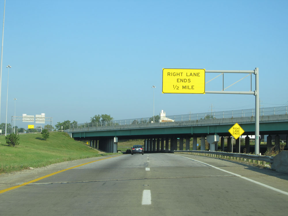 |
The right lane ends 1/2 mile ahead at this point on Interstate 480 West, as it merges with Interstate 480N West (the spur that traffic headed southbound on I-271 would take to get to I-480 West). (Photo taken 9/6/15). |
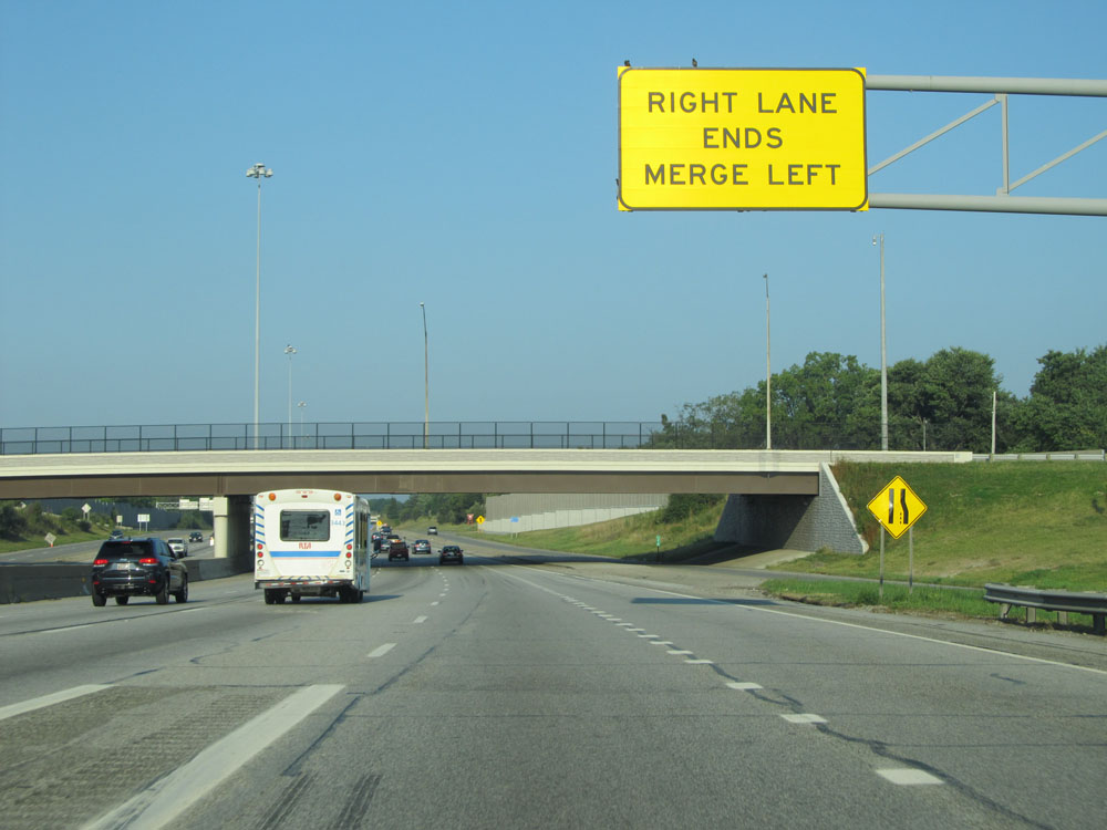 |
Interstate 480 West as it comes together with Interstate 480N West's traffic. (Photo taken 9/6/15). |
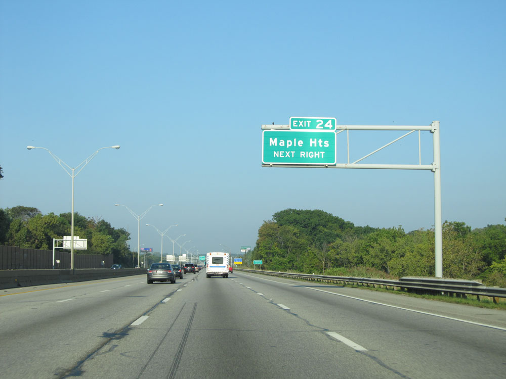 |
Take Exit 24 to Maple Heights. (Photo taken 9/6/15). |
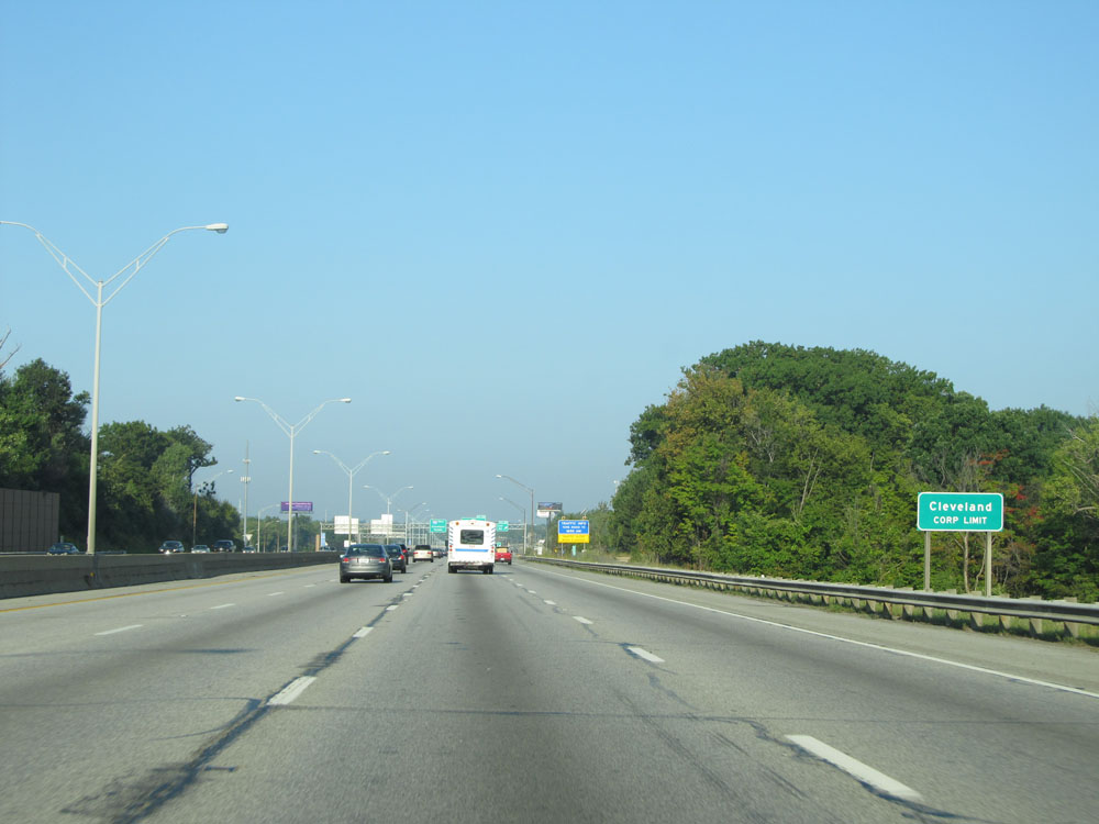 |
Interstate 480 West as it enters the Cleveland corporate limits for the first time. It bounces in and out of the Cleveland limits a few times during the remaining 24 miles. (Photo taken 9/6/15). |
 |
Interstate 480 West at Exit 24: Lee Rd (Photo taken 9/6/15). |
 |
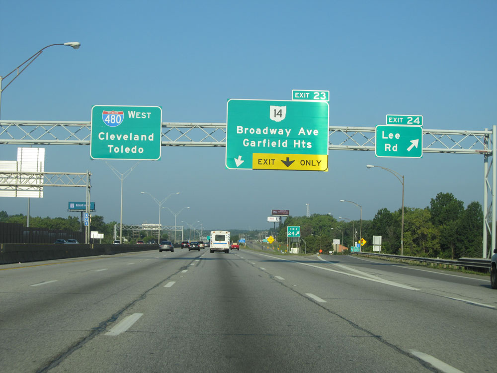
Interstate 480 West at Exit 23: OH 14 - Broadway Ave / Garfield Heights (Photo taken 9/6/15). |
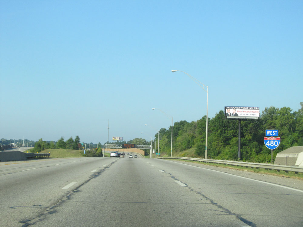 |
Interstate 480 West assurance shield. (Photo taken 9/6/15). |
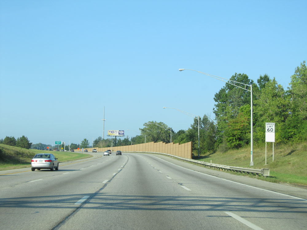 |
Speed limit sign on Interstate 480 West. Since we're still in Cuyahoga County, the speed limit remains 60 mph. (Photo taken 9/6/15). |
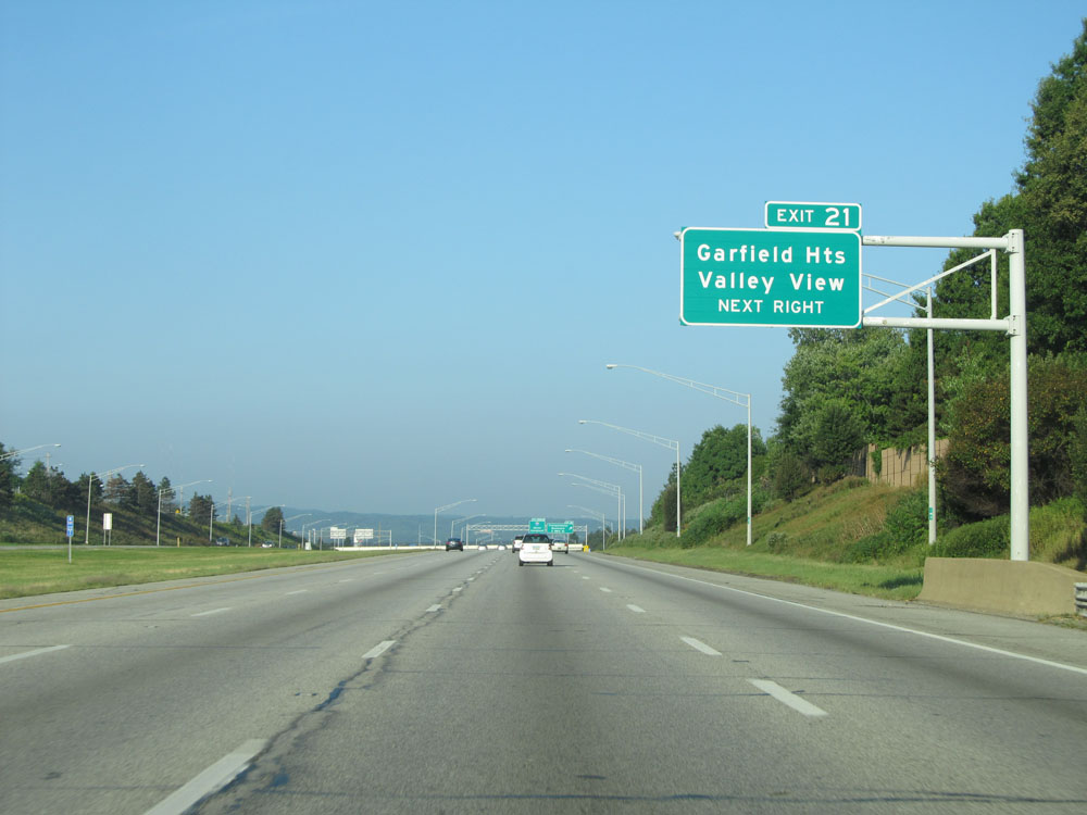 |
Take Exit 21 to Garfield Heights and Valley View. (Photo taken 9/6/15). |
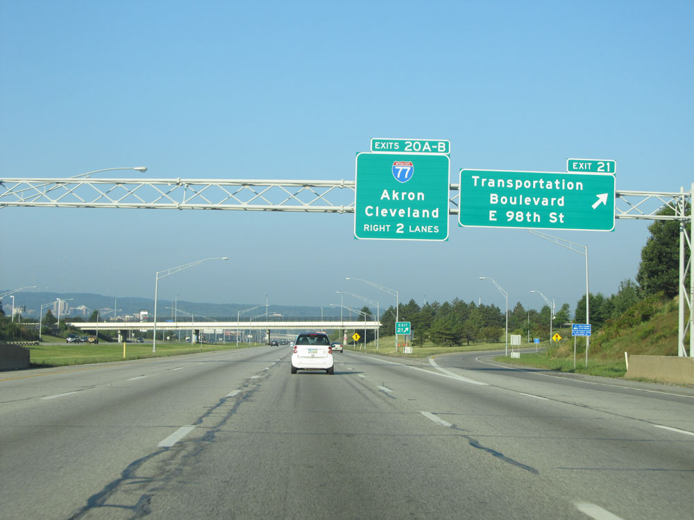 |
Interstate 480 West at Exit 21: Transportation Boulevard / E 98th St (Photo taken 9/6/15). |
 |
Another Interstate 480 West assurance shield to the west of Exit 21. (Photo taken 9/6/15). |
 |
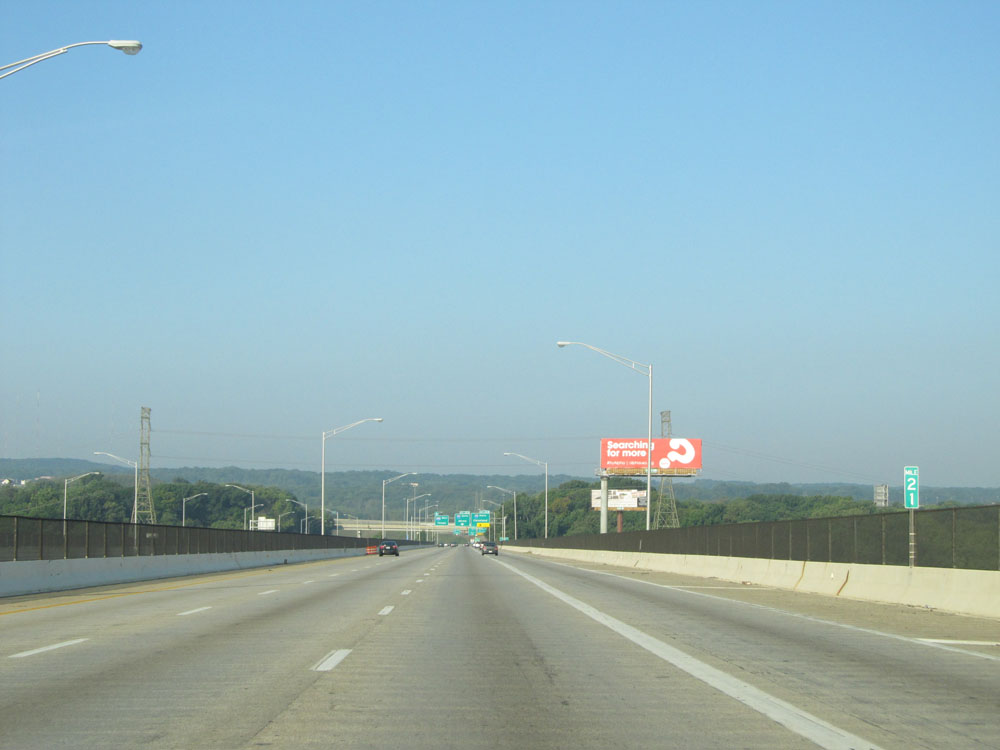
Interstate 480 West approaching Exits 20B-A - 1/2 mile. (Photo taken 9/6/15). |
 |
Interstate 480 West: Road view from mile marker 21. (Photo taken 9/6/15). |
 |
Interstate 480 West at Exit 20B: Interstate 77 North - Cleveland; Exit 20A: Interstate 77 South - Akron (Photo taken 9/6/15). |
 |
Interstate 480 West as it crosses under Interstate 77 and the ramps to and from it. (Photo taken 9/6/15). |
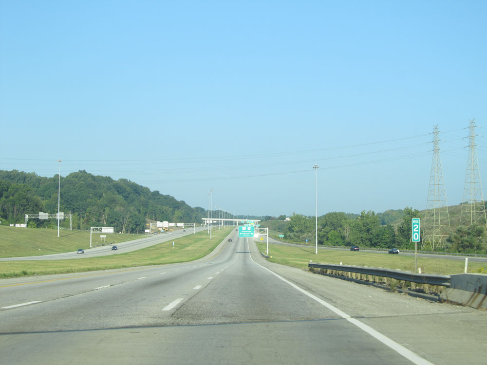 |
Interstate 480 West at mile marker 20. (Photo taken 9/6/15). |
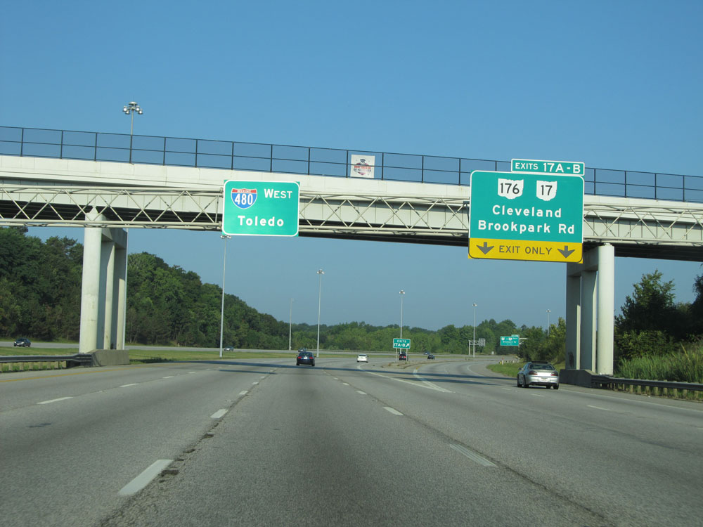 |
Interstate 480 West at Exits 17B-A: OH 176 / OH 17 - Cleveland / Brookpark Rd (Photo taken 9/6/15). |
Section 2: Brooklyn Heights (Exits 17A-B) to Interstate 80 (Ohio Turnpike)
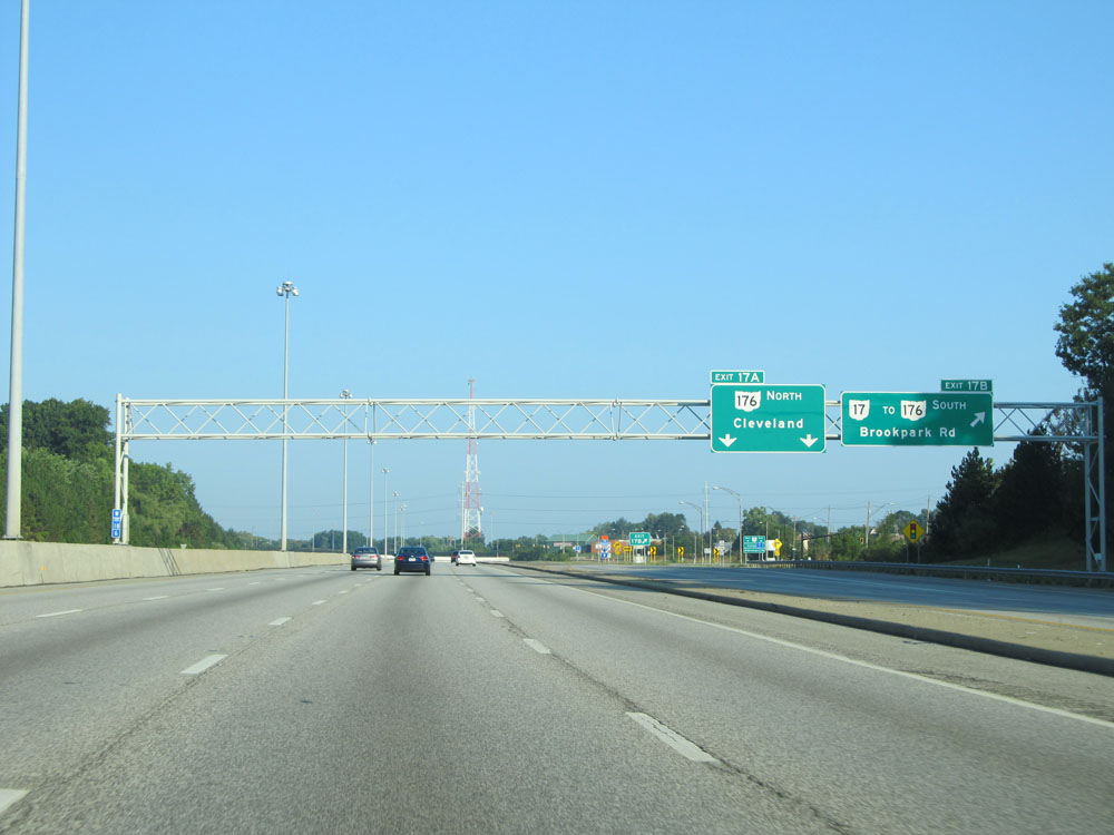 |
A closer view of the ramp for Exit 17B. (Photo taken 9/6/15). |
 |
A closer view of the ramp for Exit 17A. Take Exit 16 to Spring Rd and Hinckley Pkwy. (Photo taken 9/6/15). |
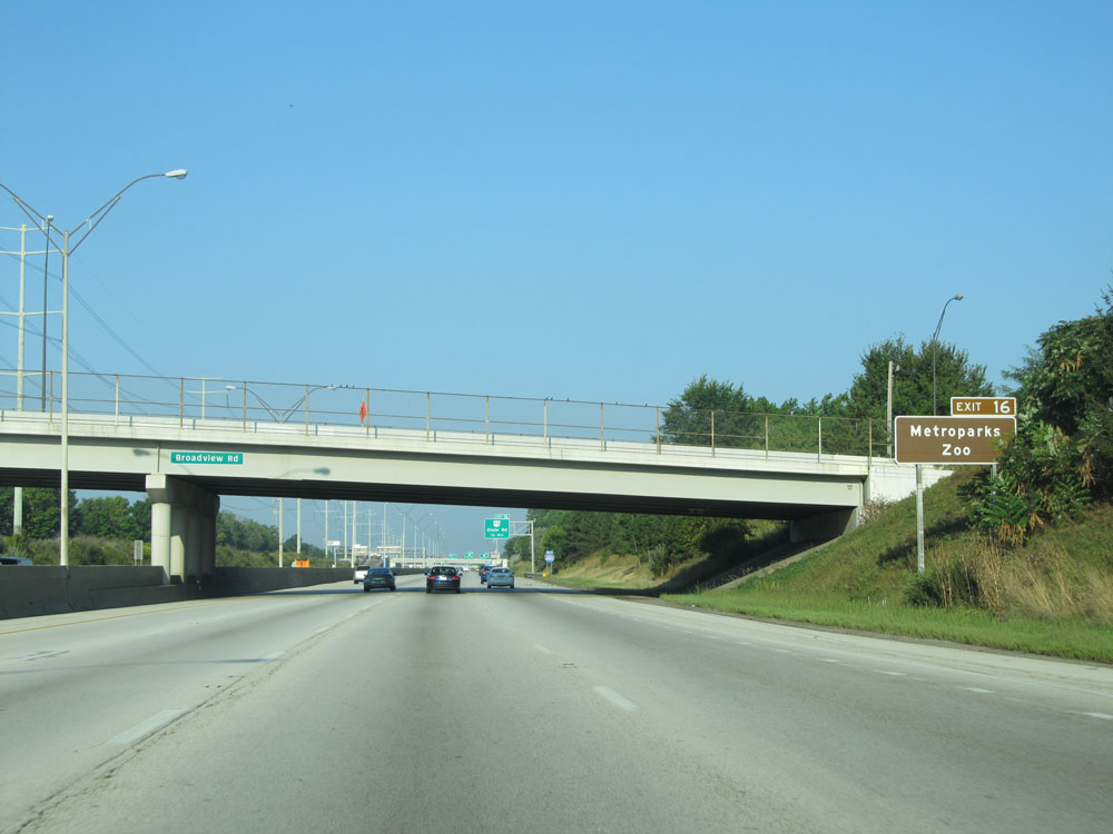 |
Take Exit 16 to Metroparks Zoo. (Photo taken 9/6/15). |
 |
Interstate 480 West at Exit 16: OH 94 - State Rd (Photo taken 9/6/15). |
 |
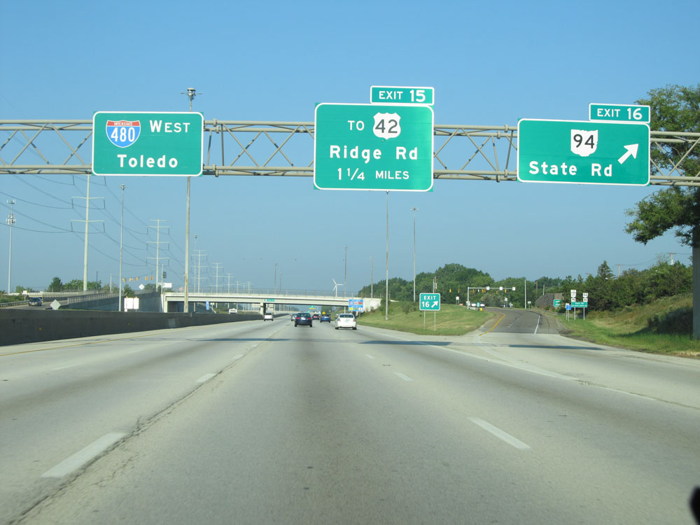
Take Exit 15 to Parma. (Photo taken 9/6/15). |
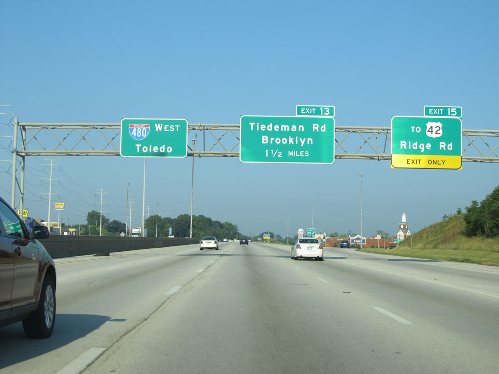 |
Interstate 480 West at Exit 15: To US 42 - Ridge Rd (Photo taken 9/6/15). |
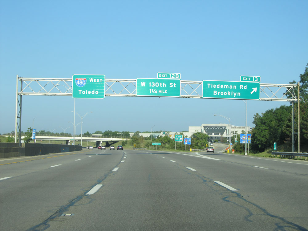 |
Interstate 480 West at Exit 13: Tiedeman Rd / Brooklyn (Photo taken 9/6/15). |
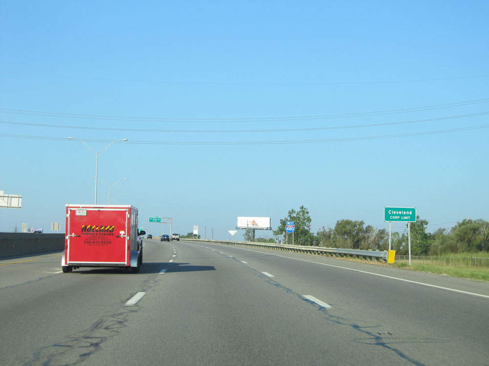 |
Interstate 480 West as it once again enters the Cleveland corporate limit. (Photo taken 9/6/15). |
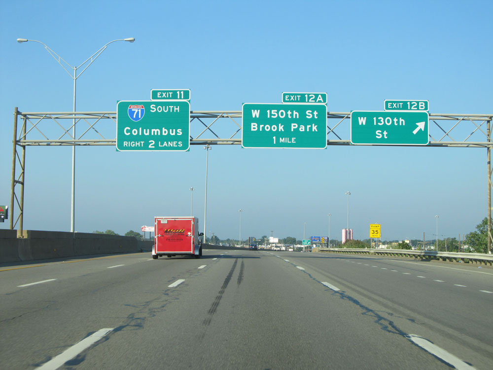 |
Interstate 480 West at Exit 12B: W 130th St (Photo taken 9/6/15). |
 |
Interstate 480 West at Exit 12A: W 150th St / Brook Park (Photo taken 9/6/15). |
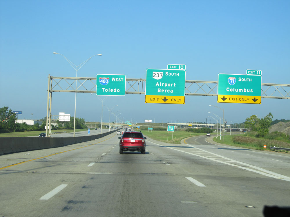 |
Interstate 480 West at Exit 11: Interstate 71 South - Columbus (Photo taken 9/6/15). |
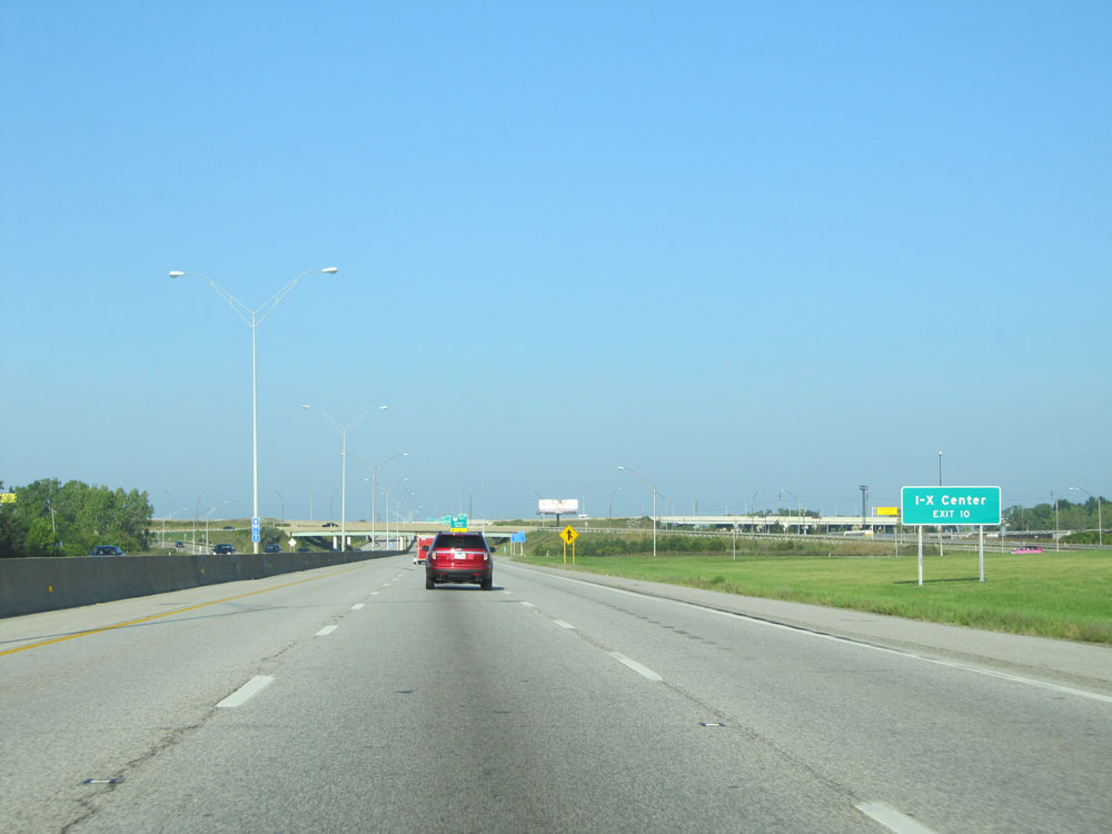 |
Take Exit 10 to I-X Center. (Photo taken 9/6/15). |
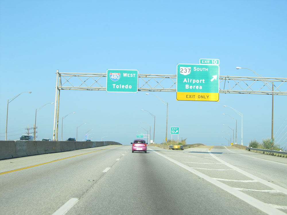 |
Interstate 480 West at Exit 10: OH 237 South - Airport / Berea (Photo taken 9/6/15). |
 |
Take Exit 9 to NASA Glenn. (Photo taken 9/6/15). |
 |
Also take Exit 9 for Rental Car Return. (Photo taken 9/6/15). |
 |
Interstate 480 West at Exit 9: Grayton Rd (Photo taken 9/6/15). |
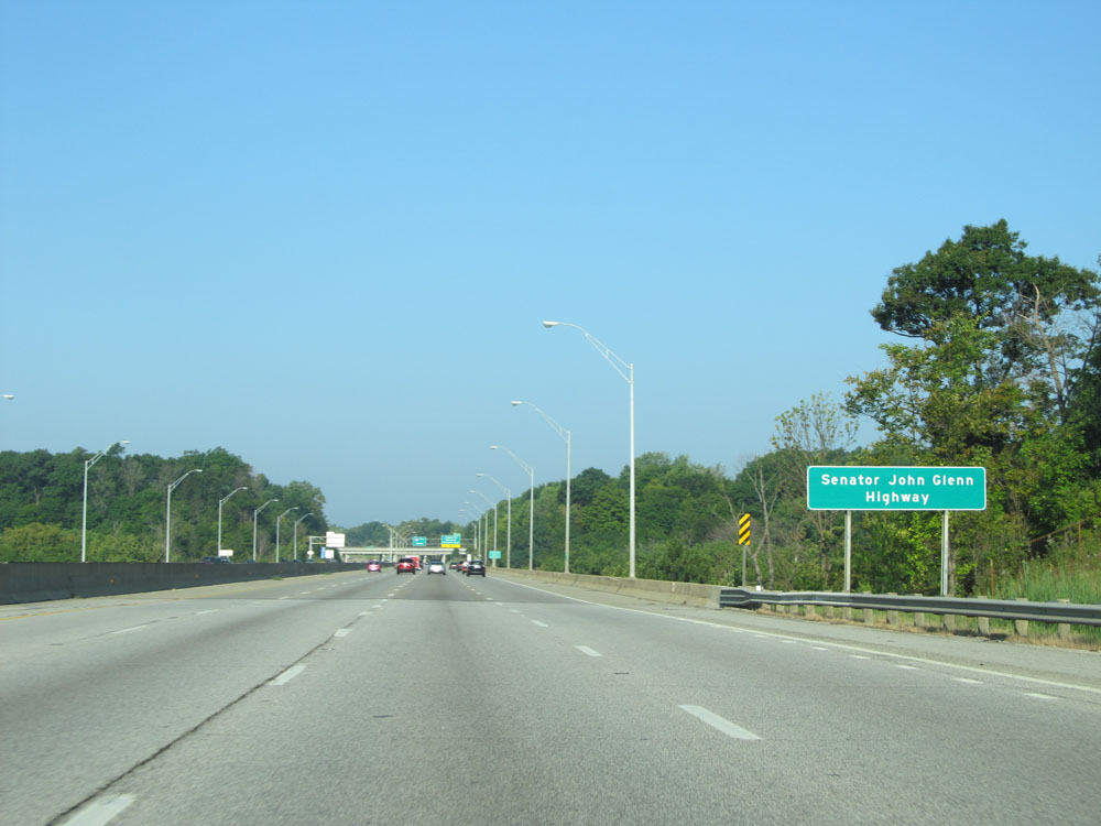 |
Interstate 480 West is also known as Senator John Glenn Highway. (Photo taken 9/6/15). |
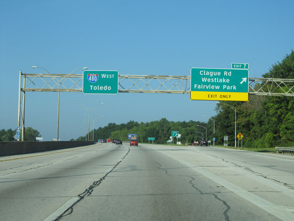 |
Interstate 480 West at Exit 7: Clague Rd / Westlake / Fairview Park (Photo taken 9/6/15). |
 |
Interstate 480 West at mile marker 7. (Photo taken 9/6/15). |
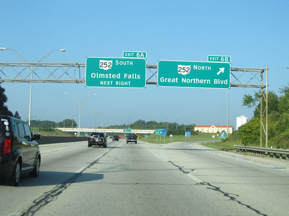 |
Interstate 480 West at Exit 6B: OH 252 North - Great Northern Blvd (Photo taken 9/6/15). |
 |
Interstate 480 West at Exit 6A: OH 252 South - Olmsted Falls (Photo taken 9/6/15). |
 |
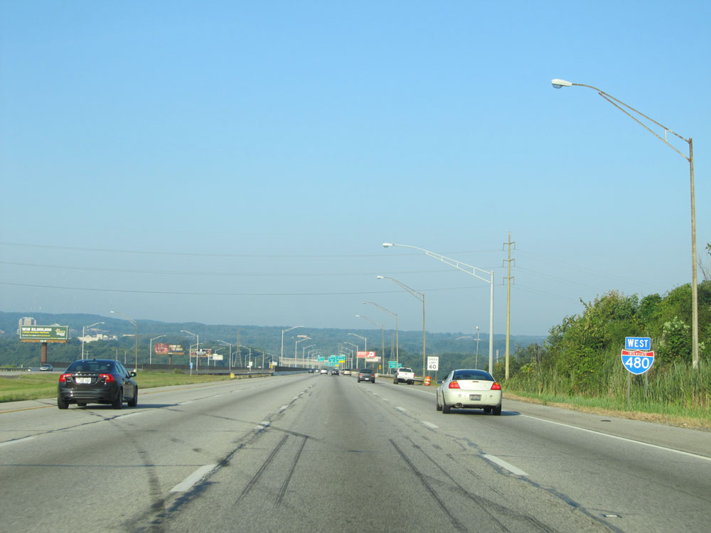
Interstate 480 West assurance shield west of Exit 6A. (Photo taken 9/6/15). |
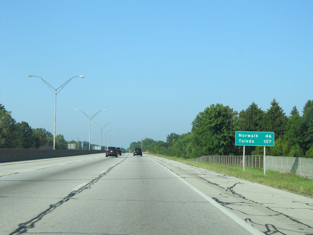 |
With the junction of Interstate 80 (Ohio Turnpike) a few miles ahead, this mileage sign lists the distances to destinations on the turnpike. It's 46 miles to Norwalk and 107 miles to Toledo. (Photo taken 9/6/15). |
 |
Interstate 480 West at mile marker 5. (Photo taken 9/6/15). |
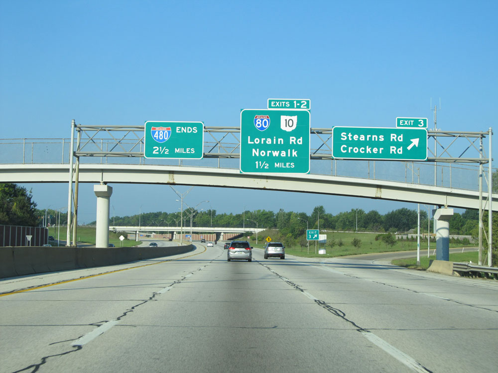 |
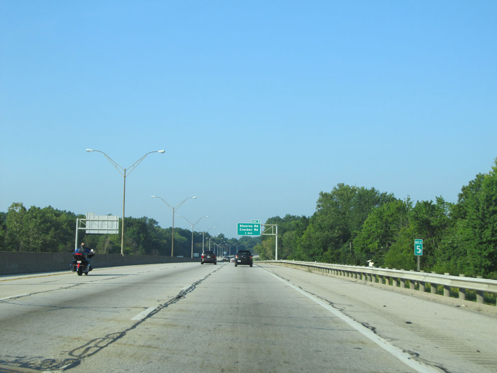
Interstate 480 West at Exit 3: Stearns Rd / Crocker Rd (Photo taken 9/6/15). |
 |
The speed limit remains 60 mph for the final miles of Interstate 480 West. (Photo taken 9/6/15). |
 |
Interstate 480 West approaching Exit 2 - 3/4 mile. (Photo taken 9/6/15). |
 |
Take Exit 2 to North Ridgeville. (Photo taken 9/6/15). |
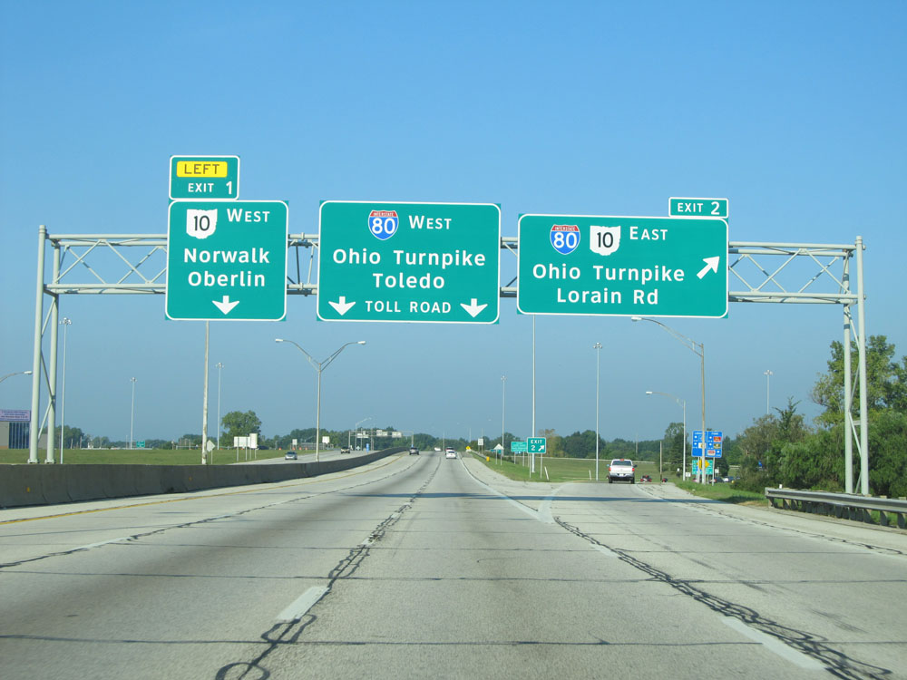 |
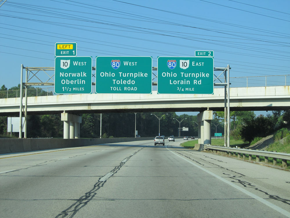
Interstate 480 West at Exit 2: Interstate 80 East / OH 10 East - Ohio Turnpike / Lorain Rd (Photo taken 9/6/15). |
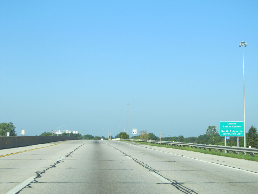 |
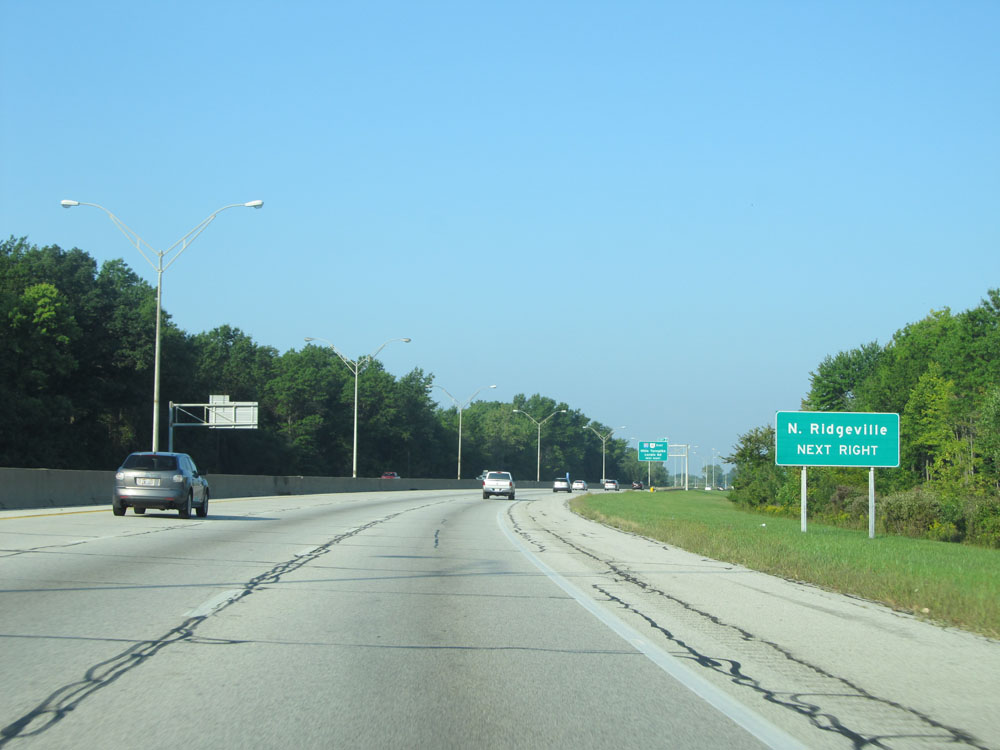
Interstate 480 West entering Lorain County and the North Ridgeville corporation limit. (Photo taken 9/6/15). |
 |
Interstate 480 West at Exit 1: OH 10 West / To US 20 - Oberlin / Norwalk (Photo taken 9/6/15). |
 |
The toll plaza for the Ohio Turnpike lies 1/2 mile ahead. (Photo taken 9/6/15). |
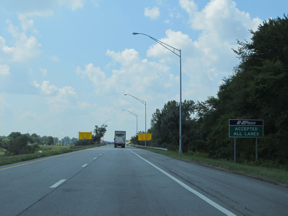 |
EZ Pass is accepted at all lanes at the toll plaza. (Photo taken 9/6/15). |
 |
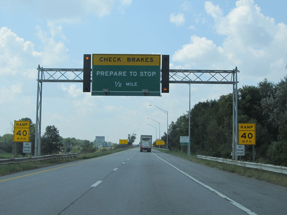
Nearing the toll plaza, motorists are advised to check their brakes and prepare to stop. (Photo taken 9/6/15). |
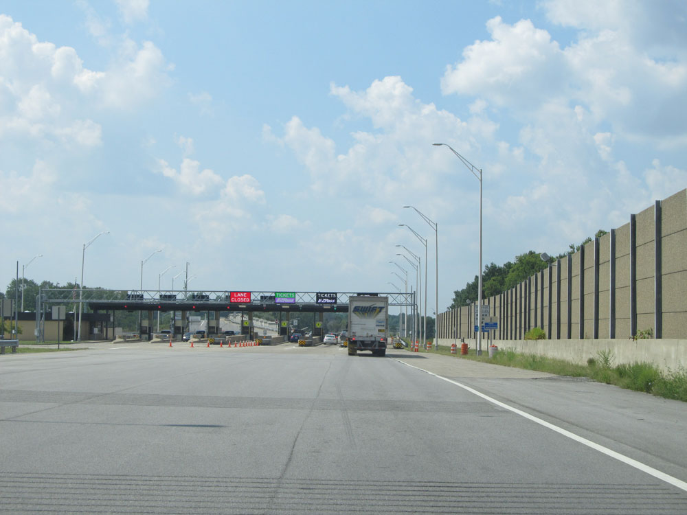 |
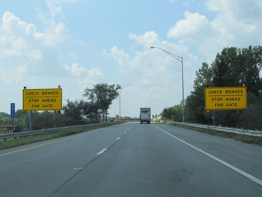
Interstate 480 West approaching the toll plaza. (Photo taken 9/6/15). |
 |
A closer view of the toll plaza. (Photo taken 9/6/15). |
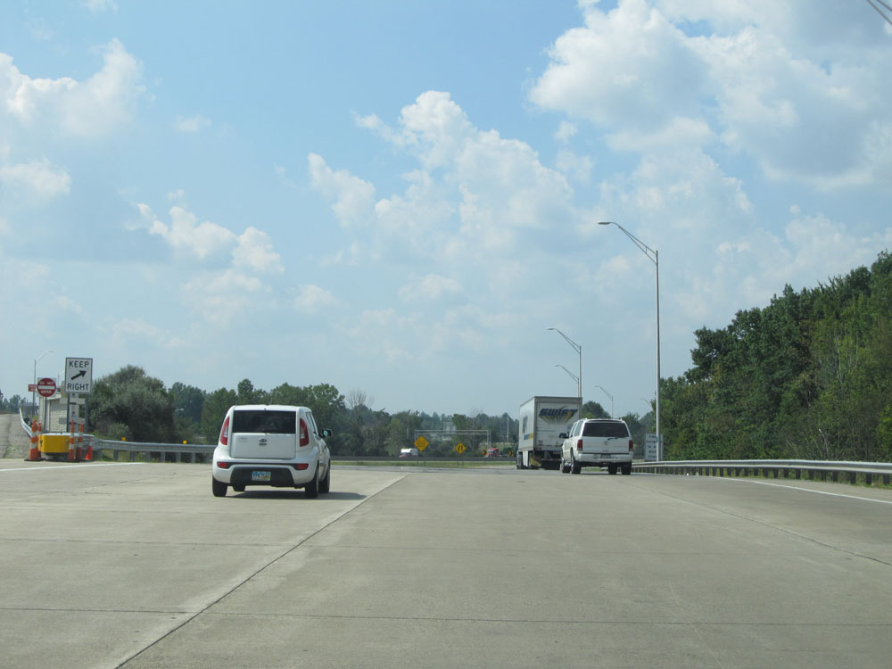 |
Interstate 480 West leaving the toll plaza and beginning its approach to the merge point of Interstate 80 (Ohio Turnpike), its western terminus. (Photo taken 9/6/15). |
 |
Interstate 480 West at its western terminus, as it merges into Interstate 80 West (Ohio Turnpike). (Photo taken 9/6/15). |